

Arizona · Claims map guide
Arizona Mining Claims Map: Sources, Steps and Fees
BLM records more than 55,000 mining claims on Arizona public land. This guide shows where to search the claim map, how to read it, what State Trust land allows instead of claims, and what a claim costs to file and keep.
Key takeaways
- BLM Arizona says more than 55,000 mining claims are recorded on Arizona’s public lands; the official records sit in the BLM’s MLRS (BLM, page read October 2026).
- A new lode claim filed with BLM on or after 1 September 2024 costs US$274: $25 processing, $49 location and $200 maintenance. A placer pays $200 per 20 acres or part (BLM fee table).
- The yearly fee is US$200 per claim, due on or before 1 September. Owners of 10 or fewer claims nationwide can file a waiver, do $100 of work and pay $15 per claim by 30 December (BLM).
- BLM only requires claims to be identified to the quarter section, so map layers are approximate; staked boundaries are in the notice of location in the case file (BLM layer metadata).
- State Trust land, 12.73% of Arizona in ASLD’s October 2010 table, uses exploration permits rather than claims, and recreational mining there is prohibited (ASLD table via AZGFD; AZGS).
In this article
- Where to find an Arizona mining claims map
- How to look up an Arizona claim, step by step
- How accurate is a claim map?
- Reading the symbols: lode, placer, mill site and tunnel site
- Who owns Arizona's land, and where a claim can be staked
- Arizona State Land Department: permits instead of claims
- Arizona mining claim fees: BLM, county and recording rules
- Recording and marking a claim the Arizona way
- Checks before you buy or walk a claim
- Where satellite data fits beside a claim map
- Frequently asked questions
The Bureau of Land Management (BLM) says, on a page we read in October 2026, that more than 55,000 mining claims are recorded on Arizona’s public lands, and the BLM’s Mineral & Land Records System (MLRS) is the place to look any of them up. There is no single official Arizona claims map. You combine three things: BLM claim records, a land-ownership map from the Arizona State Land Department (ASLD), and the county recorder’s file. This page shows which tool answers which question, how to read what it draws, what State Trust land allows instead of claims, and what a claim costs to file and keep.
It is written for licence owners, claim buyers and consultants who need to check ground before they spend money. Terms are explained as they appear. A mining claim is a parcel on which a claimant asserts the right to develop a mineral deposit; BLM notes that this right does not include exclusive surface rights. Locatable minerals are the hardrock minerals, such as gold, silver and copper, that can be claimed under the 1872 Mining Law. PLSS is the Public Land Survey System, the township, range and section grid that most claim records use.
Where to find an Arizona mining claims map
Seven sources matter for Arizona. We included the sources that the BLM and the Arizona Geological Survey (AZGS) point to for Arizona claim and land-status research, plus the county recorder. We left out paid claim-data subscriptions because we cannot check how current their data is. The table is not a ranking; the last column says what each source is best for.
| Source | Run by | What it shows | Limits | Best for |
|---|---|---|---|---|
| MLRS reports and research map | BLM | Claim case records and serial register pages; a research map where you can search by place name or legal land description after logging in | You need a serial number or a legal description; the map is generalised (see below) | Checking whether one claim is active |
| BLM national claims layers (Closed and Not Closed) | BLM | Downloadable GIS layers of claim cases, mapped from legal land descriptions | Not parcel-accurate; some cases cannot be mapped; may change without notice | Plotting many claims in GIS software |
| Land Matters claim layers | Volunteers (mylandmatters.org) | Section outlines: orange for placer, blue for lode, mill site and tunnel site, with a count per section | A snapshot; its own page says layers update about every 15 days | A quick visual of claim density |
| ASLD Parcel Viewer | Arizona State Land Department | State Trust and public land ownership, state minerals, lease status, townships and sections | Shows state leases and ownership, not BLM claims | Finding the legal description and who owns the ground |
| BLM Arizona scanned case files | BLM Arizona State Office | Scanned receipts and location notices, filed by AMC serial range | The directory we checked was last updated in 2022; newer claims are in MLRS | Reading a claim’s own location notice |
| AZGS Mining Data | Arizona Geological Survey | More than 20,000 unpublished mine files (site launched 2014), 6,800 geologic and mine maps and about 6,000 images | History, not current claim status | Learning what past miners found in an area |
| County recorder | The recorder in the county seat | Recorded location notices, claim sketches and annual filings | Searched county by county; fees vary | Confirming what the locator actually filed |
Sources for the table: BLM, MLRS; BLM, national claims layer metadata; Land Matters; AZGS, Mineral Rights; BLM Arizona case file directory; and AZGS, Gold Prospecting in Arizona. Claims in another state follow the same BLM system; our BLM claims map guide for California covers that state’s rules.
How to look up an Arizona claim, step by step
- Get the legal description. Open the ASLD Parcel Viewer, which AZGS describes as displaying townships and sections, so you can read off the township, range and section of your area.
- Check who owns the surface and the minerals. AZGS lists this as the second step of acquiring rights. If the ground is State Trust land, stop here: claims do not apply (see the State Land section below).
- Search MLRS. Use the research map to find the location by name or legal description, or run a report for a known serial number. BLM documents the serial register report: choose the administrative state, type serial numbers in capitals, and leave off the state prefix when you search by range. Arizona serials start with AMC, as in the case-file folders BLM Arizona posts.
- Separate active from closed. BLM publishes closed and not-closed claim layers separately, so a claim that lapsed is not the same as one in good standing. Treat any third-party map as a snapshot and confirm status in MLRS.
- Open the serial register page. It lists the case data for each claim. Land Matters links each of its section outlines to the live BLM report for this reason.
- Read the notice of location. BLM states in its layer metadata that it only requires claims to be identified to the affected quarter section, so the map is rough. The boundaries as staked and monumented are in the accepted notice or certificate of location in the case file.
- Cross-check the county. Arizona requires the locator to record the notice, with a map or sketch, at the county recorder within 90 days.
- Visit the ground. Claim corners are physical monuments; no map replaces finding them.
How accurate is a claim map?
Less accurate than most people assume. BLM’s claim layers are derived from legal land descriptions and placed on the PLSS grid. The metadata says some cases cannot be geocoded, each case gets a data quality score, positional accuracy varies by source, and the data may be updated without notification. A claim drawn as a section or quarter section on a screen can be a 20-acre placer or a 600-by-1,500-foot lode inside it. Use a claim map to find candidates, then read the notice for the real shape.
The same limit applies to third-party viewers. Land Matters, for example, outlines whole sections and shows how many active claims each holds, and links to the current BLM report for each. That is useful for judging how crowded an area is, not for fixing a boundary.
Reading the symbols: lode, placer, mill site and tunnel site
Most map layers split claims by type, so it helps to know what each type is and how big it can be. A lode claim covers a vein or rock in place that carries valuable minerals; a placer claim covers loose deposits such as gold in gravel. A mill site supports a mine and must sit on non-mineral ground. A tunnel site is a right-of-way under federal land used to reach lode claims. BLM sets the limits: a lode claim may be up to 1,500 feet long and 600 feet wide, a placer up to 20 acres per locator (160 acres for an association of eight or more), a mill site up to 5 acres and a tunnel site up to 3,000 feet long.
Chart
Largest size allowed by claim type
Acres; lode size calculated from 1,500 ft by 600 ft
A lode of 1,500 by 600 feet is about 20.7 acres, which is why a lode and a single-locator placer look about the same size on a quarter-section map. Placers are located by legal subdivision where practicable; lodes are described by metes and bounds, starting at the discovery point.
Who owns Arizona’s land, and where a claim can be staked
A claims map only matters where claims are allowed. Under 30 U.S. Code 22, valuable mineral deposits in federal land are open to exploration and purchase by citizens, under the regulations and rules that apply. AZGS puts it plainly: claims, leases and mineral material sales apply to federal lands, while exploration permits and leases apply to State Trust land. AZGS describes only those two routes, federal claims and State Trust permits. Tribal land follows different rules and is outside both, so contact the tribal government and BLM before assuming anything.
Chart
Share of Arizona land by owner, October 2010
Per cent of state acreage; selected owners shown
The ownership split explains why Arizona claim maps cluster where they do. In the October 2010 ASLD land-status table, BLM manages 16.69% of the state and national forests 15.3%. Private land is 17.52%, State Trust land 12.73% and tribal land 27.57%. National parks, military land, wildlife refuges and Reclamation land make up the rest of the federal share, which the table totals at 41.43%. The table is dated, so treat the shares as approximate.
Even on federal land, not every acre is open. The BLM Arizona permitting guide notes that designated wilderness is withdrawn and that many national monuments and conservation areas are too, and that these special-category lands always need a Plan of Operations for disturbance beyond casual use. Check the withdrawal status on the land-status layer before you stake anything.
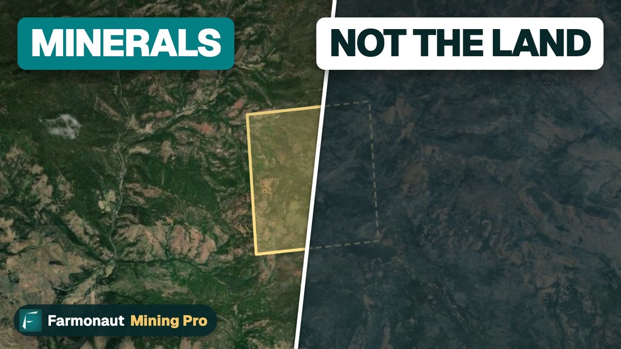
▶ Explains that a gold claim gives a right to the minerals, not title to the land (the worked example is Washington State, under the same 1872 law). · 3:19
Arizona State Land Department: permits instead of claims
State Trust land is held for beneficiaries, mainly public schools. You do not stake a claim there. ASLD’s Minerals Section issues an exploration permit under A.R.S. 27-251, which lets the Commissioner refuse an application that is not in the best interest of the trust. ASLD’s own 2019 page says an exploration permit is not a right to mine; if a valuable deposit is found, the permittee must apply for a mineral lease before mining starts. AZGS adds that recreational mining on State Trust land is prohibited.
Chart
Exploration permit costs per acre: 2017 BLM guide schedule
US$ per acre by permit year; confirm current rent with ASLD
The costs in the guides we could open are dated, so confirm them with ASLD. The BLM-compiled Arizona Mining Permitting Guide (2017) lists a $500 application fee, rent of $2 per acre in year one, none in year two and $1 per acre in years three to five, plus a minimum work spend of $10 per acre in years one and two and $20 in years three to five. ASLD’s 2019 page lists the same $500 fee and a typical reclamation bond of $3,000 for one permit or $15,000 for a blanket bond covering five or more. Those sources describe one-year permits renewable up to five years, while the current text of A.R.S. 27-253 refers to a five-year permit period, so check the term as well. Treat all of these as the 2017 BLM guide schedule and 2019 ASLD page; confirm current rent with ASLD.
Arizona mining claim fees: BLM, county and recording rules
Federal fees are the main cost of holding a claim. BLM’s fee table for new claims filed on or after 1 September 2024 adds up to US$274 for a lode claim, mill site or tunnel site: a $25 processing fee, a $49 location fee and a $200 first-year maintenance fee. A placer pays the same $25 and $49 plus $200 for each 20 acres or part of 20 acres, so a 70-acre placer owes $800 in maintenance in a year. The notice of location is due within 90 days of location.
Chart
BLM cost to file a new lode claim
US$ per claim; 2010 figures from the Arizona guide, current from BLM’s fee table
| Item | Amount (BLM) | When due |
|---|---|---|
| Processing fee, new claim | US$25 per claim | With the notice of location, within 90 days |
| Location fee, new claim | US$49 per claim | With the notice of location |
| Maintenance fee, lode, mill site, tunnel site | US$200 per claim | On or before 1 September each year |
| Maintenance fee, placer | US$200 per 20 acres or part | On or before 1 September each year |
| Small-miner waiver (10 or fewer claims nationwide) | No filing charge | On or before 1 September |
| Affidavit of assessment work or notice of intent to hold | US$15 per claim | On or before 30 December |
The fee has risen since the Arizona guide’s 2010 schedule, as the chart shows. A claimant with 10 or fewer claims and sites nationwide can file the waiver instead of the $200 fee, but must do $100 of assessment work on each claim each year and file the $15-per-claim affidavit. BLM Arizona says waiver forms need original signatures and cannot be filed online. If you locate a claim before 1 September and file it after, you may owe maintenance for two assessment years.
Missing the 1 September date is costly: BLM’s 2027 mining packet (issued by the BLM California State Office; the federal rule is the same in Arizona) says claims not paid or waived on time are forfeited by operation of law. County recorder fees are separate and differ by county, so ask the recorder for the schedule. The calculator below adds up BLM fees over a holding period; the county line is an input.
Calculator
What will my claims cost to hold?
Enter your own claim counts. The BLM fee amounts are built in; county fees are an input.
- BLM cost to file in year one: $1,644
- BLM cost for each later year: $1,200
- County fees you entered: $0
Example values only, not a quote. Fixed in the formulas from BLM’s fee table (claims filed on or after 1 September 2024): $274 for a new lode claim, $74 plus $200 per 20-acre unit for a new placer, $200 per year per claim or unit after that, and a $15 affidavit fee per claim under the small-miner waiver. The waiver counts only when you hold 10 or fewer claims nationwide and ignores any other claims you own. County recorder fees vary, so type the figure from your county. The waiver requires at least $100 of work per claim, so the work field starts at 100. The calculator does not add the extra maintenance year owed when a claim is located before 1 September but filed after it.
Recording and marking a claim the Arizona way
Arizona adds its own steps to the federal ones. For a lode claim, A.R.S. 27-202 requires a monument on the centerline, either stones at least three feet high or an upright post projecting at least four feet, carrying a location notice with the claim name, locator, date, dimensions, general course and a locality tie. Until that is done, the statute says no right of location is acquired. Under A.R.S. 27-203, the locator must record the notice and a map or sketch with the county recorder, and monument the claim on the ground, within 90 days. The sketch may be no larger than 8.5 by 14 inches, at a scale of one inch to no more than 2,000 feet, and a licensed surveyor is not required.
Under federal rules summarised in the Arizona Mining Permitting Guide, you also file a copy of the notice with the BLM State Office within 90 days. Mill sites follow placer marking, and a mill site may not be larger than five acres.
Checks before you buy or walk a claim
A map lookup is the first of several checks. Run these before paying a seller or putting a machine on the ground.
- Status. Confirm the claim is active in MLRS and that the latest maintenance fee or waiver is recorded. A seller’s spreadsheet is not a record.
- Chain of title. Match the seller to the claimant on the serial register page and the transfers on file.
- Land underneath. A claim gives rights to the minerals, not the land. AZGS notes that claims cannot be used as a residence and that there is a moratorium on patenting, so surface title cannot be obtained.
- Disturbance rules. The Arizona permitting guide says casual use needs no filing with BLM; exploration that disturbs five acres or less needs a Notice; larger work needs a Plan of Operations.
- Access. Check roads, surface owners and nearby withdrawn land. A rich area can still be unworkable if you cannot reach it.
For the buying side, see our guides to Arizona gold claims for sale and the steps to check a gold claim sale. For how to stake and file on BLM land, our page on Bureau of Land Management mining claims walks through MLRS filing and fees. Other countries run their own online registers; see our mining cadastre portals by country. For geology rather than status, see where gold is found in the United States.
Prospecting safety: get permission before entering any land, follow the rules for your land type, and never use mercury to recover gold. AZGS asks prospectors to respect public and private lands and to confine prospecting to lands designated for it.
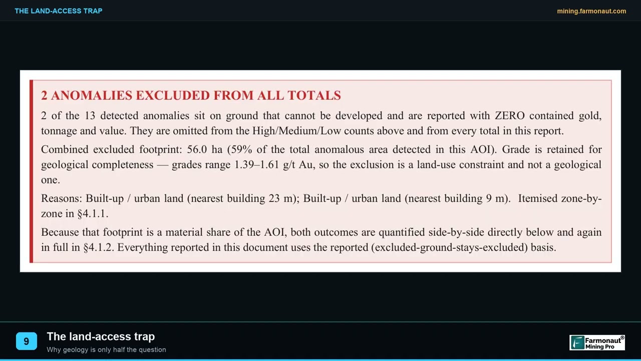
▶ Shows how land access can block good ground: on one survey, 59% of the anomalous ground sat under a town. · 2:05
Where satellite data fits beside a claim map
A claim map says who holds the right. It does not say whether the ground is worth drilling. Satellite data is a different layer: Farmonaut’s mineral detection service turns a boundary file (KML, KMZ or a polygon) into maps of alteration, structure and target zones, with delivery in 5 to 20 business days depending on size and mineral. The results are exploration targets that sit ahead of any resource estimate. They do not confirm claim status, ownership or land-use clearance, so run the checks above first. Licence owners who want the satellite layer can use the mining quote form, and the satellite mineral detection page explains the inputs.
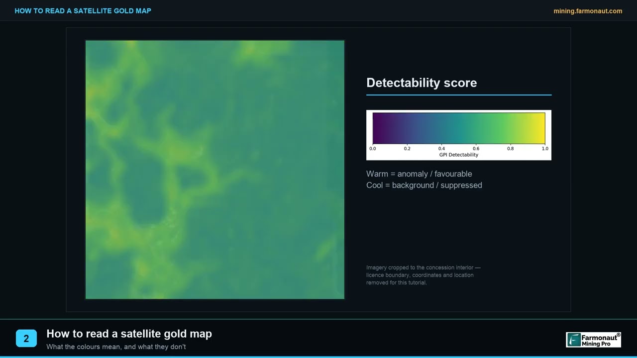
▶ Explains how to read a satellite prospectivity map, which shows clues to gold rather than the gold itself. · 1:40
For a closer look at a related question, see our guide: VGPMX Price: NAV, Holdings and Fees From Filings.
Frequently asked questions
Where can I see Arizona mining claims on a map?
Use BLM’s MLRS research map and reports for official records, the ASLD Parcel Viewer to see land ownership and legal descriptions, and a volunteer map such as Land Matters for a quick view of claim density. BLM also publishes downloadable claim layers for GIS software.
Is there one official Arizona mining claims map?
No single one. Federal claims are recorded with the BLM and also at the county recorder, and state land is handled by ASLD through permits. The BLM’s map data is the closest to an official claims layer, with the limits described above.
How accurate are claim maps?
They are approximate. BLM states it only requires claims to be identified to the affected quarter section, and the layer is built from legal land descriptions. The staked boundaries are in the notice of location in the case file.
How do I find out who owns a mining claim in Arizona?
Search the claim by serial number or location in MLRS and open its serial register page. For the original notice, check the scanned case files from BLM Arizona or the county recorder where the notice was filed.
How much does it cost to stake a mining claim in Arizona?
BLM charges US$274 for a new lode claim filed on or after 1 September 2024: $25 processing, $49 location and $200 maintenance. A placer pays $200 per 20 acres or part. County recorder fees and the cost of monuments are extra.
What is the yearly fee to hold a claim?
US$200 per lode claim, mill site or tunnel site, and $200 per 20 acres of placer, due on or before 1 September. Owners of 10 or fewer claims nationwide may file a waiver instead, do $100 of work and file an affidavit with a $15 per claim fee by 30 December.
Can I stake a claim on Arizona State Trust land?
No. AZGS says claims apply to federal land and that State Trust land uses exploration permits and leases. An exploration permit is not a right to mine, and recreational mining on State Trust land is prohibited.
How long do I have to record a claim in Arizona?
Ninety days from location, both for recording the notice and sketch with the county recorder under A.R.S. 27-203 and for filing with BLM. The claim must also be monumented on the ground within that time.
Do I need a permit to prospect on a claim?
Casual use, with no or negligible disturbance, needs no filing with BLM. Disturbing five acres or less needs a Notice, and larger disturbance needs a Plan of Operations. Special-category lands such as designated wilderness always need a Plan of Operations.
Does a claim give me ownership of the land?
No. A claim covers the right to develop the minerals, not exclusive use of the surface. AZGS notes a moratorium on patenting, so surface title cannot be obtained through a claim.
What happens if I miss the 1 September deadline?
BLM says claims for which the maintenance fee or the waiver is not filed on time are forfeited by operation of law. Check the date every year on the BLM fees page.
Can a satellite map show me claim boundaries?
No. Satellite imagery shows ground conditions, not legal boundaries. Claim boundaries come from the notice of location, and claim status comes from BLM records.
This page is for information only. It is not legal advice. Confirm the rules and current fees with the BLM Arizona State Office, the Arizona State Land Department and your county recorder. Get permission before entering any land, follow the rules for the land type, and never use mercury to recover gold.
Farmonaut mining
Get a quote for your claim area
Send a boundary and a target mineral to get a quote for a satellite mineral detection report; results are exploration targets, not a resource estimate.

Mining Pro sample view, synthetic data
Keep reading
Sources
- BLM, Mining Claims: blm.gov
- BLM, Mining Claim Fees: blm.gov
- BLM, Arizona Mining and Minerals: blm.gov
- BLM, Mineral & Land Records System (MLRS): blm.gov
- BLM, national MLRS mining claims layer (Not Closed), metadata: gis.blm.gov
- BLM, Mining Claims Serial Register Page Report guide: reports.blm.gov
- BLM Arizona, scanned mining claim case files (directory): az.blm.gov
- BLM Arizona State Office, Arizona Mining Permitting Guide (2017 edition): blm.gov
- BLM California, Mining Claim and Site Filing Requirements (mining packet): blm.gov
- Arizona Geological Survey, Mineral Rights: azgs.arizona.edu
- Arizona Geological Survey, Gold Prospecting in Arizona: azgs.arizona.edu
- Arizona Revised Statutes 27-202, locating a lode claim: azleg.gov
- Arizona Revised Statutes 27-203, recording and monumenting: azleg.gov
- Arizona Revised Statutes 27-251, exploration permit application: azleg.gov
- Arizona Revised Statutes 27-253, renewal of exploration permit: azleg.gov
- Arizona State Land Department, Minerals program page (printed 23 May 2019): resolutionmineeis.us
- Arizona Game and Fish Department, Wildlife Conservation Strategy Chapter 4 (ASLD land-ownership table, October 2010): awcs.azgfd.com
- Land Matters, BLM MLRS mining claims map layers: mylandmatters.org
- Legal Information Institute, 30 U.S. Code 22: law.cornell.edu
Discussion
Questions, corrections or field experience? Share them below. First-time comments are reviewed before they appear, and your email is never published.
No comments yet. Be the first to add a question or your experience.

 Huckleberry Garnet LLC
 Dalgety Minerals Pty Ltd
 Vortex Minerals Pty Ltd
 Faith At Work (Pty) Ltd
 Geotech Mining Solutions plc
 Vulcan International Limited
 Kidepo Associates
 GKY Mining
 Alkimy SARL
 Double A Trading
 GemSprout Metals Limited
 Qader Group
 Ileys General Trading
 SG Gold Mining LLC
 VRV Global Pte Ltd
 Omsri International FZE
 G.I.T.T.
 Jaunita Erss Ltd
 Almosi SARL
 SRK Consulting
 Berks Gold Limited
 Mwerezi Minerals Company Limited
 Exploration consultancy · South Africa · Gold










