
Mining cadastre · Country directory
Mining Cadastre Portals by Country: Sign In, Search, Apply
A mining cadastre (also spelled cadaster) is a country’s official online register of mineral rights. Most portals let anyone view licences on a map; applying and paying needs a verified account. Find each official address, sign-in route and map below.
Key takeaways
- A mining cadastre portal has a public map layer and a signed-in layer; Ghana, Zambia and Liberia now require online applications (national regulators, 2026).
- New accounts are usually verified by a ministry officer. Ethiopia’s portal asks for form MCP01, proof of identity and agent authority (Ethiopia Mining Cadastre Portal).
- The DRC’s CAMI reopened new exploration-type applications on 4 August 2026 and published its active-rights register as of 30 September 2026 (CAMI).
- Mozambique’s cadastre has closed to new applications before (1 February to 1 April 2021), and Law No. 7/2026 added artisanal and small-scale licences (Club of Mozambique; FurtherAfrica).
- Kenya’s FAQ lists a KShs 50,000 application fee and annual rent of KShs 2,000 per hectare, minimum KShs 500,000, for a mining licence (State Department for Mining).
In this article
- What a mining cadastre portal is, and why it matters before you apply
- What you can do without signing in, and what needs an account
- How to apply on a mining cadastre portal: the common 7-step workflow
- Mining cadastre portals by country: the directory
- East Africa: Tanzania, Kenya, Uganda and Rwanda
- Southern and Central Africa: Zambia, Botswana, DRC, Namibia, Mozambique, Malawi, South Africa and Zimbabwe
- West Africa and beyond: Ghana, Nigeria, Sierra Leone, Liberia and Guyana
- Before you apply: make sure the ground is worth the fees
- Frequently asked questions
Most mineral-rich countries run their licence registry online. A mining cadastre portal lets you see who holds what, check whether the ground you want is open and, in a growing number of countries, lodge and pay for an application without visiting a ministry office. Here is how these portals work, what you can do before and after you sign in, and where each country’s official portal lives.
Topic Mineral rights cadastre
Audience Licence holders, applicants, investors
Portal links Checked Sep 2026
A cadastre portal is the public, online face of a country’s mineral rights register: the official record of every prospecting, exploration and mining licence, where its boundary sits, who holds it, and whether it is active, pending or expired. For anyone who wants to acquire ground, it is the first stop. Before you commission a survey, sign a joint venture or pay an application fee, the cadastre tells you whether the area is even available.
Try it: cadastre cell counter for your licence block →
The trouble is that every country’s portal looks different, lives at a different address, and splits “public” and “signed-in” features in its own way. Some let you apply, pay and renew entirely online. Others only publish a map, and you still file paper at a cadastre office. A few are halfway through a migration. We have pulled that together country by country, with the official addresses and the steps you will actually go through.
“Ghana’s Minerals Commission stopped accepting paper applications: every new or renewal application goes through its online repository.”
A cadastre tells you whether this ground is open and on what terms you can hold it. It says nothing about whether anything worth finding sits underneath. Serious applicants answer both before paying fees. We come back to the second question at the end.
What a mining cadastre portal is, and why it matters before you apply
In mining law, a cadastre (also spelled cadaster) is the register that ties each mineral right to a defined piece of ground. The World Bank’s paper on mineral rights cadastres describes the job in plain terms: capture applications, check them for overlaps against existing rights, advise on whether they are admissible, make sure fees are paid, record applications in the order they arrive, and keep the maps and registries open to the public. The online portal is that register made visible and, more and more often, transactional. Which title you apply for through it is a separate question, covered in our overview of mining licence types, fees and applications.
Quick answer. A mining cadastre is the official register of every mineral right in a country, and the portal is its website. Some governments spell it cadaster: Kenya’s Ministry tells applicants to apply through the mining cadaster portal (see its State Department for Mining FAQs). A mineral cadastre is the same register under another name. A mining cadastre system is the wider package of database, mapping software and office procedures behind the website, which is why the same system can power a public map in one country and online filing in another.
Why does the order of arrival matter so much? Because in most jurisdictions mineral rights are allocated first-come, first-served. Nigeria’s cadastre office says so in its FAQ, and the same principle runs through most African mining codes. If two applicants want the same block, the one whose complete application is recorded first usually wins. That makes an accurate, current mining cadastre map the only reliable way to know whether you are applying for open ground or paying a fee for an area someone else already holds.
Who runs each portal?
The licensing authority runs the portal: a mining commission, a cadastre office or a ministry department. The software underneath usually comes from one of a handful of vendors, which is why portals in very different countries often look alike.
- Landfolio / FlexiCadastre (Spatial Dimension). Its owner says the platform has been deployed at more than 30 government agencies for cadastre and registry work. Tanzania, Kenya, Uganda, Zambia, Botswana, the DRC, Namibia, Mozambique and Malawi all use it for public maps or full e-government portals. The vendor was part of Trimble for several years and was sold to acQuire in 2023, which is why many portals still carry “Trimble Landfolio” in their page titles.
- MCAS + Online Repository (Revenue Development Foundation): used by Ghana, Sierra Leone and Liberia. It publishes licences and related payments, and in Ghana and Liberia it also takes applications.
- eMC+ (GAF AG): runs Nigeria’s online mining cadastre.
- Indwe Mining Licensing System: South Africa’s replacement cadastre, built by the PMG Consortium and piloted province by province alongside the older SAMRAD system.
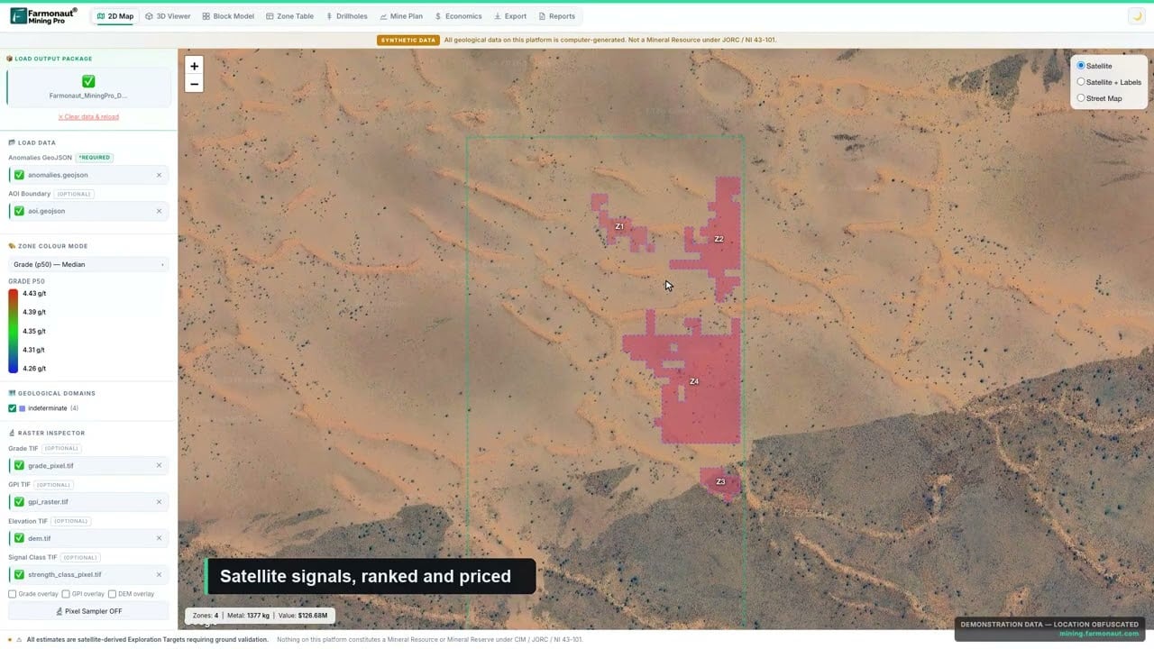
▶ Farmonaut explainer: how a licence boundary becomes a satellite-based geological and economic picture. · 4:56
What you can do without signing in, and what needs an account
Almost every portal has two layers. The public layer is open to anyone and is where most people start. The signed-in layer is for applicants and licence holders, and it is where the transactions happen. Plenty of people search for a way to sign in when everything they actually need is sitting on the public map, so work out which layer you need first.
The public layer (no login)
- View the cadastre map: licence boundaries over a basemap, usually colour-coded by licence type and status.
- Search licences by licence number, holder or company name, commodity, or by drawing or entering coordinates (Mozambique’s portal supports all four).
- Read licence details such as holder, grant and expiry dates, area and commodity (Malawi’s public map shows all of these).
- See payments. The RDF repositories in Ghana, Sierra Leone and Liberia publish fees paid against each licence, which investors find useful.
- Download forms and guidance: application checklists, fee schedules and FAQs.
The signed-in layer (account required)
- Lodge applications: select the area, attach documents and submit.
- Pay fees: application fees, annual rents and in some countries royalties, online or by uploading a bank slip.
- Manage existing licences: renewals, transfers, surrenders, contact updates and statutory reporting.
- ⚠ Account verification is rarely instant. Kenya, Uganda and Zambia let first-time applicants self-register online, then a ministry officer verifies the account. Kenya’s portal help pages ask existing licence holders to register in person so their old licences can be linked to the account, and Uganda does the same.
Verification is manual in most countries. Because rights are usually allocated first-come, first-served, a few days lost to account approval can be the difference between getting a block and watching another applicant take it.
Reading a mining cadastre map
Open the map before you look for a login. For each licence polygon, read three things: its status (granted, pending application or expired), its expiry date and its holder. Pending applications matter as much as granted licences, because ranking is by order of arrival. A polygon marked active can still be about to lapse. In the DRC, the Cadastre Minier publishes a register of active rights, dated 30 September 2026 (CAMI, register notice). Read the holder line as well: the EITI’s 2022 validation of the DRC found that the online cadastre gives coordinates for all active licences, but that titles farmed out by state companies such as Gecamines still show the state firm as holder (EITI, DRC page). Treat a clear-looking block as a lead to check, not proof.
Signing in: what to expect
Portals built on the same platform share a registration routine. Ethiopia’s portal, for example, asks a new user to prepare a completed registration form MCP01, proof of identity and, for agents, legal authority to act for the company. An email then lets you set a password, and the Ministry or a regional authority verifies the documents before access is confirmed. An in-person route exists too (Ethiopia portal, registration page).
If sign-in fails, the usual causes are an account still waiting for officer verification, a public-map address used where the application site is needed (Zambia runs the two on separate sites), an old http link in the DRC, or a portal that is down for maintenance (Nigeria’s can be intermittent). Use the addresses in the directory below.
How to apply on a mining cadastre portal: the common 7-step workflow
The details differ, but the sequence is remarkably consistent. It follows the model in the World Bank’s cadastre guidance and shows up in the Zambian, Kenyan and Nigerian portal documentation.
Chart
Kenya titles: application fee versus yearly charge
KShs thousand, as listed by the Ministry
Step 1: register and verify your account
Expect to provide identity documents for individuals and incorporation papers for companies, plus a letter of authority if an agent or lawyer is filing for you. Zambia’s self-service system sends an email verification and then waits for a Ministry representative to authorise the account. Kenya asks first-time applicants to upload ID and authority letters for Ministry verification. Budget a few working days.
Step 2: select the area
Most modern cadastres use a fixed grid. You don’t draw a polygon by hand; you pick cells, and the licence is made up of whole cells. Nigeria’s cadastral unit is 450 m × 450 m, roughly 20.25 hectares. Ghana’s licensing regulations use a 21-hectare cadastral unit. Under Zambia’s 2016 regulations the unit was six by six seconds of latitude and longitude, which works out at a little over 3 hectares near Lusaka. Other portals accept boundary coordinates. Either way, your coordinates must be in the datum and format the portal expects, or the boundary lands in the wrong place.
Because the grid only sells whole cells, the area you pay for is always a little bigger than the area you drew. The counter below shows how many cells a block takes on each grid, and whether it breaches the size caps the Nigerian and Ghanaian rules set for an exploration or prospecting title.
Step 3: check availability and overlaps
The portal compares your area against existing licences, pending applications and restricted zones such as protected areas or reserved state blocks. Some systems do this automatically as you draw. Others, like Nigeria’s, recommend a formal availability check with the cadastre office. Sierra Leone’s Mining Cadastre Office offers area-availability and overlap checks before you apply.
Step 4: submit and pay
Payment methods vary. Nigeria uses a Remita payment reference code. Liberia added online payments in December 2025, according to the Revenue Development Foundation, which built its repository. Zambia takes an uploaded bank deposit slip, and moved its cadastre onto the Government Service Bus in February 2025 to add card and mobile-money payment. Keep every receipt. The time your application is recorded often depends on the payment clearing.
Steps 5 to 7: ranking, review and grant
Once complete, the application is time-stamped and ranked. The cadastre checks technical admissibility (correct area, no overlaps, fees paid) and passes it to the licensing authority, which checks eligibility and decides. After a grant, the same account is where you pay annual rent, file reports and apply for renewal. Liberia’s ministry warned that licences which expired between May and November 2025 without a renewal application were deemed rejected. The portal is also where you keep a licence alive.
Maps can lag behind the register, and pending applications are not always drawn. Confirm availability through the portal’s own availability check or with the cadastre office, and screenshot the result with a date before you pay.
If you already hold ground, or have a boundary you are about to apply for, you can get a satellite read on it in parallel with the paperwork. Draw it on mining.farmonaut.com (Map Your Mining Site), or send the coordinates through our mining query form.

▶ Farmonaut explainer: can a foreigner get a small-scale mining licence in Africa? · 5:16
Mining cadastre portals by country: the directory
The move online took more than a decade, and it happened in steps. Tanzania’s portal launched in 2012 with about 67,000 licence records, and Sierra Leone put its first licence repository online the same year. Ghana followed with its online repository in July 2016, then stopped accepting paper on 1 November 2021. Nigeria’s eMC+ system went live in November 2022, and Zambia ended manual applications on 18 December 2023. South Africa’s Indwe pilot registered its first 37 rightholders in the Western Cape in October 2025.
The table lists the official portal for each country, the authority that runs it, and whether you can apply online or only search. Every address was checked in September 2026. Government sites move, so if a link fails, go through the licensing authority’s main website rather than a third-party copy.
| Country | Official portal | Run by | Public map / search | Apply online |
|---|---|---|---|---|
| Tanzania | portal.madini.go.tz | Mining Commission (Tume ya Madini) | Yes | Yes (online and/or hard copy) |
| Kenya | portal.miningcadastre.go.ke | Ministry of Mining, Mining Cadastre Office | Yes | Yes |
| Uganda | dgsmportal.minerals.go.ug | Directorate of Geological Survey and Mines | Yes | Yes |
| Zambia | portal.miningcadastre.com (apply); portals.landfolio.com/zambia (map) | Ministry of Mines and Minerals Development | Yes | Yes (online only) |
| Botswana | portal.miningcadastre.gov.bw | Department of Mines | Yes | Yes |
| DR Congo | drclicences.cami.cd | Cadastre Minier (CAMI) | Yes | File with CAMI |
| Namibia | portals.landfolio.com/namibia (map) | Ministry of Industries, Mines and Energy | Yes | Via ministry e-services |
| Mozambique | portals.landfolio.com/mozambique | MIREME / INAMI | Yes | Check with the regulator |
| Malawi | portals.landfolio.com/malawi | Mining and Minerals Regulatory Authority | Yes | Check with the regulator |
| South Africa | SAMRAD Online + Indwe, via DMPR Online Systems | Dept. of Mineral and Petroleum Resources | Limited | Yes (SAMRAD); Indwe in pilot |
| Zimbabwe | No public portal (Sep 2026) | Ministry of Mines and Mining Development | No | Not yet |
| Ghana | miningrepository.mincom.gov.gh | Minerals Commission | Yes | Yes (online only) |
| Nigeria | nigeriaminingcadastre.gov.ng/eMC | Nigeria Mining Cadastre Office | Yes | Yes |
| Sierra Leone | sierraleone.revenuedev.org | National Minerals Agency | Yes | File with the Cadastre Office |
| Liberia | portal.mme.gov.lr | Ministry of Mines and Energy | Yes | Yes (online only) |
| Rwanda | Via rmb.gov.rw licensing | Rwanda Mines, Petroleum and Gas Board | Geodata access | Yes (digital licensing system) |
| Guyana | eservices.ggmc.gov.gy | Guyana Geology and Mines Commission | Tenure story map | Yes (eServices) |
East Africa: Tanzania, Kenya, Uganda and Rwanda
Tanzania mining cadastre portal
Tanzania’s online mining cadastre is at portal.madini.go.tz, run under the Mining Commission (Tume ya Madini), with a public map at the portal’s Public Map page. At its 2012 launch it already held around 67,000 licence records. Registered users can lodge applications, review their licences, submit performance information and pay licence fees and royalties online. The Mining Commission’s application procedure says applications can be submitted online and/or as hard copies, and that the area applied for must be clear of existing licences.
Chart
Kenya large-scale licence: fee plus rent, cumulative
KShs million, application fee plus annual rent for two block sizes
- Licence types: Prospecting Licence (PL), Primary Mining Licence (PML), Mining Licence (ML), Special Mining Licence (SML), plus processing, smelting, refinery, broker’s and dealer’s licences.
- Law: Mining Act, Cap. 123.
- ⚠ Sign-in: guidance from 2015 required portal access to be registered in person at Mining Commission offices. Confirm the rule with your zonal mining office before you rely on self-registration.
Kenya mining cadastre portal
Kenya’s portal is portal.miningcadastre.go.ke, run by the Ministry of Mining’s Mining Cadastre Office in Nairobi. The embedded public map shows licences, applications and mineral dealings. According to the Ministry’s FAQ, applications are made online once you are registered. First-time applicants self-register and upload ID and letters of authority for verification. Existing licence holders register in person using form MCP01. Rent, deadlines and every Kenyan title are set out in our Kenya cadastre fees and deadlines guide.
- Licence types under the Mining Act, 2016: Reconnaissance, Prospecting and Retention Licences, and a large-scale Mining Licence. Small-scale operators use Reconnaissance, Prospecting and Mining Permits. Mineral dealing licences and permits sit alongside these.
- Fees listed in the Ministry FAQ when we checked in September 2026: Mining Licence application KShs 50,000 plus rent of KShs 2,000 per hectare per year (minimum KShs 500,000). Mining Permit application KShs 1,000 plus KShs 10,000 per year. The FAQ is where a revised schedule would appear, so check it before paying.
- ⚠ Deadline: the FAQ allows 90 days to complete an application.
Uganda mining cadastre portal
Uganda’s cadastre, the Mining Cadastre and Registry System, is at dgsmportal.minerals.go.ug, run by the Directorate of Geological Survey and Mines. The public side offers the cadastre map, how-to-apply FAQs, downloadable forms and a list of active dealer and refining licences. Signed-in users can apply, renew, pay, submit reports, and request transfers or surrenders. As in Kenya, first-time applicants self-register online and existing holders register in person.
- Licence types under the Mining and Minerals Act, 2022: Prospecting, Exploration and Retention Licences, and Large-, Medium- and Small-Scale Mining Licences. Artisanal Mining Licences, mineral dealer’s licences and refining/beneficiation licences complete the list.
- ⚠ Watch for portal forms that still use pre-2022 licence names such as the old mining lease. The 2022 Act replaced the mining lease with the scale-based licences above.
Rwanda
The Rwanda Mines, Petroleum and Gas Board (RMB) runs licensing through a digital mining cadastre system, which you reach from the licensing section of rmb.gov.rw. It covers mining and quarry licence applications, renewals and transfers, fee payments and reporting. Law No. 072/2024 on mining and quarry operations sets out exploration, small-, medium- and large-scale mining, mineral trading, processing and quarry licences.
The public side of an East African cadastre is a low-cost due-diligence tool. Before you buy into a project, confirm the holder matches the vendor, check the expiry date, and see how much of the claimed area is actually covered. It takes minutes and catches the most common problems in mining deal documents.
Calculator
What does a Kenyan mining licence cost in rent and fees?
Enter your block size and how many years you want to cost.
- Annual rent (KShs): 800,000
- Fee plus rent over your years (KShs): 2,450,000
- Same total in US$ at your rate: $18,992
Example values only. The KShs 50,000 application fee, KShs 2,000 per hectare annual rent and KShs 500,000 minimum rent for a large-scale mining licence come from the Kenya State Department for Mining FAQs. Stamp duty at issue is extra and varies with licence size. The exchange rate is an input: example, use today’s rate.
Southern and Central Africa: Zambia, Botswana, DRC, Namibia, Mozambique, Malawi, South Africa and Zimbabwe
Zambia mining cadastre portal
Zambia has gone furthest towards a fully online process. Manual mining licence applications stopped on 18 December 2023, and every application goes through the Self-Service Online Mining Cadastre System at portal.miningcadastre.com. A separate public map runs at portals.landfolio.com/zambia. Applicants upload documents and coordinates, the system validates the application and spatial data, and payment is by bank deposit slip or through the Government Service Bus, which adds card and mobile-money options. Accounts are email-verified and then authorised by a Ministry representative.
- Licence types have included Exploration Licences, Large- and Small-Scale Mining Licences, Prospecting Permits, Small-Scale Gemstone Licences and Artisanal Mining Rights.
- ⚠ Law in transition: the Minerals Regulation Commission Act, 2024 and the Geological and Minerals Development Act (in force from June 2025) replaced the Mines and Minerals Development Act, 2015. Check licence names and fees under the 2024 and 2025 laws before you apply.
Botswana mining cadastre portal
Botswana’s Department of Mines runs portal.miningcadastre.gov.bw, with a public map viewer. Signed-in users can submit and manage licence applications, manage company or syndicate representations, report production, transfer ownership and request inspections. The main instruments under the Mines and Minerals Act (Cap. 66:01) are the Prospecting Licence, Retention Licence, Mining Licence and Minerals Permit.
DR Congo mining cadastre portal (CAMI)
In the DRC, the Cadastre Minier (CAMI) publishes a public map of the national mining domain at drclicences.cami.cd. Use the https address; the older http version tends to time out. CAMI’s main site at cami.cd adds a map of mineral occurrences, published decisions and application forms. Applications are filed with CAMI under its published filing conditions, which include fees, a company registration (RCCM) and identity documents. CAMI’s forms page says requests must be made on forms from its counter, which can be downloaded and printed.
- Titles under the Mining Code (Law No. 18/001 of 2018): Permis de Recherches (exploration), Permis d’Exploitation (mining), Permis d’Exploitation de Petite Mine (small mine), Permis d’Exploitation de Rejets (tailings), and quarry authorisations.
Namibia, Mozambique and Malawi
All three publish public cadastre maps on the Landfolio platform: portals.landfolio.com/namibia, portals.landfolio.com/mozambique (English and Portuguese) and portals.landfolio.com/malawi. Mozambique’s map can be searched by licence number, company name or coordinates. Malawi’s shows holder, grant and expiry dates, commodity, area and status for each licence.
- Namibia (Minerals (Prospecting and Mining) Act, 1992): Non-Exclusive Prospecting Licence, Mining Claim, Reconnaissance Licence, Exclusive Prospecting Licence (EPL), Mineral Deposit Retention Licence and Mining Licence. The ministry handles applications through its FlexiCadastre-based e-services.
- Mozambique: Mining Law 20/2014 set out the Prospecting and Research Licence, Mining Concession, Mining Certificate and Mining Pass, plus processing and trading licences. Law No. 7/2026 now adds separate artisanal and small-scale licences. The cadastre has been closed temporarily at times, so check that it is open before planning a filing.
- Malawi (Mines and Minerals Act, 2023): reconnaissance, exploration, retention and large-scale mining licences, plus artisanal permits.
South Africa: SAMRAD and the Indwe licensing system
South Africa is in transition. Prospecting and mining right and permit applications have long gone through the SAMRAD online system of the Department of Mineral and Petroleum Resources (formerly the DMRE), reached from the department’s Online Systems page. SAMRAD’s public information is limited, but it shows whether rights already exist over an area. The replacement Mining Licensing System (Project Indwe) adds a map viewer and applications on a digital grid with online payment. It started in the Western Cape, where the first 37 rightholders were registered in October 2025, with the Eastern Cape next. Applicants outside the pilot provinces were still using SAMRAD when we checked in September 2026.
- Main instruments under the MPRDA (Act 28 of 2002): Prospecting Right, Mining Right, and Mining Permit (up to 1.5 hectares, for up to two years at a time). The South African rights and permits guide covers terms, requirements and DMPR offices.
Zimbabwe
Zimbabwe had no public online cadastre when we checked in September 2026. The Ministry of Mines and Mining Development has been rolling out a computerised Mining Cadastre Registration System, which the minister told Cabinet in July 2026 covers more than 60,000 titles, and title holders were told in July 2025 to submit survey-grade coordinates for their claims. Until the portal opens, searches and applications go through the Ministry’s mining offices. The main titles are blocks of claims, special grants, mining leases and Exclusive Prospecting Orders.
“Zimbabwe’s cadastre is being built to hold more than 60,000 mining titles, each needing survey-grade coordinates.”
Two kinds of map sit side by side. The licence map at drclicences.cami.cd runs on the Landfolio platform (DRC licence map). CAMI’s own site, on its maps page, adds a map of the conceded mining domain and a map that overlays mining and quarry titles on mineral occurrences (CAMI, maps). For anyone searching the DRC mining cadastre map and portal, start with both. Our DRC minerals map shows where each mineral sits by belt.
Recent CAMI notices (read 5 November 2026): on 4 August 2026 CAMI resumed receiving new exploration-type applications after cleaning up its cadastral file, and told applicants to consult the cadastral map before filing (communiqué CAMI/DG/024/2026). It then published the register of active rights as of 30 September 2026. On 29 October 2026 it reminded holders that starting works within the legal deadlines is a condition of keeping a right valid, and asked those who had not sent proof to check the attached lists (communiqué CAMI/DG/030/2026).
Forms come from the CAMI counter: its forms page says requests for mining rights and transfers must be made on the forms held there, which can be downloaded and printed (CAMI, forms).
Mozambique in more detail. The public portal went live in 2013, built with the Ministry of Mineral Resources, and FlexiCadastre, the product name still seen in older links, is now part of the Landfolio suite (Spatial Dimension, 2013). The map is at portals.landfolio.com/mozambique. Closures are real: the National Mining Institute shut the cadastre to new applications from 1 February to 1 April 2021 to update its online titles system, while still processing existing files (Club of Mozambique, January 2021). The law has also moved on: Law No. 7/2026, approved on 7 May 2026 and published on 3 June, creates separate artisanal and small-scale licences and lets authorities reserve areas for them (FurtherAfrica, October 2026). Check licence names with the Institute before you file.

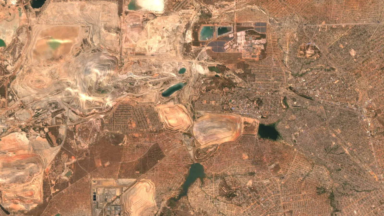
▶ Farmonaut explainer: the DRC’s copper belt and why it draws explorers. · 13:34
West Africa and beyond: Ghana, Nigeria, Sierra Leone, Liberia and Guyana
Ghana Minerals Commission online repository
Ghana’s Minerals Commission runs a public cadastre portal, map and licence repository at miningrepository.mincom.gov.gh. It shows mineral rights and the payments made against them (our Minerals Commission Ghana licensing guide walks through each licence and its timeline). Every application has been online since 1 November 2021, and paper is refused. After signing in through the Commission’s single sign-on, you can file first-time and renewal applications for large- and small-scale mineral rights, register mine support services, request cartographic and legal searches, and file reports and statutory returns.
Chart
Largest area each title allows, in square kilometres
Nigeria and Ghana limits quoted earlier in this guide
- Licence types under the Minerals and Mining Act, 2006 (Act 703) and the 2012 Licensing Regulations: Reconnaissance Licence, Prospecting Licence, Mining Lease, Restricted Mining Lease (industrial minerals), and Small-Scale Mining Licence (reserved for Ghanaians).
- ⚠ Old links: the Commission’s former cadastre address returns an error. Use the repository address above or the Commission’s main site.
Nigeria Mining Cadastre Office (eMC+)
Nigeria’s online cadastre launched in November 2022 and runs at nigeriaminingcadastre.gov.ng/eMC on GAF’s eMC+ system. You register, fill in the application, upload documents, submit and track processing online. Fees are paid through Remita using a payment reference code. Titles are granted first-come, first-served, and areas are built from cadastral units of 450 m × 450 m; our Nigerian mineral title and eMC+ filing guide has the fee table. For a formal availability check, the cadastre office asks you to bring coordinates to one of its offices.
- Titles under the Nigerian Minerals and Mining Act, 2007 and the 2011 Regulations: Reconnaissance Permit, Exploration Licence (up to 200 km²), Small-Scale Mining Lease (up to 3 km²), Quarry Lease (up to 5 km²), Mining Lease (up to 50 km²) and Water Use Permit.
- Processing fees on the office’s apply-now page when we checked in September 2026: Exploration Licence NGN 500,000 for the first 100 cadastral units, and Mining Lease NGN 3,000,000. That page is where changes would show up, so confirm the amounts before you pay.
- ⚠ Uptime: the portal can be intermittent. If it times out, try again later rather than switching to an unofficial mirror.
Sierra Leone: National Minerals Agency
Sierra Leone’s National Minerals Agency publishes its licences (large-scale exploration and mining, small-scale, artisanal, dealer and exporter) with holders and payments on the online repository at sierraleone.revenuedev.org, updated from its cadastre system. Registered users can check the status of applications and licences. Applications themselves go to the NMA’s Mining Cadastre Office, which offers area-availability and overlap checks, and payments go through the National Revenue Authority. The governing law is the Mines and Minerals Development Act, 2022.
Liberia: Ministry of Mines and Energy
Liberia’s repository at portal.mme.gov.lr maps all issued mineral rights and related payments. All applications must go through its application platform, and online payments were added in December 2025. Under the Minerals and Mining Law, 2000, the tiers are Reconnaissance, Prospecting and Exploration Licences and Class A (large-scale), Class B (small-scale industrial) and Class C (artisanal) Mining Licences. The older Landfolio concessions map redirects to a maintenance page, so use the ministry portal.
Guyana: GGMC eServices
Guyana works differently. The Guyana Geology and Mines Commission publishes an interactive Mineral Tenure map (medium- and large-scale tenure) on its website, and handles transactions (new permits and licences, renewals, claim rentals and management of prospecting licences and mining permits) through eservices.ggmc.gov.gy. Tenure GIS data can also be bought from GGMC’s Land Management Division. The governing law is the Mining Act, 1989. For the permit scales, forms and per-acre rents, see our GGMC permits and fees guide.
Other countries with public cadastre portals
The Landfolio vendor also lists public mining or concession portals for Angola, Cameroon, Ethiopia (our Ethiopian mining licence guide covers who issues what), Guinea, Côte d’Ivoire, Mauritania, Senegal, South Sudan, Togo, Papua New Guinea and the Dominican Republic. If your country’s portal is not profiled above, the vendor’s public portal list is a useful index. Always follow through to the licensing authority’s own site before you file anything.
Ethiopia. The national portal is at ethiopian.portal.miningcadastre.com, also on the Landfolio platform. It is open to existing and prospective holders who want to apply for new licences or manage current ones, once registered (Ethiopia’s portal).
Before you apply: make sure the ground is worth the fees
The portal tells you the ground is available. It cannot tell you whether it is prospective, and that gap is expensive. Application fees, annual rent per hectare and minimum work obligations start the moment a licence is granted. In first-come, first-served systems applicants often rush to file on ground they know little about, and end up with a licence that costs money every year and never justifies a drill rig.
Satellite analysis fits between step 3 and step 4 of the cadastre workflow. Once you have confirmed an open area, you already have what we need: a boundary. Our satellite-based mineral detection analyses multispectral and hyperspectral imagery of that polygon. Each mineral and alteration zone reflects energy in its own spectral signature, and we use that to flag likely mineralised target zones, alteration halos and structures such as faults and fractures, without anyone setting foot on the ground.
- ✔ Input you already have: the coordinates, KML/KMZ or polygon you prepared for the cadastre application, plus the country and target mineral.
- Speed: reports are delivered in 5–20 business days depending on area size and mineral complexity, which can fit inside the window many applicants have before committing to fees.
- Deliverables: prospectivity heatmaps, high-potential zones with estimated location and depth ranges, geological interpretation, and PDF plus georeferenced GIS files. Premium+ adds TargetMax™ drilling intelligence and 3D subsurface models.
- Cost: satellite screening can cut early-exploration costs by up to 80–85% and shorten timelines from months to days, compared with starting on the ground.
- ⚠ Limitation: satellite targets are exploration targets, not a resource estimate. They tell you where to sample and drill first, and field work confirms them.
Satellite screening involves no ground disturbance. For applicants on community land or near sensitive areas, you can learn a lot about a block before any vehicle, trench or sample pit touches it. Surface work then goes only where it’s likely to be worthwhile.
The satellite-driven 3D mineral prospectivity mapping overview shows what a typical deliverable looks like. We have scanned 100,000+ hectares for 20+ mineral types across 25+ countries in Africa, the Americas, Asia and Australia.
Found open ground on the cadastre? Check what’s under it.
Send us the same boundary you would put in your licence application. We’ll return a satellite prospectivity read, with ranked target zones, geology and next steps, before you commit to fees and work programmes.
A practical pre-application checklist
- Register your account early and wait for verification before you need to file.
- Search the public mining cadastre map for the area, and record licence numbers of any neighbours.
- Run the official availability check through the portal or the cadastre office, and save a dated copy.
- Prepare the boundary in the portal’s grid or coordinate format and datum.
- Screen the area’s prospectivity using the same boundary, so you apply for the best cells, not simply the open ones.
- Budget beyond the application fee: annual rent per hectare, minimum work obligations, reporting and renewal. Our side-by-side of exploration licence rent and minimum spend shows how far these vary.
- Submit complete. In first-come, first-served systems, an incomplete application can lose its place in the queue.
Grid-based cadastres charge by the cell. Knowing which cells carry the strongest mineral signal lets you apply for a tighter, cheaper licence, or keep the best cells when a law forces you to relinquish part of the area at renewal.
Country guides that go further
Several countries on this page have their own detailed guide:
- Ghana: the five mineral rights, block limits and fees, from reconnaissance licence to mining lease.
- Kenya: portal registration, rents and the 90-day deadline under the Mining Act, 2016.
- Nigeria: titles, cadastral units and eMC+ payments through the Mining Cadastre Office.
- Tanzania: licence classes, application steps and royalties on the Tume ya Madini portal.
- Zambia: how the self-service cadastre handles licences and fees since manual filing ended.
- Ethiopia: which ministry licenses what, and where the gold and lithium ground is.
- Artisanal and small-scale permits across several countries: plot caps, terms and who qualifies.
Frequently asked questions
What is a mining cadastre portal?
A mining cadastre portal is the official online system a government uses to publish and manage its mineral rights register. The public side shows a mining cadastre map of licences, holders and status. The signed-in side lets registered users apply for, pay for, renew and manage licences.
Is it “mining cadastre” or “mining cadaster”?
Both spellings are used. “Cadastre” is the British and most common African usage, and “cadaster” is the American spelling. They mean the same thing: the official register of mineral rights tied to defined areas of land. You will see “mineral cadastre” too, and a search for a mining cadaster portal leads to the same official systems listed in this guide.
How do I sign in to a mining cadastre portal?
First create an account on the country’s official portal. This usually means an email address plus identity documents, company papers and any letter of authority. A ministry officer then verifies the account. In Kenya and Uganda, existing licence holders register in person so their licences can be linked. Once approved, you sign in with those credentials. You don’t need an account to view the public map.
Can I check whether an area is available without applying?
Yes. The public mining cadastre map shows existing licences, and many portals have an availability or overlap check. Maps can lag the register, though, so confirm availability through the portal’s formal check or the cadastre office before you pay any fees.
Which countries let you apply for a mining licence fully online?
Among the countries in this guide, Ghana, Zambia and Liberia require online applications. Kenya, Uganda, Tanzania, Botswana, Nigeria, Rwanda and Guyana (through GGMC eServices) offer online applications. In the DRC, Sierra Leone and Zimbabwe you still file with the cadastre office. South Africa uses SAMRAD while its Indwe system is piloted.
Does a licence on the cadastre mean the ground contains minerals?
No. A licence is a legal right to explore or mine an area, not evidence of a deposit. Many licences are held over ground that has never been tested. Satellite mineral detection on the licence boundary is a fast, non-invasive way to see whether and where the area shows mineralisation signatures before you spend on fieldwork.
Can Farmonaut apply for a mining licence on my behalf?
No. We are not a licensing authority or a filing agent, and applications must go through the official portal or cadastre office. What we provide is the geological side: a satellite prospectivity analysis of the area you plan to apply for or already hold, so you can decide where to apply and where to explore first.
Portal addresses, licence types and fees in this guide come from each licensing authority’s own website, portal help pages and published guidance, and from the World Bank’s mineral rights cadastre guidance. Government systems, fees and licence names change, especially where a mining law is being replaced (Zambia, Uganda, South Africa, Zimbabwe), so always confirm with the licensing authority before you file or pay. Nothing here is legal advice.
Where is the DRC mining cadastre map portal?
The licence map is at drclicences.cami.cd (use https). CAMI’s website, cami.cd, adds a map of the mining domain and a map of titles over mineral occurrences, plus the register of active rights dated 30 September 2026. Applications are filed on CAMI forms from its counter.
Is the Mozambique mining cadastre portal open for applications?
The public map is online. The institute has closed the cadastre to new applications before, for example from February to April 2021, and a new Mining Law (Law No. 7/2026) now adds artisanal and small-scale licences. Confirm status with the National Mining Institute before planning a filing.
How much does a Kenyan mining licence cost to apply for?
The Ministry’s FAQ lists a non-refundable application fee of KShs 50,000 for a large-scale mining licence and annual rent of KShs 2,000 per hectare, with a minimum of KShs 500,000. Stamp duty is charged separately at issue. The calculator above adds these up for your block and number of years.
This page is for information only. It is not legal advice. Confirm the rules with the regulator.
Farmonaut mining
Check the ground before you pay the fees
Send your licence or claim boundary for a quote on a satellite screening that ranks exploration targets ahead of a resource estimate.
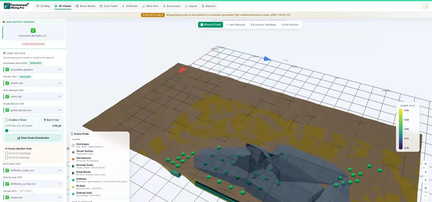
Mining Pro sample view, synthetic data
Keep reading
Sources
- Kenya State Department for Mining, FAQs: mining.go.ke
- CAMI (Cadastre Minier RDC), home page: cami.cd
- CAMI, communiqué CAMI/DG/024/2026 (4 August 2026): cami.cd
- CAMI, communiqué CAMI/DG/030/2026 (29 October 2026): cami.cd
- CAMI, register of active rights at 30 September 2026: cami.cd
- CAMI, maps: cami.cd
- CAMI, forms: cami.cd
- DRC Mining Cadastre Map Portal (Landfolio): drclicences.cami.cd
- Ethiopia Mining Cadastre Portal, registration page: ethiopian.portal.miningcadastre.com
- Spatial Dimension, Mozambique Mining Cadastre Portal launch (2013): spatialdimension.com
- Club of Mozambique, temporary closure of the Mining Cadastre (January 2021): clubofmozambique.com
- FurtherAfrica, Mozambique mining law opens artisanal sector (October 2026): furtherafrica.com
- Club of Mozambique, President promulgates new Mining Law (June 2026): clubofmozambique.com
- Nigeria Mining Cadastre Office, FAQ: miningcadastre.gov.ng
- GAF AG via Earth Observation Magazine, new Nigerian online mining cadastre (December 2022): eomag.eu
- EITI, Democratic Republic of the Congo (2022 Validation report): eiti.org
- Mozambique Mining Cadastre Map Portal (Landfolio): portals.landfolio.com
Discussion
Questions, corrections or field experience? Share them below. First-time comments are reviewed before they appear, and your email is never published.
No comments yet. Be the first to add a question or your experience.

 Klusetic Mining Investments
 Mine4Africa
 Lithspo Minerals Limited
 Tintina Mining Group
 Dalgety Minerals Pty Ltd
 Vortex Minerals Pty Ltd
 Faith At Work (Pty) Ltd
 Geotech Mining Solutions plc
 Vulcan International Limited
 Kidepo Associates
 GKY Mining
 Alkimy SARL
 Double A Trading
 GemSprout Metals Limited
 Qader Group
 Ileys General Trading
 SG Gold Mining LLC
 VRV Global Pte Ltd
 Omsri International FZE
 G.I.T.T.
 Jaunita Erss Ltd
 Almosi SARL
 SRK Consulting
 Berks Gold Limited
 Mwerezi Minerals Company Limited