3D Drone Mapping: Ag Drone & Aerial Mapping Solutions for Agriculture in 2025
Meta Description: Transform your farm management in 2025 with 3D drone mapping and aerial agricultural mapping solutions, optimizing yields, sustainability, and efficiency with precision analytics.
“By 2025, over 60% of large farms globally are projected to use 3D drone mapping for field analysis.”
Table of Contents
- Summary: Advancing Agriculture in 2025
- Introduction: The Transformative Power of 3D Drone Mapping
- The Future of Agricultural Mapping: 2025 & Beyond
- Core Technologies Behind 3D Drone Mapping & Aerial Solutions
- 3D Drone Mapping Explained: Unlocking New Dimensions
- Aerial Mapping Drones: Revolutionizing Agricultural Mapping Solutions
- Precision Agriculture and Sustainable Practices Underpinned by Mapping
- Complete Agricultural Mapping & Analysis in Practice
- Farmonaut: Satellite-Based Data, Analytics & Advisory Systems
- Key Benefits of 3D Drone Mapping vs. Traditional Mapping in Agriculture (2025)
- Beyond Mapping: Expanded Capabilities of Ag Drones in 2025
- FAQs: 3D Drone Mapping & Aerial Mapping Solutions in 2025
- Conclusion
Summary: Advancing Agriculture in 2025 – The Transformative Power of 3D Drone Mapping and Aerial Agricultural Solutions
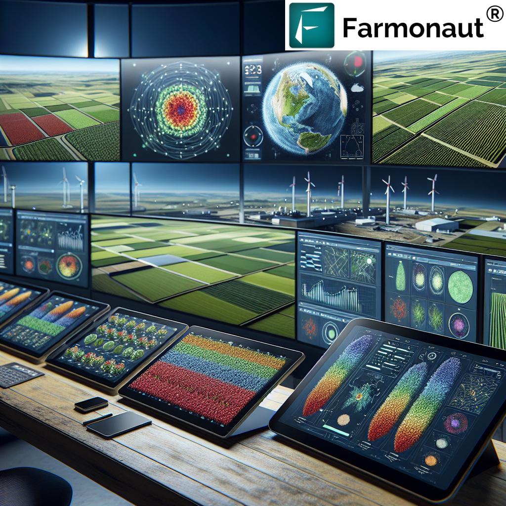
In the rapidly evolving landscape of global agriculture, 3D drone mapping and cutting-edge aerial agricultural mapping solutions stand as the transformative power reshaping the industry into 2025. Propelled by advanced data analytics, these technologies offer unmatched precision in crop management, soil analysis, and resource optimization. Farmers, agronomists, and stakeholders worldwide are leveraging 3D models, multispectral sensors, and AI-driven analytics to enhance crop health, maximize yields, reduce environmental impact, and drive sustainability to new heights. Companies like Farmonaut are making these powerful tools affordable and accessible, ushering in a new era of efficiency, transparency, and sustainability in agriculture.
Introduction: The Transformative Power of 3D Drone Mapping in Agriculture
The agriculture sector is undergoing a profound transformation in 2025, propelled by digital technologies designed to optimize productivity, strengthen sustainability, and empower farming practices. 3D drone mapping, alongside other aerial mapping drones and agricultural mapping solutions, has emerged as a pivotal force reshaping field management and operational decision-making. Instead of relying on traditional mapping techniques—which often provide only 2D perspectives and limited insight—today’s farmers, agronomists, and businesses are embracing 3D agricultural mapping and analysis to unlock new dimensions of data-driven farming.
With the unprecedented power of advanced sensors (including LiDAR and multispectral cameras) and AI analytics, these solutions reveal vital information about soil, crop health, topography, and resource use. They lay the foundation for optimizing input applications, minimizing waste, and boosting yields—all while reducing environmental impact and supporting sustainability goals. In this in-depth guide, we’ll explore the workings of these technologies, current and emerging applications, benefits over traditional methods, and showcase how platforms like Farmonaut are democratizing access to resource-saving analytics for the future of agriculture.
“Aerial mapping drones can capture up to 500 acres of farmland data in a single 30-minute flight.”
The Future of Agricultural Mapping: 2025 & Beyond
The adoption of 3D drone mapping and aerial mapping drones is not simply a trend, but a transformative shift. By 2025, it’s estimated that more than half of commercial farms globally will utilize some form of aerial or advanced mapping, marking a leap from previous tools that were often limited by cost, accessibility, and data resolution. This explosion in adoption reflects a sector-wide recognition: data-driven, precision solutions are essential in an era marked by climate variability, population growth, tightening regulations, and a pressing need for sustainable resource management.
These systems empower farmers to optimize every square meter of their land, leveraging highly accurate 3D data models and comprehensive analytics to guide planting, irrigation, nutrient delivery, pest management, and harvest projections. In effect, these tools bridge the gap between modern scientific knowledge and the practical realities of everyday farming across virtually every climate and crop type.
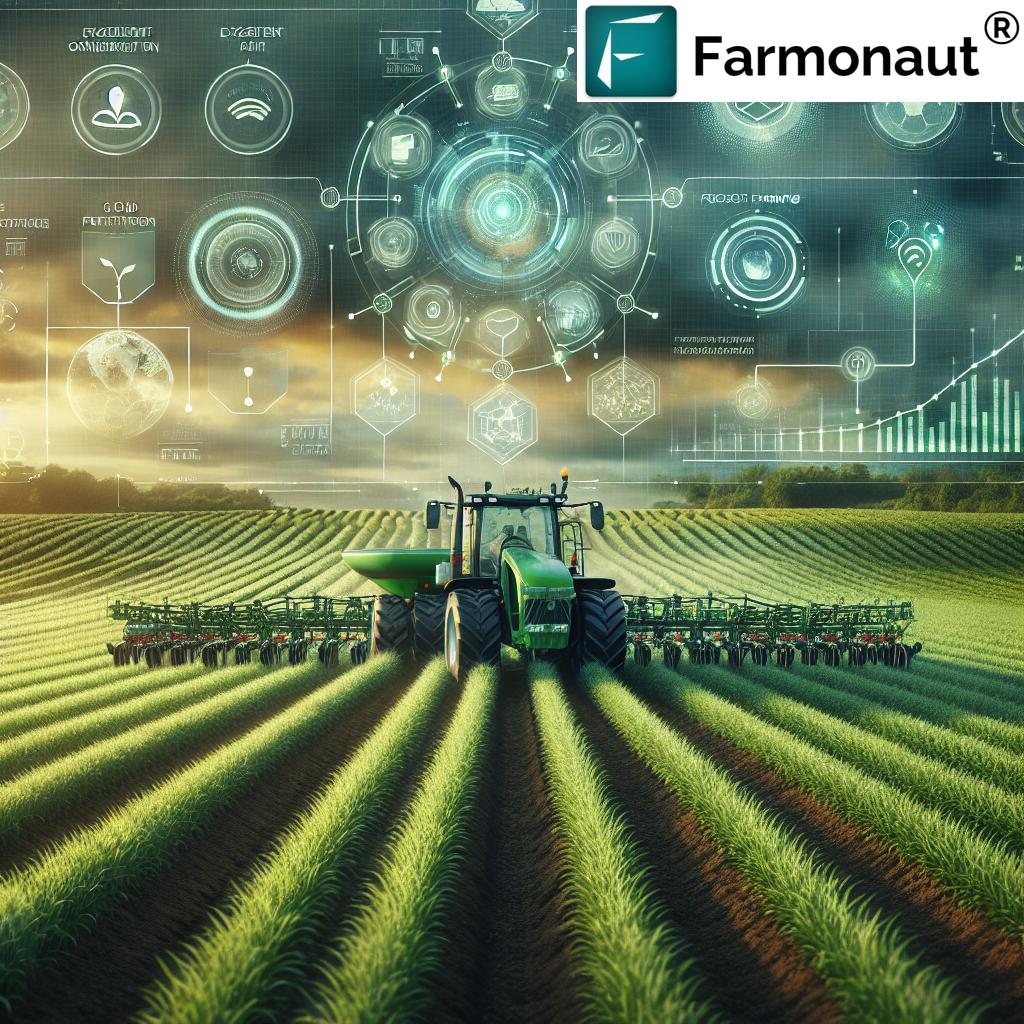
Core Technologies Behind 3D Drone Mapping & Aerial Agricultural Solutions
To appreciate the transformative power of 3D drone mapping and aerial agricultural mapping solutions, it’s vital to understand the technologies at their core:
- Advanced Sensors: LiDAR, multispectral, and hyperspectral cameras are mounted on ag drones to capture detailed information about field topography, canopy structure, and crop health.
- GPS & RTK Positioning: High-precision GPS (often with RTK corrections) ensures centimeter-level accuracy for mapping and georeferencing agricultural features.
- AI-Driven Analytics: Machine learning and artificial intelligence process the massive influx of raw drone-gathered data, converting it into actionable maps and recommendations (such as NDVI and soil moisture overlays).
- Cloud-based Platforms: Solutions like those provided by Farmonaut offer accessible, secure, and scalable interfaces for managing, visualizing, and integrating agricultural field data with other farm management practices.
- API Integration: Modern mapping systems—and platforms like Farmonaut—support APIs, allowing seamless incorporation of satellite and drone data into existing agricultural management systems.
3D Drone Mapping Explained: Unlocking New Dimensions in Farm Management
Traditional mapping techniques in agriculture provided only 2D perspectives, often restricting the ability of farmers to fully understand landscapes and limiting effective management of complex or varied terrains. 3D drone mapping changes the game by leveraging highly advanced sensors that capture vertical structure along with traditional horizontal information. Here’s how it works:
How 3D Aerial Mapping Works
- The ag drone flies over the farm, collecting millions of data points using cameras and LiDAR sensors.
- These data points are processed by software that creates detailed 3D models of fields, topography, structures, and crops.
- The resulting comprehensive maps display elevation changes, field boundaries, drainage patterns, canopy density, uniformity, and more.
Key Advantages for Agriculture
- Problem Zone Identification: 3D maps reveal problematic zones prone to soil erosion, waterlogging, or drainage issues with unrivaled accuracy.
- Topography-Informed Design: Contour farming, customized drainage systems, and targeted land improvements can be designed based on accurate terrain data, conserving water and improving soil health.
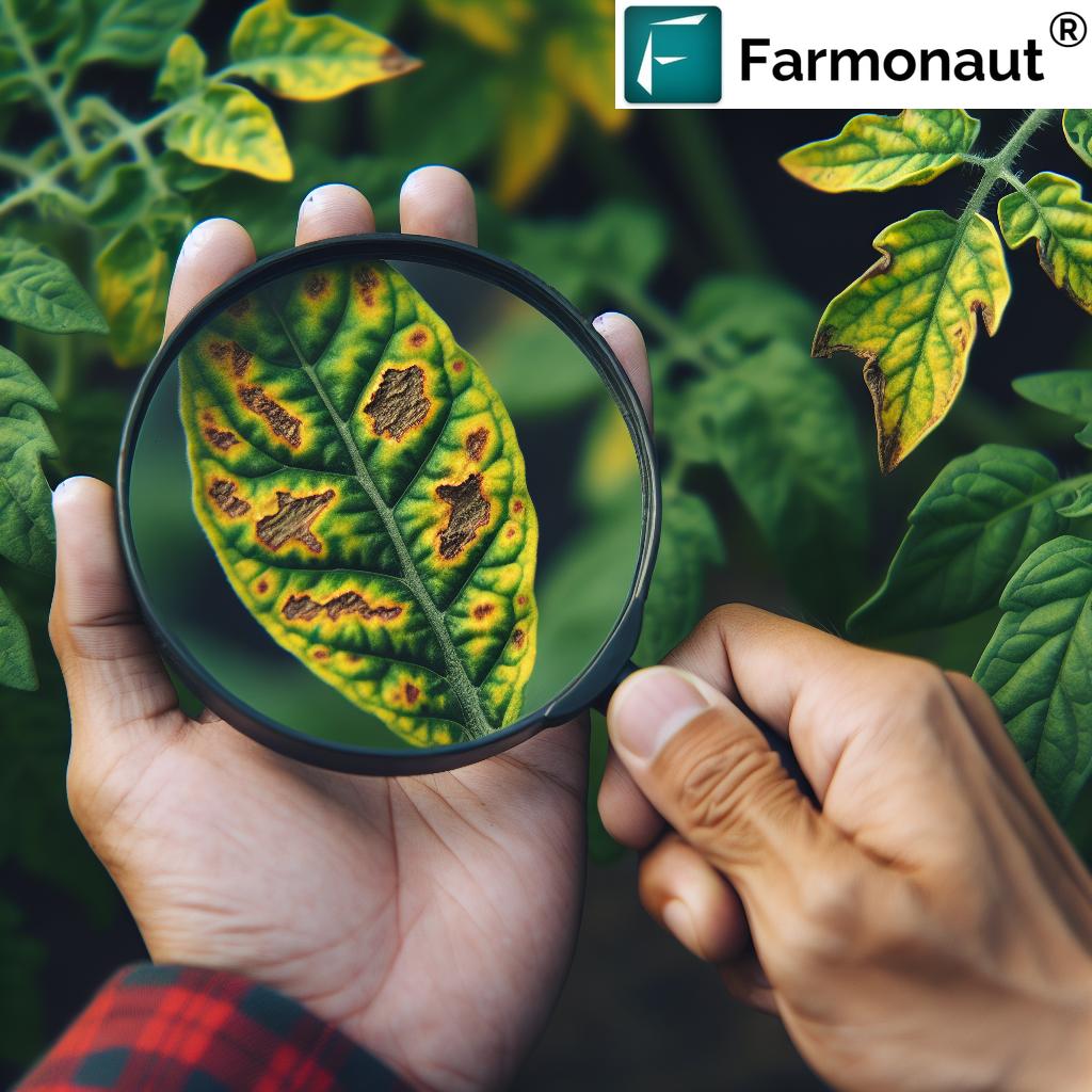
- Crop Health Assessment: 3D canopy representations help with assessing growth uniformity across entire fields and rapidly detecting issues like pest infestations or nutrient deficiencies.
This level of detail and precision enables targeted, evidence-based interventions in ways that 2D and manual field surveys simply cannot match. The result? Resource efficiency, optimized yields, lower cost, and minimized environmental impact.
Aerial Mapping Drones: Revolutionizing Agricultural Mapping Solutions
Aerial mapping drones, especially when equipped with multispectral cameras and GPS, have become the vanguard of agricultural mapping solutions in 2025. These drones capture data-rich imagery across color (RGB), multispectral (infrared, red-edge, etc.), and even thermal bands to provide unique insights into the health and needs of crops. The benefits are profound:
- Unprecedented Coverage: One drone can cover hundreds of hectares in a single flight, capturing more detailed information than traditional ground scouting or even satellite imagery alone.
- Timely Data: Since weather, growth, and disease pressure can change quickly, regular flyovers with drones provide frequent, repeatable surveys, making the data highly relevant to seasonally sensitive decisions.
- AI Analytics Integration: Modern aerial mapping solutions are integrated with analytics platforms, so output (from NDVI plant vigor to disease risk maps) is delivered through user-friendly dashboards accessible on tablets and smartphones—even in the field.
These regular, automated surveys allow for near real-time growth monitoring, stress detection, and input optimization, further propelling the sector toward higher productivity and sustainability.
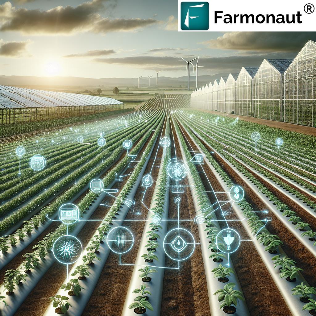
Precision Agriculture and Sustainable Practices Underpinned by Mapping
The 3D drone mapping and aerial mapping drone revolution plays a pivotal role in advancing precision agriculture and sustainable farming in 2025. Here’s how these solutions are reshaping practices and boosting impact:
- Variable Rate Application: Agricultural inputs like fertilizer, pesticide, and irrigation are delivered using variable rates based on mapped zones, reducing resource waste and minimizing environmental impact.
- Targeted Interventions: Instead of “blanket” approaches, farmers can pinpoint problematic zones and intervene precisely—preserving beneficial insects and reducing runoff into waterways.
- Water Conservation: Accurate topography and drainage pattern detection enable highly efficient water management systems.
- Enhanced Sustainability: Reduced input waste, minimized soil degradation, and better tracking of greenhouse gas emissions all become achievable with sophisticated mapping systems.
- Yield Optimization: Early detection of crop stress and disease zones means yields can be maximized and loss minimized, bolstering food security on a global scale.
Complete Agricultural Mapping & Analysis in Practice
Agricultural mapping and analysis in 2025 is no longer limited to data collection—it spans integration, prediction, and actionable insights delivered directly to the farmer’s devices. This holistic approach relies on the marriage of aerial data, ground sensors, historical records, and real-time AI-powered analytics.
- Predictive Models: By incorporating weather forecasts, soil moisture profiles, and yield history, farms can predict harvest outcomes, recognize likely stress events before they arise, and adjust operations proactively.
- Resource Management: AI analyzes variable soil health, crop development, and growth stage to recommend optimal timing for planting, fertilization, pest control, and harvest.
- Accessible Dashboards: Interactive dashboards make it easy for users to access, visualize, and act on complex analytical outputs—removing barriers to adoption for even the least tech-savvy growers.
The net result? Smarter, faster, and more informed decisions—effortlessly increasing productivity, supporting environmental stewardship, and reducing overall operational risks.
Farmonaut: Satellite-Based Data, Analytics & Advisory Systems
As a pioneering satellite technology company, we at Farmonaut empower agricultural users across the globe via advanced AI, machine learning, and satellite analytics. Our solutions provide a comprehensive suite of tools for real-time field monitoring, resource optimization, and strategic farm management—all accessible via Android, iOS, web app, and API.
- Satellite-Based Monitoring: We use multispectral satellite imagery to offer actionable insights into vegetation health (NDVI), soil moisture, and even carbon footprinting. Discover more about our carbon footprinting solutions for sustainability tracking.
- AI-Driven Advisory (Jeevn AI): Our tailored, AI-powered advisory system delivers up-to-date recommendations, weather alerts, and pest/disease forecasts so farmers can make informed, data-driven decisions for their unique field conditions.
- Blockchain-Based Traceability: We help bring transparency to the agricultural supply chain. Explore our blockchain-powered product traceability solutions, which ensure authenticity from field to market.
- Fleet & Resource Management: For larger operations, we offer advanced fleet management tools to track agricultural equipment and resources efficiently—reducing costs and maximizing operational efficiency.
- Farm Management at Scale: For big farms and enterprises, our large scale farm management solutions deliver seamless integration of analytics, reporting, and collaboration tools across teams and locations.
- Crop Loan & Insurance Verification: Our satellite-based verification helps stakeholders and financial providers streamline insurance and crop loan approvals with reliable, up-to-date field data.
All of these innovations are accessible via our web and mobile platforms and easy-to-integrate APIs (Developer Documentation).


For those looking for deeper guidance on reforestation and plantation intelligence, we provide tailored crop plantation and forest advisory services as well.
Key Benefits of 3D Drone Mapping vs. Traditional Mapping in Agriculture (2025)
To really understand the transformative advantages of 3D drone mapping and aerial agricultural mapping solutions, contrast them directly with traditional mapping techniques:
| Feature/Parameter | 3D Drone Mapping (Estimated 2025) | Traditional Mapping (Estimated 2025) |
|---|---|---|
| Data Accuracy (%) | Up to 98% | 70-80% |
| Coverage Area per Flight (hectares) | Up to 500 | 10-50 (manual/survey) |
| Time Required per Survey (hours) | 0.5 to 1 | 5-20 |
| Crop Yield Improvement (%) | Up to 30 | 5-10 |
| Environmental Impact Score | Low (due to precision) | Moderate-High |
| Cost Efficiency ($/hectare) | $2–$8 | $10–$25 |
| Automation Level (% tasks automated) | 80–95% | 15–30% |
As this table illustrates, 3D drone mapping and aerial agricultural mapping solutions deliver overwhelming benefits: higher accuracy, faster and wider coverage, better yields, improved sustainability, and significant cost reductions for modern farm management.
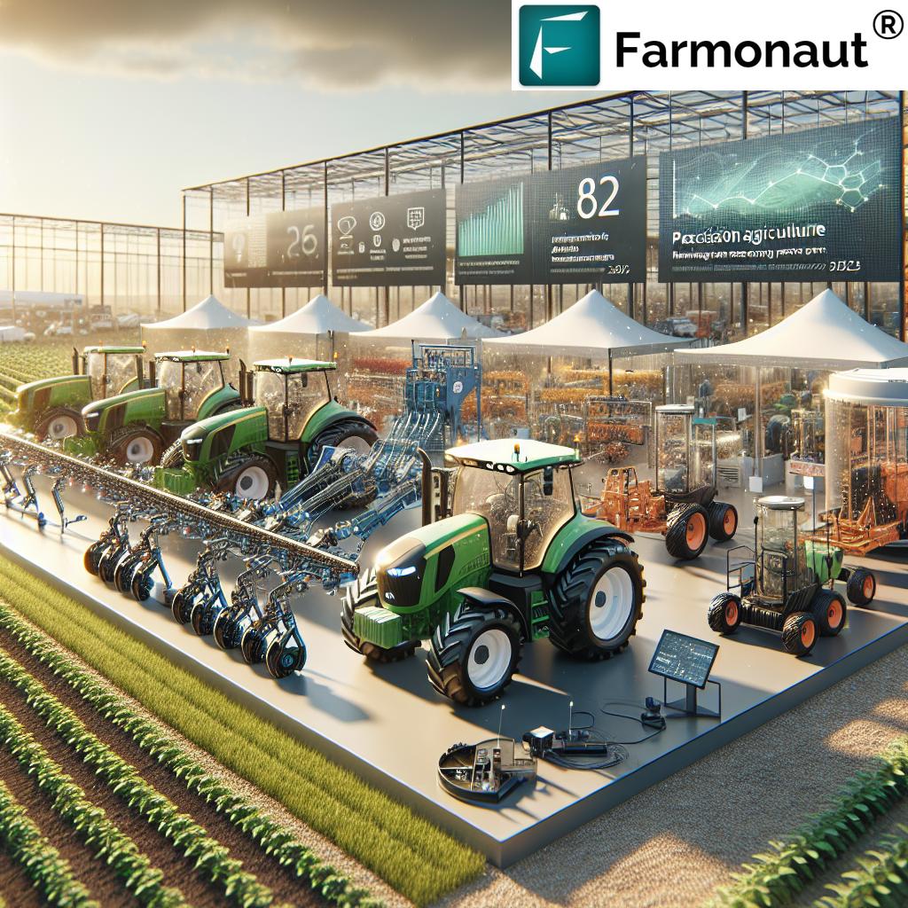
Beyond Mapping: Expanded Capabilities of Ag Drones in 2025
While mapping and analysis form the bedrock of the digital agricultural revolution, the role of ag drones is expanding dramatically. In 2025, aerial drones are not just collecting information but actively assisting in farm operations through:
- Payload Delivery: Select drones can directly spray fertilizer, pesticide, or micronutrients only in targeted, problem zones—completing the loop from analysis to action.
- Real-Time Surveillance: Drones provide rapid surveillance for security, wildlife monitoring, and even time-sensitive interventions (e.g., hail damage or irrigation leaks).
- Disaster Response: Unforeseen events—droughts, flooding, infestation—can be quickly assessed and responses rapidly orchestrated, thanks to the speed and agility of aerial platforms.
Frequently Asked Questions (FAQ) – 3D Drone Mapping & Aerial Agricultural Mapping Solutions in 2025
What is 3D drone mapping?
3D drone mapping is the process of using agricultural drones equipped with advanced sensors such as LiDAR and multispectral cameras to generate detailed, three-dimensional models of agricultural fields. These maps reveal crucial information about elevation, topography, drainage patterns, canopy structure, and crop health, empowering precise, data-driven farming decisions.
How do aerial mapping drones benefit farmers?
Aerial mapping drones allow farmers to quickly and efficiently gather large amounts of highly detailed field data. By providing regular, up-to-date imagery and analysis, these drones help detect crop stress, disease, irrigation needs, and yield potential—enabling targeted interventions and reducing unnecessary input application.
What are agricultural mapping and analysis solutions?
These are comprehensive, integrated systems that collect, process, and deliver actionable insights for farm decision-makers. They combine aerial drone data, satellite imagery, soil sensors, weather predictions, AI analytics, and actionable output to assist in every stage of the agricultural cycle, from planning to harvest.
Can small farms benefit from these solutions?
Absolutely. While large-scale farms stand to gain significant efficiency, 3D drone mapping and precision analytics can help small farms optimize every available hectare, increase yields, and cut costs. Technological advances and platforms like Farmonaut are making these tools far more affordable and accessible, regardless of farm size.
How do these mapping technologies promote sustainability?
By precisely targeting inputs, minimizing unnecessary chemical use, improving water management, and monitoring environmental impact (including carbon emissions), 3D drone mapping and AI-driven solutions directly support regenerative agricultural practices and climate-smart farming.
What level of technical skill is required to use these mapping solutions?
Most modern solutions—including those offered by Farmonaut—are designed with user-friendly dashboards and app interfaces, making advanced analytics accessible to all skill levels. APIs and integration tools allow even greater automation for those managing large-scale or enterprise operations.
Where can I access and use Farmonaut’s mapping and satellite-based solutions?
You can access our mapping and analytics platform via web app, Android app, or iOS app. For custom integrations, check out our API and API developer documentation.
Conclusion
The adoption of 3D drone mapping and aerial agricultural mapping solutions is a crucial leap into the future of smart, sustainable farming. In 2025, these cutting-edge technologies bring the transformative power of precision analytics and rapid, real-time insights to the fingertips of every farmer and agronomist. The results: increased yields, higher operational efficiency, targeted resource use, minimized environmental impact, and a stronger foundation for climate resilience and sustainability.
With companies like Farmonaut making satellite and aerial insights more affordable and accessible than ever, the pathway to a data-driven, prosperous, and environmentally responsible agricultural future is wide open. By embracing these solutions, the agricultural sector is not only reshaping its present but securing a healthy, productive, and sustainable tomorrow for our planet and future generations.
For the most advanced, affordable, and scalable satellite and AI-driven mapping solutions, try Farmonaut on web or mobile today.