Best Thermal Sensor Machine Learning: Agriculture Datasets for 2025 & Beyond
“Over 80% of remote sensing crop models now use machine learning on thermal sensor datasets for real-time soil analysis.”
- Introduction
- Thermal Sensors and Their Role in Agriculture
- Comparative Feature Table of Leading Agriculture Thermal Sensor Machine Learning Datasets
- Datasets Driving Machine Learning in Agriculture
- Applying Artificial Intelligence and Machine Learning in Remote Sensing and GIS
- Precision Irrigation and Predictive Crop Health
- Farmonaut: AI-Driven Satellite Technology Platform for Agriculture and Beyond
- Future Prospects: Toward 2025 and Beyond
- FAQ
- Conclusion
Introduction: Revolutionizing Precision Agriculture with Best Thermal Sensor Machine Learning
In recent years, the integration of advanced thermal sensors with machine learning (ML), agriculture datasets, and artificial intelligence (AI) has unleashed unprecedented capabilities in crop health monitoring, soil analysis, and precision irrigation. As we move towards 2025, the fusion of thermal sensing, machine learning, and geographic information systems (GIS) is equipping farmers and agronomists worldwide with powerful tools to optimize yield, enhance resource management, and proactively predict crop health dynamically.


This comprehensive guide dives deep into the best thermal sensor machine learning agriculture datasets and the latest AI-powered platforms that are redefining agriculture globally. Let’s explore the critical role of thermal data, modern datasets powering machine learning algorithms, and how AI-driven remote sensing and GIS integration are paving the path for sustainable and precision agriculture.
The Role of Thermal Sensors in Modern Agriculture
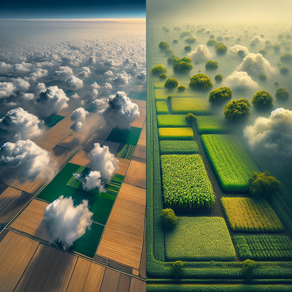
Best thermal sensor machine learning starts with precise thermal sensing. Thermal sensors detect temperature variations across agricultural fields by capturing emitted infrared radiation from plant canopies and soil surfaces. This temperature data is critical in identifying early plant stress caused by water deficiency, pests, or diseases that are often imperceptible to the naked eye. These conditions can be detected far earlier by thermal remote sensing than by standard visual inspection.
- Thermal sensors are most often deployed as:
- Ground-based devices: Measuring micro-climatic temperature at soil level.
- Drones/UAVs: Using multispectral and hyperspectral cameras for high-res mapping over fields.
- Satellites: Covering large areas, ideal for spatially explicit and temporal monitoring.
- Among best devices available today:
- FLIR and DJI Zenmuse XT2 (Drone-mounted)
- Landsat 8/9 TIRS and Sentinel-3 SLSTR (Satellite-based, multispectral)
- Hand-held thermal imager systems
The integration of thermal sensors with AI and ML algorithms enables agricultural platforms to generate high-resolution maps that facilitate:
- Localized evapotranspiration rate analysis
- Soil moisture content monitoring
- Detection of microclimatic conditions relevant to crop health
- Predictive irrigation management
With these technologies, farmers can optimize resource usage and rapidly respond to dynamic stress signals in their fields.
Comparative Feature Table of Thermal Sensor Machine Learning Agriculture Datasets
The following table provides a detailed comparison of leading thermal sensor machine learning agriculture datasets used for crop health analysis, soil monitoring, and precision irrigation.
| Dataset Name | Thermal Sensor Type | # Images/Entries (Est.) | Key Crop Types Covered | Primary ML Applications | Data Accessibility | Year of Publication |
|---|---|---|---|---|---|---|
| USDA Cropland Data Layer (CDL) | SatelliteMultispectral & Thermal (Landsat) | >250,000 images/year | Corn, Soybean, Wheat, Cotton | Crop classification, health monitoring, yield prediction | Open-source | 2008–present |
| AIRTHERM | Aerial Drone, Hyperspectral | ~15,000 fields | Grapevine, Wheat, Tomatoes | Water stress, soil moisture estimation | Research (partial open) | 2018 |
| THERMAL-FIELDSET | Ground sensors, Drone Thermal | ~30,000 entries | Rice, Barley, Citrus | Plant stress index mapping, anomaly detection | Open-source | 2020 |
| ESA WorldCereal Dataset | Sentinel-2 Multispectral, Sentinel-3 SLSTR Thermal | Millions (global) | Barley, Rice, Maize, Wheat (global) | Crop mapping, land cover, water demand | Open-source | 2021 |
| OpenAIRE AgriThermal AI Dataset | Drone, Satellite Thermal | 50,000+ | Potato, Maize, Fruits | Precision irrigation, crop disease detection | Open-source | 2022 |
| AgriTrace Thermal Blockchain Set* | Satellite & Blockchain-enabled Thermal Sensors | Confidential (enterprise-level) | Cotton, Sugarcane, Mixed Row Crops | Blockchain verification, crop traceability, insurance | Proprietary | 2023 |
* Datasets with blockchain-driven traceability are increasingly crucial for sustainable agricultural supply chain solutions. See how our Traceability Platform is shaping this future.
Agriculture Datasets for Machine Learning: The Data Driving Accurate Crop Analysis
At the heart of artificial intelligence and machine learning in remote sensing and GIS for precision agriculture are robust, high-quality datasets encompassing a range of thermal, spectral, and spatial information. ML models rely on:
- Field-collected thermal data from sensors or satellites
- Soil parameter measurements: moisture, salinity, organic matter
- Historical weather records: temperature, rainfall, wind, humidity
- Crop yield statistics and growth stages
- Remote sensing imagery: including thermal, multispectral, and visible light
These datasets form the foundation for ML-based classification, prediction, and anomaly detection systems now widely adopted in 2025 and beyond.
Main types of agriculture datasets enabling ML advances:
-
Public Datasets:
- USDA Cropland Data Layer: Annual, nationwide satellite-derived map of US crops. Extensive, multi-year, open-source thermal and multispectral imagery for advanced crop classification and health analysis.
- ESA WorldCereal: Multi-continental, Sentinel-based, supports spatially explicit crop mapping.
-
Thermal Dataset Archives:
- Landsat and Sentinel Thermal Archives: Temporal thermal data crucial for evapotranspiration estimation and irrigation scheduling.
- Research-Driven Field Datasets: Specialized, smaller in scale but rich in ground-truth labels for ML algorithm validation.
-
Indices and Derived Feature Datasets:
-
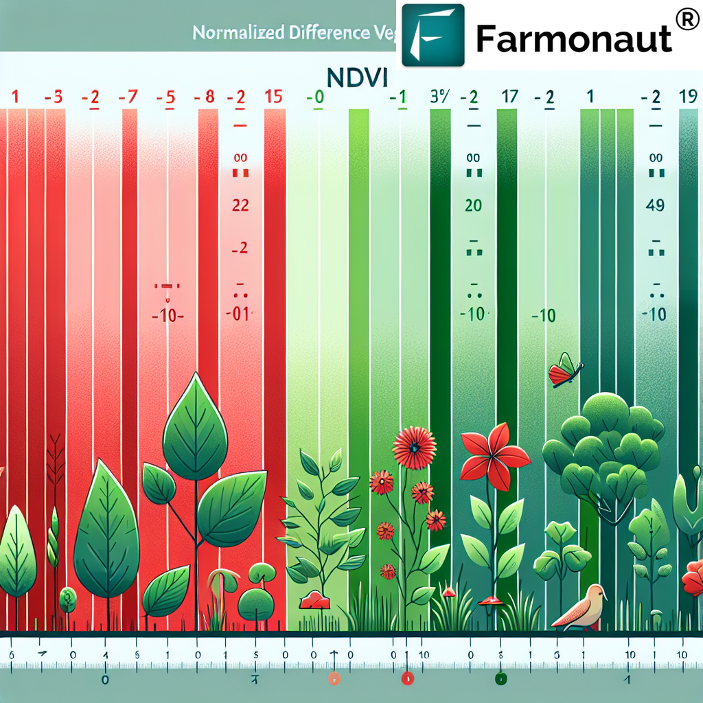
Crop Water Stress Index (CWSI), NDVI (Normalized Difference Vegetation Index), and thermal vegetation indices:
- Allow detection of subtle stress conditions and pre-symptomatic plant disease.
- Soil moisture anomaly indices calculated from multi-temporal satellite imagery.
-
Crop Water Stress Index (CWSI), NDVI (Normalized Difference Vegetation Index), and thermal vegetation indices:
-
Blockchain-Integrated Traceability Datasets:
- Trace crop origin, management, and environmental footprint for sustainability and food safety (more about traceability and blockchain).
“Precision irrigation improves by up to 30% accuracy using advanced AI trained on agriculture-focused thermal sensor datasets.”
Artificial Intelligence and Machine Learning in Remote Sensing and GIS
The application of artificial intelligence and machine learning in remote sensing and GIS has revolutionized the monitoring and management of agricultural fields worldwide. Through the integration of thermal, multispectral, and geospatial data, AI-powered models drive accurate, timely, and actionable insights for a wide range of agricultural applications.
-
Convolutional Neural Networks (CNNs):
- Automatically extract features and patterns from satellite/dronal thermal imagery for crop type classification and health detection.
-
Random Forest and Decision Tree Classifiers:
- Excellent for anomaly detection, soil analysis, and crop classification using high-dimensional and mixed-resolution thermal datasets.
-
Recurrent Neural Networks (RNNs) & LSTM Models:
- Analyze continuous, time-series thermal data sequences to predict crop stress, irrigation needs, and yield dynamically.
These algorithms are increasingly integrated into GIS platforms, enabling real-time monitoring and interventions on large farms as well as for smallholders.
Key Innovations Enabled by AI & ML in Remote Sensing for Agriculture:
- Crop Species Identification: High-resolution images and deep learning facilitate precise classification of multiple crops even in mixed or fragmented fields.
- Predictive Disease & Pest Outbreak Detection: Thermal and spectral anomalies are flagged for early intervention, often before signs are visually apparent.
- Evapotranspiration and Stress Index Mapping: Thermal imaging algorithms model water loss and stress zones for efficient irrigation intervention.
- Biomass & Yield Estimation: ML fusion of thermal and multispectral data supports better biomass calculation, improving yield predictions.
AI-enabled remote sensing GIS platforms combine temporal satellite imagery with local sensing devices to deliver on-the-ground advisories and management recommendations directly to stakeholders.
Precision Irrigation and Dynamic Crop Health Management
The fusion of thermal sensors with predictive machine learning models has unlocked new frontiers in precision irrigation:
- Thermal imagery and time-series temperature data track evapotranspiration rates, allowing precise identification of water-stressed zones within fields.
- Advanced LSTM and RNN models analyze microclimate patterns, soil moisture, and crop development to dynamically forecast future water needs.
- Integration with GIS platforms enables farmers to visualize resource requirements and deploy variable rate irrigation – optimizing water usage and reducing costs by up to 30%.
- Real-time edge computing allows in-field ML inference, supporting fast response to unexpected stress events or climatic anomalies.
The result: more resilient crops, sustainable water usage, and robust, data-backed decision making at every level of agricultural management.
What Does Precision Irrigation Look Like in 2025?
Tomorrow’s leading platforms empower farmers to seamlessly integrate thermal sensor data with AI-driven advisories. For example:
- Satellites and drones provide sub-weekly, high-resolution thermal maps.
- Smartphone apps and dashboards deliver localized irrigation scheduling recommendations.
- Automated IoT-enabled valves and pumps adjust water flow with minimal human oversight.
- Farmonaut’s Jeevn AI Advisory System (accessible via web and mobile app): Delivers real-time, satellite-powered weather forecasts, stress maps, and actionable insights.
To get started, explore our platform and developer APIs for remote sensing integration at Farmonaut Satellite API
For technical integration, see the API Developer Docs.
Farmonaut: AI-Driven Satellite Agriculture Platform for Smart Management
At Farmonaut, we combine artificial intelligence, machine learning, and multispectral satellite imagery for truly accessible, cost-effective agricultural insights. Our Jeevn AI Advisory System analyzes thermal and visual data to provide crop health monitoring, irrigation advisories, microclimate tracking, and environmental compliance.
- Monitor fields via satellite: Access detailed NDVI, thermal stress, and moisture maps—no expensive local sensors required.
- Manage entire resource fleet: Optimize agri-logistics and machine deployment through fleet management dashboards.
- Enforce blockchain-based traceability: Assure transparency for crop origin and sustainable practices—learn more at our product traceability platform.
- Access large-scale management tools: From individual smallholders to vast enterprises; discover our large scale farm management tools.
- Enable environmental stewardship: Track carbon emissions and prove compliance using our carbon footprinting service.
With a modular subscription model (monthly/yearly) and API access, our platform serves every kind of agricultural operation, no matter the scale.
Try Farmonaut Now
Future Prospects: 2025 and Beyond
As thermal sensor machine learning, agriculture datasets, and AI-driven remote sensing and GIS technologies continue to evolve, we witness:
- Increased global coverage: With new satellites being launched every year, high-resolution thermal datasets will be even more precise and frequent in 2025, supporting more detailed field-level crop analysis.
- Smarter ML Algorithms: Advances in neural network architectures, unsupervised anomaly detection, and fusion models will continuously boost prediction accuracy and timeliness.
- Full integration of weather, soil, and socio-economic data: Holistic models will factor in future climate scenarios, resource constraints, and food system risks.
- Edge & cloud computing convergence: On-device/field-level data processing paired with global cloud infrastructures will deliver real-time, autonomous interventions.
- Widespread democratization: Cloud platforms and open-source data sharing will accelerate innovation and make best-in-class thermal sensing AI tools accessible to farmers worldwide.
The future of agriculture is thus data-driven, resilient, and empowered by the best thermal sensor machine learning agriculture datasets—reducing environmental impacts while maximizing food security and economic value.
Frequently Asked Questions (FAQ)
-
Q: What is the importance of thermal sensors in agriculture?
A: Thermal sensors are vital in detecting subtle temperature variations due to water deficiency, disease, or pest stress in crops and soils—often before visible symptoms appear. They enable timely interventions for optimized resource management and improved yield.
-
Q: Which machine learning models are best for analyzing thermal agriculture data?
A: Convolutional Neural Networks (CNNs), Random Forests, Recurrent Neural Networks (RNNs), and LSTM models are especially effective for classification, prediction, and anomaly detection on agricultural thermal and multispectral datasets.
-
Q: Are open-source datasets available for remote sensing and crop monitoring?
A: Yes! Datasets like the USDA Cropland Data Layer (CDL), ESA WorldCereal, and specialized open-source drone/ground thermal sets are widely used for advancing AI-powered agricultural analysis.
-
Q: Can smallholder farmers benefit from these technologies?
A: Absolutely! Platforms are increasingly affordable and accessible via web, mobile, and API. Insights from advanced thermal and AI analysis can guide smallholders in optimizing irrigation, boosting yield, and improving sustainability.
-
Q: What is Farmonaut’s value proposition?
A: At Farmonaut, we deliver cost-effective, satellite-driven insights via real-time monitoring, AI-based advisory, blockchain traceability, and resource management tools through user-friendly apps & APIs—serving everyone from smallholders to large agri-enterprises.
-
Q: How do thermal datasets improve environmental sustainability?
A: Thermal sensor data supports precise resource interventions, reducing water waste and chemical use. Features like carbon tracking and blockchain traceability promote eco-friendly and transparent agricultural practices.
Conclusion: Advancing Agriculture with Best Thermal Sensor Machine Learning and Datasets
The convergence of thermal sensors, machine learning, and GIS-driven remote sensing is ushering in a new era of precision agriculture, where intelligent monitoring, predictive resource management, and real-time advisories are becoming standard practice for farmers and agronomists worldwide. By leveraging the best agriculture datasets for machine learning, advanced AI analytics, and open data platforms, agriculture in 2025 and beyond promises not just higher yields but greater sustainability and resilience.
Farmonaut is proud to be part of this transformation, striving to make satellite-driven, AI-based insights affordable and universally accessible for all. Whether you are a farmer, business, or government body, our solutions are designed to empower your agricultural journey with actionable intelligence.
Ready to elevate your crop health management, irrigation, traceability, and sustainability practices? Get started with Farmonaut’s advanced platform:
Useful Links:
- Carbon Footprinting Service: Track, manage, and reduce your environmental impact with advanced remote sensing and AI analytics.
- Blockchain Traceability Platform: Ensure transparency in agricultural product supply chains and enhance food safety.
- Crop Loan and Insurance Verification: Get access to finance quickly and reliably with satellite-verified documentation.
- Fleet Management Platform: Optimize logistics, reduce costs, and improve safety with real-time tracking of agricultural machinery and vehicles.
- Large-Scale Farm Management: Manage extensive farm operations efficiently, backed by AI and satellite intelligence.
- Farmonaut Web & Mobile App: Instant access to satellite-based monitoring and AI-powered insights for crop health, soil condition, and weather forecasts.
- API for Developers: Integrate AI-driven remote sensing insights into your own platforms.
- Developer Docs: Full documentation to help your tech teams embed the future of agricultural intelligence.