Optimize Saltwater Disposal: 5 InSAR Data Strategies
“In 2025, over 70% of saltwater disposal operators will use InSAR data to monitor surface deformation efficiently.”
How Operators Can Use InSAR Data to Optimize Saltwater Disposal in 2025: Summary
Saltwater disposal (SWD) remains a critical component of fluid management in the ever-evolving oil and gas industry, especially as the scale of fluid injection and disposal continues to grow through 2025. This process, in which produced saline water is injected deep underground, must be managed with precision and innovation to minimize environmental risks, detect and mitigate surface deformation or subsidence, maintain well and casing integrity, and comply with regulatory frameworks.
Enter Interferometric Synthetic Aperture Radar (InSAR), a revolutionary satellite remote sensing technology. InSAR measures ground surface deformation—often at millimeter-scale precision—making it possible to monitor injection-related landscape changes over vast regions. By comparing radar images captured by satellites over time, operators can detect subtle surface movements, patterns of ground subsidence or uplift, and zones of potential fault activation, helping them manage injection rates, reduce risks, and enhance operational efficiency.
This comprehensive guide dives deep into five InSAR data strategies that are transforming SWD operations in 2025:
- Monitoring Ground Deformation Patterns for early detection of risk
- Identifying Induced Seismicity Risks before they lead to costly shutdowns
- Optimizing Injection Well Placement and Operation with integrated data
- Ensuring Environmental and Regulatory Compliance using non-invasive, wide-area surveillance
- Cost-Effective, Large-Scale Surveillance to manage multiple sites at scale
By leveraging these strategies—especially as technology integrates with AI and IoT—operators now have the ultimate toolkit to optimize saltwater disposal in 2025 and beyond.
Understanding InSAR & Its Relevance to Saltwater Disposal
Operators in oil and gas face a variety of risks in managing SWD activities. While the injection of produced fluids or saline water deep into geological formations is essential, it can result in significant challenges:
- Subtle to pronounced ground deformation (subsidence or uplift)
- Induced seismicity (earthquakes linked to fluid injection)
- Pressure buildup and fault activation threatening well integrity
- Potential groundwater contamination risks
- Non-compliance with environmental or regulatory standards
Interferometric Synthetic Aperture Radar (InSAR) is a powerful satellite-based remote sensing technique that measures subtle ground and surface movements by comparing radar images captured over different periods. InSAR satellites—equipped with advanced radar sensors—provide wide-area, high-resolution surveillance, making it possible to:
- Detect patterns of movement in land surface or infrastructure
- Measure changes in ground elevation with extreme precision (as small as 1 mm!)
- Assess pressure, volume, or injection-related impacts on the subsurface geological environment
“InSAR technology can detect ground movement as small as 1 millimeter, revolutionizing saltwater disposal risk management.”
Unlike traditional ground-based monitoring, InSAR covers extensive areas at a fraction of the cost, with persistent, non-invasive observation. As a result, it is revolutionizing how operators manage SWD in 2025—allowing them to optimize injection parameters, ensure compliance, and reduce costly risks.
5 InSAR Data Strategies to Optimize Saltwater Disposal in 2025
1. Monitoring Ground Deformation Patterns
Focus Keyword: How Operators Can Use InSAR Data to Optimize Saltwater Disposal in 2025
The core advantage of InSAR lies in its ability to monitor persistent ground deformations—an essential component for all SWD management in the oil and gas sector.
How it works: By analyzing a series of radar images acquired before and after fluid injection, InSAR detects subtle surface subsidence or uplift near injection sites. These movements may indicate pressure changes, reservoir compaction, well casing vulnerability, or even early signs of fault slippage.
Regularly updated InSAR data—provided via satellites—enables operators to correlate injection volumes, rates, and patterns with detected ground movement. This close feedback loop helps operators actively assess risk and intervene before minor issues escalate.
- Example: If a surface subsidence pattern persists over weeks after fluid injection, operators can adjust injection rates, pause SWD activities, or investigate for casing integrity concerns.
- InSAR monitoring helps optimize SWD sites and ensure operational safety.
Did you know?
Operators achieving early detection of surface deformation with InSAR may reduce costly SWD disruptions by as much as 30%.

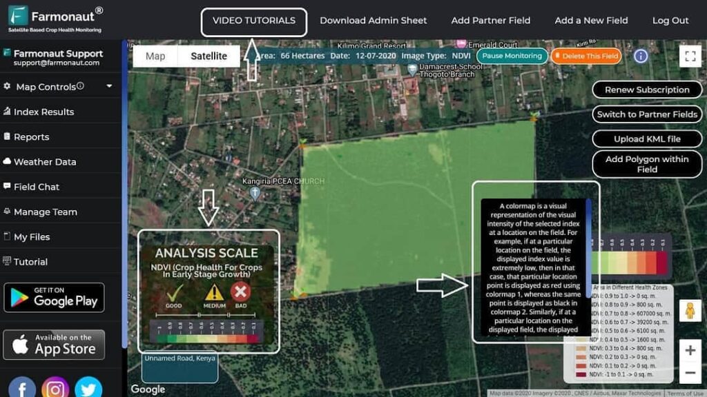
Pro Tip: Farmonaut offers real-time monitoring capabilities leveraging satellite data and AI-driven analytics to help businesses, governments, and industries like oil and gas detect and respond to early signs of deformation, groundwater risks, and environmental shifts. Explore our crop plantation and forest advisory features for sustainable resource management powered by satellite imagery.
2. Identifying Induced Seismicity Risks
One of the most serious risks tied to SWD activities is induced seismicity—seismic events triggered by increased pressures in deep subsurface formations due to fluid injection.
How InSAR helps:
- By mapping surface displacement gradients and micro-deformations, InSAR reveals potential changes in subsurface stress near known faults or weak zones.
- Operators can identify patterns of movement that may precede seismicity (often too subtle for other techniques to detect).
If persistent, abnormal ground movement is detected near a disposal site, operators can proactively adjust injection parameters (like volume or pressure), or even halt injection to mitigate the risk of induced earthquakes.
Map Seismicity Risks in Real Time:
- Integrate InSAR data with seismic sensor readings and geological models
- Confidently pinpoint vulnerable zones
- Facilitate early intervention and improved risk management strategies


Bonus: If you want seamless scalability and advanced analytics, check out Farmonaut’s API platform—integrating high-frequency satellite, radar, and weather data for next-level operational intelligence. Developer docs here.
3. Optimizing Injection Well Placement & Operation
Choosing the right location for a SWD well—or adjusting its operation—is paramount for minimizing environmental and operational risks.
How Operators Can Use InSAR Data to Optimize Saltwater Disposal:
- Integrate InSAR-derived deformation maps with subsurface geological, hydrological, and reservoir models.
- Identify zones where pressure dissipation is rapid and compaction risk is low.
- Correlate injection volumes and operational schedules to observed surface deformations, refining site-specific strategies to optimize disposal efficiency.
Benefits:
- Extended well life: Proper placement and real-time adjustment reduce stress on well casings, minimizing costly failures or regulatory non-compliance.
- Resource optimization: Operators can maximize disposal capacity while safeguarding land, groundwater and infrastructure.
- Sustainable planning: Effective management of produced fluids reduces environmental impacts and maintains land value.
If you’re an operator seeking to streamline fleet and resource management for large or complex sites, explore Farmonaut’s Fleet Management and Large-Scale Farm Management solutions.
Why?
- Gain satellite-backed insights across hundreds of square kilometers
- Optimize asset allocation and logistics
- Collect, analyze, and act on high-resolution field data—no matter your operation’s scale
4. Ensuring Environmental & Regulatory Compliance
Environmental stewardship and regulatory compliance are non-negotiable in today’s highly scrutinized energy environment. Surface deformations can threaten land stability, contaminate water resources, or cause damage to pipelines, roads, and agricultural fields.
How InSAR data enables operators to ensure compliance:
- Non-invasive, continuous monitoring: Proves SWD activities do not induce unacceptable ground movement or affect local infrastructure.
- Transparent record-keeping: InSAR data are timestamped and tamper-proof, creating valuable proof for compliance reporting.
- Automated alert systems: Detect unplanned disturbances, enabling rapid response and mitigation to safeguard environments.
Key Point: InSAR surveillance provides a clear audit trail—crucial for proving adherence to increasingly strict environmental and land use regulations in 2025.
Want to track and transparently verify environmental impacts throughout product and resource supply chains? See Farmonaut’s carbon footprinting and traceability solutions—pioneering use cases in both oil & gas and agritech.
5. Cost-Effective & Large-Scale Surveillance
Traditional ground instrumentation can be limited by cost, logistical complexity, and lack of regional coverage.
With InSAR satellites, operators get:
- Consistent revisit intervals (often every few days)
- High-resolution monitoring across hundreds of square kilometers
- Cost-effective deployments—no large field teams required, reducing operational expenses
- Simultaneous oversight of multiple injection wells/sites, with continuous data streams
- Automated alerts when surface movement exceeds safety or compliance thresholds
For users needing affordable and scalable systems, Farmonaut’s Fleet Management platform offers critical tools for managing dispersed SWD, mining, or agricultural operations through secure, cloud-based, satellite-integrated dashboards.
Comparative Table of InSAR Data Strategies for SWD Optimization
Below is a side-by-side comparison of the five essential InSAR strategies for saltwater disposal optimization in 2025, highlighting expected efficiency improvements, risk mitigation potential, example uses, and technological needs.
| Strategy Name | Primary Application | Estimated Efficiency Improvement (%) | Risk Reduction Potential | Example Use Case | Technology Requirement |
|---|---|---|---|---|---|
| Monitoring Ground Deformation Patterns | Surface deformation monitoring | 15–30% reduction in surface deformation incidents | High—early warning prevents costly failures | Real-time detection of subsidence at SWD site | Sentinel-1 SAR, sub-5m spatial resolution |
| Identifying Induced Seismicity Risks | Risk assessment, fault movement detection | 10–25% reduction in induced seismic events | Medium to High—if integrated with seismic sensors | Mapping pre-seismic ground movement | SAR satellites + AI-based analytics |
| Optimizing Well Placement & Operation | Operational optimization | 20–40% increase in disposal efficiency | Medium—targets high-risk areas for safer operations | Selecting low-risk injection zones via InSAR data | Multi-temporal SAR, data fusion with geologic models |
| Ensuring Environmental & Regulatory Compliance | Compliance documentation & site monitoring | Full traceability; up to 40% faster compliance reporting | High—proof for audits, litigation protection | Land use compliance via continuous surface monitoring | Cloud-based, timestamped SAR analytics |
| Cost-Effective, Large-Scale Surveillance | Managing multiple SWD sites efficiently | 30–50% lower surveillance costs vs. ground sensors | Medium—enables broad yet granular oversight | Automated alerts for large regional operations | Frequent revisit SAR, scalable cloud infrastructure |
The Future: Integration of InSAR with AI & IoT in Saltwater Disposal Optimization
In 2025 and beyond, saltwater disposal optimization is propelled into a new era by the seamless integration of InSAR data, AI algorithms, and IoT systems:
- Artificial Intelligence: Deep learning models analyze vast repositories of InSAR-generated ground deformation data, predicting trends, anomaly patterns, and flagging risks with unprecedented speed and accuracy.
- IoT Sensors at the Wellhead: On-site sensors feed real-time pressure, fluid volume, and temperature data to centralized, cloud-based monitoring systems.
- Automated Decision Support: The combination allows for dynamic adjustment of injection parameters, keeping them within safe thresholds while maximizing disposal capacity.
- Enhanced Environmental Management: Data integration supports regulatory reporting and environmental protection initiatives, including active groundwater safety management.
As advanced InSAR platforms like those harnessed by Farmonaut continue to evolve, operators enjoy better detection, analysis, and resilience across the entire SWD lifecycle—making surface, subsurface, and reservoir management smarter and more sustainable than ever before.
Farmonaut: Harnessing Satellite, AI, and Data Innovation for Environmental Stewardship
As a leader in democratizing affordable satellite technologies, Farmonaut empowers the oil, gas, agriculture, and mining sectors with a suite of advanced tools that include:
- Satellite-Based Monitoring: Real-time satellite imaging, including radar, enables surface and subsurface monitoring—from SWD and reservoir integrity to vegetation, infrastructure, and project performance.
- AI-Powered Decision Support: The Jeevn AI Advisory System delivers actionable insights based on satellite-derived ground and environmental data.
- Environmental Impact Tracking: Monitor carbon footprinting (Explore This Product) and ensure sustainable disposal and operational practices with up-to-the-minute analytics.
- Blockchain-Driven Traceability: Maintain transparent and tamper-proof records of fluid handling, land use, and operational metrics—for both regulatory compliance and marketplace trust (See Traceability Solutions).
- Resource Management Tools: Fleet Management for logistics optimization; Large Scale Farm Management for overseeing dispersed projects via unified dashboards.
- Cloud & API Access: Connect, automate, and integrate monitoring data at API scale—reducing time-to-alerts and boosting efficiency.
With these solutions, we at Farmonaut ensure our clients—from independent operators to major governmental bodies—are equipped to adapt and thrive within the fast-paced, compliance-driven realities of 2025 and beyond.
Ready to join the future of data-driven operations? Download Farmonaut for Android or iOS, or experience our browser-based app for satellite-powered performance monitoring, resource optimization, and environmental analytics.
Recommended Videos: Satellite Monitoring, InSAR & More
Frequently Asked Questions (FAQ)
What is InSAR and how does it help in saltwater disposal?
InSAR (Interferometric Synthetic Aperture Radar) is a satellite-based remote sensing technique that compares radar images over time to detect and measure small changes in ground elevation. In saltwater disposal, InSAR helps operators detect subsurface deformation, surface subsidence, or uplift caused by fluid injection, enabling early intervention and improved risk management.
Why is surface deformation monitoring important in SWD operations?
Persistent ground deformation near SWD sites can indicate reservoir compaction, pressure buildup, fault activation, or casing issues. Early detection using InSAR helps operators correlate subsurface changes with injection volumes, adjust operational parameters, and prevent costly equipment failures or seismic risks.
How are AI and IoT enhancing InSAR-based SWD monitoring in 2025?
AI models analyze large InSAR datasets to spot emerging deformation trends and predict risks with high accuracy. IoT sensors at wellheads provide real-time pressure, fluid, and temperature data, which—when combined with InSAR—enables automated control and faster response to safety or efficiency thresholds.
What satellite infrastructure is recommended for InSAR-based SWD optimization?
High-frequency SAR satellites like Sentinel-1, or commercial SAR platforms offering sub-5 meter spatial resolution, are best. Cloud-based analytics and AI-powered dashboards can further enhance operational awareness and risk management.
Can satellite-based monitoring help with regulatory compliance?
Absolutely. InSAR provides objective, timestamped records of ground movement, suitable for compliance audits and transparent environmental documentation. Traceability features—like those offered by Farmonaut—enhance trust and regulatory alignment by producing tamper-proof data trails.
Conclusion
Modern saltwater disposal management is driven by the need for efficiency, risk reduction, sustainability, and compliance. The deployment of InSAR data strategies in 2025 equips operators with the insights required to detect, assess, and mitigate ground deformation, induced seismicity, and environmental impacts—often before they escalate to operationally or financially significant events.
We at Farmonaut recognize that the integration of InSAR with AI, IoT, and real-time monitoring systems represents the future of safe, sustainable fluid and SWD operations, especially as environmental and regulatory expectations climb. With Farmonaut’s advanced satellite solutions, industry-leading resource management tools, and innovative traceability features, operators can confidently embrace the challenges and opportunities of modern SWD—maximizing operational efficiency, ensuring compliance, and protecting the land and subsurface resources for the future.
Ready to revolutionize your saltwater disposal practices? Experience firsthand how satellite-driven data and innovation are reshaping the oil and gas industry.