Remote Sensing in Farm Management: Key Benefits 2025
“Remote sensing is projected to increase farm yield prediction accuracy by over 30% in 2025.”


Summary: Remote Sensing in Farm Management 2025
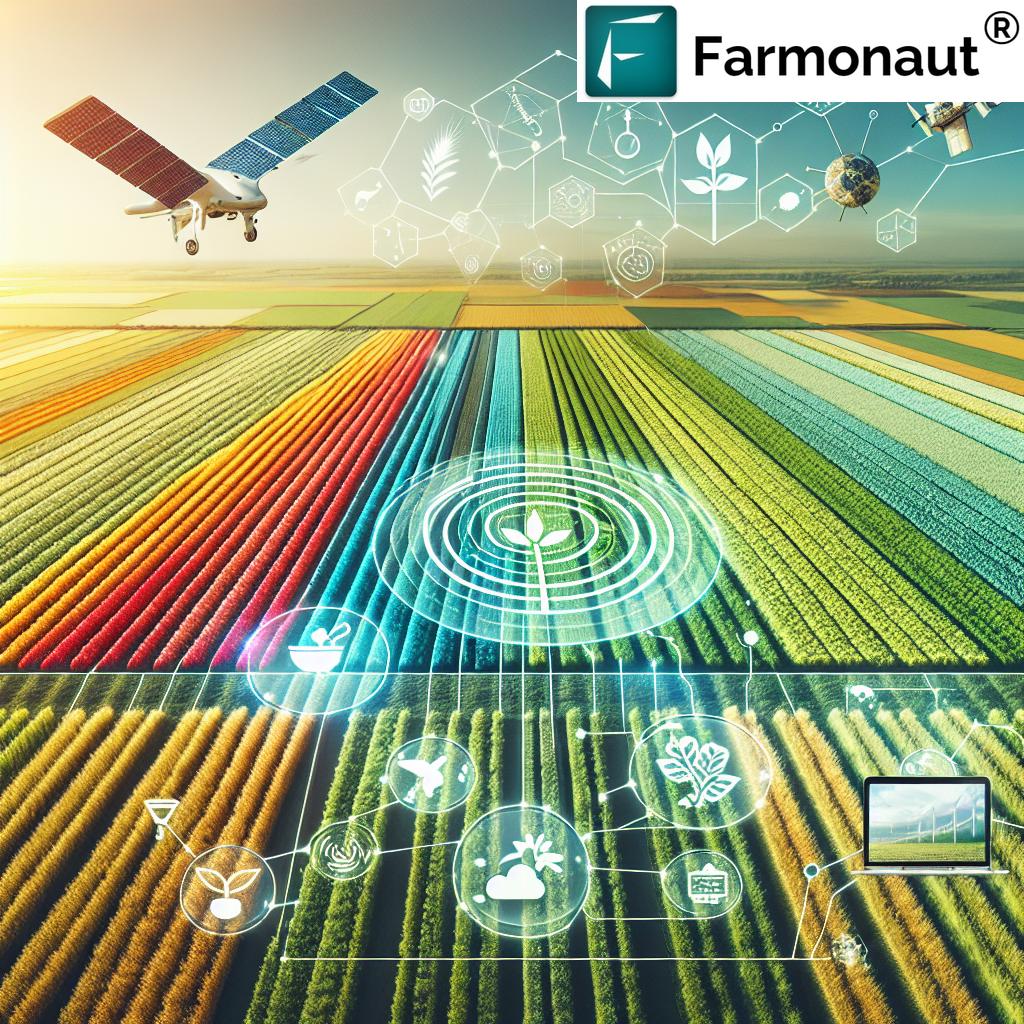
In modern agriculture, technology has rapidly evolved, becoming a critical tool for enhancing farm management, increasing productivity, and promoting sustainable practices. Among the most transformative technological processes employed by farmers today is the use of remote sensing—especially satellite and drone-based sensors—for monitoring and managing large agricultural areas.
By 2025, the integration of telemetry, real-time data collection, and best management practices (BMPs) boosts agricultural efficiency, sustainability, and decision-making far beyond what was possible in previous decades.
Understanding Remote Sensing Technology in Agriculture
Remote sensing refers to the practice of collecting information about an area or object without making physical contact. Within agriculture, it involves the use of satellite, aerial, or drone-based sensors to capture data on crop health, soil moisture, nutrient levels, pest infestations, and more. The primary goal is to obtain a comprehensive and accurate understanding of field conditions to guide data-driven decisions such as irrigation scheduling, fertilizer application, pest control, and harvest timing.
-
Remote sensing helps answer questions like: “A farmer uses remote sensing as part of his farm management. What is the most likely goal of this practice?”
Answer: To obtain a comprehensive and accurate understanding of field conditions for optimal management. - Remote sensing enables precision agriculture, where inputs such as water, fertilizer, and pesticides are optimized to increase yields while reducing waste and environmental impact.
Key Components of Remote Sensing in Farming
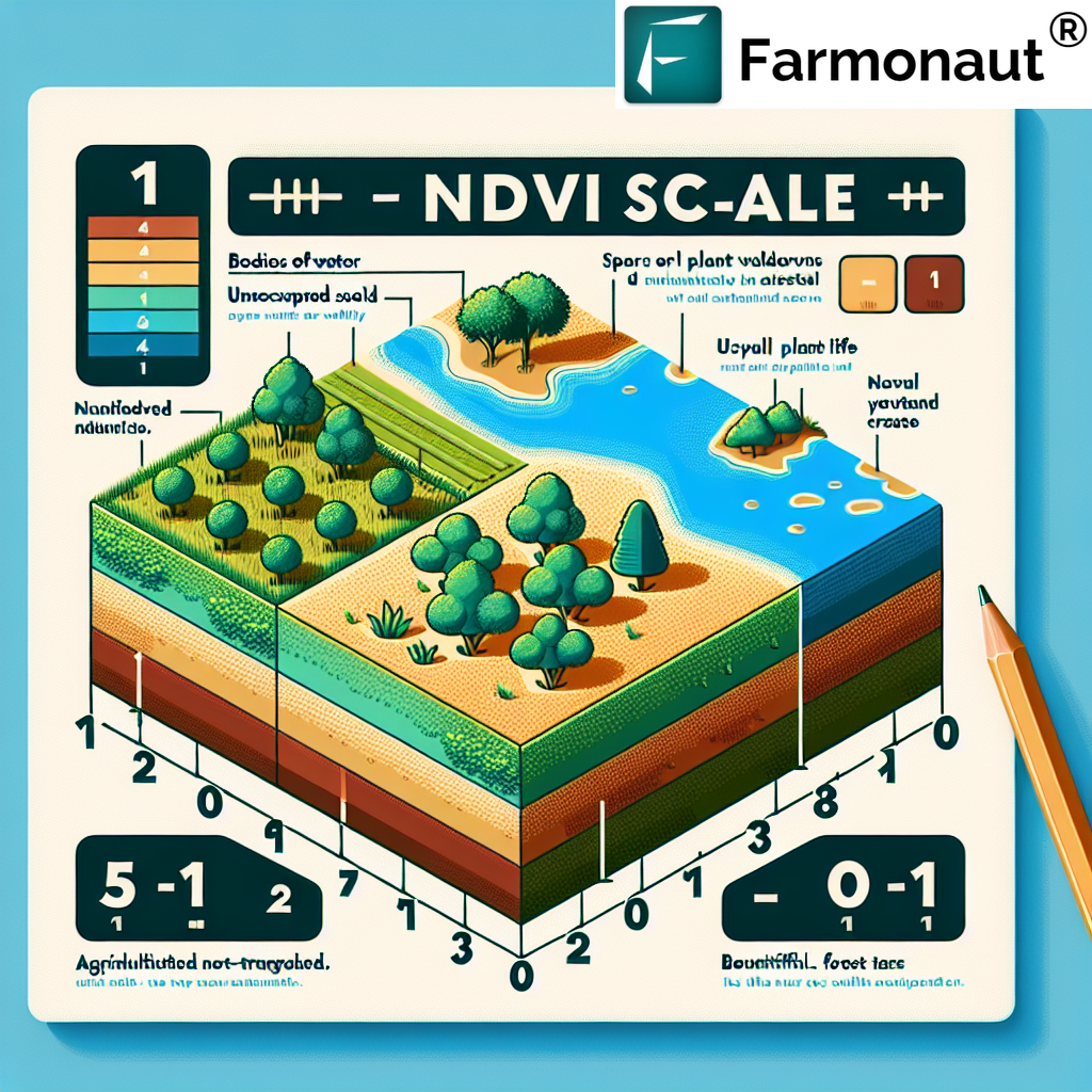
- Sensors: Devices on satellites, drones, or fixed positions that capture environmental data (e.g., NDVI for vegetation, soil moisture, temperature, or pest infestations).
- Platforms: Satellites, drones (UAVs), and ground-based stations provide the vantage points for sensors.
- Data Processing & Analysis: Use of AI and machine learning for timely, actionable insights.
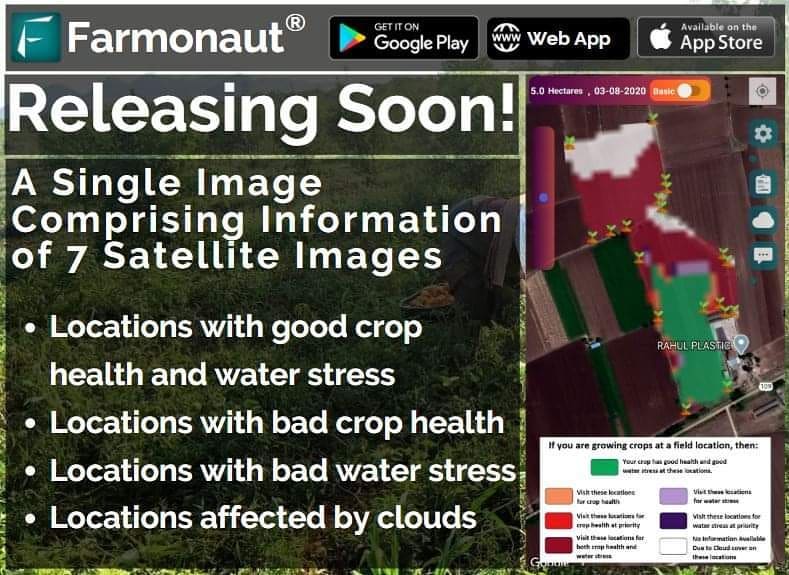
- Farm Management Systems: Software platforms (like Farmonaut) help visualize, interpret, and act upon the data collected.
Example: An American farmer managing vast tracts of farmland can use multispectral satellite images to identify sections of a field suffering from drought stress or nutrient deficiency. This capability allows for targeted interventions, significantly enhancing overall farm efficiency and sustainability.
Remote Monitoring and Telemetry Explained
Remote monitoring in agriculture involves the use of devices and sensors installed within fields or on farm machinery that collect data on environmental conditions, soil parameters, and equipment status in real-time. This data is transmitted wirelessly to farmers or agronomists for analysis, a process known as telemetry.
Telemetry thus refers specifically to this technological process:
“A farmer uses technology to remotely collect and transmit data pertaining to the conditions of their farmland for analysis. What is this technological process known as?”
The answer: Telemetry.
- Use case: A farmer employs telemetry systems linked to soil moisture sensors and GPS-enabled machinery. This setup allows monitoring not only of crop and field conditions, but also machine performance, efficiency, and predictive maintenance needs.
Benefits of Integrating Telemetry:
- Immediate alerts on irregularities in soil moisture, environmental stress, or machinery malfunctions
- Efficient management of vast agricultural areas without constant physical inspection
- Data history enables trend analysis to improve long-term yields and resource planning
- Supports remote troubleshooting and minimizes downtime for agricultural equipment
“Over 70% of large farms are expected to implement remote sensing-based management practices by 2025.”
Distinguishing Agricultural Technologies: GPS, GIS, Telemetry
What is the Difference?
When examining modern farm management, it is vital to distinguish between remote sensing, telemetry, GPS, and GIS.
Here’s an overview to clarify:
- GPS (Global Positioning System): Provides precise spatial positioning and allows for accurate mapping and navigation of farm machinery. However, GPS alone does not capture field conditions or environmental data.
- GIS (Geographic Information Systems): A platform for storing, analyzing, and visualizing spatial data. It integrates remote sensing outputs, creating actionable farm maps for planning. Often used alongside satellite or drone data.
- Cloud Seeding: A weather modification technique (not a data collection or monitoring process). It is unrelated to precision agriculture’s data-driven monitoring.
- Telemetry: As previously discussed, the technological process where an American farmer is using the process of remote monitoring of agricultural field conditions and machine details to analyze his vast area of farmland. This aids comprehensive farm analysis.
This distinction helps answer relevant questions, such as:
“An American farmer is using the process of remote monitoring of agricultural field conditions and machine details to analyze his vast area of farmland. What is this technological process known as? a. cloud seeding(gis) b. (gps) c. telemetry d. remote sensing” — The answer: Telemetry (Option c).
Practical Applications of Remote Sensing in Farming
In 2025 and beyond, the practical applications of remote sensing and telemetry in agriculture are diverse and impactful:
- Crop Health Monitoring: Detect disease outbreaks, pest infestations, or signs of nutrient/ moisture stress before they visibly appear. Use NDVI, other vegetation indexes, and thermal bands.
- Soil Analysis: Identify soil moisture levels, nutrient deficiencies, and texture variations for targeted interventions.
- Precision Irrigation & Fertilization: Schedule irrigation and fertilizer application based on real-time field conditions, minimizing waste and environmental impact.
- Pest Management: Detect early signs of pest infestations and deploy integrated pest management (IPM) measures.
- Harvest Timing: Optimize harvests based on crop maturity and weather forecasts powered by remote sensing and AI.
- Resource Management: Monitor machinery efficiency, fuel usage, and maintenance needs through remote diagnostics—further enabled by telemetry.
- Environmental Impact Tracking: Monitor carbon footprint and ecosystem changes, important for governmental compliance and achieving modern sustainability standards.
Comparison Table: Key Benefits and Impact of Remote Sensing 2025
To understand the substantial value that remote sensing brings to farm management, consider the following concise comparison table. It highlights not just the advantages, but their estimated impact in 2025 and the related enabling technology—ideal for agriculture professionals seeking rapid, evidence-based insights.
Best Management Practices in Agriculture (BMPs) and Remote Sensing
What are best management practices in agriculture? Best management practices (BMPs) encompass proven, practical techniques adopted by farmers to ensure resource efficiency, economic viability, and environmental sustainability. By 2025, integrating remote sensing and telemetry within BMP frameworks elevates the results:
- Soil Conservation: Implementing contour farming, cover cropping, and erosion barriers—which can be monitored via satellite for efficacy over time.
- Integrated Pest Management (IPM): Combining remote sensing for early pest detection with biological and chemical control techniques.
- Efficient Water Usage: Leveraging soil moisture sensors to deploy irrigation only when and where needed.
- Crop Rotation & Diversity: Systems like Farmonaut’s Jeevn AI enable optimal scheduling and spatial allocation for higher yields and soil health.
- Buffer Zones and Runoff Controls: Satellites identify at-risk field boundaries to enable rapid remedial actions.
With remote sensing, BMPS become dynamic rather than static, constantly informed by up-to-date field conditions and analyses.
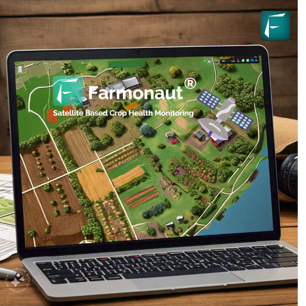
Farmonaut: Satellite-Driven Farm Insights
At Farmonaut, we believe remote sensing and telemetry should be accessible to all farmers, regardless of scale or geography. Our mission is to democratize satellite solutions for agriculture, enabling farmers, agribusinesses, and governments to manage large areas of farmland with precision, efficiency, and sustainability.
- Real-Time Data: We leverage satellite-based monitoring to deliver multispectral imagery, crop health analytics (NDVI), and soil moisture trends right to your web, Android, or iOS device.
- AI-Driven Advisory: Our Jeevn AI advisory system provides actionable recommendations for integrated crop management.
- Blockchain Traceability: Use our traceability product (Traceability) to ensure transparency, safety, and quality control in agricultural supply chains.
- Fleet & Large Scale Management: Our fleet and resource management solutions help optimize logistics, reduce operational costs, and maintain machinery health.
- Environmental Impact Monitoring: Track your carbon footprint and resource use—vital for sustainable practices—using our Carbon Footprinting tools.
- Crop Loan and Insurance: Financial institutions benefit from satellite-based verification for loans and crop insurance with satellite crop loan and insurance solutions that minimize fraud and speed up paperwork.
- Developer Friendly: Integrate satellite-powered agricultural data seamlessly into your systems with our flexible Farmonaut API and check the developer docs here.
- Farm Plantation and Forest Advisory: Our crop plantation and forest advisory platform empowers users to implement modern land management and biodiversity practices.
- Large Scale Management: The Farmonaut Agro Admin App is tailor-made for centralized oversight of large farming enterprises, cooperatives, or government-managed land, linking field logistics, resource allocation, and data analytics.
The Role of Agriculture in a Traditional Economy in 2025
Understanding the role of agriculture in a traditional economy is essential even as technology accelerates.
Agriculture remains the backbone of economic activity, employment, food security, and cultural continuity in many regions worldwide in 2025:
- Source of Food: Agriculture is the primary provider of food and sustenance.
- Raw Materials: Supplying inputs for textiles, manufacturing, and emerging bio-economy sectors.
- Livelihood: Agriculture employs a large percentage of the population in traditional economies, especially in rural regions.
- Foundation for Social Structure: Many social customs, rituals, and value systems revolve around the agricultural calendar and land ownership.
- Sustainability: Traditional farming approaches are often eco-centric, working to preserve biodiversity and maintain productive soils for future generations.
While modern technology like remote sensing and telemetry are reshaping global agriculture, it’s crucial to remember that traditional economies still rely on agriculture for food, jobs, and social stability.
FAQ: Remote Sensing in Farm Management 2025
What is remote sensing in agriculture?
Remote sensing in agriculture refers to the technique of collecting information about crops, soil, and field conditions without physical contact, typically by using satellite, drone, or other sensor-based data sources.
A farmer uses remote sensing as part of his farm management. What is the most likely goal of this practice?
The main goal is to obtain a comprehensive and accurate understanding of field conditions in order to optimize farm inputs, maximize yields, and reduce environmental impact.
An American farmer is using the process of remote monitoring of agricultural field conditions and machine details to analyze his vast area of farmland. What is this technological process known as?
This process is called telemetry—the automated, remote collection and transmission of data for analysis and real-time farm management decisions.
What are best management practices in agriculture (BMPs)?
BMPs are effective, time-tested strategies or systems used by farmers to boost productivity, conserve soil and water, protect biodiversity, and sustainably manage farm resources.
A farmer uses technology to remotely collect and transmit data pertaining to the conditions of their farmland for analysis. What is this technological process known as?
The process is known as telemetry.
What is likely to be the role of agriculture in a traditional economy by 2025?
Agriculture will remain a fundamental part of traditional economies, providing food, employment, and supporting social and cultural systems, while increasingly adopting technology like remote sensing to improve sustainability and efficiency.
Conclusion: The Path Forward with Remote Sensing in Farm Management 2025
The journey of agriculture from traditional, intuition-driven management to technology-enabled, data-driven decision making marks the biggest revolution of our era. In 2025, remote sensing and telemetry are no longer optional—they are essential for all who wish to keep pace with sustainability, efficiency, and productivity mandates.
By adopting modern technologies and best management practices in agriculture, we can optimize resources, increase yields, reduce waste, and preserve our planet for future generations. Whether managing a large-scale American farm or a family-owned field in a traditional economy, the principles remain the same: informed action, precision inputs, and a relentless pursuit of better outcomes through technology.