UAV Mapping Drone: 7 Powerful 3D Mapping Solutions for 2026
Introduction to UAV Mapping Drones in 2026
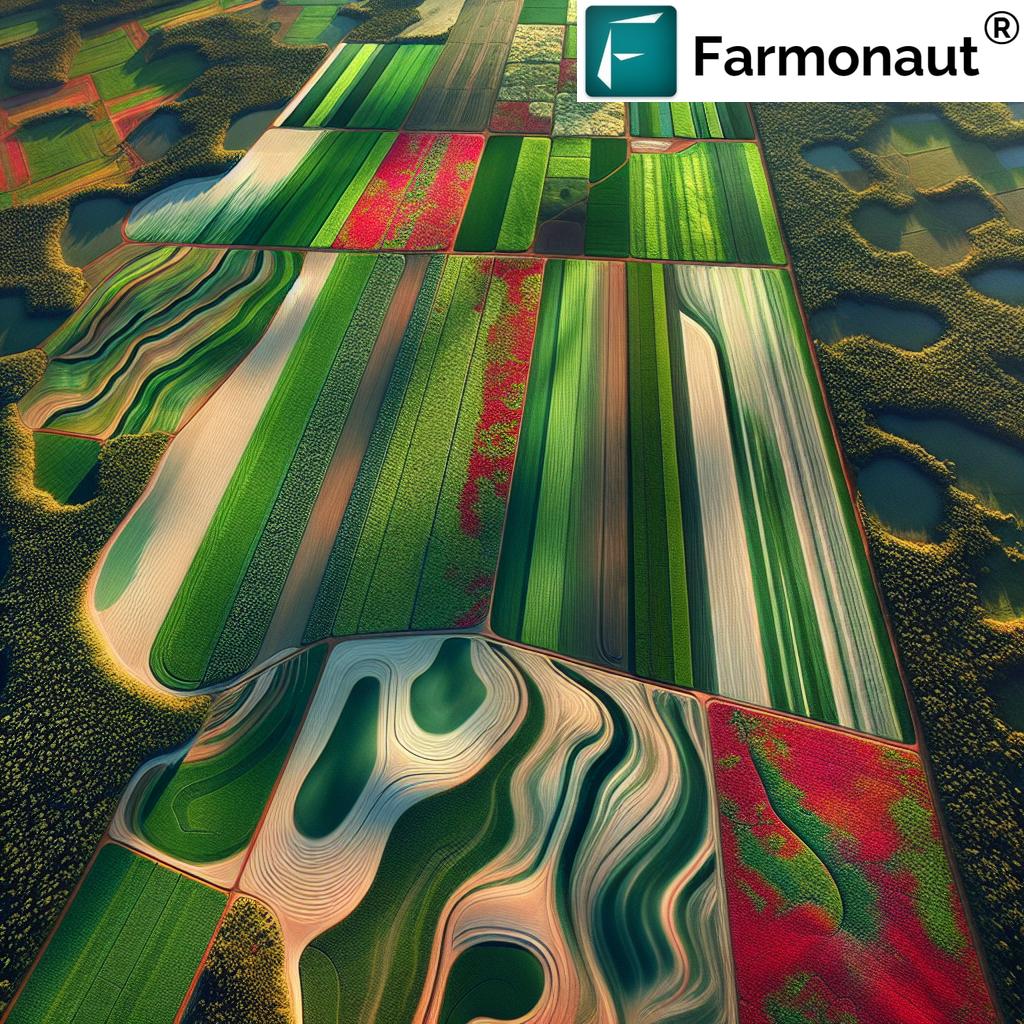
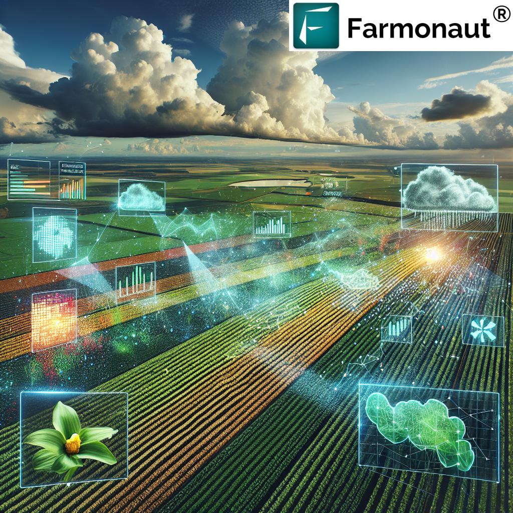
In the recent years, the fusion of unmanned aerial vehicle (UAV) technology with powerful mapping and 3D analytics has revolutionized the way industries approach surveying and spatial analysis tasks.
By 2025 and as we move into 2026 and beyond, UAV mapping services have become absolutely indispensable across agriculture, mining, forestry, infrastructure development, and defence. The seamless integration of advanced drone hardware, diverse sensors like LiDAR and multispectral cameras, as well as AI-driven data processing means UAV aerial mapping now provides more precise, efficient, and robust solutions than traditional ground-based or manned aerial surveys.
In this comprehensive guide, we dive deep into the most advanced UAV mapping drone solutions for 2026, explore industry applications across agriculture, forestry, mining, and infrastructure, discuss future trends, and compare the top 7 UAV 3D mapping solutions available for enterprises seeking cutting-edge technological advantage.
Trivia: UAV Mapping Resolution & Adoption
Why UAV Mapping Is Indispensable Across Industries
The unmanned aerial vehicle has transformed the way industries perform monitoring, assessment, and operational planning. Here’s why UAV mapping and UAV aerial mapping solutions are now the engine for innovation:
- High Resolution & Accuracy: Capture detail-rich images and highly precise 3D terrain models with unprecedented speed.
- Efficiency: Cover large areas rapidly, reducing both time and operational costs compared to manned surveys.
- Remote Access: Survey hazardous, inaccessible, or vast terrains—from dense forests to active mines—without putting human operators at risk.
- Advanced Analytics: AI-powered data analysis, blockchain-enabled traceability, and real-time monitoring open new possibilities for smart decision-making.
- Data-Driven Decisions: Enable farmers, miners, engineers, and planners to make proactive, intelligent choices for resource optimization and sustainability.
UAV Mapping in Agriculture and Forestry
How UAV Mapping Drones Are Reshaping Precision Farming
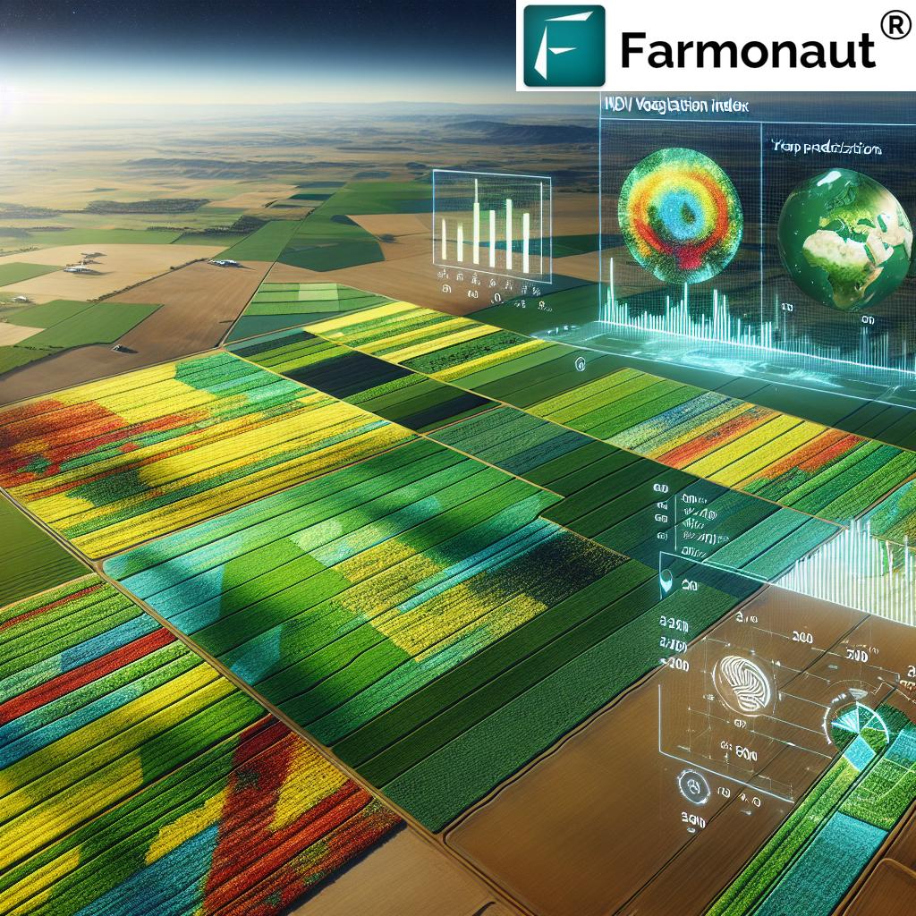
Modern agriculture demands insights that are precise, rapid, and actionable. UAV mapping and UAV 3D mapping have enabled a leap in precision farming, where knowing the health and needs of individual crop patches can directly influence yields, profitability, and sustainability.
- Multispectral & RGB Imagery: Drones equipped with multispectral and RGB cameras capture detailed images of large farmlands, enabling analysis of crop health, detection of pest infestations, and assessment of irrigation patterns.
- 3D Topographic Mapping: UAV 3D mapping techniques allow generation of highly accurate topographic models of fields—facilitating soil analysis, precision fertilization, and improved water management.
- LiDAR Penetration: UAV LiDAR mapping can penetrate dense crop canopies to understand under-canopy vegetation and subtle soil surface variations—critical for planning tillage and resource allocation.
These advantages make UAV mapping services a core pillar in digital agriculture, enabling farmers to monitor changes, identify issues before they escalate, and improve seasonal yields via precision interventions.
Forest Mapping: Monitoring Biomass, Density, and Illegal Logging
- Tree Measurement: UAV LiDAR mapping is invaluable for estimating tree heights, measuring biomass, and evaluating density in forested areas.
- Resource Management: Forest managers use these detailed 3D models to plan reforestation and monitor logging activities.
- Disaster Response: UAV mapping drones provide rapid post-disaster assessment—for fire, storms, or pest outbreaks—enabling quicker response and recovery.
For those seeking robust, affordable mapping tools, Farmonaut’s large-scale farm management platform allows users to remotely monitor, manage, and analyze vast agricultural operations using real-time satellite insights.
For advanced traceability in agriculture, Farmonaut’s blockchain-enabled traceability solution provides transparent, tamper-proof records from farm to table—boosting consumer trust across the supply chain.
UAV Mapping Solutions for Mining and Minerals
The mining industry has seen significant benefits from UAV mapping solutions. Compared to traditional, hazardous or expensive surveys, UAV mapping drones provide rapid, highly precise images and 3D site models that improve inventory accuracy, operational planning, and safety.
- Open-Pit Mapping: UAV aerial mapping enables frequently updated 3D models of open-pit mines, tailings storage facilities, and stockpiles.
- Volume & Resource Estimation: 3D mapping allows precise calculation of extracted minerals, reducing disputes and optimizing extraction strategies.
- Environmental Monitoring: UAV LiDAR mapping provides accurate monitoring of land degradation, aiding reclamation efforts and environmental compliance.
- Safety & Subterranean Mapping: Integrated with ground-based sensors, UAV LiDAR facilitates hazardous underground surveys—detecting potential collapses or water ingress zones to protect personnel.
A crucial use case for satellite-powered verification in mining is in loan and insurance approval processes—a Farmonaut service that streamlines access to financing and insurance for miners while mitigating fraud risk for financial institutions.
For resource managers focused on environmental sustainability, Farmonaut’s carbon footprinting product provides actionable real-time data about emissions and impact, helping mining operations make smarter choices for compliance and long-term ecological balance.
UAV Mapping Solutions for Infrastructure and Defence
Infrastructure development and defence planning require precise terrain intelligence, regular site inspections, and rapid progress tracking. UAV mapping drones are now essential for site planning, grading, foundation work, and asset monitoring.
Key Benefits for Construction and Engineering Firms
- Regular UAV aerial mapping flights enable up-to-date, accurate inspections, identifying issues such as erosion, poor drainage, or unauthorized encroachment instantly.
- Detailed 3D models support effective planning for grading, foundation engineering, and overall project management.
By leveraging UAV mapping services and data-driven tools, infrastructure projects can reduce rework, shorten schedules, and save millions in unanticipated costs.
Additionally, Farmonaut offers a dedicated fleet and resource management tool for those in asset-heavy sectors; it helps track equipment location and health, reduce downtime, and optimize logistics via satellite-powered dashboards. Explore Farmonaut’s fleet management platform for smart asset control from anywhere.
UAV Mapping for Defence and Intelligence
- High-resolution mapping gives commanders detailed terrain intelligence for mission planning and tactical operations.
- UAV LiDAR mapping provides foliage penetration ability, ideal for monitoring in dense environments where traditional systems fall short.
- UAV mapping drones reduce risk to personnel by performing surveillance and reconnaissance in dangerous or remote territories.
Comparison Table: 7 Leading UAV 3D Mapping Solutions in 2026
Choosing the right UAV mapping drone solution depends on your unique needs—terrain, industry, required precision, and data speed. This comparison table summarizes attributes of the seven leading UAV 3D mapping solutions for 2026, highlighting technologies, industry applications, resolution, area coverage, data speeds, and special features.
| Solution Name | Mapping Technology | Industry Applications | Resolution (Estimated) | Area Coverage per Flight | Flight Time (Estimated) | Data Processing Speed | Special Features |
|---|---|---|---|---|---|---|---|
| SkyMap Vision Pro 2026 | LiDAR, Photogrammetry | Agriculture, Mining, Infrastructure | 2–5 cm | 250 ha | 45 min | Real-time | Multispectral, Onboard AI |
| AgroFly TerrainX | RGB, Multispectral, LiDAR | Agriculture, Forestry | 2 cm | 180 ha | 40 min | 1 hr | Crop Health Analytics |
| TitanMine Mapper | LiDAR, Thermal | Mining, Minerals | 3–5 cm | 200 ha | 50 min | 2 hrs | Hazard Detection, Stockpile Volumes |
| InfraConstruct 360 | Photogrammetry, LiDAR | Infrastructure | 2 cm | 300 ha | 45 min | Real-time | Progress Monitoring, BIM Integration |
| ForestSense Pro UAV | LiDAR, NIR | Forestry, Environmental | 1–3 cm | 120 ha | 38 min | 90 min | Tree Height & Biomass Estimation |
| GeoIntel Defence Scout | LiDAR, RGB | Defence, Surveillance | 2 cm | 200 ha | 35 min | 1 hr | Foliage Penetration, Night Mapping |
| EcoSurvey Explorer | Multispectral, RGB, LiDAR | Agriculture, Mining, Environmental | 2–4 cm | 150 ha | 48 min | Real-time | Cloud Integration, Environmental Impact Tools |
Key Selection Takeaways
- Photogrammetry excels for large-area, high-resolution orthomosaics.
- LiDAR is unbeatable for dense forested regions, biomass measurement, or topographies with overgrowth.
- Industry-focused features (e.g., progress monitoring, BIM integration, hazard analytics) make all the difference—choose based on your end goal.


Developers, integrators, and enterprise managers: seeking to connect drone and satellite data for advanced analytics? Explore Farmonaut’s secure API for direct data pipeline integration or check Farmonaut’s API Developer Docs for seamless UAV mapping and satellite imagery workflow.
Future Trends in UAV Mapping: What to Expect Beyond 2026
As we look beyond 2026, UAV mapping drone technology will not only build upon today’s remarkable breakthroughs—but introduce new frontiers in intelligence, efficiency, and environmental stewardship. Here’s what industry leaders should anticipate:
- Artificial Intelligence Integration: Automated anomaly detection, yield/failure predictions, and 3D model analysis using On-board or Cloud AI for instant actionable insights.
- Sensor Miniaturization: Even smaller, lighter, and ultra-high-resolution sensors will make drone mapping accessible in more remote and challenging areas.
- Autonomous Swarms: Trials of drone swarms for simultaneous multi-terrain mapping will reduce survey times dramatically across industries—forestry, mining, and infrastructure.
- Cloud-Based Collaboration: Real-time, secure sharing of mapping data among stakeholders—planners, decision-makers, regulators—accelerating discussions and reducing bottlenecks.
- Environmental Impact Automation: UAV mapping services integrated with satellite tracking (like those we provide via Farmonaut) will create 360° dashboards of carbon, water usage, and ecosystem health in near real-time.
Note: Top-tier mapping solutions do not require massive teams or manual data crunching. If you seek to empower your farm, mining site, or infrastructure project, combine UAV and satellite intelligence through seamless platforms such as Farmonaut.
Farmonaut: Advanced Satellite-Based Insights for Mapping
At Farmonaut, our mission is to democratize access to real-time monitoring, AI-based advisory, and blockchain-based traceability via affordable satellite-driven insights. Farmonaut is not a drone manufacturer or marketplace—but our technology complements UAV mapping via high-resolution imagery, AI analytics, and API integration for agriculture, mining, infrastructure, and defence.
- Satellite-Based Monitoring: We leverage multispectral satellite maps for vegetation health monitoring (NDVI), soil condition analysis, crop stress detection, and infrastructure integrity mapping.
- Real-Time Jeevn AI Advisory: Our Jeevn AI system provides sector-specific strategies in agriculture, mining, defence, and infrastructure—directly from satellite data pipelines.
- Blockchain-Based Traceability: Ensuring supply chain transparency and fraud prevention in crop harvests, mineral shipping, and resource management.
- Fleet & Resource Management Tools: Partnering satellite intelligence with smart fleet tracking for cost control and asset optimization.
- Environmental Impact Tracking: Real-time carbon footprint monitoring and actionable compliance insights for sustainable farming and mining.
Whether you are an individual farmer, mining operator, infrastructure manager, or a government/defence user, access Farmonaut’s platform via:
FAQ: UAV Mapping Drone Solutions (2026)
What is UAV mapping and why is it important for 2026?
UAV mapping is the process of using unmanned aerial vehicles (drones) to capture high-resolution images and sensor data, transforming them into precise maps and 3D models. In 2026, UAV mapping is essential across agriculture, mining, forestry, infrastructure, and defence for rapid, safe, and accurate spatial analysis—enabling data-driven decisions, improving productivity, and reducing operational risks.
How does UAV 3D mapping differ from traditional surveying?
Traditional surveying is typically manual, time-intensive, and less scalable. UAV 3D mapping leverages advanced drones equipped with high-res sensors and AI analytics, allowing for rapid area coverage, superior detail (up to 2cm resolution), and robust 3D terrain modeling—significantly improving efficiency and safety.
What are the main types of sensors used in UAV mapping drones?
Industry-leading UAV mapping drones use a combination of photogrammetry (RGB) cameras, multispectral cameras for plant/soil insights, and LiDAR for generating highly precise elevation data—even under dense vegetation. Some solutions integrate thermal, hyperspectral, and even sonar sensors for specialized tasks.
How do UAV mapping solutions enhance mining operations?
UAV mapping services streamline routine inspection, volume calculation, hazard identification, and environmental monitoring in mining sites. This reduces time, cost, safety risks, and ensures data accuracy for resource estimation, regulatory compliance, and operational planning.
What are the advantages of integrating Farmonaut’s satellite platform with UAV mapping?
By combining UAV mapping data with Farmonaut’s satellite-based analytics, users gain access to continuous, wide-area monitoring, AI-powered advisory, blockchain traceability, and resource management tools—maximizing the impact and scope of their mapping investments across agriculture, mining, and infrastructure.
What makes UAV LiDAR mapping unique for forestry and disaster assessment?
UAV LiDAR mapping is unique for its ability to see through dense tree canopies and generate high-fidelity 3D models of forest structure, enabling biomass calculation, tree height/density measurement, and rapid damage assessment after disasters (fires, storms).
How can I start using UAV mapping or satellite data solutions?
Access Farmonaut’s web and mobile platform or use our API to integrate satellite insights into your operations. For drone-based mapping, select a leading provider from our comparison table above and combine with satellite tools for an end-to-end spatial intelligence solution.
Conclusion
From agriculture and forestry to mining, infrastructure, and defence, UAV mapping drones and UAV 3D mapping solutions have fundamentally redefined how sectors conduct spatial analysis, monitoring, and planning. By combining powerful hardware, advanced sensors like LiDAR and multispectral cameras, and AI-driven data processing, UAV mapping services in 2026 deliver high-resolution, rapid, cost-effective answers to industry challenges—replacing slower, riskier traditional approaches.
The future of mapping is collaborative—harnessing drones, satellites, and real-time collaboration platforms to create a seamless cycle of data, insights, decisions, and action. For scalable, resource-efficient, and sustainable operations, businesses must embrace the next wave of unmanned vehicle technology and mapping innovation.
Take the step—integrate UAV mapping drones with Farmonaut’s advanced satellite-driven platform to empower your agriculture, mining, infrastructure, or defence strategies today.
Ready to transform your mapping operations? Explore Farmonaut’s large-scale farm management solution or upgrade your fleet tracking with advanced satellite intelligence today.
For product traceability, environmental compliance, or custom advisory integration—choose Farmonaut for a smarter, more sustainable future.