

California claims · Lookup guide
BLM Mining Claims Map California: 7 Steps and Fees
BLM’s MLRS holds California’s claim records and maps them to the quarter section. On 15 October 2026 its layer listed 28,767 not-closed California cases, 14,387 of them Active. Here is how to check one, what it costs, and what a plan or withdrawal does.
Key takeaways
- The official map is BLM’s MLRS Research Map, with the same records as reports and GIS layers; it shows claims to the quarter section, not the staked corners (BLM, MLRS layer, 15 October 2026).
- BLM’s not-closed layer had 28,767 California cases on 15 October 2026, and 14,387 had the status Active (our count of BLM data).
- A new lode claim costs $274 in BLM fees ($25 processing, $49 location, $200 maintenance); a placer pays the same $74 plus $200 per 20 acres (BLM California, 2027 packet).
- A land-use plan cannot close land to claims; only a withdrawal can, and claims with a discovery before the date stay valid (BLM, FLPMA fact sheet).
- Plan designations change the permit you need: a plan of operations replaces a short notice in controlled-use desert areas and monuments (43 CFR 3809.11).
In this article
- Where to find the BLM mining claims map for California
- What the California claims map shows, and what it cannot
- How to check a California claim in 7 steps
- How many mining claims are there in the state
- Where claims can and cannot be staked in California
- Land-use plans, withdrawals and your claim
- What a new claim costs
- California rules that sit on top of federal rules
- Check the ground from space before you stake
- Frequently asked questions
The official map of mining claims in California is the Bureau of Land Management’s Mineral and Land Records System (MLRS), and it draws each claim to the quarter section, not to the corner posts. On 15 October 2026 the BLM “not closed” mining-claims layer held 28,767 cases whose serial numbers start with CA, and 14,387 of them had the status Active. This page shows where to find that map, how to read it in seven steps, what it costs to hold a claim, and what a land-use plan or a withdrawal does to a claim you already own.
It is written for claim owners and buyers in California who need a clear answer before they stake, pay or sell. A claim is a right to look for and develop minerals on federal land. It is not title to the land, and the BLM says plainly that the right does not include exclusive surface rights. Terms are explained where they first appear: a lode claim covers a vein or rock in place, a placer claim covers loose gravel and sand, and PLSS is the Public Land Survey System grid of townships, ranges and sections.
Where to find the BLM mining claims map for California
There is no single California-only map. BLM publishes national tools, and you filter them to California. The table lists the ones that matter, what each is best for, and the limit you should know about. If you searched for a “navigator” style viewer, the BLM tools below are the official sources of the same claim records.
| Tool | Best for | Limit |
|---|---|---|
| MLRS Research Map | Seeing claims drawn on a map and clicking a case for details | Geometry comes from legal land descriptions, and some cases cannot be mapped |
| MLRS Reports (Geographic Report, Serial Register Page) | A list of every active claim in one township, range and section | You must type the location code correctly or the report comes back empty |
| BLM Geospatial Hub “Not Closed” and “Closed” claim layers | Loading all claims into GIS software or counting them | Quarter-section detail at best; the layer is a record index, not a survey |
| Master Title Plats and land-status records in MLRS | Checking whether the land is open to mineral entry at all | Shows land status, not who has staked |
| County recorder’s office | The notice of location and map filed for a specific claim | Visit or request records county by county |
Volunteer and commercial viewers repackage the same BLM data. Western Mining History says its claim snapshot is not updated on a regular schedule and tells users to verify every claim in MLRS. Treat them as a way to browse, never as the record.
What the California claims map shows, and what it cannot
BLM describes the claim layer as built mainly from each claim’s legal land description, placed on the PLSS grid, with some cases left off the map because they could not be placed. In practice a claim appears as a block of one or more quarter sections (160 acres each) or quarter-quarter sections (40 acres each). A lode claim can be at most 1,500 feet by 600 feet, about 20.66 acres, so the drawn block is far larger than the claim.
Chart
California claim records by type
Number of cases, 15 October 2026
Three limits follow, and they decide whether the map is enough for your purpose.
- Exact corners are not on the map. The staked boundary is in the notice of location and its map, which are in the BLM case file and, in California, also at the county recording office within 90 days of location (BLM California State Office, 2027 mining packet).
- New claims lag. A claim staked last month may be at the county but not yet in MLRS, because the filing window is 90 days.
- Claims can overlap. BLM’s Montana-Dakotas packet notes that claims may be located on the same ground at the same time, and that BLM does not resolve disputes between claimants. The same federal rule applies in California, so check the county records before you assume a spot is empty.
The status column also needs care. The layer includes cases marked Active, Filed and Under Review, and Closed claims sit in a separate layer. Count Active claims when you want the best picture of held ground, and read the serial register page for any claim you care about.
How to check a California claim in 7 steps
This is the order that gives a reliable answer. It uses the MLRS Geographic Report that BLM describes in its own state packets, adapted for California.
- Write down the location. Get the township, range and section from a USGS topographic map, and note which of California’s three meridians applies. BLM lists the Humboldt meridian in the north-west corner, the Mount Diablo meridian over most of northern and central California, and the San Bernardino meridian in the south.
- Convert it to an MLRS code. The BLM meridian code table gives California 15 for Humboldt, 21 for Mount Diablo and 27 for San Bernardino. A section on the San Bernardino meridian at township 10 north, range 5 east, section 14 would be written in the BLM style as 27 0100N 0050E 014.
- Confirm the land is open. Check the Master Title Plat or land-status record. BLM’s claims brochure lists national parks, national monuments, tribal reservations, most wildlife refuges and designated wilderness among lands closed to new claims.
- Run the Geographic Report. Choose the state CA, enter the meridian, township, range and section, and set the case disposition to Active. The report lists each active claim in the section and quarter section.
- Open the case. Use the nine-digit serial number to read the serial register page: claim name, type, locator names, location date and filing history. Type codes in the data are 384101 for lode claims, 384201 for placer claims, 384301 for tunnel sites and 384401 for mill sites (BLM case-type codes).
- Get the notice of location and map. Ask the BLM California State Office public room for the filed copy, and the county recorder for the recorded copy.
- Walk the ground. Look for corner posts and the discovery monument, and ask permission from a claim holder before you prospect inside their claim.
Our own page on buying BLM claims covers the purchase side of the same checks, and the Arizona version of this guide is at mining claims map for Arizona.
How many mining claims are there in the state
We queried BLM’s national “not closed” claim layer on 15 October 2026 and counted cases by the state prefix of the serial number. Nevada is far ahead of every other state, and California ranks seventh among the eleven states in the layer; the chart shows the top eight, and New Mexico (14,509), Oregon (14,046) and Alaska (10,179) follow Colorado. Each case is one claim or site record, so these are record counts, not acres.
Chart
Mining-claim cases not closed, by state
Case records in BLM’s national claims layer, counted by serial-number prefix, 15 October 2026
Within California, lode claims are the largest group, followed by placer claims. Mill sites, which support a mine on land with no minerals, come third, and tunnel sites are rare. Roughly half of the not-closed cases carry the status Active, and the rest are mostly marked Filed. The September 1 payment deadline has just passed, so these counts will move as BLM finishes processing 2027 maintenance payments.
Where claims can and cannot be staked in California
BLM manages 15.2 million acres of public land in California, nearly 15% of the state, and administers 47 million acres of federal subsurface minerals. Claims can only be staked on federal land that is open to mineral entry. BLM also administers the federal mineral estate under 47 million acres of federal surface land, so claim records cover ground that other agencies manage.
Lands withdrawn from mineral entry include national parks, national monuments, wilderness, most wildlife refuges and military land, and new claims cannot be located there after the withdrawal date. A claim located before the date can survive only if the locator had already found a valuable mineral deposit by that date, which BLM calls a valid existing right. This is the first thing to confirm on any claim you buy, because a valid discovery is a matter of facts on the ground, not of the paperwork. Our guide to gold mining in California covers the districts and the state-level rules.
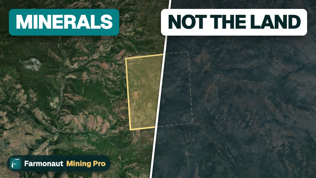
▶ Explains why owning a gold claim is not owning the land, and how the 1872 mining law frames the right. · 3:19
Land-use plans, withdrawals and your claim
People often ask what a BLM land-use plan does to a mining claim. The short answer is that a plan changes how you can work a claim, but it does not close land to claims. Only a withdrawal does that. A BLM fact sheet on sage-grouse plans says the plans recommended a mineral withdrawal, but cannot, and do not, implement one; and land can only be withdrawn through the process in section 204 of the Federal Land Policy and Management Act.
| Action | Effect on new claims | Effect on claims you already hold |
|---|---|---|
| Land-use plan decision | None by itself; the plan can recommend a withdrawal | Changes the permit level and the conditions for work |
| Notice of proposed withdrawal | Land is segregated, so no new claims, for up to two years | None until you propose operations; BLM may ask for proof of a discovery |
| Withdrawal | New claims are closed, subject to valid existing rights | Claims with a discovery before the date stay valid; others may fail a validity check |
| National monument proclamation | Closed to new claims in the proclamation | Subject to valid existing rights |
How a plan changes the work you can do
Plan designations decide which permit path you need. Under federal rules (43 CFR 3809.11), work that disturbs the surface more than casual use needs a full plan of operations, not a short notice, in several special areas. Two of them matter most in California: lands of the California Desert Conservation Area that the plan designates as “controlled” or “limited” use, and National Monuments and National Conservation Areas run by BLM. Areas of Critical Environmental Concern and land closed to off-road vehicles are on the same list.
Outside those areas, exploration that disturbs five acres or less needs only a notice filed 15 calendar days before work starts (43 CFR 3809.21). Hand panning, hand tools and metal detectors are generally casual use under the BLM definition. A plan of operations means a longer review, a bond and reclamation terms, so check the plan designation for your ground before you budget for exploration.
A California example: the desert withdrawal that was cancelled
In December 2016 BLM proposed to withdraw about 1.3 million acres of national conservation lands in the California Desert Conservation Area from the mining laws for 20 years. In February 2018 BLM cancelled the proposal. It said that of those 1.3 million acres only 1.5 percent, about 19,500 acres, was covered by mining claims, and that the segregation had temporarily blocked new claims for up to two years. The case shows the two steps clearly: a plan set aside conservation land, and a separate withdrawal that would have closed it was proposed and then dropped.
A recent California example: Chuckwalla National Monument
A monument works differently, because a presidential proclamation withdraws the land itself. Proclamation 10881 of 14 January 2025 created the Chuckwalla National Monument on about 624,270 acres of federal land in southeastern California. It withdrew that land from location, entry and patent under the mining laws, and it states that the monument is subject to valid existing rights. A lawsuit in the federal court for the Eastern District of Michigan asks the court to undo the designation. In March 2026 that court let nine organizations and several tribal nations join the case. We found no ruling at the time of writing, so check the court docket and the BLM page before you rely on the status.
How large withdrawals are approved
The size of a withdrawal changes the process. Under section 204 of the Federal Land Policy and Management Act, a withdrawal of 5,000 acres or more can run for at most twenty years and the Secretary of the Interior must notify both Houses of Congress. Smaller withdrawals can be made by the Secretary on their own motion. Publication of a notice of proposed withdrawal segregates the land first, which is why new staking stops before any final decision.
If you hold ground near a proposed boundary, read the Federal Register notice, look for the effective date, and gather evidence of any discovery made before it. A claim is the first stage of a long path, which our overview of the stages of mining sets out.
What a new claim costs
Federal fees are the same in every state, and BLM California publishes them in its yearly packet. For new claims located on or after 1 September 2026, each lode claim, mill site or tunnel site pays a $25 processing fee, a $49 location fee and a $200 maintenance fee, a total of $274. A placer claim pays the same $25 and $49 plus $200 for each 20 acres or part of 20 acres (BLM mining claim fees, BLM California 2027 packet). A 70-acre placer claim therefore pays $800 in maintenance fees every year. County recording fees are extra and set by each county.
Chart
Yearly cost: pay the fee or file the waiver
US$ per year for 1 to 10 lode claims; waiver route = $15 affidavit + $100 required work per claim
Chart
First-year BLM cost of a new claim
US$ per claim: $25 processing + $49 location + $200 maintenance per 20 acres
Holders with 10 or fewer claims and sites nationwide can file a Maintenance Fee Waiver Certification (Form 3830-2) by 1 September instead of paying, if they also performed $100 of assessment work per claim. The waiver route still needs an affidavit of assessment work and a $15 per-claim fee by 30 December (BLM California State Office, 2027 packet). The chart compares the two routes on lode claims.
A warning from BLM’s own notes: if a claim is located before 1 September but filed with BLM on or after that date, maintenance fees can be charged for two assessment years unless a valid waiver is filed. Missing the deadline forfeits the claim by operation of law, and there are no extensions.
Calculator
What will my California claims cost to hold?
Enter how many claims you plan to stake and how large the placers are.
- Maintenance fees in each later year: $1,800
- Total over the years you chose: $5,918
Example values only. Fee inputs default to BLM California 2027 packet fees: $25 processing + $49 location + $200 maintenance per claim or per 20 acres of placer. Excludes county recording fees, the waiver route and any work or survey costs.
California rules that sit on top of federal rules
Federal law lets states add their own rules for locating and recording claims, so California requirements apply as well. The California Department of Fish and Wildlife states that using a motorized suction dredge in California rivers, streams and lakes is prohibited and unlawful, while non-motorized panning is not restricted by that law. BLM’s casual-use definition mentions small portable dredges, but the state ban still applies on your claim.
State and county permits for larger operations are separate from BLM approval. BLM’s brochure says many states have their own mining and reclamation laws and advises asking the state and county before you mine, and it reminds claimants that permanent structures need prior approval from a federal official. Use no mercury, get the claim holder’s permission before you prospect, and keep to the rules for the surface manager on your ground.
Check the ground from space before you stake
A claim map tells you who holds the ground and which rules apply. It does not tell you whether the rock is worth staking. Farmonaut can screen a KML or polygon boundary with satellite data to list exploration targets, which come before any resource estimate and are not a guarantee of minerals. Treat the output as a way to decide where to spend field time, after you have confirmed the land is open and unclaimed.

▶ Explains what a satellite gold map shows and how to read it. · 4:18
Frequently asked questions
Where is the official BLM mining claims map for California?
It is the MLRS Research Map at mlrs.blm.gov, with the same claim records available as reports and as downloadable GIS layers on the BLM Geospatial Hub. The layers cover all states, so you filter them to California.
How accurate is the BLM claims map?
It places claims by legal land description on the PLSS grid, usually to the quarter section, so it shows the area a claim sits in, not its staked corners. The corners are in the notice of location and map held in the BLM case file and at the county.
How do I find out if a mining claim is active?
Run the MLRS Geographic Report for the section with the status set to Active, then open the serial register page for the claim. A claim stays active only if the maintenance fee or waiver is filed by 1 September each year.
Can I stake a claim anywhere on BLM land in California?
No. Only land open to mineral entry can be claimed. National parks, national monuments, designated wilderness and most wildlife refuges are closed, and BLM tells locators to check the land records themselves.
How much does it cost to stake a lode claim in California?
BLM’s fees total $274 for a new lode claim ($25 processing, $49 location, $200 maintenance), plus county recording fees. Each later year costs $200 per claim, or the waiver route if you qualify.
Does a BLM land-use plan cancel my mining claim?
No. A plan cannot close land to mining claims by itself, but it can change the permit you need, for example a plan of operations in a controlled-use area of the California Desert Conservation Area. A separate withdrawal closes land to new claims.
What happens to existing claims when land is withdrawn?
Claims located before the withdrawal date can remain valid if a valuable mineral deposit had been discovered by that date. BLM may require proof of that discovery before it approves new operations.
Do mining claims in California include the surface of the land?
No. A claim gives the right to look for and develop minerals, not ownership of the land and not exclusive surface rights, so the surface is not yours alone.
Is suction dredging allowed on a California claim?
No. State law prohibits motorized suction dredging in California rivers, streams and lakes, whatever the federal status of the claim.
Where can I read about claims for sale in California?
See our guide to BLM claims for sale for how listings are checked, and always compare any listing with the MLRS record and the county filing before you pay.
This page is for information only. It is not legal advice. Confirm the rules with the regulator. Ask the land manager for permission before you prospect, follow state and county permit rules, and never use mercury.
Farmonaut mining
Get a quote to screen your claim from space
Send your claim boundary and we will quote a satellite screen that lists exploration targets ahead of any resource estimate.

Mining Pro sample view, synthetic data
Keep reading
Sources
- BLM, Mining Claim Fees: blm.gov
- BLM California State Office, 2027 Mining Packet: blm.gov
- BLM, Mining Claims and Sites on Federal Lands (brochure): blm.gov
- BLM, Mining Claims: blm.gov
- BLM MLRS Research Map: mlrs.blm.gov
- BLM MLRS Reports: reports.blm.gov
- BLM Geospatial Hub, MLRS Mining Claims – Not Closed (feature service): gis.blm.gov
- BLM, GIS Data: blm.gov
- BLM, Mining claim case-type codes: reports.blm.gov
- BLM, Meridians in California: blm.gov
- BLM, Meridian code table: reports.blm.gov
- BLM Montana-Dakotas, Mining Claims Packet (MLRS steps, overlapping claims): blm.gov
- BLM, Withdrawals under Section 204 of FLPMA: What They Do, What They Don’t Do: blm.gov
- Federal Land Policy and Management Act, section 204 (BLM copy): blm.gov
- BLM, BLM cancels withdrawal proposal in California desert (2018): blm.gov
- Federal Register, Proclamation 10881, Chuckwalla National Monument: govinfo.gov
- Earthjustice, court allows organizations to intervene in Chuckwalla lawsuit (March 2026): earthjustice.org
- eCFR, 43 CFR 3809.11 plan of operations: ecfr.gov
- eCFR, 43 CFR 3809.21 notice: ecfr.gov
- eCFR, 43 CFR 3809.5 definitions: ecfr.gov
- California Department of Fish and Wildlife, Suction Dredge Permits: wildlife.ca.gov
- Western Mining History, Researching Mining Claims with the BLM MLRS: westernmininghistory.com
Discussion
Questions, corrections or field experience? Share them below. First-time comments are reviewed before they appear, and your email is never published.
No comments yet. Be the first to add a question or your experience.

 GemSprout Metals Limited
 Qader Group
 Ileys General Trading
 SG Gold Mining LLC
 VRV Global Pte Ltd
 Omsri International FZE
 G.I.T.T.
 Jaunita Erss Ltd
 Almosi SARL
 SRK Consulting
 Berks Gold Limited
 Mwerezi Minerals Company Limited
 Mining SARL
 SenGold Invest SAS
 Sean Mining Limited
 NTS Group (Pty) Ltd
 Mine4Africa
 Lithspo Minerals Limited
