

Land terms · Definition guide
Arable Def: What Arable Land Means, With World Data
Arable means land that can be plowed and used for crops. Dictionaries include land that could be farmed; the FAO counts only land in the crop cycle, about 10.7% of world land area in 2023 (World Bank).
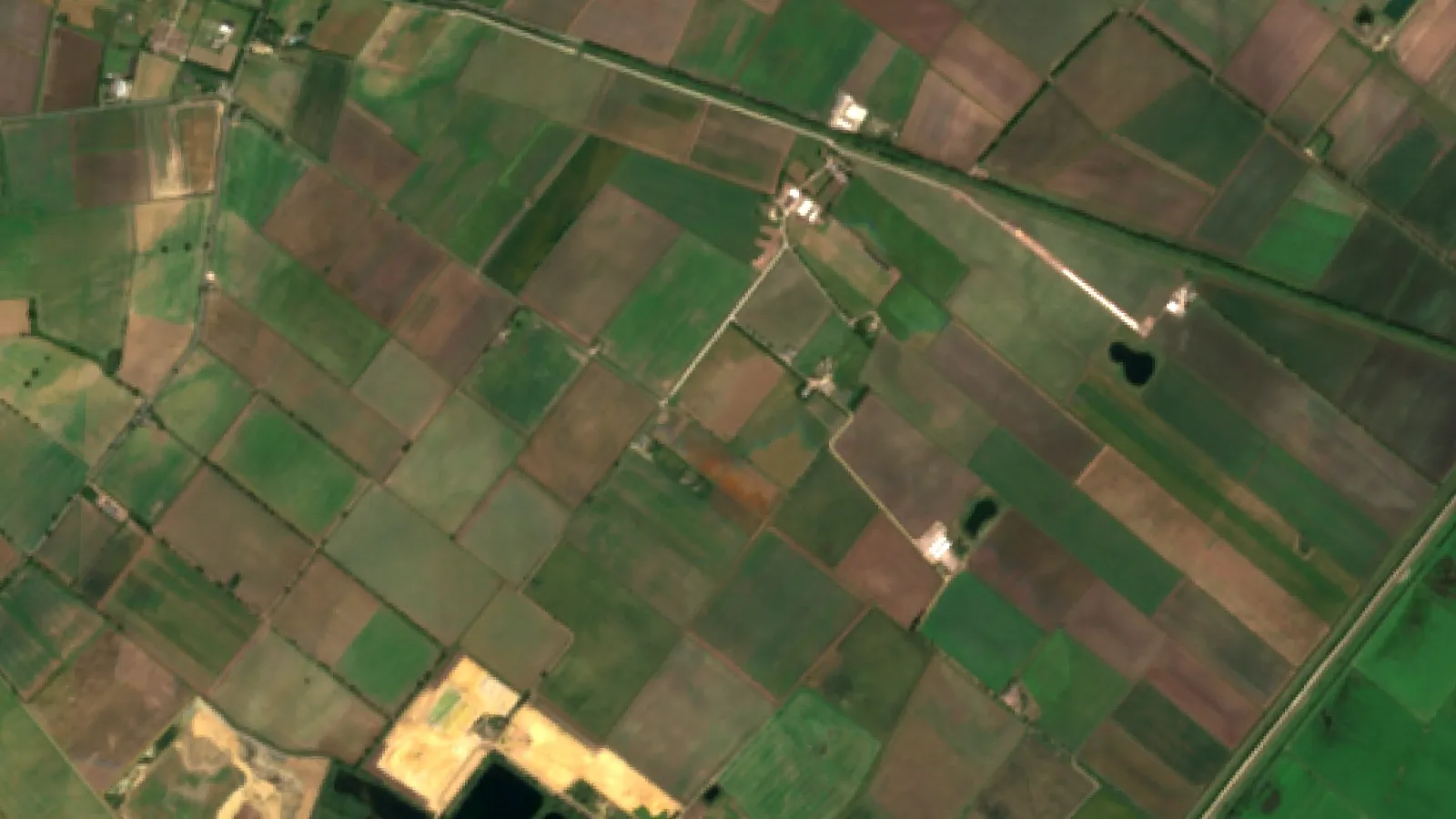
Key takeaways
- Short meaning: arable land can be plowed and used to grow crops (Cambridge Dictionary).
- The FAO counts temporary crops, temporary meadows and pastures, and temporary fallow. It leaves out land that could be farmed but normally is not.
- Orchards, vines, permanent pasture and woods are not arable. In FAO terms, cropland is arable land plus permanent crops.
- Arable share of land area in 2023: world 10.7%, U.S. 16.6%, UK 25.0%, Canada 4.3%, Australia 4.1% (World Bank).
- World arable land per person fell from 0.227 ha in 1990 to 0.173 ha in 2023 (World Bank).
In this article
- Arable def in one line, and where the word comes from
- Arable def in dictionaries and in official statistics
- What is arable land and what is not
- What makes land able to be plowed
- How much of the world is arable land
- Total area by country
- Is arable land shrinking?
- Why the arable label matters on a farm
- How to check if your land is arable
- How much of your farm counts as arable?
- FAQ
Arable means land that can be plowed and used to grow crops. That is the short arable def, and Cambridge Dictionary gives the same idea: land used for, or suitable for, growing crops. About 10.7% of the world’s land area was counted as arable in 2023, according to World Bank data compiled from the FAO.
There is one catch. Dictionaries include land that could be plowed. Official statistics usually count land that is actually in the crop cycle. This page explains both meanings, then gives country charts, a land-type table and a calculator that sorts your own acres the way the FAO does.
Arable def in one line, and where the word comes from
Arable (adjective): able to be plowed and farmed for crops. Dictionary.com lists “capable of producing crops” and “suited to the plow and for tillage”. It also records a noun use: land that can be or is cultivated.
The word comes through Old French from the Latin arabilis, built on the verb for “to plow”, as Wiktionary’s etymology entry sets out. So the plow sits inside the word itself. A simple sentence: “Only a narrow strip of arable land runs along the river; the hills above are used for grazing.”
In American English it is said AIR-uh-bul. Common near-synonyms are cultivable, tillable and plowable. “Farmland” is not a synonym, because farmland also covers grazing land and farm woods.
Arable def in dictionaries and in official statistics
Dictionaries, the FAO and Eurostat each define arable land. They agree on the core and differ at the edges.
| Source | What counts as arable | Point to notice |
|---|---|---|
| Dictionaries | Land that is or could be plowed for crops | Describes ability, not current use |
| FAO | Temporary crops, temporary meadows and pastures, temporary fallow | Leaves out land that could be farmed but normally is not |
| Eurostat | Land plowed or tilled regularly, generally in a crop rotation, plus fallow | Leaves out berry plantations and land taken out of cultivation for good |
The FAO Statistical Yearbook states the global rule. Arable land is the total of temporary crops, temporary meadows and pastures, and temporary fallow. It does not include land that is potentially cultivable but not normally cultivated. So a good meadow that has never been plowed may fit the dictionary sense and still be missing from the FAO count.
The Eurostat glossary is more detailed. It lists cereals, dry pulses, root crops, industrial crops, plants harvested green, fresh vegetables, strawberries, flowers and fallow as included.
Arable land vs cropland
These two words get swapped all the time. In FAO terms, cropland is arable land plus permanent crops, so all arable land is cropland but an orchard is cropland without being arable. The U.S. Census uses its own grouping. It counted 382 million acres of cropland in 2022, of which 301 million were harvested, per the USDA NASS census highlights. The FAO-based figure for U.S. arable land in 2023 is 151.6 million hectares, or about 375 million acres. The numbers are close but come from different systems, so do not subtract one from the other.
A note on “arable crops” in the UK
British farm reports use the word daily. Defra’s June 2026 land use survey put arable crops in England at 3.3 million hectares, and cereals made up 70.5% of that. It lists uncropped arable land apart, at 566 thousand hectares, and uses a wider term, “croppable area”, of 4.9 million hectares that also takes in horticulture and temporary grass. Check which term a report uses before comparing it with another.
What is arable land and what is not
The test is simple: is the land worked and resown in a regular cycle? A wheat field passes. A vineyard does not, even though it is productive farmland. The table below follows the FAO grouping.
| Land type | Example | Arable? | Why |
|---|---|---|---|
| Annual crops | Wheat, corn, potatoes, canola | Yes | Sown and harvested in a cycle |
| Temporary hay | Clover or grass ley in rotation | Yes | Temporary meadow, plowed back later |
| Fallow | Field rested for a season | Yes | Temporary fallow is counted |
| Permanent crops | Orchards, vines, cocoa, coffee | No | Not replanted for several years |
| Permanent pasture | Rangeland, old meadow | No | Grazed or cut, not in the crop cycle |
| Woodland | Farm woods, forest | No | Trees, no regular tillage |
| Built-up land | Roads, yards, towns, mine sites | No | Soil is sealed, removed or disturbed |
Two mistakes are common. People treat all pasture as non-arable, yet a grass ley in a crop rotation is counted as arable. People also treat all crops as arable, yet tree fruit and vines fall under permanent crops. Our page on agricultural land types and classification covers the wider system.
▶ Plantation or farm: size, crops, monoculture risk and who does the work. · 4:29
What makes land able to be plowed
Definitions tell you how land is used. Land capability systems tell you whether it can stay in crops without damage. The main limits are the same almost everywhere.
- Slope and erosion: steep fields lose soil when they are tilled and are harder to work with machines.
- Wetness: crop roots suffer in waterlogged ground. Drains or raised beds can help on some soils.
- Soil depth and stones: shallow or stony ground limits roots and damages tools.
- Dry or salty soil: droughty soils need irrigation, and salts may need flushing and good drainage.
- Climate: frost-prone or very dry places may be unable to carry an annual crop without help.
- Soil chemistry: pH and nutrients can often be corrected with lime and fertilizer, at a cost. Check product labels and local rules, and get soil test advice before applying them.
The U.S. system puts these limits into eight classes. In an NRCS land capability report for Ottawa County, Ohio, classes I to IV can be cultivated with rising limits, and classes V to VIII are not suited to regular tillage. A letter marks the main limit: e for erosion, w for wetness, s for soil, c for climate.
Other countries use similar ladders. The Canada Land Inventory rates mineral soils from class 1 to class 7 for field crops. New Zealand’s Land Use Capability system says classes 1 to 4 suit arable cropping, while classes 5 to 7 do not. England and Wales grade land from 1 to 5 under the Agricultural Land Classification.
Capability is not the same as current use. Land in a good class may sit under grass or houses, and poorer land may be cropped with care. Status can change too. Drainage or irrigation can bring land into the crop cycle, and erosion or salt can push it out.
How much of the world is arable land
The 10.7% global share in 2023 hides a very wide spread. The shares below come from the same World Bank series. Ukraine stands near 57%, with the figure repeated across 2021 to 2023. Canada and Australia are near 4%, yet each still has more than 30 million hectares of arable land.
Chart
Arable land as a share of land area
Percent of land area, 2023, selected countries and world
Eurostat counts only land belonging to farms, and on that measure it puts Denmark’s arable share at 56.2% of total land area in 2023, the highest in the EU. Ireland is the mirror image, with 54.0% of its land in permanent grassland.
Total area by country
Share and size tell different stories. Canada has a small share of its land under arable use and still has more than twice as many arable hectares as France. Figures here are from the World Bank arable hectares series. The next chart is a selection of countries for scale, not a ranking.
Chart
Arable land in selected countries
Million hectares, 2023, a selection and not a ranking
Is arable land shrinking?
Per person, yes, in the global data. The world figure fell from 0.227 hectares per person in 1990 to 0.173 in 2023, per the World Bank per-person series. Population growth is part of that, since the figure divides land by people. Australia moved the other way among the places shown.
Chart
Arable land per person, 1990 and 2023
Hectares per person, world and selected countries
In total area, the picture depends on the country. The series shows U.S. arable land down from 175.5 to 151.6 million hectares between 2000 and 2023, while Argentina rose from 27.6 to 46.2 million hectares and Brazil from 45.4 to 55.6 million. Some of those changes may reflect revised reporting as well as land changing use, so read them as a broad direction.
Chart
Arable land over time in four countries
Million hectares, selected years from 2000 to 2023
Why the arable label matters on a farm
For a farmer or buyer, the word is more than a statistic. It shapes three decisions.
Land value
Land able to carry crops generally sells for more than grazing land. USDA’s Land Values 2026 Summary put average U.S. cropland value at $6,020 per acre and pasture at $2,000 per acre (survey averages, July 2026). These are national figures for cropland and pasture, and local prices vary widely, so get a local appraisal before buying. Treat them as a sense of the gap, not a price for your parcel.
Rotation choices
Arable fields give you options. A sequence such as wheat, then a legume, then a root crop or oilseed can break pest and disease cycles and vary nutrient demand. Pasture and orchards tie you to one use for years. Cover crops, reduced tillage and leaving residue on the surface are common ways to protect soil between cash crops.
Programmes, reports and planning rules
Forms and rules often use exact terms such as arable, cropland, or croppable area. In England, a planning proposal on farmland may need the land graded under the classification linked above. Before you fill in a form, check how that scheme defines each term and ask your local office or adviser when in doubt. A wrong label can overstate your productive area.
How to check if your land is arable
Work through these steps in order. The soil test needs a lab.
- Look at its recent use. Has it been sown, cut or fallowed in a rotation? Old aerial photos can answer this.
- Read the soil map. In the U.S., the NRCS Web Soil Survey shows soil types and capability ratings for a parcel you draw. Other countries publish their own soil or land capability information, so check with your national agency.
- Check the slope and water. Walk the field after heavy rain. Note standing water, gullies and rocks.
- Dig and test. Dig a few test holes to see the root zone, and send samples to a lab for pH, nutrients and salts.
- Check the crop record. In the U.S., the USDA NASS Cropland Data Layer maps crop types from satellite data, so you can look back over past seasons.
- Sort the acres. Put each block into a land type using the table above, then total them with the calculator below.
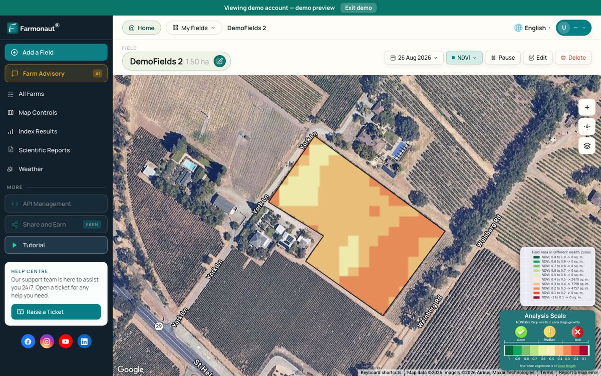
For fields in crops, satellite vegetation maps can show which parts grow evenly and which lag behind through the season. Farmonaut Satellite + AI Farm Monitoring System offers such maps. A weak patch shows that growth differs, not why, so it still needs a visit and a soil test.
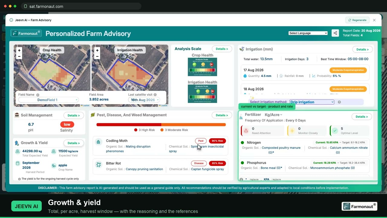
▶ A full walkthrough of satellite crop monitoring: reading NDVI and pulling a field report. · 19:36
How much of your farm counts as arable?
Enter your own blocks below. The tool applies the FAO grouping: temporary crops, temporary meadows and pastures and temporary fallow make up arable land, and adding permanent crops gives cropland.
Try the numbers for your own farm below.
Calculator
How much of your farm is arable under the FAO grouping?
Enter the area of each block in acres or hectares; use one unit throughout.
- Arable share of the farm: 72.0 %
- Cropland (arable plus permanent crops): 400
- Total farm area: 500
Example values only, not a benchmark. The grouping follows the FAO definition (Statistical Yearbook 2022): arable land is temporary crops, temporary meadows and pastures, and temporary fallow; cropland adds permanent crops. Scheme and tax definitions can differ, so check the local rules.
FAQ
What does arable mean in simple words?
It means land that can be plowed and used to grow crops. Official statistics narrow this to land actually in a crop cycle, including temporary grass and fallow.
What is the difference between arable and non-arable land?
Arable land is worked and resown in a regular cycle. Non-arable land covers orchards and vines, permanent pasture, woods, and built-up or barren land. Some of it is still valuable farmland.
Is pasture arable land?
Permanent pasture is not. Temporary pasture that is part of a crop rotation is, under the FAO definition.
Is an orchard or vineyard arable land?
No. The FAO and Eurostat place long-lived plantings outside arable land. In FAO data they count as permanent crops, which are part of cropland.
What percentage of the Earth’s land is arable?
About 10.7% of world land area in 2023, using FAO data published by the World Bank. That counts land in use as arable, not all land that could be farmed.
Can non-arable land become arable?
Sometimes. Drainage, irrigation, stone removal or liming can bring land into crops, if the slope, climate and soil allow it and local rules permit it. Costs and environmental limits decide whether it is sensible, so get professional advice first.
Related pages on our site: land use types; satellite mineral detection; mining site mapping; mining project enquiry; contact page.
Farmonaut crop monitoring
See how your own arable fields vary from space
Draw your fields once and Farmonaut shows satellite vegetation maps for them through the season, on web, Android or iOS.



Keep reading

Sources
- Cambridge Dictionary, arable: dictionary.cambridge.org
- Dictionary.com, arable: dictionary.com
- Wiktionary, arable (etymology): en.wiktionary.org
- World Bank, Arable land (% of land area), FAO data: data.worldbank.org
- World Bank API, Arable land (hectares), to 2023: api.worldbank.org
- World Bank API, Arable land (hectares per person), 1990 to 2023: api.worldbank.org
- FAO, Statistical Yearbook World Food and Agriculture 2022: openknowledge.fao.org
- Eurostat, Glossary: Arable land: ec.europa.eu
- Eurostat, Farms and farmland in the European Union (2023 data): ec.europa.eu
- USDA NASS, 2022 Census of Agriculture Highlights: Farms and Farmland (2024): nass.usda.gov
- USDA NASS, Land Values 2026 Summary (July 2026): release.nass.usda.gov
- Defra, Agricultural land use in England at 1 June 2026: gov.uk
- USDA NRCS, Land Capability Classification report, Ottawa County, Ohio: efotg.sc.egov.usda.gov
- Agriculture and Agri-Food Canada, CLI Agriculture classification: sis.agr.gc.ca
- Manaaki Whenua Landcare Research, An introduction to LUC: lrp.landcareresearch.co.nz
- GOV.UK, Guide to assessing development proposals on agricultural land: gov.uk
- USDA NRCS, Web Soil Survey: websoilsurvey.nrcs.usda.gov
- USDA NASS, Cropland Data Layer FAQ: nass.usda.gov
Discussion
Questions, corrections or field experience? Share them below. First-time comments are reviewed before they appear, and your email is never published.
No comments yet. Be the first to add a question or your experience.

 Agritein
 Delicio
 Payagri
 WB Dev
 Sama Premium
 Prochecker
 Tres Valles
 LACOS Geoinformation
 Pulsar Supernova
 Magrifly
 LatConnect 60
 WebsEdge
 Blickwinkel
 Agricultural Credit Policy Council
 Marei Nursery
 eKGIS
 Mostas Tech
 Andex
 FCF India
 Unifrutti Gulf

 Licence holder · Niger · Gold
 Licence holder · Nigeria · Gold + lithium
 Client · Tanzania · Gold
 Client · Somalia · Gold
 Client & affiliate partner · Ghana · Gold










