

Land Used for Agriculture Is Called: Arable Land Explained
Reviewed September 2026 against USDA Economic Research Service, USDA National Agricultural Statistics Service, and FAO land statistics.
Try it: Run your own numbers →
Quick Answer: What Land Suited for Agriculture Is Called
Land suited for agriculture is called arable land — ground that is flat or gently sloped, free of excess rock or salt, and reliably watered enough to grow row crops on a repeat cycle. Land that could be farmed with added work (clearing, drainage, terracing, irrigation) is cultivable land, a step below arable until that work is done. Land that has grain, vegetables, or fruit growing on it right now is cultivated land. Ground too saline, rocky, steep, or dry to farm without heavy intervention is non-arable or barren land. These four terms answer almost every version of this question that shows up in a search bar, a textbook glossary, or a multiple-choice quiz — and the rest of this article backs each one with USDA and FAO figures so you can check a specific parcel rather than take our word for it.

What Arable Land Means in Official Statistics
When a textbook, a lender or a government report says “arable land”, it usually means the FAO definition. FAO counts as arable any land under temporary crops, temporary meadows for mowing or pasture, market and kitchen gardens, and land left fallow for less than five years (FAO glossary; World Bank indicator notes). Land abandoned after shifting cultivation is not counted.
Three points follow from that definition:
- Arable land is defined by use in a crop cycle, not by soil quality alone. A fertile field that has sat idle for more than five years drops out of the count.
- Orchards, vineyards and other permanent crops are cropland but not arable land in FAO tables. That is why world cropland (1,573 million ha in 2022) is larger than world arable land (1,284 million ha) (FAO Land statistics 2001–2022).
- Cultivated land is narrower still: land with a crop on it in a given season. USDA NASS publishes a satellite-based Cultivated Layer that flags US land planted to crops in recent years (USDA NASS Cultivated Layer).
In the US, the closest equivalent is ERS “total cropland”, which includes cropland used for crops, idle cropland and cropland pasture (USDA ERS).
Arable, Cultivable, Cultivated, Non-Arable: The Actual Differences
These four terms get used interchangeably in casual conversation, which is exactly why the search queries behind this page keep landing on pages that don’t actually distinguish them. Here is the distinction that matters for anyone buying land, filing a land-use report, or answering a homework question:
- Arable land: Fertile, workable, ready now. This is the direct answer to “land suited for agriculture is called,” “land that is good for farming is called,” and “land suitable for agriculture.”
- Cultivable land: Not ready yet, but can be made fit through clearing, drainage, terracing, or irrigation. This is the answer when a question implies land with unrealized potential rather than land already producing.
- Cultivated land: Land with a crop growing on it in the current season — the direct answer to “cultivated land.” Fallow arable land is not cultivated land in a given year, even though it’s still arable.
- Non-arable / barren land: Too rocky, saline, steep, or dry to farm without heavy intervention — irrigation infrastructure, lime treatment, terracing at scale, or similar capital investment.
- Agricultural land (the broadest term): Everything currently in farm use — arable fields, orchards, vineyards, pasture, and fallow ground included.
The distinction between “cultivable” and “cultivated” trips up more readers than any other pair on this list. Cultivable describes capacity; cultivated describes current use. A quarter-section in the Dakotas left in summer fallow one season is cultivable and arable, but not cultivated that year — it has no standing crop. USDA’s Major Land Uses data series, which tracks this exact distinction at the national level, defines total cropland as land that includes both actively cropped acreage and land in short-term fallow, precisely because the two categories move independently year to year (USDA Economic Research Service).




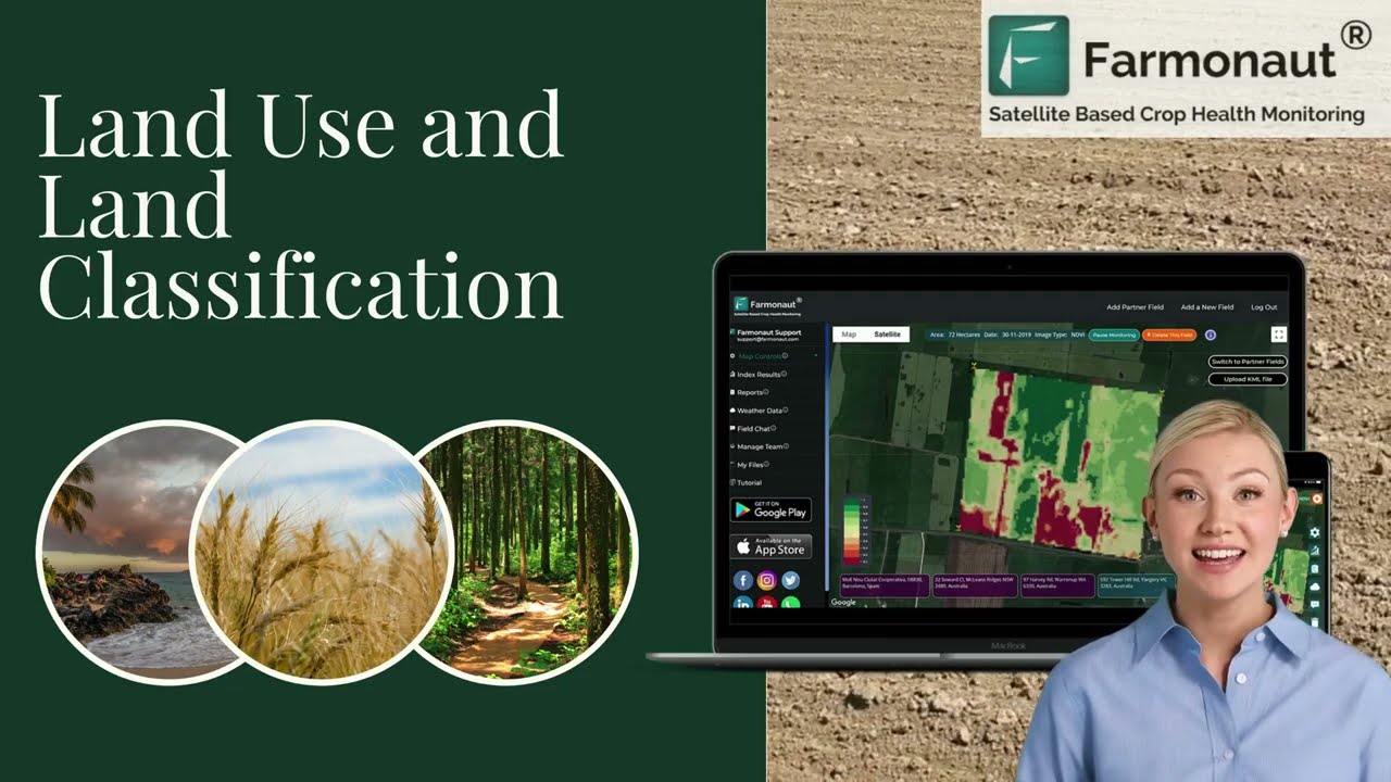
Farmonaut’s satellite platform above checks a specific parcel’s vegetation health, soil moisture, and crop stress against these same land classifications — useful for confirming whether ground you’re evaluating is behaving like arable land or showing signs it needs remediation before planting.
“Arable, Arid, Adjustable, or Acidic?” — Answering the Quiz Question
The correct answer is (a) arable. Land suitable for cultivation is called arable land. The other three options are distractors built around sound-alike words: arid describes a dry climate (the opposite condition — arid land is usually non-arable without irrigation), adjustable is not a soil or land-use term at all, and acidic describes one soil chemistry property that can affect suitability but does not define a land classification on its own. A soil can be acidic and still be arable if pH is within a workable range and lime amendments are applied; acidity alone doesn’t disqualify land the way steepness, salinity, or rockiness does. This is the standard phrasing used in agriculture textbooks and vocational-agriculture placement tests, and “arable” is the term FAO, USDA, and international land-classification systems all converge on.
How Much US Land Is Actually Arable? The USDA Numbers
The United States had 377 million acres of total cropland in 2022, per USDA’s Economic Research Service Major Land Uses report — this is the closest US federal equivalent to “arable land” as a national total. Of that, 338 million acres were actually used for crops that year: harvested acreage, crop failure, and land in summer fallow combined (USDA ERS, Amber Waves). The roughly 39-million-acre gap between total cropland and cropland-used-for-crops is idle cropland — arable by definition, but not cultivated in that particular year.
For scale, US grassland pasture and range land covered 659 million acres in 2017, nearly double the cropland figure — a reminder that “agricultural land” in the US is dominated by grazing land, not row crops, even though cropland gets most of the attention in yield reporting. Total cropland acreage has also been trending down: it stood at 390 million acres in 2017 versus 377 million in 2022, a decline of roughly 13 million acres in five years (USDA ERS, same source).
Globally, FAO put total arable land at 1,284 million hectares in 2022, of which 1,080 million hectares were in temporary crops — annual cultivations like grains and vegetables replanted each season, as distinct from permanent tree and vine crops. World cropland per person fell from 0.24 hectares in 2001 to 0.20 hectares in 2022 (FAO Land Statistics). USDA’s Major Land Uses product is republished annually, typically 12–18 months after the survey year — check the current release for the latest confirmed acreage before citing a number as current.
20 Uses of Land in Agriculture
“Uses of land in agriculture” covers more ground than crop rows. Grouped by function, here are twenty distinct agricultural land uses recognized in US land-use classification and farm management practice:
- Row crop cultivation (corn, soybeans, wheat)
- Hay and forage production
- Grassland pasture and range grazing
- Orchard and tree fruit production
- Vineyard cultivation
- Vegetable and truck-crop farming
- Oilseed production (soybeans, canola, sunflower)
- Cotton and fiber crop cultivation
- Summer fallow (rested cropland between plantings)
- Crop rotation systems for soil health — see crop rotation and GM crop practices
- Irrigated cropland under center-pivot or drip systems
- Dryland (non-irrigated) farming
- Greenhouse and protected cultivation
- Nursery and horticultural stock production
- Aquaculture ponds on farmland
- Farmstead and building sites
- On-farm roads and access lanes
- Conservation Reserve and buffer strips
- Agroforestry and windbreak plantings
- Fleet and equipment staging areas on larger operations
Categories 1–9 draw directly on USDA’s Major Land Uses classification; categories 10–20 reflect farm-management practice layered on top of that base classification, not a separate USDA accounting category.
Types of Agricultural Land: Suitability, Uses & Limitations
Land suited for agriculture is called arable land, but arable land isn’t uniform — suitability sits on a spectrum, and where a specific parcel falls on it determines what it costs to farm and what it can grow.
1. Arable Land
- Definition: Land suited for crop cultivation — flat or gently sloped, fertile, with reliable water access and no excess rockiness or salinity.
- Uses: Grains, vegetables, fruit, oilseeds, and other row and horticultural crops. Forms the core of high-yield farming regions.
- Limitations: Finite supply. US total cropland fell from 390 million acres (2017) to 377 million acres (2022) as urban and other development claimed acreage (USDA ERS).
2. Cultivable Land
- Definition: Land that can be made farmable through clearing, soil amendment, terracing, or irrigation — not yet arable, but reachable.
- Uses: Developed incrementally for row crops or fruit production, including in regions adapting cultivation practice to shifting climate conditions — see this regional case on climate-driven farming adaptation.
- Limitations: Poor drainage, low native fertility, or difficult terrain at the outset; rehabilitation costs vary by how much intervention the site needs.
3. Non-Arable or Barren Land
- Definition: Land not suited for agriculture — highly saline, rocky, steep, desert, or flood/drought-prone.
- Uses: Conservation, tree plantations, or mineral extraction. Select marginal acreage can be brought into forestry or drought-tolerant crops with heavy investment.
- Limitations: High cost or impractical to convert to conventional farming without major capital intervention (irrigation infrastructure, terracing, lime treatment at scale).
4. Agricultural Land (Broadest Category)
- Definition: All land currently in farm use — arable fields, orchards, vineyards, pasture, and fallow ground.
- Uses: Supports both crop and livestock production; US grassland pasture and range land alone totaled 659 million acres in 2017 (USDA ERS).
- Limitations: Subject to urban and infrastructure pressure; mismanagement (overgrazing, soil compaction) reduces long-term productivity.
5. “Good for Farming” / Prime Agricultural Land
- Definition: Land that is good for farming is called fertile, productive, or prime agricultural land — high native fertility, strong water retention, favorable climate for sustained yield.
- Uses: Intensive row-crop and high-value horticultural production. US corn averaged a record 179.3 bushels per acre in 2024, a national average drawn from land in this top tier (USDA NASS Crop Production).
- Limitations: Scarce, and overexploitation without rotation or cover-cropping reduces the yield advantage over time.

US soybean production reached 4.37 billion bushels in 2024 off that 50.7 bushel-per-acre average — a figure that only makes sense against arable acreage, since soybeans aren’t planted on cultivable or non-arable ground (USDA NASS). For fruit-specific acreage, yield, and production figures by crop (apples, citrus, berries, stone fruit), USDA does not publish a single consolidated national report comparable to the corn/soybean series above; the closest source is USDA NASS’s Quick Stats database, which allows commodity-, state-, and month-level queries directly at quickstats.nass.usda.gov.

Learn more about satellite-powered traceability and supply chain safety for high-value fruit markets on our Product Traceability page.
Soil Types Behind “Flat, Fertile Land Good for Growing Crops”
“Flat fertile land good for growing crops” describes a physical profile — level topography, workable soil, adequate drainage — rather than one single soil type. Several soil classes meet that description, each with distinct limits:
- Alluvial soils: Deposited in river basins and deltas; loamy, high water retention, well-drained. Among the most productive soils for grains, citrus, and orchard crops.
- Black (clay-rich) soils: High clay content and strong moisture retention; support cotton, sugarcane, and orchard fruit but crack when dry.
- Red soils: Well-drained but lower in organic matter and slightly acidic; workable with soil amendments.
- Laterite soils: Acidic, iron- and aluminum-rich; poor for row crops but manageable for select tree and berry crops with lime and irrigation.
- Mountain soils: Variable fertility and drainage, erosion risk on slope; support tree fruit at elevation (apples, pears, stone fruit).
- Desert soils: Arid, sandy, salinity risk; require drip irrigation and mulching to support even drought-tolerant crops.
Remote sensing is how USDA maps which crop is grown on each US field at scale, though not soil type: the 2024 USDA NASS Cropland Data Layer, a satellite-based crop classification product, reported 77.5% overall crop accuracy that year (USDA NASS Cropland Data Layer). That accuracy rate is itself a useful benchmark — it’s roughly what a single-season satellite classification gets right without ground-truthing, which is why practical land-suitability checks combine satellite data with soil sampling rather than relying on either alone.

Discover how our Carbon Footprinting solution monitors soil health’s impact on the environment, empowering responsible agriculture and transparency for regulatory and export standards.
Land Suitability Score Calculator
Use the calculator below to turn four site observations — slope, drainage, salinity, and irrigation access — into a rough suitability score and classification, so you can see where a specific parcel likely sits between arable and non-arable before commissioning a formal soil survey.
Run your own numbers
This score is a rough screening heuristic, not a substitute for a certified soil survey (e.g., USDA NRCS Web Soil Survey) or a site visit. It excludes climate, pest pressure, market access, and legal/zoning restrictions, and it does not account for interactions specific to a given crop’s tolerance thresholds.
Verifying Land Suitability: Satellite & Precision Tools
Once a parcel is classified as arable or cultivable, the next question is how to confirm it’s behaving that way season over season — soil that scored well on paper can still develop compaction, salinity creep, or drainage problems. Several categories of tools address this directly:
- Satellite Imagery & Monitoring: Real-time vegetation health (NDVI), soil moisture, and stress detection across both prime and marginal land.
- AI & Machine Learning: Yield forecasting and input recommendations tailored to soil type and region.
- Blockchain Traceability: Farm-to-table tracking for fruit and other high-value crops.
- Precision Irrigation & Fertilization: Sensor-driven water and nutrient delivery, most valuable on desert and laterite soils where margins for error are thin.
- Remote Resource & Fleet Management: Vehicle, equipment, and labor tracking on larger operations.
- Environmental Impact Tracking: Carbon and soil-degradation indices for compliance and reporting.
Learn more about fleet optimization for large-scale farming on our Fleet Management page, or discover how our Large Scale Farm Management app lets agri-businesses manage operations across vast areas—from planting to harvest.

For developers and agri-tech providers, our Satellite Data API and Developer Docs provide easy integration of agricultural, mining, and land management features directly into your platforms.
Comparison Table: Land Type vs. Fruit Crop Fit
| Land/Soil Type | Key Characteristics | Best-Suited Fruit/Tree Crops | Primary Limiting Factor | Remediation Needed? |
|---|---|---|---|---|
| Alluvial | Loamy, nutrient-rich, high water retention, well-drained | Citrus, banana, mango | None major | No |
| Black (clay-rich) | High clay content, strong moisture retention, cracks when dry | Citrus, pomegranate, papaya | Drainage in wet season | Minor |
| Red soil | Well-drained, low organic matter, slightly acidic | Berries, cashew, coconut | Low native fertility | Yes — amendment |
| Laterite | Acidic, iron/aluminum-rich, variable depth | Pineapple, cashew, select berries | Acidity | Yes — lime + irrigation |
| Mountain | Variable fertility, erosion risk, high drainage | Apple, pear, peach, cherry | Slope / erosion | Yes — terracing |
| Desert | Arid, sandy, salinity risk, low organic matter | Date palm, pomegranate, fig | Water availability | Yes — drip irrigation |
Fruit-specific yield-per-acre figures for these crops are not published in a single consolidated USDA national series; check USDA NASS Quick Stats for state- and county-level figures on a specific crop before budgeting against a yield assumption.
For comprehensive digital advisory across plantation crops, forestry projects, and climate-resilient agriculture, visit our Crop Plantation and Forest Advisory page.
Frequently Asked Questions
Q1: What is land suited for agriculture called?
Arable land — fertile, workable ground with reliable water access and no excess rockiness, slope, or salinity. Cultivable land is the adjacent category: not yet arable, but able to be made so through clearing, drainage, or irrigation investment.
Q2: What’s the difference between cultivable and cultivated land?
Cultivable describes capacity — land that could be farmed with effort. Cultivated describes current use — land with a crop actually growing on it this season. Arable land left in fallow is cultivable and arable, but not cultivated in that particular year.
Q3: Land suitable for cultivation is called blank land — arable, arid, adjustable, or acidic?
Arable. Arid describes a dry climate (often the opposite of farmable without irrigation); adjustable isn’t a land-classification term; acidic describes one soil chemistry property, not a full suitability classification.
Q4: How much arable/cropland does the US have?
377 million acres of total cropland in 2022, of which 338 million acres were actually used for crops that year (harvested, failed, or summer fallow). USDA ERS republishes this figure annually with a 12–18 month lag — check the Major Land Uses report for the current release.
Q5: What is land not suited for agriculture called?
Non-arable or barren land — highly saline, rocky, steep, arid, or flood-prone ground unfit for cultivation without heavy intervention. Some of it goes to conservation or tree plantation; some overlaps with mineral-rich zones suited to mining rather than farming.
Q6: Can non-arable land be rehabilitated for farming?
Yes, in some cases — irrigation infrastructure, soil amendment, terracing, and mulching can convert select non-arable parcels to cultivable status, though cost and feasibility depend entirely on what’s limiting the site (salinity is cheaper to fix than slope, for instance).
Q7: How is arable land measured or verified today?
USDA’s satellite-based Cropland Data Layer classified US cropland at 77.5% overall accuracy in 2024 — the standard benchmark for single-season remote classification. Verify a specific parcel by combining this kind of satellite read with a physical soil test rather than relying on either alone. Access field-level monitoring via Farmonaut’s satellite platform.
Q8: How does Farmonaut support land and resource management?
Farmonaut combines satellite monitoring, AI-based advisories, and blockchain traceability so users can check field-level conditions, plan input use, and maintain transparent supply chains across agriculture and mining operations.
Conclusion & Key Takeaways
Land suited for agriculture is called arable land; land that could be made suitable is cultivable land; land with a crop on it right now is cultivated land; and land unfit for farming without major intervention is non-arable or barren land. The US carried 377 million acres of total cropland in 2022, with 338 million acres actually cropped that year, against a backdrop of 659 million acres in pasture and range as of 2017 — figures that shift with each USDA release, which is why the sourcing above points to where to check the current numbers rather than treating any single year as fixed. Globally, FAO’s 1,284 million hectares of arable land and 0.20 hectares of cropland per person frame the same scarcity that drives the shrinking US cropland trend.
The durable part of this isn’t the acreage figure — it’s the four-way classification (arable / cultivable / cultivated / non-arable) and the slope-drainage-salinity-irrigation framework the calculator above walks through. That logic doesn’t expire when next year’s USDA release lands; the acreage numbers will change, and the method for checking a specific parcel against them won’t.
Check a specific parcel’s soil moisture, vegetation health, and land classification signals directly with Farmonaut’s satellite tools.
Discussion
Questions, corrections or field experience? Share them below. First-time comments are reviewed before they appear, and your email is never published.
No comments yet. Be the first to add a question or your experience.

 Fair Climate Fund
 TVS Electronics
 BW Pipelines
 WICO
WICO Gen Chayat
 Chimera Innovation
 SkyHarvest
 Polaris Digitech
 Teledarbas
 Wild Oak Farm
 SFX
SFX BACF Africa
 Doodlakine
 Exurbia Geospatial
 FieldZero
 Indico Company
