
Forests · Evidence-ranked guide
Technological Solutions to Deforestation: 7 Tools Compared
Satellite alerts paired with local patrols are the best tested: an estimated 52% less clearing in the first year of a Peruvian trial, with a wide margin of error (PNAS, 2021). Six other tools help, but their proof varies. Here they are ranked, with limits and a calculator.
Key takeaways
- Deforestation fell to 10.9 million hectares a year in 2015–2025 from 17.6 million in 1990–2000 (FAO, 2025).
- Alerts need people who respond: a Peru trial estimated 52% then 21% less clearing, with wide margins; a separate study found 18% less loss in African countries with subscribers.
- Reduced-impact logging savings of 51–76% (Indonesia) are estimates of potential, not results achieved.
- The EU rules apply from 30 December 2026 (30 June 2027 for most micro and small operators), and most sellers need plot locations.
- Technology supports policy, enforcement and land practices. It does not replace them.
In this article
- Can deforestation be sustainable?
- How much forest is still being lost
- Seven technological solutions to deforestation compared
- How to choose a tool for your land
- Is monitoring worth it? Run your own numbers
- Land practices that technology has to support
- Limits of technological solutions to deforestation
- FAQ
The technological solutions to deforestation with the best-tested evidence are satellite alerts paired with people who act on them. A randomised trial in the Peruvian Amazon, with communities trained to use alerts and paid to patrol, estimated a fall in clearing of 52% in the first year and 21% in the second compared with control communities, but the margins of error were wide and include no effect (PNAS study, 2021; percentages as summarised by WRI). Radar, lidar, plot mapping, better logging plans and drone seeding help too, but the proof behind each one differs.
This guide ranks seven tools by the strength of that evidence. It also says what each is best for and where it falls short. A calculator lets you test whether monitoring would pay for itself on your own land. If you came here asking whether deforestation can ever be sustainable, the next section answers that first.
Can deforestation be sustainable?
Strictly, no. FAO defines deforestation as the conversion of forest to other land uses, such as farming or infrastructure, so the forest does not come back on that land. Cutting trees and letting the stand regrow is a different thing: it is forest management, and the land stays forest. That is why “sustainable deforestation” is a confusing phrase. What people usually mean is one of three things: harvesting without losing the forest, keeping or returning trees on farmland, or clearing as little as possible for a mine, road or dam and then restoring the site.
The context decides what is possible:
- Forestry: planned harvests matched to growth rates can keep land under forest. Heavy, unplanned cutting can slide into lasting loss.
- Agriculture: this is where permanent clearing tends to happen, so the choice is between expanding and getting more from land already open, with trees kept in the system.
- Mining: clearing can be limited by screening ground remotely before any access tracks are cut, then rehabilitating the site after closure.
- Infrastructure: routing, buffer zones and wildlife corridors decide how much forest is cut up as well as how much is removed.
How much forest is still being lost
FAO’s Global Forest Resources Assessment puts deforestation at 10.9 million hectares a year in 2015–2025, down from 17.6 million in 1990–2000. It reports that 88 percent of deforestation from 1990 to 2025 was in the tropics. The trend is improving, yet the same report shows net forest loss rising to 4.12 million hectares a year in 2015–2025 from 3.68 million in 2000–2015, because forest gain slowed.
Chart
Annual deforestation rate by period
Million hectares per year, global and tropical domain
Satellite figures tell a similar story with a different measure. WRI and the University of Maryland report that the world lost 4.3 million hectares of tropical primary rainforest in 2025, 36% less than the year before. WRI says global forest loss is still about 70% too high to meet the 2030 goal of halting it. These numbers are not comparable with FAO’s. Tree cover loss counts any removal of tree cover, including fire and harvest that may regrow, while FAO counts land use change. Fires caused 42% of the 25.5 million hectares of tree cover lost worldwide in 2025, and WRI’s Global Forest Review says agriculture still leads tree cover loss in the tropics. So tools must cover two different problems: clearing decisions that people make, and fire.
Seven technological solutions to deforestation compared
We ranked the tools by the quality of evidence that they change what happens on the ground, not by how advanced they are. A randomised trial ranks above a before-and-after comparison, and both rank above a model of potential savings. Radar sits third because it feeds the same alert systems, though we found no impact study of radar alone. Plot mapping, lidar and drones follow because they do not yet show a measured fall in clearing.
| Tool | Best for | Evidence | Main limit |
|---|---|---|---|
| 1. Alerts + patrols | Communities, land managers | Randomised trial: est. 52%, then 21% less clearing; wide margins | Needs trained people and a way to respond |
| 2. Alert subscriptions | Agencies, NGOs, large owners | 18% less loss in Africa over two years | No substantial change in Asia or South America |
| 3. Radar alerts | Cloudy regions | Detection through cloud | Can take up to 12 days to flag change |
| 4. Logging plans | Timber concessions | Potential 51–76% emission cuts (Indonesia) | Savings depend on practice in the field |
| 5. Plot mapping | Exporters, traders, growers | Legal duty for EU sales | Shows origin; does not stop clearing elsewhere |
| 6. Lidar | Carbon and forest inventory | Measures canopy height and structure | Measures forests; does not act on loss |
| 7. Drone seeding | Large or hard-to-reach restoration | Early and site-specific | Seeds still must survive after landing |
1. Satellite alerts tied to local patrols
Best for: communities and land managers who can reach a site quickly. In the Peru trial, monitors got alerts, went to check them, recorded evidence with a mobile app and drones, and took findings to community assemblies. The comparison was 37 control communities that did not use the technologies. This is the best-designed test here because random assignment rules out many other explanations. Even so, the authors call the estimates imprecise: the first-year range runs from 19.4 hectares less to 2.6 hectares more per community, and the second-year estimate of 3.3 hectares less was not statistically clear. Patrols were also paid, so alerts alone were not what was tested.
2. Alert subscriptions for agencies and owners
Best for: organisations with staff who can respond. A study of 22 tropical countries in Nature Climate Change found that deforestation dropped 18 percent over two years in African countries where organisations subscribed to GLAD alerts. The fall was linked to organisations subscribing. The summaries do not show which actions followed. NASA’s summary adds that there was no substantial change in Asia or South America in the study period. Alerts are a tool for enforcement, not a substitute for it.
3. Radar alerts that see through cloud
Best for: wet tropical regions where cloud hides the ground for long stretches. Optical satellites cannot see through cloud. Global Forest Watch now combines four alert systems: GLAD-L, GLAD-S2, RADD and DIST-ALERT. RADD uses 10-metre Sentinel-1 radar and can detect change through cloud, while optical systems can revisit every one to four days in clear conditions and radar may take up to 12 days. So the two work best together.
4. Mapped harvest plans and reduced-impact logging
Best for: forest concessions. Mapping which trees to cut, which way to fell them and where to run skid trails reduces collateral damage. In the Congo Basin, researchers estimated that 51% of logging emissions could be avoided without reducing timber yields if the best observed practices were all applied in one operation. Work across 25 concessions in Indonesia put the potential at 51–76%, depending on the emissions measure used. These are estimates of potential, not results achieved. The Congo study also found no difference in emissions between certified and uncertified concessions, so a label alone is not proof.
5. Plot mapping and supply chain traceability
Best for: growers, traders and exporters selling into the EU. The EU Deforestation Regulation applies from 30 December 2026 for covered commodities, on the Commission’s implementation page; the Commission’s FAQ gives 30 June 2027 for most micro and small operators. Companies first placing goods on the EU market or exporting them must show where the goods were produced, while other traders have lighter duties, and the rules do not bind producers outside the EU directly unless they sell into it themselves. The Commission’s FAQ says plots under four hectares can be described with one latitude and longitude point, while larger plots need polygons. Cattle establishments can use a single point. Micro and small primary operators may be able to give a postal address instead. Check the current rules with your buyer or adviser, because this regulation has been amended and could change again.
Mapping shows where a product came from and lets anyone compare it against past satellite images. Its limit is leakage: a buyer’s clean supply chain does not stop clearing for other markets.
6. Lidar for measuring forest structure
Best for: forest inventory and carbon accounting. NASA’s GEDI instrument, flown from the International Space Station, uses three lasers to make measurements of canopy height, vertical structure and surface elevation, each from a 25-metre spot. Lidar tells you how much forest is there and how degraded it is, which plain images can miss. It supports decisions but does not stop anything by itself, so it sits low on our ranking for direct effect.
7. Drone seeding for restoration
Best for: large or remote sites where hand planting is impractical. A preprint on tropical restoration found that, in suitable sites, drone seeding could more than double the area restored for the same cost as manual planting. It has not yet passed peer review, and its authors say evidence of success remains scarce and depends on conditions that allow seedlings to establish in one round. Seeds still face predators, drying out and competition. Treat drones as a delivery method, not a restoration plan.
Chart
Measured falls in clearing linked to alerts
Percent reduction reported, compared with control or earlier period
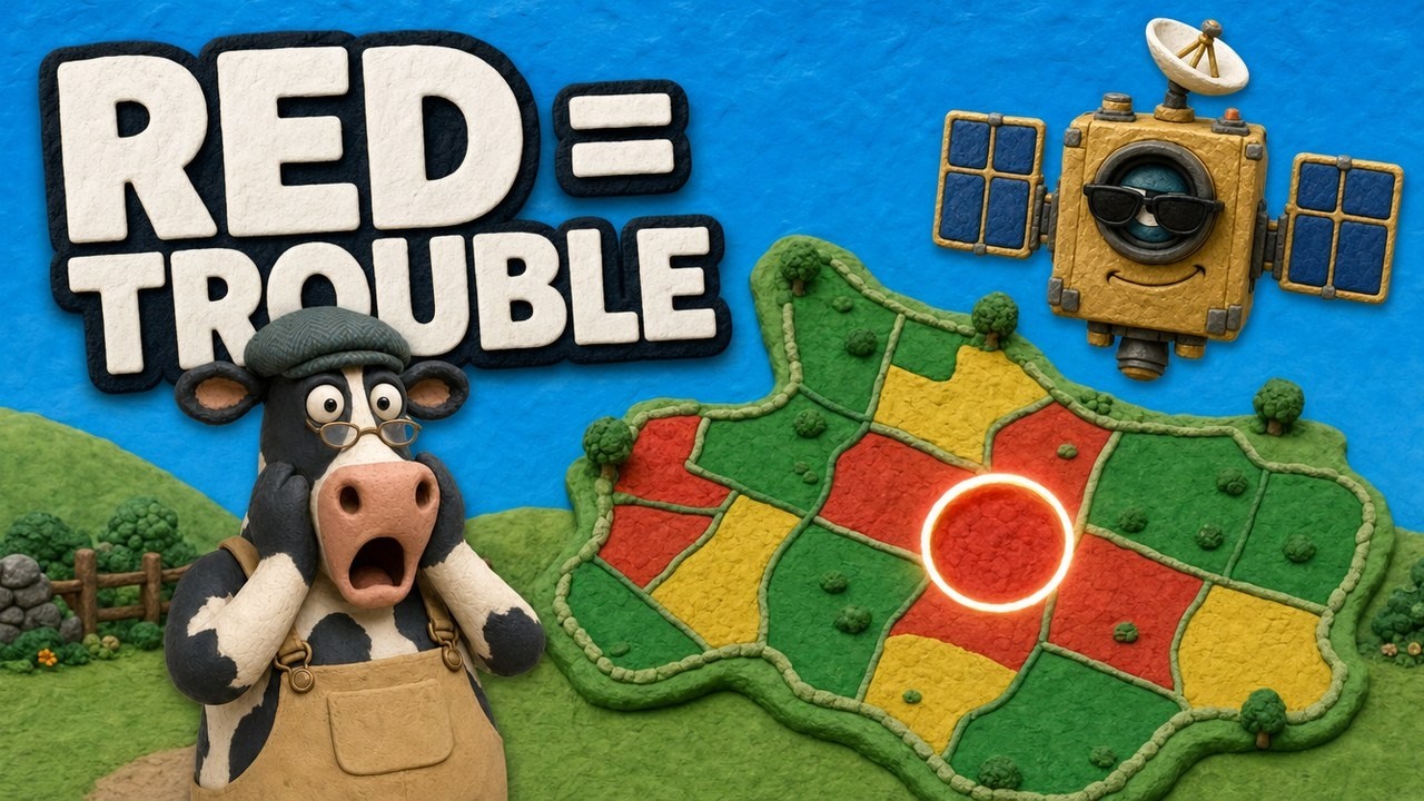
▶ How satellite vegetation maps show changes in plant cover, explained on a large farm. · 4:09
How to choose a tool for your land
Start with the decision you need to make, not the technology:
- You own or manage forest: set up alerts for your boundary and name who checks them. An alert nobody visits changes nothing.
- You sell soy, cattle, coffee, cocoa, palm oil, rubber or wood into the EU: map your plots now and keep the records with your sales documents.
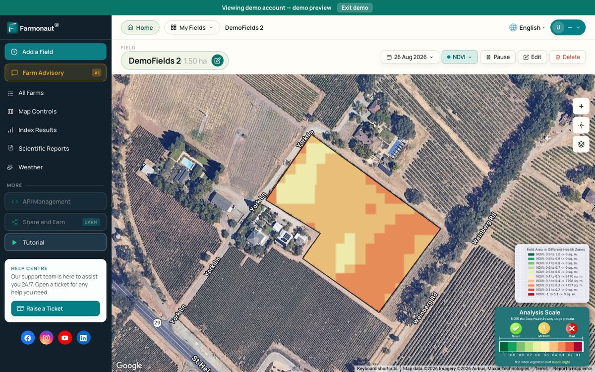
- You farm next to forest: a seasonal record of vegetation on your fields can help show where production sits and spot changes along boundaries.
- You restore land: first check whether natural regrowth will do the job. Then choose species and method, and monitor survival for several years.
- You run a mine or exploration project: screen ground remotely before cutting tracks, and write closure and rehabilitation into the plan from the start.
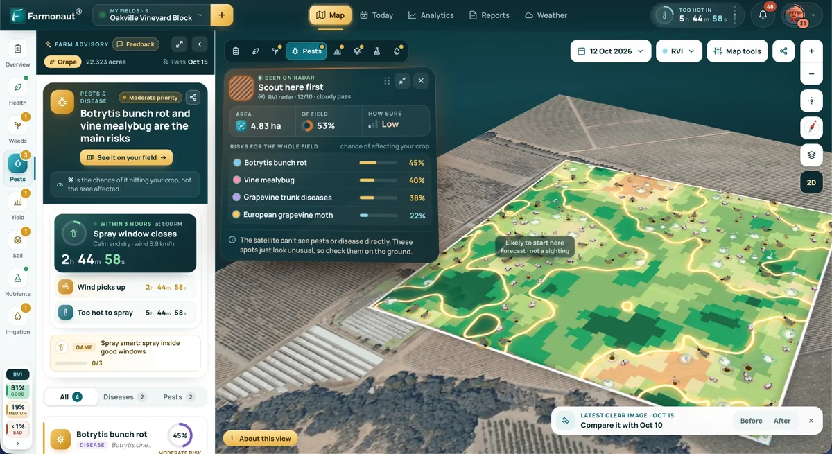
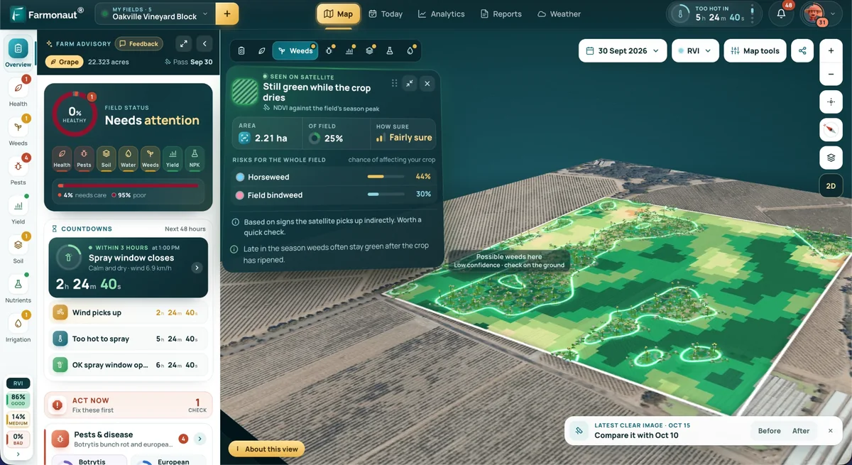
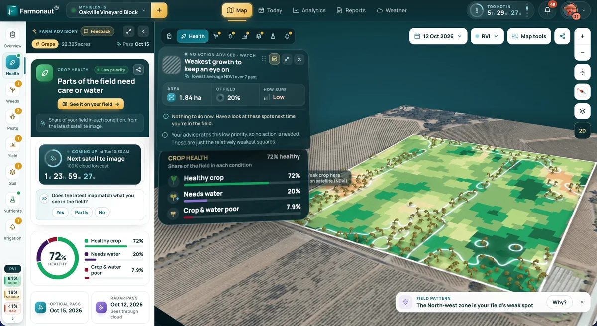
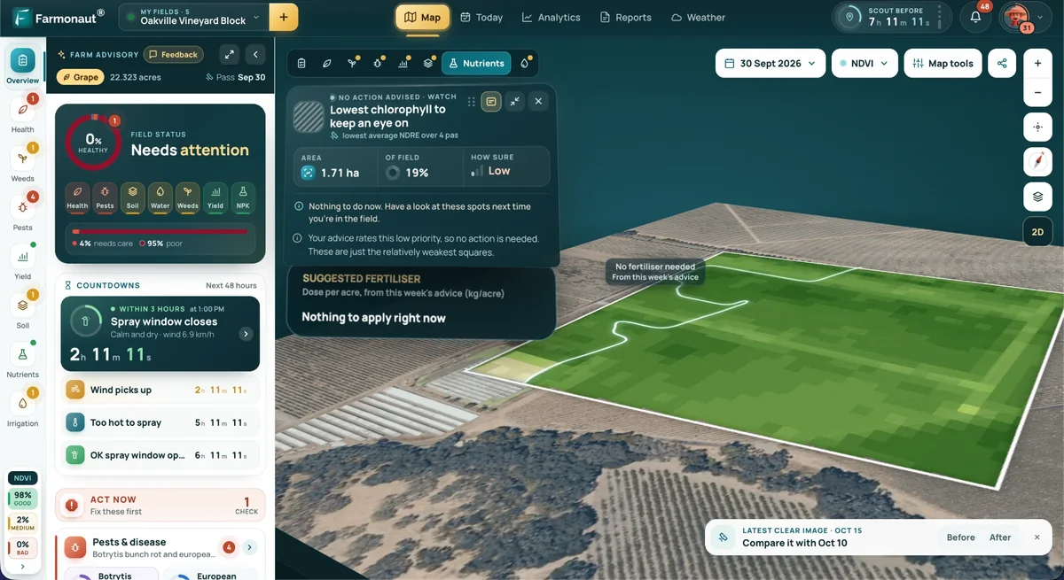
For farm owners, Farmonaut Satellite + AI Farm Monitoring System is one way to keep that seasonal vegetation record for mapped fields. For mineral explorers, satellite-based mineral detection is one way to narrow target areas before ground work; a surface screen does not replace drilling or permits. Our separate article on solutions for deforestation in mining regions covers that sector in more detail.
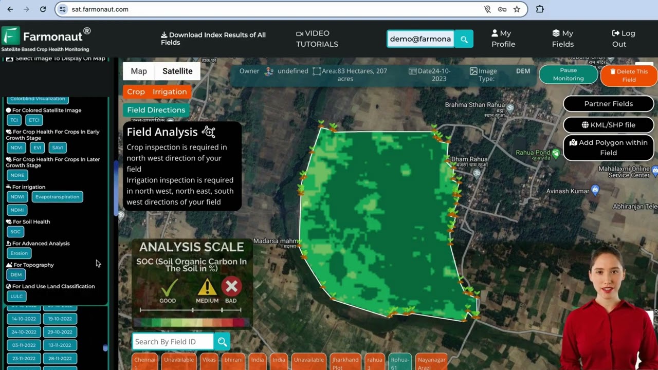
▶ A walk through a satellite monitoring web app for fields. · 8:02
Is monitoring worth it? Run your own numbers
Monitoring costs money, and the case for it depends on what the land is worth to you and how much loss you face. The calculator below compares the value protected each year with the annual cost. Replace every default with your own figures. The 18% is the African result from the study above, used only as an example input; your result could be higher, lower or zero.
Try the numbers for your own farm below.
Calculator
Would monitoring pay for itself on your land?
Enter your own area, expected loss, land value and monitoring cost.
- Hectares saved per year: 1.8 ha
- Value protected per year (US$): $5,400
- Monitoring cost per year (US$): $5,000
Example values only, set near break-even; not a benchmark or a forecast. The reduction is an input; the 18% default is the result for African countries with alert subscribers (Nature Climate Change, 2021, via UW-Madison) and may not apply to your land. Get professional advice on valuation.
Land practices that technology has to support
Software does not hold soil in place. These seven practices do the work on the ground, and the tools above help plan and check them.
Selective harvests and planned cycles
Removing chosen trees on a schedule tied to local growth rates lets a stand recover between cuts. Without monitoring, selective logging can slide into heavy cutting, and logging roads can open forest to later clearing.
Agroforestry
Agroforestry mixes trees with crops or livestock, as in alley cropping, silvopasture and windbreaks. Trees on farmland are already common: remote sensing showed that 43% of agricultural land had at least 10% tree cover in 2010. Trees can diversify income and shelter soil, though they also compete with crops for light and water, so species and spacing need to fit the site.
Native replanting and assisted regeneration
Where seed sources and root stock survive, protecting natural regrowth can be a low-cost route. Farmer-managed natural regeneration in the Sahel is a well-studied case. Where the land is too degraded, active planting with native species is the alternative. Local species suit local soils and wildlife better than a single imported tree.
Soil protection after clearing
Bare soil erodes fastest. Mulch, contour work, grass or shrub barriers and keeping machinery on set routes all reduce loss and compaction. Results vary with slope, soil and rainfall, so no single percentage saving applies. Returning stored topsoil to disturbed sites protects its organic matter and seed bank.
Buffers along streams
Riparian buffers trap sediment and take up nutrients before they reach water. In one field study cited by Ohio State University, a 19-metre forest buffer cut suspended particles by 89 percent and nitrate-N by 60 percent. The same source warns of weak results where fields are tile-drained, in high flows and for dissolved phosphorus in the dormant season. A saturated buffer can address tile water: an Iowa site showed a mean 66% fall in nitrate concentration over four years. University of Maryland Extension’s riparian buffer guide explains how zones are laid out. Check your local rules on buffer widths and ask about cost-share programmes.
Mine site rehabilitation
Good closure plans set out topsoil handling, reshaping, water control and planting before any clearing starts. Requirements vary by country and state, so check the permit and get professional advice.
Policy, certification and community planning
Legal standards, market rules and fair consultation decide whether plans get carried out. The Peru programme above ran through community assemblies as well as satellites. Certification can open markets, but the Congo study found no emissions difference between FSC-certified and uncertified concessions, so check field results.
Chart
What one forest buffer removed
Percent reduction, 19-metre riparian forest buffer, single 1984 field study
Limits of technological solutions to deforestation
- Detection is not prevention. The African study found gains where organisations signed up; elsewhere it found no substantial change.
- Fire behaves differently. Alerts can flag burning, but hot, dry conditions drive much of the loss that WRI reports outside the tropics.
- Gains can reverse. Tropical primary forest loss hit 6.7 million hectares in 2024, driven largely by fire, before falling in 2025.
- Clearing can move. A rule that protects one place or supply chain can shift pressure to another.
- Results are local. A trial in one region shows what worked there. It needs replication before anyone assumes the same elsewhere.
One point runs through all of this. WRI says the data suggest strong policy and enforcement can curb loss, and that Brazil’s 42% drop in primary forest loss in 2025 coincided with stronger policy and enforcement. Technology can support such policies. It does not replace them.

▶ Why soil organic matter matters, a reminder of what lasting land use has to protect. · 7:33
FAQ
What are the main technological solutions to deforestation?
Satellite alerts, radar monitoring, mapped harvest plans, plot mapping for traceability, lidar measurement and drone seeding. Alerts paired with local patrols have the strongest direct evidence.
Is sustainable deforestation possible?
Permanent conversion of forest is not sustainable in the strict sense. Managed harvesting with regrowth, agroforestry and minimal clearing followed by restoration can keep or return many of a forest’s functions.
Do satellite alerts actually reduce deforestation?
They can, but the evidence is not settled. A Peruvian trial estimated 52% and then 21% less clearing, with wide margins of error, and one study found 18% less forest loss in African countries with subscribers. The same study saw no substantial change in Asia or South America, so results vary by region.
Can drones replant a forest?
They can spread seed over large or remote land. Evidence is still limited, and success depends on site conditions, species and seed survival. Check establishment on the ground before scaling up.
What should a farmer do first?
Map your field and forest boundaries, keep dated records and name who will check any alert. If you sell into the EU, ask your buyer which records they need and confirm the rules with an adviser.
Related pages on our site: deforestation prevention methods; Amazon deforestation evidence.
Farmonaut crop monitoring
See your own fields from space
Draw your fields once and Farmonaut shows satellite vegetation maps for them through the season, on web, Android or iOS.



Keep reading
Sources
- FAO, Global Forest Resources Assessment 2025, Forest extent and change: openknowledge.fao.org
- WRI, Tropical rainforest loss drops 36% in 2025 (release, 2026): wri.org
- WRI Global Forest Review, latest analysis (2026): gfr.wri.org
- WRI, Global forest loss in 2024 (release, 2025): wri.org
- Global Forest Watch, Integrated disturbance alerts: globalforestwatch.org
- WRI, Global Forest Watch helps Indigenous Peoples reduce deforestation (2022, on the PNAS 2021 study): wri.org
- UW-Madison News, Subscriptions to satellite alerts (2021): news.wisc.edu
- NASA, Alert system shows potential for reducing deforestation (2021): science.nasa.gov
- University of Maryland, GEDI mission overview: gedi.umd.edu
- Assessing UAV direct seeding for tropical restoration (EcoEvoRxiv preprint): ecoevorxiv.org
- Umunay et al., Selective logging emissions in the Congo Basin (2019), Evidensia record: evidensia.eco
- The Nature Conservancy, Indonesia reduced-impact logging carbon analysis: conservationgateway.org
- European Commission, EUDR implementation page: green-forum.ec.europa.eu
- European Commission, EUDR FAQ, 5th iteration: environment.ec.europa.eu
- Zomer et al., Global tree cover on agricultural land (2016): pmc.ncbi.nlm.nih.gov
- Ohio State University, Riparian forest buffers: agbmps.osu.edu
- Leopold Center, Iowa State University, Trees and tiles (2025): leopold.iastate.edu
- University of Maryland Extension, FS724 riparian buffers: extension.umd.edu
- Drivers of farmer-managed natural regeneration in the Sahel (2020): pmc.ncbi.nlm.nih.gov
Discussion
Questions, corrections or field experience? Share them below. First-time comments are reviewed before they appear, and your email is never published.
No comments yet. Be the first to add a question or your experience.

 AgroRangers
 FCF India
 Unifrutti Gulf
 Deluxe Conseil
 TVS Electronics
 BW Pipelines
 WICO
 Gen Chayat
 Chimera Innovation
 SkyHarvest
 Polaris Digitech
 Teledarbas
 Wild Oak Farm
 SFX

 Licence holder · Niger · Gold
 Client · Tanzania · Gold