

Canada minerals · Ranked list
Minerals Mined in Canada: Ranked by Value of Output
Gold led Canadian mining in 2024 with C$19.2 billion of shipments, ahead of coal, potash, iron ore and copper (NRCan and Statistics Canada). This page ranks 18 mined products by value, shows which province mines each, and links the official mineral maps.
Key takeaways
- Gold is first among products with a published value: C$19.2 billion shipped in 2024, about a third of the C$55.8 billion non-coal total (NRCan and Statistics Canada, 2024).
- Potash is the mineral where Canada ranks first in the world: about 15 million tonnes of K2O of 49 million worldwide in 2025 (USGS estimate).
- Canada mined 14,309 tonnes of uranium in 2024, 24% of world supply and second to Kazakhstan (World Nuclear Association).
- Quebec (C$13.3 billion) and Ontario (C$13.0 billion) led on value excluding coal in 2024; Saskatchewan was third at C$10.9 billion.
- No single national mineral map exists; Saskatchewan, British Columbia and New Brunswick each publish their own occurrence layers.
In this article
- Minerals mined in Canada, ranked by value of shipments
- How this ranking was built
- Metals: gold, iron ore, copper, nickel and the rest
- Industrial minerals, potash and coal
- Which province mines what
- Six years of shipment values
- Canada's share of world mine output
- Where to find an official mineral map of Canada
- New minerals: where exploration money goes
- What is a tonne of Canadian ore worth?
- Land, water and permits
- Frequently asked questions
Gold is the most valuable thing mined in Canada among every product with a published value: mines shipped C$19.2 billion of it in 2024, ahead of coal (C$9.7 billion), potash (C$7.8 billion), iron ore (C$5.6 billion) and copper (C$4.9 billion), according to the official 2024 mineral production table from Natural Resources Canada (NRCan) and Statistics Canada. This page ranks the minerals mined in Canada by that value, shows which province each one comes from, and tells you where to find the official mineral maps if you want to look at a specific area.
The ranking is built from shipment values, not from tonnes, because a tonne of gold ore, a tonne of potash and a tonne of gravel are worth very different amounts. Where the tables hide a figure to protect a single company, the page says so instead of guessing.
Minerals mined in Canada, ranked by value of shipments
The table lists every product with a published 2024 national shipment value above C$100 million, plus diamonds, where only the Northwest Territories value is shown. Values are in millions of Canadian dollars (C$). “Shipments” means what producers sold or sent on, so it differs a little from “production”, the amount that came out of the ground and was processed.
Chart
Value of shipments by mined product, 2024
C$ billion; eight largest published values
| Rank | Product | 2024 value (C$ million) | Quantity (2024) | Where it comes from |
|---|---|---|---|---|
| 1 | Gold | 19,221 | 185,376 kg shipped | Ontario, Quebec, Nunavut, British Columbia |
| 2 | Coal | 9,663 | 42.5 million t produced | Western provinces and Nova Scotia (provincial values withheld) |
| 3 | Potash (as muriate of potash) | 7,792 | 24.4 million t shipped | Saskatchewan only |
| 4 | Iron ore (concentrates) | 5,596 | 68.0 million t produced | Quebec: 40.3 million t; rest withheld |
| 5 | Copper | 4,855 | 437,861 t shipped | British Columbia, Ontario, Quebec |
| 6 | Nickel | 2,597 | 132,429 t produced | Quebec, Ontario, Newfoundland and Labrador, Manitoba |
| 7 | Sand and gravel | 2,514 | 255.3 million t produced | Quarried across the country; Ontario, Alberta and British Columbia lead on published value |
| 8 | Stone | 1,749 | 165.8 million t produced | Ontario and Quebec lead on tonnes |
| 9 | Diamonds | 1,474 (Northwest Territories only) | 12.1 million carats produced | Northwest Territories |
| 10 | Platinum-group metals | 944 | 25.0 million grams produced | Ontario, Quebec |
| 11 | Salt | 483 | 8.8 million t produced | Saskatchewan (1.19 million t published); other figures withheld |
| 12 | Silver | 381 | 331,965 kg produced | Ontario, Yukon, British Columbia |
| 13 | Peat | 380 | 1.95 million t produced | New Brunswick (1.05 million t), Manitoba (0.27 million t), Quebec (0.19 million t) |
| 14 | Lime | 331 | 1.59 million t produced | Provincial split withheld in part |
| 15 | Zinc | 235 | 79,328 t produced | Ontario, Manitoba, Quebec |
| 16 | Lithium | 233 | 4.9 million kg produced | Quebec, Manitoba |
| 17 | Gypsum | 115 | 3.2 million t produced | Nova Scotia, New Brunswick, Ontario, British Columbia (values withheld) |
| 18 | Cobalt | 113 | 3,546 t produced | Newfoundland and Labrador, Quebec, Ontario, Manitoba |
Source for every row: the NRCan and Statistics Canada table linked above, with coal from the Statistics Canada coal survey that NRCan reproduces in the same table. Rank is by the value shown, and only products with a published national value are ranked (diamonds are placed by their Northwest Territories value). Uranium, molybdenum, niobium, graphite, titanium dioxide and some others are mined but have values withheld, so they cannot be ranked here.
The same table gives total shipments of C$55.8 billion for 2024 excluding coal, and C$65.4 billion including coal. Gold alone was about a third of the non-coal total.
For context on why this matters beyond the numbers, our short video on the benefits of mining to the economy walks through exports, jobs, public revenue and the minerals behind the energy transition.
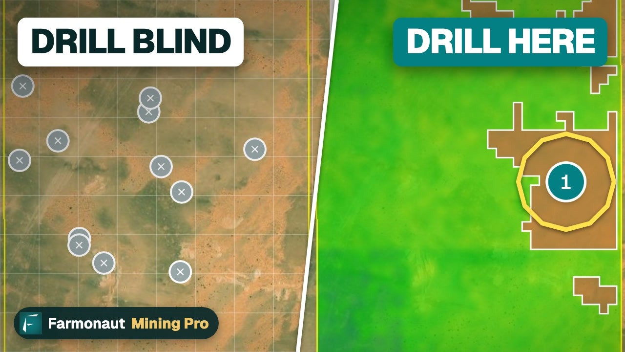
▶ Follows the money from the ground up: what mining does for an economy through exports, jobs, revenue and energy-transition minerals. · 5:03
How this ranking was built
Three choices shape the list, and each is worth knowing if you plan to quote it.
- Metric: value of shipments in current Canadian dollars for calendar 2024, the latest full year in the final NRCan table. A preliminary 2025 estimate is also published on the NRCan annual statistics page, but preliminary numbers get revised, so this page uses the final year.
- Coverage: NRCan’s table covers metals, non-metals and aggregates such as sand, gravel and stone. Since 2019 Statistics Canada collects the data under the Statistics Act, and Quebec’s figures come from the Institut de la statistique du Québec. Coal sits in a separate Statistics Canada table, so it is shown on its own line.
- Withheld values: an “x” in the table means the figure is hidden to avoid revealing one company’s output. Where we could build a floor from published parts, the text says so. Where we could not, the item is left out of the ranking and named in the note above.
Prices move the values. A product can rise in this ranking in a year when its price rises even if tonnes are flat. That is why the next sections give tonnes and provinces as well as dollars.
Metals: gold, iron ore, copper, nickel and the rest
Gold
Canadian mines produced 185,555 kg of gold in 2024 and shipped 185,376 kg, worth C$19.2 billion. Dividing the shipped quantity into the value gives an average of about C$103.7 per gram, or roughly C$3,225 per troy ounce (our arithmetic on the NRCan figures, not a market price). The provincial figures below are production: Ontario produced 69,687 kg, about 38% of the national total, followed by Quebec at 58,259 kg (31%), Nunavut at 27,028 kg (15%) and British Columbia at 19,794 kg (11%). Manitoba, Newfoundland and Labrador and Alberta supply the rest, and Saskatchewan and Yukon are withheld.
The US Geological Survey estimates Canada’s gold output at 200 tonnes for both 2024 and 2025, out of a world total of about 3,300 tonnes (USGS, Mineral Commodity Summaries 2026). The USGS figure is higher than NRCan’s 185.6 tonnes because the two agencies measure different things, shipments of mine output in one case and an estimate of mine production in the other.
Iron ore
Iron ore concentrate production was 68.0 million tonnes in 2024, and Quebec alone mined 40.3 million tonnes of it. Quebec’s shipments were worth C$3.36 billion of the C$5.60 billion national value, about 60%. The remaining shipments come from provinces and territories whose figures the table withholds.
Copper
Copper output was 444,587 tonnes, and British Columbia mined 300,187 tonnes of it, about 68%. Ontario added 88,258 tonnes, Quebec 29,202 tonnes, Newfoundland and Labrador 13,612 tonnes and Manitoba 13,327 tonnes. Shipments of 437,861 tonnes were worth C$4.86 billion, an average of about C$11,090 per tonne of contained copper (our division of NRCan’s value by quantity).
Nickel, cobalt and the platinum group
These three come from the same kind of rock, nickel-copper sulphide deposits, which is why the same provinces appear in each list. Nickel production was 132,429 tonnes: Quebec 52,355 (40%), Ontario 46,232 (35%), Newfoundland and Labrador 22,499 (17%) and Manitoba 11,343 (9%). Cobalt, which is mostly a by-product of nickel, came to 3,546 tonnes, led by Newfoundland and Labrador at 1,383 tonnes and Quebec at 1,366 tonnes. Platinum-group metals, a family that includes platinum and palladium, were 25.0 million grams, of which Ontario produced 67% and Quebec 31%. For a closer look at the nickel market and its producers, see our guide to nickel ores and nickel miners.
Uranium
NRCan withholds the uranium value, but the World Nuclear Association reports that Canada mined 14,309 tonnes of uranium in 2024, 24% of world supply, second only to Kazakhstan at 39% (World Nuclear Association, 2024 data). Two mines in northern Saskatchewan, McArthur River/Key Lake (7,808 tonnes) and Cigar Lake (6,501 tonnes), accounted for all of it. The association’s country profile describes the Athabasca ore as among the highest-grade in the world (Uranium in Canada). Grade here means the amount of uranium in each tonne of ore, and high grade is what makes these mines unusual.
Silver, zinc, lead and lithium
Smaller metals show where the base-metal belts run. Silver production was 331,965 kg, with Ontario at 100,980 kg, Yukon at 78,694 kg and British Columbia at 73,142 kg. Zinc was 79,328 tonnes (Ontario 36,629, Manitoba 33,339, Quebec 7,853), and lead, at 2,930 tonnes, came entirely from Yukon. Lithium production, 4.9 million kg in 2024, came from Quebec (3.9 million kg) and Manitoba (1.0 million kg); the value was C$233 million.
Industrial minerals, potash and coal
Potash is the mineral where Canada ranks first in the world by volume, ahead of Russia and China. It is a group of potassium salts used mainly in fertilizer. The 2024 table shows 24.7 million tonnes produced as muriate of potash (MOP, the standard product), all of it in Saskatchewan, with shipments worth C$7.8 billion, an average of about C$319 per tonne. The USGS counts potash by its K2O content and estimates Canadian mine output at 15 million tonnes in 2025 out of 49 million worldwide, ahead of Russia at 10 million and China at 6.3 million (USGS potash summary).
The bulk minerals sit lower in the ranking by value but top it by weight. Canada produced 255 million tonnes of sand and gravel and 166 million tonnes of stone in 2024, worth C$2.5 billion and C$1.7 billion. These are mined close to cities and roads because the cost of hauling them limits the market. Salt (8.8 million tonnes), gypsum (3.2 million tonnes), peat (2.0 million tonnes) and lime (1.6 million tonnes) are smaller again.
Diamonds are mined in only one territory. The Northwest Territories produced 12.1 million carats in 2024, valued at C$1.47 billion. Coal, at 42.5 million tonnes and C$9.7 billion, is a mined mineral in every statistical sense, though it is tracked in a separate Statistics Canada survey, and its provincial values are withheld in the table.
Which province mines what
The provinces below differ a lot in what they mine. The table and chart show what each one produced and shipped in 2024.
Chart
Value of mineral shipments by province, 2024
C$ billion, excluding coal; British Columbia is the sum of its published metals and aggregates (a floor)
In 2024 the three largest provinces by value of shipments, excluding coal, were Quebec at C$13.3 billion, Ontario at C$13.0 billion and Saskatchewan at C$10.9 billion. British Columbia’s total is withheld, but its published metals (C$5.49 billion) and aggregates (C$0.73 billion) already add up to about C$6.2 billion, which puts it well ahead of Manitoba. Newfoundland and Labrador’s total is withheld, but its published metals alone are C$4.2 billion, so its rank against British Columbia cannot be fixed from the table. Manitoba followed at C$1.6 billion and Alberta at C$0.9 billion. The Northwest Territories, Yukon, Nunavut and Newfoundland and Labrador are also major producers, but their totals are withheld because a single mine or two dominates each.
| Province or territory | Main products by 2024 output |
|---|---|
| Ontario | Gold (69,687 kg), nickel, copper, platinum-group metals, silver, zinc |
| Quebec | Iron ore (40.3 million t), gold (58,259 kg), nickel, lithium, copper |
| Saskatchewan | Potash (24.7 million t MOP), uranium, salt |
| British Columbia | Copper (300,187 t), gold, silver, coal |
| Manitoba | Nickel, zinc, gold, copper, lithium |
| Newfoundland and Labrador | Iron ore, nickel, cobalt, copper |
| Nunavut | Gold (27,028 kg) |
| Northwest Territories | Diamonds (12.1 million carats) |
| Yukon | Silver, lead, zinc |
Source: NRCan and Statistics Canada, mineral production in Canada, 2024. Products are named where the table publishes a figure for the province; a few are named although the figure is withheld (iron ore in Newfoundland and Labrador, uranium in Saskatchewan), and other withheld figures may add more.
Six years of shipment values
Total mining shipments, excluding coal, rose from C$43.8 billion in 2019 to a peak of C$63.1 billion in 2022, then fell to C$56.0 billion in 2023 and C$55.8 billion in 2024. The table reports dollars, not a split between price and volume, so part of any swing reflects commodity prices. The chart below plots the NRCan series.
Chart
Canadian mineral shipments, 2019 to 2024
C$ billion, all provinces and territories, excluding coal, current dollars
Canada’s share of world mine output
Canada is a major producer rather than a dominant one for most metals, with potash and uranium as the clear exceptions. The USGS publishes world totals for each mineral, so dividing Canada’s figure by the world total gives a share. Potash is about 31% of world mine output, uranium 24% (World Nuclear Association, 2024), palladium about 8%, gold about 6%, nickel about 3.5% and cobalt about 1%. The chart shows the USGS-based shares for 2024 and the 2025 estimate.
Chart
Canada’s share of world mine production
Per cent of the USGS world total; calculated by dividing Canada by world
Two cautions apply. First, the USGS 2025 figures are estimates, and some of Canada’s carry an estimate flag. Second, nickel output has shifted sharply to Indonesia, which the USGS estimates at 2.6 million of 3.9 million tonnes in 2025, so Canada’s share is small even though its output rose from 125,000 to 140,000 tonnes (USGS nickel summary). The USGS puts Canada’s palladium output at 17,000 kg in 2024 and 16,000 kg in 2025 out of 217,000 and 190,000 kg worldwide (USGS platinum-group summary), and cobalt at 3,350 tonnes and 3,500 tonnes out of 302,000 and 310,000 (USGS cobalt summary).
Where to find an official mineral map of Canada
There is no single national map that shows every mineral occurrence in Canada. Mineral rights and records belong to the provinces and territories, so each publishes its own database. These are the ones we opened:
- Saskatchewan: the Saskatchewan Mineral Deposit Index, a layer in the Mining and Petroleum GeoAtlas, describes all known mineral occurrences in the province and gains new entries as public geoscience information is analysed (Saskatchewan Geological Survey).
- British Columbia: the MINFILE mineral occurrence database is a map layer in the province’s open data service, with each point coded as producer, past producer or developed prospect (BC data service).
- New Brunswick: the provincial mineral occurrence layer is an open dataset downloadable as CSV, GeoJSON or KML, with commodity and deposit-type attributes (Open Government Portal).
Our guide to Ontario, BC and Quebec public geoscience data walks through the other major portals before staking, and the page on mineral claims in Canada by district shows where explorers stake.
Government maps show what is already known. They do not show an untested area that looks like a known one. Satellite images can: the colour of rock and soil changes where hot water has altered it, and those patterns are screened on the ground afterwards. That is the use for satellite mineral detection. It produces exploration targets, which are places to check on foot or with a drill, not resource estimates. If you hold a licence and want one screened, the mining enquiry form is the place to ask about screening a licence area.
If you are new to reading a mining map, the video below tours the layers of a licence-area map: boundary, detected zones and the stats panel.
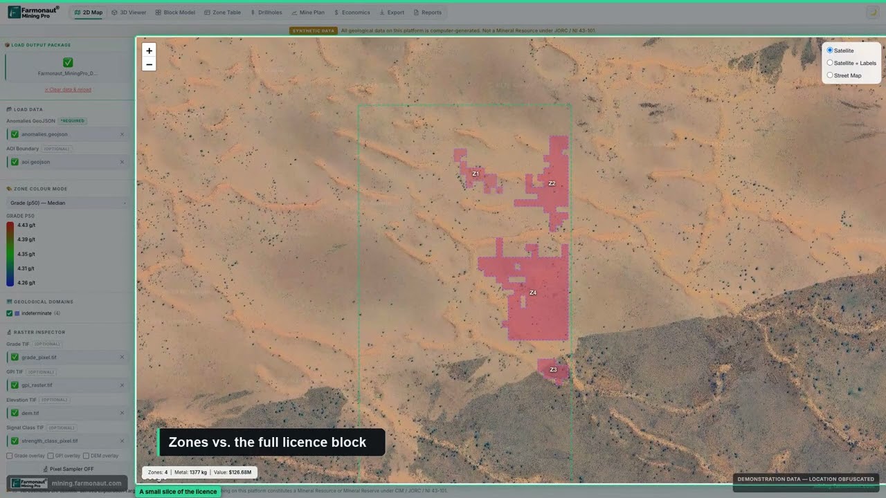
▶ A tour of a mining GIS map: licence boundaries, satellite-detected anomaly zones and live stats (de-identified demo data). · 5:38
New minerals: where exploration money goes
Today’s mines were found by earlier exploration, and the next ones are being searched for now. NRCan reports that exploration and deposit appraisal spending was C$4.2 billion in 2024, preliminary C$4.4 billion in 2025, and companies plan C$5.3 billion for 2026, a rise it ties mainly to gold exploration at record gold prices (NRCan exploration bulletin). Our analysis of the NRCan exploration data breaks that spending down by province, company size and commodity, and our page on gold deposits in Ontario covers one of the two provinces at the top of the table above.
What is a tonne of Canadian ore worth?
Everything in the ranking comes down to one calculation: tonnes mined, times grade, times recovery, times price. Use the calculator on this page to try it with your own numbers. It is set up for gold, where the grade is in grams per tonne (g/t), and it takes a price in Canadian dollars per troy ounce. The 2024 NRCan average of about C$3,225 per ounce quoted above is a derived average, not a price quote, so enter today’s price from a source you trust.
Calculator
What is your ore worth at today’s gold price?
Enter your own tonnage, grade, recovery and price.
- Contained gold before recovery: 6,430 oz
- Gross value at your price (C$): $23,148,520
- Gross value per tonne of ore (C$): $231
Example values only, not a benchmark or forecast. Price is an input: example, use today’s price (C$ per troy ounce); the NRCan average of about C$3,225 per ounce for 2024 is a derived average, not a quote. Contained ounces = tonnes x grade / 31.1035. Recovery is the share of gold that reaches the final product. Royalties, costs and tax are not included.
Land, water and permits
A mineral map says what is under the ground, not whether it can be mined. Every mine needs provincial or territorial permits, an environmental assessment, and in many regions agreements with Indigenous governments or communities whose land it is on. Water use, tailings storage and closure plans shape cost as much as grade does. The video below explains the main environmental impacts of mining in plain language, with satellite maps. Check the rules of the province or territory involved before staking or buying a claim, because each one differs.
▶ Explains the seven environmental impacts of mining in plain words, with satellite maps and sourced facts. · 2:31
Frequently asked questions
What are the main minerals mined in Canada?
By 2024 shipment value they are gold, coal, potash, iron ore, copper and nickel, followed by sand and gravel, stone, diamonds and platinum-group metals. Uranium is also a major product, but its value is withheld in the official table. Source: NRCan mineral production table.
What is the most valuable mineral mined in Canada?
Gold, at C$19.2 billion of shipments in 2024. Among products with a published value, coal comes second at C$9.7 billion and potash third at C$7.8 billion.
Which mineral is Canada the largest producer of?
Potash. The USGS estimates Canada produced 15 million tonnes of K2O equivalent in 2025 out of 49 million worldwide, more than any other country.
Is Canada a big uranium producer?
Yes. The World Nuclear Association reports Canada mined 14,309 tonnes of uranium in 2024, 24% of world supply and second to Kazakhstan.
Which province has the most mining?
By value of shipments excluding coal, Quebec (C$13.3 billion) and Ontario (C$13.0 billion) were close in 2024, with Saskatchewan third at C$10.9 billion. British Columbia’s total is withheld, but its published parts add up to at least C$6.2 billion.
Where is gold mined in Canada?
Mostly Ontario (69,687 kg in 2024), Quebec (58,259 kg), Nunavut (27,028 kg) and British Columbia (19,794 kg), according to the NRCan table.
Where are Canada’s diamonds mined?
In the Northwest Territories, which produced 12.1 million carats in 2024.
Does Canada mine lithium?
Yes. Production was 4.9 million kg in 2024, from Quebec (3.9 million kg) and Manitoba (1.0 million kg).
Is there an official mineral map of Canada?
Not one national map. Each province and territory publishes its own mineral occurrence database, such as Saskatchewan’s Mineral Deposit Index, BC’s MINFILE and New Brunswick’s open mineral occurrence layer.
How much does Canada spend on mineral exploration?
NRCan reports C$4.2 billion in 2024, a preliminary C$4.4 billion in 2025, and planned spending of C$5.3 billion in 2026.
Can satellite data find minerals in Canada?
Satellites map surface rock, soil and alteration patterns that point to areas worth checking. They do not see ore at depth, so results are exploration targets that need field work and drilling.
This page is for information only. It is not investment advice and it is not legal advice. Mining rights and permits are set by each province or territory, so confirm the rules with the regulator.
Farmonaut mining
Map your mining site from space
Send your licence boundary and see where satellite data points to targets worth a field check.

Mining Pro sample view, synthetic data
Keep reading
Sources
- Natural Resources Canada and Statistics Canada, Mineral production in Canada 2024 (table G01): sead.nrcan-rncan.gc.ca
- Natural Resources Canada, Annual Statistics of Mineral Production: mmsd.nrcan-rncan.gc.ca
- USGS, Mineral Commodity Summaries 2026: Gold: pubs.usgs.gov
- USGS, Mineral Commodity Summaries 2026: Potash: pubs.usgs.gov
- USGS, Mineral Commodity Summaries 2026: Nickel: pubs.usgs.gov
- USGS, Mineral Commodity Summaries 2026: Platinum-group metals: pubs.usgs.gov
- USGS, Mineral Commodity Summaries 2026: Cobalt: pubs.usgs.gov
- World Nuclear Association, World Uranium Mining Production: world-nuclear.org
- World Nuclear Association, Uranium in Canada: world-nuclear.org
- Saskatchewan Geological Survey, Saskatchewan Mineral Deposit Index: gisappl.saskatchewan.ca
- Province of British Columbia, MINFILE Mineral Occurrence Database layer: delivery.maps.gov.bc.ca
- Government of New Brunswick, Mineral Occurrence (Open Government Portal): ouvert.canada.ca
- Natural Resources Canada, Canadian Mineral Exploration Information Bulletin: natural-resources.canada.ca
Discussion
Questions, corrections or field experience? Share them below. First-time comments are reviewed before they appear, and your email is never published.
No comments yet. Be the first to add a question or your experience.

 Sean Mining Limited
 NTS Group (Pty) Ltd
 Mine4Africa
 Lithspo Minerals Limited
 Tintina Mining Group
 Dalgety Minerals Pty Ltd
 Vortex Minerals Pty Ltd
 Faith At Work (Pty) Ltd
 Geotech Mining Solutions plc
 Vulcan International Limited
 Kidepo Associates
 GKY Mining
 Alkimy SARL
 Double A Trading
 GemSprout Metals Limited
 Qader Group
 Ileys General Trading
 SG Gold Mining LLC
 VRV Global Pte Ltd
 Omsri International FZE
 G.I.T.T.
 Jaunita Erss Ltd
 Almosi SARL
 SRK Consulting
 Berks Gold Limited










