

Idaho claims · Staking and fees guide
Mining Claims Idaho: Costs, Rules and 6 Filing Steps
A new lode claim on Idaho federal land costs US$274 in BLM fees, then US$200 a year (BLM, 15 October 2026). Six steps, a fee chart and a calculator.
Key takeaways
- Filing a new lode claim costs US$274 in BLM fees: US$25 processing, US$49 location and US$200 first maintenance (BLM fee page, 15 October 2026).
- Each later year costs US$200 per lode claim, or US$200 per 20 acres of placer, due on or before 1 September; owners of 10 or fewer claims can file a waiver and do US$100 of recorded work per claim.
- A claim must be recorded with the county within 90 days (Idaho Code 47-604) and a copy sent to the BLM within 90 calendar days of location (BLM fee page).
- Claims give mineral rights on federal land, not surface ownership; activity beyond casual use needs a BLM notice or plan, and stream dredging needs state permits (IDL, 2026).
- BLM Idaho reported more than 40,000 active claims in 2025, so search the claim database before staking.
In this article
- What an Idaho mining claim gives you and what it does not
- Lode, placer, mill site and tunnel site: claim types and sizes
- Where in Idaho you can stake a claim
- How to stake a mining claim in Idaho: 6 steps with costs
- Idaho mining claim fees and what they add up to
- Claim cost calculator for Idaho
- The small-miner waiver: when the yearly fee is not due
- Permits after staking: notice, plan of operations and reclamation
- Suction dredges and creek work in Idaho
- Checking an existing claim before you lease or buy it
- Mistakes that cost claimants their claims
- Checking the ground before you stake
- Frequently asked questions
A new lode claim on federal land in Idaho costs US$274 to file with the Bureau of Land Management (BLM): a US$25 processing fee, a US$49 location fee and the first US$200 maintenance fee. After that the claim costs US$200 a year to hold, due on or before 1 September, unless you qualify for the small-miner waiver (10 or fewer claims nationwide). County recording fees come on top, and they are set locally. This page walks through the six steps from checking the ground to paying the annual fee, shows the cost year by year, and explains which permits you still need once the posts are in the ground.
It is written for licence holders, consultants and small operators who want to stake or keep a claim, not for people looking to buy a finished mine. If you want listings, prices and what a sale involves, read our separate guide to gold mines for sale in Idaho. This page stays on claims: staking, fees and the rules that decide whether a claim stays yours. Fee figures are those the BLM published on its fee page on 15 October 2026 for claims filed on or after 1 September 2024.
What an Idaho mining claim gives you and what it does not
A mining claim is a legal right, under the Mining Law of 1872, to explore for and mine certain minerals on federal land that is open to mineral entry. It is not ownership of the ground. The BLM describes locatable minerals as most metallic minerals such as gold, silver, copper and molybdenum, plus some industrial minerals such as zeolites. To keep a possessory right to a valuable deposit you find, you must locate a claim, record it in the county and send a copy to the BLM State Office.
Three points surprise new claimants. First, a claim is not title to the surface. The BLM guide to mining claims and sites on federal lands explains that the BLM manages the surface of public lands in the 19 states where claims can be staked, Idaho among them, and the Forest Service manages the surface of National Forest System lands, while the BLM is responsible for the minerals under both. Second, the claim has to rest on a discovery. The same guide notes that Department of the Interior decisions require a discovery of a valuable mineral deposit on each claim. Third, anything beyond light prospecting needs permission. BLM Idaho states that BLM authorisation must be obtained before exploration that creates more than casual disturbance and before mining starts.
One benefit is worth knowing: BLM Idaho notes that no royalties are owed to the federal government for locatable minerals taken from a claim. Phosphate and geothermal energy are different. They are leasable minerals, so you lease them from the BLM instead of staking a claim.
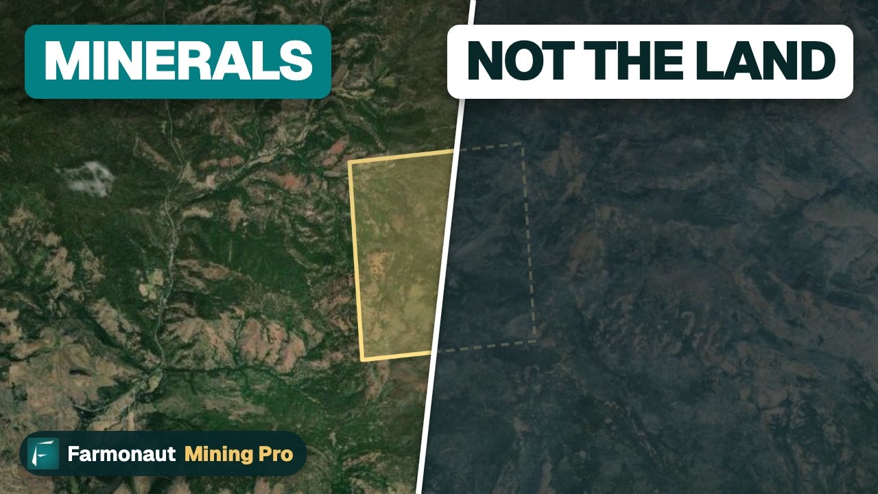
▶ Explains the 1872 mining law and why owning a gold claim is not owning the land. · 3:19
Lode, placer, mill site and tunnel site: claim types and sizes
Idaho follows the federal claim types. A lode claim covers hard-rock veins and large disseminated deposits. A placer claim covers loose deposits such as stream gravels that carry gold. Mill sites and tunnel sites are support claims. Under the BLM guide, a lode claim may run up to 1,500 feet along the vein and up to 600 feet wide, 300 feet either side of the centre line. A single placer claim is limited to 20 acres, and an association of locators can stake more: two people up to 40 acres, up to 160 acres for eight or more. A corporation is limited to 20 acres per placer claim.
Chart
Maximum claim size by type
Acres; the lode figure is our conversion of 1,500 ft by 600 ft
A lode claim at the full 1,500 by 600 feet is 900,000 square feet, which is about 20.7 acres (our arithmetic). That is why many people pick a placer claim for a creek and a lode claim for a vein in the hillside. The chart below shows the maximum size of each type.
| Claim type | What it covers | Maximum size (BLM guide) | Annual maintenance fee (BLM, 15 October 2026) |
|---|---|---|---|
| Lode claim | Veins and hard-rock deposits | 1,500 ft long by 600 ft wide | US$200 per claim |
| Placer claim | Gravels, sands and other deposits not covered by lode claims | 20 acres per locator; up to 160 acres for an association of eight | US$200 for each 20 acres or part of 20 acres |
| Mill site | Land for processing plant | Set by federal rules | US$200 per site |
| Tunnel site | Land to drive a tunnel to find blind veins | Set by federal rules | US$200 per site |
Where in Idaho you can stake a claim
You can locate a claim only on land that is open to mineral entry. The BLM guide lists areas that are closed, including National Parks, National Monuments, tribal reservations, most reclamation projects, military reservations and most wildlife refuges, and it adds that claims may not be located on lands designated as wilderness or as the wild portion of a wild and scenic river. A quarter-mile buffer on each side of a river is usually withdrawn while the river is studied for wild and scenic status.
In Idaho the ground falls into a few groups, and each has its own owner and rules:
- BLM public land. BLM Idaho manages nearly 12 million acres of surface and about 36.5 million subsurface acres. Claims here follow the federal rules in this guide.
- National Forest land. The Forest Service manages the surface. Under 36 CFR 228 Part A, an operating plan is needed if your work could cause significant disturbance of surface resources, so talk to the District Ranger before you plan more than hand sampling.
- State endowment land. The Idaho Department of Lands (IDL) explains that streams on endowment land may need an exploration location or a mineral lease, because these lands are managed for public schools and other beneficiaries. Mining there works differently from federal claims.
- Private land. BLM Idaho says private land always requires permission, and that mining claims may also need the holder’s permission before you collect because certain minerals belong to the claim holder.
Before you stake, check whether somebody else got there first. IDL says there are over 40,000 mining claims in Idaho and that the BLM keeps a database of placer and lode claims in its Mineral and Land Records System (MLRS). BLM Idaho’s own page puts the figure at more than 40,000 active claims as of 2025. Searching the claim map takes minutes and avoids staking over someone’s existing rights.
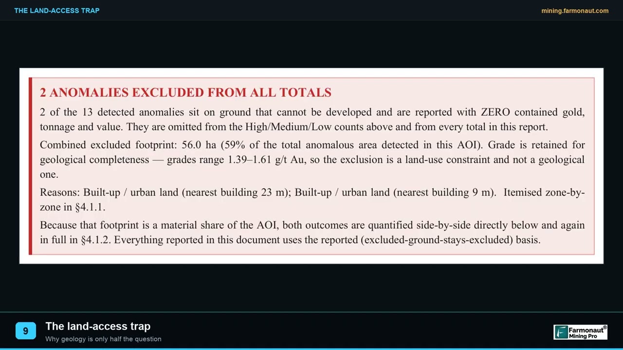
▶ A survey example where land access, not grade, blocked most of the anomalous ground. · 2:05
How to stake a mining claim in Idaho: 6 steps with costs
Step 1: Check who owns the surface and whether the land is open
Find out whether the ground is BLM, Forest Service, state endowment or private land. Land status maps, county assessor records and the BLM’s claim database all help. Look for withdrawals, wilderness boundaries and rivers under study. Satellite images and geology maps from the Idaho Geological Survey, which publishes geology, mines and minerals data in an interactive map, show where rock types and old workings sit. Cost: your time, plus map data where you buy it.
Infographic
Staking a claim in 6 steps
- 1Check the landConfirm who owns the surface and that the land is open to mineral entry.
- 2Search claimsLook up existing claims and state exploration locations.
- 3Mark the groundSet the discovery monument and post the location notice.
- 4Record locallyFile the notice with the county recorder.
- 5File with the BLMSend the notice and fees within 90 calendar days.
- 6Hold the claimPay the fee or file the waiver by 1 September each year.
Chart
What a new lode claim costs at the BLM
US$ per claim, claims filed on or after 1 September 2024
Step 2: Search for existing claims
Use the BLM claim database to see whether your ground is already claimed, and check whether the area has a state exploration location. A new claim that overlaps an older valid claim is not worth the fee. Cost: none beyond your time.
Step 3: Find a discovery point and mark the claim
Federal law asks that boundaries be distinctly and clearly marked. The BLM guide says all claims need a location or discovery monument, the notice of location is posted on a post or monument in a conspicuous place, and the discovery point is tied to a permanent object such as a survey monument, a bridge, a stream fork or a road intersection. Idaho Code 47-602 sets the Idaho rules: the notice of location is posted at one corner, and each corner or angle gets a substantial monument or a post at least 4 feet high and 4 inches square or round, marked with the claim name, the corner number and the direction of the boundary lines. BLM Idaho publishes an example location notice for Idaho in which the boundary description starts from the corner monument where the notice is posted, runs corner to corner and ends at the point of beginning, and names the adjoining claims. The Idaho notice must also give the locator names, the claim name and whether it is lode or placer, the date, the county, and the directions and distances that describe the claim (Idaho Code 47-602).
Step 4: Complete the location notice and record it with the county
The BLM guide says the location notice must give the date of location, the names and addresses of the locators, the name and type of the claim, the acreage and a description of the parcel on the ground. State law requires a copy to be filed with the county recorder in the county where the claim sits, and the guide says the maximum period anywhere is 90 days from staking, with some states requiring earlier filing. In Idaho the notice must be filed with the county recorder within 90 days after location; failing to do so counts as abandonment of the claim (Idaho Code 47-604). The county sets its own recording fee, so ask the recorder for the current amount.
Step 5: File with the BLM within 90 days and pay the fees
Federal law (FLPMA, 43 U.S.C. 1744) requires a copy of the notice or certificate to go to the BLM within 90 calendar days of the date of location. You can file and pay through MLRS, or by mail or in person at the BLM State Office. For a lode claim the filing costs US$25 processing, US$49 location and US$200 maintenance, US$274 in total; a placer claim pays the same US$25 and US$49 plus US$200 for each 20 acres or part of 20 acres. The BLM said its MLRS site would be offline from the evening of 15 October to the morning of 19 October 2026, so mail or in-person filing is the fallback if a deadline falls in that window.
Step 6: Pay the yearly fee or file the waiver by 1 September
To keep a claim you pay the maintenance fee on or before 1 September each year, or you file a small-miner waiver (explained below). Missing the date or filing in the wrong office puts the claims at risk of forfeiture by law, according to the BLM. Set a reminder in August every year.
Idaho mining claim fees and what they add up to
The fee table below uses the BLM schedule published on 15 October 2026. The figures cover federal filing fees only. County recording fees, maps, a surveyor, lawyer time, tools and any permit costs are extra and are not included here.
Chart
First-year and later-year federal cost by claim type
US$ per claim; placer fees scale with acreage
Chart
Federal fees over five years, lode claims
Cumulative US$; simplified: first-year US$274 per claim, then US$200 a year
| Item | Amount | When it is due |
|---|---|---|
| New lode claim, mill site or tunnel site | US$25 processing, US$49 location, US$200 maintenance (US$274) | Within 90 calendar days of location |
| New placer claim | US$25 processing, US$49 location, US$200 per 20 acres or part | Within 90 calendar days of location |
| Annual maintenance, existing claim | US$200 per lode claim, mill site or tunnel site; US$200 per 20 acres of placer | On or before 1 September |
| Small-miner waiver certificate | No processing fee | On or before 1 September |
| Affidavit of assessment work or notice of intent to hold | US$15 per claim | On or before 30 December |
| Transfer of interest or amended location notice | US$15 per claim per transferee or amendment | Record with the county first, then file with the BLM |
The first year costs more than later years because of the US$74 in processing and location fees. If you locate a claim before 1 September but file with the BLM on or after that date, the BLM says you pay maintenance for both assessment years unless you file a valid waiver for the second year. The line chart shows a simplified five-year total for one, five and ten lode claims, assuming one claim filed in year one and the US$200 fee paid every year after.
Placer claims scale with size. A 160-acre association placer pays US$1,600 in annual maintenance against US$200 for a single lode claim, so the choice of claim type matters long before any drilling begins. The dumbbell chart compares first-year and later-year costs.
Claim cost calculator for Idaho
Use the calculator below to total the federal fees for your own mix of lode and placer claims over the years you plan to hold them. It uses the BLM figures above as fixed values; the only things you type are your own claim counts and holding period.
Calculator
What will my claims cost in BLM fees?
Enter your own claim counts and years. Results update as you type.
- First-year federal fees (US$): $1,096
- Each later year (US$): $800
- Waiver route per year, simplified example (US$): $460
Uses BLM fees as fixed values (BLM Mining Claim Fees page, 15 October 2026): lode US$274 first year then US$200; placer US$74 per claim plus US$200 per 20 acres, then US$200 per 20 acres. Example numbers only. Excludes county recording fees, surveys and permits. The waiver line assumes you qualify (10 or fewer claims) and spend US$100 of work per claim plus the US$15 affidavit fee. The waiver line is a simplified example: it counts US$115 per claim a year and leaves out the one-time US$74 processing and location fees on new claims, and it treats each placer claim as one US$100 work unit.
The small-miner waiver: when the yearly fee is not due
The BLM small-miner waiver lets a claimant skip the US$200 fee if the claimant and all related parties own 10 or fewer claims and sites nationwide. You file Form 3830-2 on or before 1 September; there is no processing fee. In exchange you must do assessment work worth at least US$100 in labour or improvements on each claim and record proof with the BLM, with the same document recorded in the county, by 30 December. The BLM charges US$15 per claim to record the affidavit.
The BLM says assessment work includes drilling, excavations, driving shafts and tunnels, sampling, road building for the claim, and geological, geochemical and geophysical surveys. Mill sites and tunnel sites need no assessment work, but you file a notice of intent to hold by 30 December at US$15 per site. For one claim, the waiver route is therefore about US$115 a year (US$100 of work plus the US$15 affidavit) against US$200 for the maintenance fee. The work has to be real and recorded.
If you own claims in more than one state, the BLM requires a fee or waiver in each state where the claims sit. The waiver is a yearly certification, not a one-off.
Permits after staking: notice, plan of operations and reclamation
A claim does not let you do whatever you like on the ground. For activity beyond casual use, the BLM guide says you must file either a notice or a plan of operations. A notice is for exploration that disturbs 5 acres or less, and a plan of operations is needed where more than 5 acres are disturbed; both need a reclamation plan. Casual use means negligible disturbance, such as work without earthmoving equipment or explosives, and needs no notification to the BLM. On BLM land the rules sit in 43 CFR 3809 and 3715. BLM Idaho reported more than 40,000 active claims, 39 authorised plans of operation and 32 active exploration notices as of 2025, which shows how few claims reach drilling or mining stage.
The operator is responsible for reclaiming any disturbed land. Idaho adds its own layer: IDL administers the Mined Land Reclamation Act of 1971 for surface mining and the surface effects of underground mining, and it reports overseeing 1,567 active mines and 28 active dredge and placer operations. To see the disturbance side of the story, the video below sets out seven environmental impacts of mining in plain terms.
| Agency | What it handles for a claimant |
|---|---|
| BLM Idaho State Office | Claim filings, annual fees and waivers, notices and plans of operation on BLM land |
| County recorder | Recording the location notice, transfers and amendments |
| Forest Service district | Operating plans for significant disturbance on National Forest land |
| Idaho Department of Lands | Mined land reclamation, larger dredge and placer permits, exploration locations on state endowment land |
| Idaho Department of Water Resources | Permits for small-scale and recreational dredging under the Stream Channel Protection Act |
| Idaho Department of Environmental Quality | Discharge permit for suction dredging (IPDES general permit) |
▶ Walks through the seven environmental impacts of mining. · 2:31
Suction dredges and creek work in Idaho
Gold prospectors in Idaho often start in a stream, and streams carry extra rules. IDL says its Dredge and Placer Mining Protection Act covers operations using suction dredges with a nozzle of eight inches or more, and that small-scale mining with a nozzle of five inches or less and equipment rated at 15 horsepower or less is regulated by the Idaho Department of Water Resources under the Stream Channel Protection Act instead. IDWR warns that altering a stream channel without the permit is a misdemeanor with fines of US$150 to US$500 per day, and that its permit does not give access to private land or to another person’s claim or lease. A miner with an IDWR small-scale permit does not need an additional IDL permit to mine a navigable stream.
For recreational work, IDL states that in most cases two permits are required: a recreational mining permit from IDWR and an IPDES discharge permit from the Department of Environmental Quality. Idaho DEQ finalised its IPDES general permit for small suction dredge mining on 24 May 2024, effective 21 June 2024. BLM Idaho adds that dredging on BLM land is subject to 43 CFR 3809, that you must contact the BLM before you start to learn whether a notice or plan is needed, and that state rules specify which streams are open or closed to suction dredging. A claim on a creek does not override those state permits.
Panning and hand sluicing are different. BLM Idaho describes rockhounding as casual use with hand tools or metal detectors, no explosives and no motorised digging, for personal enjoyment, with no permit or fee if you follow its guidelines. Staying out of old mine workings is part of the same advice. Never use mercury to recover gold.
Checking an existing claim before you lease or buy it
Many people reach this topic because they want to buy or lease claims that someone else staked. A claim for sale is only as good as its paperwork, so check the following before you send money:
- Look up the claim in the BLM database and confirm it is active, with the serial number the seller gave.
- Ask for proof that the 1 September maintenance fee or the waiver was filed in the last year, and for the December affidavit if the owner used the waiver.
- Check the county record. The BLM says a quit claim deed or other transfer must be recorded with the county first, then filed with the BLM at US$15 per claim per transferee.
- Confirm the land is still open. A withdrawal or a new wilderness boundary can end the right to mine.
- Visit the ground. Look for posts, the discovery monument, disturbance that may carry a reclamation duty, and neighbouring claims.
Listings of operating mines and larger properties are covered in our Idaho gold mines for sale buyer guide. For the district geology behind where Idaho gold has been found, see gold deposits in Idaho: districts, claims and satellite data. If you are comparing states, Nevada claim dates and Oregon permits and claims show how neighbouring states handle the same federal framework.
Mistakes that cost claimants their claims
- Missing the 1 September date. The BLM says failing to pay or file the waiver in the proper office subjects the claim to forfeiture by law.
- Filing in the wrong state office. The fee or waiver has to be filed in each state where the claims sit.
- Skipping the county. A claim needs both a county record and a BLM filing. The BLM says the quit claim deed or amended notice must go to the county first.
- Counting the waiver as a rule for any number. The waiver covers 10 or fewer claims and sites, held by you and all related parties across the whole country.
- Staking over an older claim or closed land. Check the claim database and withdrawals before you cut a post.
- Doing work without permits. A claim does not remove the duty to file a notice or plan beyond casual use, or the state dredging permits.
- Treating the claim as surface ownership. The surface stays with the land manager.
Checking the ground before you stake
A claim is cheap compared with drilling, so most of the risk is in choosing where to stake. Geologists look at rock type, alteration, faults and old workings before spending on posts and fees. Satellite images can show iron staining, clay minerals and structures across a block of ground, which helps a claimant rank sites to visit. They do not show gold, and a map is no substitute for sampling and a discovery on the ground. If you want a desk study of a polygon you are considering, Farmonaut produces satellite-based reports from a KML, KMZ or polygon: see satellite-based mineral detection, send details through the mining quote form, or reach the team through the contact page.
For a closer look at a related question, see our guide: Mining Act of 1872: 7 Steps to Protect Land and Rights.
If this topic matters to you, read Open Cast Gold Mining: 7 Steps With Real Costs next.
Frequently asked questions
How much does it cost to stake a mining claim in Idaho?
A new lode claim costs US$274 in BLM fees (US$25 processing, US$49 location, US$200 first maintenance fee), according to the BLM fee page of 15 October 2026. A placer claim pays US$74 plus US$200 for each 20 acres or part. The county recorder charges its own fee on top.
How much is the yearly fee to keep an Idaho claim?
The BLM maintenance fee is US$200 per lode claim, mill site or tunnel site, and US$200 per 20 acres of placer claim, due on or before 1 September. Owners of 10 or fewer claims can file the small-miner waiver instead and do US$100 of recorded work on each claim.
Do I need to file with both the county and the BLM?
Yes. BLM Idaho says a claimant must record the claim in the relevant county and submit a copy to the BLM State Office. The county filing is due within 90 days of location under Idaho Code 47-604, and the BLM filing within 90 calendar days of location.
How big can a mining claim be?
A lode claim can be up to 1,500 feet long by 600 feet wide. A placer claim can be up to 20 acres for one locator, and an association of eight or more can stake up to 160 acres, per the BLM guide.
Where can I look up claims that already exist in Idaho?
The BLM keeps a database of placer and lode claims in its Mineral and Land Records System, which IDL points to for checking whether ground is already claimed. IDL says Idaho has over 40,000 claims, so check before you stake.
Can I stake a claim on private land or state land?
Not in the same way. BLM Idaho says private land always requires permission. On state endowment land, IDL says exploration locations or mineral leases may apply. The federal claim process in this guide is for federal land open to mineral entry.
Do I need a permit to pan or sluice for gold on a claim?
Light hand work counts as casual use and needs no BLM notice, but you still need permission from the claim holder if the ground is claimed. If you move streambed material below the ordinary high water mark, IDL says recreational mining usually needs an IDWR permit and a DEQ discharge permit.
Can I use a suction dredge in Idaho?
In some places, with permits. A dredge with an intake of five inches or less normally needs an IDWR permit and a DEQ IPDES permit, state rules close some streams, and on federal land you contact the BLM or Forest Service before starting.
What happens if I miss the 1 September deadline?
The BLM says that failing to pay the fee or file the waiver on time, or filing in the wrong office, subjects the claims to forfeiture by law. Ask the BLM State Office what is possible if it happens to you.
Do I pay royalties on gold from a federal claim?
BLM Idaho states that no royalties are owed to the federal government for extraction of locatable minerals. Taxes, state obligations and any private royalty agreements are separate matters for your accountant and lawyer.
How do I transfer or sell a claim?
Record the quit claim deed or other transfer with the county recorder first, then file it with the BLM at US$15 per claim per transferee, according to the BLM fee page.
Does staking a claim give me a mine?
No. A claim gives you a right to explore and mine on federal land, resting on a discovery. Turning that into a mine needs exploration, permits and money. Buyers of existing operations should see the listing guide.
This page is for information only. It is not legal advice. Confirm the rules with the regulator, including the BLM Idaho State Office, the county recorder and Idaho agencies. Get permission before you prospect, follow safety rules, stay out of old workings and never use mercury.
Farmonaut mining
Get a quote to map your ground from space
Send a KML, KMZ or polygon and Farmonaut screens the area from satellite images before you spend on ground work.

Mining Pro sample view, synthetic data
Keep reading
Sources
- BLM, Mining Claim Fees (page read 15 October 2026): blm.gov
- BLM, Annual Maintenance and Assessment: blm.gov
- BLM Idaho, Mining and Minerals: blm.gov
- BLM, Mining Claims and Sites on Federal Lands (guide): blm.gov
- BLM Idaho, Example Location Notice for Mining Claim: blm.gov
- Idaho Department of Lands, Recreational Mining: idl.idaho.gov
- Idaho Department of Lands, Dredge and Placer Mining: idl.idaho.gov
- Idaho Department of Lands, About Mining: idl.idaho.gov
- Idaho DEQ, IPDES general permit for small suction dredge mining (7 June 2024): deq.idaho.gov
- Idaho Geological Survey: idahogeology.org
- Idaho Department of Water Resources, Small Scale Mining Permits: idwr.idaho.gov
Discussion
Questions, corrections or field experience? Share them below. First-time comments are reviewed before they appear, and your email is never published.
No comments yet. Be the first to add a question or your experience.

 G.I.T.T.
 Jaunita Erss Ltd
 Almosi SARL
 SRK Consulting
 Berks Gold Limited
 Mwerezi Minerals Company Limited
 Mining SARL
 SenGold Invest SAS
 Sean Mining Limited
 NTS Group (Pty) Ltd
 Mine4Africa
 Lithspo Minerals Limited
 Tintina Mining Group
 Dalgety Minerals Pty Ltd
 Vortex Minerals Pty Ltd
 Licence holder · Nigeria · Gold + lithium










