

Drill Programme Planning: Zimbabwe Gold Head Start
A gold operator on roughly 200 hectares of Zimbabwean ground received a ranked satellite target set in mid‑2026. Drilling is still six months or more away — and the value was already banked. This is what a ranked target set does during the wait.
Most exploration case studies are written after the rig leaves. This one was written while the rig is still six months away — and that is exactly what makes it worth reading. Drill programme planning is the stage where an exploration budget is actually decided, and on this Zimbabwe gold licence the operator had already converted a satellite target set into saved time and saved money months before a single metre was drilled.
The record is simple. A gold licence of just under 200 hectares in Zimbabwe was screened from orbit. The report landed in mid‑2026. About three months later the operator told us, through our structured post‑project feedback form, that the analysis had narrowed down where to explore or drill, that it had saved them six months or more of exploration time, and that it had saved them up to USD 25,000 in exploration cost. They also told us their drill programme is still six months or more out.
Read those four answers together and a specific, under‑discussed benefit comes into focus. The savings did not come from drilling faster. They came from not having to spend the pre‑drill window the expensive way — walking the whole property, sampling it blind, and arguing about where to start.
What the operator reported back to us
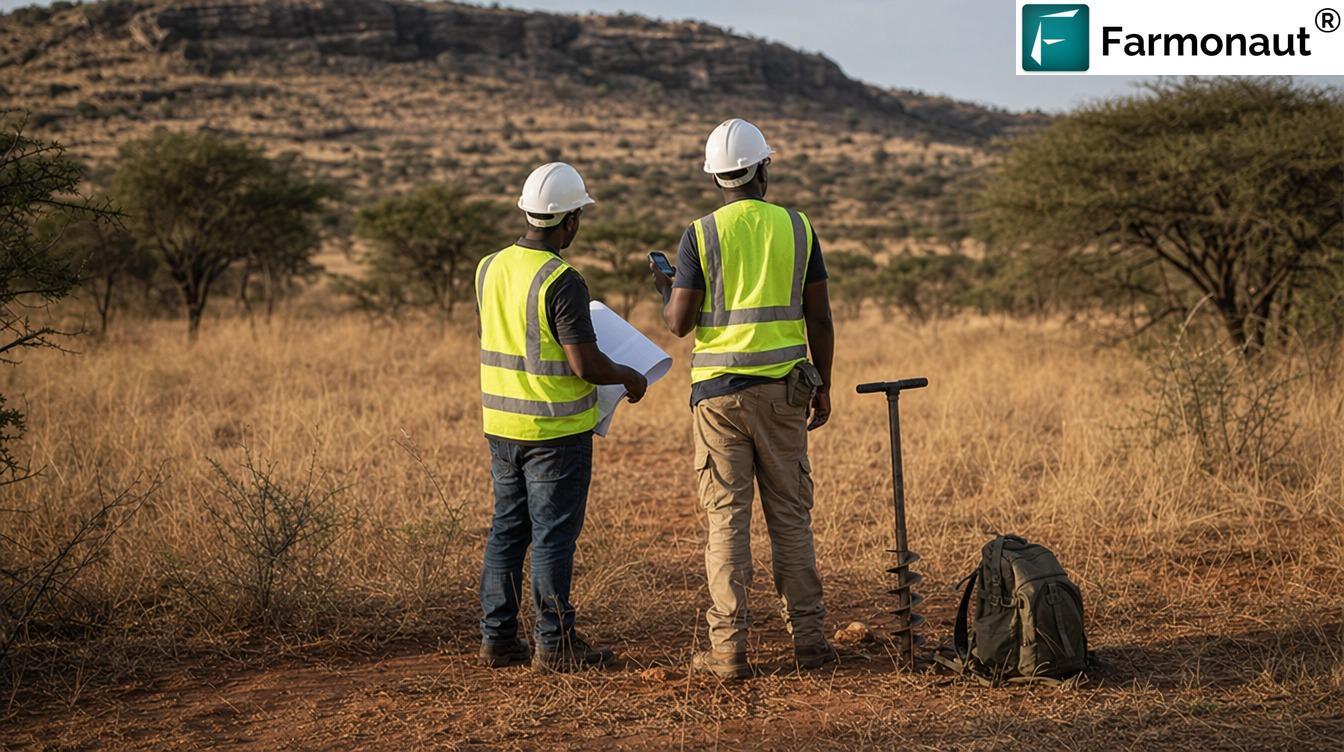
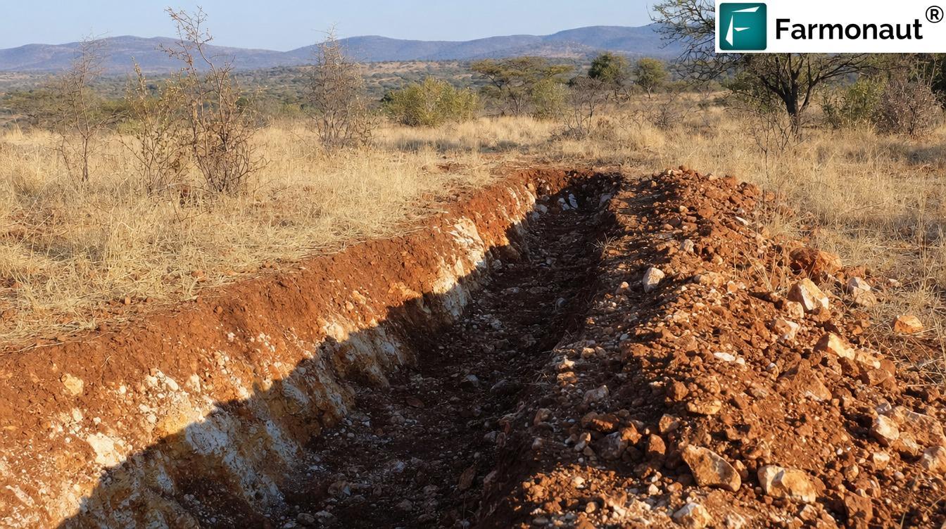
This client is not identified and did not provide a testimonial; no statement here is quoted from or attributed to them. The licence boundary, coordinates, exact area, exact dates and zone‑level results are withheld. All outcome figures are client-reported bands from our own structured post‑project feedback form. Imagery is illustrative and does not depict the client’s licence.

Why the Pre-Drill Window Decides the Whole Budget
There is a habit in exploration writing of treating the drill result as the only moment that counts. It is the most photogenic moment, certainly. But it is not where most exploration money is won or lost.
By the time a rig is on site, almost every consequential decision has already been made. The collar positions are fixed. The metreage is contracted. The mobilisation is paid. What the rig does is confirm or refute choices that were made weeks or months earlier, in an office, on a map, by people deciding which part of a licence deserved the money.
That earlier stretch — from the moment you hold ground to the moment a rig turns up — is the pre‑drill window, and it is where drill programme planning actually happens. It is where the ground gets walked, the soil grids get laid out, the trenches get cut, the geologists argue, and the budget quietly drains. And it is the stage that satellite screening changes most directly.
The operator in this case study reported saving six months or more of exploration time and up to USD 25,000 of exploration cost while still being six months or more away from drilling. Those savings are not drilling savings. They are pre‑drill savings: the walking, sampling and deciding that a ranked target set made unnecessary.
“Zimbabwe’s rains close roughly four months of every field year — planning decides how the other eight are spent.”
Anyone who has run a field season in southern Africa understands why that framing matters. Zimbabwe’s wet season runs from about mid‑November to March, with peak rainfall in December and January, and the country is effectively dry from April to mid‑November (Climates to Travel — Zimbabwe climate). Harare alone takes around 190 mm in January and close to nothing between June and September. Dirt access roads soften, drainages run, and reconnaissance productivity collapses for a chunk of every year.
So the exploration year is not twelve months long. It is roughly eight. Anything that lets an operator arrive at the start of a dry season already knowing where to work has not saved a few days — it has bought back a whole field season.
A ranked target set delivered before a field season is worth more than the same document delivered after one. It converts an open‑ended search into a finite work list, and a finite work list is what makes a field season, a budget and a rig booking possible to plan against.
For operators who want the same head start on their own ground, the fastest route is our mining query form, or you can outline the licence directly on mining.farmonaut.com and see the ground before you commit a field team to it.

The Project: Just Under 200 Hectares on the Zimbabwe Craton
The licence is a gold property in Zimbabwe of just under 200 hectares. We are not naming the holder, the district or the boundary; the operator did not consent to being identified, and on ground this size the location is itself commercially sensitive.
What can be said — because it is public geology — is the setting. About 60% of Zimbabwe’s land surface is Archaean basement: the Zimbabwe Craton, a granitic terrain enclosing the volcano‑sedimentary remnants known as greenstone belts. Those belts are where the country’s historic goldfields sit. Studies of belts such as Filabusi describe ground transected by major shear zones and fractures, most of which control the gold mineralisation (Gravity and Aeromagnetic Studies of the Filabusi Greenstone Belt, Zimbabwe Craton).
That single sentence explains why satellite work is unusually productive on Zimbabwean gold ground. If mineralisation is structurally controlled, then structure is a targeting variable you can actually observe from orbit. Lineaments, fracture sets, shear‑zone traces and the way drainage bends around them are surface‑expressed geometry. They are mappable at licence scale without anyone standing on the outcrop.
What a ~200-hectare property is really like to explore
Two hundred hectares sounds small. It is two square kilometres. On a map it looks like something you could resolve in an afternoon.
On the ground it is nothing of the sort. Two square kilometres of Zimbabwean bush — msasa woodland, tall dry grass, thin soil over rounded granite and dark schist ridges, seasonal drainages, variable outcrop — is a serious walking exercise. A systematic soil grid at the conventional 100 m spacing recommended for medium‑density coverage (Burgex Mining Consultants — Generative Exploration: Soil Sampling) puts roughly two hundred stations on a property this size. Every one of them has to be reached, augered, bagged, logged and shipped, and every one of them carries a preparation and assay cost.
That is the default plan for a licence like this, and it is a perfectly respectable plan. It is also slow, and on a property with real relief and thick grass it is the kind of programme that eats a full dry season before anyone has an opinion worth drilling on.

Judge a small licence by walking hours, not hectares. A compact property in thick bush with variable outcrop can absorb as much field time as a much larger property on open, well‑exposed ground. That is precisely the situation where a licence‑wide screen pays for itself first.
How the Ground Was Ranked From Orbit for Drill Programme Planning
The analysis screened the whole licence on one consistent basis and returned a ranked set of target zones with an interpretation attached to each one. It is worth being precise about what that means, because the honest description is more useful than the marketing one.
Satellites do not detect gold. Gold at exploration concentrations has no distinctive spectral signature at satellite resolution — a few grams in a tonne of rock simply do not paint a colour a sensor can read. What multispectral and hyperspectral imagery can map is the company gold keeps: the mineralogy that hydrothermal systems leave behind at surface, and the structural architecture that carried the fluids.
On Zimbabwean greenstone gold ground the indicator families are well understood:
- 💎 Iron-oxide signatures — goethite, haematite and jarosite from oxidising sulphides, the surface expression of a weathered mineralised system.
- 🪨 Clay and phyllosilicate alteration — sericite, illite and kaolinite haloes marking the wall rock a hydrothermal fluid passed through.
- 🧭 Silicification and quartz vein density — the vein and stockwork material that hosts much of Zimbabwe’s structurally controlled gold.
- 🗺 Structural geometry — lineaments, fracture intersections, shear traces and the drainage anomalies that betray them, which is where reef‑style systems localise.
- 🏔 Terrain and drainage context — elevation modelling that separates residual outcrop from transported cover, so a signal is read in the right geological setting.
No single one of these is decisive. Iron staining occurs without gold. Clay alteration occurs without gold. A lineament is a lineament. The targeting value comes from coincidence — from finding the places where several independent indicators overlap, and then ranking those places against each other across the whole property.
That ranking is the deliverable. Not a treasure map: a defensible priority order, with a written geological reason for each position in it, plus georeferenced GIS files so any competent geologist can load the layers and interrogate them independently. If you want the mechanics in more depth, our satellite-based mineral detection page walks through the sensing and processing chain, and the 3D mineral prospectivity mapping overview shows how the same layers are extended into depth‑indicative models.

Why the whole licence matters, not just the good bits
One structural advantage of an orbital screen is easy to miss: it covers everything, evenly, at once.
Field reconnaissance is inescapably biased towards access. Teams work the tracks, the drainages, the outcrop they can reach, and the ground someone already had a hunch about. That is rational under time pressure, and it systematically under‑samples the difficult corners of a property. On this licence the entire ~200 hectares was assessed on one basis, including the parts that a first field pass would probably have skipped — which is also how ground gets confidently de‑prioritised, not just promoted.
Knowing where not to work is half of what a ranked target set delivers, and it is the half that shows up in the cost column.
What Drill Programme Planning Banked Before Any Rig Existed
Here is the part of this case study that is genuinely unusual. The operator reported material savings while explicitly still being six months or more from drilling. So the savings must be located somewhere other than the drill.
They are located in three places.
First, in fieldwork that no longer had to be speculative. Rather than a blanket soil grid over two square kilometres, ground follow‑up can now be aimed — sampling, mapping and trenching concentrated on ranked ground, with the rest of the property covered at reconnaissance density or left until a target justifies it. Soil sampling is already the cheap end of exploration, with lower labour cost than trenching or drilling and much larger areal coverage per dollar. Aiming it multiplies that advantage.
Second, in decision time. Drill programme planning decisions are slow because the evidence is thin and the arguments are unresolvable. A ranked, documented target set collapses that. The question stops being “where should we look?” and becomes “do we agree with this ranking, and in what order do we test it?” That is a meeting, not a season.
Third, in the calendar. A licence‑wide screen is delivered in a typical window of 5–20 business days and needs no one on site. It runs during the rains. It runs while permits are in process. It runs while financing conversations are still open. Every day of that turnaround overlaps with something else the operator was going to be doing anyway, which is why a six‑month time saving on a small licence is credible rather than extravagant.
A saving reported ahead of drilling is the cleanest kind of exploration saving there is. It is not contingent on a result, it does not depend on assay turnaround, and it is realised in the period when a junior’s cash position is usually tightest. Up to USD 25,000 retained on a licence of this size is a meaningful fraction of an early‑stage programme.

Sequencing a Field Season Around Zimbabwe’s Rains
With a ranked target set in hand and drilling six months or more out, the operator’s problem changes shape. It stops being “what do we know?” and becomes “what do we do between now and the rig?”
That is a scheduling problem, and Zimbabwe’s climate gives it a hard structure. Wet from about mid‑November to March; dry and workable from April to mid‑November, with the cool, comfortable field months falling from mid‑May to mid‑August and a hot, dry, dusty run from September into November.
A ranked target set lets that calendar be filled deliberately rather than reactively. The table below sets out the shape of a pre‑drill programme built around a ranked target set on a licence of this size. It is illustrative sequencing guidance, not a description of this client’s internal schedule — which we have not published.
| Pre-drill stage | Best window in Zimbabwe | What a ranked target set changes |
|---|---|---|
| Licence-wide satellite screen | Any month, including the rains | Runs off-site in a typical 5–20 business day window; no field access required |
| Desk review and target ranking sign-off | Wet season (Nov–Mar) | Uses the closed season productively instead of waiting it out |
| Access, permitting and community engagement | Late wet into early dry | Engagement is specific to a handful of ranked zones, not the whole property |
| Geological mapping and rock-chip sampling | Apr–Jun, ground firm and grass dropping | Aimed at ranked zones first; the rest of the licence at reconnaissance density |
| Focused soil geochemistry | May–Aug, cool working months | Grid concentrated over ranked ground rather than blanket-covering ~200 ha |
| Trenching on the best-supported zones | Jun–Sep, dry and stable | Trenches cut where soil and satellite agree, not where access is easiest |
| Collar design and rig procurement | Aug–Oct | Priority order already exists, so one mobilisation can cover the queue |
| Drill programme execution | Dry season, ahead of the rains | Planned stage — ranked, sequenced and costed in advance |
Read down that right-hand column and the pattern is consistent. The ranking does not replace any of the ground stages. It orders them, and it aims them. Each stage arrives with a shortlist instead of an open question, which is why the whole sequence compresses.
“Soil sampling costs far less per hectare than drilling — but it only pays when it is aimed.”
This is also the difference between a work plan an operator can hold themselves to and one that drifts. A pre‑drill season without a target ranking tends to expand to fill whatever time is available, because there is always more ground to look at. A pre‑drill season with a ranked queue has a finish line: test the top zones, in order, and stop.

One Mobilisation, One Queue: Ordering the Collars
The single most expensive decision in an early drill programme is often not the drilling. It is the mobilisation.
Getting a rig, crew, water supply, consumables and support onto a licence carries a fixed cost that is largely indifferent to how many holes get drilled once it is there. For a small operator that fixed cost is frequently the largest single line in the campaign. Which means the governing question of drill programme planning is not “where is the best hole?” but “what is the best set of holes to drill while the rig is standing on my ground?”
Those are different questions with different answers, and only the second one can be answered with a ranked target set covering the whole property.
A ranked queue lets an operator do several things that a single favourite target does not allow:
- Fill the campaign in priority order. Holes are allocated down the ranking until the metreage budget is exhausted, so the rig is never idle waiting for a decision.
- Design the traverse. Collars can be ordered to minimise rig moves between zones — a real saving when tracks are rough and the season is short.
- Hold contingency metres against the next target down. If a hole ends early or a zone is written off quickly, the next collar is already specified rather than improvised.
- Match method to target. Shallower, first-pass tests suit rapid, lower-cost reverse circulation drilling, while deeper or structurally complex targets justify core. Industry practice is explicit that diamond drilling is slower and costs more than RC, with RC typically used to about 300–400 m for early to mid‑stage work and diamond core reserved for resource modelling, metallurgy and structural control.
- Sequence for information, not optimism. Holes can be ordered so that early results genuinely discriminate between competing interpretations, rather than all clustering on the same idea.
None of that drill programme planning is possible six months before a rig arrives unless the target set already exists. That is the practical content of “narrowed down where to explore or drill” — the answer this operator gave.
Treat the ranking as a testing queue, not a single verdict. Work down it in order, let cheap ground methods (mapping, rock chips, focused soils, trenching) refine each zone before the rig commits to it, and keep contingency metres allocated to the next target down. Used that way, a ranked target set improves every hole in the campaign — not just the first one.
What a Ranked Target Set Does for Financing and Work Plans
The pre‑drill window is not only a technical period. It is when an early‑stage operator has to be persuasive — to a financier, a joint‑venture partner, a board, or a regulator. And persuasion in exploration runs on documentation.
Making the financing conversation concrete
Juniors and private exploration companies raise money against plans, because they have nothing else yet. The quality of the plan is therefore the product being sold, and the difference between a vague plan and a specific one is enormous in that conversation.
“We hold prospective gold ground in a Zimbabwean greenstone setting and intend to explore it” describes an ambition. “We hold just under 200 hectares, the whole property has been screened on one consistent basis, we have a ranked set of targets with written geological reasoning and georeferenced GIS layers, and this is the order in which we intend to test them” describes a programme.
The second version can be interrogated. A technical reviewer on the other side can load the layers, disagree with the ranking, and have a substantive conversation about it. Counter‑intuitively, that is exactly what makes it fundable — a document that can be argued with is a document that can be trusted.
“A plan a financier can argue with is worth more than a story they can only nod at.”
Supporting licence work and reporting obligations
Zimbabwe’s mineral rights framework sits under the Mines and Minerals Act. Ground is held through prospecting licences and registered claims, with larger‑area exploration conducted under Exclusive Prospecting Orders — three‑year, presidentially authorised, transferable rights covering up to 65,000 hectares (Muvingi and Mugadza Legal Practitioners — An Overview of Mining Law in Zimbabwe). Holders are expected to progress ground rather than sit on it, and periodic technical reporting is part of how that is demonstrated.
A licence‑wide satellite screen is a useful contribution to that record. It is a structured technical assessment of the entire property, produced independently, with defensible methodology and machine‑readable outputs. It shows work being done and, importantly, shows the reasoning behind what happens next — which is a stronger position than a work plan with no technical basis attached.
None of this is legal advice, and holders should always confirm their specific obligations with their own advisors and the Ministry of Mines. The point is narrower: technical documentation produced in the pre‑drill window has administrative value as well as geological value.
Screening involves no ground disturbance whatsoever — no access tracks, no pits, no trenching, no drilling fluids, no crew camped on the property. Ground that does not warrant work is set aside without ever being touched, and physical disturbance begins only where the evidence already points. On a licence in inhabited farming and grazing country, starting narrow is both cheaper and better neighbourly practice.

Where this project sits among our other Zimbabwe gold work
Zimbabwean greenstone ground is some of the most frequently screened terrain on our platform for early drill programme planning, and the projects sit at different stages. Some have already gone to the drill; others, like this one, are in the planning window. Two published examples are our Zimbabwe greenstone target screening case study and a further Zimbabwe gold exploration case study.
Read as a set, they make a point that a single project cannot. Ranked targets are not a substitute for drilling — they are the thing that makes a drill programme worth financing, worth scheduling and worth executing in one efficient campaign rather than three hesitant ones.

How to Run This Ahead of Your Own Drill Programme
The drill programme planning workflow that produced this case study is deliberately undemanding on the operator’s side.
- Send us the ground. Coordinates, a KML or KMZ, or a drawn polygon, plus the country or region and the target mineral. On this project that was a Zimbabwe gold licence of just under 200 hectares.
- We select the data and run the analysis. Multispectral or hyperspectral imagery is chosen for the terrain and commodity, then processed through our detection stack for alteration, iron‑oxide, clay, silicification and structural indicators.
- You receive a ranked deliverable. High‑potential zones, prospectivity heatmaps, indicative location and depth ranges, geological interpretation and next‑step guidance — as a report plus georeferenced GIS files. Typical turnaround is 5–20 business days.
- You spend the pre‑drill window aiming. Ground follow‑up goes to ranked zones, the collar queue gets ordered, and the field season stops being a search and starts being a schedule.
Start with our mining query form for a quote, outline your licence on mining.farmonaut.com, or contact us if you would rather talk through the ground first.
A short glossary
- Pre-drill window
- The period between holding ground and mobilising a rig, when targeting decisions, budgets and field programmes are actually set.
- Greenstone belt
- A remnant of Archaean volcanic and sedimentary rock enclosed in granitic craton. Zimbabwe’s historic goldfields are belt-hosted.
- Alteration halo
- The zone of chemically changed wall rock surrounding a hydrothermal system, often much larger and more mappable than the mineralisation itself.
- Coincident signal
- Ground where several independent indicators — iron oxide, clay alteration, silicification, structure — overlap. Coincidence, not any single layer, drives ranking.
- Mobilisation
- The fixed cost of getting a rig, crew and support onto site, largely independent of how many metres are then drilled.
- Exploration target
- A conceptual statement of exploration potential. It is explicitly not a Mineral Resource or Reserve under JORC, NI 43-101 or SAMREC.
Spend your pre-drill window aiming, not searching
Screen the whole licence, rank the ground, and arrive at your next field season with a testing queue instead of an open question.
Frequently Asked Questions
What is drill programme planning, and why does satellite screening help it?
Drill programme planning is everything that fixes a campaign before a rig arrives: which zones get tested, in what order, with what method, and at what cost. A licence‑wide satellite screen helps because it delivers a ranked target set covering the whole property on one consistent basis, months ahead of mobilisation — which is exactly when those decisions are made. On this Zimbabwe gold licence the operator reported saving six months or more and up to USD 25,000 while still being six months or more from drilling.
Has this project been drilled?
No — and that is the point of this case study. The operator reported that their drill programme is six months or more ahead of them. The drilling is a planned next stage: targets are ranked, the queue is set, and the campaign can be sequenced and costed in advance. No drilling, sampling, assay or mineralisation result is claimed anywhere in this article.
Can a satellite detect gold directly?
No. Gold at exploration concentrations has no distinctive spectral signature at satellite resolution. What imagery maps is the surface expression of the system around it — iron‑oxide staining, clay and sericite alteration, silicification and quartz veining — together with the structural geometry that controlled the fluids. Ranking comes from where those independent indicators coincide, which is why the deliverable is a priority order rather than a discovery claim.
How does Zimbabwe’s rainy season affect exploration planning?
Zimbabwe’s wet season runs from roughly mid‑November to March, with peak rainfall in December and January, leaving a workable dry season from about April to mid‑November. Field productivity drops sharply in the rains. Because a satellite screen runs off-site and needs no ground access, it can be commissioned and delivered during the closed months so the operator starts the next dry season already knowing where to work.
Is a ~200 hectare licence too small for satellite screening to be worthwhile?
No. On compact ground the benefit shifts from coverage to precision: the full indicator stack is concentrated over a small area, producing ranking fine enough to distinguish one part of the property from another. That matters most when an operator has budget for a single drilling campaign and needs it aimed correctly. Walking hours, not hectares, are the right measure — two square kilometres of Zimbabwean bush is a substantial field exercise.
Where exactly do the reported savings come from if nothing was drilled?
From the pre‑drill window. Ground follow‑up is aimed at ranked zones instead of blanket-covering the licence; decision time collapses because the question becomes an order of testing rather than an open search; and the screen itself runs in a typical 5–20 business day window that overlaps with permitting, financing and the rains. All figures here are client-reported bands from our structured feedback form.
Can satellite results be used for resource reporting?
No. Satellite-derived outputs are exploration targets and do not constitute Mineral Resources or Reserves under JORC, NI 43-101, SAMREC or any equivalent code. They do not replace drilling, sampling, assay or a competent person’s assessment. Their role is deciding where that work should happen — which, on this licence, is precisely what they did.
Why is this client not named?
They did not consent to a testimonial and are not identified. The country is named because it is central to the geology and the field-season argument; the licence boundary, coordinates, exact area, exact dates and zone‑level results are withheld. No statement in this article is quoted from or attributed to them.
Published in anonymised form. The client is not identified and did not provide a testimonial; no statement in this article is quoted from or attributed to them. The licence boundary, coordinates, exact area, exact project dates and zone‑level results are withheld; the country is named because it is material to the geological and seasonal context. All outcome figures are client-reported bands recorded in Farmonaut’s structured post‑project feedback form and are reproduced without alteration. No drilling had taken place at the time of reporting: no mineralisation, grade, tonnage, assay or subsurface result is claimed or implied anywhere in this article, and the drill programme described is a planned next stage. Satellites do not detect gold directly; they map alteration, iron‑oxide and clay signatures and structural geometry at surface, from which prospectivity is inferred. Satellite-derived estimates are exploration targets and do not constitute Mineral Resources or Reserves under JORC, NI 43-101, SAMREC or any equivalent reporting code. Imagery is illustrative and does not depict the client’s licence. Nothing here is legal, financial or investment advice.

 GemSprout Metals Limited
 Qader Group
 Ileys General Trading
 SG Gold Mining LLC
 VRV Global Pte Ltd
 Omsri International FZE
 G.I.T.T.
 Jaunita Erss Ltd
 Almosi SARL
 SRK Consulting
 Berks Gold Limited
 Mwerezi Minerals Company Limited
 Mining SARL
 SenGold Invest SAS
 Sean Mining Limited
 NTS Group (Pty) Ltd
 Mine4Africa
 Lithspo Minerals Limited
