

Satellite Gold Exploration West Africa: 68-Point Proof
A client took our satellite target set into a Birimian greenstone concession and spent four days walking it with a GPS. They came back with a ranked drill queue, a bridge to build, and a conclusion that changed the project’s thesis: this is not an alluvial play. It is a primary hard-rock system.
This is what happens when a client takes a satellite target set into the field and checks it, zone by zone. The satellite gold exploration work was ours. The reconnaissance that follows was designed, executed and written entirely by the client’s own geologist, on their own budget, with no involvement from us — which is exactly what makes their conclusions worth reading. They came back and reclassified the whole concession.
Over four days in late March 2026, a field team traversed a Birimian Supergroup concession in West Africa, moving between the target zones our satellite screening had flagged. They logged 68 distinct localities of gold mineralisation, each fixed by GPS and elevation. They were not there to prove the geology in the abstract. They had three concrete jobs: confirm that heavy diamond drilling rigs could physically reach the priority zones, choose ground for the pit, waste dump, processing plant and offices, and map the cocoa and food farms that would need compensation before anyone mobilised.
What they wrote at the end of it is the sentence that matters most in this entire report: the area “is not merely an alluvial site but hosts a robust primary hard-rock system.” That single reclassification moves a project from small-scale alluvial economics into hard-rock exploration economics — a different capital plan, a different drill programme, a different investor conversation.
68 GPS-logged localities in four field days — and every ranked zone returned quartz, veining or worked ground.
What satellite gold exploration delivered before the team flew out
Before the field team booked a flight, they already knew where to walk. Our screening had taken the whole concession — a large licence in dense, actively farmed cocoa country — and compressed it into 14 ranked target zones, delivered as georeferenced GIS polygons with a geological interpretation attached: host structure, likely controls, and where inside each polygon the strongest evidence sat.
That is the whole economic argument for satellite gold exploration in one sentence. A conventional programme would have put crews on the ground for weeks simply to work out which parts of the licence deserved attention — grid sampling, reconnaissance traverses, trenching across ground that turns out to be barren. This team skipped that phase entirely. They landed with a route already drawn, and spent all four of their field days on productive ground, logging 68 mineralisation localities, evaluating infrastructure sites and mapping farms.
Four questions, answered in four days
A field pass over a ranked target set answers four questions at once — and on this concession, all four came back with usable answers inside a single four-day campaign:
- ✔ Presence — is there mineralisation at the target? Every ranked zone returned evidence: quartz float, veining, gossan, oxidised material or historic workings.
- ✔ Character — primary hard rock, or secondary alluvial? In-situ boulders and fractured veins reclassified the concession as a primary hard-rock system.
- ✔ Access — can heavy rigs reach it? Rig routes, a bridge crossing point and flat rig-setup ground were all identified in the same pass.
- ✔ Land and community — who farms it? Cocoa, cassava and plantain farms were mapped for compensation before mobilisation, not after.
Answering all four at once is what makes a target set operationally useful rather than merely interesting. The team came home with a drill queue already sorted into build order.
Want this run on your own licence? Get a quote for satellite mineral detection, or map your ground first at mining.farmonaut.com.
How the target zones were generated
The client supplied a concession polygon and a target mineral. Our satellite-based mineral detection workflow then screened the whole area from orbit before anyone bought a plane ticket. The general shape of that process is public; the specific tuning is not, and this case study deliberately keeps the recipe generalised.
Satellite gold exploration works because reflected electromagnetic energy carries a fingerprint. Different minerals and alteration assemblages absorb and reflect at different wavelengths, so a multispectral or hyperspectral stack can distinguish an iron-oxide-stained, clay-altered, silica-rich patch of ground from ordinary weathered regolith. Layered on top of that spectral evidence, we read the landscape itself: structural lineaments and fracture corridors, drainage geometry, terrain roughness, radar backscatter that penetrates canopy, and thermal behaviour across seasons.
· spectral alteration — iron oxide, clay/argillic, silica indicators
· structural setting — lineament density, fracture corridors, strike continuity
· geomorphology — slope, drainage, terrain position
· radar & canopy — backscatter through vegetation cover
· thermal & seasonal — multi-season anomaly persistence
↓
Filter cascade → discard low-persistence and low-coherence candidates
↓
Ranked target zones → delivered as GIS polygons + interpretation
Two design choices in that cascade matter for a project like this one. First, seasonal persistence: a signal that appears in one dry-season scene and vanishes in the next is usually surface noise, not geology, and it gets filtered out. Second, canopy penetration: this is a densely vegetated cocoa-farming landscape, and optical sensors alone would have been badly handicapped. Radar backscatter sees structure that a true-colour image cannot, which is why the target set survived contact with a forest.
The deliverable the client took into the field was a set of ranked zones with a geological interpretation attached — host structure, likely controls, and where in each polygon the strongest evidence sat. Our Premium+ tier goes further and adds TargetMax™ drilling intelligence: recommended drilling angles to maximise the probability of intersecting a vein rather than drilling parallel to it, plus interactive 3D subsurface models of the vein structures. On a NE–SW fracture system like the one confirmed here, drilling angle is not a detail — it is the difference between a barren hole and an intersection.
Four days, 68 localities: what the ground returned
The traverse covered a landscape of gentle-to-steep hills and valleys typical of a Birimian metasedimentary basin, with elevations rising toward the eastern portion of the concession and ranging roughly 60 m to 110 m above sea level. That is low relief by exploration standards, which is good news for haulage and bad news for outcrop — most of the evidence had to come from float, excavated exposures and existing workings rather than clean cliff sections.
The evidence that reclassified the project
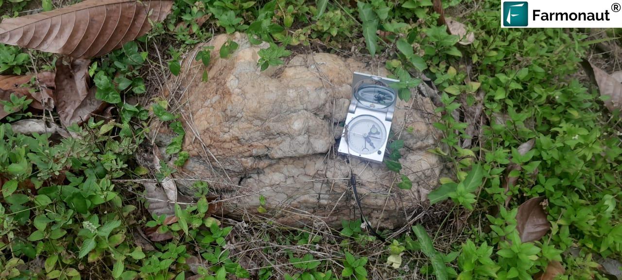
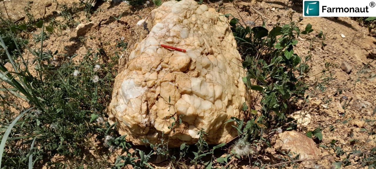
The pivotal observation was made at Zone 1. Large quartz boulders were found in situ on hilltops and slopes — not rounded, not transported, not sitting in a stream bed, but resting where they weathered out. In-situ boulders on a hilltop are the signature of a vein system eroding in place beneath them. Downslope, at the foot of those hills, the team confirmed fractured quartz veins trending NE–SW, a structural orientation the report describes as a regionally recognised high-grade gold corridor.
Put those two observations together and you have a coherent picture: a hard-rock vein set, oriented along a known regional control, shedding boulders onto the slopes around it. That is a fundamentally different asset from a placer deposit. Alluvial gold is finite, shallow and quickly worked out. A primary vein system has depth extent, and depth extent is what a diamond drilling programme is designed to measure.
The ranked zone queue
The field team scored each zone on two axes that a drill manager actually cares about: how good the geology looks, and how hard it is to put a rig on it. The full ranking below is reproduced from the client’s summary table.
| Zone | Geological interest | Field evidence | Accessibility | Strategic recommendation |
|---|---|---|---|---|
| Zone 1 (Priority) | Exceptional | Large in-situ quartz boulders; NE–SW fractured vein system indicating a primary hard-rock source | Blocked by river crossing; bridge required | Immediate — primary drill target once the bridge is in |
| Zone 5 | High | Massive existing dry pits with clear mineralisation | Excellent — along the main road | Immediate “easy win” drilling |
| Zone 3 | Moderate | Lateritic materials and quartz fragments | Fair — road widening needed | Secondary phase target |
| Zone 4 | Moderate | Large quartz boulders on surface | Restricted — near buildings and a water facility | Precision drilling; social engagement required |
| Zone 13 | Moderate | Quartz gravels and boulders on western hills | Fair — footpaths; bridge or pit filling needed for heavy rigs | Exploration upside |
| Zone 9 | Moderate | Quartz-rich conical hills | Difficult — steep terrain | Long-term target |
| Zone 8 | Low–Moderate | Extensive alluvial quartz gravel heaps | Difficult — heavily excavated | Follow-up for the alluvial-to-hard-rock transition |
| Zones 10–14 | Variable | Abandoned pits and quartz float | Fair — mixed terrain | Regional scouting |
Read down the “field evidence” column and one thing stands out: there are no blanks. Every ranked entry returned something — in-situ veining, boulders, gravels, laterite with quartz fragments, or old workings. Not every zone is a drill target, and the team was clear about that, but not one of them was barren ground. For an early-stage screening exercise over a large concession, an all-positive presence result is the outcome you hope for and rarely publish, because it is usually the ambiguous middle that gets written up.
Zone 1 — the primary target
In-situ quartz boulders over a NE–SW fractured vein system
The report’s language about Zone 1 is unusually direct: it “demonstrates the structural integrity and scale required for a major discovery”, whereas other zones show only scattered quartz fragments. That distinction — integrity and scale versus scatter — is the difference between a vein system and a debris field.
Zone 5 — the immediate drilling candidate
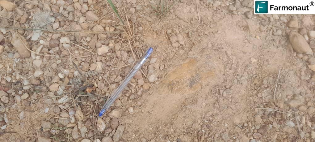
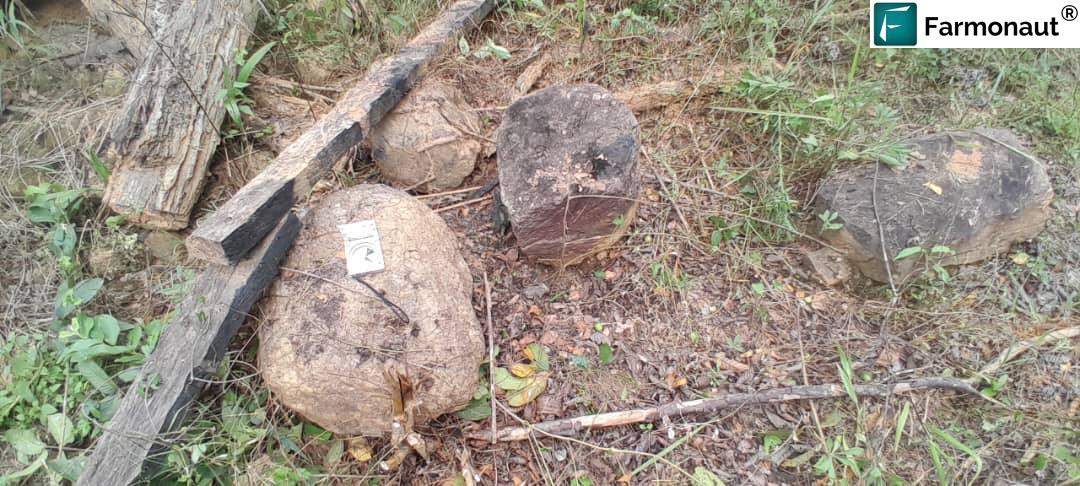
Massive existing dry pits with clear mineralisation, on the main road
Existing pits are an underrated form of validation. Somebody, at some point, dug there and kept digging — which is independent human evidence that the ground pays at surface. Combined with a satellite target and road access, that makes Zone 5 the lowest-friction way to get a rig turning on this concession.
One 35–45 metre bridge stands between a diamond drill rig and the best ground on the concession.
The bridge that unlocks the best ground
This is the finding that would never appear on a prospectivity map, and it is arguably the single most valuable line in the client’s report. Zone 1 — the exceptional target, the one with the vein system and the regional structural control — is on the wrong side of a river.
The team did not just note the obstacle. They walked the river and identified an optimal crossing point for a 35–45 metre bridge, then confirmed that the northern section beyond it offers relatively flat terrain suitable for rig setup. They also proposed locations for the pit, waste dump, processing plant and offices, and confirmed those sites sit in reasonable proximity to one another — which matters a great deal for haulage distance and site power, and which is exactly the kind of thing you can only settle by standing on the ground.
Framed commercially, one discrete piece of civil engineering converts the concession’s best geological target from unreachable to drillable. The report calls it “the key to unlocking the most prospective ground in the concession for heavy drill rigs”, and describes the river as “a manageable logistical challenge” rather than a blocker. That is a capital allocation question with a clean answer, and the field team handed it to management in a form they could act on.
Cocoa, compensation and community consent
Several of the target zones intersect active cocoa, cassava and plantain farms. The report is unambiguous about the consequence: a full crop compensation inventory must be finalised before drill mobilisation, and formal permission and support must be sought from village chiefs and the paramount chief.
One of the field team’s four stated objectives was to map the farms for future compensation purposes — planned in from the start, not discovered as an obstacle later. That ordering is the whole point. Crop compensation negotiated before mobilisation is a budgeted line item. Crop compensation negotiated after a rig is already parked in someone’s cocoa is a dispute with leverage on the wrong side of the table.
Zone 4 is the sharpest version of this problem. It carries large surface quartz boulders, but access is restricted by nearby buildings and a water facility. The recommendation is precision drilling combined with heightened community engagement — a narrower, more carefully sited programme rather than either abandoning the zone or bulldozing through the constraint.
The results, and what they were worth
Set against what the client set out to achieve, the campaign returned a clean sweep. Four objectives were stated at the top of their report. All four were met inside four field days.
| Client objective | Outcome |
|---|---|
| Survey and map areas with high gold potential identified from satellite data | Achieved — 68 GPS-logged mineralisation localities; every ranked zone returned physical evidence |
| Survey and map access routes to high-potential zones | Achieved — routes assessed for every zone and graded from “excellent” to “bridge required” |
| Propose infrastructure locations around the primary target | Achieved — pit, waste dump, plant and office sites proposed, and confirmed to sit in close proximity to one another |
| Map cocoa and other crops for future compensation | Achieved — farms mapped at the intersecting zones; compensation inventory scoped pre-mobilisation |
The headline result goes further than any of those four. The client’s geologist reclassified the entire concession — from an alluvial site to a primary hard-rock system with depth extent. That is the reclassification that changes an asset’s capital plan, its mining method and the conversation it can have with investors, and it came out of a four-day campaign directed by satellite targets.
The programme now moves to diamond drilling, sequenced exactly as the field audit recommended: Zone 5 immediately, Zone 1 as the bridge comes in.
In the client’s own words
The most persuasive lines in this case study are not ours. They are the assessments the client’s own geologist wrote up after walking the targets — independently, on their own budget, with no input from us.
The geological upside of Zone 1 is exceptional.
On the priority target: large in-situ quartz boulders “strongly indicating the presence of a massive underlying vein system”, on “a structural orientation recognised regionally as a high-grade gold corridor”. Zone 1, they concluded, “demonstrates the structural integrity and scale required for a major discovery.”
On the concession as a whole: the area “is not merely an alluvial site but hosts a robust primary hard-rock system.”
On the river standing between the rigs and the best ground: “a manageable logistical challenge” — and the crossing, “the key to unlocking the most prospective ground in the concession for heavy drill rigs.”
And the closing verdict: “The investigation confirms Zone 1 as the most prominent potential mineral host.”
Read those together and the arc of the project is clear. A satellite screening pointed at a polygon on the far side of a river; an independent geologist walked it and came back describing the structural integrity and scale required for a major discovery. That is the outcome this workflow is built to produce.
Where the time and money actually go
Traditional early-stage exploration walks a concession broadly, then narrows. Grid soil sampling, reconnaissance traverses across barren ground, trenching to find out whether a target exists at all — months of field time, at field-crew rates, in difficult terrain, much of it spent confirming that ground is empty. Satellite screening inverts the order: it narrows first, from orbit, and sends people only to the short list.
Across our exploration work generally, that reordering compresses early-stage timelines from months to days and cuts early-exploration cost by up to 80–85%. This project shows the mechanism concretely. Fourteen zones and a GIS file meant a team of geologists spent their four days logging 68 mineralisation localities, evaluating infrastructure sites and mapping farms — instead of spending the first three weeks working out where to start.
| Exploration task | Conventional ground-first approach | Satellite-first approach, as run here |
|---|---|---|
| Narrowing a large concession | Grid sampling and traverses across the full licence | Screened from orbit; 14 ranked zones delivered as GIS polygons |
| Field reconnaissance | Weeks to months of broad-area walking | 4 days, 68 GPS localities, target-directed |
| Ground disturbance during targeting | Trenching, pitting, access cutting | None — non-invasive |
| Structural interpretation | Inferred from scattered outcrop and sampling | Lineament and fracture corridors mapped before arrival; NE–SW orientation confirmed on the ground |
| Access and infrastructure planning | Typically deferred until after target selection | Assessed in the same field pass; bridge span and rig-setup ground identified |
| Community and crop mapping | Often reactive, after mobilisation | A stated field objective from day one; compensation inventory scoped pre-mobilisation |
| Drill angle optimisation | Determined after first-pass drilling | Available pre-drill via TargetMax™ 3D vein modelling (Premium+) |
Run this loop on your own concession
The satellite gold exploration pattern this client followed is repeatable, and it is the one we recommend to every early-stage licence holder: screen from orbit, then validate on foot, then drill in access order.
- Define the area. Send coordinates, a KML/KMZ, or a polygon, plus the country or region and your target mineral. Anything from a single licence to a multi-block portfolio works.
- We screen it. We select the appropriate data source — multispectral or hyperspectral — acquire it, and run the analysis. Turnaround is 5 to 20 business days depending on area size and mineral complexity.
- You receive ranked targets. High-potential zones, prospectivity heatmaps, estimated location and depth ranges, indicative quantity, geological interpretation covering faults, alteration and host rock, and seasonal anomaly validation — as a PDF plus georeferenced GIS files you can load onto a handheld GPS.
- Upgrade if you are drilling. Premium+ adds TargetMax™ drilling intelligence — optimal drilling angles for higher ore-intersection probability, and interactive 3D subsurface models of vein structures and mineral distribution.
- Validate on the ground. Send your geologists to the short list, exactly as this client did. Check presence, check whether the material is in situ, and check whether a rig can reach it.
- Sequence by access, not by rank. Drill the reachable good target while you build access to the exceptional one.
Get your concession screened before you send a field team
Farmonaut has scanned over 100,000 hectares across 25+ countries for 20+ mineral types. Tell us your area and your target mineral, and we will tell you where to walk.
Frequently asked questions
How accurate is satellite gold exploration in West Africa compared with ground surveys?
They work best together, and this case study shows what that looks like. Screening from orbit ranked a large concession quickly and non-invasively; the client’s field team then verified the short list on the ground. Every ranked zone they visited returned physical evidence of mineralisation or historic working, and the priority zone returned in-situ vein evidence strong enough for their geologist to reclassify the concession as a primary hard-rock system. Screening is what makes that hit rate achievable in four field days instead of a season; drilling then converts a validated target into measured grade.
Can satellite mineral detection work under dense cocoa and rainforest canopy?
Optical sensors alone struggle under closed canopy. That is why our workflow fuses radar backscatter, which penetrates vegetation and reveals structure, with multispectral and hyperspectral alteration signatures, terrain analysis and multi-season persistence testing. This concession is an actively farmed cocoa landscape, and the target set still held up under field checking. If a provider offers you only multispectral analysis for a heavily vegetated licence, expect a high rate of missed targets.
What is the difference between an alluvial gold site and a primary hard-rock system?
Alluvial gold has been eroded from its source rock and transported, usually by water, and it accumulates in drainage. It is typically shallow and finite. A primary hard-rock system is the source itself — gold hosted in veins or altered rock, still in place, with potential depth extent. The distinction drives everything downstream: capital plan, mining method, and whether a diamond drilling programme makes sense. In this case study the field team found large quartz boulders in situ on hilltops and fractured NE–SW veins at the hill foot, which is why they concluded the concession hosts a primary hard-rock system rather than being merely an alluvial site.
Why drill the second-best target first?
Because access is a schedule constraint, not a geological one. The priority zone here is separated from the main route by a river and needs a 35–45 metre bridge before heavy rigs can cross. The second-ranked zone sits on the main road with existing pits and exposed mineralisation. Drilling the accessible zone while the bridge is engineered and built means the programme generates assay results during the construction period instead of waiting idle. Same capital, better use of the calendar.
How long does a satellite mineral detection survey take, and what do I receive?
Delivery runs 5 to 20 business days depending on the size of the area and the complexity of the target mineral. You provide the area of interest as coordinates, KML/KMZ or a polygon, plus the country or region and the mineral. You receive a premium mineral-intelligence report covering high-potential zones, prospectivity heatmaps, estimated location and depth ranges, indicative quantity, geological interpretation of faults, alteration and host rock, and seasonal anomaly validation — delivered as a PDF together with georeferenced GIS files. The Premium+ tier adds TargetMax™ drilling intelligence and interactive 3D subsurface models.
Does satellite exploration reduce the community impact of a drilling programme?
Yes, in a direct and measurable way. The targeting phase disturbs nothing — no trenching, no soil pits, no access tracks, no clearing. Where target zones sit inside active smallholder farms, as several do here, every hectare that satellite screening removes from the field programme is a hectare that never needs to be walked, negotiated over or compensated. It also lets crop compensation inventories be scoped before mobilisation rather than after, which is both cheaper and considerably less contentious.
Which minerals and regions does Farmonaut cover?
We have scanned over 100,000 hectares across more than 25 countries in Africa, South America, North America, Asia and Australia, covering 20+ mineral types. That includes precious metals such as gold and silver; base metals including copper, cobalt, nickel, zinc, iron and manganese; energy and battery minerals such as lithium and uranium; industrial minerals including gypsum, dolomite and quartz; specialty materials such as tantalum, niobium, beryllium, diamonds and star garnets; and rare earth elements. There is no restricted geography — send us the polygon.
Glossary
- Birimian Supergroup
- A Palaeoproterozoic sequence of metasedimentary and metavolcanic rocks underlying much of West Africa, and the host of many of the region’s major gold systems.
- In situ
- In its original position. An in-situ quartz boulder has weathered out where it sits, rather than having been transported, which points to a vein source directly beneath.
- Quartz float
- Loose quartz fragments on the surface that have moved downslope from their source. Useful as a pointer, but not proof of a vein at that location.
- Gossan / iron oxide staining
- Rusty, iron-rich surface material produced by the weathering of sulphide minerals — often a visible expression of a mineralised system beneath, and a signature detectable spectrally from orbit.
- Lineament
- A linear landscape feature visible in satellite or radar imagery that commonly reflects an underlying fault or fracture — the structural plumbing that channels mineralising fluids.
- Ground truthing
- Physically visiting a remotely sensed target to verify what is actually there. The step this case study documents.
- Diamond drilling
- Core drilling that recovers a continuous cylinder of rock, allowing geologists to log and assay the mineralisation directly at depth.
- Strip ratio
- The volume of waste rock that must be moved to access one unit of ore in an open pit — a primary driver of open-pit mining cost.
This case study summarises a client-authored reconnaissance report published here in a redacted form at the client’s direction. Prospect and place names, GPS coordinates, elevations, the river and bridge crossing reference, and the author’s identity have been removed at source, along with 35 of 55 field photographs. The field observations, zone rankings, quoted assessments and recommendations are the client’s own; Farmonaut’s contribution was the satellite target set that directed the traverse. This is reconnaissance-stage exploration information and does not constitute a Mineral Resource or Reserve under JORC, NI 43-101, SK-1300 or SAMREC, nor does it constitute investment advice.
Discussion
Questions, corrections or field experience? Share them below. First-time comments are reviewed before they appear, and your email is never published.
No comments yet. Be the first to add a question or your experience.

 Omsri International FZE
 G.I.T.T.
 Jaunita Erss Ltd
 Almosi SARL
 SRK Consulting
 Berks Gold Limited
 Mwerezi Minerals Company Limited
 Mining SARL
 SenGold Invest SAS
 Sean Mining Limited
 NTS Group (Pty) Ltd
 Mine4Africa
 Lithspo Minerals Limited
 Tintina Mining Group
 Dalgety Minerals Pty Ltd
 Licence holder · Nigeria · Gold + lithium










