

Polymetallic Exploration: Gold, Silver, Uranium
A Zimbabwean licence of under 30 hectares carried three target commodities at once. A conventional three-commodity ground programme could never have been justified on ground that size — so the operator assessed all three from orbit in a single pass, then decided where to drill.
Most exploration budgets are built around a single commodity. This one could not be. The licence — a compact block in Zimbabwe of under 30 hectares — carried three target minerals on the same ground: gold, silver and uranium. That is not an unusual ambition in Zimbabwe, but it is an awkward one, because those three metals do not answer to the same exploration questions and do not respond to the same field methods.
The arithmetic is what makes this case study worth writing up. A conventional first-pass ground programme designed to say something credible about all three commodities means, at minimum, a soil-geochemistry grid analysed for a precious-metal suite, a structural mapping traverse, and a separate radiometric survey with a different instrument and a different crew for the uranium question. On a licence of several thousand hectares that is a defensible line item. On a block of under 30 hectares it is absurd — the mobilisation cost alone would exceed any sensible early-stage budget for ground that small, and no operator would spend three programmes’ worth of money to find out whether the property is worth one.
So the operator did the efficient thing: screened all three commodities from orbit in a single analytical pass, ranked what came back, and used the result to decide where the first drill hole should go. The client subsequently reported that the analysis narrowed down where to explore and drill, and selected banded savings of six months or more in exploration time and up to USD 25,000 in exploration cost against the programme they had otherwise planned. This article describes how one pass produced a ranked target set for three different mineral systems, and what that changes for a small licence holder planning a drill campaign.
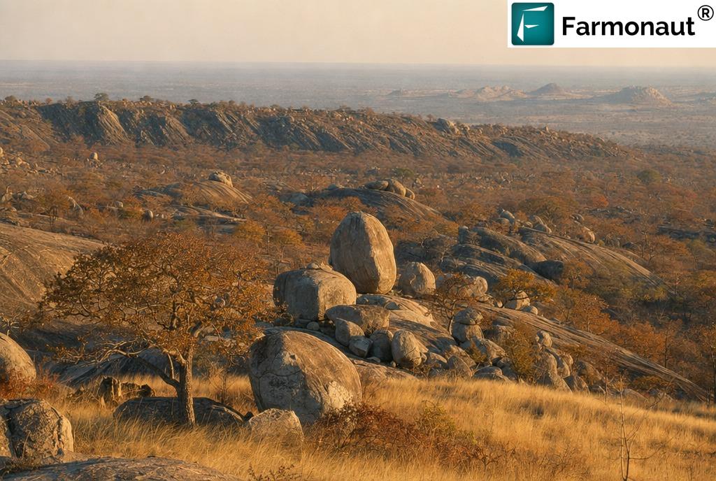
This client is not identified and did not provide a testimonial; no statement in this article is quoted from or attributed to them. The country is named with the client’s licence otherwise withheld: no concession name or number, no boundary, no coordinates, no district, no exact area and no zone-level results are published. Reporting dates are given as a season, not a date. All outcome figures below are the client’s own banded selections in Farmonaut’s structured post-project feedback form. Imagery is illustrative and does not depict the client’s licence.
Three Commodities, One Small Licence, One Analytical Pass
The defining constraint here was area, not geology. A licence of under 30 hectares is a small square of ground — comfortably walkable in a morning, and small enough that an operator can reasonably expect to fund only one drilling campaign on it, ever, unless something turns up.
That constraint cuts two ways, and the second way is the interesting one.
The obvious effect is that the ground is cheap to cover. The less obvious effect is that the cost of being wrong is proportionally much higher. On a large concession, a badly sited first hole is a learning experience: there is more ground, more budget and more time to try again. On a compact block there may be exactly one hole in the budget, and where it goes effectively decides whether the licence gets a second look from anyone. Precision matters more on small ground, not less.
Add a second commodity and the problem compounds. Add a third that requires an entirely different survey instrument, and a conventional programme stops being a budget question and becomes a structural impossibility. Something has to give: either two of the three commodities get quietly dropped, or the operator finds a way to assess all three on one dataset.
“On a block this small there may be one hole in the budget. Where it goes decides whether the licence gets a second look from anyone.”
Why an operator would hold three commodities on one block at all
It is worth pausing on why a single small licence would carry gold, silver and uranium as declared targets, because to anyone outside exploration it can look like scattergun optimism. It usually is not.
Gold is the anchor. Zimbabwe is a gold country in a way that few places are — the mineral is woven through the national economy, the licensing system and the informal sector alike, and any Zimbabwean exploration licence that has a plausible route to gold will list gold. Silver is the natural companion: it is almost never the reason a licence is pegged, but it is very commonly recovered alongside gold, and declaring it costs nothing while omitting it can complicate things later.
Uranium is the outlier, and it is the one that tells you something about the licence holder’s thinking. Uranium in Zimbabwe is not an Archaean-craton story at all — it belongs to a completely different geological chapter of the country. Listing it on a licence generally means the holder either has ground with some relationship to those younger sedimentary basins, or has seen something in reconnaissance that made the question worth asking. Either way, it is a question that a gold-focused ground programme will never answer, because nobody carries a gamma-ray spectrometer to a quartz-vein mapping traverse.
The economic case for satellite screening is usually framed as cost per hectare, which makes small licences look like poor candidates. On a polymetallic block the better frame is cost per commodity question answered. One acquisition, one correction chain and one interpretation session can be interrogated for three different mineral systems — and the marginal cost of the second and third questions is a fraction of the first.
The Ground: Zimbabwe’s Archaean Core and Its Younger Margins
Zimbabwe is one of the classic mineral terranes of Africa, and understanding why gold and uranium live in different parts of it is the key to reading a polymetallic screen properly.
Greenstone belts: where the gold is
The country is built around the Zimbabwe Craton, an Archaean block of granitoids, schists and gneisses among the oldest stable continental crust on Earth. Woven through that granitic basement are the greenstone belts — elongate keels of metamorphosed volcanic and sedimentary rock, conventionally grouped into the Sebakwian Group at around 3.5 billion years, the volcanically dominated Bulawayan Group at roughly 2.9–2.7 billion years, and the overlying, more sedimentary Shamvaian Group. Cutting across the whole craton is the Great Dyke, a linear layered intrusion running more than 500 kilometres and carrying the country’s chromium and much of its platinum.
The greenstones are where the gold sits. Zimbabwean gold is overwhelmingly orogenic in style: gold carried in hot fluids up through deep crustal structures during mountain-building, then deposited in quartz veins and altered wall rock where those structures changed geometry or chemistry. The practical consequence for exploration is that gold in this setting is structurally controlled. It follows shears, fold hinges, lithological contacts and fracture corridors. Find the structure and the alteration around it, and you have found the search space; the gold itself occupies a small and awkward fraction of that space.
Silver: the metal that comes with the gold
Silver almost never justifies its own exploration programme, and the reason is a supply-side fact rather than a geological one. According to the USGS Mineral Commodity Summaries, silver “was primarily obtained as a byproduct from lead-zinc, copper, and gold mines,” and polymetallic ore deposits account for more than two-thirds of world silver resources. The same source notes that most recent silver discoveries have been associated with gold occurrences.
That is exactly the relationship in play here. In an orogenic gold system, silver typically travels with the gold in the same hydrothermal fluid and reports to the same quartz veins — the ratio between the two metals varies enormously from system to system and is settled by assay, not by prediction. For targeting purposes, this is convenient: the search for silver in this setting is the search for gold. The same alteration, the same structures, the same ranked zones. What differs is only what the laboratory eventually reports back.
Uranium: a different geological address entirely
Uranium does not live in the greenstones. Zimbabwe’s uranium story belongs to the younger sedimentary basins along the country’s northern margin — the Zambezi Valley, and specifically the sandstone-hosted occurrences in the Kanyemba area. The World Nuclear Association records Zimbabwe in the 2024 “Red Book” with 2,000 tU of reasonably assured resources recoverable at up to USD 260/kgU, plus speculative resources of 25,000 tU, and notes that the country has been drafting a policy to govern uranium exploitation. Zimbabwe has, in other words, a real but undeveloped uranium endowment and no producing uranium mine.
Sandstone-hosted uranium forms by a completely different mechanism from orogenic gold. Oxidised groundwater carrying dissolved uranium migrates through permeable sandstone until it meets a chemical barrier — organic matter, sulphides, a reducing front — where the uranium drops out of solution. The controls are stratigraphic and hydrological: which sandstone unit, which redox front, which palaeo-channel. Structure matters, but as a plumbing system rather than as a fluid conduit at depth.
Two mineral systems, two host settings, two entirely different sets of surface clues. That is the honest starting point for any polymetallic screen involving uranium, and it dictates everything that follows.
What One Pass Delivered Across All Three Commodities
The efficiency of a polymetallic screen rests on one fact: the expensive parts of the workflow are shared. A single acquisition, one atmospheric correction, one spectral decomposition and one terrain model feed every commodity question you care to ask of the same ground. What changes between commodities is only which indicators get mapped and how the ranking is read — and interpretation time is cheap compared with putting a second crew and a second instrument on a plane.
Gold: the alteration halo is the target, and it is big
Satellites do not detect gold as an element. At concentrations measured in grams per tonne there is no spectral feature for any sensor to register, and no orbital instrument sees beneath the surface. What they map instead turns out to be far more useful for targeting: the alteration halo — the chemically rearranged rock a mineralising fluid leaves behind, typically orders of magnitude larger than the mineralised zone itself and therefore comfortably resolvable from orbit. The ore body is a needle; the alteration system around it is a haystack you can see from space, and it is the haystack that tells you where to look. For an orogenic gold system the recurring indicators are:
- ✔ Iron-oxide response. Haematite, goethite and jarosite from weathered sulphides produce characteristic behaviour in the visible and near-infrared, mappable through band ratios and principal-component techniques.
- ✔ Clay and sericite alteration. Kaolinite, illite and white mica carry diagnostic aluminium–hydroxyl absorption in the shortwave infrared — the single most useful window in hydrothermal alteration mapping.
- ✔ Silicification. Quartz flooding and vein density change surface texture, reflectance and, in thermal bands, emissivity.
- ✔ Carbonate alteration. A common companion to orogenic gold, with its own shortwave-infrared expression.
- ✔ Structural architecture. Lineaments, shear traces, fold geometry and fracture density extracted from terrain models and radar, which is where the fluid pathways actually are.
Where several of those coincide on the same ground, you have a target worth ranking highly. Where one appears alone, you have a curiosity. The discipline is in the coincidence, not in any single index — and coincidence is exactly what a multi-layer screen is built to find.
Silver: the same alteration signature, at no additional cost
Silver is where the polymetallic economics start paying immediately, because in an orogenic system it needs no separate indicator stack at all. Silver travels with gold in the same hydrothermal fluid, reports to the same quartz veins, and weathers into the same iron-oxide and clay assemblages the gold indicators already map. One set of layers, computed once, answers both questions.
That is a genuine saving rather than a rhetorical one. In a conventional programme, adding silver means an extended multi-element assay suite across every sample and the laboratory turnaround that comes with it. In a satellite screen it means nothing extra: the ranked zones that carry the strongest gold indicators are the same zones to sample for silver, and the gold-to-silver ratio — which varies widely between systems — is settled by assay when the samples go in. The operator gets a target set that serves both metals from the same pass, and knows before mobilising which zones justify the fuller assay suite.
Uranium: lithology, structure and setting
Uranium is targeted through a different indicator family, and this is precisely where a single satellite pass earns its keep on a polymetallic licence — because the conventional alternative is a second survey with its own crew, instrument and mobilisation.
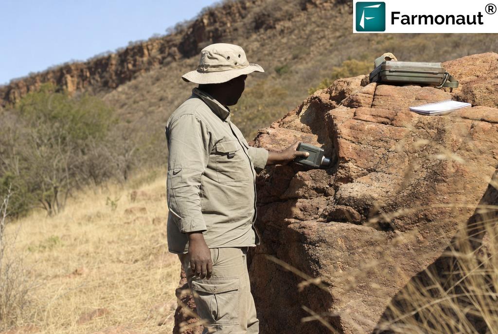
What the screen maps for uranium is setting: which sedimentary units are exposed and where, the geometry of basin architecture and palaeo-channels, the structural framework that governed groundwater movement, and the surface colouration changes that mark redox boundaries — the bleached-versus-oxidised contrast showing where reducing conditions took over and uranium would have dropped out of solution. The iron-oxide and argillic alteration indices computed for the precious-metal question feed straight into it at no extra acquisition cost. This is the standard division of labour in the published literature: a multi-disciplinary uranium study hosted at PubMed Central uses multispectral data to identify lithological units and the hydrothermal alteration zones associated with uranium deposition, then integrates them with radiometric measurement into a uranium potential map. Radiometrics — airborne or ground gamma-ray spectrometry — remain the confirming method, and the screen’s job is to make that follow-up short and specific instead of blanket.
On ground this size that distinction is worth real money. A radiometric walk over a handful of ranked zones is a manageable, fundable exercise. The same walk over an unranked licence with no lithological framework is a speculative mobilisation that small operators routinely never fund — which is how a declared uranium target quietly becomes a line item nobody ever tests. Ranking it is what keeps it alive.
“In a ground programme the third commodity costs almost as much as the first. In a satellite screen it costs interpretation time.”
Declare every commodity on your licence when you commission a screen, not just the one you consider primary. The acquisition and correction work is already paid for; each additional commodity you name costs interpretation time and nothing more. Operators who list only their headline metal routinely leave the cheapest answers on the table.
How the Screen Was Run
Farmonaut has applied Earth observation and AI to mineral exploration since 2018, across 100,000+ hectares in 25+ countries for more than 20 mineral types. On this licence the workflow followed our standard four stages, with the polymetallic brief affecting the third stage most.
- Acquisition. A multi-date image archive was assembled over the licence rather than a single scene, so that any anomaly could be tested for persistence across seasons instead of trusted from one snapshot. Seasonality matters especially in Zimbabwe, where dry-season exposure and wet-season vegetation produce very different surfaces.
- Correction and decomposition. Raw radiance was atmospherically corrected, then spectrally decomposed to separate genuine mineralogical response from soil, shadow and vegetation contributions — the step that determines whether the rest of the analysis is measuring rock or measuring grass.
- Indicator mapping, three ways. Iron-oxide, clay/sericite, silica and carbonate alteration indices plus structural extraction for the precious-metal question; lithological discrimination, basin and channel geometry, and surface redox-contrast mapping for the uranium question. The same corrected imagery, interrogated with two different indicator families.
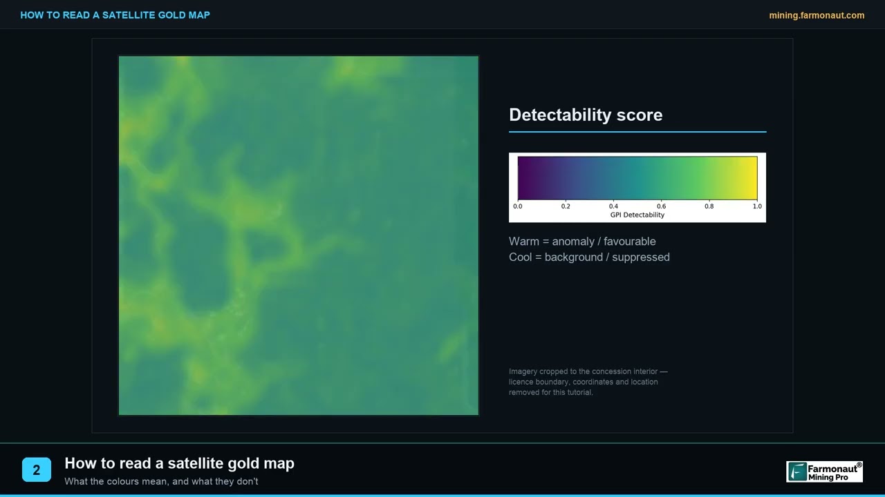
- Ranking and delivery. Layers were combined into a prospectivity surface using a weighted composite of multiple normalised sub-scores, discrete zones were delineated and ranked, and the package was delivered as a PDF report plus georeferenced GIS files — typically within 5–20 business days. The report was delivered to this client in late 2025.
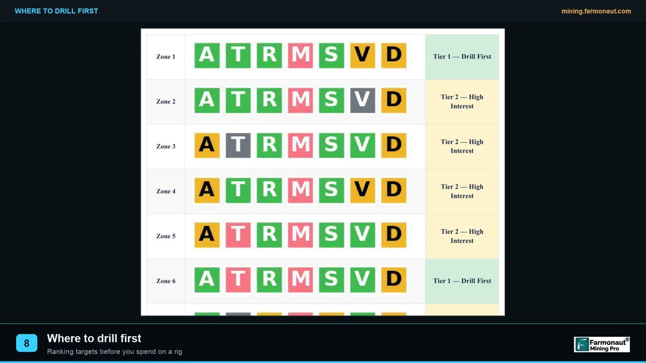
The critical design decision on a polymetallic brief is not to merge everything into one number. A single composite score blending gold indicators and uranium indicators would produce a map that is meaningless for both. The gold-and-silver ranking and the uranium-setting assessment are kept as separate products over the same ground, so the operator can see where they agree, where they diverge, and which question each part of the licence is actually answering.
The entire screening phase involves no ground disturbance whatsoever — no access tracks, no pits, no trenching, no drilling fluids, no crew camps. On a polymetallic licence this compounds: three commodity questions are narrowed before a single vehicle enters the property, and the ground that turns out not to warrant work is ruled out without ever being touched. For a uranium line item in particular, keeping speculative work off the ground until targeting is firm is the responsible sequence.
What the Client Reported Back
Some months after delivery, the client completed Farmonaut’s structured post-project feedback form — a fixed set of questions with banded answer options. Their recorded answers are reproduced below as answers, not as statements. This client did not provide a testimonial and is not named.
Three points deserve to be read carefully.
The targeting question was answered yes. Asked whether the analysis narrowed down where to explore or drill on the licence, the client answered yes. On a polymetallic brief that is the whole purpose of the exercise: converting a small block with three open questions into a ranked, specific set of places to go and a defined order to go in.
The time and cost figures are banded self-reports, not measurements. The client selected “6 months or more” for exploration time saved and “up to USD 25,000” for exploration cost saved. These are their own selections from fixed ranges, comparing the screen against the programme they had otherwise planned. They are not audited figures, they are not point estimates, and we will not convert them into one. The comparison is against a hypothetical, and it is the client’s comparison.
Nothing here has been drilled. The client answered no to the drilling question, and the mineralisation and laboratory questions therefore did not apply. Drilling is planned but had not taken place when they reported back. No subsurface finding is claimed anywhere in this article, for any of the three commodities. The story stops at the targeting decision, which is exactly where the evidence stops.
Read a case like this for what it actually establishes. It is not evidence that a deposit exists — nothing has been drilled. It is evidence about a decision process: a small polymetallic licence went from three open commodity questions to a ranked, documented target list without a ground programme, at a cost the holder reports as materially lower than the alternative. For an early-stage asset, the quality of the targeting decision is often the only thing there is to assess, and it is worth assessing properly.
On the cost band, one piece of context is genuinely useful. Across our project base, satellite screening typically lowers early-exploration cost by around 80–85% versus a conventional first-pass ground programme. On a polymetallic licence that differential widens rather than narrows, because the conventional alternative is not one programme but two or three — and the satellite alternative remains a single acquisition and a single interpretation.
Uranium Ground: Getting the Sequence Right
A uranium line item behaves differently from gold and silver for a second reason that has nothing to do with geology: uranium is a regulated material almost everywhere in the world. That is useful context for a buyer rather than a deterrent, and it is one of the reasons a screening-first sequence works so well on a polymetallic licence — it lets an operator find out whether the uranium question is worth opening before taking on the administrative work of opening it.
In Zimbabwe, two layers are worth knowing about, and we walk clients through both when a uranium target is on the licence.
The mining-law layer: strategic-mineral status
Zimbabwe’s mining framework is governed principally by the Mines and Minerals Act [Chapter 21:05], and the reform process now working through Parliament tightens the treatment of certain minerals considerably. Analysis of the Mines and Minerals Bill by the Centre for Natural Resource Governance notes that the Minister of Mines, in consultation with the Mining Affairs Board, may classify minerals — rare earths or uranium being the examples given — as strategic, and that miners must then negotiate special agreements with the State before exploration or extraction. Strategic minerals are those deemed critical to national economy, security or industrial policy, and the intent is to retain State oversight over how they are developed.
The practical implication for a licence holder is that the uranium component of a polymetallic property is not commercially equivalent to the gold component. It may require a separate negotiation, a separate agreement and a separate timeline, and its route to value runs through a policy process rather than simply through a mill.
The radiological layer: handling licensed material
Separately from mining law, radioactive material in Zimbabwe falls under the Radiation Protection Act [Chapter 15:15] of 2004, administered by the Radiation Protection Authority of Zimbabwe, which authorises the possession and use of radiation sources. In practice this means that the moment an exploration programme moves from mapping to physically collecting, transporting or storing uranium-bearing material, it enters a licensing regime that has nothing to do with the Ministry of Mines and everything to do with radiological safety.
None of this is an argument against uranium — it is an argument for sequencing, and the sequence is genuinely favourable. A satellite screen narrows the uranium question to specific ground at no regulatory cost, with no material handled and nothing on the property touched. That means an operator can arrive at the regulatory conversation already knowing which part of their licence is worth the conversation, which is a far stronger position than opening it speculatively. On a polymetallic property it also means the gold and silver programme is free to proceed on its own timetable while the uranium track runs in parallel.
Zimbabwean mining and radiation legislation is under active reform, and nothing here is legal advice — so build the regulatory step into the plan rather than discovering it later. Take current, qualified local advice on strategic-mineral designation, State agreements, radiological authorisation and export permitting while you are ranking targets. Operators who resolve this early tend to find the uranium component adds value to a licence; those who leave it to the end tend to find it stalls one.
Why Polymetallic Screening Changes Small-Licence Economics
The conventional wisdom holds that satellite screening pays off on large concessions, where the per-hectare economics are obvious. This project is a clean counterexample, and the reason is that on a polymetallic licence the relevant unit is not the hectare.
| Exploration question | Conventional first-pass approach | What a satellite screen contributes |
|---|---|---|
| Gold targeting | Soil geochemistry grid plus structural mapping traverse; crew, lab turnaround, seasonal window | Alteration and structure mapped licence-wide on one consistent basis; ranked zones delivered in 5–20 business days |
| Silver targeting | Additional multi-element assay suite on the same samples | Carried on the gold indicator set; expectation is geological, ratio settled by assay |
| Uranium targeting | Separate radiometric survey — different instrument, different specialist, separate mobilisation | Lithology, basin geometry and redox setting mapped to narrow where a radiometric survey needs to walk |
| Confirming uranium presence | Blanket airborne or ground gamma-ray survey over the whole licence | The same survey, scoped to a ranked shortlist — a day’s walk rather than a campaign |
| Ground disturbance during screening | Tracks, pits, trenches, sample sites across the property | None at all — nothing is touched until targeting is firm |
| Documentation for partners or finance | Internal field notes, often unstandardised | Independent technical report plus georeferenced GIS files any geologist can load and interrogate |
| Marginal cost of the 2nd and 3rd commodity | Close to the cost of the first — separate programmes | A fraction of the first — one acquisition, one correction chain, additional interpretation |
That last row is the whole argument. In a conventional programme, each additional commodity is close to a full additional cost, because each needs its own instrument, crew and mobilisation. In a satellite screen, the expensive parts — acquisition, atmospheric correction, decomposition, terrain modelling — are shared across every commodity question you care to ask of the same imagery. The second and third questions cost interpretation time, not fieldwork.
That is what turns three impossible programmes into one affordable pass, and it is the mechanism behind the two figures this client selected. Six months or more of exploration time saved is not a mystery when the alternative is scheduling a soil grid, a mapping traverse and a radiometric survey around a single dry season and waiting on laboratory turnaround between them. Up to USD 25,000 of exploration cost saved is not a mystery either when the alternative carries three mobilisations onto ground that could not support one. Both are the client’s own banded selections against the programme they had otherwise planned — and both point at the same structural saving.
What a ranked target set actually gives a small licence holder
The deliverable is not a map. It is a decision structure, and on compact ground that distinction is what makes a drill programme fundable.
A holder who starts with a ranked set of zones can do four things they could not do before. They can sequence the work — sample the top zones first, and let each result inform whether the next is still worth visiting. They can size the campaign honestly, because a defined number of ranked targets converts directly into a defined number of holes and a defensible budget rather than an open-ended request. They can defend the siting decision to a partner, a lender or a board with a document rather than an assertion, which is frequently the difference between a programme being approved and being deferred. And they can recalibrate as they go: once the first holes are logged and assayed, knowing which combination of indicators produced the best rock re-ranks every remaining zone against a locally tuned benchmark instead of a generic one.
“On a small licence the deliverable is not a map. It is a defensible reason to put the hole exactly there.”
The documentation dividend on a small licence
There is a second benefit for holders of compact ground that has nothing to do with geology and everything to do with how exploration licences actually change hands.
Small licences are frequently held by operators without an in-house technical department. That is not a criticism; it is the normal structure of early-stage exploration across most of the world. But it means the technical documentation supporting a licence is often thin, and thin documentation is a genuine obstacle when the holder wants to raise money, bring in a joint-venture partner, satisfy a regulator’s work commitment, or sell.
A satellite prospectivity study fills that gap in a way that is disproportionately valuable on small ground. It produces a structured, independent, third-party technical assessment covering the entire licence on one consistent basis, delivered with georeferenced GIS files that any competent geologist on the other side of a negotiation can load and interrogate for themselves. On a polymetallic licence it does more: it produces a documented, defensible position on each of the declared commodities — including an honest statement of what remains untested. For a holder whose alternative was a verbal account and a licence map, that is a substantial change in position.
From Ranked Targets to a Drill Programme
This case study ends where the evidence ends. The screen was delivered in late 2025, the client reported that it narrowed where to explore and drill, and drilling is planned but has not taken place. That is the complete state of the project — and the ranked target set is what the drill programme will now be built on.
The sequence from here is worth setting out, because it is the same sequence on any well-run polymetallic licence and it shows what the screen bought.
- Ground-truth the precious-metal targets. Walk the highest-ranked zones, confirm that the mapped alteration is actually present as rock rather than as a processing artefact, and take representative samples for multi-element assay covering both gold and silver.
- Scope the uranium question with the right instrument. Walk the ground the screen flagged as having the right lithological and structural setting with a gamma-ray spectrometer — ground-based at this scale. Because the walk is now a shortlist rather than a whole licence, this is a day’s work instead of a survey campaign.
- Resolve the regulatory position before committing. If the radiometric work is encouraging, establish the strategic-mineral and radiological position with qualified local advice before designing any programme that handles material.
- Drill the precious-metal targets. On a licence this size that likely means a small number of holes into the best-corroborated zone, sited on coincident indicators rather than on the single highest composite score.
- Assay, and re-rank. Whatever the holes return, feed the result back into the prospectivity surface. Knowing which indicator combination produced a hit — or did not — recalibrates the ranking for every remaining zone.
When you site the first hole, do not simply take the highest number on the composite surface. Look for coincidence between independent indicator layers. A moderate-scoring zone where iron-oxide response, clay alteration and a structural corridor all overlap is very often a better first hole than a high-scoring zone carried by one strong index alone — because a single index can be produced by things that are not mineralisation, and three cannot, at least not as easily.
How to Run This on Your Own Licence
- Send the ground. Coordinates, a KML/KMZ, or a polygon you draw yourself — plus the country and every target commodity, not just the primary one. On a polymetallic property the commodity list changes the analysis, so an omitted commodity is a wasted opportunity.
- We select the sensor stack. Multispectral or hyperspectral, matched to area, terrain and mineral complexity, with multi-date coverage so anomalies can be tested for seasonal persistence rather than trusted from a single scene.
- Analysis and delivery. Typically 5–20 business days, delivered as a PDF report plus georeferenced GIS files you can load directly into your own systems.
- Optional Premium+ upgrade. Adds TargetMax™ Drilling Intelligence — drill-angle recommendations, higher ore-intersection probability, and interactive 3D subsurface vein models.
- Then go to ground. Sample the precious-metal targets, take a radiometric instrument to any uranium ground, and drill what survives both. As this operator plans to do.
A short glossary
- Polymetallic licence
- A tenement on which more than one target commodity is declared. The commodities may belong to the same mineral system, as gold and silver usually do, or to entirely different ones, as gold and uranium do.
- Orogenic gold
- Gold deposited from hot fluids moving through deep crustal structures during mountain-building, typically in quartz veins and altered wall rock. Structurally controlled, and the dominant style across Zimbabwe’s greenstone belts.
- Greenstone belt
- An elongate keel of metamorphosed volcanic and sedimentary rock preserved within Archaean granitic basement. Zimbabwe’s belts are grouped into the Sebakwian, Bulawayan and Shamvaian sequences and host most of the country’s gold.
- Alteration halo
- Chemically altered rock surrounding a mineralising system, typically far larger than the mineralised zone itself — which is exactly what makes it detectable from orbit when the ore body is not.
- Gamma-ray spectrometry
- Measurement of natural gamma radiation to determine ground concentrations of equivalent uranium, equivalent thorium and potassium. Flown on aircraft or carried on the ground, it is the conventional confirming step for a uranium target — and it is fastest when a screen has already ranked where to walk.
- Sandstone-hosted uranium
- Uranium precipitated where oxidised, uranium-bearing groundwater flowing through permeable sandstone meets a reducing barrier. Controlled by stratigraphy and hydrology rather than by deep structural plumbing.
- Prospectivity index
- A per-pixel composite score ranking relative favourability across a licence, built from a weighted combination of normalised sub-scores. A ranking — not a grade, not a probability, and not a measurement.
- Exploration target
- A deliberately cautious term for an estimate too speculative to be reported as a Mineral Resource. Always expressed as a range, and never a substitute for drilling and assay.
Screen every commodity on your licence, not just the obvious one
One satellite pass, interrogated for every mineral system you have declared — with an honest statement of what each result can and cannot support.
Frequently Asked Questions
What does the screen deliver for a uranium target?
Setting: which sedimentary units are exposed and where, basin and palaeo-channel geometry, the structural framework governing groundwater movement, alteration mapping, and the surface redox contrast that marks where uranium would have dropped out of solution. That produces a ranked shortlist of ground worth walking. Radiometrics — gamma-ray spectrometry, airborne or ground — remain the confirming method, and the value of the screen is that it makes that follow-up short, focused and affordable rather than a blanket survey over the whole licence.
Was anything drilled on this licence?
No. The client answered no to the drilling question in our post-project feedback form, and the mineralisation and laboratory-testing questions therefore did not apply. Drilling is planned but had not taken place when they reported back. No subsurface finding, mineralisation or grade is claimed or implied anywhere in this article, for gold, silver or uranium. This case study is about a targeting decision, not a discovery.
How can one satellite pass address three different commodities?
Because the expensive parts of the workflow — multi-date acquisition, atmospheric correction, spectral decomposition and terrain modelling — are shared, and only the indicator mapping and interpretation differ. The same corrected imagery is interrogated with one indicator family for the gold-and-silver question (iron-oxide, clay/sericite, silica, carbonate, structure) and a different one for the uranium question (lithology, basin geometry, redox contrast). The results are kept as separate ranked products over the same ground rather than merged into a single misleading score.
Is satellite screening worthwhile on a licence this small?
On a polymetallic licence, yes — and arguably more so than on large ground. This licence was under 30 hectares, which is far too small to justify separate ground programmes for three commodities, but exactly the size at which a badly sited first drill hole is unrecoverable. The benefit on compact ground is precision rather than coverage: the full indicator stack concentrated over a small area produces fine-grained ranking, which is what matters when the budget supports one campaign.
How are gold and silver screened together?
Through the same indicator set, which is why the pairing is so efficient. Satellites do not register gold or silver as elements; what is mapped is the alteration halo — iron-oxide, clay and sericite, silica and carbonate signatures — plus the structural architecture that channelled the mineralising fluids, all of which is far larger than the ore body and therefore resolvable from orbit. In an orogenic system silver travels with the gold and weathers into the same assemblages, so one set of layers ranks the ground for both metals and the gold-to-silver ratio is settled by laboratory assay when samples go in.
What do the time and cost savings actually mean?
They are the client’s own selections from fixed bands in our structured feedback form: “6 months or more” of exploration time saved and “up to USD 25,000” of exploration cost saved, both measured against the programme they had otherwise planned. They are self-reported bands, not audited figures and not point estimates, and we do not convert them into one. As general context, satellite screening typically lowers early-exploration cost by around 80–85% versus a conventional first-pass ground programme.
Does uranium carry extra regulatory requirements in Zimbabwe?
Yes, on two separate fronts. Under Zimbabwe’s mining-law reform process, the Minister of Mines may classify minerals such as uranium as strategic, requiring miners to negotiate special agreements with the State before exploration or extraction. Separately, radioactive material falls under the Radiation Protection Act [Chapter 15:15], administered by the Radiation Protection Authority of Zimbabwe, which authorises the possession and use of radiation sources. This article is not legal advice and the legislation is under active reform — take current qualified local advice before committing to a uranium work programme.
Is a satellite analysis valid for resource reporting?
No. Satellite-derived estimates are exploration targets, not Mineral Resources or Reserves under JORC, NI 43-101, SAMREC or any equivalent code. They cannot be reported as resources and do not replace drilling, sampling or a competent or qualified person’s assessment. Their role is to decide where that work should happen — which, on this licence, is exactly what they were used for.
Why is the client not named?
Because they declined a testimonial. This client is not identified and no statement in this article is quoted from or attributed to them. The country is named; the concession name, boundary, coordinates, district, exact area and zone-level results are all withheld to protect their commercial position, and the reporting date is given as a season rather than a date. Every outcome figure is a banded response to our own structured feedback form, published without attribution.
Published in anonymised form. The client is not identified and did not provide a testimonial; no statement in this article is quoted from or attributed to them, and no first-person account is presented on their behalf. The country is named; the licence name, boundary, coordinates, district, exact area, project dates and zone-level results are withheld, and the reporting date is given as a season. All outcome figures are the client’s own banded responses to Farmonaut’s structured post-project feedback form — self-reported selections, not audited or measured values, and not to be read as point estimates. No drilling, sampling or laboratory work had been carried out on this licence at the time of reporting; no mineralisation, grade, tonnage or subsurface finding is claimed or implied for gold, silver or uranium. Optical and multispectral satellite data cannot detect gold, silver or uranium as elements; the analysis maps alteration mineralogy, lithology and structure, and uranium confirmation requires gamma-ray spectrometry or equivalent radiometric methods. Regulatory statements are general context, not legal advice, and Zimbabwean mining and radiation legislation is under active reform. Imagery is illustrative and does not depict the client’s licence. Satellite-derived estimates are exploration targets and do not constitute Mineral Resources or Reserves under JORC, NI 43-101, SAMREC or any equivalent reporting code.
Discussion
Questions, corrections or field experience? Share them below. First-time comments are reviewed before they appear, and your email is never published.
No comments yet. Be the first to add a question or your experience.

 Critica Metals Limited
 Congo Mining Solutions
 Mining SARL
 SenGold Invest SAS
 Sania Corporation
 Sean Mining Limited
 NTS Group (Pty) Ltd
 Mine4Africa
 Lithspo Minerals Limited
 Tintina Mining Group
 Dalgety Minerals Pty Ltd
 Vortex Minerals Pty Ltd
 Faith At Work (Pty) Ltd
 Geotech Mining Solutions plc
 Vulcan International Limited
 Kidepo Associates
 GKY Mining
 Alkimy SARL
 Double A Trading
 GemSprout Metals Limited
 Qader Group
 Ileys General Trading
