

Where is Gold Found in California? Gold Found Facts & Impacts
Introduction
California’s legacy of gold found continues to shape our land, water, agriculture, mining, forestry, and infrastructure. From the historic rush of 1849 to today’s search for sustainable mineral resources, the question of where gold is found in California still drives economic, environmental, and societal change. Gold’s pathways intersect with countless lives—both in urban planning and in the stewardship of the state’s incredible natural resources.
This blog takes an in-depth look at where gold was found in California, explores its lasting footprint on farming, regional development, and forest management, and reveals how state-of-the-art technologies, like Farmonaut’s satellite-based mineral intelligence, are shaping modern and future exploration in the “Golden State”.
If you seek to understand the true relevance of California gold—across soil health, water systems, sediment management, forest health, and sustainable land use—you’re in the right place.

Find Hidden Minerals by Satellite | Farmonaut Detection

Ancient river channels and geological formations — birthplaces of California’s gold
Gold Found in California: Facts, Regions & Distribution
California’s identity as “The Golden State” is rooted in the gold found in California since the late 1840s. The state’s gold endowment is neither random nor evenly spread. Instead, it concentrates in well-known geological regions, called mineral belts, that wind along the Sierra Nevada, traverse ancient river beds, and extend into forested foothills. But exactly where was gold found in California?
- ✔ Sierra Nevada Gold Belt: Runs parallel to California’s Central Valley, from Yuba County in the north to Mariposa in the south.
- ✔ Klamath Mountains: Northern California concentration, with unique geological histories and high placer gold yield.
- ✔ Mojave Desert & Southern Districts: Includes both lode and placer deposits, some still actively mined today.
- ✔ California’s Old Channel Districts: Gold placers in ancient stream beds, buried hundreds of feet beneath volcanic sediments—rich sources historically worked by drift mining.
Gold was (and is) discovered along river channels, in alluvial fans, and embedded in rock veins. Significant districts include Amador, El Dorado, Placer, Tuolumne, Nevada, Siskiyou, and Kern counties, each contributing distinctively to California’s mining and environmental footprint.
📊 Key California Gold Regions:
- 🌄 Sierra Nevada Foothills: Highest concentration of historic gold mines
- 🛤️ Klamath Mountains: Placer-rich northern ranges
- 🏜️ Mojave Desert: Modern lode mining operations
- 🏞️ Central Valley’s Tributaries: Gold-bearing gravels, historic and current sediment sources
- 🌊 Ancient River Channels: Buried placer deposits, often under volcanic cover
The total estimated gold extraction in California exceeds 100 million ounces (3,100+ tons) over the state’s history, most of it along these geological belts.
Geology & Major Gold-Bearing Districts of California
Understanding where is gold found in California is rooted in geology. Gold occurs in specific types of rock formations and deposits influenced by ancient tectonic events, volcanic eruptions, and river patterns. The spatial distribution of gold in California is closely linked to three primary geological settings:
- Mother Lode Belt (Sierra Nevada) – Famous for its long, continuous series of lode gold deposits (gold in hard rock quartz veins), running through counties like Amador, Calaveras, Tuolumne, El Dorado, and Nevada.
- Placer Gold Districts – Along ancient rivers and streams, primarily in Sierra and Klamath regions, where gold particles weathered from rock accumulate in surface gravels and alluvium.
- Desert Gold Fields – Notably in San Bernardino and Kern counties, where lode and placer deposits are found in arid, less vegetated settings, sometimes associated with epithermal veins.
Other prolific areas include Siskiyou County’s Salmon and Scott Rivers (placer) and the Trinity County Diggings. Ancient river channels beneath volcanic “table mountains” in Tuolumne and Calaveras counties yielded staggering gold quantities via hydraulic and drift mining.
- ✔ Mother Lode: Over 100 million ounces produced (ranking among the world’s richest gold belts)
- ✔ Klamath-Siskiyou Region: Major source of placer gold, unique for its rich and geologically young gravels
- ✔ Mojave and Colorado Desert: Modern hard rock mining resurgence, especially in the Randsburg and Dale districts
Each of these districts influences groundwater flow, soil mineral content, and regional infrastructure development, making gold geology fundamental to land management and stewardship in California.
Inserted Video: Gold Identification Project in Peru

Placer vs. Lode Gold: Occurrence and Methods
One of the most important distinctions in gold mining—and in understanding where gold was found in California—is the difference between placer and lode gold:
🏞️ Placer Gold:
- ✔ Gold nuggets and flakes eroded from hard rock, transported by river channels, and concentrated in stream gravels, sandbars, and ancient alluvium
- ✔ Easily mined close to surface—and responsible for the initial Gold Rush boom
- ✔ Includes panning, sluicing, and hydraulic mining (controversially used to wash entire hillsides into sluices, leading to massive erosion and sediment loads downstream)
⛰️ Lode Gold:
- ✔ Gold locked in quartz veins within bedrock (“mother lodes”)
- ✔ Requires underground or open-pit mining, blasting, and ore processing
- ✔ More technologically intensive, but can support longer-term operations
Both placer and lode mining shaped California’s rivers, landscapes, soil profiles, and forest cover. Their impacts—ranging from altered channel paths to metal-laden sediments—continue to influence agriculture, forestry, and infrastructure across gold-rich districts today.
Modern Gold Rush: Inside the Global Race for Gold | Documentary

Gold Mining’s Impact on California Agriculture & Water
The intersect between gold found in California and the health of agricultural regions is profound. The majority of early gold districts—especially those along the western Sierra foothills—lie adjacent to California’s key farming and orchard belts. As a result, historic and modern mining directly affects water rights, irrigation, soil health, sediment management, and crop viability on thousands of nearby farms.
Major Agricultural Impacts from Gold Mining:
- ⚠ Sediment Loads & Siltation: Hydraulic mining increased downstream sedimentation, clogging irrigation canals, elevating flood risk, and decreasing soil productivity on alluvial farm land
- ⚠ Heavy Metal Mobilization: Mercury, arsenic, and lead—used or released during mining—persist in sediments, entering irrigation systems that supply fruit/nut orchards, vineyards, and row crops
- ⚠ Groundwater Recharge and Availability: Old mining districts still sit along crucial recharge zones, so surface disturbance affects aquifer replenishment and water quality
- ⚠ Irrigation Rights & Water Conflicts: Dredging and diversion projects for mining often led to agricultural vs. mining disputes, especially during low-rainfall years
- ⚠ Soil Structure and Nutrient Cycling: Excavation and tailings spread low-fertility subsoils and heavy metals onto formerly productive rangelands and perennial crop zones
Modern rehabilitation of these lands centers on soil restoration, silt control, revegetation, and long-term water monitoring—practices that increasingly integrate with agricultural conservation efforts to produce healthy, sustainable crops.
Visit our Satellite-Based Mineral Detection page to see how remote sensing can help identify and monitor potential mineral and heavy metal contamination zones in agricultural regions impacted by gold mining.
How Gold is Extracted from Mines | Full Guide

Agriculture & Irrigation Synchronization
Farmers, agronomists, and land managers must thus consider the legacy and potential presence of gold mining-related sediment, metal mobilization, and groundwater alterations when planning irrigation, soil, and drainage projects. Best practices include regular water quality testing, silt-trapping wetland construction, and careful conservation planning on vulnerable lands bordering historical mining activity.
- ⚡ Data Insight: Satellite-based surveys can detect altered soil mineralogy and legacy hydrological change—informing smarter land restoration and irrigation planning (learn more about satellite-driven 3D mineral prospectivity mapping).
Restoration projects often integrate crop rotation, perennial rangeland grasses, and native plants to stabilize soil and reduce erosion.
Gold, Forestry, and Landscape Restoration
The ties between gold found in California, forestry, and ecosystem management run just as deep as in farming. Key timberlands—including the Mendocino, Sierra, and Klamath national forests—intersect major gold districts. Mining-induced disturbances such as tailings piles, washed-out valleys, and created terraces have permanently altered the structure and function of many forest landscapes.
Forestry Impacts of Gold Mining
- 🌲 Terraces & Tailings Networks: Deforestation for mining created networked terraces and tailings ponds that redirect runoff and alter natural drainage/vegetation patterns
- 🌲 Habitat Fragmentation: Historic roads, tramlines, and mine sites split wildlife corridors, reducing overall habitat connectivity
- 🌲 Erosion & Silt in Forest Streams: Exposed soils from mine workings increased erosion rates, leading to sediment accumulation in forest watersheds critical for urban and agricultural water supply
- 🌲 Forest-Soil Health: Tailings often contain toxic metals, affecting microbial/nutrient cycles and reducing tree growth rates
- 🌲 Legacy Features: Old mine benches and ponds require creative restoration to reestablish forest cover and protect watershed functions
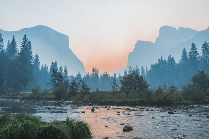
Forests and timber resources are linked to gold-bearing landscapes—restoration efforts require multidisciplinary intervention.
Restoration planning must address these legacy mining features to ensure hydrological stability and ecosystem health. Forest stewardship efforts often:
- ✔ Re-contour eroded terraces and tailings, restoring more natural slopes
- ✔ Establish vegetation corridors on and around former mining sites to reconnect wildlife routes and buffer watercourses
- ✔ Monitor for heavy metal uptake in forest soils and replant with suitable, resilient native species
In some cases, former gold mining sites are repurposed as protected habitat corridors or integrated into multi-benefit watershed management projects, strengthening both forest and downstream agricultural reliability.
🌱 Restoration Priorities in Gold-Rich Forests:
- 🟢 Tailings reshaping and vegetative covers
- 🟢 Native tree and grass reestablishment
- 🟢 Erosion control wetlands and riprap
- 🟢 Stream habitat improvement structures
- 🟢 Continued monitoring of water quality and soil health
Supporting Sustainable Forest Management
Our work leverages satellite data to help resource managers detect historical mine impacts, monitor reforestation progress, and guide smarter, landscape-scale restoration—ensuring California’s forests continue to provide ecosystem services for generations.
Map Your Mining Site Here: mining.farmonaut.com
Satellites Find Gold! Farmonaut Transforms Tanzania Mining | News Report

Mining and Infrastructure: How Gold Shapes California
Gold has not only influenced land and labor; it has also left a lasting imprint on infrastructure development across California. From the early wagon trails and railroads that followed gold belts, to today’s highways, pipelines, and powerlines, mineral-rich corridors have determined the layout of many rural and urban areas.
Infrastructure Patterns in Gold Districts
- ✔ Historic mining regions are crisscrossed by inherited transportation routes—many still used for agricultural input/output today
- ✔ Construction projects must account for ground stability—legacy mine tunnels or altered landscapes can increase foundation risks
- ✔ Power and water infrastructure frequently follows established gold-mining corridors, as these often provided the earliest access through remote forests and foothills
- ✔ Rural towns that grew around gold discoveries often became major supply hubs for the broader agricultural and forestry economy
Infrastructure in gold-rich zones continues to evolve alongside community needs, farming, and sustainable resource management—emphasizing the ongoing relevance of gold in regional development.
Satellites Spark a New Alaska Gold Rush

Environmental Restoration & Sustainable Land Stewardship
The convergence of gold mining, agriculture, forestry, and water management has spurred a new era of sustainable practices in California’s mineral-rich regions. Modern stewardship means balancing economic opportunity with environmental repair, soil protection, water quality, and community well-being.
Best Practices in Restoration and Resource Management
- ✔ Grading and Contouring old mine lands to mimic natural slopes, improving rainfall infiltration and reducing erosion
- ✔ Reestablishing Native Vegetation to bind soil, buffer waterways, and re-create lost habitat
- ✔ Wetland and Riparian Zone Creation for sediment trapping, water filtering, and aquifer recharge
- ✔ Ongoing Monitoring of Surface Water and Groundwater Quality near all former or active mine sites
- ✔ Heavy Metal and Acid Drainage Mitigation through bioremediation, buffer zones, and sediment control dams
Restoration is not a one-off project; it’s a long-term process to reduce ecosystem risk and maintain land productivity for crops, timber, and wildlife.
Our remote sensing and satellite-based monitoring provide objective, large-area data for restoration planning and progress tracking.
For efficient project scoping, try our Get Quote form to initiate your sustainable mining or land management journey.
Gold Rush Arizona 2025: History & Modern Gold Mining Revival | Ultimate Guide

Modern Mineral Discovery: Farmonaut’s Role in Satellite-Based Gold Exploration
Traditional mineral exploration in California’s gold belts relied on field surveys, drilling, and costly environmental disturbance. Modern technology—particularly our work at Farmonaut—brings a transformative approach, merging satellite-based mineral detection with artificial intelligence for faster, smarter, and more responsible mineral prospectivity mapping.
How We (Farmonaut) Enable Modern Discovery:
- ✔ Global-Scale Coverage: Screen tens of thousands of hectares for gold (or other minerals) leveraging hyperspectral and multispectral satellite data—across every district including California’s key belts
- ✔ Objective, AI-Driven Targeting: Identify mineralized zones, alteration halos, and geological patterns without introducing environmental risk to soil or water during discovery
- ✔ Time & Cost Savings: Shorten land assessment timelines from months/years to days (Get Quote)
- ✔ ESG-Aligned Approach: Our solutions produce no surface disturbance, minimize carbon footprint, and support responsible stewardship goals
How Farmonaut discovered Gold in Yemen

Our structured mineral intelligence reports integrate:
- ⭐ High-potential target zone maps
- ⭐ Georeferenced data for GIS compatibility
- ⭐ Interpretations of faults, alteration zones, and host rock associations
- ⭐ 3D prospectivity models (Premium+ users), supporting drilling and operational clarity
If you want to map your mining site for gold-bearing formations or heavy metal signatures, start with our intuitive tool: mining.farmonaut.com
- 📞 Contact Us for tailored consultancy on how satellite mineral detection can improve your agriculture, forestry, or mining operations health: farmonaut.com/contact-us
Comparative Impact Table: Gold Regions and Sector Impacts
For reference, explore the following comparative table. It illustrates estimated regional impacts of California gold districts across agriculture, mining, water quality, forestry, and sustainability—helping resource managers, investors, and landowners quickly assess relative sectoral impacts.
| Region/County | Amount of Gold Found (tons/ranking) | Impact on Agriculture | Water Quality Impact (Estimated Area sq. km) | Forestry Impact (Deforestation %) | Sustainability Initiatives |
|---|---|---|---|---|---|
| Mother Lode Belt (Sierra Nevada: Amador, El Dorado, Nevada, etc.) | >1,950 tons (Top 1) | High: Historic farmland converted, persistent soil & irrigation impacts | 2,500+ | 8–20% | ✔ Extensive wetland, riparian/soil restoration, state-funded |
| Klamath Mountains (Siskiyou, Trinity, Shasta) | 320 tons (Top 3) | Moderate: Rangeland disturbance, some cropland affected | 1,200+ | 12–20% | ✔ Selected reforestation & watershed protection programs |
| Central Valley Tributaries (Yuba, Feather, American rivers) | 230 tons (Top 5) | High: Extensive siltation in floodplains; crop shifts | >2,600 | 14–25% | ✔ Ongoing ag/wetland recovery and erosion control |
| Mojave Desert District (San Bernardino, Kern) | 180 tons (Top 6) | Low: Minimal modern agriculture | 220+ | 2–7% | ✔ Modern mine restoration attempts; regulatory oversight |
| Northern California Ancient Channels (Butte, Tehama) | 90 tons | Moderate: Past grain/rice land affected | 400+ | 8–14% | ✔ Targeted revegetation, floodplain stabilization |
Note: This table provides illustrative values based on published state statistics and environmental studies; field conditions are highly site-specific.
Key Insights, Pro Tips & Investor Notes
Historic gold mining districts overlay California’s most productive agricultural regions and influence water rights, irrigation patterns, and soil health.
Use satellite-based mapping for rapid screening of legacy mining impacts before purchasing or planning large land projects on or near old gold zones.
Ignoring deep-buried placer deposits during infrastructure planning can lead to unexpected soil stability and contamination issues.
Sustainability credentials are now central to land value in gold-rich counties; responsible restoration increases long-term regional resilience.
Persistent water/stormwater monitoring is key for forest and cropland stewardship—especially near re-mined or recently restored sites.
Top 5 Takeaways for Land and Resource Managers:
- ✔ Gold-rich regions remain hotspots for water, soil, and infrastructure interaction in California
- 📊 Data-driven (satellite) analysis reduces environmental risk and supports informed planning
- ⚠ Unmitigated gold mining legacy features can threaten land productivity & downstream health
- 💧 Integrated restoration (soil, forest, wetland) is key to sustainability in old mining areas
- 🛑 Proactive stewardship and remediation enhance land value and ecological resilience
Frequently Asked Questions
Where is gold found in California today?
While major gold rushes are a thing of the past, significant gold continues to be found in the Sierra Nevada foothills (Mother Lode), Klamath Mountains, Mojave Desert, and buried ancient river channels across the state. Modern methods also utilize satellite mineral intelligence to locate previously undetected deposits in regions overlapping with agriculture and forestry zones.
How does gold mining affect agriculture and forestry?
Gold mining can alter soils, water availability, and drainage patterns. Placer mining increases sediment and heavy metal loads in farm fields and irrigation canals. Lode mining can compact soil and affect forest regrowth. Sustainable management and restoration practices—such as contouring, revegetation, and ongoing monitoring—are necessary to maintain long-term productivity and resource health.
How can satellite data help detect gold deposits and assess mining impacts?
Satellite-based mineral detection—like that offered by Farmonaut—can identify mineralized zones using unique spectral fingerprints. This helps managers rapidly screen for gold without disturbing the land. Additionally, satellite-derived maps support detection of legacy mining impacts, such as altered drainage, vegetation stress, and soil composition changes, facilitating restoration and stewardship projects.
What is the future of gold mining in California with a focus on sustainability?
The future involves targeted, non-invasive mineral exploration using satellite and remote sensing data, paired with rigorous environmental restoration and management of legacy impacts. ESG credentials and water-soil-health stewardship are increasingly prioritized for all new and existing mining and land infrastructure developments.
Where can I get help mapping, monitoring, or restoring gold-impacted land?
You can Map Your Mining Site Here for gold or other minerals, get an expert Get Quote on mineral intelligence, or Contact Us for tailored analysis and support on any California land or project impacted by mining.
Conclusion: Sustainable Stewardship Where Gold and Growth Intersect
Where gold is found in California is a story of geology, human ambition, and environmental adaptation. The gold found near river channels, ancient rock formations, and forested hills continues to interface with California’s most vital sectors: agriculture, forestry, land management, water, and infrastructure.
Legacy mining features—from tailings ponds to altered floodplains—still influence soil and water quality for thousands of farms and forests. Effective stewardship, modern mineral intelligence, and proactive restoration are essential to maintain productivity and protect natural resources for future generations.
At Farmonaut, we harness satellite analytics to offer rapid, cost-effective, and non-invasive mineral detection and monitoring—a new era of exploration that aligns with sustainability, ecosystem health, and efficient land stewardship.
To learn more, Get Quote, Contact Us, or Map Your Mining Site Here. Let’s build a more sustainable, data-driven approach to California’s golden legacy, ensuring that resource development and land management go hand in hand for the benefit of all stakeholders—today and tomorrow.
Further Reading:
- Satellite Based Mineral Intelligence Overview: farmonaut.com/satellite-based-mineral-detection
- Learn about Satellite Driven 3D Mineral Prospectivity Mapping: View PDF
Unlock the true potential of your land—Gold, growth, and green stewardship can coexist with the right data and vision.

 SMA Investments Ltd
 NTS Group (Pty) Ltd
 Mine4Africa
 Lithspo Minerals Limited
 Tintina Mining Group
 Dalgety Minerals Pty Ltd
 Vortex Minerals Pty Ltd
 Faith At Work (Pty) Ltd
 Geotech Mining Solutions plc
 Vulcan International Limited
 Kidepo Associates
 GKY Mining
 Alkimy SARL
 Double A Trading
 GemSprout Metals Limited
 Qader Group
 Ileys General Trading
 SG Gold Mining LLC
 VRV Global Pte Ltd
 Omsri International FZE
 G.I.T.T.
 Jaunita Erss Ltd
 Almosi SARL
 SRK Consulting
 Berks Gold Limited
