Top 7 Advantages of Remote Sensing in Agriculture for 2025
Table of Contents
- Introduction to Remote Sensing in Agriculture 2025
- What is Remote Sensing?
- Interesting Trivia: Remote Sensing in Agriculture
- Comparative Advantages Table
- 1. High-Resolution Crop Monitoring and Health Assessment
- 2. Enhanced Precision Irrigation & Water Management
- 3. Data-Driven Pest and Disease Detection
- 4. Accurate Yield Prediction and Forecasting
- 5. Comprehensive Soil Mapping and Fertility Insights
- 6. Sustainable Land Use & Environmental Management
- 7. Cost Savings & Risk Reduction for Farmers
- Farmonaut: Democratizing Remote Sensing Technology
- Farmonaut Subscription Plans & Solutions
- Frequently Asked Questions (FAQ)
- Conclusion: The Future of Remote Sensing in Agriculture
Introduction to Remote Sensing in Agriculture 2025
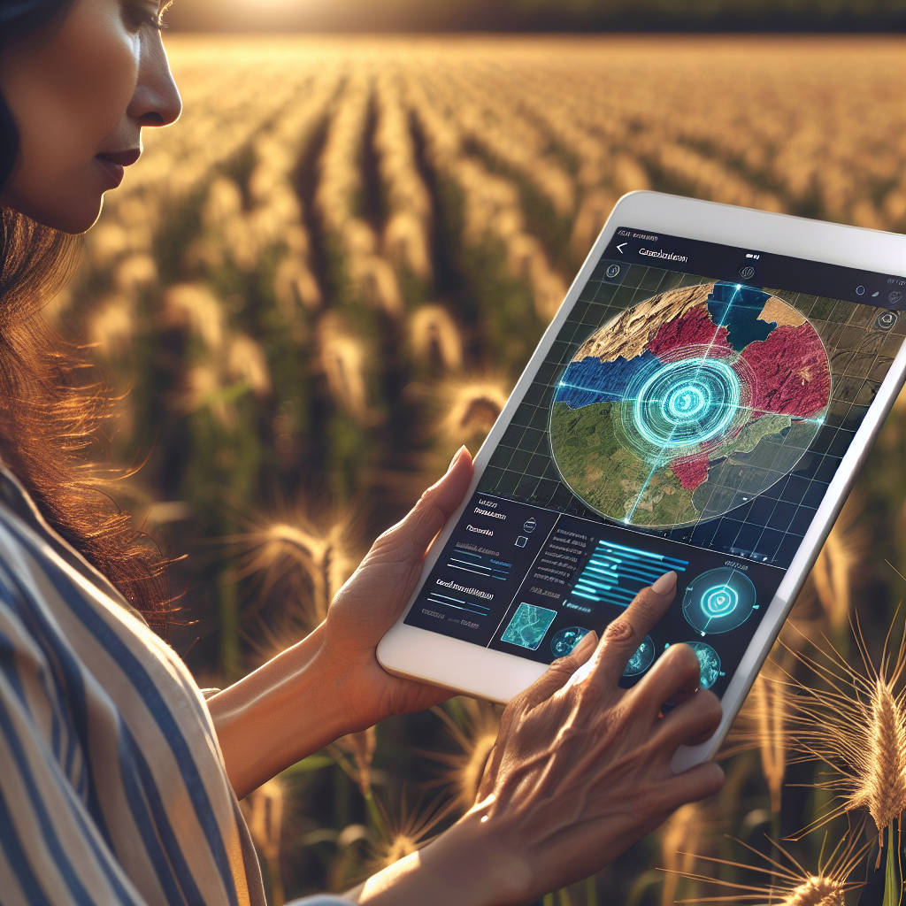
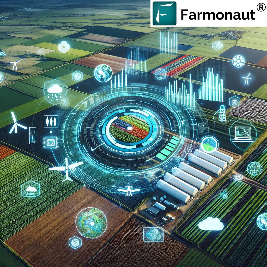
In recent years, the agricultural sector has witnessed a technological transformation like never before. The advantages of remote sensing in agriculture have propelled farming towards a new era—marked by data-driven decision making, real-time monitoring, and precision management. As we advance into 2025, the integration of drone remote sensing in agriculture alongside traditional satellite-based systems is set to revolutionize how farmers monitor crops, manage resources, and optimize yields.
Remote sensing technology offers modern farming practices new ways to observe and interpret conditions across vast agricultural landscapes without physical contact. The combination of satellites, drones, AI, and cloud-based analytics ensures we’re not only meeting today’s food demand, but also enhancing sustainability for the future.
This article explores the top 7 advantages of remote sensing in agriculture for 2025, highlighting its critical role in precision farming, sustainable land management, and addressing the growing challenges of climate change, resource optimization, and global food security.

What is Remote Sensing?
Remote sensing refers to the acquisition of information about the Earth’s surface without physical contact, typically using satellites, aircraft, or drones equipped with specialized sensors. In agriculture, this means gathering critical data on crop health, soil conditions, water availability, and pest infestations—all enabling farmers to make informed decisions in real time.
The importance of remote sensing in agriculture cannot be overstated as we step into 2025. Unlike manual scouting, remote sensing systems can deliver timely, high-resolution data over large areas, ensuring scalability and cost efficiency—an essential advantage as farms continue to grow in both size and complexity.
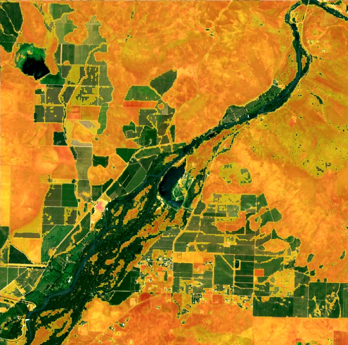
- Satellite Imagery: Wide-area coverage and trend identification.
- Drone Remote Sensing: Flexible and on-demand high-resolution field analysis.
- AI and Machine Learning: Enhance analytics, automate discovery of patterns and anomalies.
Modern remote sensing technology can be combined with carbon footprint monitoring solutions, actionable large-scale farm management platforms, and advanced traceability tools to provide unmatched transparency and efficiency throughout the agricultural value chain.

Comparative Advantages Table: Top 7 Advantages of Remote Sensing in Agriculture
| Advantage | Description | Estimated Impact (2025) | Example Application |
|---|---|---|---|
| High-Resolution Crop Monitoring | Detailed, real-time data on crop health, plant growth, and nutrient status across vast areas | Up to 15% yield improvement | Satellite & drone-based NDVI crop health maps |
| Precision Irrigation & Water Management | Optimized irrigation using soil moisture, weather, and evapotranspiration data | 20% water savings potential | Automated irrigation scheduling based on satellite and drone soil maps |
| Pest & Disease Detection | Early identification of infestations or infections using multispectral imagery | 10-30% reduction in crop loss | Drones flagging pest hotspots for targeted spraying |
| Yield Prediction & Forecasting | Proactive harvest and supply chain planning through predictive analytics | 5-20% improved harvest timing and logistics | Satellite analysis of phenological stages for yield modeling |
| Comprehensive Soil Mapping | Detailed assessment of soil moisture, organic matter, and fertility zones | Up to 25% increase in fertilizer use efficiency | Drone-enabled soil health maps guiding nutrient application |
| Environmental & Land Use Monitoring | Tracking ecosystem health, deforestation, and land degradation | 15-40% more effective conservation measures | Satellite monitoring for sustainable agroforestry programs |
| Cost & Risk Reduction | Real-time detection of threats to minimize input costs and insurance claims | 5-20% lower operational expenses | Remote crop damage assessment for insurance and loans |
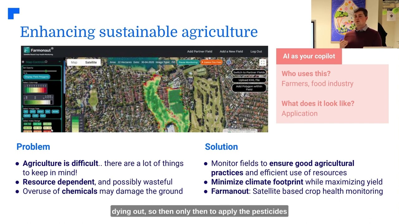
1. High-Resolution Crop Monitoring and Health Assessment
The primary advantage of remote sensing in agriculture is its ability to deliver high-resolution, timely data about crop health across large areas—a task that would be impossible or prohibitively expensive to achieve manually.
- Satellite imagery provides a bird’s-eye perspective, enabling trend analysis and early anomaly detection.
- Drone remote sensing in agriculture offers flexible aerial surveys with higher spatial resolutions compared to satellites, ideal for precision interventions.
- Multispectral, hyperspectral, and thermal cameras detect subtle variations—such as nutrient deficiencies, diseases, and water stress—that are invisible to the naked eye.
This real-time monitoring capability allows farmers to make informed decisions on when and how to intervene, facilitating targeted action that reduces input costs and increases crop productivity.

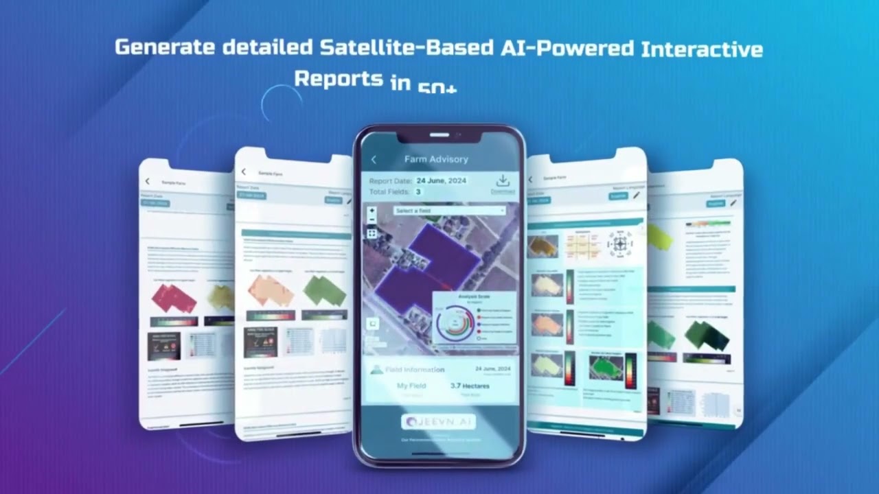
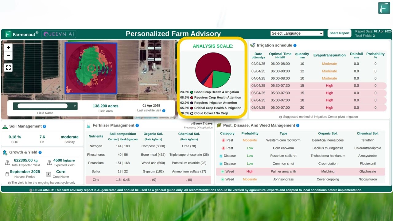
For advanced, affordable, satellite-driven crop health monitoring services, check out the Farmonaut Crop Plantation/Farm Advisory Platform.
Key Takeaways:
- Fix problems before they escalate with early detection of nutrient or water stress using satellite and drone data.
- Monitor crops in real time across diverse and remote locations.
- Boost yields by up to 15% with timely interventions.
2. Enhanced Precision Irrigation & Water Management
Water scarcity is among the greatest challenges facing agriculture in 2025. Remote sensing in agriculture makes it possible to assess soil moisture, evapotranspiration rates, and weather patterns—providing a precise guide for irrigation management.
- Optimize water usage and reduce waste by irrigating fields according to actual plant and soil needs.
- Advanced drones and satellites detect dry spots and overwatered areas, allowing for zone-specific irrigation.
- Integration of real-time weather data further enhances scheduling to minimize water loss.
Implementing remote sensing-based irrigation practices can increase water-use efficiency by up to 20%, supporting environmental sustainability and resource conservation.
Discover how integrated water and crop management solutions with Farmonaut’s Large-Scale Farm Management App can revolutionize your yields and sustainability efforts.
3. Data-Driven Pest and Disease Detection
Pest infestations and plant diseases can devastate crops when not managed proactively. The role of remote sensing in agriculture is critical in early identification of such threats, facilitating targeted, cost-effective interventions.
- Use multispectral and thermal imagery from drones and satellites to spot subtle changes in crop reflectance caused by pests or pathogens.
- Monitor patterns of spread over time to optimize pesticide application, minimize overuse, and protect beneficial organisms.
- Automated anomaly detection with AI reduces the need for extensive manual scouting.
The benefits of remote sensing in agriculture for pest and disease management go beyond immediate crop protection—they include lower input costs, reduced crop loss, and improved food safety.
Looking for a reliable system to monitor pest risks and minimize damages? Explore Farmonaut’s Crop Loan and Insurance remote sensing applications, which leverage satellite verification as objective proof of crop losses for financial protection.
Highlights:
- Automated alerts for pest/disease spread minimize yield loss and chemical use.
- AI-powered analysis supports smarter resource allocation.
4. Accurate Yield Prediction and Forecasting
As food supply chains become increasingly complex, accurate yield prediction is absolutely vital. Remote sensing in agriculture allows for the estimation of yield potential by analyzing vegetation indices, phenological stages, weather data, and historical trends.
- Early forecasts enable optimized harvest planning, storage logistics, and timely market access.
- Predictive analytics using remote and AI data can improve harvest timing and reduce both surplus and shortage risks.
- Yield estimates help manage supply contracts and enhance farmer-buyer trust.
For robust traceability and forecasting, Farmonaut’s Blockchain Traceability platform offers full supply chain transparency—from field to shelf—improving trust and quality control.
Key Steps Enabled by Remote Sensing:
- Monitor phenological crop stages and seasonality remotely.
- Integrate remote data with price and supply forecasts.
- Identify regions with higher or lower yield potential immediately.
5. Comprehensive Soil Mapping and Fertility Insights
Soil health is the foundation of long-term agricultural productivity and sustainability. Remote sensing in agriculture enables the mapping and assessment of soil conditions such as moisture, texture, organic matter content, and even salinity.
- Combine satellite imagery and drone remote sensing to generate detailed soil health maps.
- Guide precise fertilizer applications to optimize input use and reduce costs.
- Identify soil degradation trends and monitor restoration impacts over time.
Well-mapped soil variability leads to targeted treatments—helping conserve resources, safeguard the environment, and boost plant health.
Get started with Farmonaut’s Satellite Crop Management API to integrate advanced soil and field mapping insights directly into your agri-tech solutions or farm management platforms.

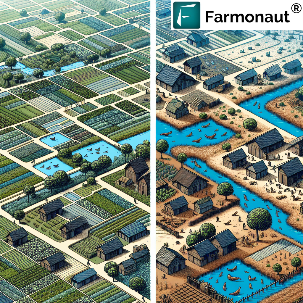
6. Sustainable Land Use & Environmental Management
With rising climate volatility and the push for more sustainable agriculture, remote sensing in forestry and environmental management is paramount. These technologies track changing land use patterns, monitor ecological health, and detect illegal deforestation or encroachments.
- Enables balancing tree cover and crop production in agroforestry systems.
- Supports carbon footprinting initiatives for farms and agribusinesses.
- Promotes biodiversity conservation and prevention of land degradation.
Interested in reducing your farm’s environmental impact? Try Farmonaut’s Carbon Footprinting Monitoring solutions for actionable, satellite-driven insights.
Examples:
- Satellite imagery spots unauthorized land clearing and alerts land managers.
- Drone surveys map reforestation and soil restoration progress on large areas.
7. Cost Savings & Risk Reduction for Farmers
Remote sensing in agriculture delivers substantial economic benefits by reducing input costs, improving resource efficiency, and supporting risk-mitigation schemes such as crop insurance.
- Insurance providers use remote crop data to process damage claims faster, providing swift compensation to farmers.
- Satellite-verified information underpins reliable loan processes for smallholder farmers, driving financial inclusion.
- Fleet management and resource optimization reduce machinery downtime and labor costs.
To streamline operations and reduce operational expenses, explore Farmonaut’s Fleet and Resource Management tools which leverage satellite insights for agriculture.
In Summary:
- Automated, objective data reduces manual labor and associated costs.
- Insurance and loan verification is faster and more reliable.
- Input efficiency and precise interventions translate into real cost savings.
Farmonaut: Democratizing Remote Sensing Technology in Agriculture and Beyond
At Farmonaut, we are committed to making satellite-driven insights affordable and accessible for everyone—from individual farmers to large agribusinesses and government institutions. By leveraging remote sensing technologies, our platform supports real-time crop and resource monitoring, AI-powered advisories, blockchain-based traceability, and environmental impact tracking.


- Jeevn AI Advisory System: Delivers real-time weather forecasts and tailored crop strategies using AI and satellite data.
- Fleet and Resource Management: Optimize logistics for field operations and equipment fleet tracking.
- Traceability & Blockchain: Trace every stage of the crop’s journey for enhanced supply chain integrity.
- Environmental Impact Monitoring: Reduce your operation’s carbon footprint with actionable, satellite-based insights.
For API integration and developer resources, access the API Developer Docs.
Farmonaut Subscription Plans & Solutions
Farmonaut operates on a flexible, subscription-based model—making high-tech remote sensing solutions accessible at scale. Choose the plan best suited to your agricultural needs and embrace data-driven decision making in 2025.
Frequently Asked Questions (FAQ)
-
Q1: What is remote sensing in agriculture and why is it important for 2025?
Remote sensing in agriculture refers to the acquisition of information about crops, soil, and farmland conditions without physical contact, typically using satellites or drone-based sensors. In 2025, it is indispensable for farmers due to its ability to provide real-time, actionable data over vast areas, helping manage resources, boost yields, and enhance sustainability—a necessity in the face of climate change and food demand.
-
Q2: What are the main benefits of drone remote sensing in agriculture?
Drone remote sensing enables high-resolution, on-demand field analysis that satellites alone cannot provide. It helps identify early-stage crop stress, pest infestations, and nutrient deficiencies, enabling targeted intervention and reducing losses.
-
Q3: How does remote sensing support sustainable farming practices?
Through precise monitoring of water, soil, and weather conditions, remote sensing reduces input waste and promotes resource efficiency. It also supports environmental monitoring and traceability, essential for sustainability compliance and carbon footprinting.
-
Q4: Can remote sensing technology replace manual farm inspections?
While remote sensing drastically reduces the need for manual scouting, it is most effective when complemented by ground truthing. The synergy enables faster, more accurate, and large-scale crop management.
-
Q5: How can farmers access remote sensing solutions?
Farmers can access remote sensing insights via dedicated apps and platforms like Farmonaut’s Android, iOS, and browser applications, as well as API integrations for business and government use cases.
-
Q6: What is the impact of remote sensing on crop insurance?
Remote sensing provides objective and transparent data for crop loss verification, streamlining claim processes for insurance providers and enabling prompt compensation.
-
Q7: Is remote sensing costly for smallholder farmers?
With innovations from companies like Farmonaut, satellite and drone data is becoming increasingly affordable, allowing even smallholder farmers to benefit from advanced monitoring systems.
Conclusion: The Future of Remote Sensing in Agriculture
As 2025 unfolds, the advantages of remote sensing in agriculture have evolved from a competitive edge to an indispensable tool for every farmer, agribusiness, and policymaker. With the convergence of drone technology, AI-driven analytics, and high-frequency satellite data, the sector is witnessing a critical shift towards precision, sustainability, and data-centric planning.
By addressing core challenges in crop health monitoring, resource efficiency, yield forecasting, soil management, and environmental conservation, remote sensing empowers decision makers to optimize productivity and build climate resilience. Beyond just “watching fields,” this technology enables a paradigm shift—championing smarter, cleaner, more equitable agricultural practices worldwide.
At Farmonaut, we champion the use of affordable satellite-driven insights and drone remote sensing technologies to help businesses, users, and governments alike monitor, manage, and enhance agricultural outputs in real-time.
Ready to join the agricultural innovation revolution?
For advanced analytics and integrations, discover our Farmonaut Satellite Crop Management API and developer documentation.
Remote sensing in agriculture is not just an evolution—it’s a revolution. The future belongs to those who harness these systems to monitor, manage, and optimize yield—making every square meter of land count.
Let’s build a sustainable agricultural future—empowered by the transformative potential of remote sensing technology!