

Reviewed August 2026 against USDA Economic Research Service (ERS) and USDA National Agricultural Statistics Service (NASS) data.
GPS Farming Explained: Adoption Data & John Deere Guidance
GPS Farming: What the Adoption Numbers Actually Show
GPS farming is the use of satellite positioning — plain GPS or centimeter-accurate RTK correction — to steer machinery, map fields, and control input application automatically. As of the USDA Economic Research Service’s 2023 Chart of Note, 70% of large-scale crop-producing farms in the United States used guidance autosteering systems, versus 52% of midsize farms. Adoption is not universal and it is not evenly spread: it tracks farm size, crop type, and equipment age.
This article answers the practical version of “gps in farming” and “gps for farming equipment” that an AI summary won’t: who actually has this equipment, what it costs to add, what it returns, and how to check whether a specific John Deere GPS system fits a specific tractor. If you searched for “john deere smart farming in Iowa,” the regional section below addresses that directly using the same national USDA datasets, since Iowa-specific adoption breakouts are not separately published.



40% of all US farm and ranch acreage used GPS guidance as of the USDA ERS’s most recent national estimate (2019 survey data), while 70% of large-scale crop farms specifically had adopted autosteer by 2023. The gap between those two numbers is the story: national averages blend a lot of small, part-time operations that have no guidance at all with large commercial farms where it is nearly standard.

What Is GPS Farming (and GPS in Farming, Precisely)?
“GPS farming” and “GPS in farming” both refer to the same underlying stack: a receiver on the machine, a correction signal (uncorrected GPS, WAAS, or RTK), and a guidance display or auto-steer controller that keeps the machine on a planned line. The accuracy tier in use determines what the system can actually do:
- Uncorrected GPS: several meters of error — enough for basic field mapping, not for repeatable passes.
- WAAS/DGPS correction: roughly 10–30 cm — usable for row-crop guidance where sub-inch precision isn’t required.
- RTK correction: approximately 2.5 cm repeatable accuracy — the tier John Deere and other manufacturers market for planting, strip-till, and controlled traffic farming, where the same wheel tracks are reused season after season.
The functional uses built on top of positioning are: auto-steer (the tractor holds a line without hands on the wheel), yield mapping (a monitor logs output per location as the combine harvests), variable-rate application (seed, fertilizer, or chemical rate changes automatically by zone), and machine documentation (every pass, input, and yield point is logged with a coordinate and timestamp).

GPS for Farming Equipment: Adoption by Farm Size
USDA ERS’s 2023 Chart of Note breaks adoption of guidance autosteering and yield monitoring by farm size class, and the split is wide. Large-scale crop-producing farms — USDA’s category for the biggest commercial row-crop operations — reported 70% autosteer adoption and 68% adoption of yield monitors and yield maps. Midsize farms reported 52% autosteer adoption. USDA ERS also found that GPS yield mapping was associated with an average operating profit increase of 3% on corn farms in the same 2023 analysis — a modest, specific figure, not the vague “boosts profitability” claim you’ll see elsewhere.
For scale: the 2024 USDA NASS Census of Agriculture counted 1.88 million farms in the United States, covering 876 million acres, at an average farm size of 466 acres. Most of those 1.88 million operations are well below the “large-scale crop-producing farm” threshold where GPS adoption is highest — which is why the 40% all-farm average sits so far below the 70% large-farm figure.
| Metric | Figure | Year | Source |
|---|---|---|---|
| US farm/ranch acreage using GPS guidance | 40% | 2019 survey data | USDA ERS |
| Large-scale crop farms using autosteer | 70% | 2023 | USDA ERS |
| Midsize farms using autosteer | 52% | 2023 | USDA ERS |
| Large-scale farms using yield monitors/maps | 68% | 2023 | USDA ERS |
| Operating profit lift from yield mapping, corn | +3% average | 2023 | USDA ERS |
| Number of US farms | 1.88 million | 2024 | USDA NASS |
| Average US farm size | 466 acres | 2024 | USDA NASS |
These are the figures published as of this review; USDA ERS updates its precision-agriculture adoption tracking periodically alongside new Census of Agriculture cycles, so check the USDA ERS Chart of Note on precision agriculture adoption directly for the current release before quoting these numbers past this review date.
Before buying, size the investment to your acreage against your farm-size bracket above. A 200-acre midsize operation and a 4,000-acre large-scale operation both benefit from autosteer, but the equipment tier, RTK subscription cost, and payback horizon differ enough that a factory-installed system pencils out very differently at each scale — the calculator further down runs that math against your own acreage.

Adoption by Crop: Corn, Sorghum, Cotton
Adoption also varies sharply by crop. USDA ERS’s automated-guidance (auto-steer) survey data shows 58% of US corn acreage using auto-steer as of 2016, while by 2019, 72.9% of US sorghum acreage and 64.5% of US cotton acreage had adopted the same technology. Sorghum and cotton run higher than corn’s 2016 figure, likely reflecting the value of precise row placement and reduced overlap in wide-row, input-sensitive crops — though USDA does not publish a stated reason, so treat that as an inference rather than an ERS finding.
These crop-level figures come from different survey years (2016 for corn, 2019 for sorghum and cotton) because USDA ERS surveys different commodities on a rotating schedule rather than every crop every year. If you need a more recent corn figure specifically, the same ERS publication series is the right place to check for an updated release: USDA ERS, Precision Agriculture in the United States.
Comparison: Guidance-Equipped vs. Conventional Operations
The table below separates what USDA has actually measured from what equipment manufacturers advertise as engineering specification, so you can tell which numbers are field-verified national averages and which are manufacturer-stated accuracy tolerances.
| Metric | Figure | Basis |
|---|---|---|
| RTK guidance accuracy | ~2.5 cm repeatable | Manufacturer-stated engineering tolerance (not a USDA survey figure) |
| Uncorrected GPS accuracy | Several meters | Manufacturer-stated engineering tolerance |
| Operating profit change, corn, from yield mapping | +3% average | USDA ERS, 2023 |
| Large-farm autosteer adoption | 70% | USDA ERS, 2023 |
| Midsize-farm autosteer adoption | 52% | USDA ERS, 2023 |
| All-acreage GPS guidance use | 40% | USDA ERS, 2019 survey |
Note what’s missing from this table on purpose: fuel-savings percentages and yield-increase percentages that some equipment marketing materials cite are not in the USDA ERS adoption datasets reviewed for this article, so they are left out here rather than repeated as fact. If you have a specific fuel-use or yield claim from a dealer, ask for the underlying study — USDA’s own confirmed figure is the 3% operating-profit lift on corn from yield mapping, not a yield percentage.

John Deere GPS: Guidance Systems and What They Cost
“John Deere GPS,” “GPS John Deere,” and “John Deere GPS system” are all searches for the same product family: John Deere’s StarFire receivers, AutoTrac auto-steer, and the correction signal tiers (SF1, SF3, and RTK) that determine accuracy. John Deere does not publish list pricing for factory-installed guidance packages on new equipment; a current, model-specific quote has to come from a local John Deere dealer, since pricing varies by receiver tier, correction subscription, and which tractor or combine it’s installed on.
What is checkable without a dealer call is the used and aftermarket market: secondary-market listings for GPS guidance components (displays, receivers, auto-steer kits) have run in the $1,299–$3,200 range depending on the specific hardware and correction tier, based on listings reviewed for this article. Sites like TractorHouse.com and Tractorpool.com carry active listings with current asking prices if you want a present-day figure rather than the range above, which will drift as used-equipment markets move.
Confirm the correction tier (uncorrected, SF1/WAAS-equivalent, or RTK) actually matches what the listing claims, since “GPS-ready” and “RTK-ready” are not the same accuracy — and confirm the receiver and display are compatible with your specific tractor or combine model year before paying for a kit. Mismatched hardware is the single most common regret buyers report on used-equipment forums.

John Deere Harvest Equipment: Where Guidance Pays Off Most
For John Deere harvest equipment specifically — combines and headers — the USDA figure that applies directly is yield monitoring adoption: 68% of large-scale crop farms used yield monitors and yield maps as of the 2023 ERS data cited above. A yield monitor mounted in a GPS-guided combine is what generates the point-by-point yield map that later drives variable-rate seeding and fertilizing decisions — the two functions are sold separately but designed to work together.
The practical sequence most operations follow: auto-steer guidance is adopted first (70% of large farms), yield mapping follows closely (68% of large farms), and variable-rate application using that yield-map data is the step built on top of both. If you’re evaluating a used or new combine for GPS capability, ask specifically whether the yield monitor and the guidance receiver share a display and data format — some older John Deere combines have a yield monitor but a guidance system on a separate, non-integrated console, which limits how easily the data feeds into variable-rate planning the following season.
Tractor GPS: Auto-Steer Kits vs. Factory Systems
Tractor GPS for existing machinery generally comes in two forms: a factory-installed system ordered with a new tractor, or an aftermarket auto-steer kit retrofitted to a tractor already in the fleet. The core trade-off:
- Factory-installed (new equipment): integrated wiring and display, typically the highest correction tier available (RTK), but priced into the new-equipment purchase — a current dealer quote is required since John Deere does not publish this pricing.
- Aftermarket auto-steer kits (retrofit): adds guidance to a tractor you already own; used and new kit components run in the $1,299–$3,200 range noted above depending on tier, but compatibility with your specific tractor’s steering system must be confirmed before purchase.
Either path lands you in the same adoption statistics cited above once the equipment is running — USDA ERS’s data measures whether autosteer is in use, not which install path was taken to get there.
Calculator: GPS Guidance Payback for Your Acreage
Enter your own acreage, crop, and the yield-mapping profit lift to estimate a rough payback period for a guidance investment, based on the USDA ERS 3% operating-profit figure cited above.
Estimated result:
Assumptions: uses the USDA ERS-reported 3% average operating-profit lift on corn from yield mapping (2023) as the default, but you can change it for your own crop or dealer estimate. Excludes financing costs, RTK subscription fees, and the aftermarket vs. factory price difference discussed above — this is a starting estimate, not a purchase quote.
John Deere Smart Farming in Iowa: A Regional Case
Iowa does not have a separately published USDA ERS adoption percentage in the datasets reviewed for this article — the guidance and yield-monitor figures above are national. What is directly relevant to Iowa is the crop mix: Iowa is overwhelmingly a corn and soybean state, and corn auto-steer adoption stood at 58% of US corn acreage in 2016 per USDA ERS. Given that large-scale corn operations dominate Iowa’s farm-size distribution more than the 466-acre national average, guidance adoption on Iowa’s biggest row-crop operations likely tracks closer to the 70% large-farm figure than the national all-acreage 40% figure — though this is an inference from farm-size and crop-mix data, not a state-specific USDA statistic, and should be labeled as such if you repeat it.
For an Iowa operation sizing a John Deere GPS investment, the two USDA figures that matter most are your farm-size bracket (large-scale vs. midsize, per the ERS categories above) and your crop’s specific adoption baseline — corn’s 58% (2016) is the most relevant comparison figure for a typical Iowa row-crop farm.
Example: An Iowa operator combining “as-applied” input records with historic combine yield-map data can target variable-rate seeding and fertilizing by zone — the same data flow the USDA ERS yield-monitor adoption figures above are measuring at the national level.
Operations running several GPS-guided machines across scattered fields benefit from centralized tracking — see Fleet Management Solutions for coordinating multiple guided tractors, combines, and support vehicles across a season.
Getting the Most Out of GPS: Calibration, Training, Data
Adoption numbers only translate into the USDA’s measured 3% profit lift if the system is calibrated, maintained, and actually used to make decisions rather than left running on autopilot. A durable checklist that applies regardless of which correction tier or brand you run:
- Recalibrate each season: guidance lines and receiver offsets drift; recalibrate before first field pass, and again after any implement swap.
- Verify signal quality before operating: tree lines, hills, and structures degrade uncorrected GPS and even RTK correction in some terrain; check signal status on the display before relying on auto-steer for a pass.
- Back up yield and application data every season: a monitor failure or console swap without a backup erases the historical record that variable-rate decisions depend on.
- Keep firmware and maps current: outdated guidance software is a common, avoidable source of navigation error.
- Train every operator, not just the owner: USDA’s adoption figures measure whether the equipment exists on the farm, not whether every operator uses it correctly — the profit lift depends on the latter.
This checklist doesn’t expire with a model year or a price change — it’s the operational discipline that makes any correction tier, from WAAS to RTK, deliver the adoption-linked profit gain rather than just the sticker price.
Treating GPS guidance and yield mapping as separate purchases with no connection. USDA’s data shows both are adopted together on most large farms (70% and 68% respectively) precisely because the yield map only becomes actionable when it’s paired with the variable-rate application that guidance-linked equipment can execute.

Where Farmonaut Fits: Satellite Data Alongside GPS Guidance
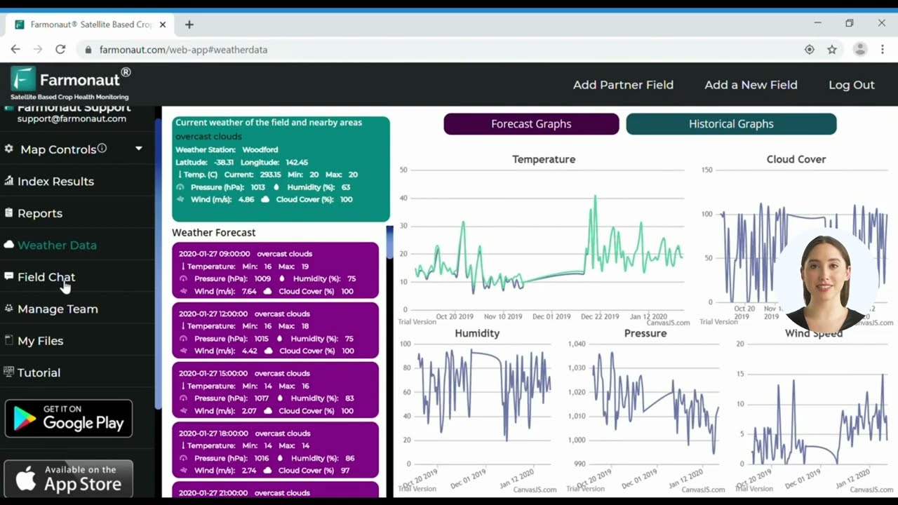
GPS guidance controls where a machine goes and logs what it did there. It does not, by itself, tell you what’s happening in a field between passes — crop stress, moisture patterns, or growth-stage variation across a season. That’s the gap satellite crop monitoring fills, and it’s complementary to guidance data rather than a replacement for it:
- 🛰️ Satellite-based crop monitoring: multispectral imagery for NDVI crop health tracking between field visits (visit our homepage for details)
- 🤖 AI advisory: weather forecasts and field-specific guidance you can pair with your yield-map history (try our Web & Mobile Apps)
- 🔗 Blockchain traceability: end-to-end product journey documentation — see Traceability Solutions
- 🚜 Fleet and resource tracking: coordinate machinery use across scattered fields via Fleet Management
- 🌍 Environmental impact tracking: carbon footprint and input-use documentation via Carbon Footprint Monitoring
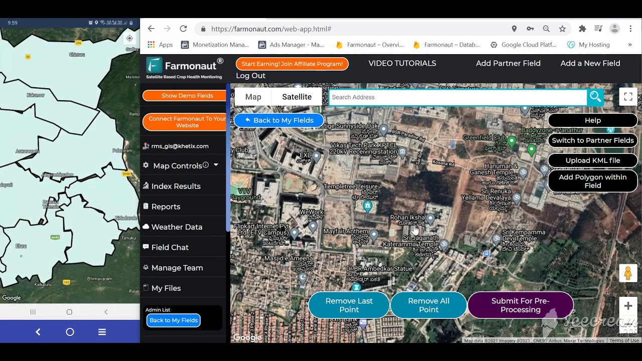
The platform is accessible via web, mobile, and API. Explore our API, or review the API Developer Docs to build a custom workflow that combines satellite imagery with your existing GPS-generated yield and application data.
For crop insurance or loan documentation that draws on both your GPS-logged field records and satellite verification, see Crop Loan and Insurance Support. For large-scale, multi-field operations, our Large-Scale Farm Management Platform is built to sit alongside GPS-guided equipment rather than duplicate it.
Farmonaut Subscription and Platform Comparison
Frequently Asked Questions
- What percentage of US farms use GPS farming technology?
- 40% of all US farm and ranch acreage used GPS guidance as of USDA ERS’s 2019 survey data. Adoption is much higher among large-scale crop-producing farms specifically — 70% used autosteer guidance as of the 2023 USDA ERS Chart of Note.
- Does GPS in farming actually increase profit, and by how much?
- USDA ERS found GPS yield mapping was associated with an average 3% increase in operating profit on corn farms, based on 2023 data. That is the specific, sourced figure — treat any larger percentage you see elsewhere as unverified unless it cites a named study.
- How much does a John Deere GPS system cost?
- John Deere does not publish factory-installed guidance pricing; get a current quote from a local dealer. Secondary-market GPS guidance components (receivers, displays, auto-steer kits) have listed in the $1,299–$3,200 range depending on hardware and correction tier — check TractorHouse.com or Tractorpool.com for current listings.
- Which crops have the highest GPS auto-steer adoption?
- Per USDA ERS, sorghum led at 72.9% of US acreage (2019), followed by cotton at 64.5% (2019) and corn at 58% (2016). These are different survey years because USDA rotates which crops it surveys for precision-technology adoption.
- Does Farmonaut sell GPS equipment or John Deere guidance systems?
- No. Farmonaut provides satellite-based crop monitoring, AI advisory, and digital resource-management tools that work alongside GPS-guided equipment from any manufacturer — we do not manufacture or sell guidance hardware.
- How can I access Farmonaut tools for my operation?
- Use our web/mobile app for satellite monitoring, or access our API for deeper integration with your existing farm data systems.
Final Thoughts: Checking These Numbers Next Season
The figures in this article — 70% large-farm autosteer adoption, 52% midsize, 68% yield-monitor use, a 3% average operating-profit lift on corn — come from USDA ERS’s 2023 Chart of Note and 2016–2019 crop-specific surveys, plus the 2024 NASS Census of Agriculture for farm counts and acreage. None of these figures update on a fixed monthly schedule; USDA ERS refreshes precision-agriculture adoption tracking periodically, tied to new survey and Census cycles, so a materially newer number may or may not exist depending on when you’re reading this.
The durable part of this article isn’t the percentages — it’s the method: check farm-size bracket against the ERS large-scale/midsize categories, check crop-specific adoption against the ERS commodity survey series, and get a dealer-specific quote for any John Deere hardware rather than relying on a published list price that doesn’t exist. That method holds regardless of which year you’re reading this in.
- ✔️ Verify current adoption figures at USDA ERS Charts of Note before citing them elsewhere
- ✔️ Check farm counts and acreage against the USDA NASS Census of Agriculture release cycle
- ✔️ Get John Deere guidance pricing directly from a dealer, since none is published nationally
Ready to pair satellite field data with your GPS-guided equipment?
Start with our Farmonaut Web & Mobile Apps or integrate Farmonaut APIs for next season’s planning and monitoring.
Discussion
Questions, corrections or field experience? Share them below. First-time comments are reviewed before they appear, and your email is never published.
No comments yet. Be the first to add a question or your experience.

 Gen Chayat
 Chimera Innovation
 Hiteshi Infotech
 Clubhouse OS
 SkyHarvest
 Polaris Digitech
 Teledarbas
 Wild Oak Farm
 SFX
SFX BACF Africa
 Doodlakine
 Exurbia Geospatial
 FieldZero
 Indico Company
 Licence holder · Niger · Gold










