

Reviewed August 2026 against USDA NASS/ERS, NCDA&CS, and ASFMRA data.
Try it: Run your own numbers →
Farm Drone Services, Ag Management & Appraisal Services: What They Cost and Who Provides Them
Farm drone services run about $5–$20 per acre for imaging and scouting, with agricultural aircraft operators quoting separately for spray work. Full farm management companies typically bill against a percentage of gross farm revenue that the company discloses in its own fee schedule — there is no single published national rate, so you request it in writing before signing. Appraisal turnaround for a professionally documented farm valuation runs days to a few weeks depending on the appraiser’s caseload and whether machinery and improvements need separate inspection. Below, each of these — drone services, ag/farm management, and appraisal — is broken out with the regulatory requirements, cost structure, and a calculator so you can price your own acreage instead of a generic estimate.
Table of Contents
- 1. Why Farm & Ag Management Services Matter Right Now
- 2. Ag Management Services vs. Farm Management Services vs. Appraisal: What’s Actually Different
- 3. Farm Drone Services: FAA Rules, Costs & What’s Included
- 4. Appraisal Services: Farmland and Asset Valuation
- 5. How to Choose a Farm Management Services Company
- 6. Cost Calculator: Management Fees & Drone Services
- 7. The “20% of North Carolina’s Workforce” Claim, Checked
- 8. Farm Management Services in Fishers, IN & Lebanon, IN
- 9. Satellite Tools Behind Modern Farm Management
- 10. Farmonaut Subscription Plans
- 11. Frequently Asked Questions
- 12. Conclusion
- Try it: Run your own numbers
Why Farm & Ag Management Services Matter Right Now
The U.S. had 1.88 million farms in 2024 — the lowest count in more than a century — down from 2.04 million in 2017 and 1.90 million in 2022, according to the USDA Economic Research Service. The average farm grew to 466 acres in 2024, about 6% larger than the 440-acre average recorded in the early 1970s. Fewer, larger operations is exactly the condition that makes professional ag management services, farm management services, and appraisal services valuable: consolidation means each remaining operator is running more acres, more equipment, and more capital with fewer people to do it, which is why management and appraisal firms exist as a distinct service category rather than a task an owner-operator absorbs personally.
Ag Management Services vs. Farm Management Services vs. Appraisal: What’s Actually Different
These three terms get used interchangeably in search but describe different scopes of work, and the company you call should match the scope you actually need. “Ag management services” is the broadest umbrella — it can mean anything from remote crop advisory to full operational control. “Farm management services” specifically implies a company or individual taking day-to-day operational responsibility: input decisions, labor, marketing grain, paying bills. “Appraisal services” is a narrower, credentialed function — an independent valuation of land, equipment, or an operation for a lender, court, or buyer/seller, distinct from ongoing management.
| Service Category | What’s Included | Who Typically Uses It | How It’s Usually Billed |
|---|---|---|---|
| Ag management services (advisory) | Crop advisory, input timing recommendations, remote monitoring, agronomic reporting — owner keeps operational control | Owner-operators wanting a second set of eyes without ceding control | Flat subscription or per-acre advisory fee |
| Full farm management | Day-to-day operational control: hiring, input purchasing, marketing, lease negotiation, budgeting, reporting to owner | Absentee landowners, trusts, estates, institutional farmland investors | Company-published percentage of gross farm revenue, disclosed on request — not centrally set or published by any federal body |
| Farm drone services | Aerial imaging, NDVI/crop-health scouting, or spray application under FAA Part 107/137 | Any operator wanting scouting data or aerial spraying without owning the equipment | Per-acre, per-flight, quoted by the operator |
| Appraisal services | Independent, documented valuation of land, improvements, water rights, and/or equipment | Lenders, estates, buyers/sellers, insurers, litigation | Flat fee per appraisal, set by the appraiser based on scope and acreage |

Watch on YouTube: JEEVN AI: Smart Farming with Satellite & AI Insights
Farmonaut’s role sits in the ag management/advisory row of that table: satellite-based crop monitoring, AI advisory through JEEVN AI, and reporting tools that a farm management company or an owner-operator layers under whichever operational or appraisal service they’ve separately contracted. It does not replace a licensed appraiser or a Part 107-certificated drone operator — it feeds both with data.
Farm Drone Services: FAA Rules, Costs & What’s Included
“Farm drone services” covers two legally distinct activities, and which one you’re buying changes the paperwork the operator must carry. Aerial imaging and crop scouting require only an FAA Part 107 Remote Pilot Certificate. Spraying or spreading chemicals requires Part 107 plus a Part 137 Agricultural Aircraft Operator Certificate, per the University of Maryland Extension guide to drone certification. Part 107 requires the applicant be at least 16, pass a 60-question FAA knowledge test (70% to pass, about $175 test fee), and renew every three years. If the spray drone exceeds 55 pounds, the operator also needs a Part 137 exemption, and most states layer on a commercial aerial applicator license with its own exam and insurance requirement.
- Verification, not trust: ask any drone service provider for their Part 107 certificate number and, for spraying, their Part 137 certificate — both are checkable, and a legitimate operator produces them without hesitation.
- Imaging/scouting cost: reported per-acre rates for aerial imaging and crop scouting commonly fall in the $5–$20 per acre range depending on flight frequency and data processing — get this in writing per flight, not as a blanket seasonal estimate, since no federal agency publishes a standard national rate.
- Spraying cost: spray rates are quoted per acre by the certificated operator and vary with chemical, drone payload, and field size — request itemized per-acre pricing before scheduling, and confirm the Part 137 certificate covers the specific chemical class you need applied.
On adoption: aerial imagery use on U.S. farms is still limited relative to other precision-ag tools. Per the USDA ERS analysis of Agricultural Resource Management Survey (ARMS) data, aerial imagery was used on 9.8% of soybean acres (2018 survey), 7.0% of corn acres (2016), 4.6% of sorghum acres (2019), 3.5% of winter wheat acres (2017), and 2.8% of cotton acres (2019) — compared with 43.7% of acres using yield maps and 21.5% using soil maps. That gap is exactly the opportunity a farm drone service sells into: most operations already map yield and soil, but haven’t added aerial imagery as a routine input.

Watch on YouTube: Farmonaut Satellite Based Crop Health Monitoring
Satellite imagery and drone imagery are complements, not substitutes: satellite revisit is fixed (days) and free of flight scheduling, while a drone gets you sub-inch resolution on demand for a specific field. Farms combining both typically use satellite monitoring for routine, whole-operation surveillance and commission a drone flight when satellite data flags a specific anomaly worth a closer look.
Appraisal Services: Farmland and Asset Valuation
Farm and rural appraisers are accredited through professional bodies rather than a single federal license. The American Society of Farm Managers and Rural Appraisers (ASFMRA) issues the Accredited Farm Manager (AFM) designation, which requires 85 hours of coursework (including agricultural land management and ethics), a four-year degree or equivalent, four years of farm/ranch management experience, ASFMRA membership, and submission of a demonstration farm management plan. Ask any farm manager or appraiser you’re considering whether they hold AFM (or the parallel Accredited Rural Appraiser, ARA) credentials, and confirm the designation directly with ASFMRA rather than taking a business card’s word for it.
What moves the number an appraiser produces: the underlying land value has been rising for five straight years nationally. U.S. farm real estate averaged $4,350 per acre in 2025, up $180 (4.3%) from 2024; cropland averaged $5,830 per acre, up $260 (4.7%); and pastureland averaged $1,920 per acre, up $90 (4.9%) — figures from USDA NASS’s 2025 Land Values Summary, referenced via the USDA Economic Research Service chart gallery. These are national averages; state and county-level figures in the same NASS release will differ meaningfully from your own parcel, which is exactly why a documented appraisal — not a national average — is what a lender or buyer needs.

Watch on YouTube: Farmonaut Large Scale Farm Mapping And Satellite Based Farm Monitoring
Field boundary mapping and historical satellite imagery are frequently supplied to appraisers as supporting documentation for acreage, cropping history, and condition — they don’t replace the appraiser’s own valuation judgment, but they cut the time an appraiser spends verifying boundaries and land use on site.
How to Choose a Farm Management Services Company
“Farm management services companies” searches usually come from someone comparing options, not looking up a definition — so here is a checklist rather than a sales pitch.
| Check | Why It Matters | Where to Verify |
|---|---|---|
| AFM/ARA credential on staff | Confirms formal training and an ethics standard behind the manager’s decisions | Ask the company, then confirm directly with ASFMRA |
| Written fee schedule | Management fees aren’t set by any regulator — get the percentage or flat rate in writing before signing | Request in the engagement letter |
| Reporting cadence and format | An absentee owner needs to know what’s being decided and spent without calling weekly | Ask for a sample report from an existing client |
| Drone/precision-ag subcontractor credentials | If the company outsources scouting or spraying, that subcontractor still needs Part 107/137 | Ask the management company to name and confirm the subcontractor’s certificates |
| References on comparable acreage and crop type | A company managing 200-acre row-crop farms may not be the right fit for 5,000 irrigated acres | Request two references matched to your operation’s size and crop |
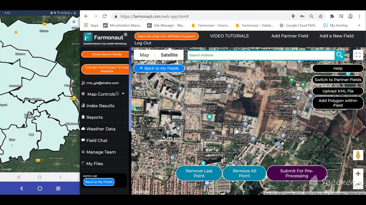
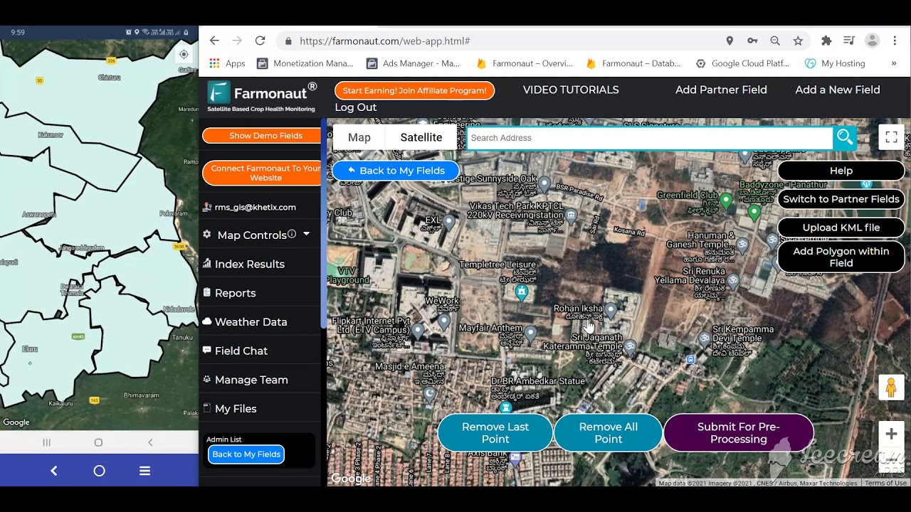
Watch on YouTube: How To Get Started with Farmonaut Field Mapping
Cost Calculator: Management Fees & Drone Services
Enter your own acreage, expected revenue, and the fee/rate a company or drone operator actually quoted you — the calculator does the arithmetic, not the guessing.
Run your own numbers
Assumes the management fee applies to gross revenue as disclosed by the company you’re quoting, and that drone cost is a simple per-acre, per-flight rate. It excludes seed, fertilizer, equipment, insurance, appraisal fees, and any minimum-contract charges a company or operator may add — confirm those separately.
The “20% of North Carolina’s Workforce” Claim, Checked
This exact phrase gets searched because it’s been repeated for years, so it’s worth checking against the newest release rather than the one that made it famous. The current figure, per North Carolina’s own agriculture department, is 19% — not 20%. According to the North Carolina Department of Agriculture & Consumer Services blog, published December 2025, NC State University economist Dr. Jeffrey Dorfman’s analysis of 2023 USDA statistics puts agriculture and agribusiness at 19% of the state’s workforce — 965,000 jobs — and $102 billion in economic impact, or 13% of the state’s total economic output. The rounding between “nearly one in five” (19%) and “one in five” (20%) is where the more memorable but slightly imprecise figure comes from.
Source: NC Dept. of Agriculture & Consumer Services blog, Dec. 2025, citing NC State University analysis of 2023 USDA data
Two things to note if you’re citing this figure yourself: first, “agriculture and agribusiness” is a broader category than farm labor alone — it includes food processing, distribution, and related manufacturing, which is why it lands near one-fifth of the workforce even though direct farm employment is much smaller. Second, this figure is refreshed roughly annually as NC State’s agricultural economics team recalculates it against the newest USDA data; check the NCDA&CS blog link above directly for whatever the current release says rather than treating either 19% or 20% as permanently fixed.
Farm Management Services in Fishers, IN & Lebanon, IN
Fishers and Lebanon sit in the Indianapolis-area corn and soybean belt, where farm management and appraisal work is shaped by three local realities: encroaching suburban development pressure on farmland at the urban edge, active grain elevator and processor relationships in Boone and Hamilton counties, and Indiana’s state-specific conservation and drainage regulations that a locally experienced manager tracks day to day. A management or appraisal firm working this corridor should be able to speak to:
- Local land-value pressure from residential and commercial development converting adjacent farmland — which affects both appraisal comparables and long-term lease negotiation
- Established buyer relationships with regional grain elevators and processors rather than a generic marketing plan
- Indiana Department of Environmental Management drainage and nutrient-management compliance, which varies from neighboring states
For an owner in either town, the checklist in the “How to Choose a Farm Management Services Company” section above applies directly — ask any Fishers- or Lebanon-based provider for their AFM/ARA credential and a written fee schedule before signing, exactly as you would anywhere else in the country.
Satellite Tools Behind Modern Farm Management
Whichever service tier you choose — advisory, full management, drone services, or appraisal support — the underlying data layer matters. Farmonaut supplies satellite-based monitoring that management companies, appraisers, and independent operators can plug into their existing workflow rather than replace it:
- Monitor crop, soil, and resource conditions in real time using multispectral, AI-powered satellite imagery
- Optimize resource allocation with fleet and asset management tools for farm machinery, improving scheduling and minimizing equipment downtime
- Ensure transparent, secure traceability by integrating our blockchain-based traceability solutions into your value chain
- Reduce environmental impact and carbon footprint through real-time carbon monitoring — see our carbon footprinting features for sustainable stewardship initiatives
- Streamline crop insurance and loan access by enabling rapid, satellite-based verification for lenders and insurers — discover more at Farmonaut’s crop loan/insurance solutions




Watch on YouTube: Farmonaut Web System Tutorial

Watch on YouTube: Farmonaut Web App Video
Through our subscription-based model and open API (see API details here | developer documentation), a management company or appraiser can:
- Integrate Farmonaut insights into custom IT systems and dashboards
- Scale monitoring, traceability, and compliance efforts across managed acreage
- Pull historical imagery for appraisal documentation from anywhere
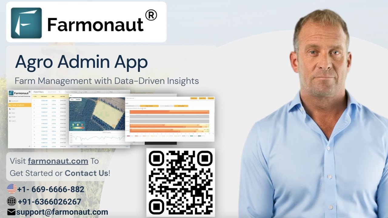
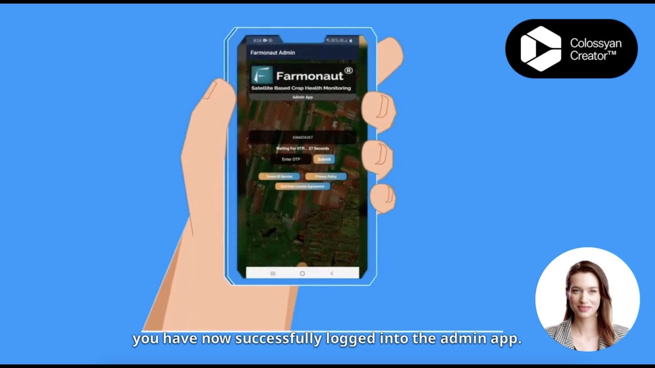
For operations large enough to need multiple field teams reporting into one dashboard, the Farmonaut Agro Admin App gives an admin-level view across managed farms rather than one field at a time — the layer most farm management companies with more than a handful of clients end up needing.

Watch on YouTube: Farmonaut Agro Admin App
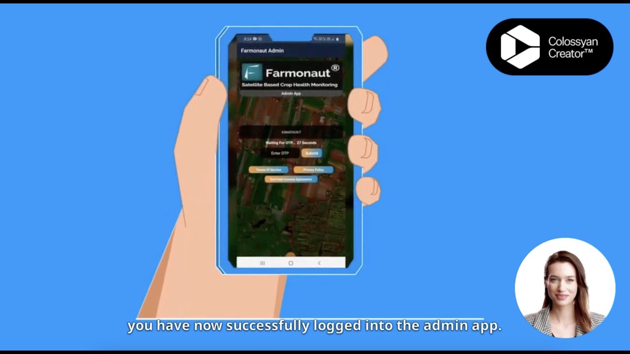
Watch on YouTube: Farmonaut For Admins Tutorial
Farmonaut Subscription Plans
Satellite monitoring, AI advisory, blockchain-based traceability, and environmental impact tracking scale from small family farms to multi-thousand-acre operations under management.
Learn about large-scale farm management with Farmonaut Agro Admin App →
Try Farmonaut Crop Plantation and Forest Advisory Now →
Frequently Asked Questions
What’s the difference between ag management services and farm management services?
“Ag management services” is the broader term and can mean advisory-only support where the owner keeps control. “Farm management services” usually implies the company takes day-to-day operational responsibility — hiring, input purchasing, marketing — reporting results back to the owner rather than just recommending them.
How much do farm management services cost?
There is no federally published rate. Management companies set and disclose their own fee schedules, commonly structured as a percentage of gross farm revenue. Get the exact percentage in writing in the engagement letter, then use the calculator above with your own acreage and revenue to see the dollar impact.
Do I need an FAA license to use a drone on my own farm?
Recreational flying on your own land has lighter rules, but any commercial use — including a service you pay for, or flying to support a business decision — requires the operator to hold an FAA Part 107 Remote Pilot Certificate, and Part 137 as well if the drone is spraying or spreading anything, per the University of Maryland Extension guide.
What credential should a farm appraiser or manager hold?
Look for the Accredited Farm Manager (AFM) or Accredited Rural Appraiser (ARA) designation from ASFMRA, which requires coursework, a degree, four years of experience, and a demonstration management plan — confirm the credential directly with ASFMRA rather than taking it on faith.
Is farmland actually still appreciating?
Yes, per USDA NASS: U.S. farm real estate averaged $4,350 per acre in 2025 (up 4.3% from 2024), marking the fifth consecutive annual increase. County-level figures vary from that national average, which is what a local appraisal is for.
How is Farmonaut different from a farm management or appraisal company?
Farmonaut is a satellite data and advisory platform, not a licensed appraiser or a management company holding operational authority over your farm. It supplies the monitoring, mapping, and AI advisory layer that management companies, appraisers, and independent operators use alongside their own credentialed services, via web, Android, and iOS.




Conclusion
The three services people search for under this umbrella — ag/farm management, farm drone services, and appraisal — are governed by different rules and different cost structures, and treating them as one purchase is where most confusion starts. Drone work needs an FAA Part 107 certificate at minimum, Part 137 for spraying. Management fees are set by the individual company, not a regulator, so get them in writing. Appraisals should come from an AFM/ARA-credentialed professional, verified directly with ASFMRA, working against current USDA NASS land-value data for your county rather than a national average.
At Farmonaut, we supply the satellite monitoring, environmental stewardship tools, blockchain-based traceability, and satellite-driven loan and insurance verification that sit underneath whichever management, drone, or appraisal service you contract separately. Download the app and connect it to your existing farm management or appraisal relationship rather than replacing it.

 Godrej Agrovet
 Hayleys Agriculture
 Linx Agritech
 Adinet
 Save Your Soils
 GalaxEye Space
 Grandstream Algérie
 XOS Realty
 Geospatial Lab Africa
 Agro La Gándara
 HIPSAC
 ZOL Zimbabwe
 Juligerm
 AdBio
AdBio MISE Maroc
 NWNS
NWNS Red August Group
 Farm Inc
 WeMe Global
 Agrotoken
 Blue BearX
 Insignito
 DnCubed
 Indosistim Teknologi
 Liquify Digital
 CU Foods
 BeyondTech Global
 Rouge VC
 AgroRisk
 Oath Inc
 Esri North East Africa
 MDCV UK
 Etech Consulting Madagascar
 Vestlandsforsking
 WB Dev
 Sama Premium
 Tres Valles
 Blickwinkel
 Agricultural Credit Policy Council
 eKGIS
eKGIS Mostas Tech
 Andex
Andex Deluxe Conseil
 WICO
WICO Chimera Innovation
 SkyHarvest
 Teledarbas
 Exurbia Geospatial
 FieldZero
