

Traceable Measurement Techniques in Agriculture Apps: Building Trust & Precision in Modern Farming
Introduction
Traceable measurement techniques in agriculture are rapidly transforming modern farming, empowering farmers, researchers, and policymakers with reliable, auditable, and reproducible data to make better decisions and optimize resource use. With agriculture land measurement apps, soil health measurement tools, and advanced biotechnology techniques in agriculture, we now have unparalleled ability to map, monitor, and manage fields with precision.
These traceable measurement techniques in agriculture use calibrated sensors, geospatial mapping, and standardized protocols to ensure every data point collected is verifiable and compliant with regulatory and industry standards. This blog explores the technologies, methods, and tools driving traceability across agriculture, from real-time field mapping to soil health analytics and trait validation in biotech labs.
What Are Traceable Measurement Techniques in Agriculture?
Traceable measurement techniques in agriculture encompass a suite of tools, processes, and protocols designed to ensure that the data collected from soils, crops, and fields are accurate, reproducible, and auditable.
At their core, these techniques provide a clear chain of data custody — from the field to the lab and into digital apps — guaranteeing that measurements can be traced back to standardized reference materials and calibration events. This traceability is essential for:
- ✔ Ensuring data integrity across farms and research stations
- 📊 Supporting comparability among datasets
- ⚠ Enabling reproducibility of analyses and practical farming decisions
- 🔒 Conforming to regulatory bodies and certification programs
- 🌱 Driving sustainable farming and resource optimization
Key Insight
Traceability anchors every measurement in agriculture to a transparent and auditable process. This provides trust for farmers, researchers, regulatory agencies, and buyers that decisions are based on standardized, verifiable data.
Why Traceability Matters in Modern Agriculture
In today’s data-driven farming environment, the importance of traceable measurement techniques in agriculture cannot be overstated:
- Legal & Compliance: Traceable records in agriculture land measurement apps resolve boundary disputes, lease agreements, and subsidy eligibility.
- Research & Innovation: Standardization and metadata logging in soil health measurement tools accelerate scientific progress and agricultural innovation.
-
Sustainability & Certification: Transparent, auditable data enable farms to meet certification schemes and participate in carbon credit markets.
Explore Farmonaut’s Carbon Footprinting Solutions → -
Risk Management: Reliable measurement ensures consistency in crop insurance and loan verification.
See Farmonaut’s Remote Sensing for Crop Loans & Insurance → - Operational Efficiency: High-quality, traceable data streamline planning, from precision irrigation scheduling to yield forecasting, reducing environmental impact.
Pro Tip
Always select agriculture land measurement apps and soil health measurement tools that offer comprehensive metadata logging and export data in standardized, auditable formats. This ensures data can be verified and compared across farms and research stations.
Core Components of Traceable Measurement in Agriculture
1. Standardized Protocols & Workflows
- 📝 Metadata collection: Each data point is logged with operator, time, location, and instrument details.
- 📏 Predefined sampling grids: Spatially uniform, randomized, or stratified sampling for fields and soil.
- 📄 Controlled field blanks & calibration: Ensure that environmental effects and sensor drift are documented and, if needed, corrected.
- 📦 Chain-of-custody documentation: Especially in laboratory or biotech contexts, guarantees each sample is reliably traced.
2. Reference Materials & Calibration
- 🧪 Certified reference soils and plant tissues are used for sensor calibration and laboratory validation.
- 🔗 Calibration curves link sensor outputs to recognized physical or chemical standards.
- 📝 Calibration history recorded digitally with each instrument or sensor deployment.
3. Digital Tools & Traceable Data Formats
- 📱 Mobile and web apps support real-time field data input, GPS-boundaries, and export of traceable, auditable records (e.g., CSV, GeoJSON, blockchain ledgers).
- 🌍 Integration with satellite imagery and drone photogrammetry for additional spatial accuracy.
- 🔒 Immutable audit trails for regulatory and certification documentation.
Investor Note
The adoption of traceable measurement techniques in agriculture is accelerating as regulatory bodies, food companies, and finance institutions demand greater transparency. Investing in robust, data-driven agri-solutions lays the groundwork for smart supply chains, reduced risk, and scalable platforms in precision farming.

Soil Health Measurement Tool & Traceability
The foundation of agricultural productivity is the soil. High-quality data about soil health is indispensable for sustainable farming, effective resource optimization, and smart land management. Soil health measurement tools combine chemical, physical, and biological indicators, and their traceability underpins their scientific and practical value.
What Parameters Do Soil Health Tools Measure?
- 🔬 Chemical indicators: pH, nutrient levels (N, P, K, etc.), organic matter content
- 💦 Physical indicators: Soil moisture, bulk density, texture, permittivity
- 🧫 Biological indicators: Microbial activity, enzymatic processes, root and biomass development
Key Insight
Portable and in-situ sensors — when paired with laboratory validation — allow for soil maps with quantified uncertainty. This is crucial for precise lime and nutrient management at the field scale.
How Is Traceability Maintained in Soil Health Measurement?
- ✔ Instrument ID, calibration history, and operator are digitally logged for each reading.
- 📍 GPS coordinates confirm exact measurement locations and horizons.
- 🗂 Time, weather conditions, reference blanks, and field controls are recorded to explain any drift or variation.
- 📤 Data exported in standardized formats (CSV, GeoTIFF, etc.) with quality flags for each measurement.

Visual List: How Traceable Soil Health Tools Work
- 📍 Deploy field probes at representative depths and locations using a rigorous sampling grid.
- 🔬 Collect soil samples for laboratory validation and tie results back to field sensors (reference curves).
- 🗂 Each data point logged with full metadata and exported to the measurement database/app.
- 🟢 Calibration events linked to international reference materials for accuracy and comparability.
- 🗃 Audit trails maintained via timestamped, version-controlled digital records.
Common Mistake
Overlooking the importance of calibration logs and environmental controls is a frequent error when using portable soil sensors. Always check for documented calibration and use field blanks to confirm sensor accuracy!

Agriculture Land Measurement Apps and Field Traceability
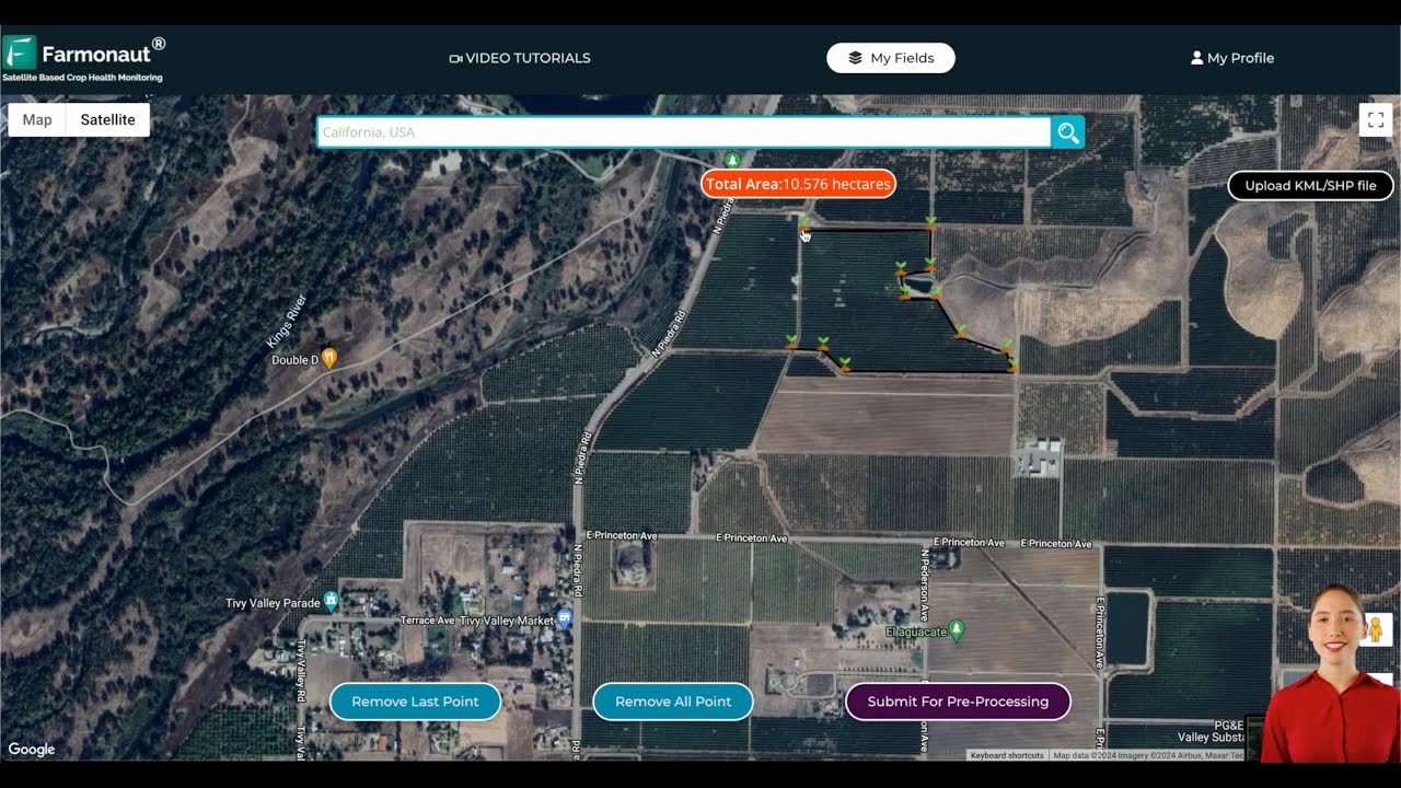
Modern agriculture land measurement apps have revolutionized how farmland measures, boundary mapping, and parcel management are conducted. These tools extend traceability into core field operations, land-use planning, and regulatory compliance.
Key Features of Agriculture Land Measurement Apps
- 📐 Georeferenced field boundary capture via GPS, satellites, and drone photogrammetry.
- 🌾 Crop area and terrain feature mapping with integration of spectral and elevation data.
- 🗺 Automated workflows for parcel delineation, field measurement, and standardized reporting.
- 🚩 Data quality flags with audit trails and certification marks.
- 🔄 Predefined grid and plot sampling for reproducibility across farms and research plots.
Visual List: How Modern Apps Support Traceable Farmland Measure
- 📲 Smartphone apps record and transmit live boundary data while associating it with user, instrument, and timestamp details.
- 🛰 Drone and satellite imagery automatically overlays field polygons for dispute resolution or lease documentation.
- 🗃 Export of records in regulatory-compliant formats (CSV, XML, GeoJSON, blockchain ledger) for certification and auditing.
With these features, agriculture land measurement apps become essential not just for operational efficiency, but for policy, insurance, and land management processes. By incorporating auditable, standardized records, they help streamline everything from boundary disputes to eligibility for subsidies and large scale farm management. Discover Farmonaut’s Large Scale Farm Management Suite →
Pro Tip
Always enable geolocation and quality flag settings in your agricultural land measurement app to ensure complete traceability and audit-ready field records.

Biotechnology Techniques in Agriculture and Traceable Measurement
Increasingly, biotechnology techniques in agriculture — such as high-throughput phenotyping, trait validation, gene editing, and molecular diagnostics — require exceptionally transparent and traceable measurement processes.
- 🧬 Chain-of-custody records for every plant or tissue sample, connecting field trials, greenhouse experiments, and laboratory analyses.
- 🏷 Physical and digital sample labeling to prevent misidentification or mix-ups.
- 📤 Standard methods for collection, storage, and analysis to allow comparisons across research sites and studies.
- 🔒 Immutable digital audit trails that document each intervention, assay, or genetic modification — essential for regulatory review.
Regulatory approval of genetically modified or gene-edited crops requires that all measurements, validations, and analytical methods meet recognized standards and can be independently verified. Blockchain and digital ledger technology are increasingly used to provide unimpeachable traceability and method confirmation.
Learn about Farmonaut Blockchain-Based Traceability for Agriculture →
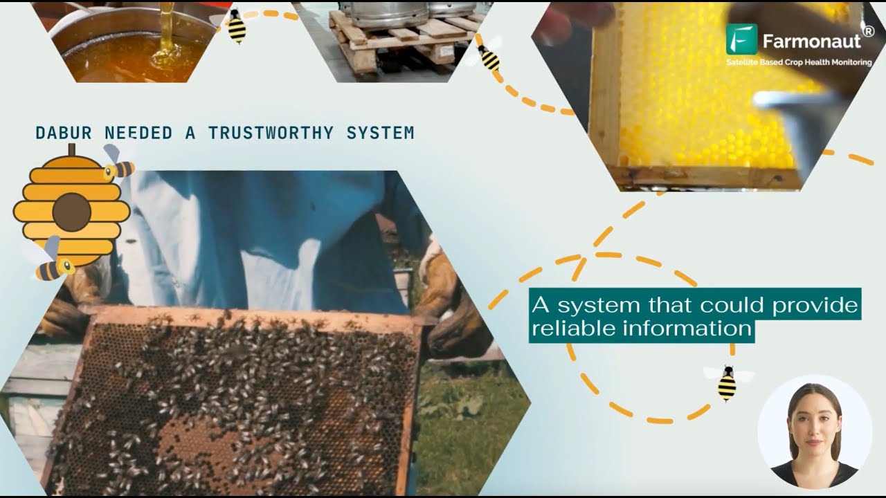
Data Insight
In biotechnology trials, using digital chain-of-custody with barcoded or RFID-tagged samples ensures that results can always be traced to the correct plant, field, or laboratory batch — minimizing error and supporting regulatory compliance.
Comparative Feature Table: Traceable Measurement Techniques
To quickly compare the primary traceable measurement techniques in agriculture apps, the table below highlights their parameters, traceability, accuracy, supported data formats, and whether their outputs are auditable.
| Technique/Tool | Measured Parameter | Traceability Level | Estimated Accuracy (%) | Supported Data Formats | Auditable Data (Yes/No) |
|---|---|---|---|---|---|
| 🌍 Satellite Imagery Analysis | Vegetation health, soil moisture, NDVI, field boundaries | High (GPS & timestamp, blockchain logs) | 85–99 | GeoTIFF, CSV, API, Blockchain Ledger | Yes |
| 📡 GPS Land Measurement | Field area, boundaries, terrain features | High (georeferenced, operator metadata) | 95–99 | CSV, GeoJSON, KML | Yes |
| 🛠 IoT Soil Sensors | Soil pH, moisture, bulk density, nutrient levels | Very High (sensor ID, calibration logs) | 90–98 | CSV, API, JSON | Yes |
| 🚶♂️ Mobile Field Scouting | Crop health notes, visual observations, sample location | Medium (operator & timestamp, location logs) | 85–95 | CSV, App Database | Yes |
Quick Comparison Bullets:
- 🌍 Satellite Imagery Analysis achieves near-instant field-wide data collection with blockchain-anchored traceability.
- 📡 GPS Land Measurement sets the standard for resolving boundary disputes and regulatory compliance.
- 🛠 IoT Soil Sensors offer continuous in-situ monitoring with calibration-driven traceable data integrity.
- 🚶♂️ Mobile Field Scouting enables contextual, operator-driven insights with time and geolocation stamps.
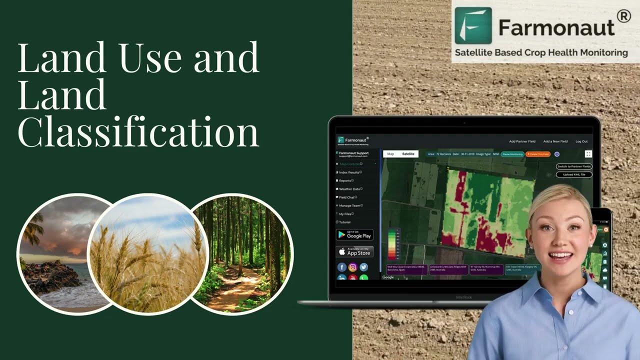
Best Practices for Implementing Traceable Measurement Techniques
- 📍 Standardize all field protocols and metadata logging for seamless data comparison across farms and research stations.
- 📅 Schedule regular calibration and audit routines for field sensors, GPS devices, and laboratory instrumentation.
- 🔒 Adopt blockchain or immutable database solutions for sensitive chains of custody — a critical factor for traceability and certification.
- 🏷 Label every sample, measurement, and event so they can be traced to the correct operator, device, time, and field.
- 📤 Export and back up data in standardized, open formats with embedded quality flags and calibration metadata.
Reminder
Don’t forget to check your app or sensor’s supported data export options. The best agriculture land measurement apps and soil health measurement tools can export traceable measurement data in GeoJSON, CSV, or blockchain formats — vital for compliance and future-proofing your operation.
Farmonaut’s Role in Traceable Measurement Techniques
At Farmonaut, we deliver a suite of advanced satellite-based tools that embody the principles of traceable measurement techniques in agriculture. Powered by multispectral imaging, AI-driven analytics, and blockchain-based traceability, our platform is designed to support reliable, auditable, and standardized data collection across farms, research, and regulatory environments.
Key Highlights of Farmonaut Solutions:
- 🔭 Satellite Imagery & Field Analytics: Monitor crop health, soil moisture, and field boundaries in near real-time with GPS and blockchain-stamped data points.
- 🤖 Jeevn AI Advisory System: Receive instant, customized recommendations based on validated satellite observations and environmental conditions.
See JEEVN AI’s Capabilities in Action → - 🔗 Blockchain-Based Traceability: Every operational and analytical action is secured within a tamper-resistant ledger. This underpins regulatory filings, resource management, and supply chain audits.
Learn More about Blockchain Traceability at Farmonaut → - 🌱 Environmental Impact & Carbon Tracking: With integrated soil and crop measurement data, our platform delivers robust carbon footprinting and sustainability analytics, enabling users to document compliance and pursue incentives.
Explore Carbon Footprinting at Farmonaut → - 💻 Fleet and Resource Management: Integrated field and fleet records optimize logistics and ensure all data is reference-linked and auditable.
See Fleet Management in Farmonaut Platform → - 🔄 Open API Access: Our open API and comprehensive developer docs make it easy to integrate traceable agricultural data into your business, ERP, or research solution.
Farmonaut API Details →,
API Developer Docs →

Application Highlight
With Farmonaut’s mobile, web, and API platform, you gain access to traceable land measurement, crop health analytics, and compliance-ready data exports — all built on a foundation of international standards and robust geospatial intelligence.
Farmonaut App Download Links



Farmonaut App Resources & Subscriptions
- 📲 Farmonaut App: Download for Android, iOS, or use the browser-based app for satellite-driven, traceable land and crop management.
- 💻 API Access: Integrate satellite, weather, and traceable measurement data into your own workflows.
Farmonaut API → - 📚 API Documentation: Developers can access complete documentation.
API Developer Docs → - 🌲 Crop, Plantation, & Forest Advisory: Use Farmonaut for climate-smart crop and forest health solutions.
Learn More →
Expert FAQ on Traceable Measurement in Agriculture
Q1: What are the main benefits of traceable measurement techniques in agriculture?
Traceable measurement techniques ensure that every data point collected in agriculture — from land boundaries to soil chemistry and plant health — is accurate, verifiable, and compliant with standardized protocols. This leads to improved resource management, reduced environmental impact, stronger support for certification and subsidies, and increased trust between producers, regulators, and buyers.
Q2: How do agriculture land measurement apps ensure traceability?
These apps log spatial coordinates via GPS, record operator metadata, use standardized units and quality flags, and export data in regulatory-compliant formats. Many also provide blockchain-based audit trails for legal and certification processes.
Q3: Why is calibration history important for soil health measurement tools?
Calibration history ensures that each instrument is functioning properly and measurements are accurate. Paired with reference materials, calibration records prevent errors due to sensor drift or changing environmental conditions, supporting reproducibility across years and research sites.
Q4: What data formats support traceable measurement?
The most robust agriculture tools support export in open, standardized formats such as CSV, GeoJSON, KML, and increasingly, blockchain ledgers or API endpoints, ensuring easy sharing, archiving, and verification.
Q5: Can Farmonaut’s platform support certification and legal compliance?
Yes! We have designed our platform to produce traceable, auditable records suitable for regulatory filings, boundary dispute resolution, land use planning, and sustainability certification, ensuring data provenance at every stage.
Conclusion
The ongoing digital transformation of agriculture hinges on robust, transparent traceable measurement techniques. From soil health measurement tools that enable auditable nutrient and moisture analyses, to agriculture land measurement apps that create regulatory-compliant field records and blockchain-powered supply chain solutions, traceability is redefining trust, efficiency, and sustainability in modern crop and resource management.
For farmers, agronomists, researchers, and business leaders, the integration of calibrated sensors, geospatial analytics, standardized protocols, and advanced apps brings verifiable, reproducible measurement to the forefront — empowering better decisions and sustainable growth for the global food system.
Ready to leverage the latest technology in traceable agricultural measurement? Download the Farmonaut app or integrate our satellite-based solutions to start building your own transparent, audit-ready farm records today.

 Godrej Agrovet
 Hayleys Agriculture
 Linx Agritech
 Adinet
 Save Your Soils
 GalaxEye Space
 Grandstream Algérie
 XOS Realty
 Geospatial Lab Africa
 Agro La Gándara
 HIPSAC
 ZOL Zimbabwe
 Juligerm
 AdBio
AdBio MISE Maroc
 NWNS
NWNS Red August Group
 Farm Inc
 WeMe Global
 Agrotoken
 Blue BearX
 Insignito
 DnCubed
 Indosistim Teknologi
 Liquify Digital
 CU Foods
 BeyondTech Global
 Rouge VC
 AgroRisk
 Oath Inc
 Esri North East Africa
 MDCV UK
 Etech Consulting Madagascar
 Vestlandsforsking
 WB Dev
 Sama Premium
 Tres Valles
 Blickwinkel
 Agricultural Credit Policy Council
 eKGIS
eKGIS Mostas Tech
 Andex
Andex Deluxe Conseil
 WICO
WICO Chimera Innovation
 SkyHarvest
 Teledarbas
 Exurbia Geospatial
 FieldZero
