

Mine water · South Africa guide
Acid Mine Drainage in South Africa: Basins, Costs, Fixes
Acid mine drainage in South Africa comes mainly from flooded Witwatersrand gold workings and Mpumalanga coal mines. In 2021 the three TCTA plants treated about 180 million litres a day, but the water stays salty and the state deferred the long-term fix.
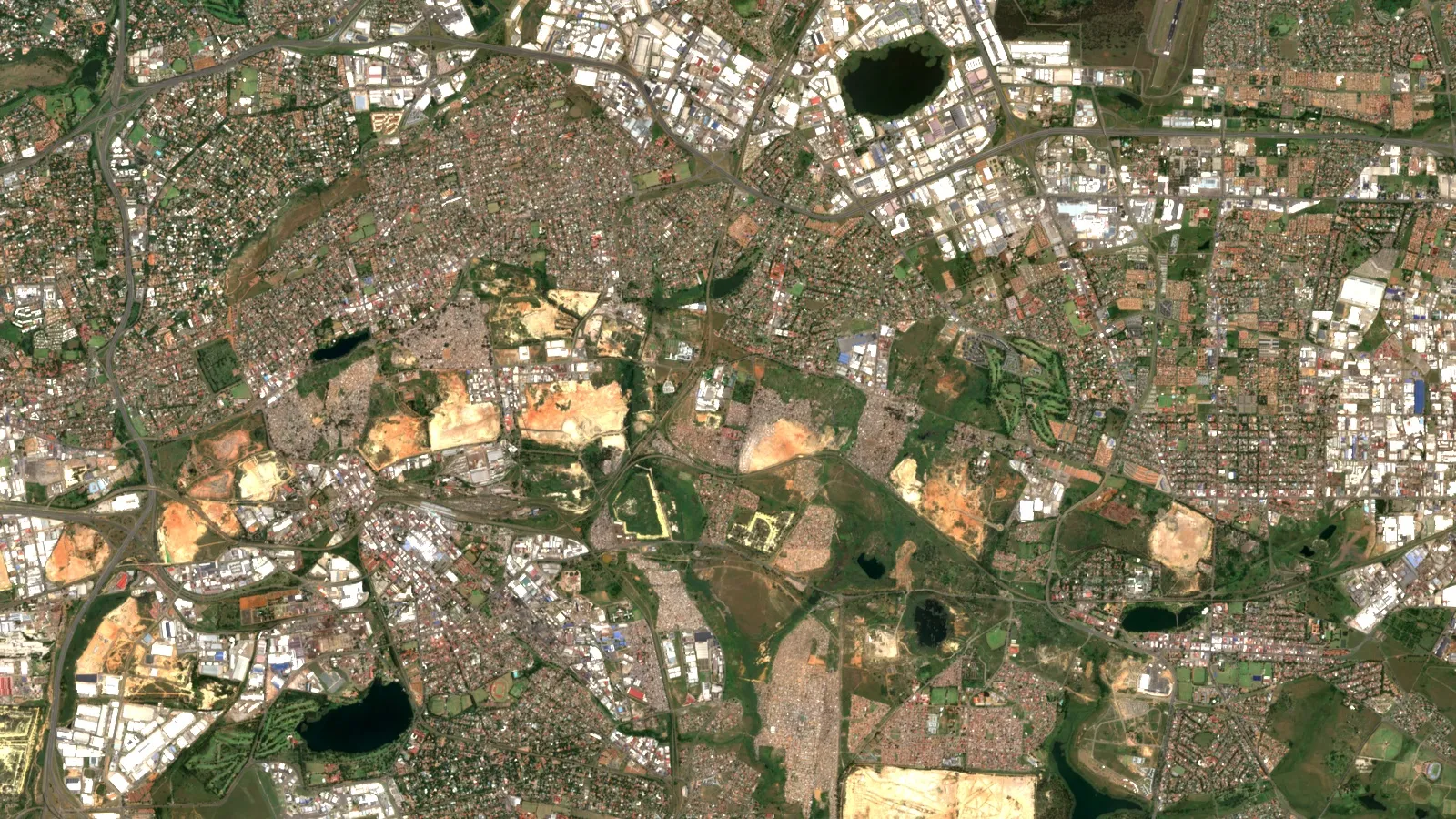
Key takeaways
- Witwatersrand gold conglomerates typically hold about 3% pyrite, and the Western Basin decant measured pH 2 to 3 with sulfate near 3,500 mg/L (McCarthy, 2011).
- Three TCTA plants treat about 180 million litres a day; the short-term works cost R2.6 billion and running them about R293 million a year (Mail & Guardian, 2021).
- Treated water still adds 362 tonnes of dissolved salts a day to the Vaal Barrage; the R10 billion long-term plan was deferred in 2021.
- In February 2022 a failed shaft seal at Kromdraai killed all fish along a 58 km reach of the Wilge River (Mail & Guardian, 2022).
- In May 2025 a Central Basin decant turned Boksburg Lake red; the TCTA told people not to drink the water (Mail & Guardian, 2025).
In this article
- What acid mine drainage is and why South Africa has so much of it
- Where acid mine drainage affects South Africa
- The Witwatersrand timeline from the 2002 decant to the treatment plants
- What the treatment plants remove and what stays in the water
- How much acid mine drainage treatment costs in South Africa
- Coal mine drainage in Mpumalanga and the Kromdraai spill
- Boksburg Lake and the Central Basin decant
- Effects on streams, soil, crops, animals and people
- How to treat acid mine drainage: lime, wetlands, source control and reverse osmosis
- Estimate the limestone a sulfide-bearing waste rock may need
- Who pays for acid mine drainage in South Africa
- Using satellite images to screen mine sites for AMD sources
- Frequently asked questions
Acid mine drainage (AMD) is acidic, metal-rich water that leaves old mine workings and waste dumps after sulfide minerals meet air and rain. In South Africa it comes mainly from two sources: the gold mines of the Witwatersrand, where the mine voids in three basins have filled with water, and the coal fields of Mpumalanga. Water at the Western Basin decant was measured at pH 2 to 3 with sulfate near 3,500 mg/L (McCarthy, South African Journal of Science, 2011). The state-owned Trans-Caledon Tunnel Authority (TCTA) now runs three treatment plants that together pump about 180 million litres a day, but the treated water is still salty and the planned long-term fix has been deferred (Mail & Guardian, 12 June 2021).
This page is written for consultants, mine owners and anyone assessing a site. It shows where the problem is, what the treatment plants do and cost, what happened in the Kromdraai coal spill and at Boksburg Lake, who is responsible for paying, and how to estimate the limestone a sulfide-bearing waste rock may need. Every figure carries its source and date.
What acid mine drainage is and why South Africa has so much of it
The chemistry is simple. Pyrite (iron sulfide, often called fool’s gold) reacts with oxygen and water to make sulfuric acid and dissolved iron. The US Environmental Protection Agency describes the result as highly acidic water that carries heavy metals leached from the rock, and notes that bacteria can speed the process (US EPA, Abandoned Mine Drainage). Left alone, rock weathers slowly. Mining breaks the rock into fragments with far more surface area, so acid forms much faster.
South Africa has two features that make this worse. First, its ore bodies are rich in pyrite. McCarthy reports that the Witwatersrand gold conglomerates typically hold about 3% pyrite, and that this pyrite ends up in the tailings dumps (the crushed rock left after gold is extracted). Second, the host rocks lack carbonate minerals such as calcite or dolomite that could neutralise the acid, so the natural buffer is overwhelmed (McCarthy, 2011).
Two terms help in the rest of this page. A decant is the point where water from a flooded mine void reaches the surface, usually at the lowest shaft or opening. The environmental critical level (ECL) is the water level in the void that the authorities try to stay below so that no decant happens.
Where acid mine drainage affects South Africa
The sources point to two main regions, plus a long tail of abandoned mines. The table sets out what each source shows. Impacts are reported river by river and reach by reach, so this page does not add them into one national total.
| Area | Main source | What the sources show |
|---|---|---|
| Witwatersrand Western Basin (Krugersdorp, Randfontein) | Flooded gold mine workings | Decant began in 2002; the TCTA brochure (2021) reports no decant of untreated AMD there (McCarthy 2011 for the 2002 start) |
| Witwatersrand Central Basin (Germiston, Boksburg) | Flooded gold mine workings | Pumping stopped in 2008; a decant reached Boksburg Lake in May 2025 (Mail & Guardian, 3 June 2025) |
| Witwatersrand Eastern Basin (Springs, Nigel) | Flooded gold mine workings | Pumping stopped in early 2011; the plant treats an average 106 Ml/day (TCTA environmental report, August 2025) |
| Klip River and Soweto | Gold dumps and old mines | Johannesburg has an estimated 278 abandoned mines and 200 mine dumps; sampling found extreme toxicity near the dumps (The Conversation, 2024) |
| Witbank and Middelburg coalfield (Olifants catchment) | Underground and opencast coal mines | Mining began in 1894; most old mines decant acidic water (McCarthy, 2011) |
The Witwatersrand basins form an arc of more than 70 km from Krugersdorp in the west to Nigel in the east, reaching over 2,000 m down. Mines inside each basin are connected underground, so when one floods it passes water to its neighbours (TCTA, Acid Mine Drainage brochure). This is why the last mine pumping in a basin was left with the whole bill, and why several closed.
For the wider picture across countries, see our page on the countries most affected by acid mine drainage. For the gold geology behind the Witwatersrand basins, see gold mining areas in South Africa.
The Witwatersrand timeline from the 2002 decant to the treatment plants
More than 120 years of gold mining left a connected network of flooded workings. The Western Basin filled and began to decant in 2002. Pumping ceased in the Central Basin in 2008, and by 2011 its water level was rising by about 12 m a month. Pumping in the Eastern Basin became sporadic at the end of 2010 and stopped in early 2011 (McCarthy, 2011).
Chart
Treatment plant capacity by basin
Megalitres per day (Ml/day), one basis per bar as labelled; Central average is 72, Eastern average 106
In 2010 Cabinet appointed an Inter-Ministerial Committee, and an expert team presented its report on 9 February 2011. On 8 April 2011 the Minister directed the TCTA to build emergency works. The plan was to pump water out of the voids, neutralise it in a plant in each basin and discharge it to the rivers while a long-term study went ahead (TCTA brochure).
The three plants differ in size. The Western Basin plant was upgraded from 12 to 33 Ml/day (a megalitre, Ml, is one million litres). The Central Basin plant at Germiston treats an average of 72 Ml/day with a peak capacity of 84 Ml/day (TCTA environmental report, August 2025); in June 2025 the TCTA gave 72 Ml/day as its maximum when planned outages are counted over a year (Mail & Guardian, 3 June 2025). The Eastern Basin plant at Springs treats an average of 106 Ml/day with a peak capacity of 110 Ml/day (TCTA operational environmental report, August 2025). A 2025 amendment application proposes a 1 Ml/day reverse osmosis unit at each of the Central and Eastern plants.
What the treatment plants remove and what stays in the water
The plants use a high-density sludge process. Limestone and lime raise the pH, air oxidises iron and manganese, calcium sulfate is crystallised out, and the solids settle in clarifiers. The TCTA brochure gives average raw water across the three basins and the discharge standard for the plant effluent. The chart shows the metals; the lines below cover the rest.
Chart
Metals in raw mine water and the plant discharge limit
mg/L; effluent values are upper limits (iron and aluminium below 1, manganese below 3)
Raw water averaged pH 4, sulfate 4,344 mg/L and uranium 0.2 mg/L. The effluent standard is pH 6 to 9, sulfate 2,400 mg/L and uranium 0.05 mg/L. The brochure itself notes that treated water still holds high salt loads.
That salt matters downstream. According to the Mail & Guardian (12 June 2021), the plants pump about 180 million litres a day from the three basins, and 362 tonnes of total dissolved solids still enter the Vaal Barrage every day. McCarthy had earlier shown that the salinity of the Vaal River more than doubles between the Vaal Dam and the Barrage because of inflow from the Klip River and the Blesbokspruit, which are fed by gold dumps and mine water. Neutralising acidity is not the same as making the water fit for use.
How much acid mine drainage treatment costs in South Africa
The short-term works cost R2.6 billion. They upgraded the Western Basin plant in Randfontein in 2012 and built the Central (Germiston) and Eastern (Springs) plants in 2014 and 2016. Running all three costs about R293 million a year (Mail & Guardian, 12 June 2021).
Chart
Reported costs of AMD treatment in Gauteng
Billion rand (R); capital, yearly running cost and the deferred long-term plan
The long-term solution was launched in May 2016. It aimed to desalinate the water to a standard fit for the Vaal River system and to postpone costly new water supply schemes for at least 30 years (SAnews, 19 May 2016). By June 2021 the Department of Water and Sanitation described it as provisionally deferred because of funding limits and a recalibration of the Vaal salinity model, with the R10 billion plan to be sized afterwards. A July 2025 commentary notes that the Mine Water Management Policy, approved in 2022, expects treated AMD to contribute to the water supply only by 2040 (Mail & Guardian, 21 July 2025). That commentary also states that a long-term treatment does not exist, which is the latest dated status in the sources reviewed (July 2025).
Full desalination is expensive. At the coal-field plant in eMalahleni, which uses reverse osmosis, McCarthy reported in 2011 that the water cost about three times as much as water delivered from the Vaal River. Amounts here are in South African rand (R) as reported at the time; no conversion to dollars is made.
Coal mine drainage in Mpumalanga and the Kromdraai spill
Coal differs from gold in how it makes acid. Underground coal workings collapse and flood, then decant from the lowest opening. In opencast mining the rock above the coal is replaced as backfill, rain passes through it and picks up acid from pyrite, and decant typically starts a decade or more after mining stops (McCarthy, 2011). McCarthy adds that in the Witbank and Middelburg coal area the problem is likely to last centuries, because nobody can say when the pyrite will be used up.
The February 2022 Kromdraai spill shows the scale a single failure can reach. An old coal mine near eMalahleni, last operated in 1966 and now part of Thungela Resources’ Khwezela Colliery, released acidic water after a concrete seal at its south shaft failed. A 58 km stretch of the lower Wilge River lost all fish and macroinvertebrates, 22 fish species died, and the plume reached Loskop Dam by 20 February 2022. The company said the water volume exceeded the treatment capacity at its dosing site (Mail & Guardian, 24 February 2022). Another aquatic scientist quoted in the report said the river would not be well again for 10 to 20 years.
Treatment can work. The eMalahleni Water Reclamation Plant has operated since 2007 and can treat a maximum of 50 Ml/day of AMD-affected water from nearby mines, producing drinking water for the municipality and the mines (environmental programme amendment, December 2021).
The legacy sites are many. Government records list no fewer than 400 abandoned coal mines (Human Rights Watch, July 2022). A Centre for Environmental Rights report released in May 2026 found that none of the 412 coal mines closed between 2006 and 2023 had set aside enough money for full rehabilitation (Mongabay, 8 June 2026).

▶ Strip mining, explained in clay: how coal is mined from the surface, with its pros and cons · 4:37
Boksburg Lake and the Central Basin decant
In May 2025 the Central Basin showed that treatment alone does not remove all risk. The TCTA saw evidence of AMD decant near Boksburg Lake on 21 May after a routine check on 2 May found none. On 23 May the Council for Geoscience traced the water to a point on a canal linked to the New Blue Sky incline shaft, which is capped, although the water found a path to the surface. The water turned rusty red as dissolved iron met oxygen. The TCTA measured pH 5.7 to 7.2 at the decant point and 5.0 to 6.5 in the lake, and it told people near the lake and downstream to Cinderella Dam not to drink the water. The plant was running at 64.7 Ml/day against a 72 Ml/day annual maximum (including outages), with a 56.8 Ml/day average over the past year, and the void level had risen sharply in the previous rainy season (Mail & Guardian, 3 June 2025).
Two lessons follow for site assessments. Decant pH can be near neutral while metals and salts remain a problem, so pH alone is not a safe test. And the TCTA said it could not predict where and when water would surface, which is why monitoring of old shafts and nearby channels matters.
Effects on streams, soil, crops, animals and people
The table lists the main effects and the evidence behind each. Where a figure is missing, the effect is described only in general terms.
| Effect | What happens | Evidence |
|---|---|---|
| Stream acidity and metals | Low pH and dissolved iron, aluminium and manganese; fish and insects die | Kromdraai: a 58 km reach lost all fish and invertebrates (Mail & Guardian, 2022) |
| Salinity | Sulfate and salts pass through treatment and raise river salinity | Vaal salinity more than doubles to the Barrage; 362 t of dissolved solids a day (McCarthy, 2011; Mail & Guardian, 2021) |
| Radioactive metals | Uranium and other metals travel with the water | Raw AMD averaged 0.2 mg/L uranium across the basins (TCTA brochure) |
| Soil and food gardens | Metals build up in river sediment and in soil beside irrigation water | Klip River study in Soweto; soil from uncultivated plots was more toxic than cultivated plots (The Conversation, 2024) |
| Irrigation and livestock | Contaminated water limits what farmers can use | Researchers advise borehole or tap water instead of river water for gardens (The Conversation, 2024) |
| Human health | Exposure to heavy metals can cause illness | Authorities told residents not to drink Boksburg Lake water (Mail & Guardian, 2025) |
The Soweto researchers also report that AMD can pollute land and water up to 20 km from a mine unless it is cleaned up, and that 1.9 million people live in Soweto, where the exposure is greatest near the dumps (The Conversation, 2024). The EPA also points out that polluted water of this type can harm people, animals and plants (US EPA).
▶ The 7 environmental impacts of mining, explained in clay with satellite maps · 2:31
How to treat acid mine drainage: lime, wetlands, source control and reverse osmosis
No single method fits every site. The main options differ in what they remove, what they cost to run and how much waste they leave.
Infographic
The high-density sludge process in 5 steps
- 1Pre-neutraliseLimestone removes free acidity and some iron.
- 2AerateAir oxidises iron and manganese.
- 3NeutraliseLime lifts the pH; metals form solids.
- 4CrystalliseExcess calcium sulfate drops out as gypsum.
- 5SeparateClarifiers settle the sludge and leave clear water.
| Method | What it does | Strength | Limit |
|---|---|---|---|
| Lime or limestone neutralisation (high-density sludge) | Raises pH, removes iron, aluminium and manganese as solids | Proven at scale in all three Witwatersrand basins | Leaves salts such as sulfate in the water; produces sludge to dispose of |
| Reverse osmosis desalination | Removes salts to give drinking-quality water | Used at eMalahleni since 2007 | High cost; McCarthy put water at about three times the Vaal supply cost |
| Constructed wetlands and passive systems | Plants and sediments take up metals at low energy use | Suggested for Soweto river reaches by researchers | Suited to smaller, steady flows; needs space and upkeep |
| Source control: cover, cap, move or reprocess dumps | Reduces oxygen and rain reaching pyrite | Cuts acid at the source | Diffuse dump seepage is hard to treat once formed (McCarthy, 2011) |
| Pumping to keep voids below the critical level | Stops decant | Used by the TCTA in every basin | Must continue for as long as water enters the void |
The high-density sludge process has a fixed order of steps, shown in the diagram below. Because acid keeps forming, pumping and treatment have no end date: the TCTA states that mines cannot simply be abandoned and the effects left to damage the environment for generations.
Estimate the limestone a sulfide-bearing waste rock may need
Consultants often run an acid-base account before mining or when reviewing a closure plan. Pyrite produces acid, and carbonate minerals neutralise it. The standard method multiplies the sulfur grade (weight per cent) by 31.25 to get the maximum potential acidity in tonnes of calcium carbonate per 1,000 tonnes of rock, then subtracts the rock’s own neutralisation potential. A USGS and Pennsylvania study argues that when carbon dioxide stays dissolved, the factor should double to 62.5 (Cravotta and others, 1990). The calculator uses both so you can see the spread.
Calculator
How much limestone could this waste rock need?
Enter your own tonnage, sulfur grade and neutralisation potential.
- Maximum potential acidity: 50,000
- Neutralisation the rock already has: 5,000
- Limestone cost at your price (US$): $1,350,000
Example values only, not a benchmark. The 31.25 factor is the standard acid-base accounting factor; 62.5 is the higher factor argued by Cravotta and others (USGS and Pennsylvania, 1990). Sulfur is assumed to be all pyritic. 3% pyrite is about 1.6% sulfur. Limestone price is an input: example, use today’s price in US$ per tonne.
Who pays for acid mine drainage in South Africa
The law says the mine pays. The 2015 financial provisioning regulations require a mining right holder to provide for rehabilitation and for latent and residual effects, including the pumping and treatment of polluted water, and the polluter-pays principle sits in the National Environmental Management Act and the National Water Act (Mail & Guardian, 12 June 2021). In practice, groups such as the Centre for Environmental Rights say companies under-assess their liabilities, regulators do not collect enough security, and firms are sold or liquidated before the bill arrives. The result is that the state, through the TCTA, runs the Witwatersrand plants on behalf of the Department of Water and Sanitation.
For an investor or buyer, this means closure liability and water rights are central parts of due diligence. Our guide to mines for sale in South Africa covers rights, consent and royalty.
This page is for information only. It is not legal advice. Confirm the rules with the Department of Water and Sanitation and the Department of Mineral Resources and Energy.
If this topic matters to you, read Mines in Brits, North West: Operators and Output next.
Using satellite images to screen mine sites for AMD sources
Satellite images cannot measure pH or metal concentrations. Water sampling does that. What they can do is map the footprint of tailings dumps, open pits and old mine workings, which are the sources, so a consultant can build a site list and plan sampling before going into the field. Repeat images also let a consultant compare a dump’s cover from one season to the next.
Farmonaut’s mining platform takes a licence boundary and screens the area from satellite data for mineral targets and surface features. It is an exploration screening tool and not an environmental clearance. To scope an AMD source survey for your site, request a quote or read about satellite based mineral detection. For more on exploration in the same region, see gold exploration in South Africa with satellite mapping. You can also contact us.
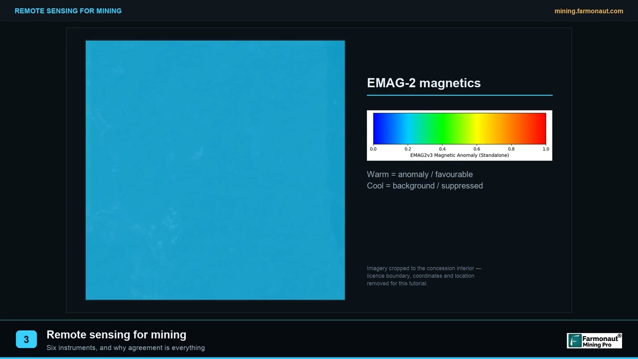
▶ Remote sensing for mining explained in three minutes · 2:01
Frequently asked questions
What causes acid mine drainage in South Africa?
Mining exposes pyrite to air and rain, which forms sulfuric acid and dissolves metals. Witwatersrand gold conglomerates hold about 3% pyrite and the host rocks lack enough carbonate to neutralise the acid (McCarthy, 2011).
Which parts of South Africa are most affected by AMD?
The Witwatersrand gold basins around Johannesburg and the Witbank and Middelburg coalfield in Mpumalanga are the two best documented areas. The Vaal and Olifants river systems carry the main downstream effects.
When did acid mine water first decant in the Witwatersrand?
The Western Basin began to decant in 2002 after the void filled with water (McCarthy, 2011).
How many treatment plants handle AMD in Gauteng?
Three, one in each basin: Randfontein (Western), Germiston (Central) and Springs (Eastern). The TCTA runs them for the Department of Water and Sanitation.
How much acid mine water is treated each day?
The Mail & Guardian reported about 180 million litres a day from the three basins in 2021. On a peak basis the plants are rated at about 33 Ml/day in the west (upgraded design), 84 Ml/day in the centre and 110 Ml/day in the east (TCTA brochure and August 2025 environmental report).
Is treated AMD safe to drink?
Not from the Witwatersrand plants. They neutralise acidity and remove metals, but the water keeps high salt loads. Reverse osmosis can produce drinking water, as at eMalahleni, but at higher cost.
What happened at Boksburg Lake?
In May 2025 an AMD decant from the Central Basin turned the lake red. The TCTA advised people not to drink the water (Mail & Guardian, 3 June 2025).
Who is responsible for cleaning up AMD?
The law places the cost on the mine owner, but when owners cannot be found or have no money, the state pays. The TCTA runs the Witwatersrand plants for the government.
How long does AMD last?
McCarthy says that in the Witbank and Middelburg coal area the problem is likely to persist for centuries rather than decades, because pyrite will only stop producing acid once it is fully oxidised and nobody can say when that will be.
Can satellites detect AMD?
They map dumps, pits and surface features that act as sources, but they cannot measure pH or metals. Water sampling is still needed.
This page is for information only. Figures are in South African rand where marked R and are not converted.
This page is for information only. It is not legal advice or investment advice. Confirm water and closure rules with the regulators.
Farmonaut mining
Map your mining site from space
Mining consultants can screen a licence area with satellite data to plan site work, as an exploration screen and not an environmental clearance.

Mining Pro sample view, synthetic data
Keep reading
Sources
- McCarthy, The impact of acid mine drainage in South Africa, South African Journal of Science (2011): doi.org
- TCTA, Acid Mine Drainage brochure: tcta.co.za
- TCTA, Operational environmental management programme amendment, Central and Eastern Basin (August 2025): tcta.co.za
- Mail & Guardian, State halts its R10bn long-term plan (12 June 2021): mg.co.za
- Mail & Guardian, Why Boksburg Lake turned red (3 June 2025): mg.co.za
- Mail & Guardian, Kromdraai coal mine spill into the Wilge River (24 February 2022): mg.co.za
- Mail & Guardian, Acid mine drainage: South Africa can learn from Japan (21 July 2025): mg.co.za
- SAnews, Long-term solution for acid mine drainage (19 May 2016): sanews.gov.za
- The Conversation, Gold mine pollution is poisoning Soweto’s water and soil (2024): theconversation.com
- Human Rights Watch, The Forever Mines (July 2022): hrw.org
- Mongabay, South Africa’s move away from coal marred by legacy of abandoned mines (8 June 2026): news.mongabay.com
- US EPA, Abandoned Mine Drainage: epa.gov
- Cravotta and others, Acid-base accounting of mine spoil (USGS and Pennsylvania, 1990): wvmdtaskforce.com
- Anglo Operations, eMalahleni Water Reclamation Plant EMPr amendment (December 2021): wsp.com
Discussion
Questions, corrections or field experience? Share them below. First-time comments are reviewed before they appear, and your email is never published.
No comments yet. Be the first to add a question or your experience.

 Imperial Impex FZE
 Congo Mining Solutions
 Mining SARL
 SenGold Invest SAS
 Sania Corporation
 Sean Mining Limited
 NTS Group (Pty) Ltd
 Mine4Africa
 Lithspo Minerals Limited
 Tintina Mining Group
 Dalgety Minerals Pty Ltd
 Vortex Minerals Pty Ltd
 Faith At Work (Pty) Ltd
 Geotech Mining Solutions plc
 Vulcan International Limited
 Kidepo Associates
 GKY Mining
 Alkimy SARL
 Double A Trading
 GemSprout Metals Limited
 Qader Group
 Ileys General Trading
 SG Gold Mining LLC










