

Gold exploration · Manitoba
Gold mine in Manitoba: who runs Lalor, what is being built at Lynn Lake, what is restarting at Bissett, and how ground is still staked with posts
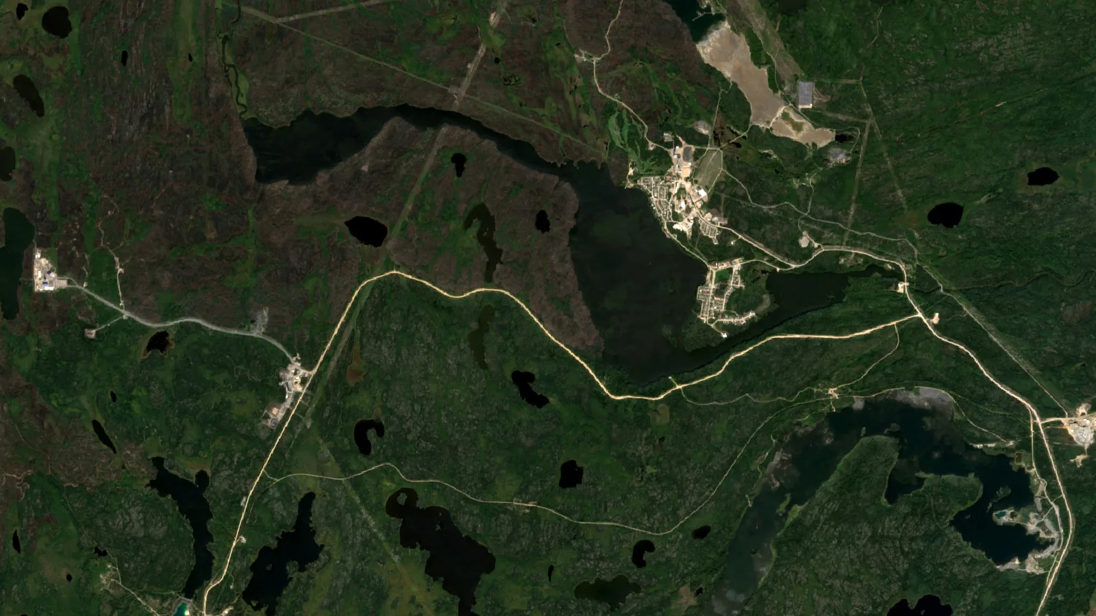
Key takeaways
- One producing district. Snow Lake, home of Lalor, the only operating gold mine in Manitoba, supplied nearly all of the province’s 2024 gold.
- Two projects to watch. Lynn Lake is in construction with first gold expected in the first half of 2029; True North at Bissett is preparing test mining ahead of a planned 2027 production decision.
- Ground staking survives. In unsurveyed territory you still plant posts, then record within 30 days for C$16 a claim.
- Work is the real cost. From year 2 a claim needs C$12.50 per hectare of work each year, rising to C$25 from year 11.
- Big ground has its own tenure. A Mineral Exploration Licence covers 5,000 hectares or more at much lower per-hectare work rates.
In this article
- Where gold deposits in Manitoba sit: three belts and a fourth to watch
- How much gold Manitoba produces, and from where
- Lalor, the operating gold mine in Manitoba, and the rest of Snow Lake
- Lynn Lake and Bissett: the next gold mine in Manitoba
- Old gold mines in Manitoba and what they left behind
- Staking near a gold mine in Manitoba: claims, licences and fees
- From open ground to drilling: the Manitoba path, step by step
- What a satellite can see over Manitoba's gold belts
- Gold mine in Manitoba: frequently asked questions
The only operating gold mine in Manitoba today is Hudbay’s Lalor mine at Snow Lake, with Alamos Gold’s Lynn Lake project under construction and 1911 Gold preparing a restart decision at Bissett.
Search for a gold mine in Manitoba and you will find a province with more history than headframes. Gold was first found here in 1890, and mining has run almost without a break for more than 120 years, yet in 2024 one district at Snow Lake did nearly all the producing. For a claim holder, junior or investor, the useful questions are narrower: which belts have proved they can host a mine, what the province charges to hold ground there, and how to rank that ground before the work bill arrives. That is the scope of this page. For the national picture, start with our guide to gold exploration in Canada and how provincial claim systems differ.
The San Antonio mine at Bissett ran from 1932 to 1968 and yielded 37,320 kilograms of gold.
Where gold deposits in Manitoba sit: three belts and a fourth to watch
The province’s own Gold in Manitoba brochure, published by the Manitoba Geological Survey, sorts the gold deposits in Manitoba into two families. Most came from quartz-carbonate veins of the orogenic type, formed along faults during mountain building. The rest is a by-product of volcanogenic massive sulphide (VMS) deposits, the copper-zinc bodies that made Flin Flon and Snow Lake famous. If you are judging a gold mine in Manitoba, that split matters, because the two families are found in different ways.
Flin Flon–Snow Lake belt
The Flin Flon belt is Paleoproterozoic and sits inside the Trans-Hudson orogen. The survey calls it one of the world’s premier VMS districts and notes that it also hosts several significant orogenic gold deposits along a trend more than 150 km long. The past-producing Snow Lake deposit, at 1.8 million ounces, sits on a discordant fault in the immediate hanging wall of a major thrust. Lalor, the deposit that turned Snow Lake into a gold camp, is a gold-copper-zinc deposit with separate gold and base-metal zones.
Lynn Lake belt
The Lynn Lake belt runs 150 km east to west and lines up with the La Ronge belt in Saskatchewan. It holds five significant gold deposits on two trends. The Agassiz metallotect, a package of picrite flows, felsic volcanic rocks and iron formation traced for more than 40 km, hosts MacLellan and Farley Lake. The Burnt Timber and Linkwood deposits sit on the Johnson shear zone, a crustal-scale break that follows the southern edge of the belt for more than 100 km.
Rice Lake belt and the Bissett camp
The Rice Lake belt is Archean, part of the Uchi domain of the western Superior province, and lies about 100 km along strike west of the Red Lake camp in Ontario. Its Rice Lake deposit at Bissett has a total endowment, counting resources and past production, of more than 5.6 million ounces, which the survey calls the largest gold deposit discovered in Manitoba to date. Anyone searching for a Rice Lake gold mine in Manitoba is looking at this camp.
Oxford–Stull domain
In the far northeast, the Oxford–Stull domain carries a set of long, sinuous greenstone belts. The survey names the Monument Bay deposit near Stull Lake as its most notable gold deposit. It is remote, and we did not confirm its current owner or status, so we leave it at that.
How much gold Manitoba produces, and from where
The national statistics are clear. In 2024, according to the Natural Resources Canada and Statistics Canada mineral production table, Manitoba produced 6,678 kg of gold and shipped 6,617 kg worth C$713.3 million. Canada’s total was 185,555 kg, so Manitoba supplied about 3.6%. The same table shows Manitoba also produced 13,327 tonnes of copper, 33,339 tonnes of zinc and 31,109 kg of silver, which is a reminder that the province’s mines are polymetallic.
The trend is up. Earlier editions of the table give 3,343 kg for 2020, 3,940 kg for 2021 and 4,659 kg for 2022. The 2023 figure is suppressed for confidentiality, which happens when few producers report. Converted at 31.1035 grams per troy ounce, 2024 output was roughly 214,700 ounces.
Chart
Manitoba gold production by year
Kilograms produced, 2020 to 2024; 2023 not published (suppressed for confidentiality)
Where did those ounces come from? Hudbay reported in January 2025 that Snow Lake produced 77,376 ounces in 2020, 146,449 ounces in 2022 and a record 187,363 ounces in 2023, and that its 2024 output was expected to beat the top of a 200,000-ounce guidance range. Set that beside the provincial total of about 214,700 ounces and the conclusion is plain: the Lalor mine and the New Britannia mill account for nearly every ounce produced by a gold mine in Manitoba in recent years.
Lalor, the operating gold mine in Manitoba, and the rest of Snow Lake
The Lalor mine in Manitoba is owned 100% by Hudbay Minerals. In its 28 September 2026 Snow Lake mine plan update, Hudbay describes its Snow Lake operations as the Lalor gold-copper-zinc mine, the New Britannia gold mill, the Stall base-metal concentrator, the 1901 zinc-gold deposit, several satellite deposits and the former New Britannia gold mine, now on care and maintenance and renamed the Britannia Gold Project. Lalor reached commercial production in 2014 and recovered its millionth ounce of gold in December 2024. Hudbay bought the New Britannia mill in 2015 and restarted it in late 2021.
The reserve figures are where buyers and analysts most often go wrong, so here they are as Hudbay states them, effective 1 September 2026 and reported under NI 43-101 with a named Qualified Person. Lalor’s gold zone carries 4.67 million tonnes of proven reserves at 3.78 g/t gold and 5.90 million tonnes of probable reserves at 3.20 g/t. Across all deposits, Snow Lake proven and probable reserves total 27.0 million tonnes at 2.33 g/t, about 2.0 million ounces. Separately, and excluded from those reserves, Hudbay reports inferred resources of 12.3 million tonnes in Lalor and the satellite deposits and 8.3 million tonnes at 2.87 g/t in the Britannia Gold Project. Inferred resources have not shown economic viability and must never be added to reserves.
Chart
Snow Lake reserves: proven and probable kept apart
Thousand tonnes of ore, effective 1 September 2026; inferred resources excluded. Grades: gold zones 2.86 g/t, base metal zones 1.60 g/t, Britannia 3 Zone 2.81 g/t Au
Two more Snow Lake facts matter to anyone holding nearby ground. Hudbay grew its land package by more than 250% in 2023 through the purchase of Rockcliff Metals, which brought the Talbot and Rail deposits within trucking distance of the mills. It also signed exploration agreements with the Kiciwapa Cree Nation for Rail in 2024 and the Mosakahiken Cree Nation for Talbot in 2025. A producer with spare mill capacity and an active search for satellite feed is the most likely buyer for a small deposit nearby, which shapes what a Snow Lake claim is worth.

▶ How ore from an underground gold mine in Manitoba such as Lalor becomes gold at a mill (10 min 34 s). · 10:34
Lynn Lake and Bissett: the next gold mine in Manitoba
Lynn Lake, Alamos Gold
Alamos Gold owns the Lynn Lake project outright. Its Lynn Lake project page lists the status as construction, following a construction decision on 13 January 2025, with first production expected in the first half of 2029. The project redevelops two historic mines, MacLellan and Gordon, just east of the town. Alamos expects production to average 186,000 ounces a year over the first ten years, and a February 2026 update that added the Burnt Timber and Linkwood satellite deposits supports a 25-year reserve life.
As of 31 December 2025, Alamos reports 3.436 million ounces of proven and probable reserves, 885,000 ounces of measured and indicated resources exclusive of reserves, and 308,000 ounces of inferred resources. The federal Impact Assessment Agency registry describes the site as about 1,000 km north of Winnipeg, with ore input of 8,250 tonnes a day over about 17 years. It records approval in March 2023 and an amended decision statement in September 2026. Once it pours, Lynn Lake will be the second large gold mine in Manitoba.
True North at Bissett, 1911 Gold
1911 Gold Corporation owns the True North complex at Bissett and about 62,000 hectares (roughly 153,000 acres) of the Rice Lake belt around it. In a 16 September 2026 release the company described True North as fully permitted, reported that dewatering of A-Shaft and Level 26 is complete and its ball mill and assay laboratory are working, and said test mining is planned for this fall ahead of a planned 2027 production decision. It also states plainly that it has not yet made a production decision. Treat it as a restart candidate, not a producing gold mine in Manitoba.
| Mine or project | Belt | Owner | Status (as published) |
|---|---|---|---|
| Lalor mine and New Britannia mill | Flin Flon–Snow Lake | Hudbay Minerals | Operating; reserve life to 2043 |
| Britannia Gold Project (former New Britannia mine) | Flin Flon–Snow Lake | Hudbay Minerals | Care and maintenance; inferred resources only |
| Lynn Lake (MacLellan, Gordon, Burnt Timber, Linkwood) | Lynn Lake | Alamos Gold | In construction; first gold expected H1 2029 |
| True North complex, Bissett | Rice Lake | 1911 Gold | Permitted; test mining fall 2026; no production decision |
| San Antonio mine, Bissett | Rice Lake | Historic | Produced 1932 to 1968 |
| Gods Lake mine | Oxford–Stull area | Historic | Produced 1935 to 1943 |
A property next to an operating mill and one next to a capped shaft are very different assets. When a seller describes a claim as “beside a gold mine in Manitoba”, ask which row of this table they mean.
Old gold mines in Manitoba and what they left behind
The province’s older Mineral Education Series booklet, Gold in Manitoba, is the best single record of the old gold mines in Manitoba. It dates the first documented discovery to 1911 (the newer survey brochure gives 1890 for the first find) at Rice Lake, near the present town of Bissett, on ground that by 1932 had become the San Antonio mine. The San Antonio gold mine at Bissett, Manitoba, ran continuously from 1932 to 1968, was reopened briefly by Brinco in 1982, and yielded 37,320.4 kg of gold, which the booklet calls the province’s most important gold mine of its era.
Around it, a string of smaller operations came and went: Central Manitoba from 1927 to 1937, Oro Grande from 1932 to 1934, Gunnar from 1936 to 1941, Ogama-Rockland in two spells, and the Jeep mine from 1947 to 1950. Farther afield, Island Lake Gold Mines produced 156 kg in 1934, the Gods Lake mine operated from 1935 until 1943, and the Gurney mine east of Flin Flon produced 778 kg between 1937 and 1939. The Nor-Acme mine on Snow Lake produced 15.9 million grams, or 15,900 kg, between 1949 and 1958.
Chart
Old gold mines in Manitoba: recorded output
Kilograms of gold over each mine’s life, as recorded by the province (selected mines)
The old producers cluster in the same three belts that host today’s projects, so historic workings show where structures carried gold. Many ran only a few years. For an investor, a past gold mine in Manitoba proves the system is real; it says nothing about what is left.
Is there placer gold in Manitoba?
Not in any form the province records as a business. The same booklet describes all known gold in Manitoba as hydrothermal in origin and notes that no fossil placer deposits of the Witwatersrand type have been found. We found no provincial source describing a placer industry. Readers chasing placer gold in Manitoba should treat any offer of “placer ground” with care and ask for the bedrock source.
Staking near a gold mine in Manitoba: claims, licences and fees
Claims and licences are issued under The Mines and Minerals Act and the Mineral Disposition and Mineral Lease Regulation. The consolidated regulation on the Manitoba Laws site, current as of 15 October 2026, shows its last amendment as M.R. 58/2013, so the fees below have not changed since May 2013. They are given here as published in the regulation’s Schedule A and on the Mines Branch fee schedule. Confirm with the Manitoba Mines Branch before you budget.
Mining claims: posts in the ground
According to the Mines Branch staking requirements, a mining claim covers 16 to 256 hectares (about 40 to 633 acres). In unsurveyed territory, which is most of the north, it must be roughly rectangular, no more than four times as long as it is wide, with no side under 400 m. You need a prospecting licence, which costs C$15 for an individual, lasts a lifetime and is open to anyone 18 or older. Companies pay C$287. Before staking, check the iMaQs Mining Map for open ground.
Staking itself is physical work. You cut and plant posts at least 1.2 m tall at each corner, write the claim name, your name and the time and date on each, add boundary posts at most 400 m apart, and blaze the line between them. Claim tags cost C$7.50 plus GST for a set of four. You then have 30 days after finishing the No. 1 post to file an application to record, with a sketch, at C$16 per claim. In surveyed territory, mostly in the south, claims follow legal subdivisions, are not physically staked, and cost C$67 per claim to record.
Required work and what it costs to keep a claim
The first year carries no work requirement. From the second year to the tenth, a claim needs at least C$12.50 of required work per hectare each year, about C$5.06 per acre. From year 11 onward the rate doubles to C$25 per hectare. Each year of work reported costs a filing fee of C$13 per claim, and claims in unsurveyed territory can be grouped, up to 3,200 hectares per group. That is why a 256-hectare claim costs C$3,200 a year in work once year 2 arrives.
Mineral Exploration Licences for large ground
For bigger areas, the province issues a Mineral Exploration Licence (MEL) by application rather than by staking. The regulation divides the province into two zones. Zone B covers the far north and a block in the west centre of the province; Zone A is the rest. A Zone A licence must cover 5,000 to 50,000 hectares and runs three years; a Zone B licence covers 5,000 to 100,000 hectares (about 12,355 to 247,105 acres) and runs five years. The application fee is C$401.
The work rates are far lower than for claims, especially early on. In Zone A the minimum is C$1.25 per hectare in year one, then C$5, C$7.50 and, if renewed, C$10, C$12.50 and C$15. In Zone B it starts at C$0.50 and climbs slowly to C$6 in year 10. An MEL suits a company that wants to screen a large block cheaply and convert the best parts to claims or a lease later.
Chart
Work required per hectare, year by year
Canadian dollars per hectare; licence years 4 onward in Zone A and 6 onward in Zone B apply only if renewed
What gold prospecting in Manitoba costs to hold: two calculators
Gold prospecting in Manitoba is cheap to start and expensive to keep. The calculator below applies the published Schedule A numbers to an area and a holding period, so you can compare claims against a licence and see how fast the work bill grows. It assumes each claim is the 256-hectare maximum, which keeps recording fees as low as they can go.
Calculator
What does it cost to hold Manitoba claims or an exploration licence?
Enter the claim area, years and licence type; the exploration licence rows use the licence area.
- Claims needed (256 ha each): 4
- Recording fees, unsurveyed (C$): $64
- Minimum required work (C$): $51,200
- Work report filing fees (C$): $208
- Total for claims in surveyed territory (C$): $51,691
- Exploration licence Zone A total (C$): $181,651
- Exploration licence Zone B total (C$): $50,401
All amounts in Canadian dollars (C$). Fees and minimum expenditures as published in Schedule A of Manitoba Regulation 64/92 (current to October 2026, last amended 2013) and the Mines Branch fee schedule. Claims are assumed to be 256 ha each; recording is C$16 per claim unsurveyed or C$67 surveyed; work is C$12.50 per hectare in years 2 to 10 and C$25 from year 11; a C$13 report fee per claim applies for each year of work. Licences: C$401 application fee, Zone A 5,000 to 50,000 ha and up to 6 years, Zone B 5,000 to 100,000 ha and up to 10 years; years beyond the schedule are not counted and years beyond the first term apply only if renewed; any cash deposit and the prospecting licence for licence holders are excluded. Excludes claim tags, GST, staking labour and permits. Example only; confirm with the Manitoba Mines Branch.
At the defaults, four unsurveyed claims covering 1,024 hectares cost C$79 to licence and record, then C$51,200 in required work over five years plus C$208 in report fees, about C$51,487 in all. Switch the tenure to a Zone A licence and set 5,000 hectares: three years of work comes to C$68,750 for nearly five times the ground. That comparison explains why companies hold MELs over large belts and stake claims only where a target firms up.
The second calculator covers the question every claim buyer eventually asks: how many ounces does a stated tonnage and grade imply? It uses the standard conversion of 31.1035 grams per troy ounce and is pre-set to Lalor’s gold-zone proven reserve as an example.
Calculator
How much gold is contained in a given tonnage and grade?
Enter tonnes of ore and grade; add a gold price to see an in-ground value.
- Contained gold in kilograms: 17,641 kg
- In-ground value at the example price (C$): $2,835,896,282
Formula: tonnes x grade (g/t) / 31.1035 = troy ounces; tonnes x grade / 1,000 = kilograms. Default values are Hudbay’s Lalor gold-zone proven reserve (4.667 Mt at 3.78 g/t, 1 September 2026, Hudbay Minerals Snow Lake mine plan update). The gold price is an example in Canadian dollars (C$) per ounce, not a forecast; check today’s price. Contained ounces are not recoverable ounces; recovery, dilution, cut-off and costs are excluded, so the value line is not revenue. Only add figures of the same category; never add resources to reserves.
From open ground to drilling: the Manitoba path, step by step
Holding a claim beside a gold mine in Manitoba does not let you drill it. The Mine Manitoba exploration page says a work permit is needed for any work on Crown land on a claim or MEL outside provincial parks, other than prospecting with hand tools. Permits run up to three years and can be renewed once for up to two more. The application needs an iMaQs client number, a valid claim or licence, map files in shape or KMZ format and a work plan. Each one goes through technical review and Crown-Indigenous consultation before a decision, which may carry conditions such as timing limits around seasonal hunting.
Infographic
The Manitoba path from open ground to a drill
- 1Prospecting licenceSet up an iMaQs profile; C$15 individual or C$287 company; must be 18 or older.
- 2Check open groundUse the iMaQs Mining Map to rule out parks, reserves, heritage sites and existing titles.
- 3Stake or applyPlant posts on 16 to 256 ha claims, or apply for an MEL of 5,000 ha or more (C$401).
- 4Record the claimWithin 30 days of the No. 1 post; C$16 unsurveyed or C$67 surveyed, per claim.
- 5Work permitSubmit a KMZ or shape map and work plan for technical review and Crown-Indigenous consultation.
- 6Work and drillingFrom year 2, C$12.50 per ha of work, a C$13 report per claim each year, and a borehole licence.
The park and reserve rules come from the Mines Branch land access page, which names Riding Mountain and Wapusk national parks among the places closed to mining; natural parks and other categories are multiple-use. The province’s consultation procedures page sets out its duty to consult. The treaty list follows the province’s own land and treaty acknowledgement.
Fire, posts and claim boundaries
Wildfire has added a step. The Mines Branch issued a notice to claim holders after the 2024 and 2025 fire seasons burned or removed posts across the province. Under section 82 of the Act, holders must keep posts and lines visible, so affected holders must re-establish outer boundaries, photograph restored posts, record UTM coordinates and send the files to the recorder. MELs and surveyed claims are exempt because they are not staked. The useful detail: the cost of re-establishment can be counted as required work.

▶ Satellite screening of northern gold country with forest, permafrost and short seasons, much like northern Manitoba (11 min 35 s). · 11:35
What a satellite can see over Manitoba’s gold belts
Every gold mine in Manitoba sits in Canadian Shield country of boreal forest, lakes, bog and glacial deposits. That terrain shapes what remote sensing can do. The Manitoba Geological Survey’s surficial geology program publishes till geochemistry maps and compiles ice-flow indicators, eskers and moraines, including a completed project around Lynn Lake, because glacial sediment covers much of the bedrock. The province’s gold map also shows large areas of Phanerozoic sedimentary rock, where any Precambrian gold-bearing belt lies out of sight.
- ✔ Structure. Faults and shear zones such as the Johnson shear zone show up as linear lakes, valleys and offsets on elevation models and radar, even under forest.
- ✔ Burn scars and outcrop windows. Recent fires strip vegetation and expose rock. Multispectral imagery can map iron oxide and clay alteration where bedrock is bare.
- 📊 Glacial transport. Ice-flow direction mapped from imagery and elevation tells you which way a till anomaly points back to its source.
- 📊 Fire impact on claims. Before-and-after imagery shows which claim blocks burned, which helps plan the boundary checks the Mines Branch now asks for.
- ⚠ Deep sulphide bodies. A Lalor-type deposit found by geophysics has no reliable signal at the surface. Satellites will not find it.
- ⚠ Short optical season. Snow and winter light remove much of the year for optical work, and summer smoke can blank whole scenes.
Manitoba’s 2024 output of 6,678 kg was double the 3,343 kg it produced in 2020.
Set against those limits, the honest role for satellites on a Manitoba gold property is a ranking tool. Use it to choose which cells or licence blocks deserve ground mapping, till sampling and geophysics, and which can be dropped before the C$12.50 per hectare bill arrives in year 2. It will not replace a geophysical survey or a drill hole.

▶ Satellite screening combined with soil geochemistry on a Canadian copper-gold target (3 min 11 s). · 3:11
Screening ground near a gold mine in Manitoba with Farmonaut
This is where we fit. Our satellite-based mineral detection takes your boundary as coordinates, KML, KMZ or a polygon, along with the target mineral, and analyses multispectral or hyperspectral imagery for target zones, alteration halos and faults. You receive a report with prospectivity heatmaps, high-potential zones with estimated location and depth ranges, a geological interpretation, and georeferenced GIS files, in 5 to 20 business days depending on size and complexity. The Premium+ report adds TargetMax drilling intelligence, with drilling-angle recommendations and interactive 3D subsurface models.
We have scanned more than 100,000 hectares for 20+ minerals in 25+ countries. Screening of this kind can cut early-exploration timelines from months to days and lower early-exploration cost by up to 80 to 85%, with no ground disturbance at the screening stage. The results are exploration targets that come before any resource estimate; they are not a resource, a reserve or a substitute for an NI 43-101 report. Under thick glacial cover or for a deep VMS target, we will say so and point you to geophysics.
The practical fit in Manitoba is the permit file. The same polygon you send us can sit in the KMZ you submit with a work permit, and our ranked zones can shape the work plan. To start, draw your claim at mining.farmonaut.com, Map Your Mining Site, or ask for a quote. Our satellite-driven 3D mineral prospectivity mapping overview shows a typical deliverable, and our Canada gold deposits by province guide covers the neighbouring belts. For tenure systems elsewhere, see the mining cadastre portal guide by country.

▶ Where Manitoba fits in the wider race for new gold supply (10 min 44 s). · 10:44
Buying a claim or a stake in a gold mine in Manitoba
If you are buying into a claim or a gold mine in Manitoba rather than staking, the checks are specific to the province. Confirm the holder and anniversary dates on iMaQs, and check whether the claims sit in a fire zone with posts that still need re-establishing. Registering a transfer costs C$15 per claim under Schedule A. Ask whether the year-2 work has been filed or is about to fall due, and ask for the NI 43-101 technical report and Qualified Person for any stated resource. Finally, ask which First Nations or Métis communities the ground affects and whether any agreement is in place. We are not a broker, marketplace, land-title adviser or investment adviser. This is general information, not investment advice.
Gold mine in Manitoba: frequently asked questions
Is there an active gold mine in Manitoba?
Yes. The active gold mine in Manitoba is Hudbay’s Lalor mine at Snow Lake, with its New Britannia gold mill, and Hudbay reports a reserve mine life to 2043. Alamos Gold’s Lynn Lake project is in construction, and 1911 Gold’s True North complex at Bissett is permitted and preparing test mining.
Where is gold found in Manitoba?
Mainly in three greenstone belts: Flin Flon–Snow Lake, Lynn Lake and Rice Lake around Bissett. The Manitoba Geological Survey also names the Oxford–Stull domain in the northeast, including the Monument Bay deposit.
How do you stake a gold claim in Manitoba?
Get a prospecting licence (C$15 for an individual), check open ground on the iMaQs Mining Map, then plant and mark corner and boundary posts on a claim of 16 to 256 hectares. Record it within 30 days at C$16 per claim in unsurveyed territory.
How much does it cost to keep a mining claim in Manitoba?
Nothing in year one beyond recording. From year 2 to year 10 you need C$12.50 of required work per hectare each year, and C$25 from year 11, plus a C$13 filing fee per claim for each year reported, as published in Schedule A of M.R. 64/92.
What is a Mineral Exploration Licence in Manitoba?
A licence over 5,000 to 50,000 hectares in Zone A (three-year term) or 5,000 to 100,000 hectares in Zone B (five-year term), applied for at C$401 rather than staked. Work rates start at C$1.25 per hectare in Zone A and C$0.50 in Zone B.
Who owns the Lalor mine in Manitoba?
Hudbay Minerals owns Lalor 100%. It was a geophysical discovery in 2007, reached commercial production in 2014, and passed one million ounces of gold recovered in December 2024.
Is there still gold in Manitoba?
Yes. Hudbay reports about 2.0 million ounces of proven and probable reserves at Snow Lake, and Alamos reports 3.436 million ounces of reserves at Lynn Lake, the next gold mine in Manitoba. Both are company NI 43-101 figures with stated effective dates.
What were the old gold mines in Manitoba?
The best known is the San Antonio mine at Bissett, which ran from 1932 to 1968 and produced 37,320 kg of gold. Others include Central Manitoba, Gunnar, Jeep, Gods Lake, Gurney and Nor-Acme at Snow Lake.
Can you find placer gold in Manitoba?
The province describes all known Manitoba gold as hydrothermal, from veins and massive sulphides, and records no fossil placer deposits. We found no provincial record of a placer industry.
Do I need a permit to explore my claim?
For anything beyond hand tools on Crown land outside parks, yes. A work permit runs up to three years, needs map files and a work plan, and goes through Crown-Indigenous consultation. Confirm with the Manitoba Mines Branch.
Can satellites find a gold mine in Manitoba?
Not directly. They map faults, glacial features, burn scars and alteration where rock is exposed, which helps rank ground. Deep deposits like Lalor need geophysics and drilling.
Authored by: Farmonaut Research & Content Team · Reviewed by: Farmonaut Mining & Mineral Exploration Team · Updated October 2026
Owner and status of each gold mine in Manitoba listed here were checked against company releases and government sources in October 2026. Check the latest SEDAR+ filing before relying on them.
Farmonaut mineral detection
Map your mining site from space
Send your claim or licence boundary as KML, KMZ or a polygon. Farmonaut returns ranked satellite exploration targets for it, usually in 5 to 20 business days.

Keep reading
Sources
- Natural Resources Canada / Statistics Canada, Mineral production in Canada, table G01 (2024): sead.nrcan-rncan.gc.ca
- Natural Resources Canada / Statistics Canada, Mineral production in Canada, table G01 (2023): sead.nrcan-rncan.gc.ca
- Natural Resources Canada / Statistics Canada, Mineral production in Canada, table G01 (2022): sead.nrcan-rncan.gc.ca
- Natural Resources Canada / Statistics Canada, Mineral production in Canada, table G01 (2021): sead.nrcan-rncan.gc.ca
- Natural Resources Canada / Statistics Canada, Mineral production in Canada, table G01 (2020): sead.nrcan-rncan.gc.ca
- Hudbay Minerals, Snow Lake mine plan update (2026): s23.q4cdn.com
- Hudbay Minerals, Millionth ounce of gold recovered from Lalor mine (2025): hudbayminerals.com
- Manitoba Energy and Mines, Gold in Manitoba, Mineral Education Series: gov.mb.ca
- Manitoba Geological Survey, Gold in Manitoba commodity brochure (2025): gov.mb.ca
- Government of Manitoba, M.R. 64/92 Consolidated Mineral Disposition and Mineral Lease Regulation (current 2026): web2.gov.mb.ca
- Manitoba Mines Branch, Fee schedule, Schedule A (2026): gov.mb.ca
- Manitoba Mines Branch, Staking requirements (2026): gov.mb.ca
- Government of Manitoba, Mine Manitoba exploration and mining work permits (2026): gov.mb.ca
- Alamos Gold, Lynn Lake project (2026): alamosgold.com
- Impact Assessment Agency of Canada, Lynn Lake Gold Project registry (2026): iaac-aeic.gc.ca
- 1911 Gold, True North news release (16 September 2026): 1911gold.com
- Manitoba Mines Branch, Notice to mining claim holders impacted by wildfire (2025): gov.mb.ca
- Manitoba Mines Branch, Crown-Indigenous consultation procedures for mineral exploration: gov.mb.ca
- Manitoba Mines Branch, Parks and protected areas: land access for mining: gov.mb.ca
- Manitoba Geological Survey, Surficial geology and till geochemistry: gov.mb.ca
- Manitoba Education, Land and Treaty acknowledgement poster: edu.gov.mb.ca
Discussion
Questions, corrections or field experience? Share them below. First-time comments are reviewed before they appear, and your email is never published.
No comments yet. Be the first to add a question or your experience.

 Mulopwe Metals Mining Ltd
 Tintina Mining Group
 Dalgety Minerals Pty Ltd
 Vortex Minerals Pty Ltd
 Faith At Work (Pty) Ltd
 Geotech Mining Solutions plc
 Vulcan International Limited
 Kidepo Associates
 GKY Mining
 Alkimy SARL
 Double A Trading
 GemSprout Metals Limited
 Qader Group
 Ileys General Trading
 SG Gold Mining LLC
 VRV Global Pte Ltd
 Omsri International FZE
 G.I.T.T.
 Jaunita Erss Ltd
 Almosi SARL
 SRK Consulting
 Berks Gold Limited
 Mwerezi Minerals Company Limited
