
Exploration field kits · Buyer guide
Mining Kits for Exploration: Field Gear List and Lab Fees
Thermo Fisher’s Niton handheld XRF models rent for US$4,200 to US$6,084 a month in the USA, and most of the precision error in a geochemical result is made at field sampling. This page sorts six exploration kits by job, with sourced limits and a budget calculator.
Key takeaways
- Thermo Fisher’s US Niton rental sheet lists XRF models at US$1,350 to US$2,028 per week and US$4,200 to US$6,084 per month, valid to 31 December 2026.
- Portable XRF precision is 5 to 20% or more, against 1 to 5% for financial-grade assays, and gold cannot be reliably measured (ALS Geochemistry technical note).
- The first field-sampling step carries on average 82.6% of the total precision error for gold, 87% for silver and 70% for copper (CONSOREM project 2013-05).
- Published recommendations average about 20% control samples; real programmes averaged slightly over 16% (Bariatska and Sergeieva, 2023).
- A smartphone is typically accurate to about 4.9 m under open sky (GPS.gov), which is too coarse for a narrow vein or a drill collar.
In this article
- What goes in a mining exploration field kit
- Six mining kits compared by job
- Handheld XRF: rent or buy
- What a handheld XRF can and cannot do
- How many control samples to send with a batch
- Lab cost per sample: what the fee tables show
- A five-step field sampling workflow
- Budget a sampling campaign
- Prospecting safety, permission and mercury
- Where satellite screening fits before the kit goes out
- Frequently asked questions
A mining exploration kit is the set of field tools a geologist carries to map ground, collect samples and take quick readings before paying for lab work. The costly item is usually the handheld X-ray fluorescence (XRF) analyser, which Thermo Fisher rents in the USA for about US$4,200 to US$6,084 per month depending on model (rate sheet valid to 31 December 2026). The cheapest item, a GPS, matters more than it looks: a phone is typically accurate to about 4.9 m (16 ft) under open sky and worse near trees. This page sorts the field kits by the job they do, shows what each can and cannot tell you, and ends with a budget calculator for a sampling campaign.
It is written for consultants, licence holders and project managers who have to specify a field programme, brief a crew or check a contractor’s quote. It is not a shopping list for a first weekend of prospecting. Prices are shown only where a seller publishes them; other items are described by task and limit. US units (ounces, short tons) and metric are both used, because field crews work in both.
What goes in a mining exploration field kit
Think of the kit in four layers, from cheap to costly. Each layer answers a different question, and the later layers only make sense once the earlier ones are done well.
- Layer 1, locate and describe: a GPS or phone with offline maps, a compass-clinometer (to measure the strike and dip of rock layers), a hand lens, a rock hammer, a field notebook or logging app, a marker, a tape and a camera. Its job is to record where each sample came from and what the rock looked like.
- Layer 2, collect and label: sample bags, sieves, a trowel or auger, tags, a scale, and a few control samples (blanks, certified standards, duplicates) for the lab batch.
- Layer 3, quick readings: a handheld XRF, a magnetic susceptibility meter, and sometimes a scintillometer (a radiation counter used for uranium and thorium). These give a result in seconds, but they indicate, they do not assay.
- Layer 4, safety and permission: first aid, a satellite messenger, protective gear, and the written permission or licence that lets you sample the ground at all.
Careful work in layers 1 and 2 usually matters more than the instrument in layer 3. A CONSOREM study of quality control in mineral exploration found that the first step, taking the sample in the field, carries on average 82.6% of the total precision error for gold, 87% for silver and 70% for copper. Everything after the field (splitting, pulverising, analysis) is a smaller source of error, so money spent on careful field collection usually does more than money spent on a better instrument.
Six mining kits compared by job
We grouped kits by the question they answer rather than by brand. A brand-by-brand ranking would go out of date within a season, and the prices that matter most are quoted, not published. Each entry gives a best-for line and honest limits.
1. Walkover mapping kit
Best for: the first visit to a licence, before any sampling budget is committed. Contents: GPS or phone, compass-clinometer, hand lens, hammer, notebook or app, camera, acid bottle for carbonate tests. Strength: low cost and fast, and it produces the geology notes every later step depends on. Limit: a phone’s roughly 4.9 m accuracy under open sky (GPS.gov) is fine for a walkover but too coarse for pinning a drill collar or a narrow vein. High-end users reach centimetre level with dual-frequency receivers and augmentation systems, which is a separate and larger purchase.
2. Soil and stream-sediment sampling kit
Best for: finding which drainage or soil line to follow up. Contents: trowel or auger, sieve, sample bags, tags, a scale, gloves, a permanent marker, and a GPS. Strength: cheap per sample and widely understood by labs. Limit: the method has to match the lab. A US Geological Survey (USGS) sediment preparation procedure dries samples at 60 °C and sieves them to pass an 80-mesh screen (under 180 micrometres), and an earlier USGS survey describes composites of about 0.5 kg of sand, silt and clay. Those are examples from past USGS work, not a rule for your project: ask your lab for its sample-weight and size-fraction specification before you buy sieves.
3. Rock-chip and core kit
Best for: sampling outcrop, trenches and drill core for assay. Contents: hammer and chisel, marker, numbered tags, heavy-duty bags, a core saw or splitter for core, and a line for the cut sheet. Strength: gives the sample a lab can turn into a real grade. Limit: a rock chip is a small piece of a variable rock. If it is not taken the same way each time, by the same person, along a measured line, two geologists will bring back two answers.
4. Handheld XRF screening kit
Best for: sorting samples in the field for base metals and pathfinder elements, and for deciding which pulps to send for full assay. Contents: the analyser, a test stand, sample cups and film, and check standards. Strength: a result in seconds, with no destructive prep. Limit: it measures only the surface it touches, and ALS states that gold cannot be reliably measured by portable XRF. The next two sections go into what it can and cannot do.
5. Magnetic susceptibility kit
Best for: separating magnetic rock (magnetite-bearing intrusions, banded iron formation) from non-magnetic rock on outcrop, chips or core. Contents: a handheld meter. One widely used model, the KT-10, weighs 0.3 kg and reads susceptibility to 1 x 10⁻⁶ SI, and it also records conductivity. Limit: readings depend on the instrument, coil and surface. A 2015 Laurentian University thesis comparing six handheld susceptibility meters found that the GDD and MS2K were the most affected by temporal drift, while the KT-10 and MS2C gave the more repeatable results. Never mix readings from two meters in one map without cross-checking them on the same samples.
6. Water and environmental baseline kit
Best for: recording the state of streams and soils before any disturbance, which later protects both the operator and the community. Contents: pH, conductivity and turbidity meters, clean bottles, labels, a cooler, and a chain-of-custody form. Strength: a dated baseline is hard to rebuild after the fact. Limit: field meters are screening tools. Samples for any regulatory purpose go to an accredited laboratory, and the permit or regulator sets the method.
| Kit | Question it answers | Output | Main limit |
|---|---|---|---|
| 1. Walkover mapping | What is the geology, and where am I? | Notes, structure measurements, tracks | Phone GPS about 4.9 m under open sky |
| 2. Soil and sediment sampling | Which drainage or line is anomalous? | Bagged samples for the lab | Must match the lab’s size fraction and weight |
| 3. Rock chip and core | What grade does the rock carry? | Samples for assay | Collection method drives most of the error |
| 4. Handheld XRF | Which samples deserve a full assay? | Indicative element values | Surface only; gold not reliable; matrix effects |
| 5. Magnetic susceptibility | Is the rock magnetic? | SI readings | Instrument drift; do not mix meters |
| 6. Water and environment | What is the baseline? | Meter readings, bottled samples | Screening only; regulator sets the method |
Handheld XRF: rent or buy
For a project that runs one or two field seasons, renting is usually the first question. Thermo Fisher publishes a US rental sheet for its Niton line, valid to 31 December 2026. It lists one-week rates from US$1,350 to US$2,028 for the XRF models, and monthly rates from US$4,200 to US$6,084. For rentals of two months or more the monthly rate drops, for example from US$6,084 to US$5,044 for the XL5 Plus. The sheet also says the first month’s rental can be credited toward a purchase, along with half of the second month’s rental, for up to three consecutive months, so a rental can double as a trial. Rentals on that sheet are available in the USA only, and the sheet tells you to confirm with a sales representative that the chosen model fits your application.
Chart
One-month rental of Niton handheld XRF models
US$ per month, Thermo Fisher US rental programme
The buy price is harder to state. The rental sheet gives no buy price, so the number depends on the detector, software options and warranty you ask for. Ask for at least two quotes for the same specification, and ask for the light-element performance in writing, because that is what the quote price is usually trading against. Our own rule for a decision: if you will use the analyser for more than the credit window of three months in a year, request the purchase quote; otherwise rent.
What a handheld XRF can and cannot do
XRF works by hitting a sample with X-rays and measuring the X-rays the sample sends back; each element sends back a characteristic energy. ALS Geochemistry, which runs pXRF in its own labs, sets out the limits in a technical note. They are worth knowing before you plan a programme around one.
- Sensitivity: the best-case lowest detection limits for common pathfinder elements are 1 to 10 ppm (parts per million), against 0.01 to 1 ppm for a typical acid-digestion and ICP-MS soil package (ALS technical note).
- Precision: when used correctly with a good quality-control programme, pXRF method precision is 5 to 20% or more depending on the element. That is close to the 10% expected from exploration geochemistry, and well short of the 1 to 5% of assays used for financial decisions.
- False readings: arsenic, tungsten and zinc may give false readings for gold; lead may give false readings for arsenic; iron can show as lead through peak pile-up, and zinc as molybdenum.
- Surface only: X-rays penetrate only the very surface, so rock, drill core and raw ore should be crushed and pulverised to a standard grain size to homogenise them before a pXRF reading. For fairly uniform material such as concentrates, 5 to 10 readings across the sample can be averaged.
- Matrix: a sample’s own chemistry changes the response. Matrix-matched certified reference materials (CRMs, samples with a known grade) matter a great deal; a sediment-hosted copper sample behaves differently from a copper-bearing volcanogenic massive sulphide sample with the same copper grade.
- Moisture: wet samples cause many problems, so dry the sample first.
ALS’s summary is that pXRF carries significant risk when used for resource estimation, commercial settlement or government purposes, and is best used as an indicative tool for field decisions. That fits how we describe it to clients: use it to sort and to choose, then confirm with a lab assay.
How many control samples to send with a batch
A field sample tells you nothing about its own quality. Quality control (QA/QC) fixes this by adding samples whose answer you already know. Blanks (barren material) test for contamination, certified standards test accuracy, and duplicates test precision. Field duplicates, taken a second time at the same spot, are the ones that catch the biggest source of error, the original collection.
Chart
Share of total precision error from the first field step
Percent of total error, average across deposits studied
There is no single legal rate. A review by Bariatska and Sergeieva (2023) of 111 QA/QC programmes at 87 ore projects, drawn from public reports, found that published recommendations average about 20% control samples of all types, while real programmes ran at slightly more than 16%. The CONSOREM project summary found that insertion rates vary a great deal and are not adjusted to field conditions, and that a considerable share of the protocols it reviewed did not mention duplicates at all, even at advanced stages. The same summary found the error from the primary field sample dominates, as the chart above shows.
For a first-pass budget we use 15% on top of the field samples and set the split with the lab and the qualified person who will sign off the data. That split is a planning input, not a standard.
Lab cost per sample: what the fee tables show
Lab prices differ by country, method and customer type, so the only honest approach is to use a published schedule as a scale and then ask for quotes. The University of South Florida geosciences ICP laboratory publishes a 2024 to 2025 schedule with three customer tiers. For a trace-element ICP-MS run on up to 20 elements it charges US$45 per sample for USF and affiliated users, US$80 for other academic users and US$200 for external or corporate users. Sample digestion adds US$16.50 for USF and affiliated users against US$50 for corporate users, and a flux fusion step adds US$12.60 against US$75. The lab also applies a US$300 minimum charge for use of its ICP instruments. This is a university facility and offers no fire assay line, so treat it as a price scale for multi-element work, not a quote for gold.
Chart
Lab price per sample at one US university ICP laboratory
US$ per sample, centre-performed (assisted) work, 2024 to 2025 schedule
Commercial labs bill by package, with preparation (drying, crushing, pulverising) charged separately from analysis. Ask which steps a quoted price includes before you compare two labs.
A five-step field sampling workflow
A good workflow is boring and repeatable. It also saves the most money, because a mislabelled bag cannot be fixed at the lab.
Infographic
Field sampling in 5 steps
- 1PlanMark sample points and lines before leaving camp.
- 2RecordWaypoint, photo, description and sample number at every site.
- 3CollectWeight and size fraction follow the lab’s specification.
- 4ControlInsert blanks, standards and duplicates in the sequence.
- 5CheckReview control results early and stop if they fail.
- Plan the lines and spacing before you leave. Mark planned sample points on a map and load them into the GPS. Spacing follows drainage density, target size and the budget, so set it for each project rather than copying another survey.
- Record every site the same way. Waypoint, photograph, rock or soil description, and the sample number written on the bag, the tag and the log.
- Collect to the lab’s specification. Weight, size fraction and bag type come from the lab, not from the field kit.
- Insert controls on a schedule. Blanks, standards and duplicates go into the numbered sequence so the lab cannot tell them from real samples.
- Check the first results quickly. If the blanks or standards fail, stop sampling and find out why before the crew moves camp.
Where several people use one kit, a shared log saves rework. Keeping maps, samples and targets in one place, rather than in several spreadsheets, is the same discipline at project scale; the short video in this section shows one way to do it.
▶ Shows how a mineral management system keeps maps, samples and targets in one place. · 3:21
Budget a sampling campaign
The calculator below adds up the cost of a campaign from your own numbers: the number of field samples, the share of control samples, the lab price per sample and a handheld XRF rental. The defaults are round examples, not benchmarks. Enter today’s quotes.
Calculator
What will a sampling campaign cost?
Enter your own sample count, control rate, lab price and XRF rental.
- Samples sent to the lab: 460 samples
- Lab bill: $92,000
- XRF rental: $5,000
- Cost per field sample: $242
Example values only, not a benchmark. The default control rate of 15% is a planning input, just below the 16 to 20% range in Bariatska and Sergeieva (2023); the lab default of US$200 is the corporate ICP-MS fee in the University of South Florida 2024-2025 schedule (an example, not a quote), so use today’s quote. Thermo Fisher’s 2026 US rental sheet lists US$4,200 to US$6,084 per month for XRF models. Excludes crew, travel, permits and freight.
Prospecting safety, permission and mercury
A kit does not give you the right to sample. Get written permission from the surface owner and check the licence or claim position with the regulator before you take a single bag. Mineral rights and surface rights are often held by different parties, and rules on sampling, vehicle access and ground disturbance differ by state, province and country.
Do not use mercury to catch gold. The World Health Organization’s review of the environmental and occupational health hazards of artisanal and small-scale gold mining, published in 2016, was prepared to inform health ministries working on the mercury provisions of the Minamata Convention. Mercury is a recognised health hazard in gold recovery. Gravity methods (a pan, a sluice, a shaking table) catch coarse gold without it. Wear gloves and a dust mask when you crush rock, never leave pits or trenches open where people or livestock can fall in, and tell someone where you are going.
Where satellite screening fits before the kit goes out
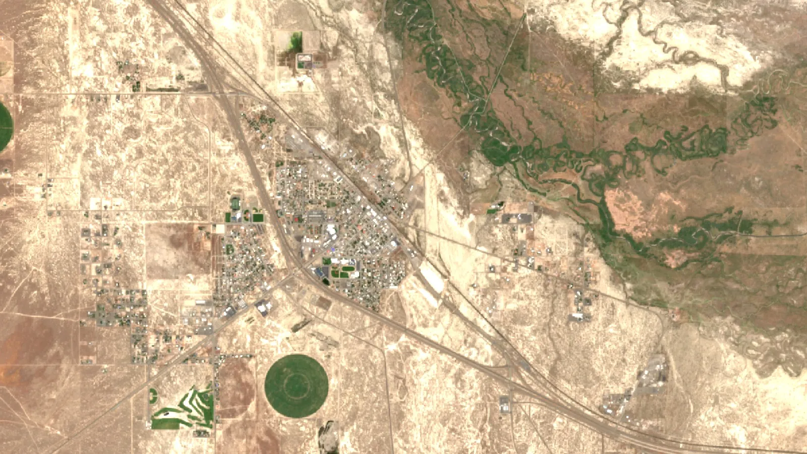
The most expensive field mistake is sampling the wrong ground. Satellite data cannot replace a field kit, but it can narrow the area it goes to. At Farmonaut we analyse multispectral and hyperspectral satellite data to flag alteration zones, faults and fractures that match mineral targets, and we deliver a report in 5 to 20 business days from a polygon, KML or KMZ file. Our stated range is up to 80 to 85% lower early-exploration cost than ground-only work, and no ground disturbance in that first phase. Results are exploration targets that sit ahead of a resource estimate; they do not replace sampling or drilling. If you are sizing a campaign, you can map your mining site, read about our satellite-based mineral detection, or contact us for a quote on a specific area.
For more on the data you check before staking and sampling, see our guide to public geoscience data before staking, our note on how to sequence a first-season geophysical survey, and our overview of satellite gold exploration in the United States.
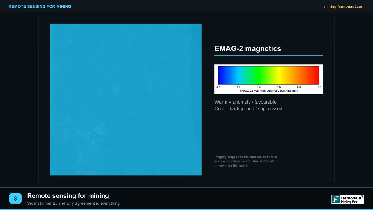
▶ Explains remote sensing for mining in plain words and why agreement between instruments matters. · 2:01
Frequently asked questions
What is a mining kit?
It is the set of field tools used to map, sample and test ground during exploration: GPS, compass, hammer, bags, sieves, and often a handheld XRF analyser or a magnetic susceptibility meter. The right kit depends on the question you are answering, not on a fixed list.
What should be in a basic geological field kit?
A GPS or phone with offline maps, a compass-clinometer, a hand lens, a rock hammer, a notebook or logging app, sample bags and tags, a marker, and a camera. Add a sieve and trowel for soil and sediment work.
How much does it cost to rent a handheld XRF?
Thermo Fisher’s US Niton rental sheet, valid to 31 December 2026, lists XRF models from US$1,350 to US$2,028 per week and US$4,200 to US$6,084 per month. Rates for two or more months are lower per month, and other renters will quote their own rates.
Can a handheld XRF measure gold?
Not reliably. ALS Geochemistry states that gold cannot be reliably measured by portable XRF, and that arsenic, tungsten and zinc can give false readings for gold. Use fire assay or another lab method for gold.
How accurate is a handheld XRF compared with a lab assay?
ALS gives method precision of 5 to 20% or more for pXRF when it is used correctly with good quality control, against 1 to 5% for the assay methods used for financial decisions. It is an indicative tool for field decisions.
How many control samples should go with a batch?
Published recommendations average about 20% control samples of all types, and the programmes reviewed by Bariatska and Sergeieva (2023) averaged slightly over 16%. Set the split between blanks, standards and duplicates with your lab and qualified person.
Why do field duplicates matter?
The CONSOREM summary found that the first sampling step accounts for on average 82.6% of the total precision error for gold, 87% for silver and 70% for copper. A field duplicate is the control that measures it.
How accurate is phone GPS for marking sample sites?
GPS.gov states that smartphones are typically accurate to within a 4.9 m (16 ft) radius under open sky, and worse near buildings, bridges and trees. That is fine for a walkover but not for locating a narrow vein or a drill collar.
What size should a stream-sediment sample be?
It depends on the lab and the survey design. One USGS survey describes composites of about 0.5 kg, sieved in the lab to under 180 micrometres (80 mesh). Ask your lab for its specification first.
Do I need permission to sample on a claim?
Yes. Get written permission from the surface owner and confirm the claim or licence position with the regulator. Rules on sampling and ground disturbance differ by jurisdiction, so confirm them locally.
Is it safe to use mercury to recover gold?
No. The WHO has reviewed the health hazards of mercury use in small-scale gold mining. Use gravity methods and keep mercury out of the process.
This page is for information only. It is not investment advice or legal advice. Confirm sampling rules, permits and surface access with the regulator and the landowner. Get permission before you sample, follow safety rules in the field, and never use mercury.
Farmonaut mining
Map your site before the crew goes out
Send us a polygon and we screen it by satellite for mineral targets, so your field kit goes to the best ground first.
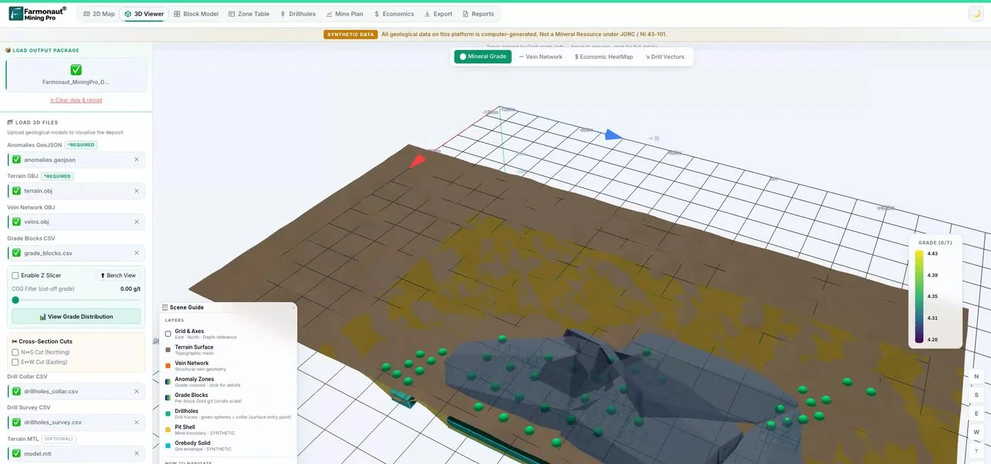
Mining Pro sample view, synthetic data
Keep reading
Sources
- Thermo Fisher Scientific, Niton Rental Program (valid to 31 December 2026): assets.thermofisher.com
- ALS Geochemistry, Portable XRF for Exploration and Mining (technical note): alsglobal.com
- University of South Florida Geosciences, ICP lab pricing 2024-2025: usf.edu
- USGS, Open-File Report 02-223, stream-sediment sample preparation: pubs.usgs.gov
- USGS, Open-File Report 93-527: pubs.usgs.gov
- GPS.gov, GPS accuracy: gps.gov
- CONSOREM, project 2013-05, QA/QC in mineral exploration: consorem2.uqac.ca
- Bariatska and Sergeieva (2023), Control samples used for QA/QC, Visnyk of Taras Shevchenko National University of Kyiv: Geology: geology.bulletin.knu.ua
- Geomatrix, Terraplus KT-10 magnetic susceptibility meter: geomatrix.co.uk
- Ngang (2015), A comparative study of hand-held magnetic susceptibility instruments, Laurentian University: laurentian.scholaris.ca
- World Health Organization (2016), Environmental and occupational health hazards associated with artisanal and small-scale gold mining: who.int
Discussion
Questions, corrections or field experience? Share them below. First-time comments are reviewed before they appear, and your email is never published.
No comments yet. Be the first to add a question or your experience.

 Omsri International FZE
 G.I.T.T.
 Jaunita Erss Ltd
 Almosi SARL
 SRK Consulting
 Berks Gold Limited
 Mwerezi Minerals Company Limited
 Mining SARL
 SenGold Invest SAS
 Sean Mining Limited
 NTS Group (Pty) Ltd
 Mine4Africa
 Lithspo Minerals Limited
 Tintina Mining Group
 Dalgety Minerals Pty Ltd
 Licence holder · Nigeria · Gold + lithium