

Exploration planning · Canada
Induced Polarization Survey Sequencing for a First Season
In most Canadian first seasons an induced polarization survey comes fourth: screen the ground from satellite and open data, fly an aerial magnetic survey, run soil or till geochemistry down-ice of the best structures, then put IP lines only over the two or three targets that survive, file the right provincial plan or permit, and drill last.
Key takeaways
- Cheap, wide methods go first and narrow, expensive ones last: satellite and open data, then airborne magnetics, then geochemistry, then the induced polarization survey, then drilling.
- One 2024 Newfoundland technical report values airborne geophysics at C$100 per line-km and ground geophysics at C$5,000 per line-km.
- In Ontario, ground geophysics that needs a generator, such as IP, is an exploration plan activity; plans start more than 35 days after submission.
- In Quebec, line cutting, soil surveys and surface geophysics do not need an impact-work authorization (ATI); drilling with hydraulic equipment does.
- Ontario counts remote sensing imagery, geochemistry, airborne and ground geophysics and drilling as assessment work at C$400 per cell per year.
In this article
- Why the induced polarization survey usually comes fourth
- Step 1: satellite screening and open data before anyone flies
- Step 2: the aerial magnetic survey
- Step 3: soil and till geochemistry in glaciated ground
- Step 4: the induced polarization survey and ground EM over ranked targets
- What a first season costs: unit rates and a budget calculator
- Permits, the field calendar and assessment work
- Step 5: drilling the first holes, and the decision point
- Induced polarization survey and first-season sequencing: frequently asked questions
Ask ten exploration geologists when to run an induced polarization survey and most will say “after you know where to put the lines”. That answer hides a sequence. Ground IP costs about fifty times more per line-kilometre than airborne geophysics in one recent Canadian technical report, it needs wire, electrodes and usually a generator on the ground, and in Ontario that generator makes it an exploration plan activity with a waiting period. This page lays out how a TSX, TSXV or CSE junior can order satellite screening, an aerial magnetic survey, soil and till geochemistry, IP and electromagnetics (EM), and the first drill holes inside one Canadian field season, with costs taken only from filed reports and rules taken from the regulators. How each geophysical method works is covered in our guide to geophysical survey methods, so here we stick to order, timing and money.
Ground geophysics at C$5,000 a line-km against airborne at C$100: the order you run them in is a budget decision.
Why the induced polarization survey usually comes fourth
Think of a first season as a funnel. A new claim block in the Abitibi, the Red Lake district or central BC may cover a few thousand hectares. Drilling can test a handful of points in it. Everything before the drill exists to shrink the ground from “the whole claim” to “these three collars”, and each method costs more per unit of ground than the one before.
Physical properties explain the order. The CIM Mineral Exploration Best Practice Guidelines (2018) list the properties geophysics has traditionally used: density, magnetic susceptibility, conductivity, chargeability, resistivity, radioactivity and seismic velocity. Magnetics measures susceptibility from the air over the whole property at once. An induced polarization survey measures chargeability and resistivity from the ground, one line at a time. The CIM guidelines also say a qualified geophysicist should plan, supervise and interpret any geophysical survey, which is worth budgeting for from day one.
| Stage | What it maps | Unit cost used in one filed report | Permit trigger to check |
|---|---|---|---|
| 1. Satellite and open data | Outcrop windows, alteration where exposed, lineaments, access, old work | Imagery and desk time; no field crew | None for remote sensing; Quebec calls it indirect work |
| 2. Aerial magnetic survey | Magnetite-bearing rocks, faults, intrusions, folds under cover | C$100 per line-km (airborne geophysics) | Quebec: no ATI for airborne or drone surveys |
| 3. Soil and till geochemistry | Metal and pathfinder anomalies, glacial dispersal from bedrock sources | C$100 per surface sample | Hand sampling is light; confirm surface-rights notice rules |
| 4. Induced polarization survey and ground EM | Chargeable (disseminated sulphide) and conductive zones at depth | C$5,000 per line-km (ground geophysics) | Ontario: generator surveys and line cutting up to 1.5 m are plan activities |
| 5. Drilling | The rock itself | C$450 per metre all-in (historic rate) | Ontario plan or permit; Quebec ATI; BC Mines Act permit |
Unit costs: Cape Ray Gold Project technical report by Equity Exploration Consultants (May 2024), used there to value historical work. Permit triggers: Ontario early exploration plan activity sheet, Quebec ATI promoter’s guide, BC Mines Act. General information, not legal advice; confirm with each regulator.
Those unit costs come from one report and one island, so treat them as an order of magnitude rather than a quote. The ratio is the useful part. If one kilometre of ground IP buys fifty kilometres of airborne data, flying first and putting the IP where the magnetics and the soils agree is simply cheaper than cutting grid over the whole claim.
Infographic
A first-season survey sequence for a Canadian junior
- 1Screen from spaceSentinel-2, open aeromagnetic grids and old assessment files.
- 2Fly magneticsAn aerial magnetic survey maps structure across the whole claim.
- 3Sample soils and tillRead the ice-flow direction, then sample down-ice.
- 4Run IP and EMGround lines over the best two or three targets only.
- 5Permit and drillOntario plan or permit, Quebec ATI, BC Mines Act permit.
- 6Report and decideFile assessment work, then the Phase 2 decision point.
Step 1: satellite screening and open data before anyone flies
The cheapest kilometre is one somebody else already paid for. Before a junior books an aircraft, three free sources are worth an afternoon each.
First, the national aeromagnetic compilation. Natural Resources Canada’s aeromagnetic survey data compilation draws on more than 700 surveys, generally flown at 800 m line spacing and 305 m above ground, with most surveys since 2000 at 400 m spacing or less, gridded at 200 m and 1 km. That is regional data: good enough to see a greenstone belt, a major fault or a pluton, not to site a drill pad. It tells you whether a new aerial magnetic survey over your claims would add detail or repeat what exists.
Second, the provincial files. Quebec’s SIGÉOM holds government geoscience and filed assessment work; Ontario and British Columbia keep their own assessment report databases, covered in our guide to geological survey agencies and free geology data. Old IP lines, soil grids and drill logs on or next to your ground can save you from re-surveying, or show you where a previous crew stopped.
Third, satellite imagery. The Copernicus Sentinel-2 mission carries a 13-band multispectral instrument at 10, 20 and 60 m resolution, with a 290 km swath and a design revisit of five days at the equator, more often at Canadian latitudes where orbits overlap. Over exposed rock it can map iron oxide and clay alteration; over the whole claim it maps lineaments, drainage, outcrop windows, old trenches and access for a crew.

▶ Why screening from space comes before ground crews and drill rigs (4 min 26 s). · 4:26
What satellites can and cannot see on the Canadian Shield
Be honest about Canada. Much of the Shield is under forest, swamp, lakes and glacial till, and snow covers it for half the year. Spectral alteration mapping works where rock or thin soil is exposed: burn scars, ridges, road cuts, alpine BC and the barren grounds of the North. Under thick till the satellite sees vegetation and water, not bedrock. There, the satellite step earns its money on structure, landforms that record ice flow, and logistics, and it hands over to magnetics and geochemistry sooner.
This is where we fit. Farmonaut’s satellite-based mineral detection screens large areas with multispectral and hyperspectral data for alteration zones, faults and deposit-associated patterns before field crews deploy, which can shorten the early-exploration screening step from months to days and lower early-exploration cost by up to 80 to 85%. We have scanned more than 100,000 hectares across 25+ countries for 20+ mineral types. The output is a ranked target map with GIS files, not a resource, and in glaciated ground it is a first filter, not a replacement for magnetics, geochemistry or an induced polarization survey. To see your own ground, open Map Your Mining Site.
Step 2: the aerial magnetic survey
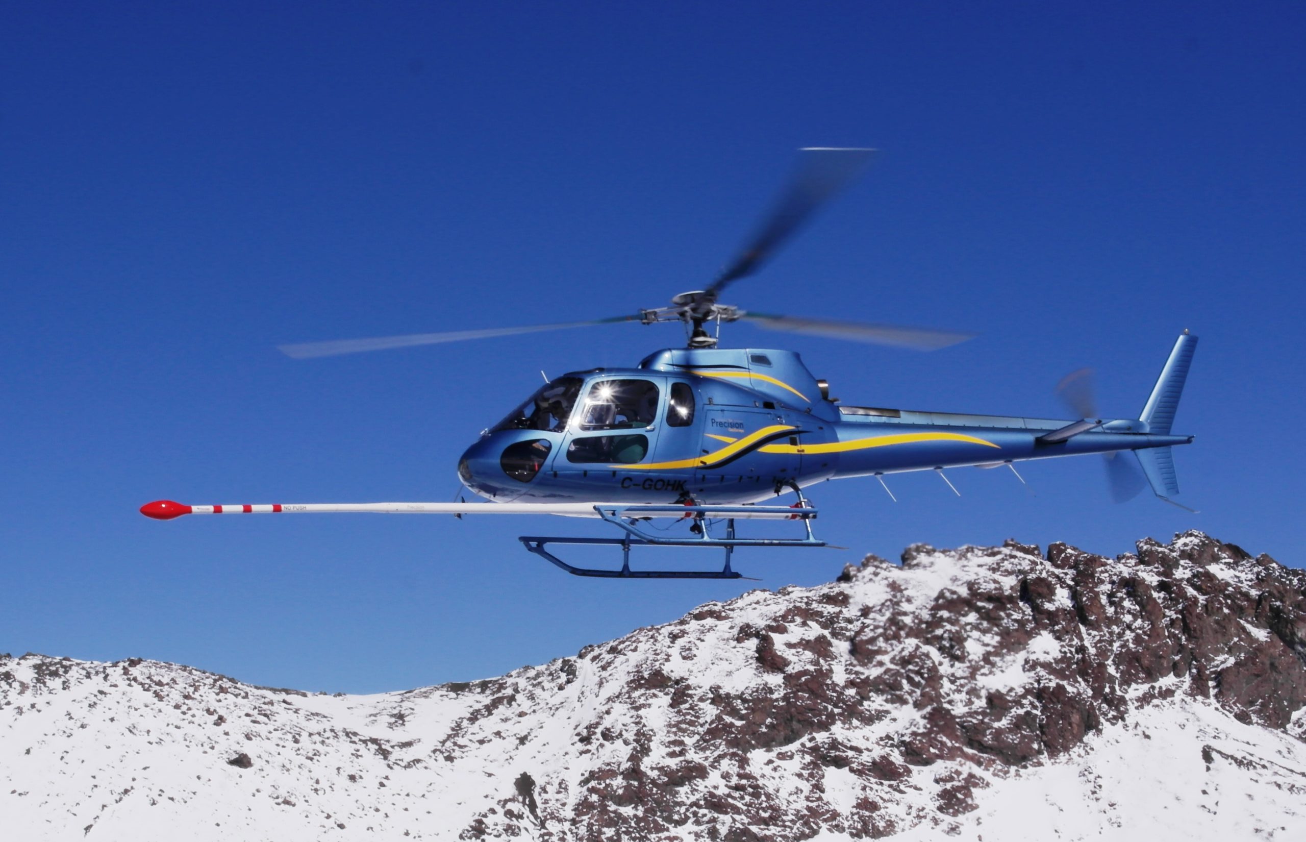
An aerial magnetic survey is the workhorse of the first season because it covers every hectare at once, it is cheap per kilometre, and it needs no ground access. It maps magnetic susceptibility, which mostly means magnetite. In greenstone belts that picks out iron formations, mafic and ultramafic units, intrusions, folds and the faults that offset them. Gold in the Abitibi and Red Lake districts, porphyry copper-gold in BC and many VMS deposits sit on or beside structures a mag map shows clearly.
The national grids above are flown at 400 to 800 m. A property survey is flown much tighter, often with lines a few tens of metres apart over a small block, which is why line-kilometres add up fast. The Cape Ray technical report notes that one company survey there was flown at 30 m line spacing and covered 16,570 line-km. Specifications such as line spacing, height and whether to add EM or radiometrics belong to your geophysicist; contractor platforms are compared in our airborne geophysical survey guide, and drone magnetometers for small blocks in our drone geophysics guide.
Paperwork is light. Quebec’s promoter’s guide to impact-causing exploration work calls geophysical surveys “carried out from an aircraft or helicopter or using a drone”, remote sensing and satellite surveys “indirect exploration work” that needs no ATI. Ontario’s early exploration plan list does not include airborne surveys either. Check flight and landowner rules with your contractor.
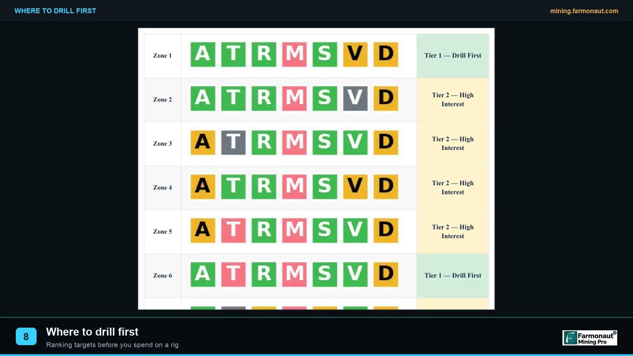
▶ How exploration targeting ranks ground before the drill (2 min 19 s). · 2:19
Reading the mag map for IP targets
The mag map rarely says “drill here”. It says where the structures are, where intrusions sit and where magnetite has been destroyed. That last point matters for IP. In a U.S. Geological Survey study of the Pebble porphyry deposit in Alaska, published in Geophysics, the authors found that chargeability highs alone covered a far larger area than the deposit, because sulphides formed through several alteration stages and mafic rocks were also chargeable. The deposit was roughly outlined where chargeability highs overlapped analytic-signal lows from the magnetics, meaning plenty of sulphide and little magnetite near surface. The lesson for a junior: fly the magnetics first, because the induced polarization survey is easier to read against them.
Step 3: soil and till geochemistry in glaciated ground
Most of Canada was scraped by ice. Glaciers picked up rock from mineralized bedrock and smeared it down-ice into till, so a metal anomaly in till usually sits on the down-ice side of its source, not on top of it. Geochemistry is also what tells you where the induced polarization survey lines should start and end. That is both the problem and the opportunity of geochemistry here: the dispersal train can be larger than the deposit, but you have to know which way the ice moved.
A British Columbia Geological Survey study shows why. Open File 2010-04 ran a 2.5 km till transect across the Copper Star porphyry occurrence in west-central BC, collecting 2 to 5 kg basal till samples. In an area with a known ice-flow reversal, copper in till peaked at 686 ppm directly west of the occurrence and declined westward, while the second-highest value sat to the east. Sample only one side of the target and you would have missed half the story.
For protocols, the Geological Survey of Canada publishes its till-sampling and analytical protocols (2020 update), and the CIM guidelines note that geochemical surveys sample soils, parent overburden, lake and stream sediments, vegetation and water across glaciated and non-glaciated terrain alike. In practice a first-season program decides three things: what medium (B-horizon soil over thin cover, basal till where cover is thick), what spacing, and which pathfinder elements the lab reports.

▶ Satellite screening and soil geochemistry for copper-gold targets in British Columbia (3 min 11 s). · 3:11
What a grassroots geochem season looks like on paper
Recommended budgets in NI 43-101 technical reports show where grassroots money goes. The January 2025 report on the Grid BC copper-gold project proposed a C$150,000 first phase for rock sampling, mapping, prospecting and geochemical surveys over a 12-day field program. The largest line was not the lab. It was the helicopter.
Chart
Where a C$150,000 grassroots season goes
Phase 1 budget for one BC copper-gold property (12-day field program), C$
Step 4: the induced polarization survey and ground EM over ranked targets
By now the claim should have shrunk to a few targets where structure, magnetics and geochemistry agree. That is when the induced polarization survey earns its cost. IP injects current into the ground through electrodes and measures how slowly the voltage decays once the current stops. Disseminated sulphides hold that charge, so they show as chargeability highs; resistivity is measured at the same time. Ground EM looks for conductors, such as massive sulphide or graphite, and suits VMS and nickel targets better than disseminated gold. The physics of chargeability and survey arrays is in our guide to IP, chargeability and resistivity.
On the ground, an induced polarization survey is a crew job. Ontario’s early exploration plan activity sheet describes IP surveys as “laying out kilometres of thin wire and placing small metal rods into the ground”, usually on cut lines less than 1.5 m wide, with warning signs posted for the electrical hazard. Lines are often cut and picketed first, which is a separate cost and, in Ontario, its own plan activity.

▶ DC resistivity and induced polarization alongside hyperspectral and LiDAR on a BC gold project (2 min 47 s). · 2:47
Induced polarization survey permits: Ontario, Quebec and BC
Here the provinces part ways, and timing matters more than cost. In Ontario, ground geophysical surveys that need a generator, which covers most IP, are exploration plan activities, as is line cutting up to 1.5 m wide. Ontario’s plan and permit guide says a plan’s start date must be more than 35 days after submission and a permit’s more than 55 days after application; a plan becomes effective 30 days after circulation and lasts two years. So a July induced polarization survey in Ontario needs its plan filed in spring, ideally alongside the drilling you expect to follow.
Quebec is lighter for surveys. Its promoter’s guide says line cutting, soil surveys and “surface and drilled geophysical surveys” do not need an ATI; the ATI regime, in force since May 6, 2024, targets work with hydraulic machinery or explosives, including drill holes in overburden or rock and seismic refraction surveys. British Columbia’s Mines Act defines a mine to include any place of mechanical ground disturbance made to explore, and exploratory drilling, and section 10 requires a permit before work starts. Whether a particular IP layout needs a Mines Act permit is a question for the BC mines ministry’s regional office before you mobilize. General information, not legal advice; confirm with each regulator.
In Ontario, an IP crew with a generator is a plan activity: file more than 35 days before the start date.
How many line-km of IP does a first season need?
Fewer than most people budget. At C$5,000 per line-km, 20 line-km of an induced polarization survey is about C$100,000 in the Cape Ray unit rates, the same as 1,000 line-km of airborne data. Two or three short grids over the best targets, oriented across strike and long enough to reach background on both sides, usually beat one large grid placed early. Your geophysicist decides array, spacing and depth of investigation; the junior decides how many targets the money can carry.
What a first season costs: unit rates and a budget calculator
The calculator below uses the unit costs from the Cape Ray technical report, the only filed report we found that states airborne, ground geophysics, geochemistry and drilling rates side by side. The defaults describe a modest first season: 300 line-km of airborne magnetics, 400 soil or till samples, 20 line-km of IP and 1,500 m of drilling. Change any number; the drilling rate is an input because it varies most, and the induced polarization survey line-km is the field most juniors overestimate.
Calculator
What will your first field season cost in C$?
Enter line-km of airborne and ground geophysics, samples and drill metres; amounts in Canadian dollars.
- Airborne magnetics (C$): $30,000
- Ground IP or EM (C$): $100,000
- Geochemistry (C$): $40,000
- Drilling (C$): $675,000
- Surveys before the drill: 20 %
Amounts in Canadian dollars (C$). Unit costs of C$100 per line-km for airborne geophysics, C$5,000 per line-km for ground geophysics and C$100 per surface geochemical sample, and the default all-in drilling rate of C$450 per metre, are the rates Equity Exploration Consultants used to value historical work in the Cape Ray Gold Project technical report (Newfoundland, May 2024). Change the drilling rate to match your ground: the Sitka RC Gold report (Yukon, July 2026) budgets C$400 per metre in summer and C$700 in winter. Excludes claim fees, permitting, consultation, reporting and contingency. A planning estimate, not a quote.
At the defaults, the surveys before the drill cost about C$170,000, one-fifth of an C$845,000 season, and drilling is the rest. That ratio is the case for doing the cheap steps well: an extra C$30,000 of magnetics that moves one hole onto a better target is worth more than it costs. Rates in your district will differ, so replace each one with a contractor quote as soon as you have it.
Where junior exploration money is going
Juniors are spending more, and that affects when you can book an induced polarization survey crew. Natural Resources Canada’s Canadian Mineral Exploration Information Bulletin (April 2026) puts 2025 exploration and deposit appraisal spending at C$4.4 billion preliminary and 2026 intentions at C$5.3 billion, with junior companies planning C$2.91 billion, up from C$2.27 billion. More money in the field also means busier geophysical crews and drill contractors, so book early.
Chart
Exploration spending by company type, Canada
Exploration and deposit appraisal, C$ billion: 2025 preliminary vs 2026 intentions
Not investment advice: these are national totals, not a signal about any company or project.
Permits, the field calendar and assessment work
A Canadian field season is short. The Cape Ray report says work there can be done year-round but is most effective from late May to late September. Snow ends spectral mapping and soil sampling; frozen ground and ice can help drilling in swampy country but slows ground geophysics in deep snow. The practical calendar for a first season looks like this:
- Winter: desk study, satellite screening, compile open aeromagnetic grids and old assessment files, book the airborne contractor.
- Spring: fly the aerial magnetic survey before leaf-out if you can, file Ontario plans (35+ days) or line up Quebec ATI and BC permit applications for drilling.
- Early summer: soil and till sampling down-ice of the best mag structures; prospecting and mapping.
- Mid to late summer: line cutting and the induced polarization survey over two or three targets.
- Fall or winter: first drill holes, if results and permits allow.
| Province | Surveys (mag, soils, IP) | Drilling | Source |
|---|---|---|---|
| Ontario | Generator-powered ground geophysics and line cutting up to 1.5 m wide: exploration plan | Drill under 150 kg: plan; heavier mechanized drilling: permit | Ontario plan activity sheet; plan and permit guide |
| Quebec | Line cutting, soil surveys, surface and airborne geophysics: no ATI | Drill holes with hydraulic equipment: ATI (since May 6, 2024) | Quebec promoter’s guide to impact-causing work |
| British Columbia | Ask a regional office whether ground disturbance triggers a permit | Exploratory drilling: Mines Act permit before work starts | Mines Act, s. 1 and s. 10 |
General information, not legal advice; confirm with the Ontario ministry responsible for mines, Quebec’s MRNF or BC’s mines ministry regional office.
Winter or summer drilling: what one Yukon report budgets
Season also changes the drill rate. Sitka Gold’s July 2026 RC Gold Project technical report in the Yukon budgets C$700 per metre all-in for a March to April winter program and C$400 per metre for the April to October summer program. In Newfoundland, the Cape Ray report budgets C$350 per metre for one zone and C$500 for another, and used C$450 to value historical drilling.
Chart
All-in drilling cost per metre in three Canadian reports
C$ per metre drilled, as budgeted or assumed by the report authors
Turning first-season surveys into Ontario assessment credit
In Ontario every cell carries C$400 a year of assessment work under O. Reg. 65/18 (C$200 for boundary claims). Survey spending is eligible work, so a good first season does double duty: it finds targets and keeps the ground in good standing. The calculator shows how many years of the annual requirement a season’s survey spend could cover, before the regulation’s own rules on applying and reserving credits.
Calculator
How many years of Ontario assessment work does one season cover?
Enter cells held, eligible survey spend in Canadian dollars and the credit rate.
- Annual requirement (C$): $16,000
- Credits earned (C$): $170,000
Amounts in Canadian dollars (C$). O. Reg. 65/18 under Ontario’s Mining Act sets C$400 of assessment work per cell per year (C$200 for boundary claims and some converted cells, not modelled) and credits eligible costs at 100% if the report is filed within 24 months of the work, 50% between 24 and 60 months. Remote sensing imagery, geochemical, ground and airborne geophysical work, line cutting and drilling are eligible work types. How credits are applied to future years follows the regulation’s own rules; an indicator, not a ruling. General information, not legal advice; confirm with the Ontario ministry responsible for mines.
At the defaults, C$170,000 of eligible surveys over 40 cells equals about ten years of the C$16,000 annual requirement, as long as the report is filed within 24 months. File late and the credit halves. Work done more than 60 months before the report is not eligible at all.
Step 5: drilling the first holes, and the decision point
Drilling is where the funnel ends. Each hole should test a specific question the surveys raised: is the chargeability high sulphide in the right host rock, does the till anomaly trace back to bedrock on this structure, does the mag break carry alteration? Plan holes to cut the target across its likely strike, and to reach the depth the induced polarization survey modelled, not just the depth the budget allows.
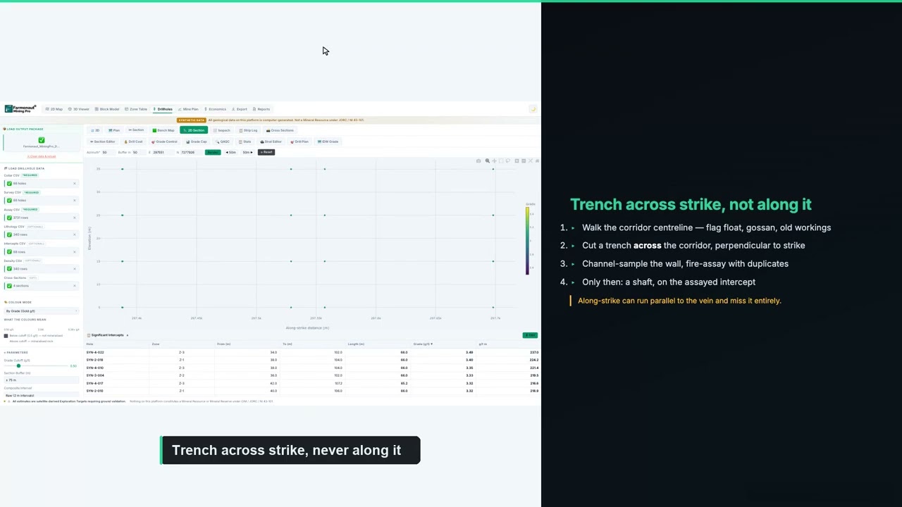
▶ Planning a drill program from targets to collars, step by step (12 min 13 s). · 12:13
Methods, hole planning and costs are covered in our exploration drilling guide, and picking a contractor in our drilling contractor guide. For this page the point is order: by the time a rig arrives, the claim should have been screened, flown, sampled and, over the best targets, surveyed with IP.
Our Premium+ report adds TargetMax™ drilling intelligence: recommended drilling angles and interactive 3D subsurface models of vein structures and mineral distribution, built from the satellite analysis, to help rank collars before the first hole. It sits ahead of drilling and a Qualified Person’s work, not in place of them. Send coordinates or a KML/KMZ polygon and the target mineral to get a quote; delivery takes 5 to 20 business days depending on area and mineral complexity.
Common sequencing mistakes in a first season
- Cutting grid over the whole claim before flying it, then finding the best mag structure off the grid.
- Sampling till on the wrong side of a target because nobody checked ice-flow indicators first.
- Booking the induced polarization survey for July in Ontario without filing the exploration plan in spring.
- Running an induced polarization survey before the geochemistry is back, then re-surveying once the soil anomaly turns up 400 m away.
- Spending the whole budget on surveys and having nothing left to drill the target they found.
- Filing the Ontario assessment report after 24 months and losing half the credit.
For the bigger picture on claims and geology, see our overview of gold exploration in Canada. If you want the satellite step done before the aircraft is booked, start at Map Your Mining Site.
Induced polarization survey and first-season sequencing: frequently asked questions
What is an induced polarization survey?
Is it induced polarization or induced polarisation?
Should a junior fly an aerial magnetic survey before IP?
How much does an induced polarization survey cost per line-km in Canada?
Do I need a permit for an IP survey in Ontario?
Do I need an ATI for geophysics in Quebec?
Why sample till instead of soil?
Does a chargeability anomaly mean there is ore?
Do surveys count as assessment work in Ontario?
When is the best time of year for fieldwork in Canada?
Can satellite data replace geophysics?
Authored by: Farmonaut Research & Content Team · Reviewed by: Farmonaut Mining & Mineral Exploration Team · Updated October 2026
General information about exploration planning in Canada, not legal, tax, securities or investment advice; confirm with your advisers, your Qualified Person, the regulator and the exchange. Unit costs come from specific technical reports and are not quotes. Farmonaut is a satellite data-analytics company, not a geophysical or drilling contractor, licensing agent, broker or investment adviser. Satellite results are exploration targets, not mineral resources or reserves.
Farmonaut mineral detection
Map your mining site from space
Send your claim or licence boundary as KML, KMZ or a polygon. Farmonaut returns ranked satellite exploration targets for it, usually in 5 to 20 business days.

Keep reading
Sources
- Equity Exploration Consultants for Matador Mining, Cape Ray Gold Project technical report (2024): minedocs.com
- Geosim Services for Sitka Gold, RC Gold Project NI 43-101 Technical Report (2026): wp-sitkagold-2024.s3.ca-central-1.amazonaws.com
- Grid BC Copper-Gold Project NI 43-101 Technical Report (2025): gridbatterymetals.com
- Natural Resources Canada, Canadian Mineral Exploration Information Bulletin (2026): natural-resources.canada.ca
- Natural Resources Canada, Aeromagnetic survey data compilation (Open Government Portal): open.canada.ca
- Government of Ontario, O. Reg. 65/18: Assessment Work: ontario.ca
- Government of Ontario, Exploration plan submission and permit application guide: ontario.ca
- Ontario ministry responsible for mines, Early exploration plan activity information: geologyontario.mndm.gov.on.ca
- Government of Ontario, Consultation framework for mineral exploration: ontario.ca
- Gouvernement du Québec, Promoter's guide: impact-causing exploration work (2024): cdn-contenu.quebec.ca
- Gouvernement du Québec, SIGÉOM geoscience portal: quebec.ca
- Province of British Columbia, Mines Act: bclaws.gov.bc.ca
- BC Geological Survey, Open File 2010-04: Copper Star till transect (2010): cmscontent.nrs.gov.bc.ca
- Geological Survey of Canada, Till-sampling and analytical protocols, 2020 update: ostrnrcan-dostrncan.canada.ca
- Shah et al., USGS, Integrated geophysical imaging of the Pebble porphyry deposit, Geophysics (2013): pubs.usgs.gov
- CIM, Mineral Exploration Best Practice Guidelines (2018): mrmr.cim.org
- CIM, National Instrument 43-101 and Form 43-101F1: mrmr.cim.org
- Copernicus / ESA, Sentinel-2 mission: sentiwiki.copernicus.eu
Discussion
Questions, corrections or field experience? Share them below. First-time comments are reviewed before they appear, and your email is never published.
No comments yet. Be the first to add a question or your experience.

 Sania Corporation
 Sean Mining Limited
 NTS Group (Pty) Ltd
 Mine4Africa
 Lithspo Minerals Limited
 Tintina Mining Group
 Dalgety Minerals Pty Ltd
 Vortex Minerals Pty Ltd
 Faith At Work (Pty) Ltd
 Geotech Mining Solutions plc
 Vulcan International Limited
 Kidepo Associates
 GKY Mining
 Alkimy SARL
 Double A Trading
 GemSprout Metals Limited
 Qader Group
 Ileys General Trading
 SG Gold Mining LLC
 VRV Global Pte Ltd
 Omsri International FZE
 G.I.T.T.
 Jaunita Erss Ltd
 SRK Consulting
