Best Drone Agriculture: Agriculture Drone Images & AI Farming
“By 2025, over 60% of large farms globally are expected to use AI-powered agriculture drone images for crop monitoring.”
Introduction: The Rise of Drone Agriculture in 2025
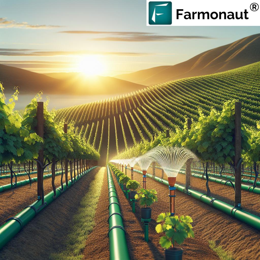
The best drone agriculture technologies, integrated with advanced multispectral and hyperspectral cameras, artificial intelligence (AI), and precision spray systems, have fundamentally revolutionized traditional farming practices. As we enter 2025 and beyond, this innovation trend is accelerating, with agriculture drone images and AI farming images delivering never-before-seen detail, efficiency, and sustainability for modern agriculture.
Today’s agricultural drones aren’t just flying cameras—they are indispensable tools enabling farmers to analyze crop health, optimize resource usage, reduce input costs, and promote sustainable farming through targeted decision-making. With the adoption of agriculture spray drones and the rising availability of agriculture drone loans, these advanced technologies are now accessible to smallholders as well as large commercial operations.
In this comprehensive article, we explore:
- The transformative role of drone imagery in modern agriculture
- How AI farming images and image analysis maximize productivity and sustainability
- The innovative leap brought by agriculture spray drones
- How financial accessibility is bridging the tech divide with agri drone loans
- And, the future potential with IoT, 5G, and real-time integrated systems
Discover why agriculture drone images are not just the future—they are the essential present.
Technology Evolution: How Drones Have Revolutionized Agriculture
The introduction and integration of drone technology into agriculture over the past years marked the beginning of a modern farming revolution. Unlike traditional ground methods or satellite monitoring, agricultural drones can fly lower and closer to crops. This positioning enables them to capture high-resolution images, deliver highly localized data, and provide real-time insights tailored to specific fields or even individual rows.
The advancements in drone models include:
- Multispectral & Hyperspectral Cameras: Capable of capturing light frequencies beyond human vision for detailed crop and soil analysis.
- Onboard AI Processors: AI farming images are analyzed in-flight, allowing drones to adjust their actions dynamically, such as modifying a spray pattern based on detected crop stress.
- Increased Battery Life & Payload: The best drone agriculture models offer extended operational windows and greater chemical tanks for spray drones.
- GPS & RTK Integration: Ensures centimeter-level accuracy in mapping and treatment delivery.
This leap isn’t just theoretical—the impact is clear in the numbers, with the global drone in agriculture market poised to exceed $7 billion by 2025, driven by demand for data-driven decision-making and environmental stewardship.
Key Benefits Realized:
- Enhanced Productivity: Real-time agriculture drone images enable timely interventions, optimizing yield.
- Precision and Sustainability: Targeted actions reduce input costs and chemical usage, protecting soil and water resources.
- Reduced Human Exposure & Labor Demands: Operators are no longer placed in hazardous environments, and labor costs for monitoring and spraying are significantly reduced.
“Precision spray drones can cover up to 50 acres per hour, revolutionizing large-scale field management with advanced imaging.”
Agriculture Drone Images: The Cornerstone of Precision Farming
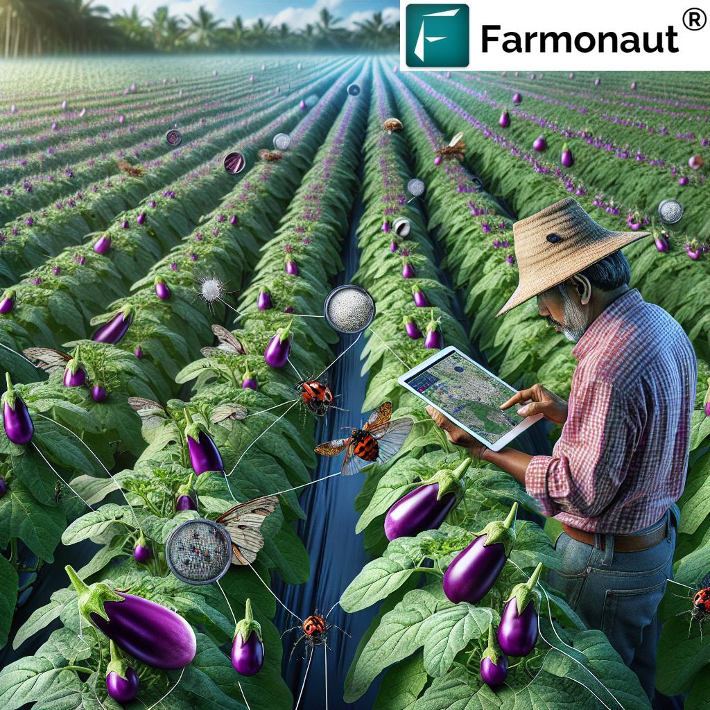
Agriculture drone images are at the heart of precision farming in 2025. By leveraging multispectral and hyperspectral capabilities, drone imagery provides farmers with a highly detailed, accurate picture of their crop and soil conditions. From nutrient mapping to pest and disease detection, the right imagery enables timely and targeted interventions that improve output and reduce losses.
Key Features of Modern Agriculture Drone Images
- Multi-Resolution Imaging: Drones can capture high-resolution images, distinguishing patterns and issues that escape the human eye or coarse satellite imagery.
- Timely Monitoring: Unlike satellites, agriculture drones can be deployed rapidly, providing on-demand information precisely when critical crop stages or events occur.
- Highly Localized Analysis: Drone imagery can pinpoint localized problems—such as micro-zones with nutrient deficiencies or water stress—enabling site-specific management (Variable Rate Application, VRA).
- Environmental Sustainability: Targeted analysis allows farmers to reduce chemical usage and minimize environmental impact by treating only areas in need.
Common Use Cases:
- Pest & Disease Detection: Early identification through visual or multispectral patterns greatly prevents crop losses.
- Irrigation Management: Thermal and hyper/multispectral images identify over/underwatered crop zones, optimizing resource usage.
- Growth Monitoring: Sequential images monitor crop development, enabling forecast adjustments as the season progresses.
Example: A farmer uses drone-based NDVI images to spot sections of a field suffering from nitrogen depletion. Instead of blanket-fertilizing the entire area, they target those spots, saving on inputs and reducing environmental run-off.
NDVI and Vegetation Index Analysis
One of the most valuable protocols in modern drone-facilitated agriculture is NDVI (Normalized Difference Vegetation Index). This index measures the difference between near-infrared (which healthy vegetation strongly reflects) and visible red light (which plants absorb). The results, translated into color-mapped images, show crop health and biomass density across the field.
NDVI and other indices derived from drone imagery empower farmers to:
- Quickly spot and assess nutrient deficiencies, pest infestations, disease outbreaks, or drought stress
- Plan targeted fertilization or chemical treatments, only applying what is needed, where it’s needed
- Track crop recovery after interventions or adverse weather events
The impact: NDVI analysis by drones significantly reduces both costs and input usage, increases yield, and ensures that agriculture remains both productive and environmentally sustainable.
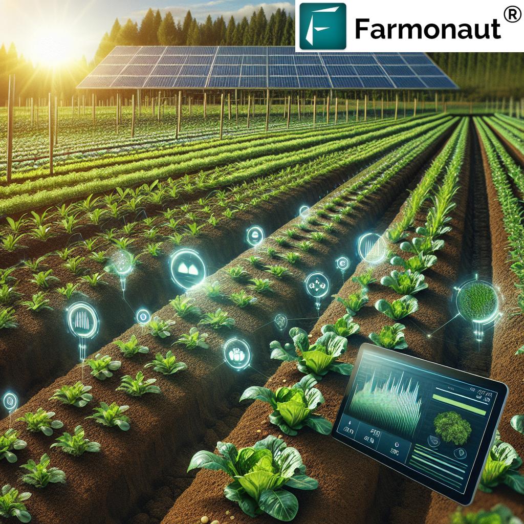
AI Farming Images: Turning Data into Actionable Intelligence
AI farming images take agricultural drone imagery to the next level. By integrating AI algorithms and machine learning into drone systems, farmers now have access to powerful image analysis tools that process vast datasets and distill them into clear, actionable insights.
How AI Empowers Farming Through Imagery:
- Automated Anomaly Detection: AI quickly recognizes patterns, spotting disease symptoms, pest populations, water stress, or abnormal growth zones invisible to the untrained eye.
- Data Integration: AI farming images don’t work in isolation—they’re integrated with soil sensor data, weather forecasts, and even historical yield data to offer context-sensitive recommendations.
- Predictive Analytics: By mapping growth trajectories and analyzing past patterns, AI can predict likely yield outcomes or alert to emerging threats, providing a valuable decision-making edge.
- Accessible Dashboards: Processed images and results are delivered via user-friendly mobile and web dashboards, ensuring insights are actionable for all types of operators.
This transformation has made AI farming images a cornerstone of modern and sustainable agriculture, with adoption rates expected to break records in 2025.
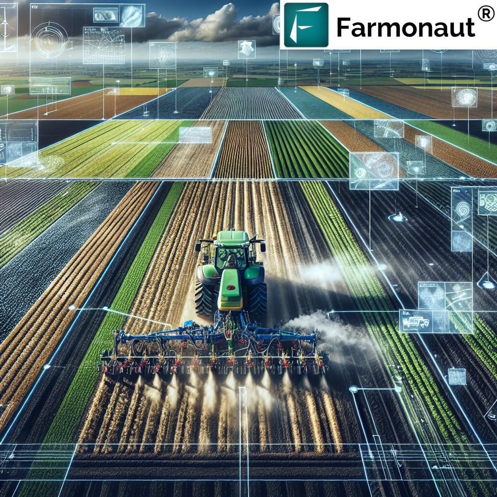
Agriculture Spray Drone: A Leap in Efficiency & Sustainability
Among the best drone agriculture models in 2025, the agriculture spray drone has truly reshaped field operations. Traditional ground sprayers often result in soil compaction, high chemical usage, worker hazard, and uneven application. Spray drones, meanwhile, are designed to cover large fields quickly and uniformly, while minimizing environmental disturbance and reducing operational costs.
Key Benefits of Agriculture Spray Drones:
- Precision Application: Spray drones use AI-powered sensors and agricultural drone images to dynamically adjust spray volumes and patterns based on real-time crop conditions.
- Environmental Stewardship: Targeted delivery minimizes chemical runoff, protecting surrounding water and soil ecosystems.
- Efficiency Gains: Cover more acreage per hour than conventional machinery—up to 50 acres/hour with leading models.
- Reduced Labor and Hazard: Spray drones reduce the need for manual labor and keep operators safely away from chemicals.
Additionally, best-in-class models are compatible with both pesticides, herbicides, and fertilizers. AI algorithms process agriculture drone images in real-time, ensuring dosage is matched exactly to plant need—preventing both overuse and under-treatment.
Comparison Table: Agriculture Drone Types & AI Abilities
| Drone Model / Type | Image Resolution (Estimated) | Spray Area Coverage (per hour) | AI Features | Application | Year Introduced | Estimated Efficiency Improvement (%) |
|---|---|---|---|---|---|---|
| DJI Agras T40 | 20 MP Multispectral | 40 hectares/hr | Crop Health, Weed Detection, Variable Rate Spraying | Pesticides, Fertilizers, Mapping | 2024 | 25% |
| Farmonaut Precision Drone | 15 MP Multispectral Satellite-Integrated | 30 hectares/hr | NDVI Mapping, AI Advisory, Resource Optimization | Fertilization, Disease & Pest Monitoring | 2025 | 30% |
| Parrot Bluegrass Fields | 14 MP RGB/NDVI | 15 hectares/hr | Field Mapping, Growth Stages, Basic Weed ID | Field Surveillance, Mapping | 2023 | 15% |
| XAG V40 Pro | 18 MP Multispectral | 50 hectares/hr | AI Crop Analysis, Obstacle Avoidance, Spray Control | Spraying, Plant Counting, Yield Prediction | 2025 | 34% |
Note: Refer to each manufacturer’s documentation for final specs.
Agriculture Drone Loans and Financial Accessibility
While the initial investment in advanced drone technology may seem significant, the rise of agriculture drone loans in 2025 has lowered the barriers for both smallholders and large operations. Financial accessibility is now a top priority as banks, microfinance institutions, and government agencies recognize the vital role drones play in boosting rural livelihoods and national food security.
How Agriculture Drone Loans Work:
- Tailored Lending Products: Loans are crafted specifically for purchasing drone systems, including spray drones and imaging models.
- Flexible Terms: Many products reduce upfront costs and spread payments over a multi-season timeline, aligning with farming cash flows.
- Bundled Advisory and Training: Most agriculture drone loans include access to training on drone operation, safety, and data interpretation, ensuring farmers can maximize ROI.
Banks and NBFCs (Non-Banking Financial Companies) often verify crop health and field conditions via satellite—like the solutions provided by Farmonaut—which reduces risks and encourages lenders to support innovation.
For streamlined, secure, and verified loan & insurance processing leveraging satellite data, see Farmonaut’s
Crop Loan & Insurance Solution.
To further support accessibility, agriculture drone images, AI farming images, and precision spray drone services are often accessible through locally available drone cooperatives or pay-per-use service networks, lowering the cost of technology adoption even more.
Moreover, API access for developers and businesses unlocking drone and satellite insights can be found at
Farmonaut API
. Find detailed API integration guides at
Farmonaut API Developer Docs.


For advanced resource tracking and logistics in agriculture, see Farmonaut’s
Fleet & Resource Management Solution
.
To monitor carbon footprinting and track environmental impact in vegetable and crop farming, check Farmonaut’s
Carbon Footprinting Platform
.
Knowledge of crop origin, traceability, and fraud-prevention is enhanced via
Product Traceability Solutions
from Farmonaut using blockchain and satellite-verification.
Emerging Trends: IoT, Edge Computing, and Ultra-Precision
As agriculture drone technology continues to evolve, their integration with other digital farming advancements is redefining the limits of modern agriculture. Leading trends shaping 2025 include:
- Internet of Things (IoT) Integration: Drones are increasingly being connected to centralized farm management systems, working in tandem with field sensors for seamless data flow and orchestration.
- Edge Computing: Real-time, on-drone analysis, reduces transmission latency. Crop health, weed identification, and spray adjustments can happen instantly—without waiting for cloud uploads and processing.
- 5G Connectivity: Rapid data transfer enables live video monitoring, ultra-fast map streaming, and instantaneous updates on mobile devices.
- Automation & Swarm Technology: Large fields are now managed by multiple drones coordinating autonomously, maximizing coverage while minimizing overlap.
- Sustainability Optimization: Advanced algorithms calculate the minimum resource usage for maximum yield, facilitating ongoing environmental stewardship in farming.
Farmonaut: Empowering Agriculture Through Satellite & AI Integration
At Farmonaut, we understand that data-driven agriculture is the key to future food security and environmental stewardship. Our mission is to make satellite-driven insights affordable and accessible across businesses, governments, and users worldwide. We leverage multispectral satellite images, AI-based advisory systems, and resource management tools to deliver value that is unparalleled in both large-scale commercial farms and smallholder operations.
- Satellite-Based Monitoring: Our platform harnesses satellite images to monitor crops, soil conditions, and track environmental impact, supporting informed decisions for better yield.
- AI Advisory System: Jeevn AI, our AI engine, analyzes imagery to produce actionable recommendations tailored for each farm—be it for irrigation, pest control, or nutrient optimization.
- Blockchain & Traceability: For end-to-end verification, our blockchain-based modules ensure transparent and secure supply chains.
- Fleet & Resource Management: We help optimize logistics, reduce operational costs, and ensure equipment safety for modern farms.
- Environmental Stewardship: Real-time tracking of carbon emissions and ecological impact drive the new standard in sustainable farming.
Our web, Android, and iOS apps, alongside robust APIs, ensure every farmer and enterprise completely unlocks the value within their fields.
Take the next step—Start using Farmonaut’s Platform for instant satellite-based crop health monitoring and resource optimization!
For those managing extensive acreage or plantation operations, discover our
Large Scale Farm Management Suite
for field mapping, monitoring, and actionable analytics.
Drive optimal resource use, environmental protection, and supply chain transparency with Farmonaut’s integrated solutions in 2025 and beyond.
FAQ: Best Drone Agriculture & AI Farming
- What are agriculture drone images?
- Agriculture drone images are high-resolution, aerial photos or multispectral images captured by drones specially designed for monitoring crops, soil health, pest infestations, and environmental conditions, enabling precision farming and timely interventions.
- How does an agriculture spray drone differ from traditional ground sprayers?
- An agriculture spray drone applies fertilizers, pesticides, or herbicides from the air with high precision, minimizing soil compaction, human chemical exposure, and resource wastage. Unlike ground sprayers, drones use AI and localized data for site-specific applications, improving efficiency and environmental sustainability.
- What is NDVI, and why is it important?
- NDVI (Normalized Difference Vegetation Index) is a key indicator derived from drone or satellite imagery, measuring plant health and vigor by analyzing reflected near-infrared and visible light. It allows farmers to quickly identify stressed or unhealthy areas and make targeted management decisions.
- How can farmers access financial support for drone adoption?
- Farmers can use dedicated agriculture drone loans offered by banks, microfinance institutions, and local associations. These loans often include training, satellite-based verification, and flexible repayment schedules aligned with cropping cycles, making advanced drone tech financially accessible.
- Can smallholder farmers benefit from drone agriculture?
- Yes, with increased financial accessibility via loans, co-ops, and pay-per-use models, even smallholder farmers can access drone images, spray drone services, and AI-powered analysis, improving productivity and sustainability on a budget.
- What are “AI farming images,” and how are they used?
- AI farming images are drone or satellite images processed by artificial intelligence and machine learning algorithms to detect anomalies, predict yield, categorize weed or pest outbreaks, and deliver actionable farming advice—often via smartphone dashboards.
- How does Farmonaut help in advanced agriculture monitoring?
- At Farmonaut, we provide satellite-based crop monitoring, AI-driven advisory systems, blockchain-based traceability, environmental impact tracking, and fleet/resource management. Our solutions equip farmers and businesses with real-time, actionable insights to drive sustainable and profitable farming operations.
Conclusion: The Future of Best Drone Agriculture in 2025
The marriage of cutting-edge drone technologies, agriculture drone images, AI analysis, and precision spray drones has revolutionized the world’s agricultural landscape. As 2025 unfolds, farmers of all scales can access high-frequency, high-resolution data—previously the domain of only the largest enterprises—empowering them to enhance productivity, reduce resource usage, minimize environmental impact, and ensure resilient food supplies for a growing population.
With continued innovations, agriculture drone images and AI farming images will remain essential not only for field monitoring and management but as cornerstones of insurance, loan processing, and supply chain traceability. Best-in-class spray drones will continue to redefine efficiency and safety in input application.
As a satellite technology provider, we at Farmonaut are proud to support this revolution through affordable, accessible and reliable satellite-driven solutions for agriculture and allied sectors. Embrace the future—unlock the potential of your farm with precision insights, actionable intelligence, and sustainability at the heart of every decision.
For questions on large-scale farm management, visit our management portal.
Learn how to build resilient, efficient, and sustainable farms in the era of AI drone agriculture and satellite-driven insights.