

Reviewed August 2026 against USDA NASS’s 2023 Irrigation and Water Management Survey, USDA ERS precision-agriculture research, and University of Georgia Extension soil-moisture field trials.
Try it: Run your own numbers →
Agriculture sensors are the field-deployed devices — soil moisture probes, water sensors, canopy optical sensors, and weather nodes — that feed real-time data into irrigation and crop-management decisions. The best ones for a given farm depend on what you’re trying to control: water sensors and soil moisture probes for irrigation timing, canopy sensors for crop stress, and weather stations for frost and disease risk. Below, every figure is sourced to a named study or government survey, with a link to check whether it has moved since.
US farmers irrigated 53.1 million acres across 212,714 farms and applied 81 million acre-feet of water, according to USDA’s National Agricultural Statistics Service (NASS) 2023 Irrigation and Water Management Survey, published October 31, 2024. That same survey put combined spending on irrigation equipment, land improvements, and computer technology at $3 billion for 2023. Sensors are a small slice of that number, but they’re the slice that determines whether the other $3 billion is used well.

Try Farmonaut’s App for Satellite-Powered Farm Monitoring
Table of Contents
- What Counts as an Agriculture Sensor
- Water Sensors in Agriculture: Scale, Cost & Verified Savings
- IoT Agriculture Sensors: Architecture, Range & Reliability
- Smart Agriculture Sensors: Where a Satellite Layer Fits In
- Best Smart Sensors for Farming: A Comparison You Can Verify
- Why Adoption Still Lags on Smaller Farms
- Deploying Agriculture Sensors: Placement, Calibration & Maintenance
- Calculator: Sensor-Guided Irrigation Savings
- FAQ: Agriculture Sensors & Water Sensors
- Get Started With Farmonaut
What Counts as an Agriculture Sensor
An agriculture sensor is any field-deployed device that measures a physical, chemical, or optical property of soil, water, or crop canopy and reports it — by cable, radio, or satellite uplink — to a system a farmer can act on. In practice, that splits into four working categories:
-
Soil moisture / water sensors: capacitance, TDR, or tension probes that measure volumetric water content or soil water tension at set depths, driving irrigation timing.
-
Soil chemistry sensors: pH, electrical conductivity, and nutrient-proxy probes that guide fertilizer and salinity management.
-
Canopy / optical sensors: spectral devices estimating NDVI and chlorophyll content to flag crop stress before it’s visible to the eye.
-
Weather / microclimate stations: integrated nodes tracking air temperature, humidity, rainfall, and wind for frost, disease, and spray-window alerts.
- Try it: Run your own numbers
Where these sensors sit matters more than which brand you buy. NASS’s 2023 survey shows irrigated acreage concentrated in a handful of states, which is also where sensor-guided scheduling has the fastest payback because pumping and energy costs per acre are highest there.
Water Sensors in Agriculture: Scale, Cost & Verified Savings
Water sensors — soil moisture and tension probes specifically — are the category with the clearest, most-cited return. NASS’s 2023 survey found the average US irrigated acre received 1.5 acre-feet of water, that 54% of applied irrigation water came from on-farm wells (average well depth: 241 feet), and that sprinkler systems now cover 12.6 million more acres than gravity irrigation nationally. Farmers spent $3.3 billion on energy to pump that water in 2023 — the cost base that a water sensor’s job is to shrink.
The clearest documented outcome comes from a University of Georgia Extension trial in Jeff Davis County, Georgia. Over two growing seasons, five farmers and one crop consultant covering 15,000 acres used soil moisture sensor readings — rather than crop appearance or calendar schedules — to decide whether to irrigate. Eliminating a single irrigation event across that group saved an average of 814,620 gallons of water and $270 in pumping cost, and all five farmers reported changing their irrigation practices based on sensor data, per the UGA CAES Extension impact statement (2018).
That case study is dated 2018, and it covers one Georgia county, not the country. Georgia’s growers spend far less per gallon than a High Plains grower drawing from a 241-foot well, so the dollar figure won’t transfer directly — the gallons-saved logic will. USDA doesn’t currently publish a national dollar-per-skipped-irrigation figure; the honest path is to run your own number through the calculator further down this page using your farm’s pumping cost per gallon.

Ground sensors measure a point; satellite layers fill in the acres between probes. Farmonaut’s satellite weather API pairs field-level soil and weather proxies with whatever ground sensors a farm already runs, and our sensor advancement research page tracks how that pairing has moved since capacitance probes were the state of the art.

IoT Agriculture Sensors: Architecture, Range & Reliability
“IoT agriculture sensors” and “agriculture IoT sensors” describe the same stack: a field sensor, a low-power radio, and a cloud or edge platform that turns readings into an irrigation trigger. Four layers make that work —
- 🌐 Low-Power Wide Area Networks (LPWAN, LoRaWAN, NB-IoT, BLE): long-range or short-range, battery- or solar-powered links from field sensors back to a gateway.
- 💻 Edge computing units: local processing that can trigger irrigation without waiting on a cloud round-trip — necessary where cellular coverage is thin.
- 🌤️ Cloud analytics platforms: fuse sensor streams with weather and satellite data for scheduling and predictive alerts.
- 🔁 Automated control systems: pumps, valves, and variable-rate applicators that act on the recommendation, with manual override.
Range and reliability are the parts vendors rarely quote with real numbers, so here is one study that did. A 2025 peer-reviewed deployment of solar-powered Bluetooth Low Energy soil-moisture stakes — mounted along a center-pivot boom over a 50-hectare field — put 86 stakes into the ground and used a rotating high-gain antenna receiver to pull data back. After 30 days, 75 of the 86 stakes (87%) were still transmitting reliably; the antenna held packet reception out to roughly 600 meters, with projected coverage to 800 meters under favorable conditions. Component cost per stake ran just under $30, per the peer-reviewed study published via PubMed Central (2025) — that figure excludes the receiver, gateway, and labor.
For anyone deploying in forestry blocks or remote nurseries, that range and solar-powered uptime is the deciding factor over indoor-rated hardware. See our breakdown of seven ways IoT sensors are boosting field farming and the complementary smart-farming systems guide for how these layers stack with automated control.
Integrate With the Farmonaut API for Sensor & Satellite Data Fusion
Smart Agriculture Sensors: Where a Satellite Layer Fits In
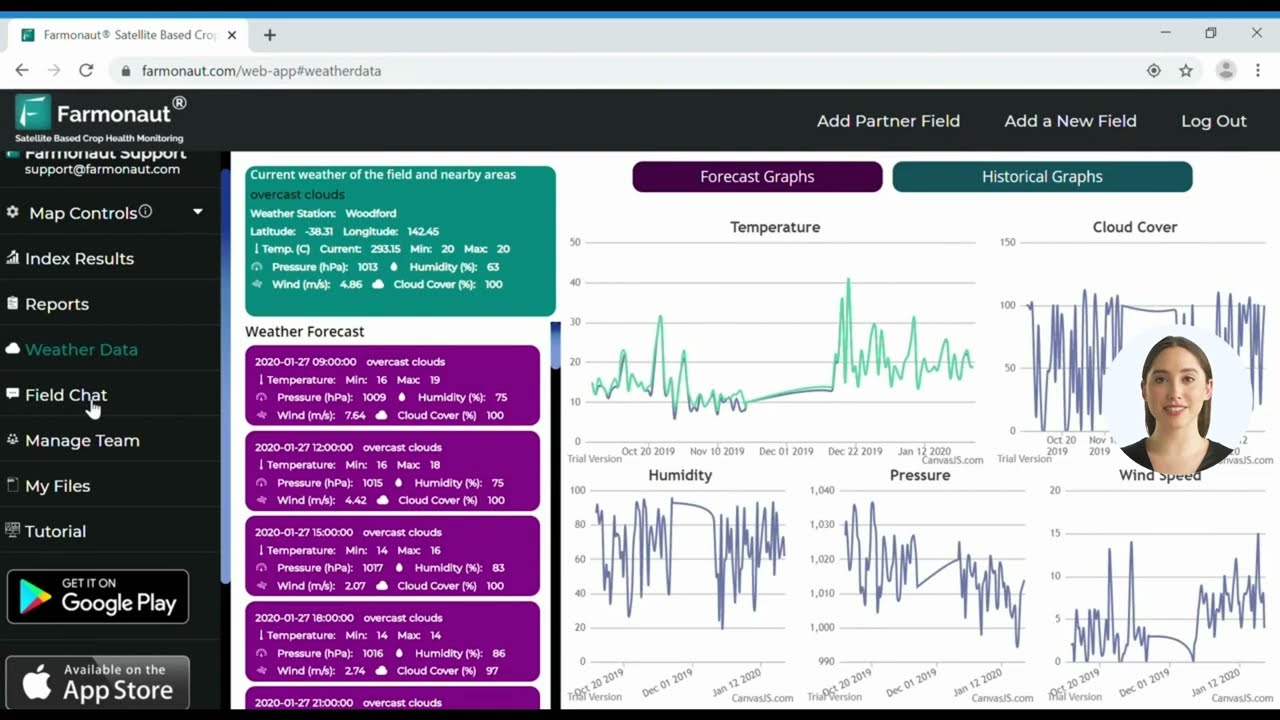
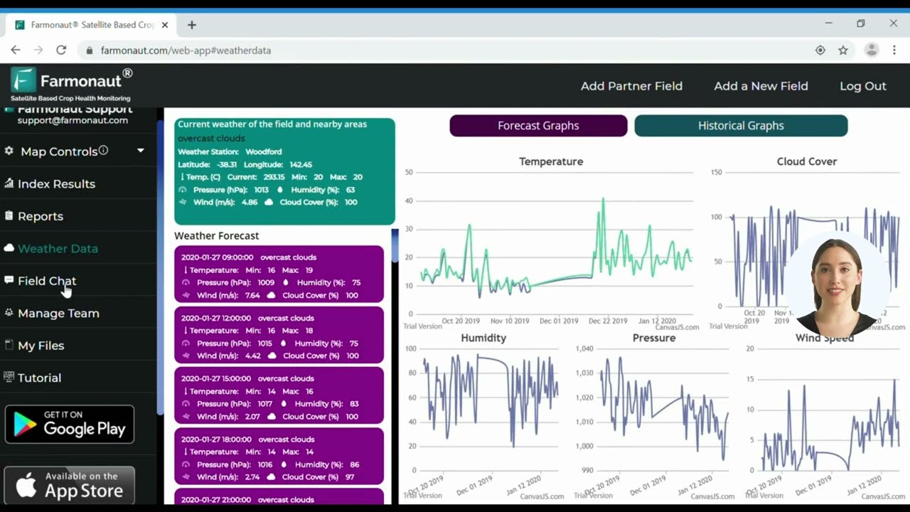
A “smart” agriculture sensor network rarely means one hardware brand — it means ground sensors, satellite imagery, and an advisory layer working from the same data. Farmonaut’s platform is built for that combination rather than as a sensor manufacturer: it fuses multispectral satellite passes with whatever field sensors and weather data a farm feeds in, then surfaces the result through the mobile and web apps.
- 📊 Satellite NDVI & crop monitoring: canopy health and stress tracking across every acre, not just where a probe sits — through the mobile and web applications.
- 🔗 Blockchain product traceability: supply-chain-level records tied to field activity — see product traceability benefits.
- 🌍 Carbon footprinting: resource-use tracking for sustainability reporting — explore carbon monitoring tools.
- 💡 JEEVN AI advisory: irrigation, planting, and harvest suggestions generated from combined sensor and satellite inputs.

Available on Android and iOS, and for larger operations, our agro-admin app handles multi-field, multi-team management across whatever mix of sensor brands a farm has already bought.



Best Smart Sensors for Farming: A Comparison You Can Verify
“Best” depends on what you’re controlling — irrigation timing, nutrient rate, or frost risk — so the table below is organized by decision, not by brand, with a verified field data point for each category where one exists and an honest gap where it doesn’t.
| Sensor Type | Decision It Drives | Typical Connectivity | Verified Field Data Point | Where to Check Current Pricing |
|---|---|---|---|---|
| Capacitance / TDR soil moisture probe | Irrigation timing | Cabled logger, LoRaWAN, or BLE telemetry | Skipping one irrigation event saved an avg. 814,620 gal / $270 across a 15,000-acre grower group (UGA CAES, 2018) | Vendor spec sheet; NASS puts combined 2023 US farm spend on irrigation equipment + computer tech at $3B |
| Granular matrix / tension sensor (e.g. Watermark-type) | Irrigation timing by soil water tension | Manual read or telemetry add-on | Not independently verified in this review — see NASS Table 25 for current method-share data | NASS Farm and Ranch Irrigation Surveys |
| Solar BLE soil-moisture stake (pivot-mounted) | Zone-level irrigation timing across a pivot boom | Bluetooth Low Energy, ~600 m verified range | 87% of 86 deployed stakes still transmitting after 30 days; ~$30/stake component cost (PMC, 2025) | Study author contact; component cost only, excludes gateway/labor |
| Optical / canopy NDVI sensor | Crop stress and nutrient timing | Intermittent / event-based | Not independently verified here; satellite NDVI is a field-wide complement, not a like-for-like substitute | Vendor spec sheet |
| Weather / microclimate station | Frost, disease-risk, and spray-window alerts | Real-time cellular or LoRaWAN | Falls within NASS’s $3.3B 2023 farm energy + equipment spend category; no per-unit figure verified here | Vendor spec sheet |
Row 2 and 4 intentionally list “not independently verified” rather than an invented range — the sourced alternative is stronger than a plausible-sounding guess.
- Confirm the stated wireless range against your farm’s terrain, not the vendor’s open-field number.
- Ask for the reporting survival rate after 30 days in field conditions, not just at install — the PMC study above found real drop-off (87% at 30 days) even with solar power.
- Get the component cost separate from gateway, install, and subscription costs.
- Cross-check any national adoption or savings claim against the current NASS Irrigation and Water Management Survey before repeating it.

Why Adoption Still Lags on Smaller Farms
Sensor and precision-technology adoption is not evenly spread by farm size. USDA’s Economic Research Service, in its “Precision Agriculture in the Digital Era” analysis of Agricultural Resource Management Survey data, found automated guidance systems — the closest large-sample proxy USDA tracks for precision-tech uptake — adopted at sharply different rates on the largest versus smallest farms across four major crops:
The pattern holds outside guidance systems too: USDA ERS’s wider digital-agriculture review found variable-rate technology, yield maps, and soil maps adopted on only 5% to 25% of total planted acreage for winter wheat, cotton, sorghum, and rice, per the USDA ERS chart of note. Scale, not enthusiasm, is the constraint — sensor and telemetry hardware carries a near-fixed cost per node regardless of field size, so the per-acre cost falls fastest on the largest operations. A farm evaluating its first sensor deployment should expect the payback math to favor a pilot block over a whole-farm rollout in year one, which is exactly the sequencing the checklist above and the calculator below are built around.
Deploying Agriculture Sensors: Placement, Calibration & Maintenance
Hardware choice matters less than deployment discipline. Five practices separate a sensor network that produces trustworthy data from one that produces noise:
- 📌 Placement: represent each distinct soil type, slope, and microclimate zone rather than clustering probes in the most convenient — usually most uniform — part of a field. Calibrate against manual probes at intervals.
- 🛠 Maintenance: rugged, weatherproof housings; scheduled battery and mounting checks to avoid data gaps.
- 📝 Metadata discipline: log location, depth, device ID, and calibration history for every node — without it, drift is invisible.
- 🔄 Interoperability: favor open standards so sensor brands can be mixed and replaced as hardware improves — see our large-scale farm management tools for multi-brand integration.
- 🚀 Pilot before scaling: run one block for a season, confirm the water or dollar savings against your own pumping costs, then expand.
Calculator: Sensor-Guided Irrigation Savings
Rather than repeat the Georgia case study’s dollar figure as if it applied everywhere, plug your own acreage, water use, and pumping cost into the calculator below — it runs the same arithmetic the UGA field trial demonstrated, on your numbers.
Run your own numbers
Assumptions: uses the water-per-event and skip-count you enter, not a fixed national average — the 27,000 gal/acre default approximates one 1-inch irrigation pass and should be replaced with your own system’s output. Excludes hardware depreciation beyond the optional payback line, water-rights fees, and labor.
FAQ: Agriculture Sensors & Water Sensors
What are agriculture sensors used for?
They measure soil moisture, soil chemistry, canopy stress, or microclimate conditions and report the reading — over cable, radio, or satellite link — into a system that informs irrigation, fertilizer, or spray-timing decisions. US farmers applied 81 million acre-feet of irrigation water across 53.1 million acres in 2023 (USDA NASS); sensors exist to make sure that water lands where and when it's needed.
Are water sensors the same as soil moisture sensors?
In practice, yes — "water sensors in agriculture" almost always refers to soil moisture or soil-water-tension probes that measure how much water is available to roots, as distinct from canopy or weather sensors that measure the plant or the air instead.
What are the best smart sensors for farming?
There's no single best sensor — the right pick depends on the decision. For irrigation timing, capacitance or tension soil probes have the strongest documented field results (see the UGA case study above). For zone-level coverage on a pivot, a solar BLE stake network with verified ~600 m range is the newest peer-reviewed option. For crop stress ahead of visible symptoms, pair a canopy sensor with satellite NDVI rather than relying on either alone.
How much do IoT agriculture sensors cost?
Costs vary by connectivity type and are usually quoted separately from the gateway and subscription. The one independently verified per-unit figure in this review is a solar BLE soil-moisture stake at just under $30 in component cost at deployment scale (PMC, 2025) — that excludes the receiver and installation. For other sensor types, request a current quote from the vendor rather than relying on a published range, since hardware pricing changes faster than most articles get updated.
How much water can smart sensors actually save?
In the UGA Extension case study, a group of five Georgia farmers covering 15,000 acres saved an average of 814,620 gallons and $270 in pumping costs each time sensor data let them skip one irrigation event. That's a field-verified example, not a national average — use the calculator on this page with your own acreage and pumping cost to estimate your figure.
Do smaller farms adopt sensors at the same rate as large ones?
No. USDA ERS data on automated guidance systems — the closest large-sample precision-tech proxy USDA tracks — shows adoption gaps of 55 to 75 percentage points between the smallest and largest farms across corn, wheat, soybeans, and cotton. Fixed per-node hardware costs make sensor networks pay back faster at scale, which is why a pilot-block approach matters more for smaller operations.




Get Started With Farmonaut
Ground sensors tell you what's happening at a point; a satellite and AI layer tells you what's happening across the rest of the field. Farmonaut combines both:
- ✔ Real-time monitoring of soil, crop, and environmental conditions
- ✔ AI-powered advisory for irrigation and input timing
- ✔ API and app-based integration with whatever sensor hardware you already run
- ✔ Traceability and carbon reporting built on the same field data
Need blockchain-level supply chain visibility? Explore our product traceability solution. Reporting on carbon stewardship? See our carbon footprinting tools. Managing a plantation or forestry block instead of row crops? Try the Crop, Plantation & Forest Advisory platform.
The next sensor a farm buys should be chosen against its own irrigation cost per gallon, not a vendor's headline savings claim — the calculator, checklist, and NASS survey link above are built to make that comparison whenever you run it.

 Esri North East Africa
 Farmer Amigo
 Cresol
 Atur Kuliner
 MDCV UK
 Zerella Group
 Etech Consulting Madagascar
 Vestlandsforsking
 Agritein
 Delicio
 WB Dev
 Sama Premium
 Prochecker
 Tres Valles
 LACOS Geoinformation
 Magrifly
 LatConnect 60
 Blickwinkel
 Agricultural Credit Policy Council
