

Soils · Illinois field guide
Illinois Soil Types and the Drummer State Soil
Illinois’s state soil is Drummer silty clay loam, a deep, black, poorly drained prairie soil on more than 1.5 million acres (Illinois Soil Classifiers Association; USDA). Here is how Illinois soils differ, how to look up yours, and seven ways to manage them.
Key takeaways
- Drummer silty clay loam became the official Illinois state soil on August 2, 2001 (Illinois Soil Classifiers Association); it is a Mollisol formed in 40 to 60 inches of loess over outwash (USDA official series description).
- Silt loam holds about 2.4 inches and silty clay loam about 2.04 inches of plant-available water per foot, versus 0.6 inch for sand (SDSU Extension, after Saxton and Rawls 2006).
- USDA-NASS put average Illinois cash rent at $261 per acre in 2026; farm managers reported $227 on fair land and $384 on excellent land (farmdoc daily, 2026).
- Illinois corn averaged 214 bu/acre in 2025 after a record 217 in 2024 (USDA final estimates via University of Illinois).
- The USDA Web Soil Survey shows the soil map units, drainage class and water storage for any field.
In this article
- Illinois state soil: Drummer silty clay loam
- Main Illinois soil types and where they occur
- How soil texture changes water supply
- Illinois soil, productivity and land value
- How to look up the soil on your own farm
- 7 tips for managing Illinois soil
- Challenging soil conditions in Illinois
- Watching soil differences from space
- FAQ
The Illinois state soil is Drummer silty clay loam, a deep, black, poorly drained prairie soil that Governor George Ryan signed into law as the official state soil on August 2, 2001, according to the Illinois Soil Classifiers Association history of the state soil. Drummer covers more than 1.5 million acres of northern and central Illinois. Most other Illinois soil on farmland is either dark prairie soil like Drummer or lighter soil that formed under forest, and the difference matters for drainage, water supply, rent and yield.
This guide explains the main Illinois soil types, what makes Drummer special, how to read your own soil map, and seven practical tips for managing these soils. It includes a chart of plant-available water by texture, the link between soil productivity and cash rent, and a calculator that shows how many days of crop water your root zone can hold.
Illinois state soil: Drummer silty clay loam
Drummer soils were first identified in Ford County in 1929 and take their name from Drummer Creek in Drummer Township. In a 1987 mail ballot, members of the Illinois Soil Classifiers Association chose Drummer from seven nominated soils. It won by more than 2 to 1 over Cisne silt loam. Bills in 1990 and 1991 failed in the Senate, and the designation finally passed in 2001 after a push led by FFA chapters. The law sits in the State Designations Act (5 ILCS 460/75).
The USDA official series description for Drummer gives the technical picture:
- Classification: fine-silty, mixed, superactive, mesic Typic Endoaquolls. That puts it in the Mollisol order, the dark, organic-rich soils of grassland.
- Parent material: 40 to 60 inches of loess or other silty material over loamy, stratified outwash.
- Landscape: nearly level or low-lying parts of outwash plains, stream terraces and till plains, with slopes of 0 to 2 percent.
- Drainage: poorly drained. Even with drainage, a seasonal high water table can sit from 0.5 foot above the surface to 1 foot below it between January and May in most years.
- Use: most areas are cropped, and corn and soybeans are the principal crops.
- Type location: the University of Illinois south farm, about a mile south of Urbana in Champaign County.
The Illinois State Museum page on the state soil describes Drummer as the most extensive soil in the state. Its prairie soil exhibit explains the profile: a black to dark gray silty clay loam surface about 19 inches thick, a gray subsoil with iron mottles down to about 47 inches, then layered loam and sandy loam. The dark color comes from the dense roots of prairie grasses that decayed into organic matter over thousands of years.
Main Illinois soil types and where they occur
Illinois soil maps list hundreds of named soil series. For planning, it helps to group them by how they formed. Soil scientists sort soils into orders under USDA Soil Taxonomy, which runs from order down to suborder, great group, subgroup, family and series. The four groups below cover most farm decisions in the state.
| Group | How it formed | Typical traits | Example series |
|---|---|---|---|
| Prairie Mollisols | Under tallgrass prairie, in loess | Thick black topsoil, high organic matter, often need tile | Drummer, Flanagan, Ipava, Sable |
| Forest Alfisols | Under trees, in loess or till | Thin, lighter topsoil, clay-rich subsoil, lower organic matter | Cisne, Hoyleton |
| Floodplain soils | River and stream sediment | Young profile, texture varies, flood risk | Varies by river |
| Sandy soils | Wind-blown or outwash sand | Drain fast, hold little water and nutrients | Varies by area |
The Drummer description lists its neighbors. Elburn (somewhat poorly drained), Blackberry (moderately well drained) and Plano (well drained) form a drainage sequence with Drummer, on higher positions in the landscape. Flanagan, Catlin, Saybrook and Sidell formed in loess over loamy till. Knowing which of these sits next to your Drummer ground explains a lot of the variation you see across one field.
Forest-formed soils are more common in southern Illinois and along river bluffs. They usually have less organic matter, a lighter surface and a denser subsoil. Floodplain and alluvial soils, like the alluvial deposits found along rivers, can be very fertile but carry flood and erosion risk.
How soil texture changes water supply
Texture is the mix of sand, silt and clay. There are 12 USDA texture classes, and the University of Wisconsin crops and soils guide to texture and water notes that water, not nitrogen, is the most limiting factor in crop production. Sandy soils drain quickly and dry out. Silty soils hold more plant-available water than clays, because clay holds part of its water too tightly for roots to pull out.
Chart
Field capacity and wilting point by texture
volumetric water content, %, soils with 2.5% organic matter, selected textures
The SDSU Extension table of soil water by texture gives estimates for soils with 2.5% organic matter, adapted from Saxton and Rawls (2006). Silt loam holds about 2.4 inches of plant-available water in the top foot and silty clay loam about 2.04 inches, compared with 0.6 inch for sand. Those silty textures are the ones that dominate Illinois prairie soils.
Real fields differ from these averages. Bulk density, clay type and organic matter all shift the numbers, so use the table as a starting point and check your own soil survey data.
Chart
Plant-available water in the top foot, by texture
inches of water per foot of soil, estimates for soils with 2.5% organic matter, selected textures
Try the numbers for your own farm below.
Calculator
How many days of crop water can your root zone hold?
Enter your soil’s available water, rooting depth and crop water use.
- Total available water in root zone: 6.00 in
- Water usable before stress: 3.00 in
Example values only, not a benchmark or forecast. Available water per foot can come from the texture chart above (SDSU Extension) or your Web Soil Survey report. Allowed depletion and daily use are your own assumptions; ask your extension office for local crop water use.
Illinois soil, productivity and land value
In Illinois, soil quality is priced into rent. Productivity indexes in University of Illinois Bulletin 811, “Optimal Crop Productivity Ratings for Illinois Soils,” rate the yield potential of each soil. A farmdoc daily analysis of cash rents and soil productivity (October 2025) uses those indexes to estimate average rent for a farm by its index and district. Its examples list Ipava silt loam at a productivity index of 142 and Virden silty clay loam at 135. It also notes that farms with excellent drainage usually rent for more than farms with drainage problems.
Chart
Average Illinois cropland cash rent
US$ per acre, USDA-NASS state average
The farmdoc daily review of Illinois cash rents in 2026 reports a USDA-NASS state average of $261 per acre for 2026, down from $264 in 2025 and $269 in 2024. These are survey averages of rents paid, not asking prices. The Illinois Society of Professional Farm Managers and Rural Appraisers mid-year survey put 2026 averages at $227 per acre for fair-quality land and $384 per acre for excellent land. Four central Illinois counties, Christian, Macon, Moultrie and Sangamon, averaged more than $330 per acre.
Yields follow the same soils. According to the University of Illinois review of the 2025 growing season, the final USDA estimate for Illinois corn was 214 bushels per acre in 2025, after state records of 214 in 2022 and 217 in 2024. Soybeans averaged 62.5 bushels per acre in 2025. The farmdoc daily summary of 2025 NASS county yields shows corn above 240 bushels per acre in Stark, McLean and DeKalb counties in central and northern Illinois, where dark prairie soils are common. For a wider view of the state’s farm economy, see our page on Illinois agriculture facts.
Chart
Illinois average corn yield, selected years
bushels per acre, USDA final state estimates; 2023 not shown
How to look up the soil on your own farm
You do not need to guess. The USDA Web Soil Survey, run by the Natural Resources Conservation Service, maps soils for almost every county. Follow these steps:
- Open Web Soil Survey and zoom to your farm, or search by address or county.
- Draw your area of interest around one field.
- Open the Soil Map tab to see map unit names, such as “Drummer silty clay loam, 0 to 2 percent slopes,” and the share of the field in each.
- Use Soil Data Explorer for ratings such as drainage class, available water storage, hydrologic group and farmland class.
- Click a series name to read its official description, including depth, drainage and typical crops.
- Save the report as a PDF and keep it with your field records.
Then compare the map with what you see. Wet spots, yield map lows and slow-drying areas often match the poorly drained map units.
7 tips for managing Illinois soil
1. Keep tile drainage working
Drummer and its poorly drained neighbors need drainage to farm well, because the water table can sit near the surface in spring. Check outlets each spring, watch for blowouts and wet streaks, and repair breaks early. As the farmdoc rent analysis notes, drainage quality also shows up in what a farm can earn in rent.
Best for: Drummer, Sable and other dark, low-lying prairie soils.
2. Match planting dates to soil conditions
Wet, silty clay loam compacts easily. Planting or driving on it when it is too wet can leave compaction that lasts for seasons. Wait until the soil crumbles in your hand at planting depth. Read more on soil structure and how to protect it.
Best for: fine-textured prairie soils.
3. Know your available water
Use the texture table and calculator in this guide to estimate how long your root zone can carry a crop between rains. Sandy fields and thin forest soils run short first. This is where irrigation scheduling or drought-tolerant hybrids pay off.
Best for: sandy and eroded fields.
4. Soil test on a regular grid or by zone
Test pH, phosphorus, potassium and organic matter on the same points over time. Lighter forest-formed soils may need lime more often, so check pH before deciding. Plants need a balanced supply of the 17 essential plant nutrients, and a test shows which ones fall short. Follow the University of Illinois or your agronomist’s lime and fertilizer recommendations and local rules.
Best for: all soils, especially lighter forest soils.
5. Cut tillage where you can
No-till and reduced tillage leave more residue on the surface, which helps protect soil from erosion and hold moisture compared with conventional tillage. A farmdoc daily article on detecting tillage from space (October 2026) found that soybean fields generally have more no-till than corn fields. It also found that in parts of the central Midwest, including Illinois, conventional tillage has increased in corn while reduced tillage declined, and soybean systems are shifting toward more reduced tillage.
Best for: sloping and erodible fields.
6. Use cover crops on bare winter ground
Cover crops protect soil between harvest and planting, add roots and organic matter, and can hold nutrients that would otherwise leave the field. Start on a few fields, pick a species that fits your rotation and termination plan, and follow seed and herbicide labels. Our guide to sustainable soil management practices covers more options.
Best for: fields left bare over winter.
7. Keep field records
Store soil tests, maps, yields, input rates and drainage repairs in one place. Good records show trends over years and help when you talk to a landlord, lender or conservation office. An agriculture database for farm records or one of the farm management software options can make this easier.
Best for: every farm.

▶ Our video on soil organic carbon: why it matters for soil structure and long-term fertility. · 12:28
Challenging soil conditions in Illinois
Wet, poorly drained ground
The very soils that yield best can be the hardest to work in a wet spring. Ponding is common for short periods on Drummer, according to its USDA description. Drainage, careful traffic and patience at planting are the main tools.
Floodplains
Soils along rivers vary in texture over short distances and may flood. Keep grass buffers on stream banks and check crop insurance and local floodplain rules before changing land use.
Acid and eroded soils
Thin, lighter soils on slopes have often lost topsoil to erosion. They tend to hold less water and fewer nutrients. Lime, cover crops and reduced tillage help, along with contour farming or waterways on steeper ground.
Karst areas
Parts of western and southern Illinois sit on limestone with sinkholes. Water and nutrients can move quickly to groundwater here, so careful nutrient timing and setbacks around sinkholes matter. Check local rules for manure and fertilizer near sinkholes.
Watching soil differences from space
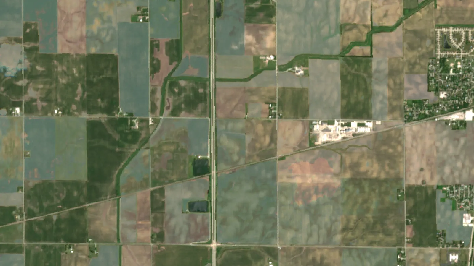
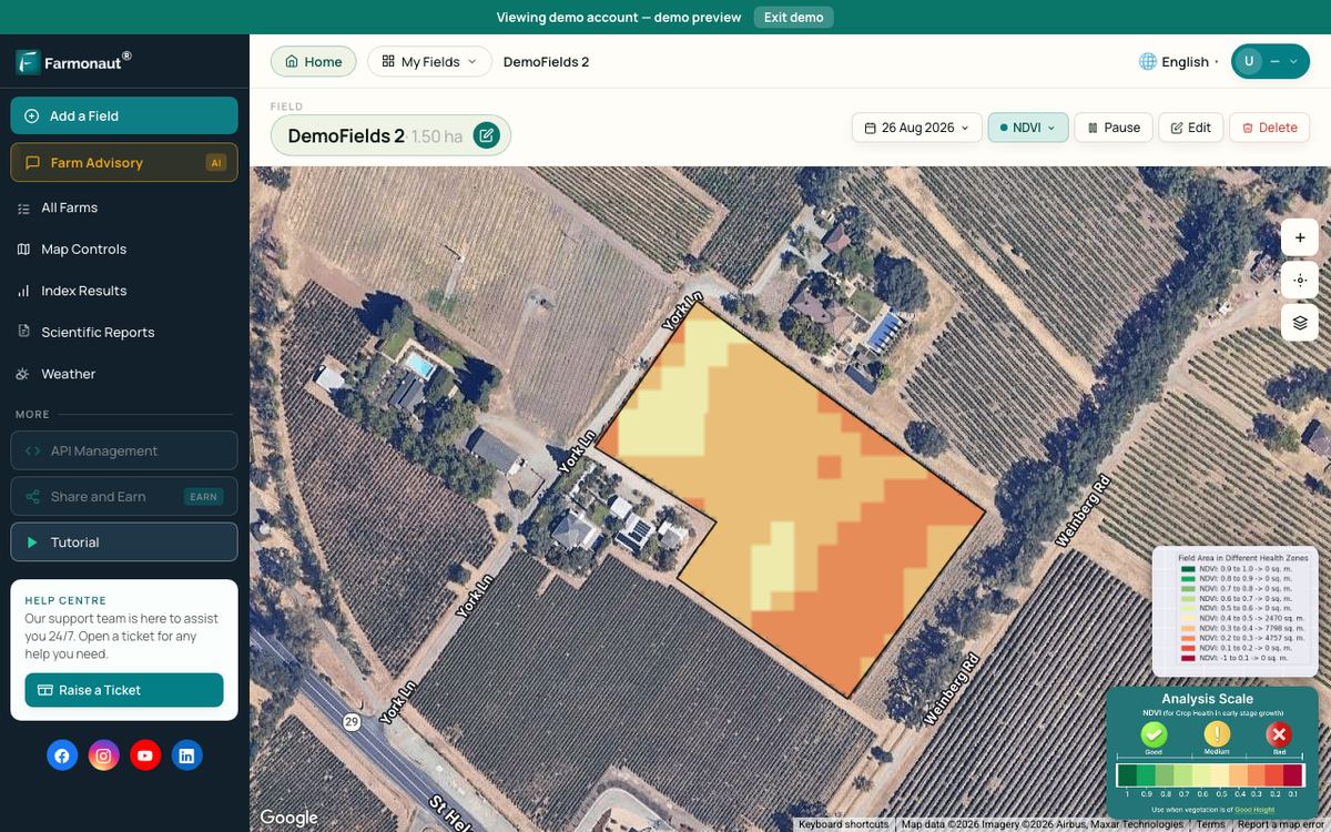
Satellite images do not show the soil itself under a crop, but they do show where the crop grows differently. Vegetation index maps often reveal the same wet spots, sandy knolls and eroded slopes that a soil map predicts. Farmonaut Satellite + AI Farm Monitoring System gives field-level crop health and moisture maps through the season, which can help you decide where to scout first. Use them with your soil survey and soil tests, not instead of them.

▶ Tutorial: monitoring crop health on your fields with Farmonaut’s web app and satellite indices. · 8:43
FAQ
What is the Illinois state soil?
Drummer silty clay loam. It became the official state soil on August 2, 2001, under the State Designations Act. It is a deep, poorly drained, dark prairie soil that covers more than 1.5 million acres in northern and central Illinois.
Why is Illinois soil so dark and fertile?
Much of it formed under tallgrass prairie on deep loess. Dense grass roots decayed into organic matter for thousands of years, which gave the topsoil its black color and its ability to hold water and nutrients.
What are the main soil types in Illinois?
Dark prairie soils (Mollisols) such as Drummer, Flanagan and Ipava; lighter forest soils (Alfisols) such as Cisne and Hoyleton; younger floodplain soils along rivers; and smaller areas of sandy soils.
How do I find the soil type on my land?
Use the USDA Web Soil Survey. Draw your field, open the Soil Map tab and read the map unit names and ratings. You can also ask your county Soil and Water Conservation District.
How much water does Illinois soil hold?
It depends on texture. SDSU Extension estimates about 2.4 inches per foot for silt loam and about 2.04 inches for silty clay loam, versus 0.6 inch for sand. Multiply by your rooting depth to estimate the total.
Does soil type affect farmland rent in Illinois?
Yes. University of Illinois farmdoc analysis links average cash rent to the soil productivity index from Bulletin 811. In 2026, professional farm managers reported averages from $227 per acre on fair land to $384 per acre on excellent land.
Farmonaut crop monitoring
See your own fields from space
Compare satellite crop health maps with your soil map to see where to scout first.



Sources
- Illinois Soil Classifiers Association, IL State Soil – Drummer: illinoissoils.org
- USDA-NRCS, Official Series Description: Drummer: soilseries.sc.egov.usda.gov
- Illinois State Museum, State Symbol: State Soil: museum.state.il.us
- Illinois State Museum, Central Prairie – Prairie Soil: museum.state.il.us
- University of Wisconsin Extension, The important role of soil texture on water: cropsandsoils.extension.wisc.edu
- SDSU Extension, How Soil Holds Water: extension.sdstate.edu
- farmdoc daily, Relationships between average cash rents and soil productivity (2025): farmdocdaily.illinois.edu
- farmdoc daily, Illinois cash rents in 2026 and outlook for 2027 (2026): farmdocdaily.illinois.edu
- University of Illinois farmdoc, The 2025 growing season in Illinois (2026): farmdoc.illinois.edu
- farmdoc daily, 2025 NASS county corn, soybean and winter wheat yields (2026): farmdocdaily.illinois.edu
- farmdoc daily, Detecting tillage practices from space (2026): farmdocdaily.illinois.edu
- USDA-NRCS, Web Soil Survey: websoilsurvey.nrcs.usda.gov
Discussion
Questions, corrections or field experience? Share them below. First-time comments are reviewed before they appear, and your email is never published.
No comments yet. Be the first to add a question or your experience.

 MapMyCrop
 Cresol
 Atur Kuliner
 MDCV UK
 Zerella Group
 Etech Consulting Madagascar
 Vestlandsforsking
 Agritein
 Delicio
 WB Dev
 Sama Premium
 Prochecker
 Tres Valles
 LACOS Geoinformation
 Magrifly
 LatConnect 60
 Blickwinkel
 Agricultural Credit Policy Council
 Marei Nursery
 eKGIS
 Mostas Tech

 Exploration consultancy · South Africa · Gold
 Licence holder · Niger · Gold
 Licence holder · Nigeria · Gold + lithium
 Client · Tanzania · Gold
 Client · Somalia · Gold
 Client & affiliate partner · Ghana · Gold










