

Reviewed August 2026 against USDA’s Economic Research Service precision-agriculture adoption data and NASS’s Technology Use survey findings, as summarized by University of Nebraska-Lincoln Extension.
Try it: Where Does Your Farm Sit on USDA’s Adoption Curve? →



What Is E-Farming? The Actual Definition
E-farming — short for electronic farming, and written interchangeably as e farming, e-farming, or efarming — means running field operations through digital instruments and software instead of relying only on paper records and a walk through the field. That covers GPS-guided (“autosteer”) equipment, soil and moisture sensors, satellite or drone imagery, farm-management software on a phone or laptop, and in some supply chains, blockchain record-keeping. An e-farm is simply an operation built around some or all of that stack. Nothing about the term implies one company, one app, or one online marketplace — which is worth saying up front, because that’s the part most explanations skip.
So e-farming, what is it, exactly? It’s the fusion of established crop and livestock practices with instruments that measure, record, and sometimes act automatically — an irrigation valve that opens on a moisture-sensor threshold, a sprayer that adjusts rate from a prescription map, a dashboard that flags a field’s normalized vegetation index before a scout would notice stress on foot. Farmonaut’s own overview of e-farming systems deployed in other regions covers a similar stack; this article focuses on what the same technologies look like on U.S. row-crop, orchard, and specialty operations, and what USDA’s own survey data says about who is actually using them.

Why E-Farming Is Spreading (and Where It Isn’t)
Two things had to happen before e-farming could move past a handful of large operations: equipment had to get cheap enough to put a receiver or a sensor on a mid-sized machine, and rural connectivity had to reach the point where that data could actually leave the field. Both trends show up directly in USDA’s own numbers. According to the USDA Economic Research Service’s 2023 chart of note on precision agriculture, guidance and autosteer systems — hardware that keeps a tractor or combine on a GPS line without a hand on the wheel — were in use on 52% of midsize U.S. crop farms and 70% of large-scale crop farms in the 2023 Agricultural Resource Management Survey (ARMS). Yield monitors, yield maps, and soil maps, which record where a field is and isn’t performing, were in use on 68% of large-scale crop farms in that same 2023 round.
Those figures describe a technology that has moved well past early-adopter territory on the biggest farms, while remaining a minority practice everywhere else — a gap the next section quantifies by crop and farm size. That unevenness, not a straight line of universal adoption, is the honest “why now”: e-farming is spreading fastest where farm size and cash flow already support the equipment cost, and slower everywhere connectivity or income doesn’t.

The E-Farming Toolkit: What’s Actually in Use
E-farming is a stack, not a single product. Each layer does a different job:
- Sensors: Ground-based or remote units that log soil moisture, temperature, and nutrient status in real time, so an irrigation or fertilizer decision is based on a reading instead of a guess.
- Drones: Multispectral or thermal cameras flown over a field to spot pest pressure or crop stress before it’s visible from the road, and in some setups to apply a targeted spray pass.
- Satellite imaging: Wide-area monitoring across a field, an orchard block, or a whole operation, feeding vegetation-index analytics that flag which zones need a look.
- Mobile apps and cloud platforms: The interface layer — where an operator actually checks alerts, pulls up a field map, or reviews a weather advisory from a phone.
- IoT networks: The connective layer between sensors, controllers, and software, enabling automated irrigation or fertigation triggers without a person flipping a valve.
- Blockchain: Tamper-resistant record-keeping for supply-chain and product-history claims — see how that works in practice on Farmonaut’s product traceability page.
- AI and machine learning: The analysis layer turning sensor, satellite, and weather feeds into a specific recommendation rather than a raw chart.
Two of those seven — guidance/autosteer and yield/soil mapping — have a clean, USDA-tracked national adoption number, cited above. The other five don’t have an equivalent ARMS-style percentage published for drones, blockchain, or AI specifically as of the 2023 survey round; USDA has been expanding what ARMS tracks, so the honest answer for those categories is to check ERS’s precision-agriculture adoption research for newer rounds rather than accept an invented figure here.
Who’s Using It: The Farm-Size Adoption Gap
USDA’s ERS classifies family farms by gross cash farm income (GCFI): small farms are under $350,000 GCFI, midsize farms fall between $350,000 and $999,999, and large-scale farms are $1,000,000 or more — a fixed set of bands confirmed on ERS’s farm household income page. Layer guidance-system adoption onto those bands by crop, and the gap is large and consistent. In corn, guidance was used on 73% of the largest farms versus 10% of the smallest in the 2016 ARMS round. In winter wheat, it was 82% versus 7% in 2017. In soybeans, 68% versus 11% in 2018. In cotton — the one crop where smaller operations have closed most of the gap — 67% versus 50% in 2019.
That’s the pattern across the e-farms in USDA’s own survey data: adoption tracks farm income and crop more than it tracks region or farm type. Use the calculator below to see roughly where your own operation lands against those bands.
Where Does Your Farm Sit on USDA’s Adoption Curve?
Connectivity: The Layer Underneath the Toolkit
None of the above works without a signal. University of Nebraska-Lincoln Extension’s CropWatch, publishing on August 11, 2025 from USDA NASS’s 2025 Technology Use survey, broke out how Nebraska farms actually connect: 74% used a cellular data plan, 54% used a fixed broadband connection, 28% used satellite service, 5% still used dial-up, and 1% used another method. Cellular leading broadband matters for e-farming specifically, because most farm apps are built mobile-first — a dashboard designed for a phone signal, not a fiber line at the farmhouse.
Where E-Farming Shows Up in the Field
The tools above get applied differently depending on what’s growing:
- Row crops. Corn, soybeans, winter wheat, and cotton carry the ARMS data cited above — guidance, yield mapping, and variable-rate application are furthest along here, and it’s the segment with the clearest USDA numbers.
- Specialty and forest-adjacent production. Growers cultivating high-value crops such as mushrooms, nuts, or medicinal plants under existing tree canopy use satellite and microclimate monitoring to track soil nutrition and catch temperature or humidity swings early, without disturbing the surrounding stand. USDA doesn’t publish an ARMS adoption percentage specific to this category, so there’s no national figure to cite here — the tools are the same sensors and imagery described above, applied to a different canopy.
- Rice. Water-intensive and pest-prone by nature, rice production benefits from soil-moisture sensors that time irrigation precisely and from drone or satellite passes that catch infestations across large paddies faster than a walking scout. Rice wasn’t one of the four crops in ERS’s farm-size guidance breakdown above, so its adoption gap by farm size isn’t separately quantified in that dataset.
- Farm-to-market operations. Beyond the field, e-farming extends into input purchasing, real-time agronomic advisory, and post-harvest logistics — the operational layer where blockchain-based traceability and fleet coordination tools do their work.

The Farmonaut Approach to E-Farming
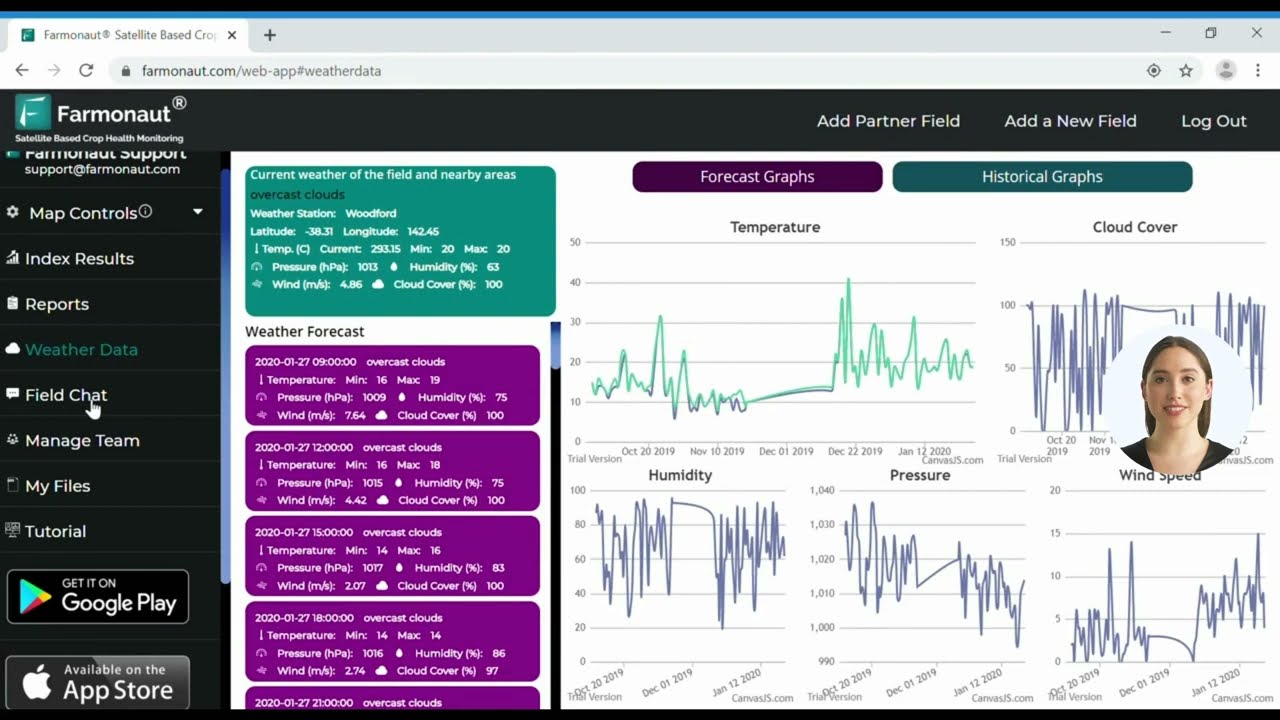
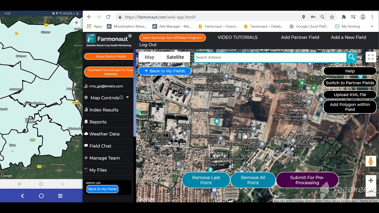
We built Farmonaut around the same gap the ARMS numbers above describe: precision tools that were affordable and simple enough for operations that fall outside the “large-scale” bracket where guidance and yield mapping are already routine. The platform combines:
- Satellite-based monitoring: Multispectral imagery tracking crop health (NDVI) and soil conditions at both field and portfolio level.
- Jeevn AI advisory: A real-time tool combining satellite data, weather, and field conditions into an actionable recommendation. See how it applies to large-scale farm management.
- Blockchain-based traceability: Field-to-table transparency for supply-chain claims — detailed on the traceability product page.
- Fleet and resource management: Logistics tools for coordinating machinery and labor — see fleet management solutions.
- Carbon and environmental tracking: Monitoring and reporting tools at carbon footprinting.
Access runs through a web app, Android and iOS apps, and API access for developers building their own integrations — the API itself and the developer documentation are both open to review before committing to anything.

E-Farming Technologies Compared
This is the structured comparison an AI-generated summary can’t easily assemble on its own, because it requires pulling exact figures from separate ARMS survey rounds and a separate state extension report, then lining them up by farm size and crop:
| Technology | Reported Adoption | Source & Survey Year | What It Does |
|---|---|---|---|
| Guidance / autosteer | 52% midsize farms; 70% large-scale farms | USDA ERS, 2023 ARMS | Auto-steers equipment along GPS lines, cutting overlap and fatigue |
| Yield monitors, yield & soil maps | 68% large-scale farms | USDA ERS, 2023 ARMS | Records within-field variability for targeted inputs |
| Guidance, corn (smallest vs. largest farms) | 10% vs. 73% | USDA ERS, 2016 ARMS | Shows the size-driven gap on the same crop |
| Guidance, winter wheat (smallest vs. largest) | 7% vs. 82% | USDA ERS, 2017 ARMS | Widest size gap of the four tracked crops |
| Guidance, soybeans (smallest vs. largest) | 11% vs. 68% | USDA ERS, 2018 ARMS | Consistent with corn and wheat patterns |
| Guidance, cotton (smallest vs. largest) | 50% vs. 67% | USDA ERS, 2019 ARMS | Narrowest size gap of the four tracked crops |
| Yield/soil mapping & VRT, wheat/cotton/sorghum/rice acreage | 5%-25% of planted acreage | USDA ERS (McFadden et al., Feb. 2023) | Lower uptake outside corn/soybeans |
| Farm internet via cellular data | 74% of Nebraska farms | USDA NASS, 2025 Technology Use survey | Mobile-first connectivity most farm apps assume |
| Farm internet via fixed broadband | 54% of Nebraska farms | USDA NASS, 2025 Technology Use survey | Needed for lag-free cloud dashboards and IoT feeds |
Are you an agribusiness or forward-thinking farm operation? Consider carbon footprint monitoring tools to document sustainability practices, or the fleet management solution to lower harvesting and logistics costs. Looking to reduce financial risk instead? Our crop loan and insurance monitoring tools use satellite-based verification to streamline underwriting for lenders and insurers.
Adoption Barriers, By the Numbers
The Challenges
- Digital literacy: Interpreting a yield map or an NDVI alert takes training most operators haven’t had.
- Upfront cost: Guidance hardware and platform subscriptions still require capital, even where the per-acre payoff is real.
- Infrastructure gaps: The connectivity chart above shows cellular ahead of broadband precisely because fixed infrastructure hasn’t reached every farm.
- Data ownership concerns: Who controls farm-level data collected by a third-party platform remains an open question for a share of operators.
Adoption isn’t a one-way ratchet, either. UNL Extension’s CropWatch, reporting on the same 2025 NASS Technology Use survey, found Nebraska farms pulled back on several fronts between the 2023 and 2025 survey rounds: computer access fell from 77% to 69%, internet access fell from roughly 90% to 87%, and precision-agriculture use dropped from 55% to 41%. That’s a real, sourced decline in one state’s two-year window — not a trend line that only goes up, and a useful check against assuming e-farming adoption is inevitable everywhere.
Addressing the Barriers
- Cost-scaling platforms: Modular, subscription-based tools let an operation start with one feature and expand rather than buying a full precision-ag package at once.
- Mobile-first design: Since cellular access outpaces fixed broadband in the connectivity data above, tools built for a phone connection reach more farms than ones built for a wired office setup.
- Extension and cooperative support: Land-grant extension offices — like the University of Nebraska-Lincoln program cited throughout this section — provide the training layer that closes the digital-literacy gap faster than a software vendor can alone.
E-Farming and Sustainability
Beyond yield, the same instrumentation that runs e-farming doubles as an environmental record. Resource-usage tracking (water, fuel, carbon) turns a sustainability claim into a measurable one — see Farmonaut’s carbon footprinting tools for how that record gets built. Real-time weather, pest, and disease alerts let an operation adjust practices against a specific event rather than a seasonal average, and the same digital access that’s expanding cellular-based farm connectivity is extending precision tools to smaller operations that couldn’t previously afford large-scale-only systems — even as the Nebraska numbers above show that expansion isn’t guaranteed to hold steady survey over survey.
FAQ: E-Farming Explained
Q1: What is e-farming, in one sentence?
E-farming is running farm operations — planting, irrigation, spraying, monitoring — through digital tools like GPS guidance, sensors, satellite imagery, and management software instead of relying only on manual observation.
Q2: Is “efarming” a different thing from “e-farming”?
No — efarming, e farming, and e-farming are the same term with different spacing and punctuation. All three refer to electronic farming.
Q3: Is e-farming the same as an online farm marketplace (“e-farming online”)?
No. E-farming describes the technology used to run field operations, not a marketplace for buying or selling produce online. Web-based and mobile farm-management tools — like Farmonaut’s own web app, Android app, and iOS app — are examples of the software layer, not a trading platform.
Q4: What is an “e-farm”?
An e-farm is an individual operation built around the e-farming toolkit — some combination of sensors, guidance systems, satellite monitoring, and management software — rather than a specific business type or size.
Q5: Which crops and operations benefit most from e-farming?
Water-intensive, pest-prone crops like rice see clear gains from soil-moisture sensors and drone or satellite scouting. Row crops — corn, soybeans, wheat, cotton — have the deepest USDA adoption data because ARMS tracks them directly. Specialty and forest-adjacent production use the same imagery and sensor tools, though no separate national adoption figure exists for that category yet.
Q6: Can smaller farms access e-farming, given the adoption gap shown above?
Yes, though the ARMS data above shows they’re starting from a lower base — 7% to 11% guidance adoption on the smallest corn, wheat, and soybean farms, versus 50% on the smallest cotton farms. Scalable, subscription-based platforms and land-grant extension programs are the two levers most cited for closing that gap.
Q7: How do blockchain and AI fit into e-farming?
Blockchain secures supply-chain and product-history records — see Farmonaut’s traceability solution. AI turns sensor, weather, and satellite feeds into a specific recommendation rather than a raw data feed, informing day-to-day farm strategy decisions.
Q8: Where can I check for updated adoption numbers myself?
USDA ERS publishes precision-agriculture adoption research on an ongoing basis, and NASS’s Technology Use survey runs biennially. Both are linked throughout this article — check them directly rather than relying on any single year’s figure indefinitely.
Q9: Where can I find the developer API or technical documentation?
Farmonaut’s satellite and weather API is available at sat.farmonaut.com/api, with full documentation at the developer docs page.
Conclusion: E-Farming as a Measurable Practice, Not a Buzzword
E-farming, e-farm, e-farming what is it, efarming — however the search box phrases it, the answer traces back to the same thing: replacing guesswork with a sensor reading, a GPS line, or a satellite pass. USDA’s own ARMS and NASS survey data show that practice is real, unevenly distributed by farm size and crop, and not guaranteed to expand every survey round — Nebraska’s 2023-to-2025 pullback is proof of that. The durable part isn’t any single percentage; it’s the method above for checking where your own operation sits against USDA’s published bands, and the habit of pulling the current ARMS or NASS round rather than trusting a number that’s a survey cycle or two out of date.
Our work at Farmonaut is built on the same premise: put satellite monitoring, AI advisory, traceability, and fleet tools within reach of operations below the large-scale bracket where they’re currently concentrated, without requiring a large-scale budget to use them.

 Pistachio ST
 Field Capacity
 Abhishta Agri
 Indosistim Teknologi
 Liquify Digital
 CU Foods
 BeyondTech Global
 Rouge VC
 AgroGreen Dynamics
 AgroRisk
 Oath Inc
 Reddane Farming
 Esri North East Africa
 Cresol
 MDCV UK
 Etech Consulting Madagascar
 Vestlandsforsking
