

Reviewed August 2026 against Market Research Future and DJI Enterprise Insights.
Try it: Run your own numbers →
Aerial agriculture imaging — capturing farmland from drones, aircraft, or satellites and turning the pictures into crop-health, moisture, and nutrient maps — is a distinct discipline from ground-based scouting because it converts a whole field into measurable data in minutes rather than hours. The global agriculture drones market was valued at $6.35 billion in 2024 and is forecast to reach $70.58 billion by 2035, according to Market Research Future. That eleven-fold projected growth is the clearest signal that agriculture imaging has moved from novelty to standard operating procedure on commercial farms across the US and UK.
This article covers what aerial imagery actually measures, how it compares to walking fields, what the different sensor types do, and how to work out whether the investment pays off on your acreage — with a calculator at the end built on the same cost logic.
Table of Contents
- What Aerial Agriculture Imaging Actually Measures
- Why Aerial Agriculture Imaging Matters Now
- Ground Scouting vs. Aerial Imagery: The Numbers
- Imaging Techniques: RGB, Multispectral, Thermal, 3D
- Aerial Farm Surveys, Drone Surveying, and Seed Broadcasting
- Data-Driven Crop Management & Yield Optimization
- Environmental Health, Stewardship, and Land Resilience
- Integrating Technologies in Aerial Agriculture
- Implementation Strategies for Smart Farming
- Calculator: Aerial Imaging Cost vs. Input Savings
- The Farmonaut Edge for Aerial Agriculture
- Farmonaut Subscription Plans
- Frequently Asked Questions
- Conclusion: Getting Started
- Try it: Run your own numbers
What Aerial Agriculture Imaging Actually Measures
Aerial imagery can detect crop stress up to 10 days before visible symptoms appear to the naked eye. That gap exists because plants under water, nutrient, or disease stress change their internal reflectance — measurable in near-infrared and red-edge wavelengths — well before leaves visibly wilt, yellow, or curl. This is the core reason aerial agriculture and agriculture imaging exist as a category: they convert a change invisible to a person in the field into a mapped, quantified signal a manager can act on.
Precision aerial analysis can improve fertilizer efficiency by up to 30% through targeted application in agriculture. Rather than spreading a uniform rate across a field, imagery identifies the specific zones showing deficiency, so nitrogen, phosphorus, or potassium goes only where the crop needs it.
Drone-assisted application and monitoring reduces input costs by 25-30%, per industry analysis cited by ZenaTech’s precision farming research. Combined with 20-30% yield improvement from earlier stress detection (DJI Enterprise Insights), the economic case for agriculture imaging rests on two separate levers: spending less and harvesting more from the same acreage.
This guide explains how aerial agriculture imaging works, what it costs, where it beats ground scouting, and where it doesn’t — with Farmonaut’s satellite-based tools as one practical entry point for growers who want the data without owning a drone fleet.
Why Aerial Agriculture Imaging Matters Now
The case for aerial agriculture rests on five measurable pressures on US and UK farm operations:
- ✔ Crop Health Visibility: A single flight or satellite pass gives a whole-field snapshot of vigor, leaf area, and chlorophyll status that a walking inspection cannot match in the same time.
- ✔ Faster Detection: Imagery flags water stress, disease, and pest pressure across entire zones before symptoms are visible on the ground.
- ✔ Whole-Farm Assessment: Large or irregular fields — common across US row-crop operations and larger UK arable holdings — can be assessed in one pass instead of a multi-day walk.
- 📊 Quantified Data: Multispectral and infrared sensors turn “the crop looks a bit off” into a mapped, repeatable index (like NDVI) that can be compared week to week or season to season.
- ⚠ Labor Constraints: Skilled field-scouting labor is harder to source and retain on both sides of the Atlantic; aerial imagery reduces the acreage that needs a person walking it.
The market reflects this: agricultural drone applications for crop health monitoring account for 38.4% of total agricultural drone use, according to DJI Enterprise Insights’ 2025 market analysis — the single largest use case ahead of spraying, mapping, or seeding applications.




Ground Scouting vs. Aerial Imagery: The Numbers
The clearest way to evaluate agriculture imaging against traditional scouting is side by side, on the specific dimensions that determine whether it earns its cost:
| Assessment Criteria | Ground Scouting | Aerial Imagery (Drone/Satellite) |
|---|---|---|
| Stress Detection Lead Time | Visible symptoms only — no lead time | Up to 10 days before visible symptoms |
| Area Coverage per Day | ~10 hectares (about 25 acres) per inspector per day | 100–1,000 hectares (250–2,470 acres) per flight |
| Time per Field | 3–4 hours per inspector per field | 15–30 minutes flight time including data processing |
| Input Cost Impact | Uniform application; no targeting | 25-30% reduction in input costs via targeted application (ZenaTech analysis, 2024) |
| Yield Impact | Baseline; reactive management only | 20-30% yield improvement from early stress detection vs. traditional management (DJI Enterprise Insights, 2024) |
| Data Type | Qualitative, visual judgment | Quantitative — multispectral indices, repeatable across seasons |
Combine multispectral aerial imagery with soil health maps to build a fertilization and irrigation plan around actual zone-level deficiency, not a whole-field average. This is where the 25-30% input-cost reduction figure comes from — it requires acting on the zone data, not just collecting it.
Imaging Techniques: RGB, Multispectral, Thermal, 3D
“Agriculture imaging” is not one technology — it’s a set of sensor types, each answering a different question about the crop:
- Visible Light (RGB) Photography:
- Standard RGB cameras on drones or satellite platforms produce field mosaics for basic visual assessment — the equivalent of a high-resolution aerial photo of the whole farm.
- Multispectral Imaging:
- Captures visible, near-infrared, and red-edge wavelengths, enabling NDVI (Normalized Difference Vegetation Index) and similar plant-health indices that flag stress before it’s visible.
- Infrared Imaging:
- Reveals water stress and plant moisture status invisible in standard RGB images — the sensor class behind most early-stress-detection claims.
- Thermal Imaging:
- Detects canopy temperature anomalies that typically indicate water scarcity or root-zone stress before wilting is visible.
- 3D Photogrammetry:
- Builds terrain and canopy models from overlapping images, used for plant height, density, and topographic mapping — the basis for most professional aerial farm surveys.
Flying at inconsistent times of day, sun angles, or growth stages makes season-over-season comparison unreliable. Standardize flight timing to the same phenological stage and similar light conditions each time.

Aerial Farm Surveys, Drone Surveying, and Seed Broadcasting
A few related terms are worth distinguishing, since they describe specific tasks inside the broader aerial agriculture category rather than synonyms for it.
Aerial farm surveys typically refer to a mapping-focused flight — producing an orthomosaic (a stitched, geometrically corrected image of the whole field) and often a 3D terrain model, used for drainage planning, boundary verification, or establishing a baseline before a multispectral programme starts. A survey flight is usually RGB or photogrammetry-based rather than multispectral, and its output is a map, not a crop-health index.
Aerial drone surveying and unmanned aerial vehicles in agriculture (UAVs) describe the platform rather than the output — the drone itself, as distinct from satellite or crewed-aircraft imagery. UAVs fly lower and at higher resolution than satellites, which matters for smaller fields or spot-checking a flagged zone, but they cover far less ground per flight (100–1,000 hectares versus a satellite pass covering an entire region in one image). The choice between drone and satellite imagery is a resolution-versus-coverage tradeoff, not a question of which is more advanced.
Aerial seed broadcasting — spreading seed from a drone or aircraft rather than a ground drill — is a separate application from imaging and monitoring. It’s used mainly for cover-crop establishment into standing cash crops, or on ground too wet or steep for equipment. Where it intersects with imaging is straightforward: the same NDVI or canopy-cover maps used for stress detection are also used afterward to check germination and stand establishment across a broadcast field, since uneven emergence is visible in a follow-up flight days before it’s obvious from the ground.
None of these three are the primary subject of this article, but each shares the same underlying economics: coverage per flight, cost per acre, and what the imagery is actually used to decide.
Data-Driven Crop Management & Yield Optimization
Aerial imagery’s value shows up in three specific management decisions:
1. Targeted Input Application
- 🌱 Fertilizers and Sprays: Nutrient maps identify the specific zones showing early deficiency, replacing uniform whole-field application.
- 💧 Irrigation Scheduling: Thermal and moisture imaging show dry patches and water-logged areas, enabling zone-specific irrigation instead of a fixed schedule.
- 🦠 Pest & Disease Detection: Reflectance-pattern changes signal outbreaks before visible leaf damage appears.

2. Field Scouting and Phenological Tracking
- 📊 Canopy Cover Mapping: Tracks growth stage across a field, flagging zones lagging behind the field average.
- 🗺️ Phenological Stages: Repeat flights track flowering, fruiting, and senescence for timing decisions.
- 🌾 Weed and Encroachment Monitoring: Flags unwanted vegetation early enough for targeted, rather than blanket, control.
3. Change Detection and Yield Benefits
- ⏳ Compare Seasons: Overlaying multi-year maps shows which management changes actually moved the needle.
- 📈 Boost Yields: DJI Enterprise Insights reports 20-30% yield improvement from early stress detection compared with traditional management — the return side of the input-cost-reduction figure above.

Market Research Future projects the global agriculture drones market growing from $6.35 billion (2024) to $70.58 billion by 2035 — a trajectory reflecting a shift from pilot programmes to standard-practice adoption across commercial farming. Full report and methodology: Market Research Future, Agriculture Drones Market.
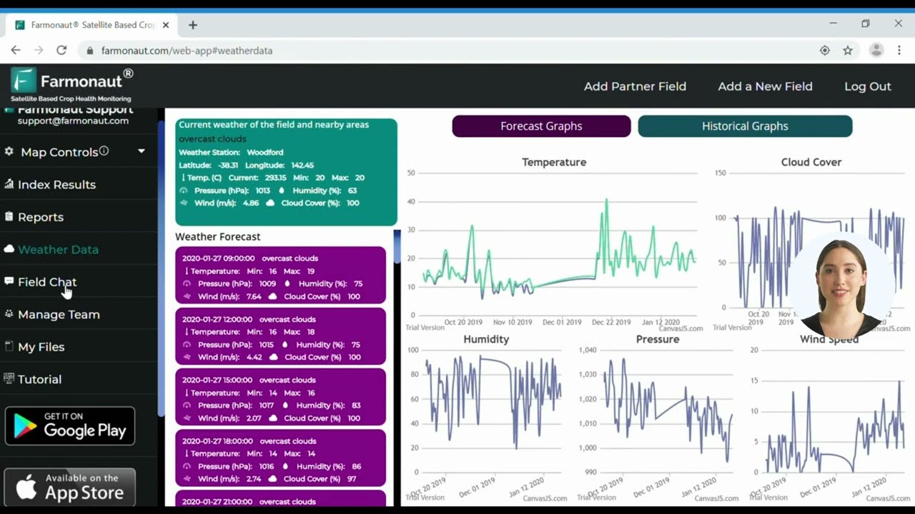
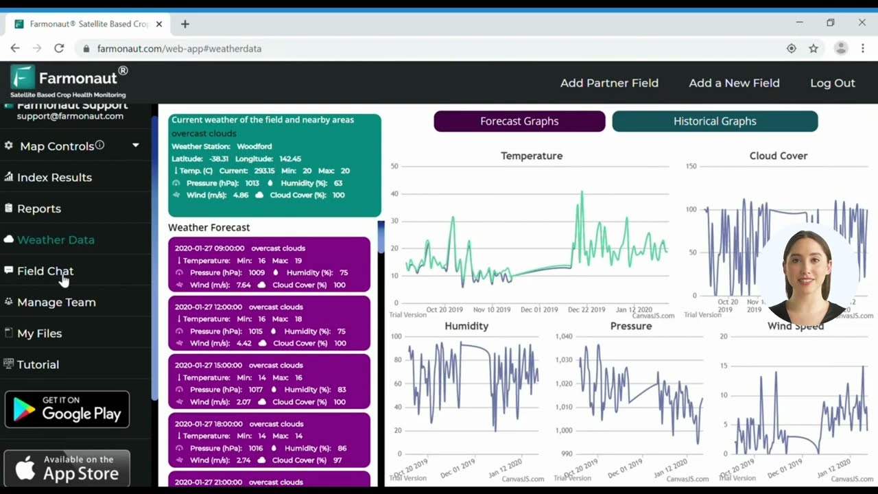
We deliver real-time crop health mapping via Farmonaut’s web & mobile apps. Get actionable NDVI, NDWI, and additional indices, all accessible from any device. Start optimizing your fields now with our advanced aerial photo analysis tools!
Environmental Health, Stewardship, and Land Resilience
Precision aerial agriculture isn’t only about yield — it also supports soil, water, and long-term land management goals under increasing regulatory attention in both the US and UK.
- 🌍 Soil Erosion Assessment: Aerial images show erosion patterns, directing conservation work before topsoil loss accelerates.
- 🌊 Water Runoff Control: Drainage-pattern mapping allows intervention before water loss or nutrient runoff spreads downstream.
- 🌲 Forestry and Agroforestry: Tree vigor and stand health can be monitored across large or mixed-use land systems.
- 🏞️ Landscape Restoration: Re-vegetation and soil stability can be tracked in reclaimed or disturbed land.

Want to track and minimize the carbon impact of your cropping program? Discover Farmonaut Carbon Footprinting—use satellite insights to quantify your operation’s carbon footprint, improve compliance, and drive climate-smart agriculture.
Integrating Technologies in Aerial Agriculture
Aerial imaging delivers the most value combined with other farm-management systems, not used in isolation.
Key Integrated Technologies
- 🤖 AI & Computer Vision: Separates crops from weeds, classifies field anomalies, and automates alerts.
- 🔗 Blockchain Traceability: Secure, tamper-proof crop history via Farmonaut’s traceability platform.
- 🛰️ Satellite Monitoring: Routine, large-region monitoring without deploying a drone fleet.
- 🗄️ API Integration: Pull aerial imagery and farm data into your own agronomic platform with Farmonaut’s API and API developer docs.
- 📦 Fleet and Resource Management: Track machinery and logistics to cut fuel waste (see Farmonaut Fleet Management).
Implementation Strategies for Smart Farming
A working rollout plan for agriculture imaging, regardless of farm size:
Step-by-Step: How to Roll Out Aerial Analysis in Your Operation
- Define Objectives: Start with a clear goal — cost reduction, yield increase, or environmental compliance.
- Sensor Selection: Choose sensor types (multispectral, thermal, RGB) matched to that objective and crop.
- Pilot and Validate: Test on pilot plots and compare results against your existing scouting method before committing farm-wide.
- Scale Up: Expand to more fields once the pilot shows a measurable difference.
- Analyze and Act: Use agronomist support or an integrated platform to turn imagery into a specific action, not just a report.
- Integrate with Other Data: Overlay imagery with soil maps, yield history, and irrigation records.
- Plan for Seasons: Standardize flight or satellite-pass timing to the same growth stage each cycle for comparable data.

Callout: Common Mistake
Not archiving imagery in a consistent, searchable format makes multi-season comparison difficult later. Set up a standard file structure and naming convention from the first flight.
Land management benefits extend past cropping into forestry and mixed-use programmes — tree health, stand vigor, and wildfire scars can all be tracked remotely. Read about our plantation & forest advisory for details.
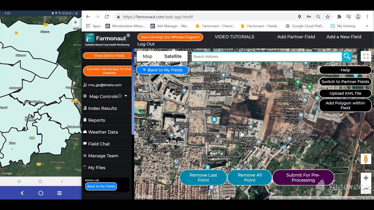
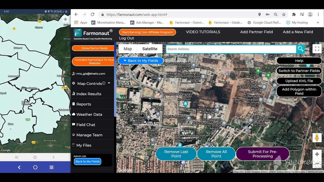
Administer every field, plot, and resource using Farmonaut Large Scale Farm Management. Map boundaries, assign crews, access all imagery, and generate reports—boost efficiency across your enterprise.
Need financing for your next season? With satellite-based crop verification, Farmonaut Crop Loan and Insurance helps you obtain tailored crop loans and protected, data-based insurance products.
Calculator: Aerial Imaging Cost vs. Input Savings
Use the figures you’ve already read in this article — 25-30% input-cost reduction and 20-30% yield improvement — against your own acreage, input spend, and crop value to see where the breakeven falls.
Run your own numbers
Assumptions: input savings and yield gains are applied only to a portion of revenue attributable to yield increase, not total revenue; the calculator excludes drone/equipment purchase cost, pilot certification, and data-processing subscription fees, which vary by whether you fly your own drone or use a satellite/service-based platform. Treat the output as a planning estimate, not a guarantee.
The Farmonaut Edge for Aerial Agriculture
As a satellite technology company, Farmonaut gives growers and agronomists:
- ✔ Affordable satellite and aerial monitoring that doesn't require owning drone hardware
- ✔ Real-time crop health assessment (NDVI, NDWI, and more) via Android, iOS, and web platforms
- ✔ AI-driven advisory — including Jeevn AI — for actionable recommendations across the season
- ✔ Blockchain-based traceability for supply-chain trust
- ✔ Environmental and carbon-footprint monitoring for sustainability reporting
- ✔ Customizable API access, fully documented (read API docs)
- ✔ Pricing tiers for individual growers, businesses, and enterprise operations
Farmonaut Subscription Plans
Choose your level—whether you're an independent grower, agribusiness, or government agency. Unlock all the aerial view farmland and routine monitoring benefits directly in your workflow.
Frequently Asked Questions
What's the difference between aerial agriculture and agriculture imaging?
Aerial agriculture is the broader practice of using airborne or satellite platforms in farm management — flights, imagery, spraying, seeding. Agriculture imaging specifically refers to the sensor data captured (RGB, multispectral, thermal) and the maps derived from it. Imaging is one component of aerial agriculture.
Do I need a drone, or does satellite imagery work?
Both have a role. Satellites cover large areas on a routine schedule without flight logistics or pilot certification, which suits regular whole-farm monitoring. Drones fly lower for higher resolution, useful for verifying a specific flagged zone or smaller fields. Many operations use satellite monitoring as the default and drones for targeted follow-up.
What crops benefit most from aerial imagery?
Row crops, cereals, oilseeds, and orchards all benefit; the larger and more variable the field, the more value there is in a whole-field data pass versus a manual walk-through.
How often should I fly or pull satellite imagery?
Align passes with key phenological stages — early vegetative, pre-flowering, fruiting, and pre-harvest — so comparisons are made at equivalent growth stages rather than arbitrary calendar dates.
Where can I find current cost-per-acre figures for professional aerial surveys?
Published, standardized cost-per-hectare figures for professional survey services in the UK and US aren't part of any public dataset we could verify for this article — pricing depends heavily on sensor type, flight frequency, and service versus DIY-drone model. Get a current quote from at least two local survey providers or your chosen platform's sales team before budgeting, and use the calculator above to test whether a quoted price clears breakeven for your acreage.
Is Farmonaut an input retailer, farm machinery supplier, or regulator?
No. We are a satellite technology company providing monitoring, data, traceability, and advisory solutions — not a marketplace, retailer, or regulator.
How do I integrate aerial imagery with my existing farm records?
Our platform supports API connectivity for direct data transfer, or you can download and overlay imagery with soil/yield files using standard GIS tools. Read more: API Developer Docs.






Conclusion: Getting Started
Aerial agriculture and agriculture imaging have moved past the early-adopter phase: a market forecast to grow from $6.35 billion in 2024 to $70.58 billion by 2035 (Market Research Future) reflects that a majority of commercial operations either already use this data or are actively evaluating it. The specific, checkable numbers worth carrying forward:
- ✔ Aerial imagery detects crop stress up to 10 days before visible symptoms
- ✔ Targeted, imagery-guided input application cuts input costs 25-30% (ZenaTech, 2024)
- ✔ Early stress detection improves yield 20-30% versus reactive management (DJI Enterprise Insights, 2024)
- ✔ Crop-health monitoring is the single largest drone application category, at 38.4% of use (DJI Enterprise Insights, 2025)
- ✔ Aerial imagery covers 100-1,000 hectares per flight versus roughly 10 hectares per scouting day on foot
The durable method, independent of how these figures move next year: pilot on a subset of fields, compare input spend and yield against your untreated baseline for one full season, and only scale up once your own numbers — not an industry average — clear your breakeven. Revisit the market-size and adoption figures at Market Research Future and the applications breakdown at DJI Enterprise Insights periodically, since both are updated as new data becomes available.
Aerial agriculture imaging turns a whole field into measurable data — before problems are visible, at a fraction of the time cost of walking it. Get started today with Farmonaut.

 Agro La Gándara
 Global Agrifood
 Cazlv
Cazlv HIPSAC
 ZOL Zimbabwe
 Juligerm
 AdBio
AdBio MISE Maroc
 NWNS
NWNS Red August Group
 Farm Inc
 WeMe Global
 Agrotoken
 Blue BearX
 Insignito
 Croptimum
 DnCubed
 Field Capacity
 Indosistim Teknologi
