

Land mapping · Accuracy and cost guide
Drone Topography: Accuracy, Cost per Acre, 7 Survey Uses
Drone topography builds elevation maps from overlapping photos or LiDAR. Penn State reported a 0.999 elevation correlation with LiDAR data on four Pennsylvania farm sites (2026). Published US prices vary widely, so compare the deliverable as well as the rate.
Key takeaways
- Penn State (2026): 0.999 elevation correlation with 2017 LiDAR data on four farm sites, and runoff-risk maps within 1.53%.
- Correlation is not vertical error. Ask for RMSE on independent check points.
- US vendor list prices viewed November 2026 span about US$16 to US$500 an acre for drone work, depending on size and scope.
- Use LiDAR under tree cover; photos record the top surface.
- Check public elevation data before paying for a flight, and ask a licensed surveyor about legal work.
In this article
- What drone topography produces
- How accurate is drone topography?
- Check public elevation data first
- Drone topography cost per acre
- What moves a drone survey quote
- Questions to ask before you sign
- Hire a pilot or buy a drone?
- 7 uses for drone topography on farms and land
- How to plan a drone topography flight
- Rules to check before you fly
- Drone topography or satellite: which comes first?
- FAQ
Drone topography means mapping ground elevation from a small aircraft, using overlapping photos (photogrammetry) or laser pulses (LiDAR). A Penn State study reported in May 2026 found drone photo models correlated at 0.999 with existing LiDAR elevation on four Pennsylvania farm sites. Vendor examples put a 50-acre job at about US$800 to US$2,000 (Robota), while another guide starts at US$5,000 for 50 to 200 acres (THE FUTURE 3D), so the quote depends heavily on the deliverable.
This guide shows what the accuracy numbers really cover, why per-acre prices differ so widely, seven farm and land uses, and how to plan a flight. A calculator tests whether hiring a pilot or buying your own kit costs less at your acreage.
What drone topography produces
A drone flies a grid over the site and captures overlapping data. Software turns it into some or all of these products:
- Orthomosaic: a scaled, stitched aerial photo.
- Digital surface model (DSM): elevation of the top surface, including crops, trees and buildings.
- Digital terrain model (DTM) or bare-earth DEM: elevation of the ground itself.
- Contours: lines of equal height, often at 1, 2 or 5 foot intervals.
- Point cloud: the raw 3D points, used by engineers and CAD software.
The DSM and DTM difference matters on a farm. A surface model over standing corn shows the height of the corn. For drainage or grading work you need the ground, so fly bare soil or short stubble, or pay for a sensor and processing chain that can reach the ground.
Photogrammetry and LiDAR in plain terms
Photogrammetry matches points across many photos, then calculates their 3D position. It needs visible ground and enough surface texture. LiDAR measures distance with laser pulses. As USGS explains, the first point cloud includes returns from structures and plants, and these are stripped away in processing to leave a bare-earth model. That is why LiDAR is the usual choice under tree cover.
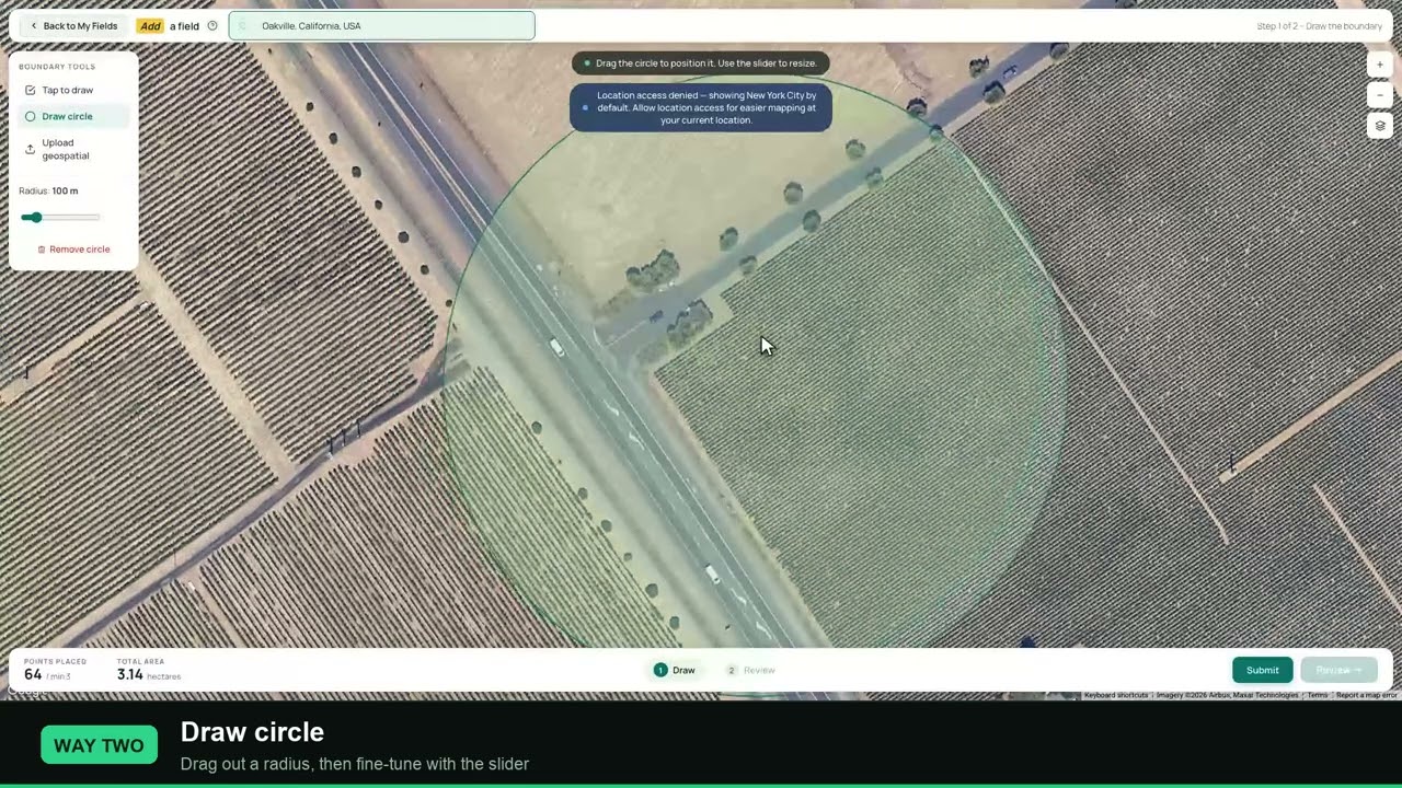
▶ How to draw a field boundary in Farmonaut, three ways, a useful step before comparing a field with any map. · 3:50
How accurate is drone topography?
The best farm-specific evidence comes from Penn State. The team flew four sites in a USDA experimental watershed in Northumberland County, Pennsylvania, and compared drone models with existing 2017 LiDAR data. They checked accuracy against 400 to 1,000 ground control points per site. Elevation correlation was 0.999. Maps of hydrologically sensitive areas and phosphorus critical source areas differed by less than 1.53%.
Read those figures with care:
- Correlation is not error. Two models can rise and fall together and still sit a few centimetres apart. Ask your provider for the vertical error (RMSE) on independent check points.
- The 1.53% is a map difference. It describes runoff-risk maps, not elevation height.
- The comparison was aerial LiDAR data from 2017, not a drone LiDAR flown the same day.
- The sites were Pennsylvania farms. Dense woodland or tall crops may give different results.
Vendors quote tighter targets for controlled jobs. THE FUTURE 3D’s cost guide lists 1 to 3 cm for survey-grade work using RTK or PPK with ground control, and 5 to 10 cm for mapping grade. Robota (December 2025) warns that basic drones with no ground control may only reach 1 to 3 metres. Both firms sell these services or aircraft, so treat their figures as claims to test on your site.
For a public yardstick, the USGS quality-level table sets a 10 cm vertical RMSE for lidar at quality levels 1 and 2. A drone result can be judged against that number when both are measured on independent check points.
Check public elevation data first
You may not need a flight at all. The US 3D Elevation Program offers lidar point clouds and elevation models at no charge. Its 1-metre S1M layer is the finest smooth dataset it produces nationally, though USGS says production has been in progress since mid-2025, so coverage is still filling in. Worldwide, the Copernicus DEM gives 30 m and 90 m grids, but it is a surface model that includes buildings and vegetation.
Chart
Grid spacing of public elevation data
Metres between elevation values, approximate; a smaller number shows finer detail
Public data has two limits. It is only as new as the last overflight, and a coarse grid can miss the small swales and ridges that steer water across a field. Penn State’s researchers made the same point about old LiDAR: a drone can refresh the map after the land changes.
Drone topography cost per acre
Published prices differ widely, so compare full quotes and not the headline rate. All figures below are US vendor list prices or examples, viewed November 2026. They are not auction or contract results.
Chart
Published per-acre prices by method
US$ per acre, US list prices from one vendor guide, viewed November 2026
| Method | Published price | Field speed claim | Fits |
|---|---|---|---|
| Drone photos | US$150-300/acre under 10 acres (THE FUTURE 3D) | Under 2 hours flying for 50 acres (Robota) | Open or bare ground |
| Drone LiDAR | US$150-300/acre at 500+ acres; US$400-500 detailed (THE FUTURE 3D) | A few hours to a day (Drone Lidar Mapping) | Woodland, brush, heavy cover |
| Ground crew | US$500-1,500/acre (THE FUTURE 3D) | About 10 acres a day (Robota) | Small sites, legal work |
| 50-acre example | Drone US$800-2,000; ground US$3,500-7,000+ (Robota) | Not stated | Shows the spread between sellers |
Robota’s 50-acre example works out to about US$16 to US$40 an acre for drone work, far below THE FUTURE 3D’s rates for small sites. Scope explains part of the gap. A stamped CAD topographic plan with breaklines costs more than a basic elevation model. Drone Lidar Mapping’s January 2026 guide gives a broader US$500 to US$15,000+ range by project.
THE FUTURE 3D claims savings of 50 to 75% against ground crews on sites over 5 acres. Robota’s 50-acre example implies a similar saving at its midpoints. Neither is an independent study, and the saving disappears if you still need a surveyor to tie in control or sign the plan.
What moves a drone survey quote
- Area: mobilization is spread over more acres on bigger jobs.
- Ground cover: vegetation can push the job from photos to LiDAR.
- Accuracy class: survey-grade work adds RTK or PPK positioning and control points.
- Contour interval: 1-foot contours need denser data than 5-foot.
- Surveyor’s stamp: an added cost when the plan has legal force.
- Rush delivery: THE FUTURE 3D adds 25 to 50% to its 1 to 2 week standard.
Chart
Bigger drone jobs cost less per acre
US$ per acre, our calculation from midpoints of sample project ranges
Questions to ask before you sign
- What vertical error will you report, and on how many independent check points?
- Which datum and coordinate system will the files use?
- Will I get a bare-earth model, or only a surface model?
- Are travel, control points and revisits inside the price?
- Who holds the licence and insurance, and is a surveyor signing anything?
- Can I have the raw images or point cloud, so another firm can reprocess them later?
Send two or three providers the same written scope, with the same area, accuracy class, contour interval and file formats. Otherwise you are comparing different products. If one quote is far lower, ask which deliverable it leaves out.
Hire a pilot or buy a drone?
Robota puts an RTK drone system at US$15,000 to US$30,000. The purchase only pays if you fly enough acres each year and have someone trained to process the data. Software, training and replacement batteries are real yearly costs, so enter your own figures below.
Try the numbers for your own farm below.
Calculator
Does hiring or owning a mapping drone cost less?
Enter your own acres and quotes to compare one year of each option.
- Hiring per year (US$): $15,000
- Owning per year (US$): $15,000
- Break-even acres per year: 500 acres
Example values only, set near break-even; they are not benchmarks or forecasts. The kit price example sits inside the US$15,000-30,000 RTK system range from Robota (December 2025). Every number is your input. Your own labour is only counted if you include it in yearly overhead. Get professional and tax advice before buying.
7 uses for drone topography on farms and land
1. Mapping runoff and phosphorus risk
Best for: conservation planning and buffers. This is the use Penn State tested. Its team notes that about 80% of phosphorus losses come from about 20% of watershed area, so finding those spots helps target the work.
2. Planning tile and surface drainage
Best for: flat fields with wet spots. Elevation data shows low points, outlets and possible main routes. A drainage designer still sets the grades, and local drainage and wetland rules still apply, so get professional advice before any work starts.
3. Laying out terraces and waterways
Best for: erosion-prone slopes. Contours help place terraces and grassed waterways. Fly after harvest or before crop canopy closes, so the model shows the soil surface.
4. Land leveling and irrigation layout
Best for: surface-irrigated fields. A cut-and-fill estimate from a before-and-after pair can guide earthwork. Ask for a tight vertical check, because small height errors matter on very gentle grades.
5. Tracking change between dates
Best for: gullies, streambanks and repaired ground. Two flights over the same control points show what moved. Use the same flight height, overlap and control, or differences in method can look like real change.
6. Mapping wooded land and forest roads
Best for: woodlots, skid trails and road design. LiDAR earns its higher price here because photos see the canopy and not the soil beneath it. Leaf-off flights help where the trees drop their leaves.
7. Measuring stockpiles and earthworks
Best for: silage, gravel, manure and mine or construction sites. Volume comes from the surface model, so photogrammetry often suits these open piles. Pick a stable base surface and keep it the same between flights.
Which uses need survey-grade work?
Not every use needs the same accuracy. A broad runoff map or a rough look at a wet corner can use mapping-grade data. Drain grades, land leveling and anything that an engineer will sign need tighter control and proper checks. Paying for survey grade on a simple planning map wastes money, and the reverse can mean costly earthwork errors. Tell your provider what decision the map will support, and let the accuracy target follow from that.

▶ Six plain steps to start precision farming without buying a robot. · 4:18
How to plan a drone topography flight
- Name the decision. Drainage design, a volume estimate and a broad runoff map need different accuracy.
- Check existing data. Download public elevation first and see what it misses.
- Choose the sensor. Use photos on open ground and LiDAR under cover.
- Set control. Place ground control points or use RTK or PPK positioning, and keep separate check points that the software never sees.
- Plan the grid. Set height and overlap to suit the required detail. Follow your software maker’s overlap advice for photo work, and raise it over low-texture ground such as bare, even soil.
- Fly in good conditions. Steady light and low wind reduce shadow and blur. Avoid days with standing water if you need the ground surface.
- Process and test. Report vertical error on the check points before anyone uses the map.
- Deliver usable files. Common formats are GeoTIFF, LAS or LAZ, DXF and Shapefile.
Rules to check before you fly
Commercial flights in the US fall under 14 CFR Part 107. The FAA’s summary says the operator needs a remote pilot certificate or direct supervision by a holder, with a 400-foot altitude limit in general and a visual line-of-sight rule. In Canada, Transport Canada requires a valid drone pilot certificate for drones of 250 g and over. In the EU, EASA’s open category sets a 120 m limit. UK, Australian and NZ pilots should check with their national aviation authority. Rules change, so confirm them before each season.
Boundary work is a separate matter. Licensing rules for land surveying vary by state and country. If a plan will support a title, boundary or permit, ask a licensed surveyor what they will accept before the flight.
Drone topography or satellite: which comes first?
They answer different questions. A drone gives fine detail on the terrain of one site on the day you fly. A satellite repeats over wide areas and shows how crops change through the season, not the height of the soil. Nebraska Extension’s guide notes that drones give higher image resolution than satellites and aircraft, but cover fewer acres.
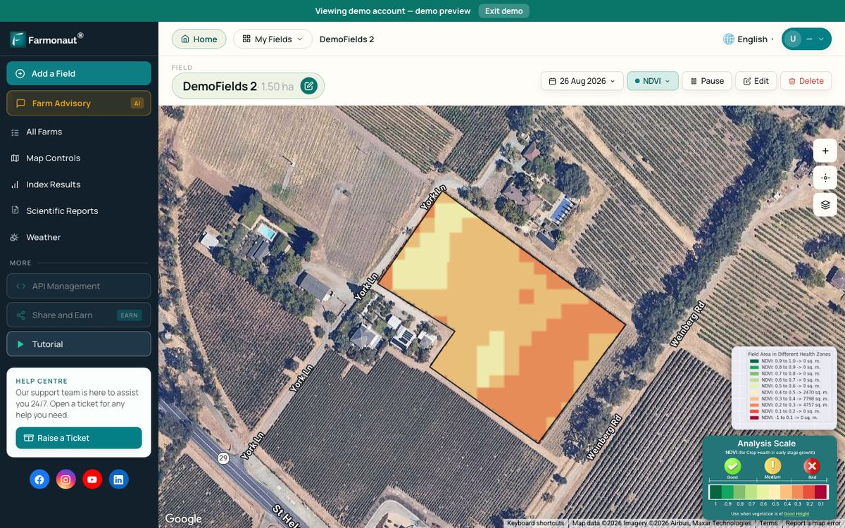
A practical order for a farm: use satellite crop maps to see which zones keep underperforming, then fly a drone where you suspect water or terrain is the cause. Farmonaut provides satellite crop monitoring for that first step; it does not produce survey-grade elevation. For exploration ground, Farmonaut’s satellite-based mineral detection screens large areas before crews or drones go in.
Related pages on our site: choosing a drone for topographic survey · contact page · mining project enquiry form · mining site mapping
▶ How satellite NDVI maps show crop stress across a large farm. · 4:09
FAQ
How accurate is a drone topographic survey compared to LiDAR?
On four Pennsylvania farm sites, Penn State found a 0.999 elevation correlation with 2017 LiDAR data, and runoff-risk maps that differed by less than 1.53%. Correlation does not give centimetre error, so ask for vertical RMSE on independent check points. Under dense cover, LiDAR usually keeps its advantage.
How much does drone topography cost per acre?
US vendor list prices viewed in November 2026 run from about US$16-40 an acre (implied by Robota’s 50-acre example) to US$150-300 for small photogrammetry jobs and up to US$500 for detailed LiDAR (THE FUTURE 3D). Get a quote against your own deliverable.
How long does a drone survey take?
Robota’s example puts flying a 50-acre site at under 2 hours, while Drone Lidar Mapping’s comparison table says hours to a day. Control placement, travel and processing add time. THE FUTURE 3D quotes a 1 to 2 week standard turnaround.
Can drones see through crops and trees?
Photos cannot see through a closed canopy, so they record the top surface. LiDAR pulses can reach the ground through gaps, and processing then removes vegetation points. Very dense cover still leaves fewer ground points, so fly when cover is lowest.
Do I need a licensed surveyor?
For farm planning, often not. For boundaries, title or stamped engineering plans, ask your state or national licensing board and a licensed surveyor first. The aviation certificate covers flying the aircraft and does not license anyone to survey land.
Farmonaut crop monitoring
See your own fields from space
Draw your fields once and Farmonaut shows satellite crop maps through the season, which can show where a closer terrain check may help.



Keep reading

Sources
- Penn State University, Drones match farm planning effectiveness of more expensive tech (May 2026): psu.edu
- USGS, What is lidar data and where can I download it?: usgs.gov
- USGS, Topographic Data Quality Levels: usgs.gov
- USGS, About 3DEP Products and Services: usgs.gov
- Copernicus Data Space Ecosystem, Copernicus DEM: dataspace.copernicus.eu
- eCFR, 14 CFR Part 107: ecfr.gov
- FAA, Small UAS Regulations (Part 107): faa.gov
- Transport Canada, Flying your drone safely and legally: tc.canada.ca
- EASA, Open Category civil drones: easa.europa.eu
- Nebraska Extension, Getting Started with Drones in Agriculture, G2296 (2017): extensionpublications.unl.edu
- THE FUTURE 3D, Topographic Survey Cost Guide (viewed November 2026): thefuture3d.com
- Robota, Drone Surveying vs Traditional Land Surveying (December 2025): robota.us
- Drone Lidar Mapping, Drone Topographic Survey Cost guide (January 2026): dronelidarmapping.com
Discussion
Questions, corrections or field experience? Share them below. First-time comments are reviewed before they appear, and your email is never published.
No comments yet. Be the first to add a question or your experience.

 SP Farms
 Indosistim Teknologi
 Suminter India Organics
 Liquify Digital
 CU Foods
 BeyondTech Global
 Rouge VC
 AgroGreen Dynamics
 AgroRisk
 Oath Inc
 Reddane Farming
 Esri North East Africa
 Cresol
 MDCV UK
 Zerella Group
 Etech Consulting Madagascar
 Vestlandsforsking
 Delicio

 Exploration consultancy · South Africa · Gold
 Licence holder · Niger · Gold
 Client · Tanzania · Gold
 Client · Somalia · Gold










