

Mine technology · Decision guide
Edge Computing in Mining: Uses, Latency and Bandwidth Math
Edge computing runs mine jobs on the machine or on site; the cloud handles slow analysis. Geostationary satellite round trips take 477 to 541 ms in one model, so control loops stay local. Includes a bandwidth cost calculator.
Key takeaways
- The ITU Journal (December 2023) splits mine data into hard real-time, soft real-time and non-real-time work; only the first two need the edge.
- A geostationary satellite round trip is 477 to 541 ms in a bent-pipe model; low-orbit links at 600 to 1,200 km are 8.0 to 41.8 ms (arXiv 2103.14169, Table I).
- Komatsu says it commissioned its 1,000th autonomous ultra-class haul truck in April 2026 (International Mining, 21 April 2026).
- One underground operator reported about 10 Mbps per autonomous vehicle, mostly video (CIM Magazine, August 2017).
- US MSHA rule 30 CFR 75.1732 (January 2015) requires proximity detection on underground coal continuous mining machines (Federal Register).
In this article
- Edge computing in mining: what runs on site and what goes to the cloud
- Which mine workloads need the edge
- Why distance sets the limit: satellite and radio delay
- How much data a mine site sends: bandwidth math
- Autonomous haulage: the largest edge workload
- Safety systems that cannot wait for the cloud
- Computer vision on site: what to run locally
- Where the cloud still wins: data mining and long-term analysis
- Satellite data and the edge: different jobs
- Checklist before you specify an edge system
- Frequently asked questions
Edge computing in mining: what runs on site and what goes to the cloud
Edge computing means processing data on or near the machine that produces it, instead of sending every reading to a distant data centre. A 2023 review in the ITU Journal on Future and Evolving Technologies describes it as bringing computing and storage close to the data, and says it supplies latency-critical and security-critical services inside mines, both underground and open pit (ITU Journal, December 2023). In plain terms: the decision that must happen in a fraction of a second stays at the mine, and the analysis that can wait goes to the cloud.
This guide is written for mining consultants and site planners who have to decide where each job should run. It covers the three kinds of workload, the physics that limits remote links, the bandwidth arithmetic (with a calculator you can fill in), the autonomous haulage and safety systems that already depend on local processing, and the questions to ask a vendor before you sign. Mining here means the extraction business; if you are looking for the other meaning, data mining, there is a short section on it further down.
For wider context on the machines and sensors involved, see our overview of technological innovations in mining and safety and the roundup of new mining and construction technology equipment. For the production side, our page on gold mining methods shows the open-pit and underground settings where these systems are installed.
Which mine workloads need the edge
The ITU review sorts mine data by how much delay it tolerates. Hard real-time work has a strict, predefined delay limit, with industrial control systems and autonomous vehicles as the examples. Soft real-time work tolerates some bounded delay, such as live voice and video calls. Non-real-time work has no time pressure, and the review gives batch and continuous haulage as its example. That three-way split is the simplest way to decide where a job should run.
| Workload type | Mine examples | Where it should run | Why |
|---|---|---|---|
| Hard real-time | Machine control, emergency stops, collision and proximity warnings, autonomous truck steering and braking | On the machine or at a nearby edge server | A round trip to a remote cloud adds delay and fails when the link drops |
| Soft real-time | Live video review, voice calls, dispatch screens, camera alerts for a control room | Edge server on site, with cloud as backup | Short delays are tolerable, but video eats bandwidth |
| Non-real-time | Monthly reports, model training, fleet benchmarking, planning, compliance archives | Cloud or head office | Large storage and compute are cheap there, and nobody is waiting |
Table basis: the three delay classes come from the ITU Journal review (December 2023); the mine examples in the middle columns are our reading of those classes, not figures from the paper.
The same review notes that the underground environment is awkward for radio, because tunnels and rough rock surfaces weaken signals, and that edge platforms can keep applications running even if the connection to outside networks is lost. That second point matters more than raw speed. A mine that stops safety monitoring whenever the internet link fails has a design problem, not a bandwidth problem.
The ITU review also describes layers. Machines carry a small processor of their own, which the authors call a micro-edge. These connect to larger edge servers at the radio base station, and those connect to the cloud. Jobs such as video encoding run on site, while slower tasks move up the chain. The authors call this the edge-cloud continuum.
Why distance sets the limit: satellite and radio delay
Remote sites often reach the outside world through a satellite link. Light travels at roughly 300,000 km per second, so the delay of a satellite hop is fixed by how high the satellite is. A satellite in geostationary orbit sits about 35,786 km above the equator. A signal that goes up and down once covers nearly 72,000 km, which takes about 240 ms before any equipment adds its own delay (Satellite Signals, geostationary latency page).
Chart
Round-trip delay by satellite orbit
Milliseconds, bent-pipe model, 10 degree minimum elevation; satellite leg only
A research paper on satellite networks for machine-type communication tabulates round-trip delay for a bent-pipe design, where the satellite simply relays the signal. For a geostationary satellite it is 477 ms with the satellite overhead and 541 ms near the horizon. For low orbits it is far shorter: 8.0 to 25.8 ms at 600 km altitude and 16.0 to 41.8 ms at 1,200 km (arXiv preprint 2103.14169, Table I). The chart below plots those figures.
What this means for design: a control loop that must react within tens of milliseconds cannot depend on a geostationary link, and even a low-orbit link adds delay. The ground network and any cloud region add further delay on top of the satellite hop, which the table does not include. Treat these numbers as a lower bound on the satellite leg only.
How much data a mine site sends: bandwidth math
Video is the main load. A report on underground communications in CIM Magazine quotes a Barrick Hemlo engineer saying each Sandvik autonomous vehicle needs around 10 Mbps, that video is what consumes bandwidth, and that more camera angles mean more bandwidth (CIM Magazine, August 2017). The same article reports that for direct vehicle-to-server control, latency matters more than bandwidth, and that older leaky feeder radio systems support neither the bandwidth nor the latency that automation needs. These are 2017 figures from one underground operation, so use them as an order of magnitude, not a specification.
Now the arithmetic. One camera streaming at 2 Mbps produces about 0.9 GB per hour and about 650 GB per month if it runs around the clock. Twenty such cameras produce roughly 13 TB per month. Sending all of that over a metered satellite link is expensive; analysing the stream on site and sending only alerts, short clips and summaries cuts the volume by whatever share you filter out. The calculator below lets you enter your own camera count, bit rate and satellite price per gigabyte to see the difference. Every default is an example, not a quote.
One caution on the saving. Filtering only works if the on-site model is good enough that you trust what it discards. A Frontiers in Energy Research review of machine learning for mining energy optimization (a related field, not an edge-computing survey) notes that remote sites face limited connectivity and heavy computing demands, and lists pruned and quantised models running on small edge devices as one fix (Frontiers in Energy Research, 2025). A smaller model is cheaper to run but can miss events, so test it against a sample of raw footage before you stop uploading that footage.
Calculator
How much video data does your site send, and what does filtering save?
Enter your camera count, bit rate and link price. Defaults are examples.
- Data sent after filtering: 648 GB
- Cost if all raw video is sent: 64,800 US$
- Cost after on-site filtering: 3,240 US$
- Monthly difference: 61,560 US$
- Uplink needed to send raw video: 40 Mbps
Example values only, not a quote or benchmark. The month is fixed at 30 days. Video bit rate and satellite price per GB are inputs: example, use today’s price and your own camera settings (US$). Filtering share is the part of the video you still send after on-site analysis.
Autonomous haulage: the largest edge workload
Driverless haul trucks are the clearest case of local processing in mining, because the truck must sense, decide and brake without waiting on a distant server. Komatsu said in April 2026 that it had commissioned its 1,000th autonomous ultra-class haul truck, a 930E-5AT with a 290-tonne payload at Nevada Gold Mines in the United States, and that customers using its FrontRunner system had moved over 11.5 billion tonnes (International Mining, 21 April 2026, quoting Komatsu). Those are the company’s own figures. Of the 1,000 trucks, about 52% were 930E models, with 24% each for the 830E and 980E.
Chart
Komatsu autonomous haul trucks by model
Approximate trucks of the 1,000 commissioned by April 2026
Caterpillar reported a similar milestone for its Command system at Fortescue in Western Australia: 1 billion tonnes moved, and a 30% productivity improvement at the site (reported in 2019), again a company-reported result (Canadian Mining Journal via Mining.com, November 2019). That report describes trucks that respond to shovel calls, haul to dump points and report for maintenance without an operator on board.
The connectivity sources show that the site network has to be built for the trucks. The CIM article describes fibre down the shaft, Wi-Fi access points along the drift and fast handover between access points so that navigation, steering and emergency stops never lose their link. If you advise a mine on fleet connectivity, our page on mobile fleet networks in mining covers the network side.
Safety systems that cannot wait for the cloud
Regulation already treats some on-machine detection as mandatory. In January 2015 the US Mine Safety and Health Administration published a final rule, 30 CFR 75.1732, requiring proximity detection on continuous mining machines in underground coal mines (full-face machines are excluded). MSHA reviewed accidents from 1984 to 2013 and found that 34 of 75 preventable pinning, crushing and striking fatalities involved continuous mining machines (Federal Register, 15 January 2015). The rule requires a machine that is tramming or repositioning to stop before it touches a miner, with limited exceptions, which is a decision that has to be taken on the machine itself. MSHA reminded operators that the compliance deadline for all covered machines was 16 March 2018 (MSHA alert).
Chart
Deaths in all US mining by fiscal year
Number of fatalities reported by MSHA
The wider safety picture is the reason such rules exist. MSHA’s summary tables show 28 deaths in all US mining in fiscal year 2025, a fatal injury rate of 0.0101 per 200,000 hours worked, compared with 41 deaths in fiscal year 2023 (MSHA At a Glance, FY1978-2025). The chart shows the seven years in that table. It is context, not proof that any one technology moved the numbers, because deaths depend on hours worked, commodity mix and many other factors.
Computer vision on site: what to run locally
Cameras are the easiest sensors to add and the hardest to move across a thin link. The practical rule is to run detection where the camera is and send only the result. The ITU review lists video encoding as a job suited to local processing, while tasks that need more processing, such as AI-based operations, are carried out in the centralised cloud. Typical on-site uses include spotting spillage or blockages on a conveyor, flagging a person inside an exclusion zone, and checking that a truck is parked in the right bay.
Two limits are worth stating. Small edge devices have limited computing capacity, which is why the Frontiers energy-optimization review lists compressed (pruned and quantised) models as a fix for on-site deployment and mentions federated learning, where several sites train a shared model without pooling raw data. And an alert is only useful if someone has agreed what to do with it, so write the response rule before you switch the camera on.
For a plain-language look at what an AI mining app does and which jobs it can take on, our short explainer covers the three main jobs.

▶ Explains the three jobs an AI mining app does and who builds one. · 3:52
Where the cloud still wins: data mining and long-term analysis
People searching for “data mining on cloud computing” usually mean something different from extracting minerals. Data mining is the statistical search of large datasets for patterns, such as which pump vibrations preceded a failure. That work belongs in the cloud or at head office, where storage and compute are plentiful and no machine is waiting for an answer.
The two layers feed each other. Sites send summaries and alerts up; the cloud trains or retrains a model on the pooled history; the updated model goes back down to the edge devices. The Frontiers energy-optimization review lists model compression for the edge and federated learning for secure multi-site collaboration among its proposed solutions. Other cloud jobs include compliance archives, group-level benchmarking and planning.
Satellite data and the edge: different jobs
Satellite imagery does not replace on-site sensors, and on-site sensors do not replace satellites. Edge systems watch machines and people inside a mine. Satellites look at the ground from above, across a whole licence area, before and between site visits. That work is processed in large data centres, so it sits at the cloud end of the picture.
For a consultant, the useful link is early in the project: map the licence area from space to decide where field crews and equipment should go, then size the site network for the areas that matter. We supply satellite mineral detection reports built from a licence boundary or polygon, which are exploration targets and sit ahead of any resource estimate. For a short introduction to how remote sensing works for mining, see the video below.
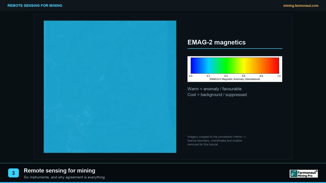
▶ Explains remote sensing for mining in plain words: what the instrument families measure and why agreement between them matters. · 2:01
Checklist before you specify an edge system
- What must still work when the link is down? List the functions (stops, alarms, local logging) and ask the vendor to show the system running with the uplink unplugged.
- What delay does each function tolerate? Use the three classes above and get the number in writing for the hard real-time functions.
- How much data leaves the site, and who pays per gigabyte? Run the calculator with your own camera count and link price.
- How are models updated? Ask how a new version reaches each device, and how a bad update is rolled back.
- Who owns the data and where is it stored? Check licence and country rules on data location before video leaves the site.
- What is the handover plan across access points? The CIM report quotes an engineer saying that if the handover between access points is not smooth, you cannot control navigation, speed, steering, brakes or emergency stop.
- What does the safety regulator expect? In US underground coal, 30 CFR 75.1732 already sets proximity detection duties; other jurisdictions have their own rules.
Frequently asked questions
What is edge computing in mining?
It is processing data on or near the machine or site that produces it, rather than in a distant data centre. The ITU Journal review (December 2023) says it brings latency-critical and security-critical services into mines and lets applications keep running if the outside connection is lost.
How is edge computing different from cloud computing?
Edge computing runs close to the machine and answers faster, but its hardware is limited. Cloud computing runs far away with large storage and compute, and answers more slowly. Most mines use both, which the ITU review calls the edge-cloud continuum.
Does a mine need 5G to use edge computing?
No. The ITU review describes machines connecting by 5G base stations or Wi-Fi depending on mobility and speed, and the CIM report describes fibre plus Wi-Fi with mesh extensions at an underground mine. The right network depends on the site.
Can a satellite link run machine control?
Not for hard real-time control. In the bent-pipe model above, geostationary round trips are 477 to 541 ms, and even low-orbit links add tens of milliseconds before the ground network is counted. Keep control loops local and use the satellite link for reports, alerts and updates.
How much bandwidth does an autonomous truck need?
One underground operator reported around 10 Mbps per Sandvik autonomous vehicle in 2017, mostly for video (CIM Magazine). Open-pit fleets and newer systems may differ, so ask the vendor for the figure for your trucks and cameras.
What does data mining on cloud computing mean?
It means searching large stored datasets for patterns, such as early signs of equipment failure. In mining it is the slow, large-scale half of the edge-cloud pair: the cloud trains the model on pooled history and the edge device runs the smaller trained version.
Are there rules that require on-machine detection?
In US underground coal mines, 30 CFR 75.1732 requires proximity detection systems on continuous mining machines, and the compliance deadline for all covered machines was 16 March 2018 (MSHA). Rules in other countries differ, so confirm with the regulator that covers your site.
Does edge computing cut cost?
It can cut data transfer cost where links are metered, which the calculator on this page shows. It adds hardware, power and maintenance cost on site, so compare both before deciding.
Can satellites replace on-site sensors?
No. Satellites map the ground and surface change across a licence area; on-site sensors watch machines, people and processes. They answer different questions and work best together.
This page is for information only. It is not legal advice or engineering advice. Confirm safety and communications rules with the regulator and a qualified engineer.
Farmonaut mining
Map your mining site from space
Consultants can see how satellite data screens a licence area as an exploration target, ahead of a resource estimate, before planning field kit and site networks.

Mining Pro sample view, synthetic data
Keep reading
Sources
- ITU Journal on Future and Evolving Technologies, Edge computing for critical environments (December 2023): itu.int
- ITU Journal, full article PDF: itu.int
- Frontiers in Energy Research, machine learning for mining energy optimization (2025): frontiersin.org
- arXiv 2103.14169, satellite networks for machine-type communication, Table I: arxiv.org
- Satellite Signals, geostationary satellite latency: satsig.net
- CIM Magazine, The bandwidth backbone (August 2017): magazine.cim.org
- International Mining, Komatsu commissions 1,000 autonomous ultra-class trucks (21 April 2026): im-mining.com
- Canadian Mining Journal via Mining.com, Caterpillar and Fortescue (November 2019): mining.com
- Federal Register, Proximity Detection Systems final rule (15 January 2015): govinfo.gov
- MSHA alert, proximity detection installation deadline: msha.gov
- MSHA, Mine Safety and Health At a Glance FY1978-2025: msha.gov
Discussion
Questions, corrections or field experience? Share them below. First-time comments are reviewed before they appear, and your email is never published.
No comments yet. Be the first to add a question or your experience.

 Mwerezi Minerals Company Limited
 Congo Mining Solutions
 Mining SARL
 SenGold Invest SAS
 Sania Corporation
 Sean Mining Limited
 NTS Group (Pty) Ltd
 Mine4Africa
 Lithspo Minerals Limited
 Tintina Mining Group
 Dalgety Minerals Pty Ltd
 Vortex Minerals Pty Ltd
 Faith At Work (Pty) Ltd
 Geotech Mining Solutions plc
 Vulcan International Limited
 Kidepo Associates
 GKY Mining
 Alkimy SARL
 Double A Trading
