

Geoscience data guide · Ireland
Geological Survey Ireland: Maps, Data and Licences
Geological Survey Ireland (GSI) publishes bedrock, Quaternary, Tellus geophysics and geochemistry, and mineral layers as downloads and viewers. This guide shows how to use them and how a prospecting licence works.
Key takeaways
- GSI releases its own data under Creative Commons Attribution 4.0, with a set attribution line (GSI, Data and Maps page).
- Tellus airborne surveys flew magnetics, radiometrics and electromagnetics at about 60 m height and 200 m line spacing (GSI geophysics page).
- A prospecting licence is normally valid for 6 years, has an application fee of EUR 190 per area and does not allow mining (Department of Climate, Energy and the Environment).
- Boliden reported Tara Mines reserves of 16.6 Mt at 5.4% zinc and 1.3% lead at 31 December 2025.
- Licence-holder reports become public after 6 years or on surrender, through the Department’s viewer.
In this article
- What Geological Survey Ireland publishes
- How to use the GSI map viewers and downloads
- Irish bedrock map and Quaternary maps: scales and limits
- Tellus airborne geophysics: what was flown and how to get it
- Tellus geochemistry: stream sediment, stream water and soil
- Mineral localities, exploration boreholes and open-file records
- Prospecting licences in the Republic of Ireland
- Irish-type zinc-lead: Tara, Galmoy and Lisheen
- Tara Mines: reserves, resources and Tara Deep
- Gold in Ireland: Clontibret, Curraghinalt and Cavanacaw
- Geological Survey of Northern Ireland and Tellus NI
- A desk study workflow before you apply or buy
- Where satellite imagery adds to GSI data
- Frequently asked questions
Geological Survey Ireland (GSI) is the national geoscience body of the Republic of Ireland, and its public data are the best starting point for anyone exploring Irish ground. It publishes bedrock, Quaternary (glacial sediment), groundwater, marine, geotechnical, minerals, geophysics and geochemistry datasets as downloads, map viewers and web services, all listed on its Data and Maps page. Data that GSI produces itself is released under the Creative Commons Attribution 4.0 licence, so you can use it commercially if you credit the source.
This guide explains what each dataset holds, how to read it for exploration, how the Tellus airborne and soil surveys work, how a prospecting licence is applied for in Ireland, and what the best-known Irish zinc-lead and gold deposits look like in the data. A short section covers Northern Ireland, which has its own survey. A calculator further down turns an area and a line spacing into airborne survey line-kilometres.
What Geological Survey Ireland publishes
GSI sorts its output by theme. The GSI Data and Maps page lists bedrock, Quaternary, groundwater, marine, geological heritage, geotechnical, minerals, geophysics, geochemistry and geohazards. Each theme offers zip downloads, an online viewer, metadata through the Irish Spatial Data Exchange, and REST or WMS web services you can load straight into GIS software. Files use the Irish Transverse Mercator (ITM) grid unless stated; marine files use WGS84.
A separate archive called GOLDMINE holds scanned old maps and reports. Exploration companies that held prospecting licences in the past have filed reports there, so it is often the quickest way to find out who looked at your ground before you.
For reuse, GSI asks for one attribution line: Contains Irish Public Sector Data (Geological Survey Ireland) licensed under a Creative Commons Attribution 4.0 International (CC BY 4.0) licence. The terms are on the Creative Commons site. Groundwater flooding data is the exception: it carries a non-commercial, no-derivatives licence, so check the layer before you put it in a client report.
Everything in this guide is read from the official GSI and Department pages as they stand today. Datasets are re-issued from time to time, so confirm the release note on a layer before you rely on it.
How to use the GSI map viewers and downloads
You do not need paid software to start. Work in this order and you will have a usable desk study in an afternoon.
- Pick the viewer for your question. Open the Data and Maps page, choose a theme and use its Map Viewer link. GSI also publishes a video tutorial on the viewer.
- Find your ground. Zoom to your ground in the viewer, then switch on bedrock at 1:100,000 scale.
- Add mineral localities and exploration boreholes. These two point layers show known occurrences and old drilling near you.
- Add Tellus. Magnetic, radiometric and electromagnetic grids show what lies under cover; soil and stream chemistry shows metal anomalies.
- Download what you need. Each layer has a zip, a release note and metadata. Keep the release note with the file.
- Bring layers into GIS. GSI explains the connection: in QGIS use Add ArcGIS MapServer Layer or Add WMS layer and paste the service link; in ArcGIS Pro add a new WFS, WMS or WMTS server connection.
Keep every layer in ITM (EPSG:2157) while you work and reproject only for the final map. Mixing ITM with older Irish Grid or with WGS84 shifts points by tens of metres, which is enough to put a borehole on the wrong side of a fault.
The same habit works for any state survey. Our video on open maps for Western Australia shows how an explorer reads a survey’s map portal before going near the field; the steps map directly onto GSI data. For a wider look at how survey agencies publish geology, see our guide to the BC Geological Survey and other agencies.
▶ How to read a state geological survey’s map portals before prospecting (Western Australia example). · 4:13
Irish bedrock map and Quaternary maps: scales and limits
The GSI bedrock page offers national coverage at 1:1,000,000, 1:500,000 and 1:100,000, plus 1:50,000 sheets for the northeastern, midlands, Dublin and Cork areas, bedrock outcrops, borehole records with logs, 3D geological models and hyperspectral sample data. A 1:1,250,000 summary map of Britain and Ireland was produced with the British Geological Survey and the Geological Survey of Northern Ireland, mainly as a teaching map.
The 1:1,000,000 map was published jointly with the Geological Survey of Northern Ireland in 2014, so it shows the whole island. It is built from the GSI 1:500,000 and 1:100,000 data and the Northern Ireland 1:250,000 map. For prospecting work you will mostly use the 1:100,000 map, which gives rock units and faults, and the 1:500,000 series, which has separate lithology, faults and dykes layers.
Read bedrock maps with one caution in mind. GSI itself notes that bedrock is commonly covered by soil, peat and glacial sediment, so a bedrock map is an interpretation of the available data and not a photograph of the ground. In Ireland the cover is thick: glacial till, esker gravel and bog hide much of the rock. That is why geochemistry and airborne geophysics matter so much here. For a general guide to map scales and how to read them, see our article on geological mapping methods and scales. Sediment maps are covered in our companion page on surficial geology maps.
The Quaternary layers matter for a different reason. Drift thickness and ice-flow direction decide where a soil anomaly came from. A zinc anomaly in till may sit down-ice of its source by hundreds of metres, so check the Quaternary map before you place a trench.
Tellus airborne geophysics: what was flown and how to get it
Tellus is GSI’s national survey of geophysics and geochemistry. The GSI geophysics page describes three airborne measurements. Magnetic data (in nanotesla) were recorded at 10 Hz. Radiometric data (total counts, potassium in percent, equivalent thorium and uranium in ppm) and four-frequency electromagnetic data (912, 3005, 11962 and 24510 Hz, in-phase and quadrature responses plus resistivity transforms) were recorded at 1 Hz. The nominal survey height is 60 m and the line spacing is 200 m for all three.
Chart
Size of the merged Tellus downloads
Megabytes, merged data for all Tellus phases (XYZ point files)
What each one tells an explorer is simple. Magnetics map magnetite-bearing rocks, faults and dykes under cover. Radiometrics map the potassium, thorium and uranium of the top few tens of centimetres of ground, which separates granite, shale and altered rock. Electromagnetics respond to conductive ground such as sulphides, graphite and wet clay, and to soil conductivity.
The surveys were flown in blocks: Tellus Border (2013), North Midlands (2015), A1 and Waterford (2016), A2 (2017), A3 and A4 (2018), A5 to A7 (2019) and A8 and A9 (2022), plus older pilot surveys from 2006 over Cavan-Monaghan, Silvermines and Castleisland and a 1979 to 1981 survey of central Ireland. Merged data for all Tellus phases to date are offered as XYZ point files and as grids in grd, tiff and gxf formats.
The merged files are large, so plan storage and use the block downloads if you work on one licence area. The merged magnetic grid, for example, is 843 MB, while the merged four-frequency EM point file is 1.10 GB.
Calculator
How many line-km is an airborne survey block?
Enter your block area, line spacing and aircraft speed.
- Flying time, lines only (hours): 22.7
- Magnetic readings: 818,182
- Distance between readings (m): 6.1
Defaults use the Tellus 200 m line spacing and 10 Hz magnetic sampling (Geological Survey Ireland). Aircraft speed is an example only, check with your contractor.
Tellus geochemistry: stream sediment, stream water and soil
The GSI geochemistry page lists twelve Tellus coverage blocks, G1 to G12. Four sample types are offered: stream sediment (the minus-150 micron fraction, coded C), filtered stream water (W), shallow topsoil (A) and deeper topsoil (S).
For stream sediments in blocks G1 to G4 (surveyed 2011 to 2017) the laboratory measured major, minor and trace elements by X-ray fluorescence, and gold, palladium and platinum by lead-collection fire assay with an ICP-MS finish. Stream water was measured for pH, conductance and alkalinity in the field and for trace elements by ICP-MS in the laboratory.
Two uses stand out. First, stream sediment gold and pathfinder elements (arsenic, antimony, copper) outline drainage basins worth following up. Second, soil lead and zinc highlight the limestone belts that host Irish-type zinc-lead deposits. If you want a plain guide to how to design and read this kind of data, see our piece on geochemical survey design.
Sample coverage is uneven. Not every county has every sample type, so open the coverage map for each block before you assume your ground has been sampled.
▶ Remote sensing for mining explained: the six instrument families that measure ground from a distance. · 2:01
Mineral localities, exploration boreholes and open-file records
The GSI minerals page is the most useful page for a licence holder. It lists these datasets, each with a download, viewer and web service where stated:
- Mineral localities: a point layer showing locations where minerals have been found in Ireland.
- Mineral exploration boreholes: boreholes drilled between 1957 and 2002 and submitted by exploration companies, as shapefile or Excel.
- Exploration records (open file): company reports for current and past prospecting licence areas, viewed through a map hosted by the Department and through GOLDMINE.
- Minerals Prospectivity Mapping (MPM) Project: historic soil geochemistry for the northwest Midlands (Galway, Roscommon, Mayo, Sligo, Leitrim and Longford, with parts of other counties) mainly for copper, lead and zinc, plus structural lineaments picked from Tellus and magnetic and EM data downloads.
- Quarry directory (2014) and Aggregate Potential Mapping: crushed rock, sand and gravel, and dimension stone.
- Core store catalogue: a spreadsheet of stored drill core, with core viewing arranged through GSI.
A mineral locality is not a resource. It records that a mineral was seen at a place. Treat it as a reason to read the old report, not as a grade or tonnage.
The Department also runs a viewer that shows current prospecting licence ground, drillholes, environmental constraints and the footprint of airborne surveys. Its maps, reports and data page says licence-holder reports stay confidential for six years or until the licence is surrendered, whichever is sooner, and are then released through the viewer and a searchable database. Airborne geophysical data can be requested from [email protected].
Prospecting licences in the Republic of Ireland
This section covers the rules on the official pages only. Check with the Department before you apply, because terms and forms change.
Mineral exploration in the Republic is regulated under the Minerals Development Acts 1940 to 1999 by the Department of Climate, Energy and the Environment. The Department’s prospecting licence page sets out the process. A prospecting licence lets the holder search for specified minerals in a defined area. It does not give permission to mine, as the Department’s minerals policy page states.
| Item | What the Department states |
|---|---|
| Legal basis | Minerals Development Acts 1940 to 1999; the Minerals Development Act 2017 was enacted on 26 July 2017 and is due to be commenced |
| Term | Normally valid for 6 years; can be renewed, subject to the Minister |
| Application fee | EUR 190 per prospecting licence area |
| What you submit | Application form, evidence of technical ability and financial viability, reasons for the minerals chosen with an exploration programme, agreed expenditure commitment, insurance against third-party and environmental claims |
| Public notice | Minister’s intention to grant is advertised on gov.ie, in a local newspaper, at the county council office and at a local Garda station |
| Reporting | Report on activities every 2 years; end-of-phase submittal form at review, renewal or surrender |
| Data confidentiality | Six years or until surrender, then public |
Licence holders must respect landowners’ wishes on access and follow the Department’s Guidelines for Mineral Exploration, which set standard working procedures to avoid damage and pollution. The Department also commissioned reports in 2017 on how common exploration methods affect habitats and species protected under the EU Birds and Habitats Directives.
The USGS Minerals Yearbook for Ireland recorded 611 prospecting licences, 6 state mining licences and 10 state mining leases active at the end of 2017 and said a prospecting licence typically covers about 35 square kilometres (USGS, 2017-18 yearbook). That is a snapshot from the end of 2017. Use the Department’s licence viewer for today’s ground status.
Irish-type zinc-lead: Tara, Galmoy and Lisheen
Ireland is known for a deposit style that geologists call Irish-type zinc-lead: massive zinc and lead sulphide replacing Lower Carboniferous limestone along faults. It matters to your desk study because the same limestones, faults and geochemical signatures show up across the Midlands in GSI’s data. For how zinc mining compares around the world, see our guide to zinc mining: top producing countries and biggest mines.
Chart
Irish mine zinc output
Zinc content of mine output, tonnes
Three mines show the history:
- Tara (Navan, Co. Meath): the Navan orebody was discovered in 1970 and production began in 1977, according to Boliden’s reserves report. It lies 2 km northwest of Navan, about 50 km northwest of Dublin.
- Galmoy (Co. Kilkenny): ceased production in October 2012.
- Lisheen (Co. Tipperary): ceased production in December 2015.
The Department says Galmoy and Lisheen were the first Irish mines to be opened, run and closed under modern mining, planning and environmental regulation, and it published an independent assessment of their social, environmental and economic effects in 2020 (see the Department assessment). Their mine geology, geotechnical, groundwater and closure data were made public in March 2017 on the mine data release page. That is rare, detailed data on how a zinc-lead orebody sits in the ground, and worth downloading if you explore limestone ground.
USGS data show Irish mine zinc output (zinc content) falling from 282,600 tonnes in 2014 to 131,742 tonnes in 2018. The drop spans the closure of Lisheen at the end of 2015.
Tara Mines: reserves, resources and Tara Deep
Boliden’s 2025 summary report on Tara Mines is a useful, current reference on a working Irish orebody. At 31 December 2025 it reported mineral reserves of 16.6 million tonnes at 5.4% zinc and 1.3% lead, up from 13.9 million tonnes a year earlier. The report also gives an inferred resource of 7.5 million tonnes at 5.1% zinc and 1.3% lead, and a separate inferred resource for the Tara Deep deposit of 27 million tonnes at 8.4% zinc and 1.6% lead.
Chart
Tara Mines reserves and resources
Million tonnes, Boliden, PERC standard
Inferred means the lowest confidence class of resource: tonnage and grade are estimated from limited sampling and are not yet proven. Boliden says Tara Deep was discovered in 2012 and lies at depths of 1 to 2 km, about 1 km southeast of the main mine, and is a major exploration focus. In 2025 the mine hoisted 1.44 million tonnes of mineralised material, after a 14-month care and maintenance period that ended in September 2024. The planned production target is 1.8 million tonnes a year. Boliden describes Tara as one of the largest zinc mines in Europe.
These figures belong to Boliden and are reported under the PERC standard. Tara is a good reminder that a mature district can still grow: the discovery of Tara Deep came 35 years after production began.
Gold in Ireland: Clontibret, Curraghinalt and Cavanacaw
Gold in Ireland is found mostly in quartz veins in old, folded rocks. The British Geological Survey’s Earthwise summary of gold and silver in Northern Ireland describes the main examples.
- Clontibret (Co. Monaghan, Republic): gold in quartz veins with stibnite, part of the same vein swarm as the lead veins of the South Armagh-Monaghan mining district.
- Curraghinalt (Co. Tyrone, Northern Ireland): discovered in 1983 by following a shallow soil arsenic anomaly. Gold sits in quartz veins a few millimetres to 3 m wide in Dalradian rocks (muddy and sandy metamorphic rocks).
- Cavanacaw (Co. Tyrone, Northern Ireland): found by prospecting in 1985, in the Lack Inlier west of Omagh, in steeply dipping quartz veins.
The BGS text (2004) quotes older estimates for both Tyrone deposits: 470,000 tonnes at 17 g/t gold at Curraghinalt and, as quoted by the company, 2 million tonnes at 6.9 g/t at Cavanacaw. These are old figures and not current resources, so do not reuse them as if they were. Grams per tonne (g/t) is the standard gold grade unit.
Curraghinalt is also a live planning case. Northern Ireland’s Department for Infrastructure says the Dalradian application for an underground mine and processing plant was submitted on 27 November 2017 and referred to a public local inquiry (see the Department overview). The Planning Appeals Commission list of live cases dated 6 August 2026 says the inquiry opened in January 2025, was adjourned while the Department carried out a transboundary consultation, and reconvened in April 2026. On 12 November 2026 the Commission’s Curraghinalt case page reported that the hearing sessions had closed and that its reports will go to the referring authorities by the end of February 2028; no planning decision has been issued.
On Tellus, a 2013 Irish Times report on the border gold search says the Tellus survey found gold anomalies in an arc from Donegal to Down and confirmed earlier work at Clontibret. Anomalies are leads, not discoveries: they need follow-up sampling. For how satellite data fit into this kind of screening, see our overview of how satellite mineral exploration works.
Geological Survey of Northern Ireland and Tellus NI
Northern Ireland is a separate jurisdiction with its own survey, rules and licences. The Geological Survey of Northern Ireland (GSNI) is part of the Department for the Economy and is staffed by British Geological Survey scientists under contract, according to its Open Data NI entry.
The Northern Ireland Tellus airborne survey was flown in 2005 and 2006 by the Joint Airborne-geoscience Capability, a venture of the Finnish and British geological surveys. Its magnetic, electromagnetic and radiometric data were recorded at 200 m line spacing and a 56 m flying height (240 m over built-up areas), according to the Open Data NI survey description. The radiometric XYZ file in the GSNI data catalogue lists easting, northing, total counts, potassium (%), uranium (ppm eU) and thorium (ppm eTh) for each reading. The same listing shows the magnetic data under the UK Open Government Licence.
The Northern Ireland and Republic data sets do not match in every respect: flying height (56 m against 60 m) and flight years differ, although both surveys used 200 m line spacing. Check this before you merge grids across the border. If you need British mapping next, see our guide to British Geological Survey maps.
A desk study workflow before you apply or buy
Here is a short workflow that uses only public data. It suits a licence applicant, a consultant screening ground for a client or an investor checking a claim.
Infographic
Public-data desk study in 6 steps
- 1Outline the groundDraw your area in ITM and note county, townland and any licence ground.
- 2Read the bedrockCheck 1:100,000 rock units and faults for your commodity.
- 3Check localitiesAdd mineral localities and old boreholes nearby.
- 4Add TellusLook at magnetic, radiometric and EM grids and soil or stream chemistry.
- 5Read old reportsSearch GOLDMINE and open-file records for past work.
- 6Rank targetsKeep ground with several signals and little past drilling.
The aim is to rank ground, not to prove it. A target that has a bedrock unit favourable for your commodity, a nearby mineral locality, a Tellus anomaly and no sign of heavy previous drilling is a better first licence than ground that has only one of these.
Where satellite imagery adds to GSI data
GSI data tell you what is under the surface at survey scale. Satellite imagery adds a different layer: the surface of the ground, updated often and at the size of your licence. Satellites map surface and near-surface signatures such as iron staining, clay alteration and structure lines, and sampling and drilling confirm what they suggest. In Ireland, grass, bog and tree cover limit what optical imagery can see, so use it with Tellus, not instead of it.
Farmonaut produces satellite mineral reports for licence areas and can screen a block against the signatures above before a field programme. For the general method, see satellite-based mineral detection.

▶ How satellites help in exploration: they map the rock around mineralisation, not the metal itself. · 4:25
Frequently asked questions
What is Geological Survey Ireland?
It is the national geoscience body of the Republic of Ireland. It maps bedrock, glacial sediment, groundwater and seabed, runs the Tellus survey, and publishes data on minerals and geohazards through online viewers and downloads.
Where can I find the Irish bedrock map?
On the GSI bedrock page, which offers national maps at 1:1,000,000, 1:500,000 and 1:100,000, and 1:50,000 sheets for selected areas. Each has a download, a viewer and a web service. Bedrock maps are interpretations because soil and sediment cover much of the rock.
What is the Tellus survey?
Tellus is GSI’s programme of airborne geophysics (magnetic, radiometric and electromagnetic) and ground geochemistry (stream sediment, stream water and soil). The airborne blocks were flown between 2013 and 2022 at about 60 m height and 200 m line spacing.
How do I download GSI maps and data?
Open the Data and Maps page, choose a theme and use the zip download, viewer or web service links. Layers can be loaded into QGIS or ArcGIS through the MapServer or WMS links. Credit GSI as the licence requires.
Can I use GSI data commercially?
Data that GSI produces is released under Creative Commons Attribution 4.0, which allows commercial use with attribution. Groundwater flooding data uses a non-commercial licence, so check the layer you need.
How do I get a prospecting licence in Ireland?
Complete the Department’s application form, pay EUR 190 per licence area, show technical and financial ability, and give an exploration programme, an expenditure commitment and insurance. The intention to grant is advertised publicly. Check with the Department before you apply.
How long does a prospecting licence last?
The Department says a licence is normally valid for 6 years and can be renewed, subject to the Minister. Holders report every 2 years.
Does a prospecting licence let me mine?
No. It covers exploration only. The Department states that it does not give permission to mine.
Is there a geological survey of Northern Ireland?
Yes. GSNI is part of the Department for the Economy and publishes its own maps and Tellus NI data through its data catalogue and Open Data NI. Licensing and planning there are separate from the Republic.
Where is the Irish mineral localities map?
It is a layer on the GSI minerals page with a viewer, a zip download and web services. Use it with the exploration boreholes layer and GOLDMINE reports to see who explored nearby.
Which Irish mines are the best-known?
Tara near Navan in Co. Meath is the working zinc-lead mine, operated by Boliden. Galmoy and Lisheen closed in 2012 and 2015. In Northern Ireland, Curraghinalt and Cavanacaw are the best-known gold deposits.
Does GSI list gold and zinc occurrences?
Yes, through the mineral localities layer and the MPM project data, which cover base metals in the northwest Midlands. The occurrence layer records where minerals were seen, not how much there is.
This page is for information only. Check licence rules and fees with the Department before you apply. It is not legal advice, and any resource figure quoted here belongs to the company named and is not a Farmonaut resource estimate.
This page is for information only. It is not legal advice or investment advice. Confirm licence rules, fees and data terms with the Department and Geological Survey Ireland. Resource figures quoted belong to the companies named and are not JORC, NI 43-101 or SAMREC resources of ours.
Farmonaut mining
Screen your Irish licence area from space
Send a boundary and we will map surface alteration and structure signatures to compare with GSI data, ahead of any field work.
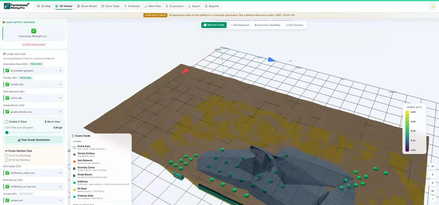
Mining Pro sample view, synthetic data
Sources
- Geological Survey Ireland, Data and Maps: gsi.ie
- Geological Survey Ireland, Bedrock data and maps: gsi.ie
- Geological Survey Ireland, Geophysics (Tellus): gsi.ie
- Geological Survey Ireland, Geochemistry (Tellus): gsi.ie
- Geological Survey Ireland, Minerals data and maps: gsi.ie
- Creative Commons Attribution 4.0 International: creativecommons.org
- Department of Climate, Energy and the Environment, Apply for a Prospecting Licence: gov.ie
- Department, Minerals policy information: gov.ie
- Department, View mineral exploration and mining maps, reports and data: gov.ie
- Department, Mine data release (Galmoy and Lisheen): gov.ie
- Department, Assessment of Galmoy and Lisheen Mines: gov.ie
- USGS, Minerals Yearbook, Ireland 2017-18: pubs.usgs.gov
- Boliden, Mineral Resources and Mineral Reserves, Tara Mines 2025: boliden.com
- British Geological Survey, Earthwise: gold and silver, Northern Ireland: earthwise.bgs.ac.uk
- Infrastructure NI, Dalradian goldmine public local inquiry overview: infrastructure-ni.gov.uk
- Irish Times, The search is on for gold in Ireland’s Border counties: irishtimes.com
- GSNI Data Catalogue, Tellus airborne radiometric survey of Northern Ireland: gsni-data.bgs.ac.uk
- Open Data NI, GSNI Tellus Regional Airborne Geophysical Survey, Magnetics: admin.opendatani.gov.uk
- Planning Appeals Commission NI, Live cases list (6 August 2026): pacni.gov.uk
- Planning Appeals Commission (NI), Curraghinalt project case page (update of 12 November 2026): pacni.gov.uk
Discussion
Questions, corrections or field experience? Share them below. First-time comments are reviewed before they appear, and your email is never published.
No comments yet. Be the first to add a question or your experience.

 Jaunita Erss Ltd
 Almosi SARL
 SRK Consulting
 Berks Gold Limited
 Mwerezi Minerals Company Limited
 Mining SARL
 SenGold Invest SAS
 Sean Mining Limited
 NTS Group (Pty) Ltd
 Mine4Africa
 Lithspo Minerals Limited
 Tintina Mining Group
 Dalgety Minerals Pty Ltd
 Faith At Work (Pty) Ltd
 Geotech Mining Solutions plc
 Vulcan International Limited

 Licence holder · Nigeria · Gold + lithium
 Client · Somalia · Gold










