
Geophysical contractors · Buyer's guide
Geophysical Survey Companies: Ground vs Airborne Compared
Airborne firms such as Geotech, Sander and SkyTEM cover big blocks; ground firms such as Zonge, Abitibi and Dias sharpen drill targets. Match the method to your question, then compare quotes on the same line spacing.
Key takeaways
- USGS says airborne magnetic surveys fly about 90 to 150 metres above ground, by helicopter over rugged terrain and by airplane over flat ground (USGS Fact Sheet 2020-3055).
- SkyTEM’s systems map from the top 100 metres (SkyTEM 101) to more than 500 metres (508 and 512), per a 2014 Ground Water Canada profile.
- A recent USGS Earth MRI release in Idaho and Montana used 200 metre flight lines, so a 100 km2 block needs about 500 flight-line kilometres, plus tie lines.
- A ground IP job can be small: Dias Geophysical’s January 2022 Nevada survey for Allied Copper was about 21 line-kilometres, imaging to 500 to 600 metres.
- No official register of contractors exists, and no current public price list was found, so compare written quotes on the same design.
In this article
- How we chose the companies listed
- Geophysical survey companies compared by type of work
- Airborne survey companies and what each is known for
- Ground survey companies and what they measure
- Which geophysical method answers which question
- Geophysical surveying and mapping services: what you should receive
- How to choose a geophysical survey company
- Geophysical survey services: how pricing works
- Check public data and satellite imagery before you hire anyone
- How to brief and compare quotes
- After the survey: from anomalies to drill targets
- Frequently asked questions
The main geophysical survey companies for mineral exploration fall into two groups: airborne contractors such as Geotech, Sander Geophysics, Xcalibur Multiphysics and SkyTEM, and ground contractors such as Zonge International, Abitibi Geophysics and Dias Geophysical. Airborne firms cover hundreds to thousands of line-kilometres quickly and are used to rank ground. Ground firms work on foot or with small crews and are used to sharpen drill targets inside ground you already hold. The right choice depends on three things: the question you need answered, the size of the area, and how much of the answer public data already gives you.
This guide is written for licence and claim owners, consultants and investors who need to hire or compare geophysical survey services. It names companies that publish what they do, explains the methods they sell, shows how line spacing drives the size and cost of an airborne job, and gives a checklist for choosing and briefing a contractor. Companies are listed for orientation only. Farmonaut has no commercial relationship with any of them, and this is not a recommendation or a ranking.
How we chose the companies listed
There is no official register of geophysical contractors, so any list is a sample. We included companies that meet three tests: the company describes its own mineral-exploration services on its website or in an interview, there is at least one independent project record (a company news release, a government survey open file or trade press) that names it, and the company still publishes its services on its own site. Where a fact comes only from the company, the text says so. Where a figure is old, the year is given next to it.
The list is not a top ten. Contractors differ so much in method, region and size that a single ranking would mislead. The table orders companies by type of work instead, and it leaves out firms whose current status we could not confirm from a dated source. If your region has strong local contractors, add them to your shortlist; a local crew often has lower mobilisation costs than an international firm.
Geophysical survey companies compared by type of work
The table shows what each company says it does, where it is based, and one dated project or fact that can be checked. Details come from the company pages and project records linked in the sections below.
| Company | Type | Main services | Base or offices | A checkable fact |
|---|---|---|---|---|
| Geotech | Airborne | VTEM, ZTEM and HTEM electromagnetics, magnetics, radiometrics | Canada | Serves mineral, groundwater and government clients (company site) |
| Sander Geophysics | Airborne | Gravity (AIRGrav), magnetics, electromagnetics, radiometrics | Ottawa, Canada | Founded 1956; airborne work since 1958 (company profile) |
| Xcalibur Multiphysics | Airborne | Magnetics, radiometrics, gravity gradiometry, electromagnetics | Offices in Spain, South Africa and Colombia in 2021 | Bought CGG’s Multiphysics businesses in June 2021 (GeoExpro) |
| SkyTEM | Airborne | Helicopter time-domain electromagnetics | Denmark; offices in South Africa, Australia and Canada in 2014 | Mineral work was about half of its business in 2014 (Ground Water Canada) |
| Zonge International | Ground | Induced polarization, CSAMT, magnetotellurics, gravity, TEM, drone magnetics | Reno (field), Tucson (instruments), Hermosillo | Founded 1972; employee-owned (company site) |
| Abitibi Geophysics | Ground | OreVision and DasVision IP, InfiniTEM, microgravity, drone magnetics | Quebec and Thunder Bay | Described a rise in critical-minerals work in 2022 and 2023 (2023 interview) |
| Dias Geophysical | Ground | DIAS32 3D induced polarization and resistivity | Not stated in the release | Surveyed the SK Property, Nevada, for Allied Copper in January 2022 |
Airborne survey companies and what each is known for
An airborne contractor flies a magnetometer, a gamma-ray spectrometer, an electromagnetic system or a gravimeter over your ground on closely spaced lines. The USGS explains that surveys use helicopters over rugged terrain and airplanes where the ground is relatively flat, typically at about 90 to 150 metres above the ground for magnetic work (USGS Fact Sheet 2020-3055). The same fact sheet says the USGS contracts professional services that operate small aircraft from local airports, which is the same route a private licence owner takes. For a deeper look at platforms, see our guide to airborne geophysical survey platforms and specifications.
Chart
How deep each SkyTEM system maps
Depth of investigation by system, metres (company figures, 2014)
Geotech
Geotech describes itself as an airborne geophysical survey company. Its website lists the VTEM (versatile time-domain electromagnetic), ZTEM (z-axis tipper electromagnetic) and HTEM helicopter systems, plus magnetic surveys from helicopter and fixed wing and radiometrics, with data mapping and interpretation offered as part of the service (Geotech). A sister company, Geotech Aviation, provides aircraft services. The site says Geotech serves minerals, groundwater and government clients. Time-domain electromagnetics send a pulse into the ground and listen to the decay, which makes them suited to conductive targets such as massive sulphide bodies.
Sander Geophysics
Sander Geophysics (SGL) is based in Ottawa, Canada. Its company profile says it was founded in 1956 by Dr George Sander, began with ground surveys, flew its first airborne surveys as early as 1958 and by 1967 was mainly an airborne company (SGL company profile). It offers high-resolution airborne gravity, magnetic, electromagnetic and radiometric surveys with fixed-wing aircraft and helicopters, and flies airborne gravity with AIRGrav, a gravimeter it designed in house. SGL has described itself as one of the largest airborne survey companies in the world; that is a self-description and not an independent ranking.
Xcalibur Multiphysics
Xcalibur Airborne Geophysics, which has operated since 2002, completed its purchase of the CGG Multiphysics businesses (excluding the multi-client data library) at the end of June 2021 and renamed the combined group Xcalibur Multiphysics. GeoExpro reported at the time that the group had collected more than four million line-kilometres of data, mainly in Africa, the Middle East and Canada, and had offices in Spain, South Africa and Colombia, with plans to add more in the Americas, Europe, Africa and Australia (GeoExpro, June 2021). Airborne gravity gradiometry is among the services it named. Check the current office list with the company before relying on the 2021 one.
SkyTEM
SkyTEM grew out of research at Aarhus University in Denmark. A Ground Water Canada profile reports that it was mainly a research organisation until its first commercial flight in 2003 and was incorporated the next year, and that mineral exploration was about half of its business in 2014 (Ground Water Canada, August 2014). The same article gives the depth each system maps: the SkyTEM 101 maps the top 100 metres, the 304 about the top 350 metres, and the 508 and 512 more than 500 metres. Those are the company’s own figures from 2014, and newer systems may differ.
Ground survey companies and what they measure
Ground crews walk lines cut across the property and read an instrument at each station. The work is slower and costs more per kilometre than flying, but it reaches targets that airborne data can only hint at. Our guide to electrical resistivity, IP and chargeability surveys explains the readings in more detail.
Zonge International
Zonge was founded in 1972 by Dr Ken Zonge and is employee-owned. Its instruments are made in Tucson, Arizona, its field services are centred in Reno, Nevada, and it has an office in Hermosillo, Mexico. Methods listed on its site include induced polarization, controlled-source audio magnetotellurics (CSAMT), magnetotellurics, gravity, transient electromagnetics and drone magnetics, for mining, geothermal and groundwater clients. Most of its fieldwork is in the western United States and Mexico (Zonge International).
Abitibi Geophysics
Abitibi Geophysics works from Quebec and has an office in Thunder Bay. In a 2023 interview its president described products including OreVision 2D and 3D induced polarization, the DasVision distributed array for true 3D acquisition, InfiniTEM time-domain electromagnetics, microgravity and airborne drone magnetics, and said that 2022 and 2023 brought a notable shift toward critical-minerals exploration (Abitibi Geophysics interview, 2023).
Dias Geophysical
Dias Geophysical develops and runs the DIAS32 system for 3D resistivity and induced polarization. A January 2022 release from Allied Copper describes a Dias survey on the SK Property in eastern Nevada: eight lines with a combined length of about 15 kilometres on a 3D grid spaced 400 by 200 metres, plus three 2D lines with a combined length of about 6 kilometres, aiming to image to 500 to 600 metres depth in search of signs of a porphyry system, with results due before the drill programme was planned (Allied Copper release, 31 January 2022). The example shows how small a typical ground programme is: about 21 line-kilometres in total.
Other systems you will see named in reports
Survey reports often name a system rather than a company. The Quantec Titan-24 survey over the Minto mine in central Yukon, for example, combined DC resistivity and induced polarization with magnetotellurics using a pole-dipole layout with 100-metre station spacing (Yukon Geological Survey Open File 2010-19). Reading old assessment reports for the ground you hold or plan to buy tells you which contractors and methods have already been tried there.
Which geophysical method answers which question
Companies sell methods, and each method answers a narrow question. Pick the method first and the contractor second. The USGS describes magnetic surveys as passive, measuring only the intensity of the Earth’s natural magnetic field, and radiometric surveys as passive measurements of gamma rays from natural potassium, thorium and uranium at the surface (USGS Fact Sheet 2020-3055). The table below summarises the main choices. It is a guide to the question each method answers, not a promise that a method will find a deposit.
| Method | Platform | What it senses | Typical question |
|---|---|---|---|
| Magnetics | Airborne or ground | Magnetic minerals and structures in the rock | Where are the rock units, faults and intrusions under cover? |
| Radiometrics | Airborne or ground | Potassium, thorium and uranium in surface material | Is there potassic alteration or a granite boundary at the surface? |
| Electromagnetics (TEM) | Airborne or ground | Electrical conductivity | Is there a conductive body such as massive sulphide? |
| Gravity | Airborne or ground | Rock density | Is there a dense or light body at depth? |
| Induced polarization and resistivity | Ground | Chargeability and resistivity | Where is disseminated sulphide or alteration worth drilling? |
| Magnetotellurics and CSAMT | Ground | Deep resistivity structure | What does the system look like below a few hundred metres? |
Induced polarization was first noticed when the voltage between measuring electrodes did not drop to zero at once after the current was switched off; the US EPA’s geophysics pages describe it as a delayed voltage decay that surveys then measure (US EPA, Induced Polarization). Zonge notes that induced polarization is generally a follow-up to magnetic or gravity information, which guides the orientation of the IP lines, and is commonly used to prioritise drill targets. That order, regional airborne first and ground second, is the usual sequence. Our overview of geophysical survey methods for mining covers each method in more depth, and the gold exploration stages guide shows where geophysics sits in a programme.
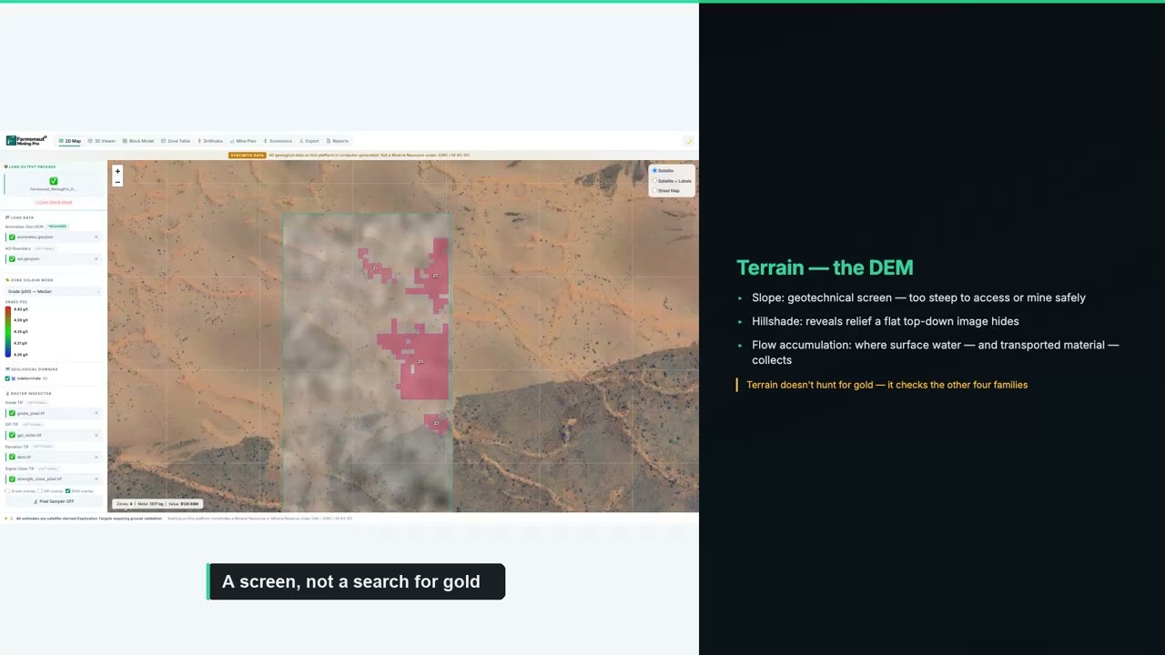
▶ Explains how magnetic fields, heat, radar and terrain each give evidence about a mineral system in Farmonaut Mining Pro. · 18:58
Geophysical surveying and mapping services: what you should receive
Searches for geophysical surveying and mapping services are usually about the deliverable: what the contractor hands back. A complete job should include the following, and your contract should name each item.
- Located raw data. Flight-line or station data with coordinates, in a standard format, not just images.
- Processed grids and maps. Levelled and gridded data, plus images of the main products, in the coordinate system of your licence.
- An acquisition and processing report. Aircraft or crew, sensor types, line spacing, nominal height or station spacing, base-station records and quality-control checks. USGS releases include a contractor report of this kind with the grids and flight lines.
- Interpretation. A map of faults, units and anomalies, and a ranked list of targets with the reasoning. For ground IP, inverted 2D or 3D sections.
- Ownership terms. Who owns the data, whether it becomes public after a period, and whether the contractor may keep a copy.
Ask for the data to be delivered in the form you can load into your own mapping software. If you plan to bring in a consultant later, raw located data is the item that cannot be rebuilt from a picture.
How to choose a geophysical survey company
Start from your question, then screen on evidence. Use these checks to compare two or three quotes on the same footing.
Chart
Line and tie-line spacing in a USGS survey
Spacing in metres, Earth MRI airborne magnetic and radiometric release
- Write the exploration question in one sentence. For example: “Is there a chargeable zone under the gossan?” The question decides the method. A contractor who proposes several methods without asking what you want to know is selling hours.
- Check for the right method at the right depth. Depth of investigation depends on the system. The SkyTEM figures above, from 100 metres to more than 500 metres, show how much systems of one family differ. Ask for the depth the contractor expects at your site, with the assumptions.
- Ask for two project references in similar terrain. Rugged mountains, dense forest and desert flats change the aircraft, the flying height and the data quality.
- Compare line spacing and height in every quote. Prices are quoted per line-kilometre, so a tighter spacing multiplies the kilometres. See the chart and calculator below.
- Ask about safety. Low-level flying is hazardous. Asking any airborne contractor about its safety audits, pilot experience and aircraft maintenance is reasonable.
- Clarify mobilisation. A fixed fee to move aircraft or crews to your site can be a large share of a small job. A nearby crew often costs less.
- Confirm data ownership and format. See the deliverables list above.
- Look at processing capability. Some contractors only acquire data; others process and interpret. Independent interpretation can also be bought separately.
- Check permits. Aircraft need flight permissions and landowner or community notice in many regions; ground crews need access and line-cutting permission. Ask who obtains them.
- Get the quote in writing with the weather and standby terms. Stand-by days and weather delays are a common source of extra charges.
Line spacing is the specification you can check against public practice. The USGS Earth MRI airborne release for east-central Idaho and Montana (2023 to 2024) used 200-metre east-west flight lines with tie lines about 2,000 metres apart (USGS data release, Idaho and Montana). That is a regional government survey. A property-scale survey for a licence holder may use tighter spacing, such as 100 metres or 50 metres, depending on the target size.
Geophysical survey services: how pricing works
Airborne contractors usually price per line-kilometre flown, plus a mobilisation fee and sometimes a daily standby rate. Ground contractors price per line-kilometre or per day for a crew, with line-cutting and accommodation often separate. We could not find a current published price list from the companies above, and a single old quote is not a safe benchmark. Treat any number you see online as a prompt to request quotes.
Chart
Line-kilometres needed for a 100 km2 block
By flight-line spacing, tie lines not included
What you can calculate yourself is how many line-kilometres a design needs, because that is geometry. Divide the area by the line spacing. A 100 square kilometre block flown on 400-metre lines needs about 250 line-kilometres; the same block on 100-metre lines needs about 1,000, four times as much. Each of those kilometres is then multiplied by the quoted rate. That is why a client who asks for the tightest possible spacing across the whole licence can multiply the bill, while a client who flies wide lines everywhere and then tightens only over anomalies spends less for the same result.
The calculator below turns your own area, spacing and quoted rate into line-kilometres, a rough cost and flying days. Prices are inputs that you replace with the figures from your quotes. It ignores edge turns, terrain-following extra distance, processing and interpretation, which most contractors price separately.
Calculator
How many line-kilometres and what budget for my block?
Enter your own block size, spacing and the rate from your quotes.
- Flight-line kilometres: 500
- Tie-line kilometres: 50
- Survey cost before processing: $75,000
- Flying days: 1.4
Example values only, not a benchmark or a price list. Prices are inputs: example, use today’s price from your contractor quotes. Line-km = area x 1000 divided by spacing, plus tie lines; it ignores turns, terrain-following distance, processing and interpretation. Tie lines at ten times flight-line spacing follow the USGS Earth MRI Idaho and Montana release cited on this page.
Check public data and satellite imagery before you hire anyone
The cheapest survey is the one you do not need to commission. Governments have flown large parts of the world already. The USGS says that although the whole United States has some aeromagnetic coverage, only areas with data at sufficient resolution support detailed subsurface mapping, and Earth MRI is filling those gaps and releasing the data publicly. Check the geological survey of your state, province or country for existing surveys over your ground first: an existing 200-metre survey may answer your question outright, or tell the contractor where a gap remains.
Satellite imagery is a screening step that sits before, not instead of, geophysics. It shows alteration minerals, iron stains and structures at the surface, which helps you decide where to spend an airborne or ground programme. Farmonaut maps the surface of a licence area from satellite data, with delivery in 5 to 20 business days, and the result is an exploration target map that sits ahead of any resource estimate. The video below shows the mapping workflow.
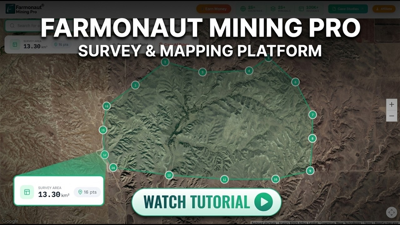
▶ Step-by-step tutorial on mapping a mining concession and exploration zones in Farmonaut Mining Pro. · 6:03
How to brief and compare quotes
A clear request for quotation gets comparable prices. Include the following in every request.
- A polygon of the licence as a KML or shapefile, with the coordinate system.
- The question you want answered and the target depth.
- Your preferred line spacing and direction, or ask each contractor to propose and justify one.
- Terrain and access notes: roads, nearest airstrip, camp options, protected areas and no-fly zones.
- The earliest and latest dates, including seasons when ground is inaccessible.
- The deliverables list from above and your data format.
- Payment milestones tied to delivery of quality-checked data.
Send the same package to two or three contractors with different methods. Where a company declines to quote because the design does not suit its system, treat that as useful information.
After the survey: from anomalies to drill targets
Geophysical anomalies are not deposits. A magnetic high can be a harmless iron-rich rock, and a conductor can be graphite. Interpreters combine the survey with geology, soil geochemistry and satellite maps to rank targets, and then a drill programme tests the best ones. The guide to drilling rigs in mineral exploration and our page on core samples cover that next step. Where drilling is planned, a drillhole database ties the survey to assays and lithology, as the video below explains.
For small and medium projects, drone magnetics and mine survey drones are an increasing option, and several of the ground contractors above list drone magnetics. Drones fly low and slow, which gives fine detail over small areas, but they cannot cover regional blocks as quickly as aircraft.
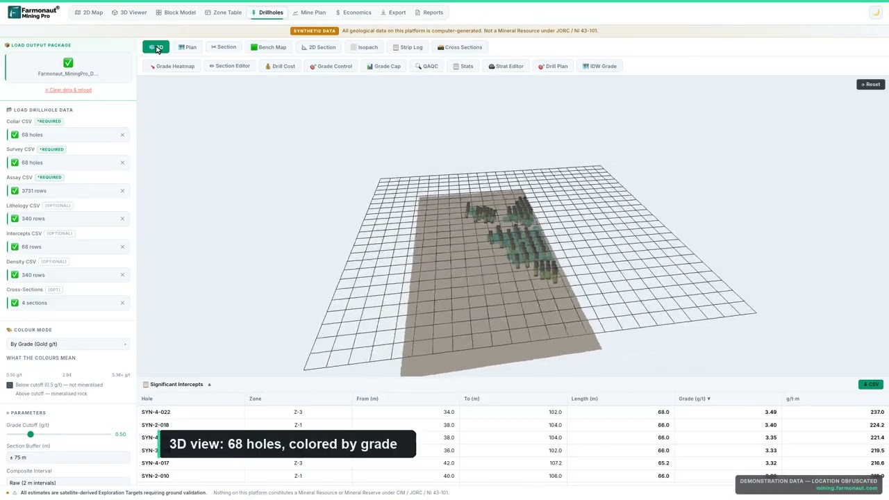
▶ Shows what is inside a drillhole database: collars, surveys, assays and lithology, using a labelled synthetic dataset. · 14:58
Frequently asked questions
Who are the main geophysical survey companies for mineral exploration?
Airborne contractors include Geotech, Sander Geophysics, Xcalibur Multiphysics and SkyTEM. Ground contractors include Zonge International, Abitibi Geophysics and Dias Geophysical. Many regional firms also work in Australia, Africa, Canada and the United States. No official register exists, so check each firm’s own project records.
What does a geophysical survey cost?
Airborne surveys are priced per line-kilometre flown plus mobilisation, and ground surveys per line-kilometre or crew day. We found no current published price list, so request quotes. Use the calculator on this page to estimate line-kilometres from your area and line spacing, then multiply by your quoted rate.
What is the difference between airborne and ground geophysics?
Airborne surveys cover large areas quickly at 90 to 150 metres above ground for magnetics (USGS), while ground surveys give finer detail and can image deeper electrical structure with induced polarization or magnetotellurics. Most programmes fly first and walk later.
How do I choose a geophysical survey company?
Write your exploration question first, pick the method that answers it, ask for two similar-terrain references, compare quotes on the same line spacing and height, and confirm data ownership, safety practices and what is delivered.
What are geophysical surveying and mapping services?
They are services that collect physical measurements such as magnetic, radiometric, electrical or gravity readings, process them into grids and maps, and interpret them. The deliverables should include located raw data, processed grids, a report and an interpretation.
How much area can an airborne survey cover?
That depends on line spacing. On 200-metre lines a block needs five line-kilometres for every square kilometre. A 100 square kilometre block therefore needs about 500 line-kilometres plus tie lines.
What line spacing should I ask for?
A recent USGS Earth MRI release in Idaho and Montana used 200 metres. A licence-scale survey over a small target may use 100 metres or less.
Do I need a geophysical survey before drilling?
Not always. Geophysics narrows the places to drill, and whether a survey is worth its cost depends on the stage of the project and the size of the target. Discuss it with your geologist before committing.
Can a satellite replace a geophysical survey?
No. Satellites map the surface: minerals, alteration and structure. Geophysics senses properties beneath the surface. They are used together, with satellite screening first.
How long does a survey take from order to report?
It varies with contractor schedules, weather, permitting and processing. Ask each contractor for mobilisation, flying or field days, and report delivery as separate dates in the quote.
This page is for information only. Company descriptions are taken from their own materials or the dated sources linked. Confirm current services and prices with each company.
This page is for information only. It is not investment advice, and companies are named for orientation, not as recommendations. Confirm current services, safety standards and prices with each contractor.
Farmonaut mining
Screen your ground from space before you hire a crew
Request a quote to map alteration and structure on your licence from satellite data and decide where a geophysical programme should go.
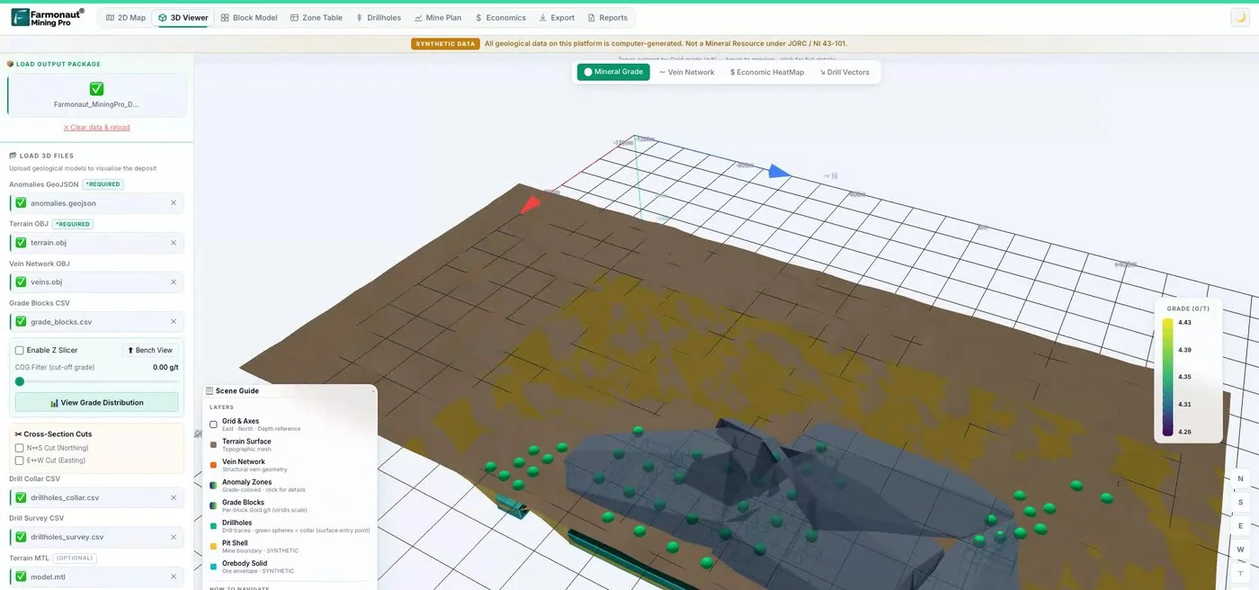
Mining Pro sample view, synthetic data
Sources
- USGS, Technical Overview of Earth MRI, Fact Sheet 2020-3055: pubs.usgs.gov
- USGS data release, east-central Idaho and Montana (2023-2024): usgs.gov
- Geotech Ltd, company site: geotech.ca
- Sander Geophysics, company profile: sgl.com
- GeoExpro, Xcalibur expansion (18 June 2021): geoexpro.com
- Ground Water Canada, SkyTEM profile (29 August 2014): groundwatercanada.com
- Zonge International, about: zonge.com
- Abitibi Geophysics interview, Quebec Mining 2023: projects.gbreports.com
- Allied Copper release, Dias survey, SK Property (31 January 2022): uk.marketscreener.com
- Yukon Geological Survey, Quantec Titan-24 survey, Minto mine (Open File 2010-19): open.yukon.ca
- US EPA, Induced Polarization (Environmental Geophysics): archive.epa.gov
Discussion
Questions, corrections or field experience? Share them below. First-time comments are reviewed before they appear, and your email is never published.
No comments yet. Be the first to add a question or your experience.

 Berks Gold Limited
 Mwerezi Minerals Company Limited
 Congo Mining Solutions
 Mining SARL
 SenGold Invest SAS
 Sania Corporation
 Sean Mining Limited
 NTS Group (Pty) Ltd
 Mine4Africa
 Lithspo Minerals Limited
 Tintina Mining Group
 Dalgety Minerals Pty Ltd
 Vortex Minerals Pty Ltd
 Faith At Work (Pty) Ltd
 Geotech Mining Solutions plc
 Vulcan International Limited
 Kidepo Associates
 Licence holder · Nigeria · Gold + lithium