
Drone geophysics · Survey guide
Drone Geophysics: Aeromagnetic, LiDAR and Mine Surveys
A drone geophysical survey flies a magnetometer a few metres to tens of metres above ground. Magnetics was the method in 39 of 59 mining studies reviewed in 2025 (Drones). This guide adds heights, line spacing, LiDAR, stockpile volumes, flight rules and a line-km planner.
Key takeaways
- Magnetometry appeared in 39 of 59 drone geophysics studies in mining, ahead of gamma-ray (18), electromagnetics (5) and radar (1) (Perikleous et al., Drones, 2025).
- Drones fly a few metres to tens of metres above ground; traditional aeromagnetic surveys usually fly 100 to 500 m (Zheng et al., Drones, 2021).
- In an Ontario test a drone flew 48 line-km of magnetics in 7 hours on 25 m lines; a follow-up ground survey took about two weeks in complex, densely vegetated terrain (Zheng et al., 2021).
- At a Malawi quarry a drone stockpile survey took 35 minutes in total against 97 for tape, with 2.6% and 1.3% volume error (Matsimbe et al., 2022).
- Height limits are 400 ft under FAA Part 107 and 122 m in Canada; confirm local rules before planning a campaign (FAA; Transport Canada).
In this article
- What drones do in mining and exploration
- Drone geophysics: how an aeromagnetic survey drone works
- Height and line spacing in a drone geophysical survey
- Drone geological survey: mapping with photogrammetry
- LiDAR geology and LiDAR geological mapping
- Drone mining survey: topographic surveys, volumes and safety
- Rules for flying survey drones
- Where satellites fit before drone geophysics
- Frequently asked questions
Drones now do two very different jobs for the minerals industry. In exploration they carry magnetometers and cameras low over rough ground that is slow to walk and costly to fly with a helicopter. On operating mines they survey pits, stockpiles and haul roads without putting surveyors next to high walls. This guide covers both: what drone geophysics can and cannot see, how to plan a photogrammetry or LiDAR flight, what the rules allow, and where satellite targeting fits before any drone leaves the case.
Uses Exploration · mine surveying
Markets Australia · Canada · East Africa
Scale Prospect to pit
Drone geophysics means flying geophysical sensors, most often a magnetometer, on an unmanned aircraft a few metres to a few tens of metres above the ground. It sits between a walked ground survey and a helicopter survey: faster than walking, sharper than flying high. Add cameras and LiDAR and the same drones produce geological maps, bare-earth terrain models and the topographic surveys mines use every week.
That breadth creates confusion. “Drone survey” can mean a magnetometer grid over a gold prospect, a photo flight over an outcrop, a LiDAR scan through forest, or a stockpile volume check on a working mine. They use different sensors, different flight plans and different accuracy standards, so it pays to be precise about which one you need.
“In an Ontario test, a drone flew about 48 line-km of magnetics in 7 hours; the ground survey took about two weeks.” (Drones, 2021)
“Where are the magnetic structures?” needs a magnetometer. “What does the outcrop look like?” needs a camera. “What is under the trees?” needs LiDAR. “How much ore is in the pile?” needs a calibrated survey. One flight rarely answers all four.
What drones do in mining and exploration
Split drone work into two families. Exploration drones collect data that tell you what is in or under the ground: magnetics above all, plus imagery for mapping and LiDAR for terrain. Operational drones collect data that tell you what has changed at a mine: pit shape, stockpile volumes, haul-road grades, tailings and rehabilitation. The first family is a drone geophysical survey or a drone geological survey; the second is a drone mining survey in the surveyor’s sense.
Chart
Multirotors carry most drone geophysics
Share of 66 drone-based geophysical applications by platform, %
- Drone geophysics: magnetometers on multi-rotor, fixed-wing or unmanned helicopter platforms, flown on lines like a miniature aeromagnetic survey.
- Drone geological mapping: high-resolution photographs stitched into orthomosaics and 3D models of outcrop, trenches and pit walls.
- LiDAR geology: laser scanning that separates ground from vegetation to show faults, terraces and old workings.
- Drone survey in mining: repeat topographic surveys for volumes, reconciliation and slope monitoring.
For the ground and airborne methods drones sit alongside, see our overview of geophysics for mineral exploration.

▶ Farmonaut explainer: six kinds of AI geology tools, what each does and three questions to ask before you trust one. · 3:18
Drone geophysics: how an aeromagnetic survey drone works
The best single overview is a 2021 systematic review in Drones that summarised 70 studies from 2005 to 2021 and classified 56 papers, theses and websites by platform. Multi-rotor drones had become the most widely used type because they are easy to operate, cheap and able to fly very low, even though they arrived later than fixed-wing and helicopter types. Payload growth has also made multi-magnetometer set-ups more common.
Chart
Magnetometry leads drone geophysics in mining
Number of studies using each method, among 59 studies reviewed
The interference problem
A drone is a flying source of magnetic noise: motors, batteries, wiring and moving conductive parts. The review explains that the compensation methods used on manned survey aircraft cannot be applied directly, partly because the field a few metres above ground is not uniform and partly because the compensation manoeuvres are hard to fly with multi-rotors. The common fix is distance: hanging the magnetometer on a rope, fixing it on a rigid rod, or towing it in a bird. Each brings instability, swing and position errors of its own, so ask any drone geophysics contractor how they handle it and how they checked the result.
Which magnetometers fly
The review found a mix of scalar total-field sensors and vector (fluxgate) sensors. Among the 27 multi-rotor sources it examined, 13 used a scalar total-field magnetometer and 10 a vector magnetometer, with a few using pairs or arrays. It cites a small electric drone with about one hour of endurance carrying a 1 kg load, which gives a feel for how light the whole system must be.
Why magnetics leads drone geophysics
Magnetometers are light, passive and need no transmitter, which makes them the easiest geophysical sensor to put on a small aircraft. A later review of aerial drones for geophysical prospection in mining, also in Drones, found aerial magnetometry the most extensively researched method in drone geophysics for mining, and linked that to how easily magnetometers integrate with drones and how well low-altitude flights work for high-resolution surveys. Other sensors are being flown too, but the published evidence is thinnest for them, so treat claims about drone EM or drone radiometrics with more caution and ask for comparisons against conventional data.
Before paying for a drone magnetic grid, ask to see the drone’s own magnetic signature measured in flight at the survey site: a hover test and a set of headings. Noise that changes with direction can mimic geology on a line-by-line map.
Which geophysical sensors fly on drones
Magnetics is not the only method, but it is the best proven. A 2025 review of 59 studies and 66 drone-based geophysical applications in mining counted magnetometry in 39 studies, gamma-ray spectrometry in 18, electromagnetic surveys in five and ground-penetrating radar in one (Perikleous et al., Drones, 2025). Multirotor drones were used in 72.7% of the applications, fixed-wing in 12.1% and unmanned helicopters in 9.1%. If a contractor offers drone electromagnetics or radiometrics, ask for field results from similar terrain and target depth. For magnetics the evidence base is far deeper.
Height and line spacing in a drone geophysical survey
Flying low is the whole point of drone geophysics. The review notes that traditional aeromagnetic surveys usually fly 100–500 m above ground, while drones fly from a few metres to tens of metres. The published cases show what that buys. In one study, magnetometers flown about 0.5, 1.3 and 2.2 m above the ground on 1 m lines picked up every anomaly seen in a ground survey. In a chromite test, flights at 20 m and 60 m on 30 m lines both covered the known deposit, but only the 20 m data located it clearly and hinted at a second, unexposed body.
Chart
Drones fly far lower than traditional aeromagnetic surveys
Height above ground in metres: two published drone cases and the typical range of traditional surveys
In Ontario, a six-rotor drone flew grids of about 500 × 700 m at roughly 35, 45 and 70 m above ground on 25 m lines, collecting over 48 line-km in 7 hours. The results were compared with a regional helicopter survey at about 85 m on 100 m lines and a follow-up ground survey that took about two weeks in the rough, forested terrain. In central Sweden, an eight-rotor drone collected about 20 line-km over roughly 2 km² in 3 hours, and its results matched historical low-altitude fixed-wing data over iron-oxide mineralisation.
Spacing rules of thumb
Line spacing should be comparable to the flight height or tighter, so that anomalies are sampled between lines at the same detail as along them. The published cases above follow that pattern: 25 m lines at 35–70 m height in Ontario, 30 m lines at 20–60 m in the chromite test. Tie lines are still needed for levelling. As with any magnetic survey, a base-station magnetometer on the ground records daily variations for correction.
Planning a drone geophysics campaign
- Start from existing data. Pull public aeromagnetics and any satellite targeting, and pick blocks of a few square kilometres at most.
- Set height and spacing together. Choose a height the terrain and trees allow safely, then set line spacing at or below it.
- Test the platform on site. Hover and heading tests measure the drone’s own magnetic noise before production flying.
- Run a base station for the whole campaign and fly tie lines for levelling.
- Check against something known. Re-fly one line, or compare a strip with a short ground traverse.
- Interpret with geology. Drone geophysics gives detail; mapping and sampling decide what the anomalies are.
What the deliverables should include
Ask for the raw magnetometer readings with positions and heights, the base-station record, the noise-test results, levelled line data and final grids, plus a short report describing corrections and any lines re-flown. Without the raw data and heights, nobody can later reprocess or merge the survey with a helicopter or ground dataset, and a drone geophysics survey loses much of its long-term value.
Drone geophysics covers square kilometres, not whole districts. Use public aeromagnetics and satellite alteration maps to choose the few blocks that deserve a 25 m drone grid.
Drone, helicopter or ground: what changes in an aeromagnetic survey
The cases above, taken from the 2021 review in Drones, show how a drone geophysical survey differs from the older ways of measuring the same field.
| Survey | Height above ground | Line spacing |
|---|---|---|
| Traditional aeromagnetic survey | Usually 100 to 500 m | Varies by program |
| Regional helicopter survey (Ontario case) | About 85 m | 100 m |
| Drone survey (Ontario case) | About 35, 45 and 70 m | 25 m |
| Drone chromite test | 20 m and 60 m | 30 m |
On cost, the review quotes a comparison in which drone magnetic data cost about US$35 per line-kilometre against US$85 for a conventional ground survey under the same conditions. That is one operator’s figure from the review’s literature, so treat it as a starting point for quotes, not a price list. The planner below turns your block size and line spacing into line-kilometres, flying hours and a cost range. Drones suit blocks of a few square kilometres. For regional coverage, public aeromagnetic data or a manned survey is usually the better buy; our guide to geophysical survey companies compares ground and airborne providers, and the gravity survey guide covers the other main potential-field method.
Calculator
How many line-km and flying hours is your block?
Enter your own block size, line spacing, production rate and cost per line-km.
- Flying time at your rate: 2.1 hours
- Drone cost at your price: $514
- Ground survey cost at your price: $1,250
Example values only, not a benchmark. The 25 m spacing and 500 by 700 m block follow the Ontario drone case; the 6.9 line-km per hour is that case’s 48 line-km in 7 hours (Zheng et al., 2021). The US$35 and US$85 per line-km are the drone and ground figures quoted in that review; they are example prices, so use today’s quotes. Tie lines, mobilisation and processing are not included.
Drone geological survey: mapping with photogrammetry
A camera drone turns hundreds of overlapping photos into an orthomosaic (a distortion-free map image) and a 3D surface model. For a field geologist that means centimetre-scale maps of outcrop, trench walls and pit faces, including places too steep or dangerous to reach. Using a drone for geological mapping does not replace walking the ground and sampling it, but it gives you a far better base map to walk with.
Ground sampling distance
The key number is ground sampling distance (GSD). Pix4D’s support documentation defines it as the distance between two consecutive pixel centres measured on the ground: a GSD of 5 cm means one pixel covers 5 cm. GSD depends on sensor width, focal length, image width in pixels and flight height, in the standard relationship GSD = (sensor width × flight height) ÷ (focal length × image width). Fly higher and each pixel covers more ground; fly lower for more detail but more flights.
Keep all photos in one project at the same height where you can. Pix4D’s guidance on mixed heights notes that images taken at the same flight height share the same GSD and detail, which makes matching between images easier. On steep pit walls or cliffs, fly a separate oblique or facade mission rather than forcing one grid over everything.
For choosing map scales and the rest of the field-mapping workflow, see our guide to geological mapping methods and scales.
Calculator
What ground sampling distance will your drone give?
Enter your own camera values and flight height.
- Ground width of one image: 150 m
- Height as share of the 122 m ceiling: 82.0%
Example values only; enter your camera’s specification. GSD = sensor width x flight height / (focal length x image width), the relationship Pix4D describes. Footprint assumes a vertical camera over flat ground. The 122 m limit is Transport Canada’s ceiling and 400 ft is about 122 m under FAA Part 107; both have exceptions, so confirm with your regulator.
LiDAR geology and LiDAR geological mapping
LiDAR fires laser pulses and times their return. Some pulses reach the ground through gaps in vegetation, and processing classifies those returns as bare earth, producing a terrain model with the trees removed. The Washington Geological Survey says landslides, faults, river terraces, drumlins, glacial outwash channels, alluvial fans, eskers and fluting are readily apparent in lidar, while noting that dense forest in leaf is hard for the laser to penetrate fully. A USGS study in Glacier Bay, Alaska, used 0.5 to 1.0 m lidar DEMs and a bare-earth model to map fault scarps, fractures and landslides.
Chart
Minimum lidar pulse density by quality level
Pulses per square metre; vertical accuracy 5 cm (QL0), 10 cm (QL1, QL2), 20 cm (QL3)
How good is the data?
The USGS Lidar Base Specification defines quality levels. QL0 and QL1 require at least 8 pulses per square metre, QL2 at least 2 and QL3 at least 0.5. Vertical accuracy (RMSEz on non-vegetated ground) is 5 cm for QL0, 10 cm for QL1 and QL2 and 20 cm for QL3. Whether the LiDAR is flown by drone or aircraft, the specification is a useful yardstick for what to write into a contract: name the quality level, or the density and accuracy you need.
LiDAR gold prospecting
For gold explorers, the value of LiDAR is in the landforms. Terraces and alluvial fans mark where old rivers dropped heavy minerals. Fault scarps and linear breaks trace the structures that control many lode systems. Old pits, trenches and spoil heaps from historical workings can also stand out in a bare-earth model, in the same way the Washington Geological Survey describes subtle landforms that dense vegetation hides from the eye. None of that is gold detection: LiDAR maps the shape of the ground, and it is the geologist who reads which shapes matter. Combined with magnetics and satellite alteration mapping, it sharpens where to sample.
A LiDAR image full of historical pits proves people once dug there. It says nothing about what is left. Treat it as a reason to map and sample, and ask for assays before it shapes any valuation.
For a licence owner, the practical use of a bare-earth model is to rank targets before anyone walks the ground: faults and terraces first, old workings second. How those targets are ranked is covered in our guide to exploration targeting.
Drone mining survey: topographic surveys, volumes and safety
On an operating mine, the most common drone job is a topographic survey by drone: a photogrammetry or LiDAR flight that produces a surface model of the pit, dumps and stockpiles. Repeating it weekly or monthly gives the change between surveys, which is what mine planners and accountants need for volumes moved, stockpile reconciliation and progress against plan. A mine survey drone can also inspect high walls, benches and tailings embankments without sending people to the edge.
- Stockpile and dump volumes: surface models compared against a base surface or the previous survey.
- Pit and bench mapping: as-built surfaces for design compliance and the next blast or dig plan.
- Slope and wall inspection: photographs and models of faces that are unsafe to approach.
- Haul roads and drainage: grades, water ponding and erosion.
- Rehabilitation: repeat imagery of reshaped and revegetated ground for closure reporting.
Getting survey-grade results
Accuracy depends on ground control, camera or LiDAR quality, GSD and processing, not on the drone brand. For a topographical survey drone job, agree the accuracy target in advance, fix ground control or use corrected positioning, fly consistent heights, and check the result against independently surveyed points. Where a volume figure feeds financial reporting, have a registered surveyor sign off the method.
| Drone survey type | Sensor | Main output | Typical user | Key quality measure |
|---|---|---|---|---|
| Drone geophysical survey | Magnetometer (scalar or vector) | Magnetic anomaly grids | Exploration geologists and geophysicists | Height, line spacing, drone noise, levelling |
| Drone geological survey | RGB camera | Orthomosaic and 3D outcrop models | Field and structural geologists | Ground sampling distance |
| LiDAR survey | Laser scanner | Bare-earth DEM, point cloud | Geologists, planners, hazard teams | Pulse density and vertical RMSE (USGS QLs) |
| Drone mining survey | Camera or LiDAR | Surfaces, volumes, change maps | Mine surveyors and planners | Accuracy against checkpoints |
| Satellite screening | Multispectral and hyperspectral | Alteration and structure targets | Exploration managers | Spectral and spatial resolution |
Flying a drone over a high wall or tailings dam keeps surveyors out of the hazard zone, and repeat flights document rehabilitation for regulators without new tracks through restored ground.
Drone versus tape: a measured stockpile test
A 2022 study at the Njuli quarry in Malawi measured one stockpile of known volume both ways (Matsimbe et al., Frontiers in Built Environment, 2022). Total operation time (set-up, data collection and processing) was 35 minutes for the drone against 97 minutes for the tape method. The drone volume was 2.6% off the known figure and the tape result 1.3% off, both inside the plus or minus 3% limit the authors used. The drone flight captured 164 images, used five ground control points and reached a 1.44 cm ground sampling distance. The takeaway: drones save field time and keep people off the pile, but the accuracy still depends on ground control and on a surveyed base surface.

▶ Farmonaut explainer: keeping maps, samples and targets in one place so survey data is not lost in spreadsheets. · 3:21
Rules for flying survey drones
Drone surveys are aviation, and the regulator decides where and how high you fly. In the USA, the FAA Part 107 fact sheet sets a maximum of 400 feet above the ground (higher within 400 feet of a structure), a maximum speed of 100 mph, drones under 55 pounds including payload, and daylight or civil-twilight operations with anti-collision lighting. In Canada, Transport Canada’s rules for drones of 250 g to 25 kg require flying below 122 m, registering and marking the drone, and holding a basic or advanced pilot certificate.
Other countries, including Australia and those across East Africa, have their own regulators, permits and limits, and many require permission for commercial work or for flying near mine sites, airstrips and settlements. Check the current rules with the national civil aviation authority before planning a campaign, and note that low magnetometer flights and long tow cables may need specific approval.
Two limits matter on long mine campaigns. In the USA, flights beyond visual line of sight or above 400 feet need a waiver, and the FAA lists both among the most requested (FAA, Part 107 summary). In Canada, flying above the 122 m ceiling needs a special flight operations certificate (Canadian Aviation Regulations, s. 901.25), and drones between 250 g and 25 kg count as small drones with pilot certificate rules (Transport Canada). Plan survey heights inside these limits or build the permit time into the schedule.
Where satellites fit before drone geophysics
Drone geophysics and drone mapping are superb at detail over small areas. Satellites are superb at screening large ones. Used in that order, satellite alteration and structure mapping picks the blocks, and drone geophysics or LiDAR then resolves them. Our guide to remote sensing for mineral exploration covers the spectral methods, and our guide to hyperspectral mineral mapping goes further on imaging spectrometers.
Our satellite-based mineral detection analyses multispectral and hyperspectral imagery of your boundary and flags likely mineralised target zones, alteration halos, faults and fractures, with no ground disturbance. Send coordinates, a KML/KMZ file or a polygon with the country and target mineral, and we deliver in 5–20 business days depending on area and mineral complexity.
- 📊 Speed: early exploration timelines from months to days.
- 📊 Cost: up to 80–85% lower early-exploration cost.
- Deliverables: prospectivity heatmaps, estimated location and depth ranges, geological interpretation, and GIS files to plan drone blocks and flight lines.
- Premium+: TargetMax™ Drilling Intelligence with drilling-angle recommendations and 3D subsurface models.
- Experience: 100,000+ hectares scanned for 20+ mineral types across 25+ countries.
- Limits: we do not fly drones, and satellite targets are exploration targets, not resources.
Draw your licence on mining.farmonaut.com: Map Your Mining Site, see a sample of satellite-driven 3D mineral prospectivity mapping, or ask for pricing through the mining query form. Our mineral exploration guide puts every stage in order.
Send the drone where the targets are.
Share your licence boundary. We’ll return ranked target zones and GIS files you can load straight into your drone flight-planning software.
▶ Farmonaut explainer: remote sensing for mining in three minutes, and why agreement between instruments matters. · 2:01
Frequently asked questions
What is drone geophysics?
It is geophysical surveying from unmanned aircraft, most often magnetics. Drones fly a few metres to tens of metres above ground on closely spaced lines, giving more detail than conventional aeromagnetic surveys and far faster coverage than walking, especially in rough or forested terrain.
How accurate is an aeromagnetic survey drone compared with a ground survey?
In one published test with magnetometers flown 0.5 to 2.2 m above ground on 1 m lines, all anomalies seen in the ground survey were also found in the drone data. At greater heights resolution falls: a chromite test located the deposit clearly at 20 m but not at 60 m.
What is a drone survey in mining used for?
Mostly repeat topographic surveys: stockpile and dump volumes, pit and bench as-builts, haul roads, wall inspections and rehabilitation monitoring. In exploration, drones add magnetics, outcrop mapping and LiDAR terrain models.
Can LiDAR see through trees for geological mapping?
Partly. Some pulses pass through gaps in the canopy and are classified as ground, producing a bare-earth model. The Washington Geological Survey notes dense forest in leaf is hard to penetrate fully, so leaf-off timing and higher pulse density help.
How high can I fly a mining survey drone?
Under FAA Part 107 in the USA, 400 feet above ground (higher within 400 feet of a structure). In Canada, below 122 m under Transport Canada rules. Other countries set their own limits; check with the national aviation authority, and remember many mine sites add their own rules.
Should I use a multi-rotor or fixed-wing drone for drone geophysics?
Multi-rotors fly lower and slower and can hover, which suits small, rugged blocks and very detailed grids; the 2021 review found them the most used platform. Fixed-wing drones cover more line-kilometres per flight and suit larger, gentler areas. Match the platform to the block size, terrain and the height you need.
How is a drone survey different from satellite mineral mapping?
Satellites read reflected light from the surface over whole licences and districts, mapping alteration minerals and structures. Drones carry sensors close to the ground over small blocks, measuring magnetism or capturing very detailed imagery and terrain. Satellites choose the blocks; drones resolve them.
Is a drone geological survey a replacement for field mapping?
No. It gives a far better base map and access to unsafe faces, but rock types, structures and alteration still need to be checked, measured and sampled on the ground.
Aviation rules change and vary by country; confirm with your regulator before flying. Volume figures used in financial reporting should be signed off by a qualified surveyor. Satellite targets are exploration targets, not mineral resources.
How is a drone geophysical survey different from a helicopter aeromagnetic survey?
Height and spacing. In the Ontario case a regional helicopter survey flew about 85 m above ground on 100 m lines, while the drone flew 35 to 70 m on 25 m lines and covered 48 line-km in 7 hours. Drones give more detail over small blocks; helicopters and aircraft cover regions.
How much does a drone magnetic survey cost?
A comparison quoted in the 2021 Drones review put one operator’s drone magnetic data at about US$35 per line-km against US$85 for a traditional ground survey. Prices vary by country, terrain and sensor, so use the planner on this page for line-km and ask for quotes.
What can a drone geophysics survey carry besides a magnetometer?
Published work covers gamma-ray spectrometers, electromagnetic instruments and ground-penetrating radar. In a 2025 review of 59 mining studies, magnetometry appeared in 39, gamma-ray in 18, electromagnetics in five and radar in one (Perikleous et al.).
How accurate is a drone volume survey of a stockpile?
In one quarry test the drone volume was 2.6% off a known figure and the tape result 1.3% off, both inside plus or minus 3% (Frontiers, 2022). Ground control and a surveyed base surface drive the accuracy.
This page is for information only. It is not legal advice. Confirm aviation and site rules with the regulator before flying, and have a registered surveyor sign off volumes used in financial reporting. Satellite targets are exploration targets, not mineral resources.
Farmonaut mining
Pick drone blocks from satellite targets
Send your licence boundary for a quote on a satellite screen of alteration and structure targets, then plan drone blocks on the ranked zones.
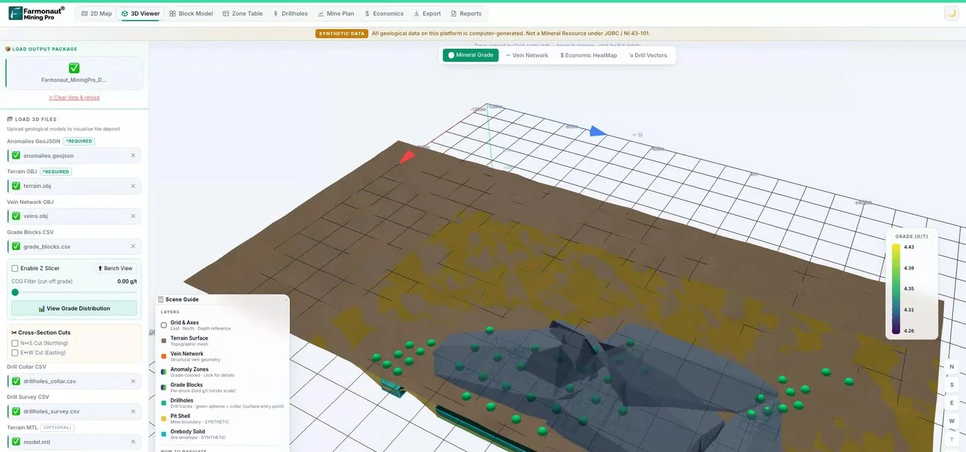
Mining Pro sample view, synthetic data
Keep reading
Sources
- Zheng et al., Unmanned Aerial Vehicles for Magnetic Surveys: A Review on Platform Selection and Interference Suppression, Drones (2021): mdpi.com
- Perikleous et al., Aerial Drones for Geophysical Prospection in Mining: A Review, Drones (2025): doi.org
- Matsimbe et al., Drone vs traditional methods in open pit stockpile volumetric computation, Frontiers in Built Environment (2022): frontiersin.org
- USGS, Lidar Base Specification, version 1.3 (2018): pubs.usgs.gov
- USGS, Lidar Base Specification 2025 rev. A, tables: usgs.gov
- Washington Geological Survey, Lidar: dnr.wa.gov
- FAA, Small unmanned aircraft systems (UAS) regulations, Part 107: faa.gov
- Government of Canada, Canadian Aviation Regulations SOR/96-433, section 901.25: laws-lois.justice.gc.ca
- Transport Canada, Drone operation categories and pilot certificates: tc.canada.ca
- Pix4D, Image acquisition (ground sampling distance): support.pix4d.com
- Government of Canada, Learn the rules before you fly your drone: tc.canada.ca
Discussion
Questions, corrections or field experience? Share them below. First-time comments are reviewed before they appear, and your email is never published.
No comments yet. Be the first to add a question or your experience.

 Faith At Work (Pty) Ltd
 Geotech Mining Solutions plc
 Vulcan International Limited
 Kidepo Associates
 GKY Mining
 Alkimy SARL
 Double A Trading
 GemSprout Metals Limited
 Qader Group
 Ileys General Trading
 SG Gold Mining LLC
 VRV Global Pte Ltd
 Omsri International FZE
 G.I.T.T.
 Jaunita Erss Ltd
 Almosi SARL
 SRK Consulting
 Berks Gold Limited
 Mwerezi Minerals Company Limited
 Mining SARL
 SenGold Invest SAS
 Exploration consultancy · South Africa · Gold