

Gold exploration · Nevada for TSX juniors
Walker Lane Gold for Canadian Juniors: Geology, BLM, Permits
The Walker Lane is a belt of strike-slip faults along Nevada’s western edge that hosts young volcanic-hosted (epithermal) gold-silver deposits such as Comstock, Goldfield and Tonopah, while the Carlin Trend in northeastern Nevada hosts older, sediment-hosted “invisible” gold; both sit mostly on federal land, where a Canadian junior stakes BLM lode claims, pays a US$200 annual fee per claim and permits drilling through a Notice or a Plan of Operations.
Key takeaways
- The Walker Lane is a system of right-lateral faults in western Nevada and eastern California that carries about a fifth of the motion between the Pacific and North American plates.
- Its gold is mostly epithermal and young: Comstock (8.3 Moz recorded), Goldfield (4.19 Moz) and Tonopah (1.86 Moz) sit in rocks of the ancestral Cascades arc.
- The Carlin Trend holds sediment-hosted, mostly invisible gold of Eocene age; more than 50 Moz had been recovered there by early 2002.
- On BLM land a new lode claim costs US$274 in federal fees in year one and US$200 a year after that; exploration over 5 acres (about 2 ha) needs a Plan of Operations.
- Results from any remote method are exploration targets, not resources; disclosure runs through NI 43-101 in Canada and S-K 1300 for SEC registrants.
In this article
- Walker Lane geology: a young shear zone over an old volcanic arc
- Carlin Trend geology, and why it is a different exploration problem
- Nevada gold exploration spending: what the survey numbers say
- Why so many Walker Lane and Carlin Trend projects sit with Canadian-listed juniors
- BLM claims in Nevada: sizes, fees and dates for a Walker Lane land package
- Notice or Plan of Operations: permitting Walker Lane and Carlin Trend drilling
- NI 43-101 vs S-K 1300 for a Nevada gold project
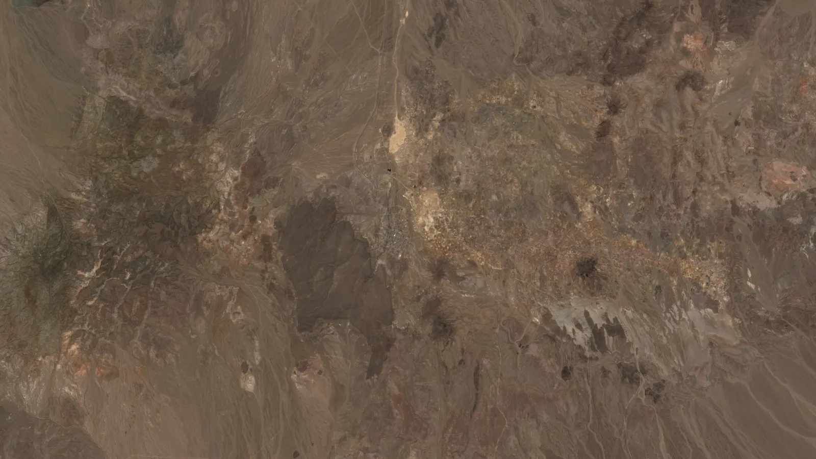
- What satellites see in Walker Lane and Carlin Trend country
- Walker Lane and Carlin Trend: frequently asked questions
Ask a Vancouver or Toronto exploration team where it would go in the United States and the answer is usually Nevada, and within Nevada either the Walker Lane or the Carlin Trend. The two belts could hardly be more different. The Walker Lane is a young, active shear zone along the California border, dotted with volcanic-hosted silver and gold camps that were mined in the 1860s and 1900s. The Carlin Trend is a narrow line of sediment-hosted deposits in the northeast where the gold is too fine to see. This page compares the two as exploration ground, then walks through what a Canadian-listed junior has to handle on federal land: BLM claims and fees, the Notice or Plan of Operations decision, and how NI 43-101 and the SEC’s S-K 1300 treat the same Nevada project. Claim dates, county filings and reclamation thresholds for the whole state are in our guide to gold deposits in Nevada, so we only summarize them here.
Goldfield is the largest quartz-alunite gold deposit known in North America, says the USGS: 4.19 Moz recorded.
Walker Lane geology: a young shear zone over an old volcanic arc
The Walker Lane is not a single fault. In their 2008 review for the Arizona Geological Society, James Faulds and Christopher Henry of the Nevada Bureau of Mines and Geology (NBMG) describe a system of dextral faults, the Walker Lane in the north and the eastern California shear zone in the south, that takes up about 20% of the dextral motion between the Pacific and North American plates. Where the San Andreas is one continuous fault 1,100 km long, this belt is a patchwork of shorter faults, from under 10 km to about 250 km long. GPS measurements give about 10 mm a year of strain across it in the western Great Basin.
The amount of offset falls toward the north. The same paper puts cumulative right slip at 60 km or more in southern and east-central California, about 25 km in northwest Nevada, and close to zero in northeast California. The northern Walker Lane is the youngest part: dextral shear only reached it around 4 million years ago. For a geologist that means two things. Southern and central Walker Lane structures have had longer to open pull-apart basins and dilational bends, and many older deposits have since been cut and shifted by younger faults.
Where the gold came from: the ancestral Cascades arc
The gold itself is older than most of the Walker Lane faulting. A 2015 paper by David John, Edward du Bray, Christopher Henry and Peter Vikre, listed by the USGS, links the epithermal gold-silver deposits of western Nevada and eastern California to the ancestral Cascades volcanic arc, which was active from about 45 million to about 3 million years ago. Its southern segment ran from 42°N in northern California to 37°N in western Nevada and is bounded on the east by the northeast edge of the Walker Lane. The authors count seven epithermal deposits in this segment that each produced more than 1 Moz of gold.
They split those deposits into two families. Quartz-adularia (low- and intermediate-sulfidation) systems include the Comstock Lode, Tonopah and Bodie. Quartz-alunite (high-sulfidation) systems include Goldfield and Paradise Peak. The difference matters on the ground: quartz-alunite systems leave broad, acid-leached, clay- and alunite-rich alteration that shows up well from space in dry country, while quartz-adularia veins sit in narrower structures with subtler halos.
The recorded production of the historic districts shows how big the best of these systems were. The USGS described them in Bulletin 1857, Geology and Resources of Gold in the United States (1990). The Comstock Lode, found in 1859, produced 8.3 Moz of gold and 192 Moz of silver, with its boom between 1860 and 1880 along the east-dipping Comstock fault. Goldfield produced 4.19 Moz of gold, with peak output in 1910. Tonopah produced 174 Moz of silver and 1.86 Moz of gold, mostly between 1910 and 1930.
Chart
Recorded gold output of four Walker Lane districts
Million troy ounces of gold, historic recorded production as published
| District | Deposit style | Recorded output | What it tells an explorer |
|---|---|---|---|
| Comstock Lode | Quartz-adularia veins | 8.3 Moz Au, 192 Moz Ag | Bonanza ore along and above one normal fault |
| Goldfield | Quartz-alunite (high-sulfidation) | 4.19 Moz Au, 1.45 Moz Ag | Ore clustered on a caldera margin in acid-altered rock |
| Tonopah | Quartz-adularia veins | 1.86 Moz Au, 174 Moz Ag | A silver camp first; gold came with it |
| Bullfrog Hills-Bare Mountains | Epithermal, Walker Lane belt | About 3 Moz Au, 4 Moz Ag | Old districts can host large modern resources |
Comstock, Goldfield and Tonopah from USGS Bulletin 1857 (1990); Bullfrog Hills-Bare Mountains from AngloGold Ashanti’s 2025 Form 20-F.

▶ Why majors and juniors keep spending on gold exploration, and where early satellite screening fits. · 10:44
The Beatty district: a modern Walker Lane consolidation
The most useful recent example for a Canadian junior sits near Beatty, in Nye County. AngloGold Ashanti’s 2025 annual report on Form 20-F places its North Bullfrog project in the Walker Lane mineral belt and the Southwestern Nevada Volcanic Field, about 14 km northwest of Beatty, in a district that produced about 3 Moz of gold and 4 Moz of silver, mainly from the old Bullfrog pit. The company reports a gold Mineral Reserve of 6.4 Moz, Measured and Indicated Mineral Resources of 6.1 Moz and Inferred Mineral Resources of 9.6 Moz for its Nevada projects, prepared under the SEC’s S-K 1300 rules.
Much of that ground was assembled from juniors. In September 2021, AngloGold Ashanti agreed to buy the roughly 80.5% of Corvus Gold it did not already own, at C$4.10 a share and a total cost of about US$370 million. Corvus was listed on the TSX and Nasdaq, and its projects included North Bullfrog and Mother Lode. The 20-F adds that AngloGold completed the purchase of Augusta Gold in October 2025 for US$158 million in cash, adding the permitted Reward project and the Bullfrog deposit next to its existing claims. A small company proving up a Walker Lane district, then selling it to a major, is the model many Canadian juniors are trying to repeat.
Carlin Trend geology, and why it is a different exploration problem
Over in northeastern Nevada, the gold looks nothing like a Comstock vein. According to the NBMG’s 2002 bulletin Gold deposits of the Carlin trend, Newmont geologists John Livermore and Alan Coope first found disseminated gold there in 1961; by early 2002 more than 50 Moz (1,560 t) had been recovered from 26 operating or past-producing mines, and more than 40 separate deposits had been outlined. The same page gives an endowment of 107 Moz as of the end of 1996. The NBMG’s history of Nevada mining adds that Newmont’s Carlin mine poured its first gold bar in May 1965 and that statewide output peaked at 8.9 Moz in 1998.
The USGS counts about 100 Carlin-type deposits along two northwest-trending belts in north-central Nevada, the Carlin trend and the Battle Mountain-Eureka trend, plus the smaller Getchell trend and the Jerritt Canyon district. Together they have produced more than 2,000 metric tonnes of gold, mostly from the Carlin trend. Ages cluster in the Eocene: a USGS grade-and-tonnage study lists 42 to 33 million years as one of three likely mineralizing epochs in the Great Basin.
What a Carlin-type deposit looks like
The USGS descriptive model for carbonate-hosted gold-silver deposits sums it up as very fine-grained gold and sulfides disseminated in carbonaceous, calcareous rocks and the jasperoids around them. Ore replaces thin-bedded silty or muddy limestone and dolomite next to high-angle faults, regional thrusts or favorable beds. The geochemical signature is gold with arsenic, mercury and tungsten, then a later overprint of arsenic, mercury, antimony and thallium. Carlin and Getchell are the type examples.
Size matters for a junior’s expectations. The USGS’s Open-File Report 2014-1074 gives the median Carlin-subtype deposit as 7.1 million tonnes at 2.0 g/t gold, from 88 deposits in the western United States, Indonesia, Iran and Malaysia, and notes that decalcification (dissolving the carbonate out of the rock) is the dominant alteration. Run that median through the calculator below to see what a typical Carlin Trend discovery holds in the ground.
Calculator
How many ounces could a Nevada gold target contain?
Enter tonnes, grade and an example gold price to see contained ounces and in-situ value.
- Rock, short tons: 7,826,401 short tons
- In-situ metal value at the example price (US$): $1,894,642,082
- In-situ value per tonne (US$): $266.85
Amounts in US dollars. Contained ounces = tonnes x grade (g/t) / 31.1035. Defaults are the median Carlin-subtype deposit in USGS Open-File Report 2014-1074 (7.1 million tonnes at 2.0 g/t). The example price is the Kitco spot bid of about US$4,150/oz on 15 October 2026. 1 tonne = 1.10231 short tons. In-situ value ignores recovery, dilution, costs and royalties, so it is not what a deposit is worth. Exploration targets are not resources; only a Qualified Person’s estimate under NI 43-101 or S-K 1300 is. Not investment advice.
At the defaults the median deposit holds about 456,540 contained ounces. That is a useful sanity check when a news release talks about a “Carlin-style” target: most Carlin-type deposits are not Goldstrike, and the economics depend on recovery, strip ratio and whether the ore is oxide or refractory. Our guide to scoping, pre-feasibility and feasibility studies covers how those factors are tested.
| Feature | Walker Lane | Carlin Trend |
|---|---|---|
| Main deposit style | Epithermal veins and high-sulfidation alteration in volcanic rock | Sediment-hosted disseminated gold in carbonate rock |
| Typical age | Oligocene to Pliocene arc (about 45 to 3 Ma window) | Eocene epoch, about 42 to 33 Ma |
| Gold you can see | Sometimes, in bonanza veins | Rarely; gold is sub-microscopic |
| Key surface clue | Silica, alunite and clay alteration, quartz veins | Jasperoid, decalcified carbonate, arsenic and mercury anomalies |
| Who dominates the trend | Mixed: majors, mid-tiers and many juniors | Nevada Gold Mines (Barrick 61.5%, Newmont 38.5%) |
Compiled from USGS Bulletins 1693 and 1857, USGS Open-File Reports 2005-1156 and 2014-1074, John and others (2015) and Barrick’s Nevada Gold Mines page.

▶ From ore to doré bar: how open-pit and underground gold ore is mined and processed. · 10:34
Who owns the Carlin Trend today
Most of the Carlin Trend’s producing ground sits inside one company. Barrick (now Barrick Mining Corporation) says Nevada Gold Mines is a joint venture created in 2019, 61.5% owned by Barrick and 38.5% by Newmont, operated by Barrick, and organized into the Carlin, Cortez, Turquoise Ridge and Phoenix complexes. The state’s own production report shows how lopsided that makes Nevada.
Chart
Nevada gold production by operator in 2024
Thousand troy ounces, top six operators; state total 3,479,748 oz
The Nevada Division of Minerals’ Major Mines of Nevada 2024, published by the NBMG, puts the state’s 2024 gold output at 3,479,748 troy ounces, down 13.7% from 4,030,556 ounces in 2023. Nevada Gold Mines produced 2,612,946 ounces of that. The report also cites USGS figures that make Nevada about 70% of US mine production (112 of 160 metric tonnes). For a junior, the practical reading is simple: on the Carlin Trend the likely buyer of a discovery is often the same company that holds the land on all sides, while the Walker Lane has many more possible partners.
Nevada gold exploration spending: what the survey numbers say
How much does exploration actually cost in Nevada, and who pays? The NBMG’s Nevada Mineral and Energy Resource Exploration Survey 2023/2024 (Jowitt and Fisher, 2025) is the best public answer. It covers 162 companies: 57 that answered the survey and 105 researched through public filings. It found at least US$450.2 million spent on exploration in Nevada in 2023, 85% of it on precious metals, and at least US$282.8 million in 2024, a figure that misses the last quarter of the year. The mean company spent US$2.81 million in 2023; the median spent only US$0.5 million.
The survey also breaks down where the money goes, and here juniors and majors part ways.
Chart
Where a Nevada exploration dollar goes
Average share of Nevada budget, 2023-2024 survey responses
Juniors and prospect generators reported spending on average 49.35% of their Nevada budget on actual exploration and 27.35% on holding land. Major and mid-tier miners reported 69.22% and 7.22%. The authors explain why: land fees are fixed, so a company with a small budget, or one that cannot raise money in a given year, ends up spending a large share of its Nevada budget just keeping claims alive. Three respondents named the recent rise in the BLM maintenance fee, and one said it had laid off a staff member to keep its property position.
| Factor | Average impact score (1 to 5) |
|---|---|
| Favorable geology | 4.7 |
| Potential for new discoveries | 4.4 |
| Time and costs required to permit | 3.8 |
| Claim fees and leases | 3.7 |
| Uncertainty over US mining law reform | 3.0 |
Factors affecting exploration decisions in Nevada, as rated by survey respondents (5 = highest impact). Source: NBMG Exploration Survey 2023/2024.
Juniors in Nevada spend 27% of their budget just holding land, against about 7% for larger miners.
Why so many Walker Lane and Carlin Trend projects sit with Canadian-listed juniors
Walk the claim records around almost any Walker Lane or Carlin Trend target and a Canadian-listed company is likely to turn up. The NBMG survey gives the clearest sourced picture of that: the 105 companies it researched through public filings were primarily domiciled in Canada and the United States, with financial statements that itemize spending by project on SEDAR+ (Canada’s filing system) and EDGAR (the SEC’s). The authors also say that many companies working in Nevada, especially juniors, were struggling to raise money in 2023 and 2024.
The survey points to the reasons companies give for coming at all. Respondents rated favorable geology (4.7 out of 5) and the potential for new discoveries (4.4) as the strongest positive influences, ahead of the cost of permits and claim fees. Access to public land drew mixed views, with several respondents pointing to land withdrawals. Even so, the federal claim system described below lets a junior stake open BLM ground itself rather than negotiate a mineral lease with a private owner.
Financing is the other half of the story. One survey respondent noted that the United States has no equivalent of Canada’s flow-through share incentive, and said that this makes Nevada properties harder to finance. In practice, Canadian-listed juniors raise money in Toronto or Vancouver and spend it in Nevada; the company in our Beatty example, Corvus Gold, was listed on the TSX and Nasdaq before AngloGold Ashanti bought it. We have not found an official count of Nevada projects held by TSX, TSXV or CSE issuers, so we do not quote one.

▶ How satellite screening is being used across US gold districts on large federal land holdings. · 11:35
Before a field season, teams usually want to know which parts of a district are worth a claim. Farmonaut’s satellite-based mineral detection screens an area for alteration, structure and deposit-associated patterns, and you can see what our map view looks like at Map Your Mining Site (mining.farmonaut.com). Results are exploration targets that sit ahead of any resource estimate.
BLM claims in Nevada: sizes, fees and dates for a Walker Lane land package
Most ground in the Walker Lane and on the Carlin Trend that is not already patented or held is federal land managed by the Bureau of Land Management (BLM). BLM Nevada says the state has more than 270,000 active mining claims, 47% of the BLM total. The basic unit is the lode claim. Under the Mining Law as codified in 30 U.S.C. 23, a lode claim can run up to 1,500 feet along the vein and up to 300 feet either side of it: 1,500 by 600 feet, or about 20.66 acres (8.36 hectares). Placer claims follow different rules; our explainer on placer and lode claims covers the difference.
Federal fees are set by the BLM and adjusted for inflation. The BLM’s mining claim fee page lists, for claims located on or after 1 September 2024, a US$25 processing fee, a US$49 location fee and a US$200 initial maintenance fee, US$274 per lode claim, due within 90 days of location. Each later year, the maintenance fee of US$200 per claim is due on or before 1 September. Claimants who hold 10 or fewer claims nationwide can file a small-miner waiver instead, but a junior assembling a district-scale package will be well above that limit.
The 2024 increase was large. The BLM’s July 2024 announcement raised the location fee from US$40 to US$49 and the maintenance fee from US$165 to US$200, based on the change in the Consumer Price Index from December 2018 to December 2023. For a 500-claim package, that is an extra US$17,500 a year in holding costs before a single sample is taken.
Nevada adds county paperwork on top. The Nevada Division of Minerals’ summary of claim filing requirements (as of January 2025) says new claims must be recorded with the county recorder and with the BLM within 90 days after location, that the county filing for maintenance fees is due on or before 1 November each year, and that county fees vary from county to county. Check open and closed ground in the BLM’s Mineral and Land Records System (MLRS) and on the Division of Minerals’ claims page and open-data map before anyone drives out to stake.
Calculator
What will BLM fees cost to hold a Nevada claim block?
Enter the area you want to cover and the years you plan to hold it.
- Lode claims needed: 49 claims
- Your target area in hectares: 405 ha
- First-year BLM fees (US$): $13,426
- Maintenance fees for later years (US$): $19,600
Amounts in US dollars. A full-size lode claim is 1,500 x 600 ft, about 20.66 acres or 8.36 ha (30 U.S.C. 23); claims needed = area / 20.66, rounded up, ignoring gaps and fractions along boundaries. BLM fees for claims located on or after 1 September 2024: US$25 processing + US$49 location + US$200 maintenance = US$274 per claim in the first year, then US$200 per claim each year by 1 September (BLM fee page, checked October 2026). County recording fees and the county intent-to-hold filing vary by county and are not included. The small-miner waiver (10 or fewer claims nationwide) is not applied. General information, not legal advice; confirm with BLM Nevada and the county recorder.
At the defaults, covering 1,000 acres (about 405 hectares) needs 49 full-size lode claims and about US$33,000 in federal fees over three years. Scale that up to a district-sized package of several hundred claims and the holding cost alone runs into six figures a year, which is exactly the pressure the NBMG survey picked up. Our guide to Bureau of Land Management mining claims walks through staking and filing step by step.
Notice or Plan of Operations: permitting Walker Lane and Carlin Trend drilling
Owning claims does not give you permission to drill. On BLM land, surface disturbance is governed by 43 CFR subpart 3809, and the first decision for any program is whether it fits under a Notice or needs a Plan of Operations.
A Notice covers exploration that disturbs 5 acres or less of public land that has not yet been reclaimed. Under 43 CFR 3809.21, the operator must submit a complete notice 15 calendar days before starting, and must not split a project into a series of notices to avoid filing a plan. Under 43 CFR 3809.311, the BLM reviews a notice for completeness within 15 calendar days of receiving it. Under 43 CFR 3809.312, operations can start no sooner than 15 calendar days after the BLM receives a complete notice, and only once the required financial guarantee for reclamation is in place.
Anything bigger needs a plan. 43 CFR 3809.11 requires a Plan of Operations and BLM approval for operations beyond casual use that do not qualify for a notice, for any bulk sample of 1,000 tons or more, and for disturbance in special status areas such as designated Areas of Critical Environmental Concern, parts of the National Wild and Scenic Rivers System, and land or water known to contain federally proposed or listed threatened or endangered species. Under 43 CFR 3809.411, the BLM reviews a plan for completeness within 30 calendar days, then runs the environmental review under the National Environmental Policy Act (NEPA) and takes public comment for at least 30 days. The regulation sets no deadline for the final decision.
Nevada adds its own permit. The Nevada Division of Environmental Protection says a state reclamation permit is needed before any exploration, mining or processing project creates more than 5 acres of disturbance, with bonds calculated using its Standardized Reclamation Cost Estimator. At the time we checked, BLM Nevada listed 198 authorized plans of operations and 282 active exploration notices across the state.
Infographic
From open ground to drill core on BLM land in Nevada
- 1Check the groundBLM MLRS case records, NDOM claim map, land status and closures.
- 2Stake and fileMonument, then record with the county and BLM within 90 days (US$274 per claim).
- 3Hold every yearBLM US$200 per claim by 1 September; county filing by 1 November.
- 4Notice or PlanNotice for exploration up to 5 acres (2 ha), filed 15 days ahead; larger work needs a Plan, NEPA and an NDEP reclamation permit.
- 5Drill and discloseA Qualified Person signs off under NI 43-101 or S-K 1300.
Plans of Operations also bring tribal consultation. The 2014 protocol agreement between BLM Nevada and the Nevada State Historic Preservation Officer sets out how the BLM handles historic properties under the National Historic Preservation Act, including resources of religious and cultural significance to Native American tribes, and says the BLM consults tribes when such properties are identified. Build time for cultural surveys and consultation into any plan schedule.

▶ Gold exploration on federal land in the US Southwest, from historic camps to modern revival. · 14:55
NI 43-101 vs S-K 1300 for a Nevada gold project
A Nevada project can end up reported under two rulebooks. A company listed in Canada discloses scientific and technical information under National Instrument 43-101, administered by the Canadian Securities Administrators; the Ontario Securities Commission publishes NI 43-101 and its companion policy. A US-registered company, or a foreign issuer filing an annual report on Form 20-F, follows the SEC’s Regulation S-K subpart 1300. Our NI 43-101 guide covers the Canadian side in detail.
The two systems are close cousins. The SEC’s small-entity compliance guide says S-K 1300 applies to registrants whose mining operations are material, from the first fiscal year beginning on or after 1 January 2021. It requires a Qualified Person with at least five years of relevant experience who is a member in good standing of a recognized professional organization. Resources are classed as inferred, indicated or measured, reserves as probable or proven, and the technical report summary for resources must include an initial assessment of reasonably assumed technical and economic factors.
Canadian issuers that report to the SEC through the Multijurisdictional Disclosure System (MJDS) usually stay with NI 43-101. Endeavour Silver’s 2025 Form F-10 is a typical example: it states that, as an MJDS filer, it is not subject to S-K 1300, and warns that NI 43-101 estimates may not qualify as, or may differ from, S-K 1300 estimates. When a junior’s Nevada project is bought by a company that files a 20-F, as Corvus’s ground was, the same deposit is re-reported under S-K 1300. Compare the categories, the price assumptions and the Qualified Person’s sign-off before comparing the ounces.
What satellites see in Walker Lane and Carlin Trend country
Nevada is close to ideal ground for satellite screening. Rock is exposed over large areas, vegetation is thin, and clouds are rare for much of the year. The European Space Agency’s Sentinel-2 mission gives 13 spectral bands at 10, 20 and 60 m resolution across a 290 km swath, revisiting each point every 5 days with two satellites. NASA’s ASTER instrument has six shortwave-infrared bands at 30 m that separate clay, alunite and carbonate minerals well, but the USGS Land Processes archive warns that ASTER SWIR data acquired since April 2008 are not usable, so ASTER mineral mapping relies on older scenes.
What can those sensors pick up? In the Walker Lane, the target is the alteration around epithermal systems. The USGS model for these deposits and for Carlin-type ore lists kaolinite, illite, alunite and jarosite among the alteration minerals, and the quartz-alunite systems such as Goldfield leave broad acid-leached zones that are spectrally distinct. On the Carlin Trend, satellites can map jasperoid ridges, iron oxides, structural lineaments and the edges of carbonate units, but not the sub-microscopic gold itself.
The limits are just as real. A 10 m or 30 m pixel averages everything inside it, so a narrow vein or a small jasperoid outcrop can be lost. Much of Nevada’s bedrock is buried under the gravel and sediment of its valleys, where no optical satellite sees the rock. And Carlin-type gold often sits below unaltered cover, so surface alteration may be weak or absent over the ore. Satellite results narrow where to put geologists, geochemistry and geophysics; our guide to geophysical survey methods covers what comes next, and our exploration drilling guide covers how holes are planned.
How Farmonaut fits into a Nevada program
We work from an area of interest you supply as coordinates, a KML or KMZ file, or a polygon, plus the target mineral. We choose the data source (multispectral or hyperspectral), run the analysis and deliver in 5 to 20 business days depending on area and mineral complexity. Our Premium report gives high-potential zones, prospectivity heatmaps, geological interpretation of faults, alteration and host rock, and georeferenced GIS files. Premium+ adds TargetMax™ drilling intelligence with suggested drilling angles and 3D subsurface prospectivity models. Across our work we have scanned more than 100,000 hectares for over 20 mineral types in more than 25 countries, and satellite screening can cut early-exploration timelines from months to days and lower early-stage costs by up to 80 to 85%.
Our results are exploration targets ahead of any resource estimate. They are not NI 43-101 or S-K 1300 disclosures, and they do not replace mapping, sampling or drilling. Farmonaut is not a licensing agent, land-title adviser, broker or investment adviser. To scope a Walker Lane or Carlin Trend block, get a quote or open Map Your Mining Site. For claim systems in other countries, see our mining cadastre portal guide.
Walker Lane and Carlin Trend: frequently asked questions
What is the Walker Lane in Nevada?
Is there gold in the Walker Lane?
Where is the Carlin Trend?
How much gold has the Carlin Trend produced?
What is the difference between Walker Lane and Carlin-type gold?
How much does a BLM mining claim cost in Nevada?
How big is a lode mining claim?
Do I need a Notice or a Plan of Operations to drill in Nevada?
Why do Canadian juniors explore in Nevada?
Do Nevada projects report under NI 43-101 or S-K 1300?
Can satellites find gold in the Walker Lane?
Authored by: Farmonaut Research & Content Team · Reviewed by: Farmonaut Mining & Mineral Exploration Team · Updated October 2026
General information about geology, claims and disclosure rules, not legal, tax or investment advice. Farmonaut is a satellite data-analytics company, not a licensing agent, land-title adviser, broker or investment adviser. Satellite results are exploration targets, not mineral resources or reserves. Confirm claim status and rules with the Bureau of Land Management, the Nevada Division of Minerals and the county recorder.
Farmonaut mineral detection
Map your mining site from space
Send your claim or licence boundary as KML, KMZ or a polygon. Farmonaut returns ranked satellite exploration targets for it, usually in 5 to 20 business days.

Keep reading
Sources
- Faulds and Henry, Nevada Bureau of Mines and Geology, The Walker Lane (2022): nbmg.unr.edu
- USGS, John and others, ancestral Cascades arc and Walker Lane epithermal deposits (2015): pubs.usgs.gov
- USGS, Bulletin 1857-H, epithermal gold deposits (1990): pubs.usgs.gov
- AngloGold Ashanti, Form 20-F for 2025 (SEC, 2026): sec.gov
- AngloGold Ashanti, Corvus Gold acquisition release (SEC, 2021): sec.gov
- NBMG, Bulletin 111, Gold deposits of the Carlin trend (2002): pubs.nbmg.unr.edu
- USGS, Open-File Report 2005-1156, Carlin-type deposits (2005): pubs.usgs.gov
- USGS, Bulletin 1693, model 26a Carlin-type gold: pubs.usgs.gov
- USGS, Open-File Report 2014-1074, grade and tonnage models (2014): pubs.usgs.gov
- NBMG, Nevada mining history: nbmg.unr.edu
- Barrick, Nevada Gold Mines operations page: barrick.com
- NDOM and NBMG, Major Mines of Nevada 2024 (2025): pubs.nbmg.unr.edu
- NBMG, Nevada Mineral and Energy Resource Exploration Survey 2023/2024 (2025): pubs.nbmg.unr.edu
- BLM, Mining claims fees (2026): blm.gov
- BLM, Adjustments to mining location and maintenance fees (2024): blm.gov
- BLM, Nevada mining and minerals program: blm.gov
- 30 U.S.C. 23, lode claim dimensions (Cornell LII): law.cornell.edu
- 43 CFR 3809.11, when a plan of operations is required (Cornell LII): law.cornell.edu
- 43 CFR 3809.21, notices (Cornell LII): law.cornell.edu
- 43 CFR 3809.411, plan review (Cornell LII): law.cornell.edu
- Nevada Division of Environmental Protection, mining reclamation: ndep.nv.gov
- Nevada Division of Minerals, mining claim filing requirements (2025): minerals.nv.gov
- BLM Nevada and Nevada SHPO, State Protocol Agreement (2014): achp.gov
- SEC, S-K 1300 small entity compliance guide: sec.gov
- Ontario Securities Commission, NI 43-101 instrument page: osc.ca
- ESA, Sentinel-2 mission (SentiWiki): sentiwiki.copernicus.eu
- NASA JPL, ASTER instrument characteristics: asterweb.jpl.nasa.gov
- NASA LP DAAC, ASTER SWIR detector status: lpdaac.usgs.gov
Discussion
Questions, corrections or field experience? Share them below. First-time comments are reviewed before they appear, and your email is never published.
No comments yet. Be the first to add a question or your experience.

 WSP Investment Company
 Dalgety Minerals Pty Ltd
 Vortex Minerals Pty Ltd
 Faith At Work (Pty) Ltd
 Geotech Mining Solutions plc
 Vulcan International Limited
 Kidepo Associates
 GKY Mining
 Alkimy SARL
 Double A Trading
 GemSprout Metals Limited
 Qader Group
 Ileys General Trading
 SG Gold Mining LLC
 VRV Global Pte Ltd
 Omsri International FZE
 G.I.T.T.
 Jaunita Erss Ltd
 Almosi SARL
 SRK Consulting
 Berks Gold Limited
 Mwerezi Minerals Company Limited
 Mining SARL
