

Lithium Exploration Nigeria: 300 ha, 6 Months Saved
Two commodities, one licence, and a targeting problem that had to be solved before any field budget was committed. This is what satellite screening delivered — and, just as importantly, what it has not yet proven.
In August 2025 we delivered a combined lithium exploration Nigeria and gold targeting analysis over a 300-hectare licence. Twelve months later the client, an exploration operator we will refer to as Malik, answered our post-project questionnaire. He reported that the work narrowed down where to explore, saved more than six months, and avoided up to USD 25,000 in early-stage cost.
He has not drilled yet — and this article does not pretend otherwise. What makes his feedback interesting is a single word in his testimonial that points at a use for detection reports we do not talk about enough.
Before the methodology, here is what he wrote.
“Farmonaut helped us identify and articulate key points of mining asset.”
Identify is the expected half. Articulate is the half worth writing about, and we return to it below.
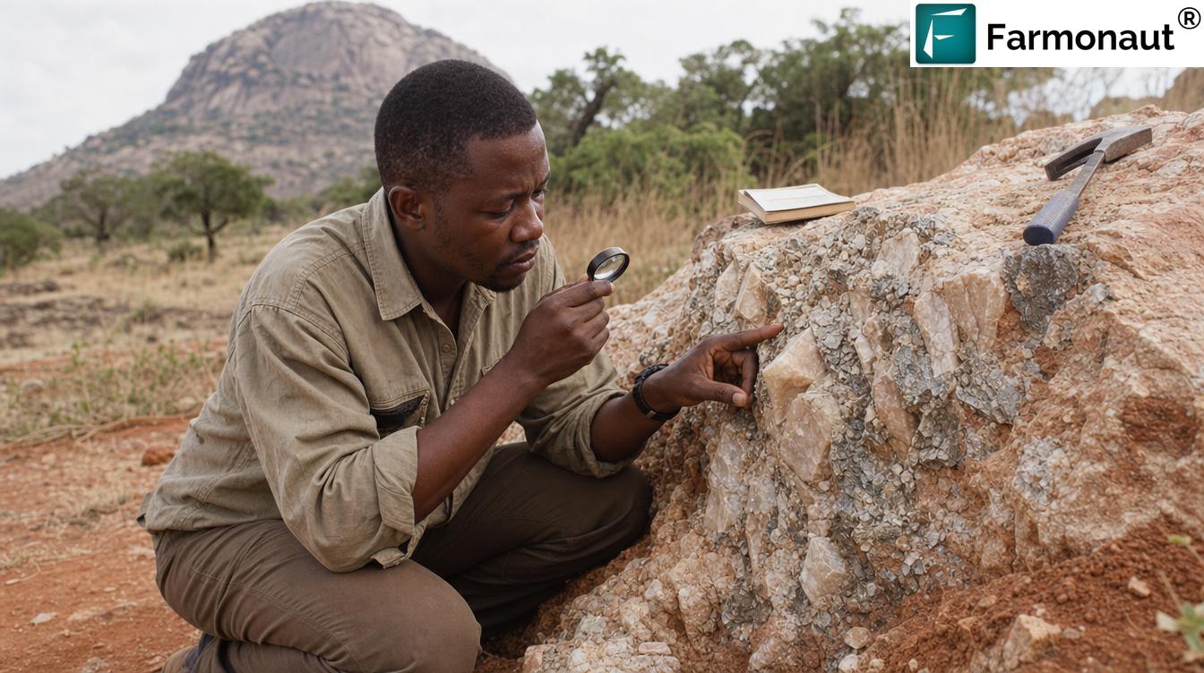
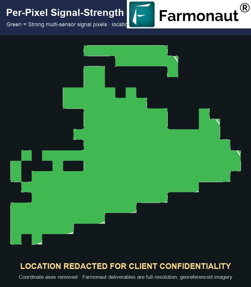
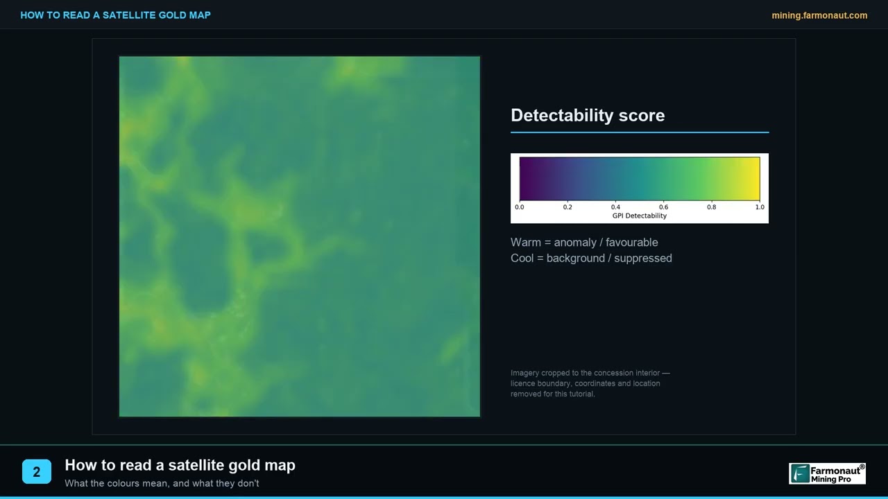
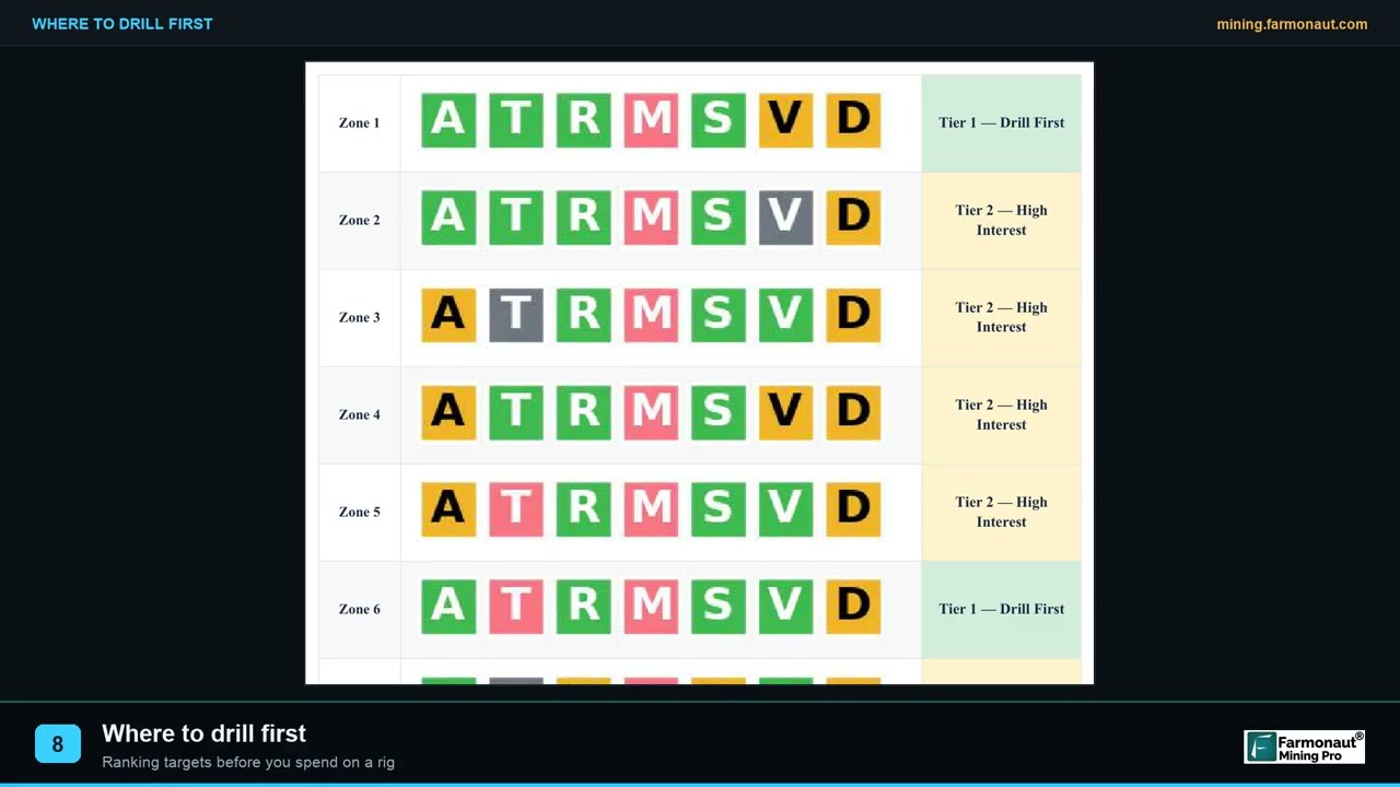
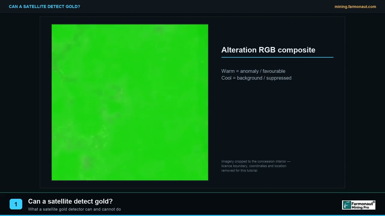
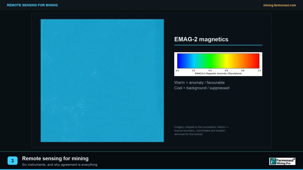
This client’s licence boundary, coordinates and zone-level results are confidential and are not published here. The analytical figures below come from a separate, already-redacted Farmonaut gold project and appear purely to show what our deliverables look like — they are not this project’s data. Field photography is illustrative of Nigerian exploration terrain.

Nigeria’s Critical-Minerals Moment
The timing of this project is not incidental. Nigeria is in the middle of the most significant repositioning of its solid-minerals sector in decades, and lithium is at the centre of it.
The Nigerian Geological Survey Agency has confirmed a mineral belt in Kaduna State containing platinum group metals, gold, nickel, copper, lithium and rare earth elements — described by the Minister of Solid Minerals Development as a world-class mineral province. Downstream investment has followed quickly: approval for the Jupiter Lithium Project as the country’s first Tier-1 lithium operation, an $800 million processing plant, a $600 million facility in Nasarawa State, and a refinery in the Federal Capital Territory. ASX-listed explorers have secured licences across Nasarawa, Kogi, Kwara, Ekiti and Cross River.
Gold runs on a separate and much older track. Nigeria’s alluvial and primary gold sits in the schist belt threading through Zamfara, Kebbi, Niger, Kaduna and Osun states, where artisanal and small-scale mining still accounts for the bulk of production and most of it remains informal.
“Nigeria confirmed a world-class Kaduna belt carrying lithium, gold, platinum group metals and rare earths.”
The two commodities also sit at opposite ends of the formalisation spectrum, which matters more than it first appears. Nigerian gold production is dominated by artisanal and small-scale operators, much of it outside the formal system, and government initiatives such as the Presidential Artisanal Gold Mining Development Initiative exist specifically to aggregate that output into regulated channels. Lithium, by contrast, has arrived as a formal, capital-intensive, export-oriented industry from the outset — large licences, foreign investment, and processing infrastructure built to specification.
A licence holder standing on ground prospective for both is therefore straddling two very different commercial worlds, with different buyers, different regulatory expectations and different evidentiary standards. That is a strong practical argument for characterising both possibilities early rather than defaulting to whichever commodity is locally familiar — and it is why a combined gold and lithium exploration Nigeria screen is a more useful first step than sequentially testing one hypothesis at a time.
For a licence holder, that combination creates a specific and slightly awkward situation. Ground that is prospective for gold may also be prospective for lithium — and the two are found in completely different rocks, by completely different methods. Screening for one and ignoring the other risks leaving the more valuable half of your licence unexamined.
Gold and lithium are not competing targets on the same licence — they are different questions asked of the same ground. Gold targeting follows alteration and structure. Lithium targeting follows pegmatite bodies and their mica chemistry. A single satellite acquisition can carry both analyses, which is why screening for both costs far less than twice screening for one.
What the boom means for a small licence holder
Headline investment figures are easy to read as good news for everyone holding ground. In practice a critical-minerals boom changes the position of a small operator in three concrete ways, and only one of them is straightforwardly positive.
The positive one is demand for ground. When refineries and processing plants are being financed, prospective licences acquire strategic value to parties who need feedstock. That is a genuine opportunity for an operator holding well-characterised ground.
The second change is competition for attention. Larger, better-capitalised explorers are actively acquiring licences and can present institutional-grade technical documentation. A small operator competing for the same partner or investor is competing on evidence quality, not just on geology.
The third is the pace of the licensing cycle. Work commitments and expenditure obligations do not pause while an operator raises money, and licences carry deadlines. Anything that shortens the interval between acquiring ground and having a defensible technical picture of it directly reduces the risk of losing that ground.
All three point the same direction: for a Nigerian licence holder, the binding constraint is frequently not geology but the speed and credibility of technical characterisation. That is precisely the gap satellite screening fills, and it explains why lithium exploration Nigeria projects increasingly begin from orbit rather than from a field camp.

The Problem: A 300-Hectare Licence and a Two-Commodity Question
Three square kilometres is a small licence by exploration standards, and that shapes the economics in a particular way. The area is small enough that a full conventional ground programme is technically feasible — but on a licence this size, a conventional programme can easily consume the entire early budget without producing a single ranked drill target.
Malik’s requirement was to establish, quickly and cheaply, three things:
- ✔ Where on the licence the strongest indications sat, rather than treating 300 hectares as uniform.
- ✔ Which commodity the ground actually favoured — gold, lithium, or both in different places.
- ✔ Something defensible to show other people — the point we come back to later.

Request a quote for your licence, or draw your concession boundary yourself at mining.farmonaut.com.
Screening Gold and Lithium Together from Orbit
Farmonaut has applied Earth observation and AI to mineral exploration since 2018, across 100,000+ hectares in 25+ countries for more than 20 mineral types. The physical principle is constant: every mineral and alteration assemblage absorbs and reflects light in a characteristic way. What changes between commodities is which part of that signal matters.
Why the two commodities need different indicators
This is the technical heart of a dual-commodity screen, and it is genuinely different work rather than one analysis relabelled twice.
| Screening dimension | Gold targeting | Lithium (pegmatite) targeting |
|---|---|---|
| Host rock sought | Altered volcanics, schists, shear-hosted quartz systems | Coarse-grained granitic pegmatite bodies |
| Primary spectral indicators | Iron-oxide and clay alteration indices, silica | Al-OH mica features; lithium-bearing mica assemblages |
| Structural control | Shear zones, fracture corridors, fault intersections | Late-stage intrusive contacts, pegmatite swarms and dyke trends |
| Typical target shape | Linear to irregular alteration halos | Narrow, elongate, often steeply dipping bodies |
| Biggest false-positive risk | Barren iron staining, laterite duricrust | Barren pegmatite — texturally identical, chemically empty |
| Confirmation required | Drilling and assay | Sampling and assay; mica chemistry is decisive |
Note the fifth row, because it is the honest limitation of lithium remote sensing. Pegmatites are relatively easy to see; fertile pegmatites are not. A barren pegmatite and a lithium-bearing one can look nearly identical from orbit. Satellite work reliably narrows a licence to the pegmatite population worth sampling — it does not tell you which of those bodies carries spodumene or lepidolite. Only geochemistry does that.
The workflow
- Define and acquire. The client supplies the AOI as coordinates, KML/KMZ or polygon, plus target commodities. We assemble a multi-date archive rather than relying on a single scene.
- Correct and decompose. Radiance is atmospherically corrected and spectrally decomposed to separate mineralogy from soil, shadow and vegetation.
- Run both indicator sets. Gold-relevant alteration and structure, and pegmatite-relevant mica and intrusive-contact mapping, are derived from the same corrected imagery.
- Rank and deliver. Zones are delineated and ranked per commodity, delivered as a report plus georeferenced GIS files, typically in 5–20 business days.
If your licence sits in a region prospective for more than one commodity, ask for both screens in the same acquisition. The imagery, atmospheric correction and terrain modelling are shared costs. Commissioning a lithium screen twelve months after a gold screen means paying for that shared work twice.
What the Report Gave Malik
The specific zone geometry and per-commodity rankings on this licence are the client’s confidential property. What we can publish is what he reported back to us in August 2026, a full twelve months after delivery.
He confirmed the analysis narrowed down where to explore. He reported saving more than six months — the highest time-saving band we offer — and avoiding up to USD 25,000 in exploration cost. He has not drilled, and indicated drilling is more than six months out.
Treating a completed satellite screen as a completed exploration programme. It is the first stage, not the last. On this licence the targeting is finished and the drilling has not started — anyone reading the ranked zones as though they were proven mineralisation would be drawing a conclusion the data cannot support.
What the screen could not tell him
A targeting instrument that is oversold becomes a liability, so it is worth stating the limits of this particular analysis as plainly as its results.
- ⚠ It did not establish lithium fertility. Mapping the pegmatite population is not the same as knowing which bodies carry spodumene or lepidolite. That distinction is made by sampling and mica chemistry, and it had not been made at the time of this feedback.
- ⚠ It did not measure grade or tonnage in the ground. Any modelled figures in a report of this type are exploration targets expressed as ranges — derived from surface response and geological modelling, not from assay.
- ⚠ It did not see beneath cover. Where transported soil or thick laterite masks the basement, the surface signal weakens and confidence drops. Those portions of a licence are reported as lower-confidence rather than quietly averaged in.
- ⚠ It could not distinguish a narrow high-value body from a wide barren one on spectral character alone — pegmatite geometry at depth is a drilling question.
- ✔ What it did establish was a defensible ranking of 300 hectares across two commodities, produced in days, at a fraction of the cost of walking the same ground.
That is a narrower claim than “we found lithium”, and it is the accurate one. In a market where lithium exploration Nigeria projects attract considerable enthusiasm, the discipline of separating what has been demonstrated from what has merely been indicated is what makes a technical document credible to a serious counterparty.
The Second Job of a Detection Report: Articulating the Asset
Now back to that word. Malik did not write that we helped him find mineralisation. He wrote that we helped him “identify and articulate key points of mining asset”.
Articulation is a commercial function, not a geological one. An early-stage licence holder spends a surprising amount of time explaining their ground to people who will never visit it — prospective investors, joint-venture partners, lenders, regulators reviewing work commitments, and buyers. In that setting, “we believe there is gold on this licence” is worth very little. A structured technical document showing which parts of the licence rank highest, on what evidence, produced by an independent third party, is worth considerably more.
“Farmonaut helped us identify and articulate key points of mining asset.”
This is the part of the value that rarely appears in exploration marketing, and it showed up unprompted in a one-line testimonial. A detection report does two jobs at once: it tells the operator where to work, and it gives the operator something credible to put in front of the people funding the work.
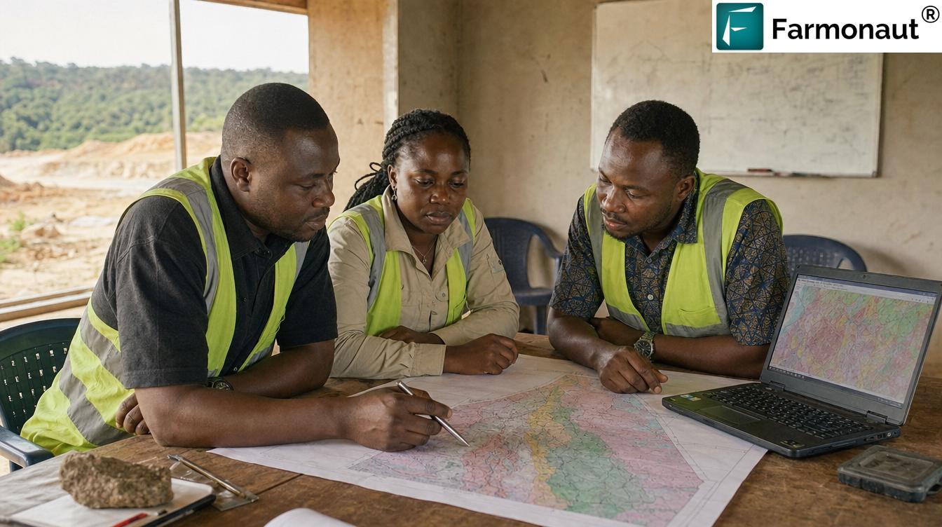
When an early-stage licence is presented to you with a satellite prospectivity study attached, read it for what it is: independent evidence of where the operator intends to spend, and why. It is not evidence of mineralisation. The right follow-up question is not “how good is the anomaly” but “what is the sampling and drilling plan against it, and when”.

Time, Cost and the Case for Screening First
Malik reported saving more than six months. On a 300-hectare licence that figure deserves unpacking, because the area is small enough that people assume ground work would be quick.
The saving is not really about walking the ground — it is about sequencing. Conventional practice on a dual-commodity licence is to run a reconnaissance programme, wait for laboratory turnaround, interpret, then design a follow-up programme. Each loop carries a season and a lab queue. Satellite screening compresses the first loop into a delivery window of 5–20 business days and lets the first physical programme be a targeted one rather than an exploratory one.
The cost saving follows the same logic. Broadly, satellite screening reduces early-exploration cost by 80–85% relative to conventional first-pass ground programmes, because expensive field effort is redirected rather than repeated. Malik’s reported figure of up to USD 25,000 is consistent with a licence of this size.
Why the saving is larger on a two-commodity licence
There is a compounding effect here that is easy to miss. On a single-commodity licence, satellite screening replaces one reconnaissance loop. On a licence prospective for two commodities with different host rocks, the conventional alternative is closer to two programmes — a soil-geochemistry campaign oriented to gold pathfinders, and a separate pegmatite mapping and sampling exercise for lithium. They target different features, and often different parts of the licence.
Screening both from one acquisition collapses both of those first passes at once. The imagery, atmospheric correction, terrain modelling and structural interpretation are shared inputs; only the indicator sets and deposit models differ. That is why the six-month-plus saving on a licence of only 300 hectares is credible rather than surprising: the saving scales with the number of questions being asked of the ground, not simply with its area.
It also reorders the spending. Instead of committing field budget to characterise the licence and then discovering where to focus, the operator commits analysis budget first and arrives at the field stage already knowing which ground — and which commodity — deserves it.
Screening involves no ground disturbance — no access tracks, no pits, no trenching, no drilling fluids. In a country where informal artisanal activity has already imposed significant environmental and safety costs, keeping the speculative phase of exploration entirely non-invasive means barren ground is ruled out without ever being disturbed.
How to Run This on Your Own Licence
- Send the ground. Coordinates, KML/KMZ or a drawn polygon, plus country and target commodities — name all of them, not just the obvious one.
- We select the sensor stack. Multispectral or hyperspectral, matched to area size and mineral complexity, with multi-date coverage for seasonal validation.
- Analysis and delivery. Typically 5–20 business days, delivered as a report plus georeferenced GIS files.
- Optional Premium+ upgrade. Adds TargetMax™ Drilling Intelligence — drilling-angle recommendations, interactive 3D subsurface models, and commercial next-step guidance.
- Then sample, then drill. For pegmatite-hosted lithium, sampling and mica chemistry come before the rig. For gold, drilling follows target ranking.
One practical note on sequencing for anyone planning lithium exploration Nigeria work specifically: build the sampling campaign into your schedule at the same time you commission the screen, rather than treating it as a decision to be taken after the report arrives. Pegmatite sampling is inexpensive relative to drilling and it is the step that converts a mapped body into a fertility answer. Operators who plan both together tend to reach a defensible position on their ground within a single field season; those who wait for the report before thinking about sampling routinely lose a season to the gap.
A short glossary
- Pegmatite
- A very coarse-grained igneous rock formed from the last, volatile-rich fraction of a crystallising magma. Lithium-bearing pegmatites are the principal hard-rock source of lithium worldwide.
- Fertile vs barren pegmatite
- A fertile pegmatite carries economically interesting minerals such as spodumene or lepidolite; a barren one does not. They can be visually and spectrally similar, which is why sampling is decisive.
- Alteration halo
- Chemically altered rock surrounding a mineralising system, typically much larger than the ore body itself — which is what makes it detectable from orbit.
- Prospectivity index
- A per-pixel composite score ranking relative favourability across a licence. Not a grade, not a probability.
- Exploration target
- A deliberately cautious term for an estimate too speculative to be reported as a Mineral Resource. Always a range. Everything satellite analysis produces sits here.
- Ground truthing
- Physically testing a remotely sensed prediction through mapping, sampling, and drilling. On this licence, ground truthing is still ahead.
Screen your licence before you commit field budget
Gold, lithium, or both — assess the whole licence first and spend the field money where the evidence points.
Frequently Asked Questions
Can satellites detect lithium directly?
No. Satellite analysis maps the pegmatite bodies and mica assemblages that host hard-rock lithium, plus the intrusive contacts and structural trends that control them. It cannot distinguish a lithium-fertile pegmatite from a barren one — that requires sampling and mica chemistry. Lithium exploration Nigeria projects should treat satellite output as a sampling plan, not an answer.
Can one analysis cover both gold and lithium?
Yes, and it is markedly cheaper than two separate engagements. The imagery, atmospheric correction and terrain modelling are shared; only the indicator sets and deposit models differ. Name every commodity of interest when you submit your area — adding a second commodity later means paying for the shared groundwork twice.
Has this Nigerian project been drilled?
No. As of the client’s August 2026 feedback, targeting was complete and drilling was more than six months away. We publish this deliberately: the case study demonstrates targeting and time savings, not confirmed mineralisation. A separate Farmonaut case study in Niger covers a project that was drilled and lab-confirmed.
How much time and money did the client report saving?
More than six months of exploration time — our highest banded option — and up to USD 25,000 in exploration cost across the 300-hectare licence. Both figures are the client’s own selections from banded options, not our estimates. Analysis turnaround for a licence this size is typically 5–20 business days.
Why is the client not fully named?
He consented to a testimonial and is identified by first name only, which is what he provided. Licence boundaries, coordinates and zone-level results stay confidential because publishing them could affect land access, partner negotiations and competitive position.
Is satellite analysis accepted for resource reporting?
No. Satellite-derived estimates are exploration targets, not Mineral Resources under JORC, NI 43-101 or equivalent codes. They cannot be reported as resources and cannot replace drilling, sampling or a qualified person’s assessment. Their role is deciding where that work should happen.
How do I start on a licence in Nigeria?
Send your area of interest — coordinates, KML/KMZ or polygon — and your target commodities through the mining query form, or draw the boundary directly at mining.farmonaut.com. We work across 25+ countries with no restricted-country list.
Published with the client’s consent to use his testimonial; he is identified by first name only, as provided. Licence coordinates, boundary geometry and zone-level results remain confidential and are not disclosed. Analytical figures reproduced in this article originate from a separate, unrelated and already-redacted Farmonaut gold project and are shown solely to illustrate deliverable format — they are not this project’s results. Field photography is illustrative of regional exploration conditions. This project has not been drilled; no mineralisation is claimed or confirmed. Satellite-derived estimates are exploration targets and do not constitute Mineral Resources or Reserves under JORC, NI 43-101 or any equivalent reporting code, and are not a substitute for sampling, drilling or qualified-person assessment.
Discussion
Questions, corrections or field experience? Share them below. First-time comments are reviewed before they appear, and your email is never published.
No comments yet. Be the first to add a question or your experience.

 Berks Gold Limited
 Mwerezi Minerals Company Limited
 Congo Mining Solutions
 Mining SARL
 SenGold Invest SAS
 Sania Corporation
 Sean Mining Limited
 NTS Group (Pty) Ltd
 Mine4Africa
 Lithspo Minerals Limited
 Tintina Mining Group
 Dalgety Minerals Pty Ltd
 Vortex Minerals Pty Ltd
 Faith At Work (Pty) Ltd
 Geotech Mining Solutions plc
 Vulcan International Limited
 Kidepo Associates
