

Satellite Gold Exploration Niger: 1,870 ha Verified
A Niger exploration company brought us a concession and a familiar problem: too much ground, too little budget, and no defensible reason to drill in one place rather than another. Eight months after the report landed, they had drilled, assayed, and confirmed mineralisation — and told us what it saved them.
Most exploration case studies end at the map. This one does not. In December 2025 we delivered a satellite gold exploration analysis over a 1,870-hectare concession held by ALMOSI SARL in the Maradi region of southern Niger. Eight months later the company came back through our client feedback programme and answered a short, deliberately blunt questionnaire: did it narrow your search, did it save time, did it save money, and — the question that actually matters — did you drill, and did the lab confirm what we said was there?
They answered yes to all four. That last yes is rare enough in early-stage exploration that it is worth walking through the whole engagement carefully, including what satellite data can and cannot tell you.
Before the methodology, here is the client’s own verdict. ALMOSI SARL wrote the following in French after drilling and assaying the targets, and authorised us to publish it verbatim under their company name.
« Par la présente, ALMOSI SARL exprime toute sa satisfaction et sa gratitude à l’égard de la société Farmonaut, spécialisée en exploitation et télédétection minière.
Le travail effectué a dépassé nos attentes. La rigueur, la réactivité et la qualité des analyses fournies nous ont permis d’avancer efficacement dans nos projets.
Nous recommandons vivement leurs services et espérons collaborer à nouveau prochainement. »
English translation
“ALMOSI SARL hereby expresses its full satisfaction and gratitude towards Farmonaut, a company specialising in mining exploration and remote sensing.
The work carried out exceeded our expectations. The rigour, responsiveness and quality of the analyses provided enabled us to advance our projects efficiently.
We warmly recommend their services and hope to collaborate again soon.”
Maradi, Niger · Gold exploration · 1,870-hectare concession
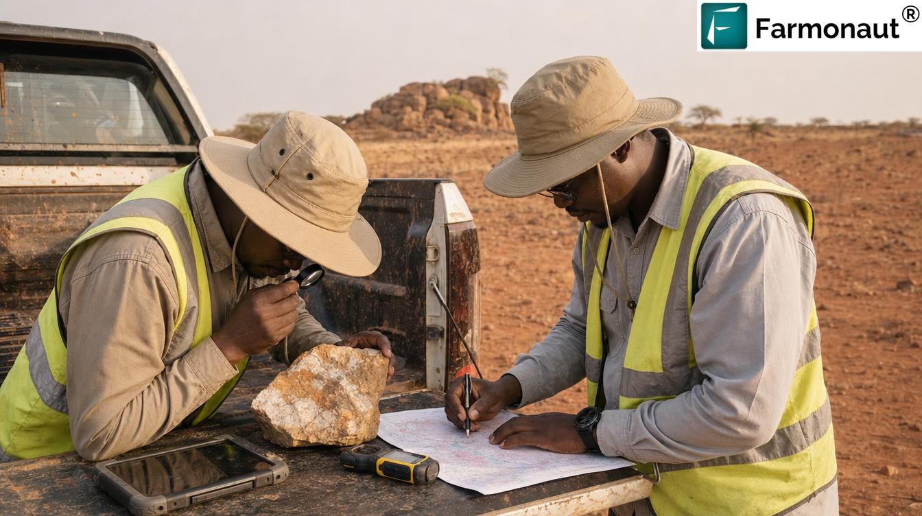
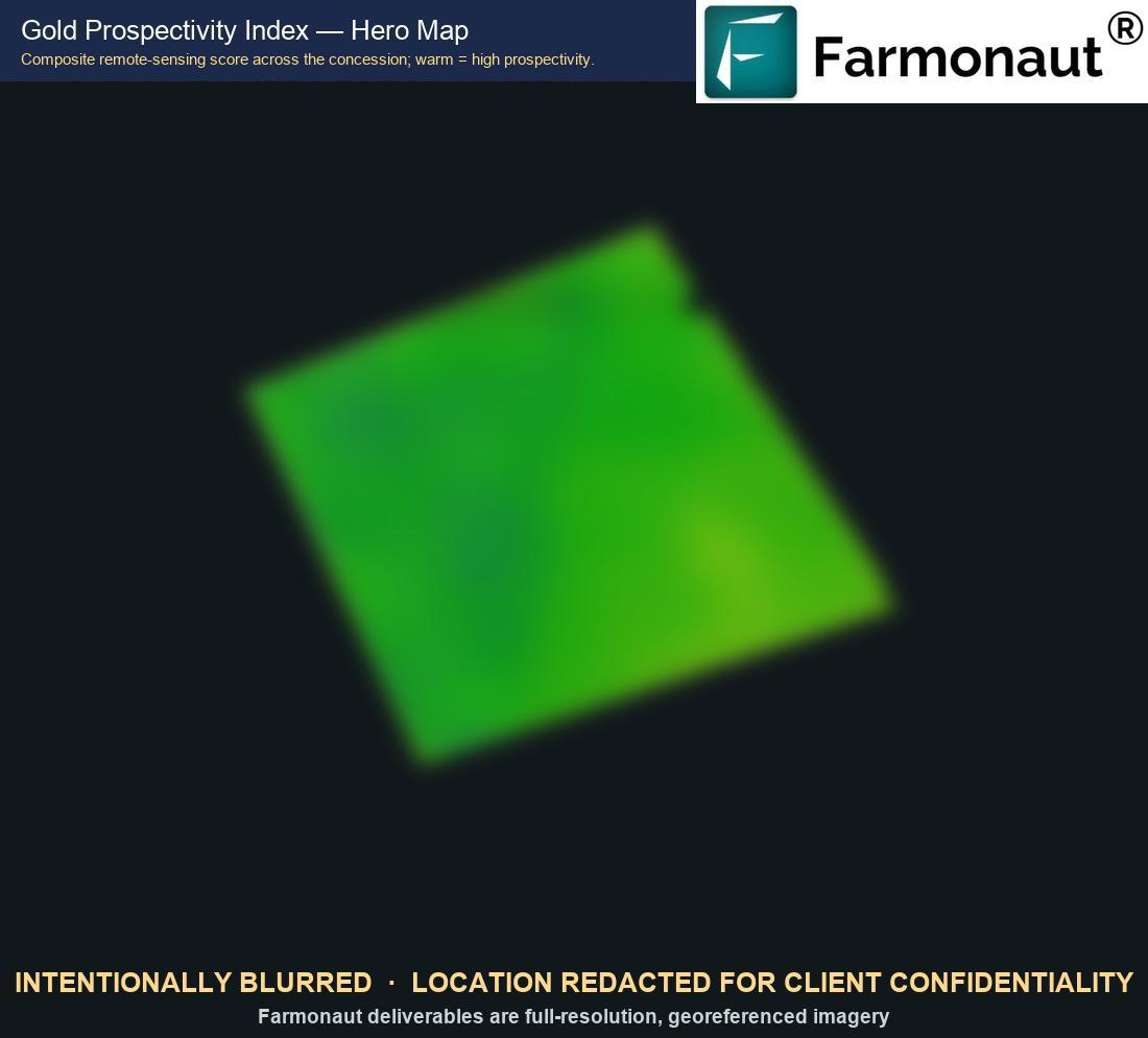
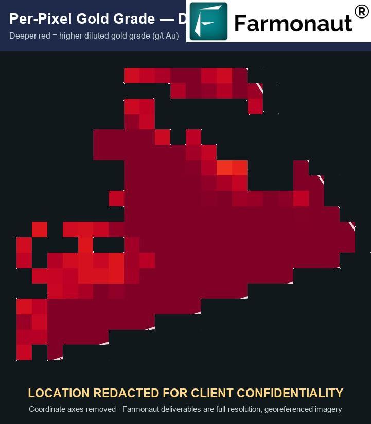
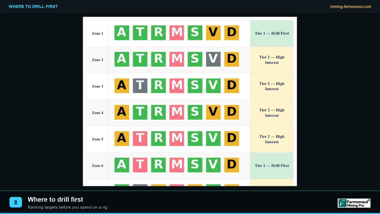
ALMOSI SARL’s concession boundary, coordinates, per-zone grades and tonnage estimates are commercially confidential and are not published here. The prospectivity and grade figures shown below are drawn from a different, already-redacted Farmonaut gold project and appear purely to illustrate what our deliverables look like. They are not ALMOSI SARL’s data and should not be read as such. Field photography is illustrative of Sahelian exploration conditions.
Gold in Niger: A Frontier That Satellites Reached First
Niger is not a country most investors associate with gold. It is associated with uranium — the Arlit and Akouta operations shaped the national economy for decades. Industrial gold arrived late: the Samira Hill mine, the country’s first industrial-scale gold operation, only opened in 2004, in the Liptako region in the far west where Birimian greenstone belts run north-east to south-west.
Southern Niger is a different geological story and a much less explored one. The Maradi region sits on the Pan-African basement close to the Nigerian border, and academic work has documented gold mineralisation indices across the South Maradi Pan-African province. On the ground, that potential shows up the way it usually does in West Africa first: as artisanal workings. Gold panning is active in the Madarounfa department in southern Maradi, and the Garin-Liman area became internationally known in 2021 for the wrong reason, when a hand-dug shaft collapsed.
That is the context a company like ALMOSI SARL operates in. There is credible regional evidence of gold. There is very little modern, systematic, publicly available exploration data. And the conventional route to generating that data — grid soil sampling, trenching, geophysical surveys across thousands of hectares — costs more than most early-stage licence holders in the region can justify before they have any indication they are in the right place.
“Niger’s first industrial gold mine opened only in 2004 — most of the country has never been systematically explored.”
Why West African licence holders reach for satellite data first
The pattern we see across West Africa is consistent, and Niger fits it exactly. Licences are large. Regional geology is genuinely prospective. Public geoscience datasets are thin, dated, or held at a scale too coarse to guide a drill programme. And the operators holding ground are frequently national or regional companies working to budgets that do not stretch to a full conventional reconnaissance campaign before the first hole.
Satellite screening has become the pragmatic answer to that combination for three reasons. It is complete — the whole licence is assessed on one consistent basis, not just the parts a field crew reached. It is fast, which matters when licence terms carry work commitments and expenditure deadlines. And it is archival: satellite imagery already exists over your ground going back years, so a first-pass assessment does not wait on a field season.
There is precedent for the underlying technique in Niger specifically. Researchers have used Landsat archives to track the evolution of the Koma Bangou gold panning site from 1984 to 2020 — a demonstration that satellite records carry meaningful, decades-deep information about Nigerien gold districts. Our work applies the same class of data to the targeting problem rather than the monitoring one.
If your licence carries a minimum expenditure or work commitment, check whether a satellite screening programme qualifies. In many jurisdictions a documented, professionally produced remote-sensing assessment counts toward exploration commitments — and it produces a defensible technical record for the regulator as well as a target list for you.
The bottleneck in frontier exploration is almost never whether mineralisation exists somewhere on the licence. It is knowing which few hundred metres to spend your first drilling budget on. Satellite analysis attacks that specific problem.
The Challenge: 1,870 Hectares and No Obvious Place to Start
Eighteen point seven square kilometres does not sound large until you have to walk it. At a realistic first-pass reconnaissance density, systematically covering that area with soil geochemistry means thousands of samples, weeks of field crews, vehicle and fuel logistics across terrain with limited road access, sample shipping and laboratory turnaround. In the Sahel you are also working around a hard seasonal constraint: the rainy season closes tracks and makes systematic ground access impractical for months at a time.
The economics are unforgiving. Spend the whole first-year budget on reconnaissance and there is nothing left to drill with. Drill early without targeting and you are buying lottery tickets at roughly $50–150 per metre. Neither is a strategy.
ALMOSI SARL’s requirement was therefore narrow and practical: reduce 1,870 hectares to a small number of defensible, ranked targets, fast enough and cheaply enough to leave drilling budget intact.

Why this terrain suits satellite work
There is a genuine technical reason the Sahel is a good place to do this, and it is worth being precise about it. Multispectral and hyperspectral mineral mapping works by measuring reflected electromagnetic energy. Alteration minerals — the clays, iron oxides and silica associated with hydrothermal gold systems — have diagnostic absorption features. Dense vegetation and thick transported cover mask those features.
- ✔ Sparse vegetation cover means the spectral signal reaching the sensor is dominated by rock and soil, not leaves.
- ✔ Extensive bedrock and weathered-profile exposure lets alteration mineralogy be mapped directly rather than inferred.
- 📊 Long dry seasons deliver repeated cloud-free acquisitions, so anomalies can be tested for persistence across multiple dates rather than trusted from a single image.
- ⚠ Limitation: the same conditions that help also produce false positives — laterite duricrust and barren iron staining can mimic alteration if the analysis is naive about it.
Request a quote for your concession if you are sitting on a licence and facing the same targeting problem — or map the boundary yourself first at mining.farmonaut.com.
How Satellite Gold Exploration Actually Works
Farmonaut has been applying Earth observation and AI to mineral exploration since 2018, and our satellite mineral detection platform has now screened over 100,000 hectares across 25+ countries for more than 20 mineral types. The method is consistent regardless of commodity, and it rests on a simple physical fact: every mineral and alteration assemblage reflects and absorbs light in a characteristic way.
The workflow runs in four stages.
- Define and acquire. The client supplies the area of interest as coordinates, KML/KMZ or a polygon, plus the target commodity. We select the appropriate sensor stack — multispectral or hyperspectral depending on area and mineral complexity — and assemble a multi-date archive rather than a single scene.
- Correct and decompose. Raw radiance is atmospherically corrected, then spectrally decomposed to isolate the mineralogical signal from soil, shadow and vegetation contributions.
- Map the indicators. We map alteration mineralogy, iron-oxide and clay indices, structural features such as faults and fracture corridors, and lithological boundaries — the geological architecture that controls where gold sits.
- Rank and deliver. Indicator layers are combined into a prospectivity surface, discrete anomaly zones are delineated and ranked, and the package is delivered as a PDF report plus georeferenced GIS files, typically within 5–20 business days.
Reading a prospectivity surface
The central output is a prospectivity index: a per-pixel composite score across the whole licence, where warmer values indicate a stronger coincidence of the indicators associated with the target deposit style. It is not a gold assay from orbit. It is a ranking of relative favourability, and its job is to order your ground so you spend field time in the right sequence.
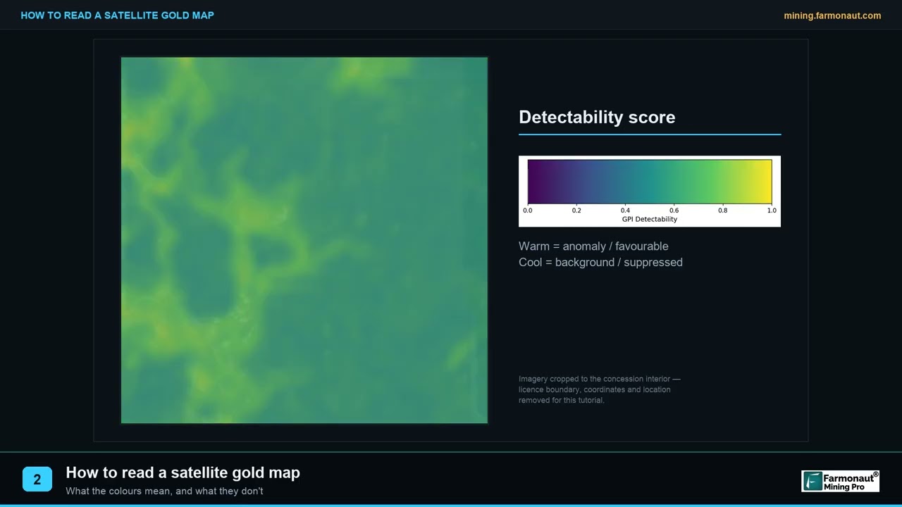
Treat a single-date anomaly with suspicion. A real alteration footprint is a persistent property of the ground and should reappear across images from different seasons and years. An anomaly that appears in one scene and vanishes in the next is usually moisture, shadow or transient surface cover — seasonal validation across multiple acquisitions is what separates a target from an artefact.
From surface score to discrete, drillable targets
A heatmap alone is not actionable. The next step converts a continuous surface into discrete zones with defined footprints, then models grade and contained-metal ranges per zone so that targets can be compared against one another on a consistent basis.
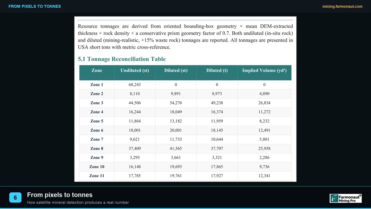
Reading satellite-derived tonnage and grade as if they were a resource statement. They are exploration targets, expressed as ranges, derived from surface spectral response and geological modelling. They are not JORC or NI 43-101 Mineral Resources, they cannot substitute for drilling, and any operator who treats them as a resource is misusing them. Their purpose is to rank where to drill — nothing more, and nothing less.
What satellite gold exploration could not tell ALMOSI SARL
It is worth being explicit about the limits, because they define how the deliverable should be used. A prospectivity report is a targeting instrument, and a targeting instrument that is oversold becomes a liability.
- ⚠ Depth is modelled, not measured. Spectral response is a surface phenomenon. Where a report indicates depth ranges, those are geological inferences from surface expression and structural context — not direct observation of anything below the weathering profile.
- ⚠ Grade is an estimate expressed as a range. Modelled grade distributions describe expected variation across an anomaly. They are not assays and cannot be reconciled against one until the core comes back from the laboratory.
- ⚠ Structure beneath cover stays hidden. Where transported sediment or thick laterite masks the basement, the surface signal weakens. Those parts of a licence carry lower confidence and we say so in the report rather than smoothing over it.
- ✔ What it does tell you is the relative ranking of your ground — consistently, across the entire licence, in days rather than seasons.
ALMOSI SARL used it that way. They treated the report as a shortlist, then spent real money testing the shortlist physically. That sequence — screen wide, then drill narrow — is the whole argument for satellite gold exploration as a first-pass method.
What the Analysis Delivered for ALMOSI SARL
We delivered the ALMOSI SARL report in December 2025 covering the full 1,870-hectare concession. The specific zone geometry, grade modelling and contained-metal ranges are the client’s confidential property and stay that way. What we can report is what the client themselves subsequently told us, in their own answers to our feedback questionnaire.
The first question we ask is the most important one: did the analysis narrow down where to explore or drill? ALMOSI SARL answered yes. The 1,870 hectares stopped being undifferentiated ground and became a ranked shortlist.
From Satellite Target to Drill Core: The Validation That Matters
Everything above this point is, strictly speaking, a prediction. Remote sensing measures the surface; gold is usually not at the surface. The only thing that converts a satellite target into knowledge is a drill rig and a laboratory.
ALMOSI SARL did both. By the time they completed our questionnaire in August 2026, they confirmed they had drilled the targets, completed laboratory testing, and found mineralisation. In our feedback dataset to date, this is the only project where all three of those boxes are ticked together — which is precisely why it is worth publishing.
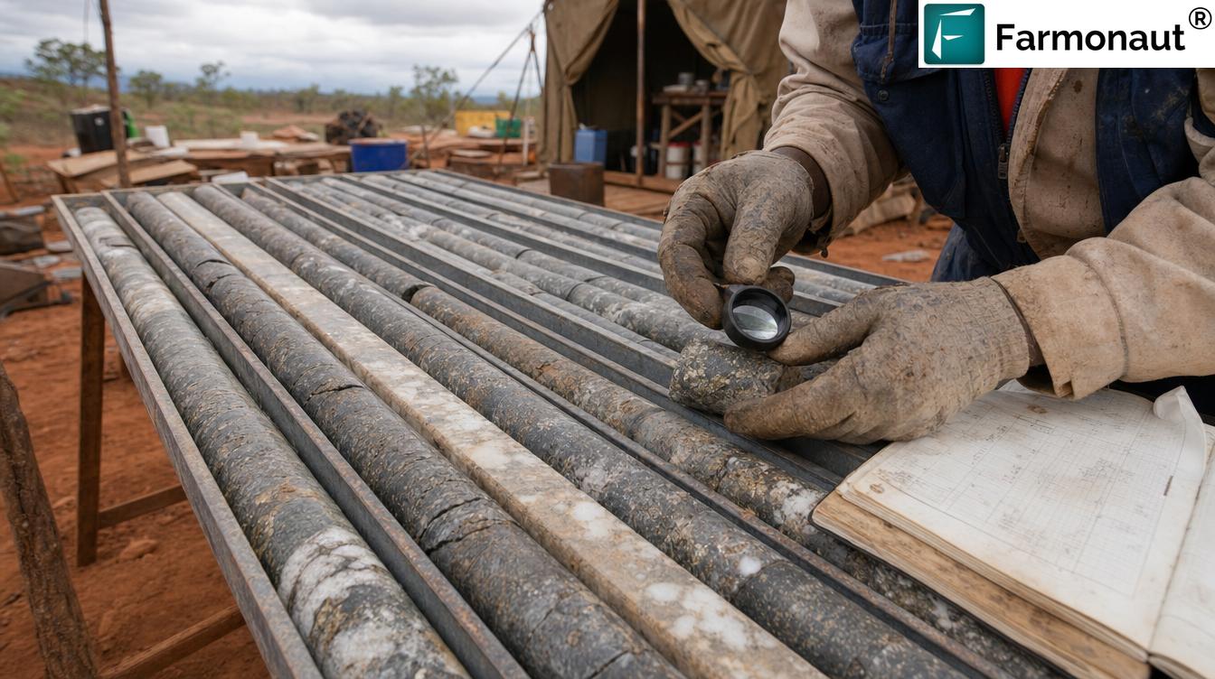
When assessing an early-stage licence, ask a specific question: has anything on this ground been drill-tested, or is the entire story still a surface interpretation? A satellite anomaly that has been drilled and assayed carries a different risk profile from one that has not — regardless of how impressive the heatmap looks.
The Measured Impact: Time, Cost and Risk
ALMOSI SARL reported saving three to six months and USD 50,000 to 100,000. Both are the client’s own selections from banded options; we have not adjusted or extrapolated them. In our feedback set to date, that cost band is the highest any client has reported.
“Three to six months and USD 50,000–100,000 saved — on a single 1,870-hectare programme.”
The time saving is easy to trace. Systematic ground reconnaissance across 18.7 km² is a multi-month undertaking before laboratory turnaround, and in the Sahel it is hostage to the rainy season. A satellite screen delivered in 5–20 business days collapses that first pass and, critically, lets a team plan field mobilisation around a shortlist instead of a licence outline.
The cost saving is the reconnaissance that never had to happen at full scale. Broadly, satellite screening lowers early-exploration cost by 80–85% relative to conventional first-pass ground programmes, because the expensive activity is redirected rather than repeated.
| First-pass approach on a ~1,870 ha licence | Conventional ground programme | Satellite-guided programme |
|---|---|---|
| Coverage of full licence area | Progressive, grid by grid | Complete from the first pass |
| Typical elapsed time to a target shortlist | Several months, season-dependent | 5–20 business days |
| Ground disturbance during screening | Access tracks, pits, trenches | None |
| Seasonal accessibility constraint | Significant — rainy season blocks access | Minimal — archive imagery spans seasons |
| Primary early cost driver | Crews, logistics, sample volume | Analysis; field effort deferred to targets |
| Output | Sample geochemistry over covered ground | Ranked prospectivity across whole licence |
| Still requires drilling to confirm | Yes | Yes |
Note the final row. Satellite analysis does not remove the drilling requirement — it changes what you know before you commit to it.
The screening phase involves no ground disturbance whatsoever — no access tracks cut, no trenches, no pits, no drilling fluids, during a phase that is conventionally the most environmentally invasive relative to what it produces. In jurisdictions where artisanal mining has caused significant environmental and safety harm, a non-invasive first pass also reduces the footprint of speculative exploration on ground that turns out to be barren.

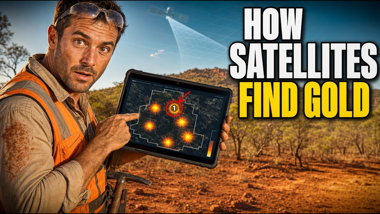
How to Run This on Your Own Concession
The process is deliberately low-friction at the start, because the whole point is to spend analysis money before field money.
- Send the ground. Coordinates, a KML/KMZ, or a drawn polygon — plus the country and your target commodity or commodities.
- We select the sensor stack. Multispectral or hyperspectral, chosen against area size and mineral complexity, with a multi-date archive for seasonal validation.
- Analysis and delivery. Typically 5–20 business days, delivered as a report plus georeferenced GIS files you can load straight into your own systems.
- Optional Premium+ upgrade. Adds TargetMax™ Drilling Intelligence — drilling-angle recommendations, interactive 3D subsurface vein models, and commercial next-step guidance.
- Then drill. The report tells you where to start. It does not tell you what is underground — only the rig and the lab do that.
A short glossary for non-specialists
Exploration writing is dense with shorthand. If you are an investor, a licence holder, or a landowner rather than a geologist, these are the terms that carry the most weight in a satellite gold exploration report.
- Area of Interest (AOI)
- The polygon you want assessed — usually your licence or concession boundary. ALMOSI SARL’s AOI was 1,870 hectares, or 18.7 square kilometres.
- Alteration halo
- The zone of chemically altered rock surrounding a mineralising system. It is typically far larger than the ore body itself, which is precisely why it can be detected from orbit when the ore cannot.
- Prospectivity index
- A composite per-pixel score combining multiple geological indicators into a single relative ranking of favourability across the licence. Higher is more promising — it is not a grade and not a probability.
- Anomaly zone
- A discrete area delineated from the prospectivity surface and carried forward as a named, ranked target with its own footprint and modelled characteristics.
- Exploration target
- A formally cautious term for an estimate of quantity and grade that is too speculative to be reported as a Mineral Resource. Always expressed as a range. Everything satellite analysis produces sits in this category.
- Multispectral vs hyperspectral
- Multispectral sensors record a handful of relatively broad wavelength bands; hyperspectral sensors record many narrow contiguous ones, resolving finer mineralogical distinctions. Which one suits a project depends on area size, target mineralogy and available coverage.
- Ground truthing
- Physically checking a remotely sensed prediction — mapping, sampling, and ultimately drilling and assay. ALMOSI SARL’s confirmed mineralisation is the result of ground truthing, not of the satellite analysis alone.
Map your concession the way ALMOSI SARL did
Screen your entire licence before committing field budget — and know which ground deserves the first drill hole.
Frequently Asked Questions
Can a satellite actually detect gold directly?
No, and any provider claiming otherwise is overselling. Satellites detect the alteration mineralogy, iron-oxide and clay signatures, and structural features associated with gold-bearing systems — not gold atoms. Satellite gold exploration is a targeting technology: it ranks ground by favourability so drilling is directed rather than speculative. Confirmation always requires drilling and assay, as it did for ALMOSI SARL.
How accurate is satellite mineral detection in practice?
Accuracy depends on terrain, cover and deposit style. Arid and semi-arid settings such as southern Niger are among the most favourable, because sparse vegetation and exposed weathered bedrock let the spectral signal through. The honest measure of accuracy is what happens at the drill bit — which is why we ask clients directly whether drilling confirmed mineralisation, and publish the answer.
What did the Niger project actually cost the client in time and money?
ALMOSI SARL reported saving three to six months of exploration time and USD 50,000–100,000 in exploration cost against their planned conventional approach across the 1,870-hectare concession. Those are the client’s own reported bands. Analysis turnaround for a project of this size is typically 5–20 business days.
Why aren’t the actual grades and coordinates published?
Because they belong to the client. Concession boundaries, coordinates, zone geometry, modelled grades and contained-metal estimates are commercially sensitive — publishing them could affect licence negotiations, land access and competitive position. Every figure in this article is either a client-authorised response, general regional context, or illustrative output from a separate redacted project.
Does this work for minerals other than gold?
Yes. The same spectral approach covers 20+ mineral types — precious metals, base metals such as copper, cobalt, nickel and manganese, battery and energy minerals including lithium and uranium, industrial minerals, and rare earth elements. The indicator sets and deposit models change by commodity; the underlying method does not.
Is satellite exploration recognised for regulatory or resource reporting?
Satellite-derived estimates are exploration targets, not Mineral Resources under JORC, NI 43-101 or equivalent codes. They cannot be reported as resources and cannot replace drilling, sampling and a qualified person’s assessment. Their role is upstream of that process — deciding where the drilling that does generate reportable data should happen.
How do I start on my own licence in Niger or elsewhere in West Africa?
Send your area of interest — coordinates, KML/KMZ or polygon — and target commodity via the mining query form, or draw your concession directly at mining.farmonaut.com. There is no restricted-country list; we work across 25+ countries.
Published with the express consent of ALMOSI SARL, who authorised use of their company name and testimonial. Concession coordinates, boundary geometry, zone-level grades and contained-metal estimates remain confidential and are not disclosed. Prospectivity and grade figures reproduced in this article originate from a separate, unrelated and already-redacted Farmonaut gold project and are shown solely to illustrate deliverable format; they are not ALMOSI SARL’s results. Field photography is illustrative of regional exploration conditions. Satellite-derived estimates are exploration targets and do not constitute Mineral Resources or Reserves under JORC, NI 43-101 or any equivalent reporting code, and are not a substitute for drilling, sampling or qualified-person assessment.
Discussion
Questions, corrections or field experience? Share them below. First-time comments are reviewed before they appear, and your email is never published.
No comments yet. Be the first to add a question or your experience.

 Omsri International FZE
 G.I.T.T.
 Jaunita Erss Ltd
 Almosi SARL
 SRK Consulting
 Berks Gold Limited
 Mwerezi Minerals Company Limited
 Mining SARL
 SenGold Invest SAS
 Sean Mining Limited
 NTS Group (Pty) Ltd
 Mine4Africa
 Lithspo Minerals Limited
 Tintina Mining Group
 Dalgety Minerals Pty Ltd
