

Reviewed August 2026 against USDA Economic Research Service and IMARC Group data.
- Introduction: How Are Robots Used in Agriculture
- How GPS Is Used in Agriculture: The Adoption Numbers
- GPS and GNSS for Agriculture Robots: What’s Under the Hood
- Robots Used in Agriculture: A Category-by-Category Breakdown
- Precision Agriculture Robots: How They Actually Navigate a Field
- Drones in the Robot Fleet: Where Aerial Fits GPS Ground Robots
- Imaging, Sensing & Machine Vision Behind Robot Decisions
- Specialized Robotics: Weeding, Spraying & Pruning
- Farmonaut’s Satellite Layer: Extending Coverage Where Robots Can’t Reach
- Comparison Table: Robotics Technologies in Precision Agriculture
- Fuel & Overlap Savings Calculator
- Safety, Fleet Management & Common Adoption Mistakes
- Getting Started with GPS-Guided Robotics
- FAQs: Robots and GPS in Agriculture
How Are Robots Used in Agriculture: Precision GPS Drones
Robots in agriculture use GPS and GNSS positioning to steer tractors, sprayers, and drones with centimeter-level accuracy, so that every pass — planting, spraying, or scouting — lines up exactly with the last one. That single capability is what turns a machine into a “precision agriculture robot”: not the robot body itself, but the geolocation stack underneath it. GPS-guided auto-steer already covers most of the acreage of the largest US row crops, and it’s the foundation every other layer of agricultural automation — drones, in-row weeders, harvesters — builds on top of.
This article answers three related questions people search for separately but that are really one topic: how GPS is used in agriculture, how robots (ground and aerial) use that GPS signal to operate, and what the current adoption numbers, costs, and technology categories actually look like in the United States. We’ll cite USDA’s own adoption figures, break down the robot categories by function, and hand you a fuel-savings calculator built on a real USDA Extension figure — not a generic ROI widget.

GPS auto-steer adoption in major US row crops already sits above half of planted acreage for corn, cotton, wheat, and soybeans, per USDA’s Economic Research Service. Everything else in “agricultural robotics” — drones, weeders, harvesters — layers on top of that same positioning backbone.
How GPS Is Used in Agriculture: The Adoption Numbers
“How is GPS used in agriculture” has a concrete answer: it’s the guidance layer that lets a tractor, sprayer, or robot hold a line across a field without a human correcting the steering wheel. The USDA Economic Research Service has tracked this directly through its Agricultural Resource Management Survey, crop by crop:
- Cotton: 64.5% of US planted acreage used GPS auto-steer and guidance systems as of 2019 — the highest of the four major row crops tracked.
- Corn: 58.4% of US planted acreage used GPS auto-steer and guidance systems as of 2016.
- Winter wheat: 55.9% of US planted acreage used GPS auto-steer and guidance systems as of 2017.
- Soybeans: 54.5% of US planted acreage used GPS auto-steer and guidance systems as of 2018.
- Jump to the calculator
These figures come from USDA’s Economic Research Service chart of note on GPS guidance adoption, and each crop was surveyed in a different year as part of USDA’s rolling commodity-cost surveys — cotton in 2019 is the newest data point in the set, corn in 2016 the oldest. That gap matters: if you need a number for 2024 or later, USDA hasn’t republished crop-specific auto-steer adoption at this resolution since these survey years, and the next full Census of Agriculture lands in 2027. The way to get a current figure for your own crop and state is to check the ERS chart-of-note page directly and cross-reference with your state’s NASS QuickStats survey release, since ERS updates the underlying chart as new ARMS survey waves are processed.
Zoom out from auto-steer specifically and the picture broadens: 27% of US farms and ranches reported using any precision agriculture technology as of 2023, according to USDA. That’s a much larger denominator than “GPS auto-steer on row crops” — it includes yield monitors, variable-rate technology, and soil mapping — and it tells you that GPS-guided steering is actually the single most widely adopted precision technology inside that broader 27%, not a niche add-on.
Aerial imagery adoption for crop monitoring — the other half of the “robots and GPS” story — is far behind ground-based auto-steer. USDA ERS found 9.8% of US soybean acreage used aerial imagery for monitoring as of 2018, and just 7.0% of US corn acreage did so as of 2016, per the ERS chart of note on aerial imagery adoption. In other words: most US row-crop acreage is already GPS-guided on the ground, but drone and aerial scouting is still a minority practice on the specific crops USDA has measured.
If you’re deciding where to invest first, USDA’s own numbers say GPS auto-steer has the deeper track record and higher adoption ceiling already reached, while aerial imagery adoption still has the most room to grow from a low base.
GPS and GNSS for Agriculture Robots: What’s Under the Hood
“GPS for agriculture robots” and “GNSS for agriculture robots” are often used interchangeably, but the distinction matters for anyone actually specifying equipment. GPS is the US satellite constellation; GNSS (Global Navigation Satellite System) is the umbrella term covering GPS plus other constellations — Russia’s GLONASS, the EU’s Galileo, China’s BeiDou. Most commercial ag guidance receivers today are GNSS receivers that fuse signals from multiple constellations, because more visible satellites means more reliable fixes under tree cover, near grain bins, or on cloudy days.
Positioning accuracy comes in tiers, and the tier you buy determines what tasks a robot can actually do unattended:
- 📍 Standard GPS/GNSS (uncorrected): Roughly 3–10 meter accuracy — usable for basic mapping and record-keeping, not for row-level steering.
- 📍 WAAS/SBAS-corrected GNSS: Sub-meter accuracy, common on mid-tier auto-steer systems for broadacre row crops where inch-level precision isn’t required.
- 📍 RTK (Real-Time Kinematic) GNSS: Centimeter-level accuracy, achieved by comparing the robot’s raw signal against a fixed base station or a network correction service. This is the tier required for autonomous in-row weeding, controlled traffic farming, and repeatable pass-to-pass accuracy across seasons.
The research available doesn’t include a published, dated breakdown of what share of US guidance systems are RTK versus standard-correction GNSS, or a controlled study quantifying the yield difference between the two tiers — that specific split isn’t in USDA’s public adoption data. If that split matters for an equipment decision, the way to get it is to ask your GPS guidance dealer for the accuracy spec and correction-service subscription cost of the specific receiver model, since RTK network subscription fees and base-station costs vary by region and provider.
What GNSS accuracy buys a robot, concretely:
- ↔️ Row and line consistency: Robots align with beds, irrigation lines, and crop rows pass after pass, which improves crop spacing and supports mechanized harvesting later in the season.
- 🌐 Multi-machine coordination: Several robots or implements can share the same field map and correction stream, avoiding overlap and skipped strips on large or irregularly shaped fields.
- 🤝 Cross-brand interoperability: Tractors, sprayers, and drones referencing the same GNSS correction source follow the same virtual map even when built by different manufacturers.
- ⏱ Recordkeeping: Every pass is geotagged automatically, producing an audit trail usable for crop insurance claims and input-application records.

Buying a GNSS receiver by accuracy spec alone and ignoring correction-service coverage in your region. RTK correction requires either your own base station within range or a subscription network with a tower or satellite-delivered signal that reaches your specific fields — confirm coverage before purchase, not after.
Robots Used in Agriculture: A Category-by-Category Breakdown
“Robots used in agriculture” spans several distinct machine categories, each solving a different task. Here’s how they divide, and where GPS/GNSS sits in each:
- GPS auto-steer tractors and sprayers: The most widely adopted category by far, per the USDA figures above — a human still drives or supervises, but the steering is GNSS-guided.
- Fully autonomous ground robots: No driver in the seat; navigate fields using GNSS plus obstacle-avoidance sensors (LiDAR, stereo cameras, ultrasonic). Used for seedling transplantation, fertilizer banding, and precision crop spraying.
- In-row weeding robots: Ground-based, GNSS-referenced machines using rotating blades or tine weeders to mechanically disrupt weeds between and within crop rows.
- Aerial drones: GNSS-guided flight paths for imaging, mapping, and — on a smaller number of platforms — targeted spraying.
- Specialized harvesters: Vision- and force-sensor-equipped robots for automated fruit and crop picking, often GNSS-tagged for yield mapping as they move.
Each category answers “how are robots used in agriculture” for a different task, but all of them depend on the same underlying positioning signal discussed above.

-
🤖
Robotic Tasks: Seedling planting, material transport, pruning and harvesting. -
🛰
Satellite Sensing: Crop health, moisture, and field variability mapping. -
🚜
Autonomous Tractors: GPS-guided field navigation, soil preparation, input banding. -
🌡
Field Monitoring: Real-time temperature, humidity, and nutrient deficiency insights. -
🦾
Mechanical Weeding: Automated, in-row, and inter-row weed disruption.
The US agricultural robotics market was valued at $3.43 billion in 2025, and the US agricultural drone market specifically at $833 million in 2025, according to IMARC Group. Both figures are 2025 snapshots from a market research firm that updates its estimates on a roughly annual cycle — check the sources linked below directly for the latest published figure rather than treating these as fixed.



Precision Agriculture Robots: How They Actually Navigate a Field
A precision agriculture robot’s operating loop looks the same whether it’s a $30,000 auto-steer retrofit kit or a fully autonomous weeding platform:
- Scouting: Drones and ground robots assess crop status, moisture, nutrient levels, and pest presence, each pass geotagged by GNSS.
- Intervention planning: Imaging and soil-sensor data generate a variable-rate map for fertilizer, irrigation, or pesticide application, referenced to field GNSS coordinates.
- Precision action: Autonomous or auto-steered machinery executes planting, weeding, pruning, or spraying along the planned GNSS path.
- Post-intervention monitoring: Follow-up scouting checks whether the intervention worked, using the same coordinate reference so before/after comparisons line up pixel-for-pixel.
- Refinement: Season-over-season data, all geotagged consistently, narrows input use and cost over time.
The reason GNSS matters at every one of these five steps, and not just during planting, is that it’s the common coordinate system tying scouting data, intervention maps, and post-action verification together. Without it, a drone’s pest hotspot and a sprayer’s treated zone are two separate, unlinked records.
Each pass of a GNSS-guided machine is recorded with a geotag, supporting post-operation analysis, crop insurance verification, and mapping for the next season’s interventions — the audit trail is a byproduct of the guidance system, not a separate purchase.
-
🔋
Power Options: Hybrid, solar-augmented, and long-range batteries for large acreage. -
🛡
Safety Systems: Obstacle avoidance using LiDAR, stereo vision, and ultrasonic sensors. -
⚙️
Modular Toolheads: Quick-swap for seeding, weed control, spraying, and harvesting. -
📶
Cloud Connectivity: Real-time operation tracking and fleet coordination.
Drones in the Robot Fleet: Where Aerial Fits GPS Ground Robots
Drones are the aerial half of the robots-and-GPS story, and they fill the gap that ground-based auto-steer can’t: whole-field visibility in a single flight. With aerial robotics now carrying multispectral and thermal payloads, a drone flight does something a ground robot physically cannot — capture a canopy-level view of an entire field’s stress patterns in one pass, then hand coordinates back to the ground fleet for action.
- 📸 Multispectral & thermal cameras: Detect crop stress, nitrogen deficiencies, and soil moisture variability, flagged by GNSS coordinate for later ground-robot follow-up.
- 🌤 Rapid whole-field scouting: A single flight can cover far more ground per hour than a walking scout, though USDA’s aerial-imagery adoption figures above (9.8% soybeans, 7.0% corn) show this is still a minority practice on the crops measured.
- 📈 Scheduled or event-triggered flights: Weekly, daily, or storm-triggered flights build a time series of the same GNSS-referenced field.
- 🚁 Targeted spraying: A smaller subset of drone platforms can spot-treat flagged zones directly, reducing drift versus boom spraying.
Where aerial imagery adoption is still low relative to ground auto-steer, satellite monitoring is one way growers close the gap without buying drone hardware at all — more on that below.

Satellite-powered platforms—like the Farmonaut Satellite Crop Monitoring System (explore the app)—close the aerial-imagery gap for growers who haven’t invested in drone hardware, extending field-level visibility without a flight at all.
How We at Farmonaut Support Next-Gen Monitoring
We offer satellite-based monitoring as a complement or alternative to drones, so producers can:
- ✔ Monitor crop and soil health remotely using multispectral satellite data analysis, without a drone fleet.
- ✔ Detect stress and nutrient deficiencies before they’re visible to the eye on the ground.
- ✔ Access historical and current imagery for continuous field comparison season to season.
- ✔ Layer satellite data on top of GNSS-guided robotics, sharing the same field coordinate reference.
API access—for integration into custom fleet management and automation platforms—is available (see Farmonaut API & developer docs).
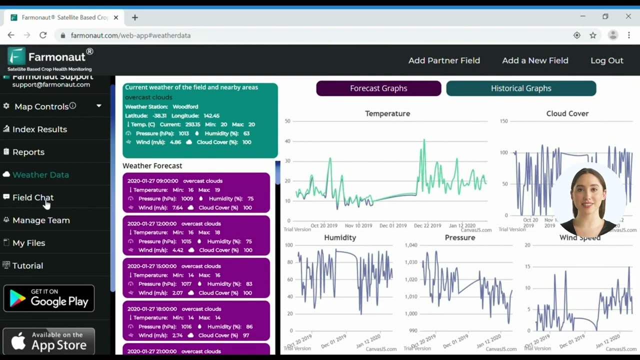
Realizing the full value of GNSS-guided robots and drones requires reliable correction-signal coverage, accurate field boundary data, and connectivity to sync logs — confirm all three before committing to a fleet purchase.
Imaging, Sensing & Machine Vision Behind Robot Decisions
Precision agriculture robots combine imaging, soil sensing, and machine vision to make field-by-field decisions in real time — mapping current conditions and flagging emerging problems before they’re visible on the ground.
- 🖼 Multispectral imaging: Captures NDVI and vegetation-health indices across a field, geotagged to the same GNSS grid the ground robots use.
- 💧 Soil sensors & moisture mapping: Identify irrigation needs, directing water to the driest zones rather than the whole field uniformly.
- 🧬 Machine vision weed & pest detection: AI-powered cameras on robots and drones identify weed species and pest hotspots at coordinates a ground robot can later revisit.
- 🌱 Input optimization: Sensing data calculates the fertilizer or herbicide rate needed at each GNSS-tagged zone, rather than applying a flat field-wide rate.
Our Farmonaut Jeevn AI Advisory System leverages these inputs to deliver tailored strategies (learn more about AI-based crop and plantation advisory solutions).

Specialized Robotics: Weeding, Spraying & Pruning
GNSS-referenced mechanical and chemical weed control is one of the fastest-growing robot categories:
- 🌾 In-row weeding robots: Rotating blades and tine weeders mechanically disrupt weeds between crop rows, cutting herbicide need while GNSS keeps the tool off the crop line itself.
- 💦 Variable-rate sprayers: Apply chemicals only at GNSS-mapped zones flagged by imaging, lowering drift and runoff versus blanket spraying.
- ✂️ Robotic pruning tools: In orchards, automated platforms thin branches and clear undergrowth, tracked by GNSS pass logs.
- 🍏 Fruit-picking robots: Vision and tactile-feedback systems identify ripe produce and harvest without bruising, with each pick geotagged for yield mapping.
Each pass is geotagged automatically, which supports product traceability requirements. Visit our traceability page for details.
Targeting inputs to GNSS-mapped zones rather than whole fields reduces runoff into waterways and lowers the volume of herbicide and pesticide applied per acre — the environmental case and the cost case point the same direction.

Farmonaut’s Satellite Layer: Extending Coverage Where Robots Can’t Reach
Not every acre justifies a ground-robot or drone-fleet investment. Satellite monitoring extends the same GNSS-referenced coordinate system to fields where physical automation isn’t yet cost-effective:
- 🌍 Yield mapping: Harvester logs, imagery, and soil maps combine to flag underperforming zones for the next season’s input plan.
- 💧 Irrigation scheduling: Moisture mapping supports variable-rate irrigation on the same GNSS grid as ground equipment.
- 🌱 Crop health alerting: Automated alerts for stress signatures route to a manager’s app for same-day action.
- 📈 Input cost tracking: Season-over-season records support narrowing fertilizer and chemical spend at the zone level.
Our tools also support environmental monitoring and carbon footprint tracking (Farmonaut Carbon Footprinting), relevant for sustainability reporting and buyer compliance requests.
Robots aren’t confined to row crops either. In forestry, plantation management, and land restoration, GNSS-referenced monitoring supports stand thinning, remote plantation health checks, and revegetation tracking on terrain too large to walk. Our Large-Scale Farm & Plantation Management solution gives administrators overseeing multiple fields or forestry tracts a single coordinate-referenced view across all of them.
Comparison Table: Robotics Technologies in Precision Agriculture
| Technology Type | Positioning Basis | Main Function | Typical Applications | US Adoption Data Point |
|---|---|---|---|---|
| GPS Auto-Steer Tractors/Sprayers | WAAS/SBAS or RTK GNSS | Planting, soil prep, input application | Row crops: corn, cotton, wheat, soybeans | 54.5%–64.5% of planted acreage across corn/cotton/wheat/soy (USDA ERS, 2016–2019) |
| Aerial Drones | GNSS flight path + onboard IMU | Imaging, scouting, spot spraying | Crop monitoring, rapid mapping | 7.0%–9.8% of corn/soybean acreage using aerial imagery (USDA ERS, 2016–2018) |
| In-Row Weeding Robots | RTK GNSS (centimeter-level) | Mechanical weed disruption | Row crops, vegetables, orchards | Not separately published by USDA; ask equipment dealer for local adoption data |
| Autonomous Harvesters | GNSS + machine vision | Picking, sorting, yield mapping | Fruit/vegetable harvesting | Included within broader 27% precision-ag adoption figure (USDA, 2023) |
| Satellite Crop Monitoring | Georeferenced imagery, no onboard GNSS | Remote health/moisture monitoring | Fields without drone/robot investment | Complements the 7.0%–9.8% aerial-imagery figure above where drones aren’t deployed |
Fuel & Overlap Savings Calculator
North Dakota State University Extension has documented that farms using GPS guidance systems save an average of 435 gallons of fuel per farm annually, largely from eliminating pass-to-pass overlap. Use the calculator below to scale that documented figure to your own acreage and fuel price.
Assumptions: scales the North Dakota State University Extension figure of 435 gallons/year fuel savings per farm using GPS guidance, linearly by acreage ratio to your farm size. Excludes labor savings, input savings from reduced overlap, equipment financing cost, and RTK subscription fees — those are separate line items this tool does not estimate.
Safety, Fleet Management & Common Adoption Mistakes
Modern robotic platforms collaborate in fleets, coordinate via cloud analytics, and share sensor streams in real time — reducing soil compaction and worker risk while extending field coverage. Safety protocols that matter in practice:
- 🦺 Collision avoidance: LiDAR, stereo cameras, and ultrasonic sensors halt robots when obstacles or people are detected.
- 🔋 Power management: Hybrid power and solar options extend operation in fields far from a charging point.
- ⚡ Maintenance access: Modular design and remote diagnostics keep downtime low during planting or harvest windows.
- 📋 Regulatory compliance: Spraying and intervention modes adapt to state and federal application-rate rules using logged GNSS data as the compliance record.
For businesses and rural managers, fleet management tools ensure optimal deployment and supervision of machines. Our fleet management solution covers farm vehicles, robots, and equipment, reducing operational costs and improving safety oversight.
Treating a GNSS receiver as “set and forget.” Correction-signal subscriptions lapse, firmware needs updates, and antenna placement drifts after equipment repairs — schedule a GNSS accuracy check each season, not just when steering visibly fails.
Getting Started with GPS-Guided Robotics
Practical steps for adopting GNSS-guided robots, in order:
- 👩💻 Choose a monitoring platform first. Apps like Farmonaut Web & Mobile Platforms combine satellite imagery with field-level insight before you commit to hardware.
- 🤖 Identify which task benefits most from automation. Given USDA’s numbers above, ground auto-steer already has the deepest track record; aerial imagery and in-row weeding have more room to prove ROI on your specific acreage.
- 🛰 Confirm GNSS correction coverage for your fields before buying RTK-tier equipment — check with your dealer whether a base station or network subscription reaches your specific parcels.
- ⚡ Layer in compliance tools. Track sustainability metrics with carbon footprinting and traceability solutions, both of which reuse the GNSS pass logs your equipment already produces.
- 💡 Add advisory automation last. AI-driven advisory systems layer custom recommendations on top of the data your GNSS-guided equipment is already collecting (discover Farmonaut Jeevn AI).
Explore pricing and subscription options below to get started:
FAQs: Robots and GPS in Agriculture
- Q: How is GPS used in agriculture?
A: GPS and GNSS provide the positioning signal that lets tractors, sprayers, drones, and autonomous robots hold a precise line across a field. USDA’s Economic Research Service found this already covers over half the planted acreage of major US row crops — 58.4% of corn (2016), 64.5% of cotton (2019), 55.9% of winter wheat (2017), and 54.5% of soybeans (2018). - Q: How are robots used in agriculture today?
A: Robots automate planting, in-row weeding, pruning, spraying, harvesting, and crop scouting, using GNSS positioning plus sensors like LiDAR and multispectral cameras to operate with precision and consistency. - Q: What’s the difference between GPS and GNSS for agriculture robots?
A: GPS is specifically the US satellite constellation. GNSS is the broader category that includes GPS along with GLONASS, Galileo, and BeiDou. Most commercial ag guidance receivers today are GNSS receivers fusing multiple constellations for a more reliable fix. - Q: How much fuel do GPS-guided robots actually save?
A: North Dakota State University Extension has documented an average of 435 gallons of fuel saved annually per farm using GPS guidance systems, primarily by eliminating pass-to-pass overlap. Use the calculator above to scale that to your own acreage. - Q: How big is the US agricultural drone and robotics market?
A: IMARC Group valued the US agricultural drone market at $833 million and the broader US agricultural robotics market at $3.43 billion, both as of 2025. Check IMARC Group’s site directly for their latest published update. - Q: What share of US farms use precision agriculture technology at all?
A: 27% of US farms and ranches reported using some form of precision agriculture technology as of 2023, per USDA — a figure that includes GPS guidance, yield monitors, and variable-rate application, not just robotics specifically. - Q: What are the main adoption challenges for agricultural robots?
A: Confirming GNSS correction-signal coverage for your specific fields, upfront equipment cost, staff training, and connectivity for data transfer are the primary considerations before a fleet purchase.
GPS and GNSS aren’t a feature bolted onto agricultural robots — they’re the coordinate system that makes “robot” mean something more than “automated machine.” USDA’s own adoption numbers already show most major US row-crop acreage guided this way; the frontier now is extending the same precision to weeding, aerial scouting, and satellite-covered acres that haven’t caught up yet.

Summary: Robots, GPS, and the Future of Precision Agriculture
Robots in agriculture — ground and aerial — run on the same underlying positioning layer: GPS and GNSS. USDA’s Economic Research Service data confirms this isn’t emerging technology anymore for row crops; auto-steer already covers more than half of planted acreage for corn, cotton, wheat, and soybeans. What’s still catching up is aerial imagery (7.0%–9.8% of corn and soybean acreage) and the broader precision-technology category (27% of all US farms and ranches as of 2023).
Precision farming and drones, GPS guidance, and advanced sensing extend into forestry, plantations, and supply-chain traceability — the same GNSS coordinate reference threading through planting, monitoring, weeding, harvesting, and post-harvest tracking.
At Farmonaut, we extend that same coordinate-referenced monitoring to fields that haven’t yet invested in ground robots or drone fleets, through satellite-based crop health and moisture data, AI-driven advisory, and traceability tools — closing the gap between the acreage already GNSS-guided and the acreage still catching up.

 Godrej Agrovet
 Hayleys Agriculture
 Linx Agritech
 Adinet
 Save Your Soils
 GalaxEye Space
 Grandstream Algérie
 XOS Realty
 Geospatial Lab Africa
 Agro La Gándara
 HIPSAC
 ZOL Zimbabwe
 Juligerm
 AdBio
AdBio MISE Maroc
 NWNS
NWNS Red August Group
 Farm Inc
 WeMe Global
 Agrotoken
 Blue BearX
 Insignito
 DnCubed
 Indosistim Teknologi
 Liquify Digital
 CU Foods
 BeyondTech Global
 Rouge VC
 AgroRisk
 Oath Inc
 Esri North East Africa
 MDCV UK
 Etech Consulting Madagascar
 Vestlandsforsking
 WB Dev
 Sama Premium
 Tres Valles
 Blickwinkel
 Agricultural Credit Policy Council
 eKGIS
eKGIS Mostas Tech
 Andex
Andex Deluxe Conseil
 WICO
WICO Chimera Innovation
 SkyHarvest
 Teledarbas
 Exurbia Geospatial
 FieldZero
