

Land Leveling in Agriculture: Top 7 Methods for 2026 Success
Unlocking the future of field management with modern land leveling techniques to optimize irrigation, enhance yields, and boost soil health for 2025 and beyond.
“Laser land leveling can increase water use efficiency by up to 50% compared to traditional methods.”
Understanding Land Leveling in Agriculture: Principles & Significance
Land leveling in agriculture serves as a foundational agronomic practice—one that sits at the intersection of farm engineering, soil science, and water resource management systems. Field level agriculture involves reshaping uneven land into a uniform plane or designed slope to optimize irrigation, drainage, and resource application. In 2026, as climate, automation, and digital technologies drive efficiency, land leveling in agriculture is more crucial than ever—maximizing resource use, supporting higher yields, and directly impacting the levels of production in agriculture.
Key Insight
Modern land leveling methods deliver not only irrigation efficiency and uniform crop maturity, but also reduce weed pressure, nutrient runoff, and enable precise farm mechanization.
What is Land Leveling in Agriculture?
- ✔ Objective: Create a uniform field slope & contour so water distributes evenly—minimizing ponding, erosion, and nutrient runoff.
- ✔ Context: Essential in rice, wheat, maize, sugarcane, forestry nurseries, reforestation, and mining reclamation.
- 📊 Benefit: More efficient irrigation, reduced input costs (water, fertilizer, energy), improved weed control, even crop stand.
- ⚠ Risk: Poor land leveling can lead to local waterlogging, increased soil salinity, or topsoil loss.
Why Does Uniform Land Leveling Matter?
Agriculture Impact
- Ensures even application of irrigation—vital for paddy rice (alternate wetting and drying schemes), wheat, maize, sugarcane.
- Reduces water waste by enabling targeted surface, border, sprinkler, or drip irrigation systems.
- Supports efficient mechanization—enabling easier planting and harvesting machine passes.
- Promotes uniform crop establishment and maturity, helping achieve target yields.
Beyond Crops: Forestry, Nurseries, & Mining
- Forest nurseries & reforestation: Leveling provides uniform beds for seedling establishment, mulch, and irrigation application.
- Mining/infrastructure rehabilitation: Stabilization of degraded lands for replanting & ecosystem restoration.

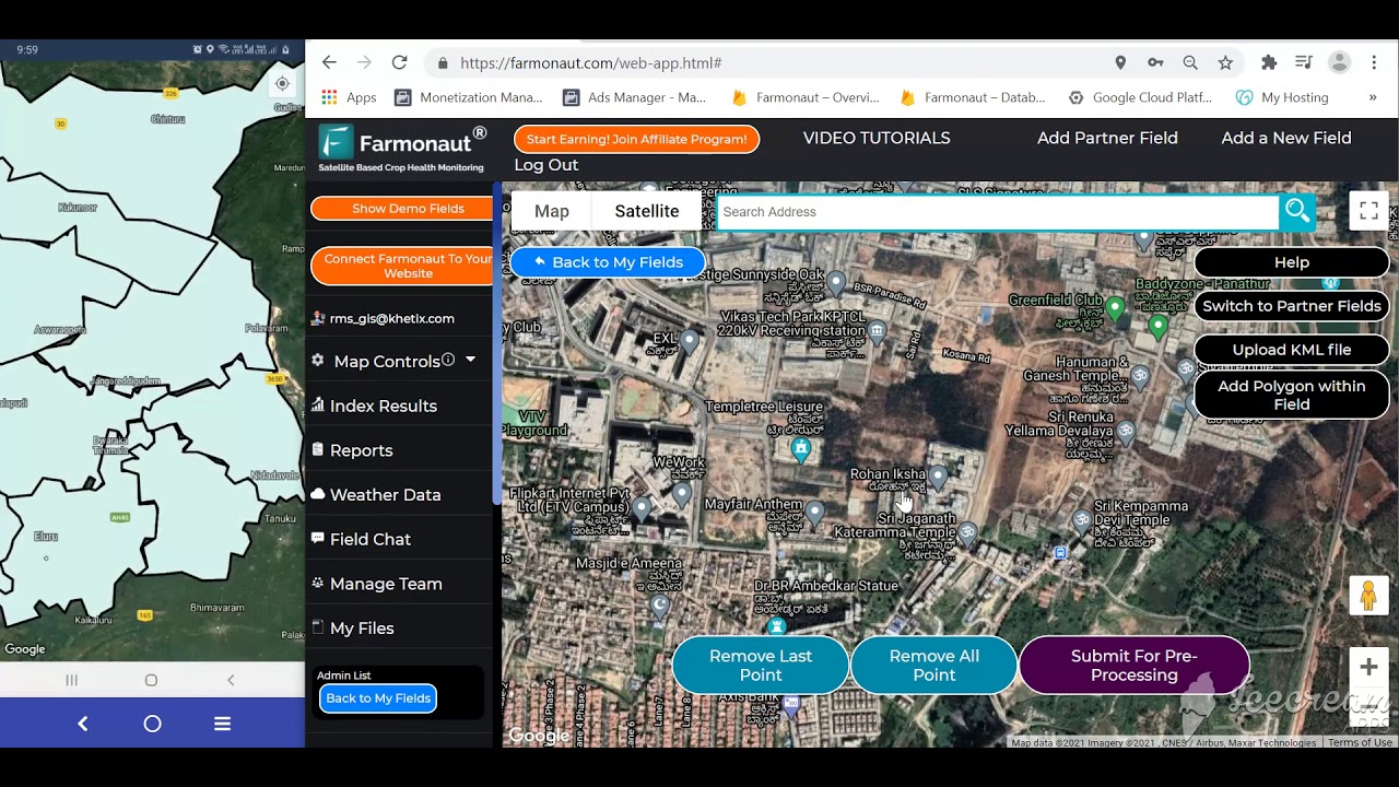
Access satellite-based insights & land monitoring on the Farmonaut Web App.
Principles of Land Leveling in Agriculture
- ✔ Uniform Water Distribution: Prevents ponding, reduces erosion and nutrient loss.
- ✔ Drainage Control: Promotes speedy runoff when needed, prevents waterlogging, assists leaching of salts (salinity control).
- ✔ Soil Health Optimization: Map out field microtopography—minimizing disturbance to protect beneficial soil carbon and organic matter.
- ✔ Compatibility with Modern Machinery: Supports precise depth control and field trafficability for planting, spraying, and harvesting.
Common Mistake
Overly aggressive land leveling can strip topsoil or expose subsoils, damaging soil health and reducing yields.
Top 7 Methods of Land Leveling in Agriculture for 2026
In field level agriculture, leveraging the right leveling method is dictated by field area, soil type, crop, local climate, available equipment, and economic context. Below, we explore 7 leading methods defining land leveling in agriculture for 2025–2026.
-
Laser-Guided Land Leveling
- Uses a rotating laser beam transmitter and receiver on earth-moving machinery (scraper, dozer).
- Achieves precise uniform plane (as close as ±2 cm) across entire field.
- Best for intensive crops: paddy rice, wheat, maize, sugarcane
- Reduces water use and input waste by minimizing micro-ponding and overwatering zones.
-
GPS / GNSS-Based Land Leveling
- Integrates GPS receivers and Geographic Information Systems for surveying and controlling scraper/dozer blades.
- Offers high-precision, repeatable topographic adjustment for large fields and commercial farms.
- Data-driven and easily integrated with precision agriculture systems.
-
Traditional Surveyor-Controlled Leveling
- Manual leveling using leveling staff, dumpy level, or transit, and field pegs for height adjustment.
- Lower upfront cost; ideal for small to medium plots/terraces or remote regions.
- Relies on operator skill, less precision than laser or GPS systems.
-
Bulldozer/Scraper Land Leveling
- Employs industrial machinery fitted with grading blades for large-scale earth movement.
- Best for initial field formation, reclamation, or heavy topographic modification.
- Can be combined with digital guidance for improved accuracy.
-
Contour Leveling (Graded Beds/Terracing)
- Reshapes sloped fields into long, level steps (terraces) following the land’s contour lines.
- Interception of surface runoff, minimized erosion in hilly/undulating terrain.
- Critical for agroforestry, reforestation, and rainfed lands.
-
Controlled Land Slope Design
- Creates gentle, strategic slopes (0.1–0.2%) to direct water flow in surface irrigation schemes.
- Requires careful surveying, design, and execution—especially in saline or poorly drained soils.
-
Graded Furrow & Raised Bed Leveling
- Forms parallel, level beds and furrows for row crops.
- Improves surface drainage and distribution uniformity.
- Great for vegetables, maize, cotton, pulses.
Pro Tip
For highest efficiency and data-driven results, consider integrating large-scale farm management with modern satellite monitoring systems.

Comparative Feature Table: Land Leveling Methods for 2026
| Method Name | Technology Used | Estimated Cost (USD/ha) | Precision Level | Water Savings (%) | Suitability (Soil/Field Type) |
|---|---|---|---|---|---|
| Laser Land Leveling | Laser transmitter & receiver, hydraulic controls | 300–700 | High (±2 cm) | 25–50% | Flat/undulating soils, high-value crops |
| GPS/GNSS Leveling | GPS receiver, GIS, Auto control | 400–900 | Very High (±1 cm) | 30–45% | Large, extensive fields (rice, sugarcane, maize) |
| Traditional Leveling | Dumpy level, pegs, staff | 100–250 | Medium (±3-6 cm) | 10–20% | Small/remote fields, terraces |
| Bulldozer/Scraper Leveling | Tractor, dozer, scraper blade | 200–600 | Medium-High (±3 cm with guidance) | 15–25% | Initial field formation, reclamation |
| Contour Leveling (Terracing) | Surveyor tools, manual/motorized earthmoving | 200–800 | High (terracing contour accuracy) | 30–40% | Sloped/hilly, agroforestry/reforestation |
| Controlled Slope Design | Surveying, grading tools | 200–350 | Medium-High (±2-4 cm) | 20–30% | Saline, heavy, or poorly drained lands |
| Graded Furrow/Raised Beds | Bed former, manual or guided implement | 100–300 | Medium (±3-5 cm) | 10–18% | Vegetables, row crops, nurseries |
Investor Note
By 2026, over 60% of large farms globally are projected to adopt GPS-guided land leveling technology, unlocking significant water and input cost savings while creating data-driven value chains.

Modern Technology & Digital Integration: Land Leveling Systems in 2026
Land leveling in agriculture is being transformed by the latest innovations—from AI-powered mapping, satellite-based terrain analysis to blockchain traceability. Digital systems recognize complex field elevation patterns and support controlled, precise earthwork.
- ✔ Laser & GNSS (GPS+GLONASS) units enable sub-centimeter precision grade mapping and automatic blade adjustment, shrinking error and waste.
- ✔ Satellite-based remote sensing offers elevation heat maps, moisture profiling, and seasonal change detection.
- ✔ Farmonaut’s Jeevn AI Advisory System provides real-time field analysis, grade optimization, and digital field records for compliance and planning.

- 📊 Data Insight: Satellite imagery detects low-spot ponding, erosion-prone slopes, and runoff patterns—improving field design before leveling begins.
- ⚠ Risk/Limitation: Digital systems require reliable internet and power infrastructure; less suited to extremely remote, off-grid farms unless paired with offline/manual backups.

Monitor, map, and optimize your fields with the Farmonaut Mobile App (Android).

Land Leveling, Soil Health, and Sustainable Practices
Soil forms the heart of field level agriculture. Successful land leveling must safeguard natural soil structure and organic matter, laying the foundation for resilient farming in 2025 and beyond.
- ✔ Preserve Topsoil: Avoid excessive cutting & filling; maintain fertile top layer for crop rooting.
- ✔ Salinity Control: Leveling supports efficient drainage and salt leaching—critical in areas with groundwater or irrigation-induced salinity.
- ✔ Erosion Mitigation: Contour leveling/terracing helps maintain slope stability, reduces gully formation, and protects against soil loss during heavy rainfall.
- ✔ Compatibility with Soil Type: Adapt leveling type and implements to soil hardness, moisture, and compaction concerns.
- ✔ Support Regenerative Practices: Combine with carbon footprint tracking and residue management to build long-term fertility and reduce soil carbon disturbance.
Key Insight
Land leveling, when combined with digital mapping technologies and site-specific soil management, empowers producers to optimize input use, conserve resources, and build sustainable systems fit for 2026 farming.
- 🌱 Soil Health – Maintain soil organic content, avoid compacted subsoil exposure.
- 🛠 Tool Adaptability – Match leveling method to soil compatibility and local climatic patterns.
- 🌾 Uniform Crop Stand – Enhanced germination, establishment, and field maturity through even topography.
- 🌍 Sustainability – Offset carbon disturbance, integrate cover cropping and mulching post-leveling.
- 👨🌾 Efficiency – Optimize field passes, minimize labor and machinery hours, reduce runoff loss.

Economic Considerations & Efficient Farm Management
Cost-Benefit Analysis of Land Leveling in Agriculture
Despite upfront equipment investment, land leveling in agriculture results in recurrent savings by reducing water, fertilizer, and energy requirements, enhancing yields, and prolonging equipment life via compatibility with modern mechanized systems.
- ✔ Water Savings: Up to 50% in laser-levelled rice compared to traditional layouts.
- ✔ Labor & Fuel Reduction: Fewer field passes, less redundancy, easier transitions for automated machinery.
- ✔ Pesticide/Fertilizer**
Reduction: Minimized runoff and leaching.
- ✔ Yield Stabilization: Uniform establishment and ripening, less field loss at harvest.
Integration Callout
Developers and agribusinesses can integrate live satellite-based data, irrigation, and carbon tracking via the Farmonaut API.
Get API Documentation for custom integration.
- ✔ Government Subsidies, Soil Health & Irrigation Programs: Incentivize adoption of precise land leveling and digital monitoring tools on large commercial operations.
- ✔ Smallholder Access: Service models for contract laser/GPS leveling and cooperative equipment sharing continue to expand in Cleveland agriculture and other technologically advancing regions.
Future Outlook: Land Leveling in Agriculture 2026 and Beyond
The next generation of land leveling in agriculture will be marked by system integration, smart analytics, and sustainability. The synergy of AI, remote sensing, and site-specific digital design will bring unprecedented efficiency to field management and resource optimization.
- 🔍 Smart Survey & Grade Planning: AI/ML models analyze multi-year elevation, soil, and water patterns for multi-crop and climate scenarios.
- 🌱 Resilient Land Restoration: Leveling underpins forest/advisory and reforestation by supporting seedling establishment and sustainable irrigation.
- ⛏ Mining Rehabilitation: Post-extraction reclamation projects use digital terrain models to prepare graded beds for ecosystem restoration.
- 🔗 Traceability: Blockchain-backed records of land treatment and field management improve supply chain transparency and ecosystem services valuation.
- 🌍 Climate Adaptation: Integration with conservation practices (mulching, cover crops, no-till) for adaptive water infiltration, erosion control, and carbon sequestration.
Efficiency Driver
Leverage large-scale farm management tools for automated mapping, historic yield tracking, and predictive advisory— essential for maximizing the impact of land leveling in agriculture in 2026.

Sustainability Callout
Track, analyze, and report on carbon impact of land preparation by integrating carbon footprint management tools—turn compliance into opportunity.
Farmonaut: Digital Innovation in Land Leveling & Field Management
At Farmonaut, we pioneer digital satellite technology for agriculture, mining, and infrastructure. Our satellite-based solutions and AI advisory systems enable users to visualize terrain, optimize land grading, and monitor impact—in real-time, anywhere in the world.
- ✔ Affordable, Scalable Insights: Subscription-based model brings high-tech field monitoring to every grower, farm business, or land manager.
- ✔ Real-Time Resource Tracking: NDVI, moisture, elevation, and more—customized for user needs.
- ✔ Blockchain-Traceability: Authenticate land rehabilitation and field operations for agriculture, mining, and restoration supply chains.
- ✔ Environmental Impact Monitoring: Carbon, water, and energy use tracking for regulatory/donor reporting and sustainability metrics.
- ✔ Fleet & Equipment Management: Manage and optimize equipment usage and logistics during earthworks and field operations.
Farmonaut services are accessible globally via web, Android, iOS app, or API—providing monitoring, traceability, and advisory capabilities for even the most remote rehabilitation plots or commercial fields.

Get the Farmonaut App for iOS and monitor your land’s progress from anywhere in the world.
Farmonaut Subscription Table
“By 2026, over 60% of large farms are projected to adopt GPS-guided land leveling technology.”
Smart Finance Callout
Access reliable land verification and monitoring to boost crop loan and insurance approvals, reducing risk and improving financial sustainability for modern agricultural operations.
Frequently Asked Questions: Land Leveling in Agriculture
-
Q1. What is land leveling in agriculture and why is it important?
Land leveling is the process of reshaping the surface of a field to a uniform plane or specific gradient, enabling even water distribution, optimizing irrigation, minimizing ponding, reducing runoff, and supporting efficient mechanized farming. -
Q2. Which method offers the best water savings and precision?
Laser land leveling and GPS/GNSS-based systems provide the highest water savings (up to 50%) and precision (as close as ±1-2 cm), especially for paddy rice, wheat, and sugarcane. -
Q3. Is digital land leveling suitable for small farms?
While initial costs can be a barrier, shared services, contract leveling, and affordable digital solutions (like Farmonaut’s app) are making high-precision leveling accessible on small and medium farms. -
Q4. Does leveling harm soil carbon or contribute to erosion?
If done without care, it can. Best practices include minimal disturbance, preservation of topsoil, and combining with cover cropping, mulching, and site-specific soil management to sustain soil health and carbon. -
Q5. How does Farmonaut help with land leveling in agriculture?
We provide advanced satellite monitoring, AI-based terrain analysis, and digital traceability—all supporting precision leveling, resource management, and compliance for every scale of operation.
- 💡 Field-level agriculture success hinges on choosing the right leveling system—whether laser, GNSS, or contour-based—suited to the crop, soil, and irrigation context.
- 💧 Irrigation efficiency, uniform yields and input savings are directly linked to land leveling accuracy in 2026 agriculture.
- 🌳 Reforestation, nurseries, and mining restoration all depend on precise field leveling for successful seedling beds and ecosystem stabilization.
- 📲 Digital satellite technology (Farmonaut) drives efficiency—providing insights for survey, planning, grading, and post-leveling management.
- ⚙️ Integrating monitoring, traceability, and soil health tracking ensures resilient, sustainable, and profitable field operations as climate patterns evolve.
Summary: Land Leveling in Agriculture 2026
Land leveling in agriculture, incorporating advanced laser and GPS technologies, establishes a uniform field grade—supporting efficient irrigation, higher yields, and improved soil health. The top 7 methods outlined here demonstrate how technology, from laser to satellite guidance and AI-driven analytics, is reshaping land management for 2025 and beyond. Paired with sustainable farming practices and digital platforms, field level agriculture delivers productivity, resource efficiency, and ecosystem stewardship for modern, resilient food and forestry systems.
Land leveling remains a cornerstone investment, bridging the gap between traditional best practices and the digital, sustainable future of agricultural production.

 Grow Indigo
 FFBS
FFBS Jontra
 Kalustyan
 Tucor
Tucor Geno
Geno Hayleys Agriculture
 Linx Agritech
 Adinet
 Save Your Soils
 Grandstream Algérie
 XOS Realty
 Geospatial Lab Africa
 Agro La Gándara
 HIPSAC
 ZOL Zimbabwe
 Juligerm
