

Harnessing Drone Technology for Agricultural Land Management in 2025: Comparative Trends in the UK & USA
“In 2025, over 60% of large UK farms are projected to deploy drones for land usage analysis.”
“USA agricultural drone sales are expected to surpass 120,000 units annually by 2025.”
Introduction to Agricultural Land Usage & Drone Usage in 2025
In the ever-evolving landscape of agricultural land usage, the year 2025 marks a turning point. Advanced drone usage in agriculture is fundamentally transforming how land is managed, developed, and sustained across USA and UK markets. From expansive wheat fields in the Midwest to the patchwork of hedged fields in rural England, drones equipped with multispectral cameras, NDVI sensors, and advanced imaging systems are enabling a new era of precision agriculture.
These technological innovations now permeate every aspect of agricultural land management—from due diligence when you buy agricultural land in the USA and undertake agricultural land sales, to optimizing irrigation, boosting yield, and ensuring sustainable stewardship for the future.
-
✔
Drone-driven data unlocks actionable insights for farmers, agronomists, and landowners, impacting investment, crop health, and environmental stewardship. -
📊
Drone usage in agriculture is forecasted to double efficiency in soil and crop monitoring by 2026. -
⚠
Ignoring drone adoption now may leave farms at a competitive disadvantage by 2027—asset value and yields directly benefit from this transition.

Drone Usage in Agriculture: Market Dynamics in the USA & UK
Both the USA and UK are at the forefront of integrating drone technology into their agricultural sectors. Vast differences in field size, topography, and farming systems shape regional innovation.
- The USA leads in large-scale adoption, particularly across the expansive midwestern corn belt and Western rangelands. Here, the sheer area—sometimes thousands of hectares per farm—demands scalable, high-fidelity aerial surveys.
- The UK is noted for early and dense adoption among progressive, mid-sized to large estate farms in England and Scotland. Drone data offsets the complexity of smaller, irregular parcels and diverse soil types.
In both jurisdictions, regulations in 2025 are stable and supportive. Operators benefit from clearer frameworks on aerial data collection, privacy, and landowner rights.

The estimated market value of drones in USA agriculture exceeds USD 1.5 billion in 2025, with the UK projected at over USD 250 million. These evolving markets are ripe for technology investment and innovation.
Technological Advancements: Key to Optimized Agricultural Land Usage
The core of today’s agricultural land management revolution is the potent combination of multispectral imaging, NDVI sensors, high-resolution cameras, and real-time data connectivity. Drones equipped with these tools give farmers and agronomists an unprecedented view of the health, boundaries, and resource distribution on their fields.
-
⚙️
Multispectral Cameras: Capture visible and invisible light, revealing crop stress and soil anomalies invisible at ground level. -
🌐
NDVI Sensors: Quantify plant vigor and chlorophyll productivity, key indicators for fertilizer application and yield forecasting. -
🔗
AI and Data Platforms: Process vast imagery and telemetry, enabling targeted interventions rather than blanket treatments.
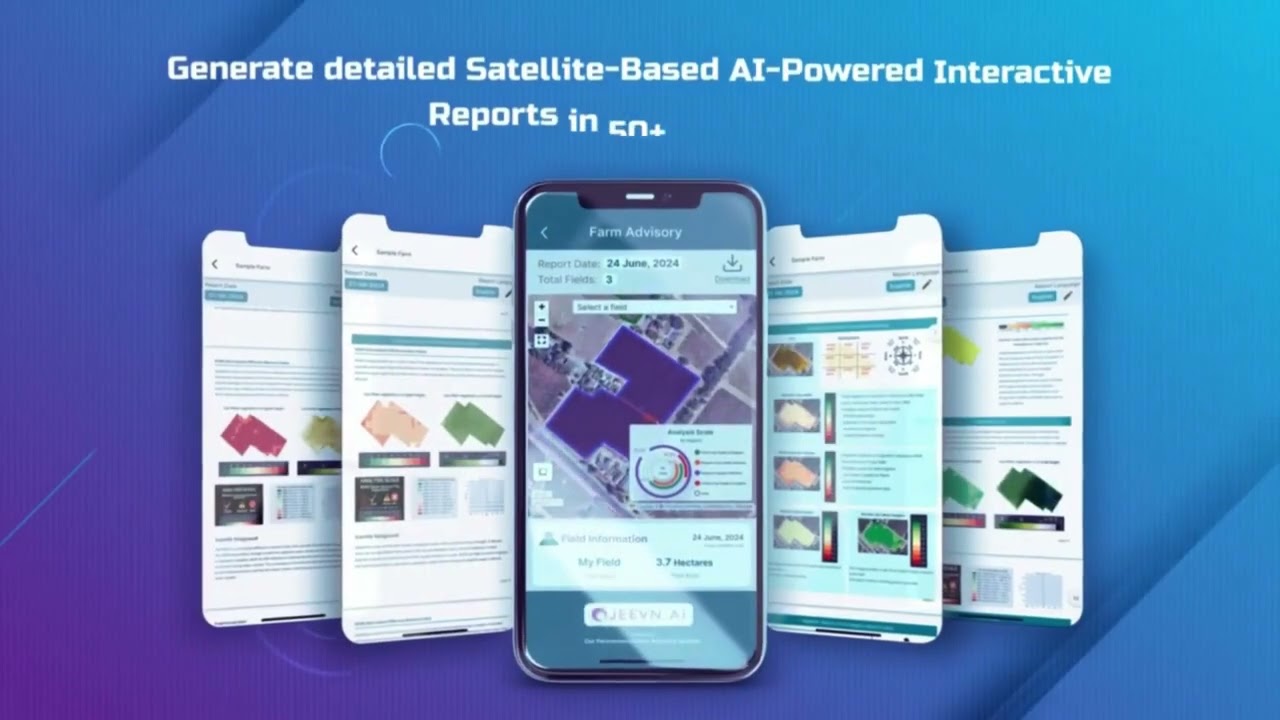
These drones and their data platforms bridge the gap between satellite imagery (which we, at Farmonaut, provide at global scale) and ground truth—offering both strategic and tactical decision support.

Land Assessment & Planning: How Drones Transform Due Diligence for Agricultural Land Usage
Robust land assessment marks the earliest phase of good agricultural land usage—whether for buying agricultural land in the USA, pursuing agricultural land sales in the UK, or developing new farmland parcels. Precision drone surveys deliver:
- Accurate topographic maps: Understand elevation, slope, and water drainage pivotal for irrigation plans.
- Boundary delineations: Verify zoning and ownership—particularly valuable for complex UK parcels or US mega-farms spanning multiple lots.
- Soil and crop suitability analysis: Map soil types and evaluate risk of erosion or waterlogging—core considerations for investment decisions.
Drone-augmented due diligence in 2025 accelerates land purchase, clarifies marketability for agricultural land sales, and underpins informed rotation and development plans.

Real-Time Crop Monitoring & Health Assessment: Optimizing Land Usage with Drones
Regular aerial flights by drones offer indispensable value for crop monitoring in 2025, surpassing ground inspections in speed, breadth, and accuracy across all major agricultural land usage models. Main applications include:
- Detecting nutrient deficiencies and water stress early, before visual symptoms develop.
- Identifying pest incursions or disease outbreaks promptly, enabling targeted interventions rather than blanket treatments.
- Correlating crop health patterns with soil moisture and fertility for optimized rotation and yield prediction.
Multispectral and thermal imaging reveal subtle plant physiological changes—reducing input costs, raising sustainability, and supporting compliance with evolving environmental regulations in both the USA and UK.
Many new drone users only scan fields once per season. Regular, scheduled monitoring throughout the crop cycle is essential for timely interventions and maximum yield gain.

Irrigation Efficiency and Water Management with Drone Technology
Water scarcity and rising costs make efficient irrigation a defining competitive edge. Drones excel by mapping moisture distribution, evapotranspiration patterns, and drainage across large or fragmented fields.
- 💧 Guide variable-rate irrigation systems—apply water only where needed.
- ✨ Pinpoint waterlogged or drought-prone zones within a parcels group, arranging rapid remedy.
- 🌱 Align fertilizer application with water availability, boosting yield and sustainability.
For UK arable systems and US irrigation districts, drone data ensures compliance with water regulations, while minimizing runoff and fertilizer leaching—an ever-growing environmental concern.

Yield Optimization and Harvest Planning through Drone Usage in Agriculture
Drone analytics deepen field-by-field insights for yield forecasting, harvest scheduling, and rotation plans:
- Canopy vigor data (from NDVI and multispectral cameras) helps project probable yield long before harvest, facilitating advanced sales contracts and market positioning in the USA and UK.
- Identifying fields requiring replanting or introduction of cover crops supports sustainable stewardship and complies with evolving agri-environmental schemes.
- Optimizing logistics for harvest—especially on large-scale US farmland—by mapping access routes, timing equipment, and labor deployment.
These capabilities are vital for farmers aiming to maximize value and minimize waste during volatile climate and market cycles.
Comparative Data Table: Agricultural Land Usage & Drone Adoption in USA and UK, 2025
Below, we compare agricultural land usage and drone adoption rates in the USA and UK, highlighting differences in scale, technology uptake, and market potential:
Data Insights:
- While the USA leads in acreage, the UK boasts a higher percentage (60%) of farms deploying drones.
- Market value for drone technology is surging with adoption across varying farm sizes and crop types.
By 2026, compliance with carbon and water-use reporting will become mandatory for all major UK and US farm operations. Drone-driven data helps automate this process—streamlining reporting and reducing penalty risks.
Drone Usage in Agriculture: Visual Overview of Benefits
- ✔ Precision Land Assessment
- ✔ Early Crop Stress Detection
- ✔ Water and Fertilizer Efficiency
- ✔ Sustainable Practices & Reduced Environmental Impact
- ✔ Data-Driven Decision-Making across Farm Operations
Potential Risks or Considerations
- ⚠ Privacy & Data Security: Mishandling of sensitive drone data could violate regulations or breach confidentiality.
- ⚠ Operator Skill Gaps: Insufficient training leads to poor survey quality and suboptimal recommendations.
- ⚠ Weather Disruption: Inclement weather in both UK and USA may limit drone flight opportunities during critical seasons.
- ⚠ Compliance Challenges: Regulatory changes can affect drone flight permissions and aerial data acquisition.
- ⚠ Upfront Costs: Despite rapidly falling prices, acquiring fleet and training still require capital outlays for small farms.
Agricultural Land Sales: Using Drone Data for Buying & Selling
The process to buy agricultural land in USA or execute agricultural land sales in the UK increasingly depends on objective, drone-derived data. Here’s how:
- Drone-collected soil maps, NDVI overlays, and yield histories strengthen negotiation and decrease acquisition risk.
- Infrastructure health—from irrigation to fencing—is visually documented, increasing buyer trust.
- Boundary accuracy reduces disputes and smooths planning applications for development or enterprise grants.
Landowners and estate agents offering verified drone data see faster sales, reduced due diligence timelines, and premium pricing for well-documented parcels.
Get Satellite-Driven Insights—Anytime, Anywhere



-
Farmonaut Large Scale Farm Management:
Manage multiple fields, rotations, and fleets with satellite-based crop health, soil, water, and yield reports—perfect for portfolios and estate administration. -
Farmonaut Carbon Footprinting Tool:
Track emissions and environmental impact—align your farm management plans with regulatory and funding requirements in the UK and USA. -
Blockchain Traceability in Agriculture:
Ensure transparent, tamper-proof tracking through your supply chain—from farm to market. -
Fleet & Resource Management:
Optimize equipment deployment, reduce overhead, and enhance operational safety with real-time vehicle and asset monitoring. -
Satellite-Verified Crop Loan & Insurance:
Streamline loan and insurance approvals for agricultural projects by providing reliable, historic land use and crop condition data.
Drone Data Management, Privacy & Compliance Considerations
With the explosion of drone-derived insights, data governance is paramount for modern farms. Key considerations for drone-driven agricultural land usage:
- Clear flight schedules and data ownership agreements are vital—preventing misunderstandings between landowners, service operators, and tenants.
- Cloud-based, standardized data storage platforms (see Farmonaut platform solutions) simplify cross-parcel aggregation for multi-site portfolios.
- Compliance with local regulations and GDPR (UK/EU) or CCPA (USA)—especially for cross-border data sharing in agricultural land sales negotiations.
- Long-term data archiving: Protect investment by regularly backing up and benchmarking historical drone and satellite records for trend analysis.
We, at Farmonaut, enable users to manage and safeguard their field and crop data through secure, role-based access controls, keeping you in command of your privacy and compliance obligations.
Training, Autonomous Solutions & Scalable Service Models in Drone Usage
Drone usage in agriculture is not one-size-fits-all. Progressive farms adopt either commercial drone service models or invest in autonomous fleets, depending on scale and operational complexity.
- UK family estates often begin with contracted flights for spring and post-harvest analysis, phasing into on-site ownership as staff upskill.
- USA mega-farms increasingly deploy autonomous and AI-linked drone platforms for routine, scheduled monitoring of multiple fields and parcels.
- Full-service providers offer bundled drone data processing, reporting, and regulatory support, making adoption seamless for busy farm operators.
- Training resources—from in-person workshops to cloud-based modules—help ensure compliance and maximize ROI on drone investment.
We, at Farmonaut, support scalable monitoring models—from a handful of hectares to nationwide farm holdings—by merging drone and satellite analytics under a single unified interface.
Farmonaut: Affordable Satellite & Drone Data Subscriptions
Our flexible, subscription-based model means farmers, agronomists, businesses, and governments access advanced field management without costly hardware or licensing.
🛠️ Key Steps to Scale Drone Usage in Agriculture:
- Audit land holdings for size, topography, and irrigation potential
- Define data goals—e.g., yield optimization, compliance tracking, sales preparation
- Initiate targeted pilot projects; prove return on investment (ROI) on a single field before expanding
- Establish data governance protocols for privacy and regulatory alignment
- Integrate platforms (like Farmonaut via secure API access) to centralize satellite and drone datasets
“USA agricultural drone sales are expected to surpass 120,000 units annually by 2025.”
Frequently Asked Questions (FAQs): Drone Usage & Land Management
Q1: What are the main benefits of drone usage in agriculture for UK and USA farms?
Drones: enable precise mapping, early detection of crop health issues, targeted application of water and fertilizer, reduced input costs, and enhanced record-keeping for compliance and marketing. Adoption accelerates return on investment, especially for large and diverse land holdings.
Q2: How does drone data help when buying agricultural land in the USA or UK?
By providing detailed imaging of soil quality, drainage, boundaries, and existing infrastructure, drones dramatically improve due diligence. This reduces purchase risk and supports higher sale values when marketing land.
Q3: Are drone services cost-effective for small farms in the UK or USA?
Yes. The growth of subscription platforms and contracted drone flights makes data-driven monitoring affordable for farms as small as 5–10 hectares. Regional service providers often offer bundled, season-specific packages.
Q4: How do farmers and businesses ensure drone data privacy and regulatory compliance?
Set clear agreements about data use and storage. Use secure, role-based platforms (like ours at Farmonaut) for field-level access control. Always comply with local aerial and data laws (GDPR in the UK/EU, CCPA in the USA).
Q5: What types of sensors are most valuable for agricultural drone surveys?
Multispectral and NDVI sensors are essential for crop vigor, soil analysis, and water distribution. Thermal imaging is particularly valuable for irrigation planning and identifying pest/disease onset.
Further Resources & Get Started with Advanced Land Monitoring Today
As drone technology reshapes the future of agricultural land usage and precision field management, now is the time to arm your farm or investment portfolio with the best available data.
- Want real-time, AI-based insights? Explore Farmonaut Large Scale Farm Management.
- Interested in environmental and regulatory compliance? Check out our Carbon Footprinting services.
- Require supply chain authentication? Harness blockchain traceability for your farm-to-market chain.
- For developers and agri-tech integrators: Get API access and documentation here and here.
- Compare subscription options and value: See our pricing table above for a plan that fits your field or farm size.
Conclusion: Drones and Sustainable Land Stewardship—2026 & Beyond
As we approach 2026, drone usage in agriculture will be the standard—not the exception—for efficient, resilient, and sustainable agricultural land usage in both USA and UK markets. Drones, combined with satellite-driven intelligence (such as those delivered by our team at Farmonaut), make land assessment, crop monitoring, irrigation, and yield optimization faster, more precise, and cost-effective than ever before.
Adopting this technology-first approach positions farms for regulatory certainty, market advantage, and environmental stewardship well into the future. Whether you are buying agricultural land, managing multi-site assets, or preparing for next season’s harvest, leveraging drone and satellite data promises enduring value—both for your land and our shared planet.
Ready to future-proof your land management? Start your agri-tech journey today—enhance your agricultural land usage with Farmonaut’s real-time satellite and drone-powered solutions.
If you invest in intelligent, data-backed farm management plans and embrace drone usage in agriculture today, your operation will lead the market in yield, compliance, and land value tomorrow!

 Misteo
 Tres Valles
 LACOS Geoinformation
 Pulsar Supernova
 Magrifly
 LatConnect 60
 WebsEdge
 Blickwinkel
 Agricultural Credit Policy Council
 MCSOD
MCSOD Marei Nursery
 eKGIS
eKGIS Mostas Tech
 Andex
Andex FCF India
 Unifrutti Gulf
 Deluxe Conseil
