

Lithium · Environmental guide
Lithium Mining Environmental Effects: Data by Mine Type
The effects differ by route: brine sites pump groundwater and can sink the ground, hard-rock and clay mines clear land and store waste. Mine-level figures from regulators and studies, plus two calculators.
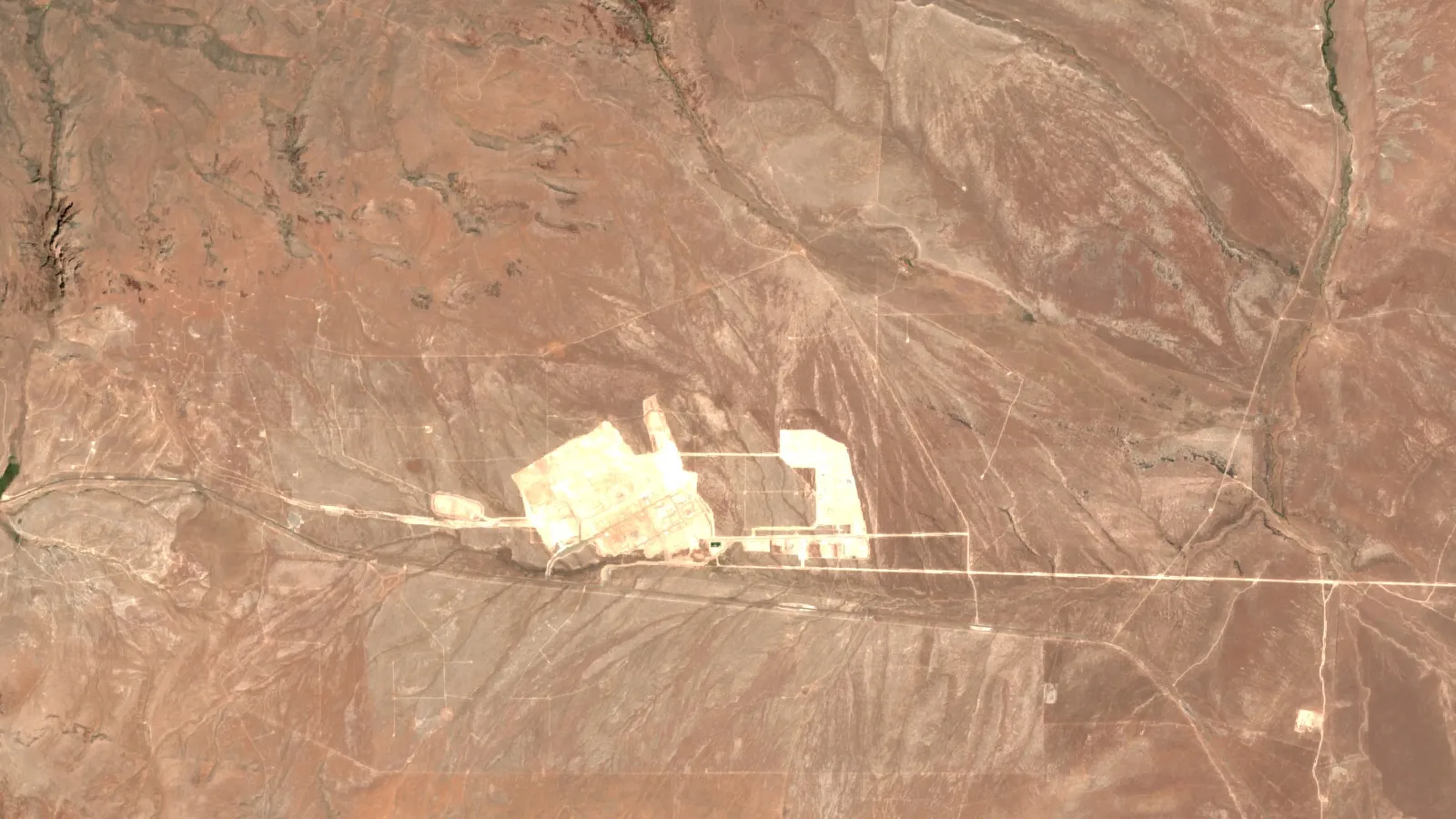
Key takeaways
- The Salar de Atacama was reported sinking 1 to 2 cm a year over a zone of about 8 by 5 km (lead author, SAOCOM-1 radar), and about 90% of the water in evaporation ponds is lost to the air (Reuters, 2024).
- Thacker Pass in Nevada plans about 5,695 acres of disturbance and 5,200 acre-feet of groundwater a year after year 4, about 9% of its basin’s perennial yield (US Department of Energy, 2023).
- A 2025 Greenbushes referral in Western Australia proposes 541 hectares of clearing in a 2,826 hectare envelope (EPA Western Australia, 2025).
- Flamingo counts fell 10 to 12% over 11 years at the Atacama but held steady on salt flats without mining; the operator disputes the link (Reuters, 2022).
- A 2026 model finds direct lithium extraction could avoid 20% to 50% of land conversion, but a 2025 field study found one DLE plant used more freshwater per tonne than a pond plant.
In this article
- Lithium mining environmental effects at a glance
- Water: pumping, evaporation and sinking ground
- Land: pits, dumps, ponds and tailings stacks
- Wildlife and wetlands
- Tailings, waste rock and chemicals
- Can direct lithium extraction reduce the effects?
- How satellites measure these effects
- What to check in an environmental assessment
- Frequently asked questions
Lithium mining environmental effects at a glance
The main environmental effects of lithium mining are groundwater drawdown and ground sinking at brine operations, vegetation and habitat clearing at hard-rock and clay mines, and waste stored as tailings or waste rock. Which one dominates depends on how the lithium is taken out of the ground. This guide sorts the evidence by extraction route and gives mine-level numbers from regulators and peer-reviewed studies, so you can check a project against them.
Demand is the reason these effects get attention. Batteries took 88% of world lithium use, and world mine production outside the US (whose output USGS withholds) was estimated at 290,000 tonnes of contained lithium in 2025, up from 222,000 tonnes in 2024; Australia, China and Chile led (USGS Mineral Commodity Summaries, 2026). For the wider costs and benefits, including jobs, carbon and prices, see our companion guide on the pros and cons of lithium mining. This page stays on the environmental side only.
| Extraction route | Typical effects to check | Evidence used below |
|---|---|---|
| Brine with evaporation ponds | Groundwater pumping, ground subsidence, pond area, lagoons and birds | Atacama salt flat studies reported by Reuters |
| Hard rock (spodumene) | Native vegetation clearing, waste rock leachate, habitat offsets | Greenbushes, Western Australia, regulator documents |
| Clay | Large pit, acid plant, clay tailings stack, groundwater demand | Thacker Pass, Nevada, federal environmental impact statement |
| Direct lithium extraction (DLE) | Smaller land footprint in models; freshwater use and brine reinjection need checking | Journal of Cleaner Production (2026) and Heliyon (2025) |
Lithium is a metal, so it is grade-limited: the ore holds a small share of lithium and the rest becomes waste or spent brine. That is why footprints are measured in hectares, acres and cubic metres per tonne, and why we use those units below. A tonne here means a metric tonne; one hectare is about 2.47 acres.
Water: pumping, evaporation and sinking ground
Brine projects pump salty groundwater to the surface and let the sun concentrate it in ponds. Reuters reports that in this evaporation process about 90% of the water is lost to the atmosphere, and that native communities around the Atacama salt flat worry about freshwater and brine being drawn down for people and wildlife (Kitco/Reuters, August 2024).
Ground subsidence at the Salar de Atacama
A University of Chile study used radar satellite data from 2020 to 2023 and found the Atacama salt flat sinking by 1 to 2 centimetres a year. The sinking zone is about 8 km north to south and 5 km east to west, in the southwest part of the salt flat where most pumping happens. The lead author said the brine is pumped faster than the aquifers recharge. He also said subsidence caused by irreversible changes in permeability can be a very serious problem (same Reuters report). The work sits in a 2024 IEEE Transactions on Geoscience and Remote Sensing paper by Delgado and colleagues that tests SAOCOM-1 radar data on volcanoes, earthquakes, glaciers and subsidence, Atacama being one of five examples. The 1 to 2 cm and 8 by 5 km figures come from the lead author’s comments to Reuters, not from the paper’s abstract.
The same report (August 2024) says Chile’s environmental authorities had charged the two producers, SQM and Albemarle, with possible irregularities in brine extraction. Charges are not findings, so treat that as a regulatory fact, not a verdict.
Freshwater is a separate question from brine
Brine is not the same as the freshwater that local people use. A 2025 Heliyon study of two Argentine salt-flat projects separated the two and found that the plant using direct lithium extraction used more freshwater per tonne than the pond plant. The authors also cite earlier work (Vera et al., 2023) saying that DLE technologies may need larger freshwater volumes than evaporation, which matters in arid regions (Díaz Paz et al., Heliyon, 2025). Our pros-and-cons guide shows the per-tonne figures; here the point is the method: ask for freshwater and brine as two separate numbers.
Hard rock and clay use less groundwater but still need a supply
Open-pit mines need water for crushing, dust control and processing. At Thacker Pass in Nevada, a clay project, the federal environmental impact statement puts demand at 2,600 acre-feet a year for the first four years and 5,200 acre-feet a year after that. That is about 9% of the estimated perennial yield of the Quinn River Valley groundwater basin, which is fully allocated, and the right would come from transferring existing farm water rights to mining use (US Department of Energy, adopted Final EIS, 2023). Pit dewatering was projected to reach only about 55 gallons per minute at its peak, in the far future of the mine plan. The calculators below let you run the same arithmetic on any project.
Calculator
How far does the ground sink over the years?
Enter a sinking rate, the number of years and the affected area.
- Total sinking: 0.15 m
- Volume of ground lowered: 6.0 million m3
Example values only. Defaults sit inside the 1 to 2 cm a year and about 8 by 5 km reported for the Salar de Atacama (University of Chile study via Reuters, 2024). The calculator assumes an even rate over the whole area, which real sinking zones do not have.
Land: pits, dumps, ponds and tailings stacks
Every route changes land, but the shape differs. A scenario study by The Nature Conservancy mapped operating hard-rock mines and evaporation facilities. It describes their current footprints as similar, at about 300 km2, and projects that together they add about 600 km2 by 2040 under business as usual (Kalies et al., Journal of Cleaner Production, 2026). Those are modelled totals, not measurements of one mine.
Chart
Greenbushes referral: clearing by component
Hectares, 541 ha in total
Chart
Thacker Pass: planned disturbance by component
Acres, selected components of the 5,695-acre total
Thacker Pass: how 5,695 acres break down
The Thacker Pass plan shows how a clay mine uses land. The project area is 17,933 acres, and the planned disturbance footprint is about 5,695 acres (roughly 2,300 hectares), including 300 acres of exploration. Of the named facilities, the clay tailings filter stack (1,166 acres) and the pit (1,100 acres) are the largest. Haul roads, stormwater ponds, fencing and other inter-facility disturbance add another 1,641 acres, the biggest single line in the table. The lined stack holds the spent clay and salts left after acid leaching. The statement also records about 28 acres of wetlands and 128,411 linear feet of stream channel in the survey area; the Army Corps of Engineers confirmed these do not meet the test for waters of the United States (same Department of Energy document). Partial pit backfill is assessed as an alternative, with no permanent pit lake expected under that option.
Greenbushes: clearing native forest for hard rock
Greenbushes, south of Perth, is a spodumene mine that has operated for more than 30 years. In a 2025 referral to Western Australia’s Environmental Protection Authority, the operator proposed to raise the development envelope from 2,207 to 2,826 hectares. The proposal needs additional clearing of 191 hectares, which brings the total to 541 hectares: 350 hectares of native vegetation approved earlier, 162 hectares more in State Forest 20, and 29 hectares of existing mine disturbance that has been rehabilitated (EPA Western Australia referral page, April 2025). These are proposed figures, not an approval. In May 2025 the EPA decided to assess the proposal as a Public Environmental Review with an 8-week public review, and its proposal page was last updated in December 2025.
For the earlier expansion, the EPA said in May 2019 that clearing 350 hectares of native vegetation was unavoidable for the proposal to proceed, and it recommended offsets for lost habitat of Carnaby’s and Baudin’s black cockatoos, the numbat and the western ringtail possum (EPA Western Australia media statement, May 2019).
If you want the geology behind these three routes before judging footprints, read our guide to pegmatite, brine and clay lithium deposits.
Wildlife and wetlands
Salt-flat lagoons are small, shallow and fed by scarce water, so small changes matter. A study in the Royal Society’s Proceedings B counted flamingos across Chilean salt flats and used satellite images of mining ponds as a proxy for water taken by mining. Reuters reports that at the Atacama the James’s and Andean flamingo counts fell by 10 to 12% over 11 years, while flamingo numbers stayed steady on salt flats without mining. The authors also say climate change is drying lakes across the region, so mining adds to a wider water squeeze (ScienceDaily, March 2022). SQM disagreed with key parts of the study and said its own monitoring shows stable flamingo populations (Reuters via Mining.com, May 2022).
The study is observational, so it shows a link and not a proven cause, and pond area is an indirect measure of water use. Both points are fair reasons to ask for ground monitoring next to satellite counts. The practical lesson for a reviewer is to ask where the baseline bird, wetland and vegetation surveys are, and how long they ran before pumping began.
Hard-rock mines bring a different habitat question: forest and woodland are cleared, and threatened species need offsets, as the Greenbushes decision shows. In both cases the effect is not only the area removed. Roads, pits and dams cut habitat into smaller pieces.
▶ The 7 environmental impacts of mining, explained in clay (2:31) · 2:31
Tailings, waste rock and chemicals
Every route leaves a waste stream. Hard-rock mines leave waste rock and tailings. Brine plants leave spent brine and salts. Clay projects leave acid-leached clay and sulfate salts. At Thacker Pass the plan includes a sulfuric acid plant, with an estimated capacity of 5,800 tons a day once both phases are built (2,900 in phase 1), regulated under a permit from the Nevada Division of Environmental Protection, and a permanent lined clay tailings filter stack (Department of Energy Final EIS).
At Greenbushes, the referral includes new water management infrastructure to stop discharge of water-borne leachates from waste rock on the eastern side (EPA Western Australia referral, above). Leachate is water that has run through waste and picked up dissolved salts and metals, so capturing it is a basic control.
Questions to ask about any waste facility: Is it lined? Where does seepage go? What is stored, and in what volume? What happens to it at closure? A tailings plan that cannot answer those four is not ready for approval.
Can direct lithium extraction reduce the effects?
DLE pulls lithium out of brine with sorbents or membranes and can return the brine underground. The Nature Conservancy study modelled three supply scenarios with the same lithium output. Moving to moderate or aggressive DLE adoption could avoid 141 to 381 km2 of land conversion (a 20% to 50% cut), and lower freshwater use by about 11% to 32% and CO2 emissions by about 9% to 44%. The authors add that real benefits depend on the DLE technology chosen, how well brine is reinjected, the energy source and how fast DLE scales (Kalies et al., 2026).
Chart
Modelled cut versus business as usual, by 2040
Percent reduction in each footprint
Developers in California’s Salton Sea area propose a closed-loop system that they say is cleaner and safer than hard-rock mines or evaporation ponds, though the project pipeline there is under pressure (CalMatters, September 2026). The right reading is cautious: the model shows a possible gain, and the Heliyon work shows a freshwater trade-off. Each project needs its own numbers.
How satellites measure these effects
Several effects above were found from space. The Atacama sinking was mapped with radar satellites, and the flamingo study measured pond area in satellite images. The US Geological Survey explains that radar interferometry (InSAR) can detect land-surface change as small as a few millimetres by comparing radar signals from the same point at different times (USGS Fact Sheet 069-03). Optical images such as Sentinel-2 show vegetation loss, pond area and bare ground each season.
Farmonaut’s satellite-based mineral detection takes a licence boundary (KML, KMZ or polygon) and returns satellite maps of the ground. A baseline image of the area before any disturbance does not replace field surveys or a legal assessment, but it dates the starting condition. If you want one for your own area, use the mining query form.
▶ Remote sensing for mining explained in 2 minutes · 2:01
What to check in an environmental assessment
Use this checklist when you read a lithium project’s environmental statement, an investor presentation or a community submission.
Calculator
What share of a basin does a project’s water use take?
Enter the project’s annual water demand and the basin’s sustainable yield.
- Net demand per year: 6,414,096 m3
- Average pumping rate: 3,223 gal/min
Example values only, not benchmarks. Defaults are the Thacker Pass figures from the Department of Energy Final EIS (5,200 acre-feet a year; Quinn River Valley perennial yield 60,000 acre-feet a year). One acre-foot is 1,233.48 cubic metres. Replace them with your project’s own.
- Water balance. Annual demand in cubic metres or acre-feet, the source, and the share of the basin’s sustainable yield. Brine and freshwater should be listed separately.
- Drawdown and subsidence. Modelled water-table fall, how far it reaches, and whether the project commits to satellite or ground subsidence monitoring.
- Disturbance by component. Pit, dumps, tailings, plant, roads and ponds in hectares or acres, with a total that adds up.
- Habitat and wetlands. Baseline surveys, listed species, offsets and how long surveys ran.
- Waste and chemicals. Liner design, seepage capture, acid or reagent storage, and who holds the permit.
- Closure. Backfill options, final landform, and how the closure cost is secured.
- Monitoring and data. Whether results are public and independently reviewed.
The two calculators on this page cover items 1 and 2. They use simple arithmetic and the inputs you enter, so they are only as good as your project’s own numbers.
If this topic matters to you, read Causes and Effects of Mining: Key Impacts With Data next.
Related reading on this site: Water Usage in Lithium Extraction per Ton: Real Data.
Frequently asked questions
What are the main environmental effects of lithium mining?
The main effects are groundwater drawdown and ground subsidence at brine sites, habitat and native vegetation clearing at hard-rock and clay mines, and waste storage in tailings, waste rock or spent brine. At the Atacama, a University of Chile study found 1 to 2 cm of sinking per year (Kitco/Reuters, 2024); at Greenbushes, a 2025 referral proposed 541 hectares of clearing.
Is lithium mining bad for the environment?
It has real local costs: water, land, habitat and waste. The size of those costs differs by extraction route and by site, which is why mine-level documents matter more than general claims. Mitigation such as reinjection, backfill, lined waste stacks and offsets can reduce some effects, but the evidence for each is project specific.
How does lithium brine extraction affect water?
Brine is pumped from salt-flat aquifers and concentrated in ponds, where about 90% of the water evaporates (Reuters, 2024). Heavy pumping can outpace recharge and cause subsidence, and freshwater use is a separate figure from brine volume.
Does lithium mining cause the ground to sink?
At the Salar de Atacama, satellite radar measured sinking of 1 to 2 cm a year over a zone of roughly 8 by 5 km, according to the lead author, who linked it to brine pumping. Not every site is measured this way, so ask whether subsidence monitoring is part of the permit.
How much land does a lithium mine use?
It varies widely. The Thacker Pass plan disturbs about 5,695 acres (roughly 2,300 hectares), while the Greenbushes referral covers a 2,826 hectare envelope with 541 hectares of clearing. Compare components, not only totals.
Does lithium mining harm wildlife?
A 2022 study linked mining water use to a 10 to 12% fall over 11 years in two flamingo species at the Atacama, alongside climate-driven drying, though the operator disputes the link and the study is observational. At Greenbushes, regulators required offsets for threatened black cockatoos and other species.
Is direct lithium extraction better for the environment?
A 2026 model found DLE could cut land conversion by 20% to 50% and freshwater use by 11% to 32% compared with business as usual. A 2025 field study found one DLE plant used more freshwater per tonne than a pond plant. Both can be true, so check the site’s own data.
What waste does lithium mining produce?
Waste rock and tailings at hard-rock mines, spent brine and salts at brine plants, and acid-leached clay and sulfate salts at clay projects. Thacker Pass plans a lined clay tailings filter stack for this purpose.
Can satellites monitor lithium mine impacts?
Yes, for several of them. Radar InSAR measures land movement down to millimetres, and optical images track vegetation, ponds and bare ground (USGS). Satellites show surface change; they do not show chemistry or species counts, which need field sampling.
Where can I read the official environmental documents for a project?
Look for the government environmental impact statement or referral. In the US these are on the federal agency’s project page (for example BLM and the Department of Energy for Thacker Pass); in Western Australia they are on the EPA website. Company filings and mine plans give the engineering detail.
This page is for information only. It is not legal advice or investment advice. Confirm project figures against the regulator’s documents.
Farmonaut mining
Map your licence area from space
Request a quote for satellite maps of a licence area before fieldwork begins.
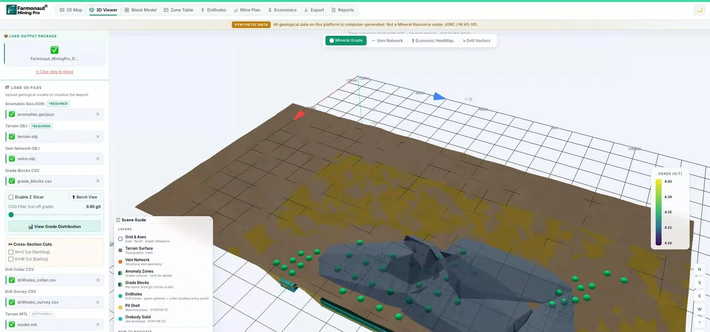
Mining Pro sample view, synthetic data
Keep reading
Sources
- USGS, Mineral Commodity Summaries 2026, Lithium: pubs.usgs.gov
- Reuters via Kitco, Lithium mining is slowly sinking Chile’s Atacama salt flat (2024): kitco.com
- Reuters via Mining.com, In Chile’s Atacama, lithium mining stirs fight over flamingos (2022): mining.com
- Kalies et al., Journal of Cleaner Production (2026), land, water and emissions footprints through 2040: conservationgateway.org
- US Department of Energy, Thacker Pass Final EIS (DOE/EIS-0561, 2023): energy.gov
- EPA Western Australia, Greenbushes Lithium Mine referral (2025): consultation.epa.wa.gov.au
- EPA Western Australia, Expansion of Greenbushes Lithium Mine recommended for environmental approval (May 2019): epa.wa.gov.au
- USGS Fact Sheet 069-03, Measuring human-induced land subsidence from space: pubs.usgs.gov
- Díaz Paz et al., Heliyon (2025), water footprint of lithium extraction in Argentina: pmc.ncbi.nlm.nih.gov
- CalMatters, Is California’s lithium valley dream fading? (September 2026): calmatters.org
- ScienceDaily, flamingo abundance and lithium mining (2022): sciencedaily.com
- EPA Western Australia, Greenbushes waste rock landforms proposal page: epa.wa.gov.au
Discussion
Questions, corrections or field experience? Share them below. First-time comments are reviewed before they appear, and your email is never published.
No comments yet. Be the first to add a question or your experience.

 Omsri International FZE
 G.I.T.T.
 Jaunita Erss Ltd
 Almosi SARL
 SRK Consulting
 Berks Gold Limited
 Mwerezi Minerals Company Limited
 Mining SARL
 SenGold Invest SAS
 Sean Mining Limited
 NTS Group (Pty) Ltd
 Mine4Africa
 Lithspo Minerals Limited
 Tintina Mining Group
 Dalgety Minerals Pty Ltd

 Licence holder · Nigeria · Gold + lithium










