

“In 2023, over 40% of Ireland’s large farms adopted drone technologies for export-oriented crop management.”
“Irish agricultural drone usage increased by 60% between 2021 and 2023, revolutionizing export data collection.”
Drone Technologies Boosting Ireland’s Agriculture Exports: A 2025 Snapshot
Ireland’s agriculture is globally renowned for its premium dairy, beef, crops, and horticulture. As we look forward to 2026 and beyond, drone technologies are playing a transformational role in driving export growth, enabling precision crop monitoring, sustainable practices, and advanced data management that align with the EU Green Deal objectives and the broader movement toward sustainability in Europe. This blog is your comprehensive 2025 snapshot of how drone technologies are boosting Ireland’s agricultural exports, what it means for farmers, and why it matters for global markets.
Table of Contents
- 1. Ireland’s Agriculture Exports: The Future Overview
- 2. The Drone Evolution in Ireland’s Farming Sector
- 3. Precision Crop Monitoring: At the Forefront of Innovation
- 4. Livestock Management and Animal Welfare
- 5. Forestry Oversight, Land Use, and Plantation Health
- 6. Export Quality Assurance and Traceability
- 7. Sustainability, Organic Farming, and the Green Deal
- 8. Policy, Infrastructure, and Support Ecosystem
- 9. Poland’s Agriculture & China Agricultural Exports: A Global Comparison
- 10. Future Outlook: 2026 and Beyond
- 11. Impact Table: Drone Technologies & Export Metrics
- 12. Mid-Article Trivia
- 13. Key Insights, Pro Tips, and More
- 14. Visual Lists & Bullet Points
- 15. FAQ: Drone Technologies in Ireland’s Agricultural Exports
Ireland’s Agriculture Exports: The Future Overview
Ireland‘s agricultural export sector continues to punch far above its weight, highlighting world-class standards in dairy, beef, horticulture, and crops. Drone technologies boosting Ireland’s agricultural exports are now the cornerstone of this evolution. In 2025 and beyond, Irish agriculture is not just keeping pace but leading the charge in technology adoption, sustainability, and global market competitiveness.
Consumers today, from Berlin to Beijing, demand traceable, premium, and eco-friendly agricultural products. The European Union’s ambitions for carbon-neutral food production—echoed by buyers and regulators worldwide—place a spotlight on drone-enabled monitoring, rapid in-field diagnostics, and efficient input use as levers of both compliance and competitiveness.
The metamorphosis is well underway, as seen in rapid increases in drone adoption rates, the proliferation of data-driven farm management tools, and the integration of **satellite-based and drone-based systems** for precise resource deployment, yield monitoring, and export documentation.
The Drone Evolution in Ireland’s Farming Sector
Drone technologies boosting Ireland’s agricultural exports began as pilots and research projects a decade ago. By 2023, over 40% of large farms in Ireland had integrated drones for export-oriented crop management. As we enter 2026, the sector’s digital revolution shows no signs of slowing. Major technology pillars include:
- ✔ Precision Crop Monitoring using multispectral & RGB drones
- ✔ Variable Rate Application (fertilizer, pesticide, irrigation) driven by drone and satellite data
- ✔ Livestock Management with thermal and visual imaging
- ✔ Forestry Oversight (canopy survey, pest risk management, plantation assessment)
- ✔ Advanced Export Documentation and **Certifiable Traceability** aligned with international standards
As Ireland’s agricultural sector matures technologically, integration of innovations like AI, machine learning, and blockchain into drone workflows ensures precise management—reducing waste, increasing yield quality, and opening new markets.

Precision Crop Monitoring: At the Forefront of Innovation
One of the most transformative aspects of ireland drone farming is precision crop monitoring. Drones equipped with multispectral and RGB sensors provide rapid, high-resolution imagery—delivering insights unattainable with the naked eye or traditional scouting.
Drone technologies detect nuanced changes in:
- 🌱 Nutrient deficiencies, such as latent nitrogen or potassium shortfalls
- 💧 Water stress and optimizable irrigation schedules
- 🦠 Pest pressures and disease outbreaks—enabling early intervention long before symptoms become visible
- 🍂 Canopy gaps, density, and uniformity
Combining drone data with satellite, IoT soil sensor, and ground-truth measurements creates a comprehensive view for Irish farmers to create precise spray maps and variable-rate fertilizer prescriptions. This minimizes input costs, limits environmental runoff, and maximizes yield quality—all vital for sustainable exports and compliance with EU and international standards.

Drones using multispectral imaging can spot early-stage disease and nutrient deficiencies across thousands of acres within hours—enabling Irish farmers to save on inputs and protect the premium quality demanded by export buyers. The use of satellite-based advisory tools extends this capability for even broader, field-to-field comparison across regions.
Learn more about carbon footprinting for agriculture and how Farmonaut enables climate-smart productivity monitoring.

How Drones Integrate with Satellite AgTech in Ireland
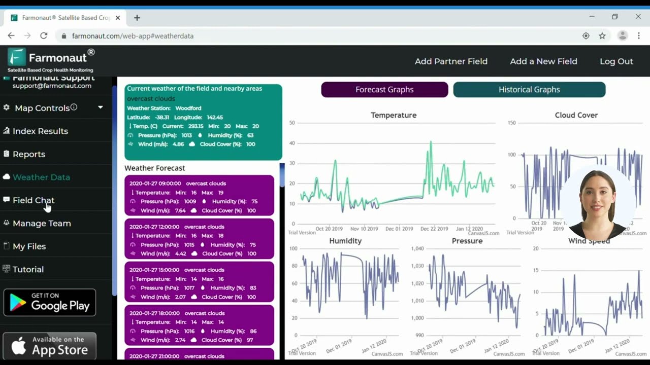
While drones deliver ultra-local, high-frequency data, satellites enable wide-area seasonal trend analysis. Management platforms like Farmonaut (available on web, Android, and iOS), bring these datasets together, empowering farmers with actionable information on everything from crop health to resource optimization.
For developers building their own integrations, Farmonaut’s API and API developer docs offer direct access to aggregate crop data, health indices, and weather overlays.



To maximize ROI on drone investment, synchronize drone-generated crop health maps with daily/weekly satellite-based field health overviews for a complete growing season perspective. This can dramatically improve spray timing and reduce overlap in fertilizer applications.
Benefits for Exporters
- 📦 Improved yield consistency and crop quality, supporting Ireland’s premium export reputation
- 🔗 Certifiable data for export compliance and market access
- 🌍 Access to eco-conscious global buyers seeking sustainable and traceable sources
Livestock Management and Animal Welfare: Drones in Every Pasture
Ireland’s grass-fed livestock production underpins its exports of premium beef and dairy. Drone technologies boosting Ireland’s agricultural exports give Irish farmers new capabilities in the management of grazing systems, wellbeing monitoring, and asset surveying.
- 🗺 Aerial surveys reveal pasture health, gaps, and water source integrity
- 🤖 Thermal imaging identifies heat stress events in dairy herds and lambs—enabling immediate welfare interventions
- 🪁 Tracking flights count livestock, monitor movements, and integrate with grazing rotation plans
- 🚜 Fencing integrity and asset mapping reduces losses and strengthens biosecurity
When paired with Irish data standards and EU regulatory requirements, these practices both optimize animal welfare and maximize productive output—ensuring every litre of milk or kilogram of beef meets the “premium Irish quality” badge expected in target export markets.

Whereas old systems required costly and time-consuming in-person pasture scouting, drone deployment means issues are detected early, supporting continuous compliance with animal welfare standards—essential for export certification.
Focusing only on field crops for drone monitoring. For true export efficiency and traceability, extend drone usage to livestock asset management and pasture oversight—areas with major compliance and welfare advantages.

Livestock Drone Applications—What It Means for Exports
- 💲 **Reduced losses** from early stress/disease detection
- 🔒 Stronger traceability for international exporters
- 🌱 Optimized rotational grazing strategies for pasture longevity and output
For Irish producers, this spells higher efficiency, lower risk, and better sustainability credentials in global markets.
Forestry Oversight, Land Use, and Plantation Health: Drones Beyond the Field
Forestry represents a rising star in Ireland’s agricultural exports—from sustainable timber to carbon sequestration projects. Drone aerial surveys are an essential tool for timber growers, plantation managers, and certification auditors in 2025 and beyond.
- 🌲 Canopy density and gap analysis—ensuring resource efficiency in timber operations
- 🐞 Bark beetle and pest risk mapping
- 📅 Harvest planning and compliance checks
- 🌳 Carbon market support for national and EU climate objectives
Regular drone surveys in forestry plantations minimize disease spread, detect outbreaks, and verify sustainable harvest practices through certifiable aerial evidence—a must-have for premium certified timber and biomass exported to global buyers.
Combined with satellite monitoring platforms (like Farmonaut’s plantation/forest advisory tools), the system enables end-to-end resource management—a game changer in proof-of-origin, carbon credits, and traceable timber exports.
The synergy between drone-based plantation health monitoring and satellite carbon accounting is unlocking new value in Ireland’s forestry sector—paving the way for expanded carbon market participation and premium timber exports aligned with global sustainability standards.
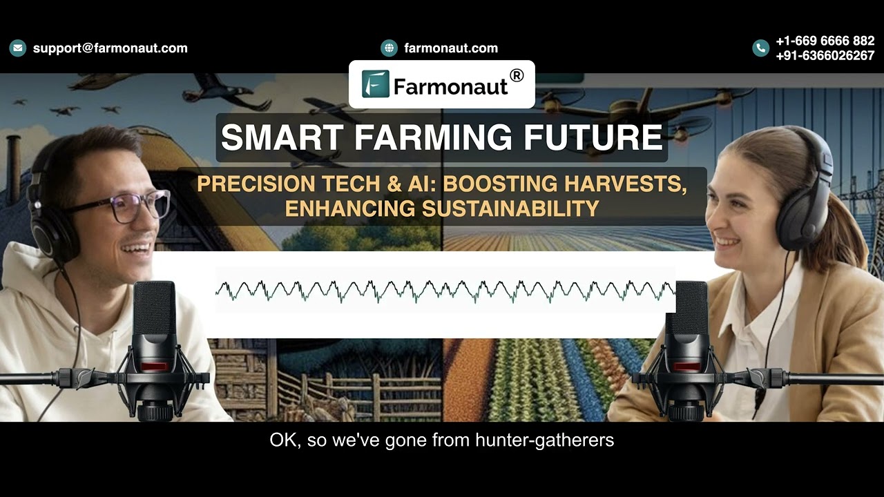
Explore large scale farm management solutions for seamless drone/satellite data integration—ideal for agribusinesses overseeing extensive Irish crop, livestock, or forestry operations.
Export Quality Assurance & Traceability: Drone Data for Compliance and Premium Markets
Irish agricultural exporters face rigorous traceability, compliance, and sustainability standards—whether shipping dairy, beef, grains, or specialty crops. Drone technologies boosting Ireland’s agricultural exports now provide granular, certifiable records for:
- 📝 Pesticide/fertilizer application timing and volume
- 📅 Harvest conditions and logistics tracking
- 🎯 Post-harvest bulk shipment inspection
Drone-enabled documentation streamlines compliance with EU, UK, Chinese, and global import requirements—unlocking premium markets and reducing barriers. Blockchain-integrated traceability platforms, such as those available via Farmonaut’s traceability suite, further ensure every input, process, and shipment can be verified—building unbreakable trust with buyers and regulators worldwide.
Benefits of Drone-Assisted Export Documentation
- 🔒 Certifiable logs meet or exceed export/import compliance standards
- 🚢 Higher market access for high-value horticultural and specialty crops
- 📈 Lower risk of rejected shipments due to inconsistent or unverifiable quality
Sustainability, Organic Farming, and the Green Deal: Reputation as a Global Export Leader
Ireland’s reputation for organic and grass-fed products is a powerful narrative in global markets. With drone and satellite-advised targeted spray applications, Irish farmers increase efficiency and yield while minimizing impacts on non-target fields/crops/pastures. This supports not only premium prices, but also vital international certification and organic standards.
- 🌿 Spot spraying reduces unnecessary input use—lowering chemical residue for organics
- ♻️ Traceable, low-carbon production aligned with the EU Green Deal’s sustainability goals (see Farmonaut’s carbon impact module)
- 💚 Precision bloom monitoring and disease management support long-term productivity
These sustainable, technology-driven practices will keep Irish exports at the top tier of global food and agricultural markets for years to come.
Farmers and cooperatives can now access advanced insurance verification and fleet management tools leveraging drone, satellite, and AI insights—making farm investments and operations more secure and efficient than ever.
Policy, Infrastructure, and the Support Ecosystem: Building the Backbone for 2026+
The adoption of drone technologies boosting Ireland’s agricultural exports is strongly supported by national investment in:
- ⚡ Rural broadband and data infrastructure for rapid drone upload/download & decision support systems integration
- 🛡 Safety regulations, airspace management, and data standards for wide adoption at the farm and regional levels
- 👩🎓 Training programs, extension services, and co-op technical assistance—democratizing access for small and mid-size producers
Irish agricultural authorities work to facilitate seamless integration of drone data with farm ERP and management platforms. National drone standards, aerial documentation guidelines, and digital recordkeeping position Ireland as an exemplar in Europe for safe and transparent drone agriculture practices.
Poland’s Agriculture & China Agricultural Exports: A Global Comparison
While Ireland drone farming leads in certain tech and export-adaptation metrics, global comparisons are instructive—especially with Poland’s agricultural sector and China’s expansive farming landscape.
- Poland’s agriculture: Rapid modernization, mirroring Ireland’s precision farming but focused on grains, potatoes, and oilseeds. Drones are used for crop scouting, pesticide applications, and yield prediction—applicable lessons for compliance regimes and export traceability.
- China agricultural exports: Huge scale, with advanced drone integration for rice, wheat, fruits. “Field-to-port” traceability and certification for export, often leveraging massive, connected logistics networks. Ireland’s approach—targeted, high-value integration—emulates best practices suitable for smaller, premium-driven systems.
Both countries illustrate the universal value of drone-enabled precision agriculture for boosting exports by improving quality and compliance.
Did You Know?
“In 2023, over 40% of Ireland’s large farms adopted drone technologies for export-oriented crop management.”
Future Outlook: 2026 and Beyond
In 2026 and the following years, drone technologies boosting Ireland’s agricultural exports will be both the norm and the driver of continued evolution. We expect:
- Even tighter integration of drone, satellite, and IoT data across all farm and regional management systems
- Expansion of traceability requirements for all major export commodities from Ireland
- Automated compliance documentation using real-time aerial and environmental data, including carbon footprint and resource management proof
- Broader adoption among smallholders & organic-certified farmers seeking premium export markets
Snapshot Forecast for 2026-2030
- ✔ Nearly 70% of large Irish farms predicted to use drone-satellite integrated management platforms
- ✔ Strong “tech-for-sustainability” narrative boosting Ireland’s reputation in premium agriculture exports
- ✔ New value streams—from carbon credits to blockchain-verified timber—directly tied to drone-collected field data
Impact of Drone Technologies on Ireland’s Agricultural Export Metrics
| Drone Technology Type | Estimated Yield Increase (%) | Estimated Reduction in Chemical Usage (%) | Estimated Export Growth (%) | Sustainability Rating (1-5) |
|---|---|---|---|---|
| Precision Crop Monitoring | Up to 20% | 15-25% | 10-15% | 5 |
| Aerial Imaging & Asset Surveys | 10-15% | 8-15% | 6-10% | 4 |
| Variable Rate Application (Fertilizer/Spray) | 12-18% | 20-30% | 12-18% | 5 |
| Thermal Imaging (Livestock) | 5-8% | N/A | 5-7% | 4 |
| Forestry Canopy & Disease Surveys | 8-12% | N/A | 10-14% | 5 |
| Data Analytics for Export Documentation | N/A | 10-15% | 15-20% | 5 |
*Estimated metrics based on aggregated industry, research, and EU/Irish government sources. Figures extrapolated for 2025–2028 projections.
Drone-recorded application maps help Irish farmers comply effortlessly with cross-border export & organic certification requirements.
Exporters get higher shelf-life and reduced spoilage on fresh/horticultural shipments tracked by drone inspections at packing.
Drone technologies are driving new revenue streams beyond traditional commodities—think carbon credits and provenance-verified products with transparent blockchain records.
Ignoring drone-generated data analytics can slow exporter response to market shifts, diminishing Ireland’s competitive agility.
Drone and satellite-driven fleet management systems (see example) enable Irish exporters to unify logistics, lower cost, and sharpen their export edge.
Key Bullet Points & Visual Lists: Drone Technology in Ireland’s Export Success
- ✔ Drone-enabled precision increases Irish crop yield quality and export value
- 📊 Data-driven management reduces input waste and improves compliance with EU sustainability mandates
- ⚠ Risk of market exclusion if traceability and documentation are neglected
- 🔗 Blockchain integration secures provenance for beef, dairy, and forestry products
- 🛠 Robust infrastructure & policy are key for large-scale, safe drone deployment
Top 5 Ways Drones Boost Irish Agricultural Exports
- 1️⃣ Spot disease and stress before visible symptoms, ensuring premium quality exports
- 2️⃣ Enable variable-rate spray and nutrient applications, minimizing chemicals used
- 3️⃣ Facilitate real-time import/export compliance documentation for every field or lot
- 4️⃣ Track livestock for welfare, health, and tracing from pasture to plate
- 5️⃣ Strengthen forestry oversight for timber, carbon, and environmental accountability
Drone-Enabled Export Market Access: Key Factors
- 📦 Certifiable traceability is now a must for global buyers
- 📈 Yield gains and input cost savings translate directly into improved national export competitiveness
- 🤝 Sustainability certifications attract premium markets—from organic to fair trade to zero-deforestation
- 🕒 Real-time crop health intervention means fewer rejected shipments and lower spoilage losses
- 🌍 Global compliance, local advantage: Ireland’s standards lead the way
Get Started with Advanced Satellite Monitoring
Frequently Asked Questions: Drone Technologies and Ireland’s Agricultural Exports
What are the main benefits of drone technologies boosting Ireland’s agricultural exports?
Drones enable rapid, high-precision crop and livestock monitoring, early detection of disease and nutrient stress, and streamline export documentation. This results in improved yield and quality, reduced input costs, enhanced traceability, and easier compliance with international standards—key factors for accessing premium global markets.
How do drones help with export certification and compliance?
Drones record timing, location, and application rates for all major field inputs (pesticides, fertilizers), as well as monitor harvest and post-harvest processes. These certifiable data records ease compliance with EU and international regulations for food safety and traceability, minimizing risk of shipment rejection.
Are drone and satellite technologies only helpful for large farms?
No. Today’s platforms, including Farmonaut, offer scalable API, app, and subscription models for both large agribusinesses and small or medium-sized Irish farms, making technology accessible and affordable for all.
What crops and sectors benefit the most from drone adoption in Ireland?
Dairy, beef, cereals, horticulture, pastures, and forestry all gain from drone-driven yield improvements, input savings, sustainable market access, and traceable export documentation practices.
Is Ireland leading in drone technology adoption compared to Poland and China?
Ireland is a global leader in aligning drone technologies with premium export and sustainability goals, setting an example for reliable traceability. While Poland’s agriculture is modernizing quickly and China’s agricultural exports use scale, Ireland offers a targeted, high-quality model.

 Clubhouse OS
 John Deere
 Progenseed
 SkyHarvest
 Polaris Digitech
 Teledarbas
 Wild Oak Farm
 SFX
SFX BACF Africa
 Doodlakine
 Exurbia Geospatial
 FieldZero
 Indico Company
 Kubota
