

Gold exploration targeting · Abitibi
Abitibi Greenstone Belt: Faults, Gold Camps and Targets
The Abitibi greenstone belt is a band of Archean volcanic and sedimentary rock about 800 km long that straddles the Ontario-Quebec border; most of its roughly 200 million ounces of gold sit near two crustal faults, the Porcupine-Destor and Cadillac-Larder Lake breaks, and their smaller splays.
Key takeaways
- The Abitibi greenstone belt runs roughly 800 km east-west and 400 km north-south across northeastern Ontario and northwestern Quebec.
- Published estimates put more than 112 Moz of gold along the Cadillac-Larder Lake zone and more than 89 Moz along the Destor-Porcupine zone.
- Most deposits sit on second-order splays, bends and rock contacts within a few kilometres of the main breaks, not on the breaks themselves.
- Glacial lake clay and till hide much of the bedrock, so satellite and magnetic data narrow the search and till sampling and drilling test it.
- Remote results are exploration targets, not resources; public disclosure on a material property needs a Qualified Person under NI 43-101.
In this article
- What the Abitibi greenstone belt is, and where it runs
- Porcupine-Destor and Cadillac-Larder Lake: the two breaks that carry the gold
- Orogenic gold structural targeting in the Abitibi greenstone belt
- The northern Abitibi belt: Detour, Casa Berardi and the older gold
- Exploring under glacial cover in the Abitibi clay belt
- What satellites can and cannot see over the Abitibi greenstone belt
- Open data and a targeting workflow for Abitibi gold ground
- Abitibi greenstone belt: frequently asked questions
The Abitibi greenstone belt has produced gold for more than a century, and it still hosts Canada’s largest gold mine. That makes the Abitibi greenstone belt the most studied piece of Archean crust in the country, and also one of the hardest to find something new in. The easy outcrops were staked long ago. What is left sits deeper on known structures, out on poorly tested splays, or under tens of metres of glacial clay and till. This page is about the geology that controls where gold sits in the belt and the targeting logic explorers use on both the Ontario and Quebec sides. Claim rules, fees and mine-by-mine ownership are covered in our overview of gold exploration across Canada and in the two province guides linked below, so we do not repeat them here.
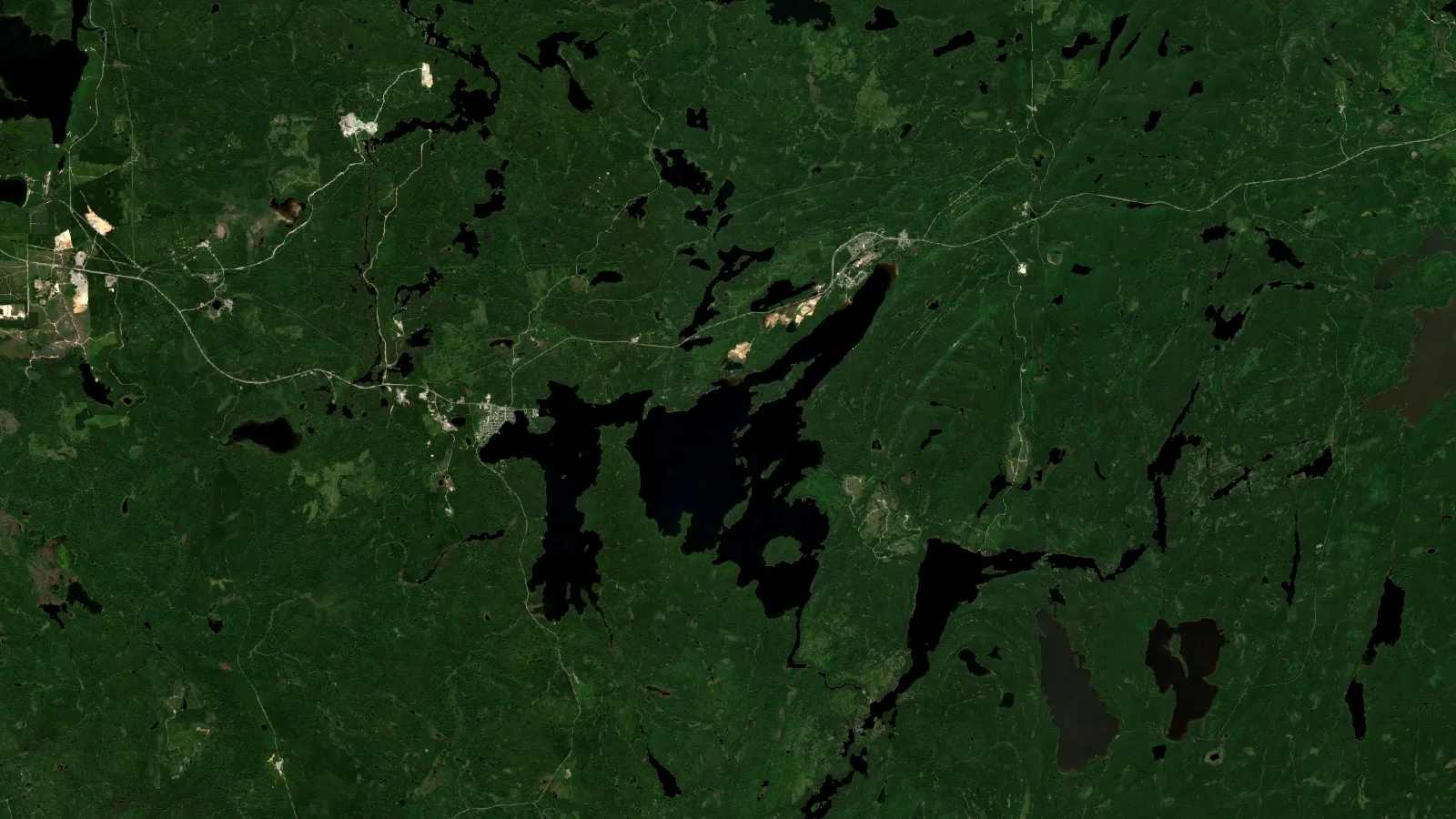
The Larder-Cadillac break is a 250 km thrust that hosts seven mining camps and about 100 Moz of gold.
What the Abitibi greenstone belt is, and where it runs
Picture a belt of old seafloor lava, volcanic islands and sediment, folded and squeezed between granite bodies about 2.7 billion years ago. That is a greenstone belt, named for the green chlorite and epidote that low-grade metamorphism grows in the volcanic rocks. The Abitibi greenstone belt is among the largest in the world. A 2019 short course by John Ayer of Laurentian University’s Mineral Exploration Research Centre (MERC) describes the Abitibi greenstone belt as extending about 800 km east-west and about 400 km north-south, built from seven older volcanic assemblages (2790 to 2700 Ma) overlain unconformably by four sedimentary assemblages (2700 to 2670 Ma).
On a map, the Abitibi belt starts west of Timmins in Ontario and runs east past Kirkland Lake, Rouyn-Noranda, Malartic and Val-d’Or into Quebec. The Ontario side holds the Timmins (Porcupine), Kirkland Lake, Larder Lake and Detour camps. The Quebec side holds Rouyn-Noranda, Cadillac, Malartic and Val-d’Or, plus the northern belts around Casa Berardi and Chibougamau. If you want mine names, owners and production by province, read our guide to gold deposits in Ontario and our guide to Quebec’s gold mines and claims. This page treats the Abitibi greenstone belt as one geological system, because the faults do not stop at the border.
The volcanic and sedimentary assemblages
The Timmins slide in the same MERC course lists the ages of the main assemblages in the southern Abitibi. They matter for targeting in the Abitibi greenstone belt because gold arrived late, after most of the volcanic pile was in place, and the youngest sedimentary basins sit right on top of the gold-bearing faults.
| Assemblage | Type | Age range (Ma) | Why an explorer cares |
|---|---|---|---|
| Pacaud | Volcanic | 2750 to 2735 | Oldest unit in the Timmins column |
| Deloro | Volcanic | 2730 to 2724 | Dated at 2725 Ma in the Detour Lake section |
| Stoughton-Roquemaure | Volcanic | 2723 to 2720 | Part of the older volcanic pile |
| Kidd-Munro | Volcanic | 2719 to 2711 | Thrust south over Porcupine turbidites on the Pipestone fault |
| Tisdale | Volcanic | 2710 to 2704 | Folded into the Tisdale anticlines at Timmins |
| Blake River | Volcanic | 2704 to 2696 | Hosts the Noranda volcanogenic massive sulphide camp |
| Porcupine | Sedimentary | 2690 to 2685 | Turbidite basin over the volcanic pile |
| Timiskaming | Sedimentary | 2676 to 2670 | Conglomerate and sandstone basins along the breaks |
Ages from the MERC Timmins short course (Ayer, 2019) and, for Blake River, the MERC Larder Lake presentation; Deloro age at Detour from the same course, citing Oliver et al. (2012).
One rule falls out of that table. At Timmins, the course places the economic “main stage” gold after the Timiskaming sediments were laid down, younger than about 2670 Ma, while early gold in ankerite vein clasts inside Timiskaming conglomerate was uneconomic. In the northern Abitibi, gold at Detour and the Barry deposit is older, around 2697 Ma. So a target model built for Timmins does not transfer unchanged to the north, and the age of the nearest sedimentary basin is a useful first filter.
▶ Ontario's gold belts and camps, from Timmins and Kirkland Lake to Detour Lake, in under three minutes. · 2:53
Porcupine-Destor and Cadillac-Larder Lake: the two breaks that carry the gold
Ask any geologist where the gold in the Abitibi greenstone belt is and the answer starts with two names. The Porcupine-Destor deformation zone runs east from Timmins toward Destor in Quebec. The Cadillac-Larder Lake deformation zone, often just “the break”, runs from west of Kirkland Lake through Larder Lake, Rouyn-Noranda, Cadillac and Malartic to Val-d’Or. A Metal Earth presentation from MERC on the crustal architecture of the Larder Lake area, citing Monecke and co-authors (2017) in Reviews in Economic Geology, puts gold endowment at more than 89 Moz along the Destor-Porcupine zone and more than 112 Moz along the Cadillac-Larder Lake zone.
Those two numbers explain why land around both faults has been held for decades. They also hide a trap: endowment is past production plus remaining resources, counted differently by different authors. The Ayer course gives about 200 Moz for the whole Abitibi and about 100 Moz for the Larder-Cadillac break. Treat any figure for the whole Abitibi greenstone belt as an order of magnitude, never as something a single property inherits.
The Cadillac-Larder Lake zone in three segments
A 2019 Laurentian University MSc thesis on the Cadillac Group north of the Larder Lake-Cadillac deformation zone describes the zone as a major structure about 250 km long. It trends east for about 170 km, swings southeast for about 35 km along the Malartic segment, then returns to an easterly trend for another 45 km. The Ayer course calls it a D2 thrust that dips south from Matachewan to Kirkland Lake and turns to a north dip east of Larder Lake. In Quebec it marks the contact between Abitibi volcanic rocks to the north and the Pontiac sediments to the south.
That bend at Malartic is worth a second look. Agnico Eagle says its Canadian Malartic complex covers a 16.5 km section of the gold-rich Cadillac-Larder Lake fault. Open-pit mining continues in the Barnat pit and the Odyssey underground mine has been in production since 2023, according to the same page. A long change in strike is the kind of place where a thrust can open space for fluids, and a large open-pit operation sits on this one.
Kirkland Lake is still producing. Agnico Eagle’s fourth-quarter and full-year 2025 results report 312,729 ounces of payable gold from Macassa in 2025. The same release lists Detour Lake under the Abitibi region of Ontario and calls it Canada’s largest gold mine, with 692,675 ounces produced in 2025. Further west along the same break, the MERC Larder Lake slides credit the Kerr Addison deposit with about 11 Moz and Upper Canada with about 1 Moz, and map eleven deposits along the fault in the Larder Lake area.

▶ Why majors and juniors keep spending on gold exploration, and where satellite data fits in the early stages. · 10:44
Orogenic gold structural targeting in the Abitibi greenstone belt
Most gold in the belt is orogenic: it was carried by hot, carbon-dioxide-rich fluids moving up crustal faults during mountain building, and dropped where pressure, temperature or rock chemistry changed. The deposits are usually networks of quartz-carbonate veins, or broad zones of sulphide replacement, inside carbonate-altered rock. A Geological Survey of Canada synthesis by Dubé and Gosselin describes these greenstone-hosted quartz-carbonate vein deposits as the main source of gold in Canada, sitting along large crustal fault zones, often near unconformities.
The MERC course boils its targeting advice for the southern Abitibi down to a short list, which we paraphrase here:
- Regional faults and their second-order splays. Detour, Kerr Addison and Hemlo sit on regional structures; Dome, Hollinger, Hoyle Pond and Kirkland Lake sit on splays.
- Late sedimentary basins. Faults near unconformable successor basins of turbidite, conglomerate and alkaline volcanic rocks, with mantle-derived intrusions.
- Contacts between rocks that break differently. Brittle against ductile, and iron-rich mafic or ultramafic rocks against felsic rocks or sediments.
- Flexures in the regional faults. Timmins, Hemlo and Larder Lake are the course’s examples.
- Proximal alteration. Ankerite (iron carbonate) and potassic alteration close to ore, with weaker calcite and chlorite further out.
Put together, the model says: start at a regional break, move a few kilometres into the hanging wall or footwall, find a splay, find where it crosses an iron-rich unit or bends, and look for a carbonate halo. Every step of that can be tested before a drill turns, which is why compiling the structure carefully is cheaper than drilling blind.
What the Timmins camp teaches
Timmins is the template for the Abitibi greenstone belt. The MERC course calls it the world’s largest Archean orogenic gold camp, with about 2,125 tonnes (75 Moz) at an average grade of 6.5 g/t, in five major clusters. The chart shows how lopsided that endowment is.
Chart
Timmins camp: gold by deposit cluster
Tonnes of gold (production plus remaining), five largest clusters; camp total about 2,125 t (75 Moz)
Read the chart as a warning against averages. One cluster carries about 1,000 t and the smallest of the five about 120 t. The difference is structure: the course, after Bateman and co-authors (2008), ties the main-stage gold to veins in hanging-wall anticlines and Cu-Mo-Au stockwork, formed after the Timiskaming sediments, in fold and thrust panels north of the Porcupine-Destor zone. Hoyle Pond, Pamour and the Dome mine property are now part of the Porcupine Complex owned by Discovery, which changed its name from Discovery Silver Corp. to Discovery Mining Ltd. in June 2026.
How much ground lies near a break?
A corridor a couple of kilometres either side of a fault sounds small until you multiply by its length. Use this to size the area your desk study, satellite screen or till program has to cover. The defaults use the 250 km length of the Larder Lake-Cadillac zone and the roughly 2 km offset of Kirkland Lake’s Main Break from it.
Calculator
How much ground lies near a gold-bearing break?
Enter the length of fault you want to screen, how far either side to look and the satellite pixel size.
- Corridor area: 1,000 km²
- Corridor area: 247,105 acres
- Pixels to classify: 10,000,000 pixels
Example values only. Area = 2 × distance × length, treating the fault as a straight line, so bends and overlapping splays are ignored. Default length is the about 250 km Larder Lake-Cadillac deformation zone (Samson, Laurentian University MSc thesis, 2019); the default 2 km follows the Main Break’s position about 2 km northeast of that zone at Kirkland Lake (Ayer, Laurentian University MERC, 2019). 1 km² = 100 ha = about 247.1 acres. Sentinel-2’s sharpest bands are 10 m (ESA). This sizes a screening area only; it says nothing about where gold is. Confirm open ground on MLAS (Ontario) or GESTIM (Quebec).
At the defaults, a 4 km wide corridor along one fault is 100,000 ha, about the size of a large claim portfolio, and ten million Sentinel-2 pixels. No junior holds all of it, and nobody should till-sample all of it. The job of the early desk and satellite work is to cut that corridor to the handful of bends, splays and contacts where a till line or a geophysics grid is worth paying for.

▶ From hard-rock vein to gold bar: how ore like the Abitibi's quartz-carbonate veins is mined and processed. · 10:34
Beyond veins: intrusion-related and volcanic-hosted targets
Not every target in the Abitibi greenstone belt is a vein on a splay. The MERC course points to Archean porphyry-style gold-copper-molybdenum systems in high-level diorite and tonalite intrusions as an underexplored target, naming Côté, Troilus and Chibougamau. Côté sits about 3 km south of the Ridout-Tyrrell deformation zone in the southeast Swayze belt, and the course dates its mineralization to about 2740 Ma, far older than the Timmins veins. IAMGOLD describes Côté Gold as an open-pit mine about 25 km southwest of Gogama, owned 70% by IAMGOLD and 30% by Sumitomo Metal Mining, with low to moderate grade gold (with some copper) in brecciated and altered tonalite and diorite; it reached commercial production in August 2024.
The Blake River Group, which hosts the Noranda massive sulphide camp according to the MERC Larder Lake slides, adds a third style: gold carried in volcanogenic sulphide systems. Each style wants a different first layer. Veins want structure. Porphyry-style systems want intrusions and their alteration footprint. Volcanic-hosted systems want felsic centres and synvolcanic faults. A targeting study that only draws lineaments will miss two of the three.
The northern Abitibi belt: Detour, Casa Berardi and the older gold
North of the Porcupine-Destor zone, the gold-bearing faults of the Abitibi greenstone belt behave differently. The MERC course describes them as early, south-verging thrusts, with gold between about 2700 and 2690 Ma, older than the main-stage gold of the south (2670 to 2665 Ma). They are also long, and they run through country with far less outcrop.
Chart
Gold-bearing deformation zones of the Abitibi greenstone belt
Approximate strike length in kilometres of four auriferous breaks, as mapped in published work
The Casa Berardi zone extends about 300 km, associated with 2696 Ma turbidites, and the Chicobi zone about 200 km, according to the course. At Detour, the Sunday Lake deformation zone is a south-verging thrust that extends about 150 km, and the gold zones run about 9 km along it. Later movement matters here: the course describes sinistral D2 and dextral D3 overprints on the early thrusting at Detour, and ties the Casa Berardi gold veins to the D2 sinistral overprint.
For a junior, the north is where much of the Abitibi belt’s covered, less-tested fault length lies. That cuts both ways. Ground is easier to acquire, but the first program has to be designed around glacial sediment from day one.
Exploring under glacial cover in the Abitibi clay belt
How deep is the problem? One Ontario Geological Survey record gives a sense of it. The Ontario Mineral Inventory entry for sonic drill hole 87-71 in Currie Township, in the Kirkland Lake resident geologist district, logs an uppermost glacial package 27.4 m thick: varved clay and silt deposited in proglacial lakes Barlow and Ojibway, over two subglacial tills separated by sand. Below that sits a second package to 36.3 m, with till from ice that advanced toward a different azimuth (240°, against 170° for the upper package), then a third package of clay over lodgement till.
That one hole shows why the Abitibi greenstone belt is hard to explore. The surface is clay that came from a lake, not from the rock beneath it. The tills under it were laid down by ice moving in different directions at different times, so a gold grain in till may have travelled from more than one direction. The same record notes thirteen gold grains in one sample, including a large grain of 275 by 675 microns, which is the kind of signal drift prospecting is designed to catch.
One sonic hole near Matheson drilled 27.4 m through lake clay and till before reaching an older glacial package.
The Geological Survey of Canada’s drift prospecting work
Drift prospecting in the Abitibi greenstone belt is old and well tested. During the winter of 1971 to 1972, the Geological Survey of Canada ran an overburden drilling program across the Abitibi clay belt: 394 rotary holes in eleven areas from Timmins to Val-d’Or, plus more than 140 percussion holes around Kirkland Lake. About 6,000 till and bedrock samples were processed for heavy minerals and analysed for trace metals. The methods and costs are in GSC Open File 116, and the gold results in GSC Open File 945.
Those files are still worth downloading before a program. They tell you where the clay is thin enough for cheap sampling, where it is not, and which areas already returned gold in overburden. Modern explorers run the same logic with sonic and reverse-circulation rigs: drill through the clay, sample the till and the top of bedrock, count gold grains and heavy minerals, then trace anomalies up-ice to a source.

▶ Satellite exploration on cold, forested, glaciated northern ground: the Alaska example has the same cover problems as the Abitibi. · 11:35
What satellites can and cannot see over the Abitibi greenstone belt
Satellites read the surface. Over most of the Abitibi greenstone belt that surface is boreal forest, peat, lakes and clay, and in winter it is snow. So a satellite cannot see a quartz vein under 27 m of glacial sediment, and any claim that it can should be ignored. What it can do is map the things that steer the ground program.
Chart
Pixel size of the free satellites used on greenstone belts
Finest and coarsest band ground resolution in metres; smaller is sharper
The chart compares the pixel sizes of the three free sensors most used on greenstone belts. The Sentinel-2 mission page lists 13 bands, four at 10 m, six at 20 m and three at 60 m, on a 290 km swath. NASA’s Landsat 9 mission page gives 15 m panchromatic, 30 m visible to shortwave infrared, and 100 m thermal bands. ASTER, on NASA’s Terra, has 15 m visible, 30 m shortwave and 90 m thermal bands, but its shortwave infrared detectors stopped working in April 2008, so ASTER’s best alteration bands exist only in the older archive.
Over the Abitibi, those pixels are most useful for:
- Lineaments and bends. Straight drainage, lake shores and topographic breaks that follow faults and splays, read together with public aeromagnetic maps.
- Outcrop windows. Bare rock ridges, old pits and road cuts where alteration minerals can actually be measured, and where a geologist should go first.
- Cover mapping. Clay plains, eskers, moraines and peat, which tell you where till is reachable and which way the ice flowed.
- Access and disturbance. Roads, trails, burn scars and old drill pads, which set the cost of every later step.
That is a lot of value for a desk study, but it is not detection of gold under cover. In heavily covered parts of the Abitibi belt, a fair split of effort is satellite and magnetic structure to rank the corridor, then till sampling and ground geophysics to test the ranked spots, then drilling. Our pages on geophysical survey methods and exploration drilling cover the later stages.

▶ Satellite layers combined with soil geochemistry on a Canadian gold-copper property, the same pairing that till sampling plays in the Abitibi. · 3:11
How we screen Abitibi ground
This is where we fit. Farmonaut’s satellite-based mineral detection analyses multispectral or hyperspectral data for alteration signatures and structural patterns (faults, fractures, alteration halos) and returns prospectivity heatmaps with GIS files your geologist can load beside OGS or SIGÉOM layers. You send an area of interest as coordinates, KML/KMZ or a polygon, plus the target mineral, and the report arrives in 5 to 20 business days depending on size and complexity. Across all clients we have screened more than 100,000 hectares, for over 20 mineral types, in more than 25 countries.
On covered ground in the Abitibi greenstone belt we are explicit about the limit: our targets rank where to look, and till, geophysics and drilling decide what is there. The output is a set of exploration targets ahead of any resource estimate. It is not an NI 43-101 estimate and makes no claim of compliance with that instrument. To start, Map Your Mining Site on mining.farmonaut.com, or get a quote for a claim block or a fault corridor.
Putting a number on a target
Once a target in the Abitibi greenstone belt has drill results, the first sum everyone does is contained ounces. The formula is simple: tonnes times grade in grams per tonne, divided by 31.1035 grams per troy ounce. The default grade below is the 6.5 g/t Timmins camp average from the MERC course. The gold price is only an example: Kitco showed US$4,155 per ounce on 15 October 2026, so check today’s price.
Calculator
How many ounces does an Abitibi target contain?
Enter tonnes, average grade and an example gold price in US dollars.
- Contained gold: 6,500 kg
- In-situ value (US$, before costs): $868,310,640
Example values only. Contained ounces = tonnes × g/t ÷ 31.1035. Default grade 6.5 g/t is the Timmins camp average (Ayer, Laurentian University MERC, 2019) and is not a forecast for any property. The gold price is an example in US dollars (US$4,155 per ounce, Kitco, 15 October 2026); check today’s price. In-situ value ignores dilution, recovery, royalties, capital and operating costs, and is not a resource, reserve or valuation. Public figures on a material property must come from an NI 43-101 technical report.
Two cautions. First, a one-million-tonne block at Timmins grade is a big, rich target, far better than most early-stage drill results; try 3 g/t or 1 g/t to see how fast the number falls. Second, in-situ value is not what a company earns. Read the NI 43-101 report, our explainer on NI 43-101 resource categories, and the economics section before you compare properties.
Open data and a targeting workflow for Abitibi gold ground
The Abitibi greenstone belt is one of the best-mapped greenstone belts in the world, and most of that work is free. On the Ontario side, GeologyOntario from the Ontario Geological Survey holds maps, the Ontario Mineral Inventory and assessment files, and the Mining Lands Administration System (MLAS) shows which cells are open. On the Quebec side, SIGÉOM holds geology and assessment work, and GESTIM manages mining titles. For an Abitibi gold belt map, the provincial geological compilations and the OGS map of the Lake Abitibi area (Ayer, Berger and Trowell, 1999, cited in the OGS record above) are the place to start.
Infographic
From belt map to drill hole under cover: six steps
- 1Compile the geologyPull OGS and SIGÉOM maps, faults, assemblages and past drill holes.
- 2Read the structureTrace satellite and magnetic lineaments, bends and splays off the breaks.
- 3Map the coverMark clay, till, ice-flow directions and outcrop windows to sample.
- 4Sample through itTill and overburden drilling for gold grains and heavy minerals (GSC Open File 116).
- 5Plans and permitsOntario exploration plan or permit; Quebec notices and Indigenous consultation.
- 6Drill and discloseDiamond drilling; a Qualified Person signs off public results under NI 43-101.
Step five is where the provinces differ. Ontario’s exploration plan and permit guide says plans and permit applications go through MLAS and are circulated to potentially affected Aboriginal communities; a plan takes effect 30 days after circulation, and an early exploration permit is expected to take 31 to 50 days. Surface rights owners must also be notified. Quebec’s Aboriginal community consultation policy for the mining sector encourages claim holders to inform concerned communities within 60 days of registering a claim and at least 30 days before work starts. Detailed claim fees and work credits are in the two province guides. General information, not legal advice; confirm with the Ontario Ministry of Energy and Mines or Quebec’s Ministère des Ressources naturelles et des Forêts.
For a junior with a single claim block in the Abitibi greenstone belt, the practical version is shorter: pull every assessment file and drill hole within 5 km, draw the faults and splays from the provincial maps and magnetics, mark outcrop and cover from satellite imagery, and only then decide between a till line, an IP grid or a drill hole. Our pages on free data from geological survey agencies and Canada’s gold deposits by province give the wider context.
Abitibi greenstone belt: frequently asked questions
Where is the Abitibi greenstone belt?
How much gold has the Abitibi greenstone belt produced?
What is the Cadillac-Larder Lake fault?
What is the Porcupine-Destor fault?
Why is gold found near faults in the Abitibi belt?
Is there still gold to find in the Abitibi greenstone belt?
Where can I find an Abitibi gold belt map?
How do you explore under the Abitibi clay belt?
Can satellites detect gold in the Abitibi?
Is the Abitibi greenstone belt in Ontario or Quebec?
Authored by: Farmonaut Research & Content Team · Reviewed by: Farmonaut Mining & Mineral Exploration Team · Updated October 2026
General information about geology and exploration practice, not legal, tax or investment advice. Farmonaut is a satellite data-analytics company, not a licensing agent, land-title adviser, broker or investment adviser. Satellite results are exploration targets, not mineral resources or reserves. Confirm claim status and rules with the Ontario Ministry of Energy and Mines or Quebec’s Ministère des Ressources naturelles et des Forêts.
Farmonaut mineral detection
Map your mining site from space
Send your claim or licence boundary as KML, KMZ or a polygon. Farmonaut returns ranked satellite exploration targets for it, usually in 5 to 20 business days.

Keep reading
Sources
- Ayer, J., Laurentian University MERC, Tectonic Setting and Timing of Gold in the Superior Province, short course (2019): merc.laurentian.ca
- Laurentian University MERC / Metal Earth, Crustal architecture of the Larder Lake area (citing Monecke et al. 2017): merc.laurentian.ca
- Samson, B., Laurentian University MSc thesis, Deformation history and gold mineralization of the Cadillac Group (2019): laurentian.scholaris.ca
- Geological Survey of Canada, Till and bedrock survey, Timmins to Val d'Or, 1971-1972: geochem.nrcan.gc.ca
- Geological Survey of Canada, Open File 116, Drift prospecting in the Abitibi Clay Belt (1972): geochem.nrcan.gc.ca
- Geological Survey of Canada, Open File 945, Gold content of overburden samples in the Abitibi Clay Belt (1983): geochem.nrcan.gc.ca
- Ontario Geological Survey, Ontario Mineral Inventory record MDI42A07NE00018, sonic drill hole 87-71: geologyontario.mndm.gov.on.ca
- Ontario Geological Survey, GeologyOntario: geologyontario.mndm.gov.on.ca
- Agnico Eagle, Fourth Quarter and Full Year 2025 Results (February 2026): sec.gov
- Agnico Eagle, Canadian Malartic Complex (2026): agnicoeagle.com
- IAMGOLD, Côté Gold operations page (2026): iamgold.com
- Discovery Mining Ltd., name change receives TSX approval (2026): s21.q4cdn.com
- ESA SentiWiki, Sentinel-2 mission: sentiwiki.copernicus.eu
- NASA, Landsat 9 mission: science.nasa.gov
- NASA JPL, ASTER instrument characteristics: asterweb.jpl.nasa.gov
- NASA JPL, ASTER SWIR alert (2009): asterweb.jpl.nasa.gov
- Government of Ontario, Exploration plan submission and permit application guide: ontario.ca
- Government of Ontario, Mining Lands Administration System (MLAS): ontario.ca
- Gouvernement du Québec, Aboriginal community consultation policy specific to the mining sector: cdn-contenu.quebec.ca
- Gouvernement du Québec, GESTIM mining title management: gestim.mines.gouv.qc.ca
- Kitco, gold spot price chart (15 October 2026): kitco.com
Discussion
Questions, corrections or field experience? Share them below. First-time comments are reviewed before they appear, and your email is never published.
No comments yet. Be the first to add a question or your experience.

 Mine4Africa
 Lithspo Minerals Limited
 Tintina Mining Group
 Dalgety Minerals Pty Ltd
 Vortex Minerals Pty Ltd
 Faith At Work (Pty) Ltd
 Geotech Mining Solutions plc
 Vulcan International Limited
 Kidepo Associates
 GKY Mining
 Alkimy SARL
 Double A Trading
 GemSprout Metals Limited
 Qader Group
 Ileys General Trading
 SG Gold Mining LLC
 VRV Global Pte Ltd
 Omsri International FZE
 G.I.T.T.
 Jaunita Erss Ltd
 Almosi SARL
 SRK Consulting
 Berks Gold Limited
 Mwerezi Minerals Company Limited
