

Lithium exploration · Eeyou Istchee James Bay
Spodumene in James Bay: Pegmatites, Projects and Claims
Spodumene is the lithium pyroxene mined from LCT pegmatites, and in Quebec’s Eeyou Istchee James Bay region it hosts reserves such as PMET’s 84.3 Mt at 1.26% Li2O at Shaakichiuwaanaan and Rio Tinto’s Galaxy deposit.
Key takeaways
- Spodumene (LiAlSi2O6) is the main lithium mineral in James Bay’s LCT pegmatites; pure crystals carry 8.03% Li2O, and reported reserves run 1.26% to 1.36% Li2O.
- Rio Tinto owns Galaxy (formerly the James Bay Lithium Mine Project) and controls Nemaska Lithium’s Whabouchi mine; it expects to choose between them in Q4 2026.
- PMET’s Shaakichiuwaanaan reports the district’s largest reserve: 84.3 Mt at 1.26% Li2O (probable, September 2025).
- Ground is taken by map designation in GESTIM: C$218.40 to C$244.40 per right of more than 45 ha north of the 52nd parallel, a three-year first term, then two-year renewals.
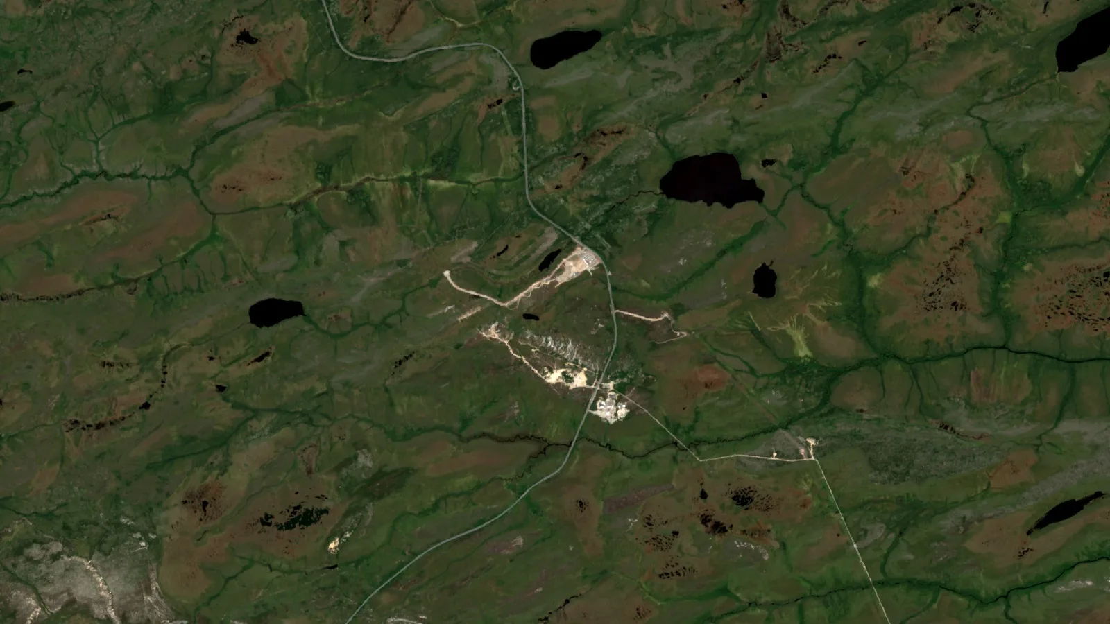
- Satellites can flag pale, exposed outcrop and structure, but till, forest, lichen, lakes and snow hide most pegmatites; sampling and drilling decide.
In this article
- What spodumene is, and why James Bay matters for Canadian lithium
- How LCT pegmatites form, and how to read a spodumene pegmatite field
- James Bay lithium projects and owners: Galaxy, Whabouchi, Shaakichiuwaanaan, Moblan and Rose
- Staking spodumene ground in GESTIM: rights, fees and the 30-day work plan
- Working in Eeyou Istchee: land categories, consent and tallymen
- Outcrop versus till: where a spodumene pegmatite shows at surface
- What remote sensing can screen for in LCT pegmatite exploration
- From Li2O grade to LCE and concentrate: the spodumene arithmetic
- Frequently asked questions about spodumene and James Bay lithium
Spodumene turned a remote stretch of northern Quebec into one of the busiest lithium exploration areas in North America. The mineral sits in white, coarse-grained dykes called LCT pegmatites, and in Eeyou Istchee James Bay those dykes now carry several reserves of tens of millions of tonnes. This guide is for the people who stake, buy, drill or finance that ground: it explains what a spodumene pegmatite is and how to read a pegmatite field, who owns the advanced projects as of October 2026, what an exclusive exploration right costs in GESTIM, how Cree land categories and the Cree Nation Mining Policy shape a program, and what satellite data can and cannot see through till, forest and lichen.
For a wider view of Canadian lithium, including Alberta brines and Manitoba’s Tanco, see our guide to lithium exploration in Canada, from brines to pegmatites. This page goes deeper on one district. For how the deposit types compare worldwide, see pegmatite, brine and clay lithium deposits, and for licensing systems elsewhere, the mining cadastre portal guide by country.
Spodumene is composed of lithia (8.03% Li2O), aluminium oxide (27.40% Al2O3) and silica (64.58% SiO2).” (Rio Tinto, 2025 Form 20-F)
What spodumene is, and why James Bay matters for Canadian lithium
Start with the chemistry. Spodumene is a lithium aluminium silicate, LiAlSi2O6, and the U.S. Geological Survey’s lithium chapter in Professional Paper 1802-K lists it at 3.73% lithium by weight, alongside petalite and the pink mica lepidolite as the main hard-rock lithium minerals. Rio Tinto’s 2025 annual report on Form 20-F puts the same mineral at 8.03% Li2O when pure. Ore is far leaner than that, because a spodumene pegmatite also holds quartz, feldspar and mica: James Bay reserves sit at about 1.2% to 1.4% Li2O.
The same USGS chapter breaks the world’s present and potential lithium sources down by deposit type: closed-basin brines about 58% and pegmatites, including lithium-enriched granites, about 26%. For an explorer, the point is that pegmatite lithium is found and proven the way other hard-rock deposits are: by mapping, sampling and drilling dykes, which is work a junior can fund in stages.
Canada is still a small producer. Natural Resources Canada’s lithium facts page says the country had two lithium mines operating in 2024, which together produced an estimated 5,983 tonnes of lithium, or 2.5% of world output. One of them, North American Lithium near Val-d’Or, sits in Abitibi rather than James Bay; the other, Tanco, is in Manitoba. The same page puts Canada’s hard-rock lithium resources at 5.4 million tonnes of lithium oxide.
Chart
Lithium mine output by country, 2024
Tonnes of contained lithium, 2024 preliminary; Canada had two operating mines
Where do the James Bay deposits fit? The USGS notes that some pegmatite deposits, naming Quebec, contain large lithium reserves that have not been mined. That is still the position in Eeyou Istchee James Bay in October 2026: several spodumene deposits have reserves, permits or partly built sites, but none was in commercial production. Whabouchi has run trial mining and a demonstration concentrator, as Nemaska Lithium describes below.

▶ Method explainer: how a satellite lithium screen is built, step by step. The terrain is African, so watch it for the method, not the geology. · 10:49
How LCT pegmatites form, and how to read a spodumene pegmatite field
A USGS deposit model by Dwight Bradley and Andrew McCauley, Open-File Report 2013-1008, is the most practical short reference for LCT pegmatite exploration. LCT stands for lithium, cesium and tantalum. The report describes these pegmatites as a subset of granitic pegmatites linked to certain granites, made mostly of quartz, potassium feldspar, albite and muscovite, with spodumene, petalite and lepidolite as the lithium ore minerals and columbite-tantalite as the tantalum ore.
Three points from the model drive how a junior should look at a James Bay property:
- ✔ Pegmatites come in groups. LCT pegmatites typically occur in groups of tens to hundreds of dykes covering up to a few tens of square kilometres.
- ✔ The best ones sit far out. LCT pegmatites can form as far as 10 km from their parent granite, and the most distant ones are the most fractionated, so the spodumene often lies away from the obvious intrusion.
- ⚠ Most dykes are barren. The most highly fractionated, rare-element pegmatites make up only 1% or 2% of a regional pegmatite population.
- Zoning shows the way. Moving outward from the granite, beryl appears first, then columbite, then tantalite and spodumene, and finally pollucite.
The model also lists mineral clues that work in the field. Potassium feldspar from the most fractionated pegmatites carries more than 3,000 ppm rubidium; muscovite carries more than 2,000 ppm lithium. Garnet moves from red iron-rich almandine near fertile granites to orange manganese-rich spessartine in evolved dykes, and tourmaline from black schorl to pink or green elbaite. Around a dyke, lithium, rubidium and cesium move into the country rock, and in mafic rocks the purple lithium amphibole holmquistite can form haloes up to 20 m beyond the pegmatite.
Galaxy is a good local example of what a spodumene pegmatite looks like. Rio Tinto’s 2025 Form 20-F describes pale-green spodumene, with grains from under a millimetre to one metre long, fine-grained in a 3 to 5 cm chilled margin and coarsening towards the centre of each dyke. PMET describes its Shaakichiuwaanaan pegmatites as part of a large system on a 463-claim property; Elevra describes 75 discrete lithium pegmatite dykes modelled at Moblan.
James Bay lithium projects and owners: Galaxy, Whabouchi, Shaakichiuwaanaan, Moblan and Rose
Ownership has changed more since 2024 than in the decade before it, so check every name against a current filing. Rio Tinto completed its acquisition of Arcadium Lithium on 6 March 2025, which brought it two James Bay assets. Its Galaxy project page describes a hard-rock development expected to produce up to 40,000 tonnes of LCE a year in spodumene concentrate. The federal registry lists Galaxy under its former name, the James Bay Lithium Mine Project: an open pit about 100 km east of James Bay near the Cree community of Eastmain, averaging 5,480 tonnes of ore a day over an estimated 15 to 20 years.
The second asset is Nemaska Lithium. Rio Tinto said on 18 February 2026 that it had raised its stake to 53.9%, with the Government of Québec holding 46.1%. Nemaska owns the Whabouchi spodumene mine and the Bécancour lithium hydroxide plant. According to Nemaska’s own Whabouchi page, the mine is partly built, about 30 km east of the Nemaska Cree community, and concentrate would travel 405 km by truck to the Matagami railyard and then 900 km by rail to Bécancour.
Which mine feeds Bécancour is still open. Rio Tinto’s third-quarter operations review, released 14 October 2026, says construction at Bécancour remains at reduced levels, first production is planned for 2028, and the strategic review of the Whabouchi and Galaxy alternatives continues, with a decision expected in Q4 2026.
Chart
Reported mineral reserves, million tonnes
Probable (or proven + probable) reserves of James Bay spodumene projects
| Project | Owner(s) | Location and land | Status (Oct 2026) | Owner-reported reserve |
|---|---|---|---|---|
| Galaxy (formerly James Bay Lithium) | Rio Tinto 100% | Near Eastmain; Billy Diamond Highway access; 200 claims, 9,867.88 ha | Development; mining lease BM1061 approved 14 Feb 2024; Q4 2026 decision pending | Probable 37 Mt at 1.27% Li2O (31 Dec 2025) |
| Whabouchi | Nemaska Lithium: Rio Tinto 53.9%, Québec 46.1% | About 30 km east of Nemaska | Partly built; trial mining and demonstration concentrator done | Proven 5.3 Mt at 1.40%, probable 8.0 Mt at 1.27% (31 Dec 2025) |
| Shaakichiuwaanaan (CV5, CV13) | PMET Resources | 14 km south of Hydro-Québec’s transmission corridor; 463 claims, 23,710 ha | 2025 feasibility study on CV5 | Probable 84.3 Mt at 1.26% (11 Sep 2025) |
| Moblan | Elevra Lithium 60%, Investissement Québec 40% | Eeyou Istchee James Bay; 20 claims, 433 ha | Development stage, no operating infrastructure | Probable 20.7 Mt at 1.36% (Elevra 60% share, 30 Jun 2025) |
| Rose | Critical Elements Lithium Corporation | About 38 km north of Nemaska | Federal decision statement 2021, amended May 2025 | See the company’s NI 43-101 report |
Sources: Rio Tinto 2025 Form 20-F and Galaxy page; Nemaska Lithium; PMET Resources project page; Elevra Lithium 2025 Form 20-F; Impact Assessment Agency of Canada registry (Galaxy, Rose). Reserves are kept separate from resources.
PMET’s Shaakichiuwaanaan page gives the district’s largest numbers. Its June 2025 resource holds 108.0 Mt at 1.40% Li2O indicated and 33.4 Mt at 1.33% inferred, and the September 2025 probable reserve on CV5 is 84.3 Mt at 1.26%. The lithium-only feasibility study uses a dense-media-separation-only flowsheet for up to about 800,000 tonnes a year of concentrate, with 68.9% average recovery over a mine life of about 20 years.
Moblan’s owner changed name too. Elevra Lithium, formerly Sayona Mining, completed its merger with Piedmont Lithium on 29 August 2025, according to its 2025 Form 20-F. The filing reports Moblan’s probable reserve as Elevra’s 60% share, 20.7 Mt at 1.36% Li2O, and says Investissement Québec acquired its 40% from SOQUEM on 31 December 2023. Critical Elements’ Rose project is in the federal registry as an open-pit lithium and tantalum mine about 38 km north of Nemaska, at about 4,500 tonnes of ore a day over 17 years.
For what the reserve categories mean, our explainer on NI 43-101 rules, qualified persons and resource categories covers the terms, and the feasibility study guide explains what moves a resource to a reserve.
Staking spodumene ground in GESTIM: rights, fees and the 30-day work plan
Quebec has no ground staking for this terrain. You take ground by map designation in GESTIM, the province’s online mining title system. The ministry now calls each designated cell an exclusive exploration right, though company filings still say claims. The right is obtained by designating one or more grid polygons, the first term is three years, and it is renewed for two-year terms in GESTIM as long as the holder meets the conditions of the title, including exploration work whose nature and minimum amounts are set by regulation.
The fees changed in mid-2026. The province’s rates and indexation page says new amounts took effect on 15 July 2026 with an amendment to the Mining Regulation, on top of the 2.05% indexation for 2026. North of the 52nd parallel, where most of the James Bay lithium belt lies, registering one right costs C$53.95 under 25 ha, C$193.70 for 25 to 45 ha, C$218.40 for over 45 to 50 ha and C$244.40 over 50 ha. Renewal fees are the same amounts. If one holder designates more than 150 rights on the same day, each right above 150 costs five times as much.
How big is a right? Company filings give a rough answer: Rio Tinto lists Galaxy as 200 claims over 9,867.88 ha, about 49 ha each, and PMET lists 463 claims over 23,710 ha, about 51 ha each. So most James Bay rights fall in the two top fee bands.
Chart
GESTIM fee per right, north of 52°N
Registration fee in Canadian dollars (C$) by right area: up to 150 rights vs above 150 on one day
Calculator
What do GESTIM fees cost for a James Bay land package?
Enter your rights, fee band, years and right size. Amounts in Canadian dollars (C$).
- Designation fees (C$): $24,440
- Renewal fees (C$): $48,880
- Number of two-year renewals: 2
- Average per hectare per year: 2.09 C$/ha/yr
- Land package: 5,000 ha
- Land package in acres: 12,355 acres
Canadian dollars (C$). Registration and renewal fee per right as entered: C$244.40 is the over-50-ha rate north of the 52nd parallel in force from 15 July 2026 (C$218.40 for over 45 to 50 ha), per the Gouvernement du Québec rates page. Rights above 150 designated by one holder on the same day cost five times the fee. First term three years, then two-year renewals. Excludes the minimum exploration work set by the Mining Regulation, field costs and taxes. Example values only. General information, not legal advice; confirm with the Ministère des Ressources naturelles et des Forêts and in GESTIM.
At the defaults, 100 rights of about 50 ha held for seven years cost C$24,440 to designate and C$48,880 in two renewals, C$73,320 in fees, or about C$2 per hectare per year. That is cheap next to the work commitment and the field program, which this calculator leaves out on purpose: the minimum work per right is set in the Mining Regulation and depends on the area and the number of terms, so check the current figure in GESTIM before you budget.
Two newer obligations affect every program. Before any work, including airborne geophysical surveys, the holder must give an annual exploration work plan to the local municipality and, where applicable, the affected Indigenous nation or community at least 30 days ahead, post it on the holder’s website, and hold an information session if asked. And when the work is done, the province’s obligations page says work reports are made public in GESTIM once accepted, with a qualified professional’s signature required above C$5,000 of work per right. General information, not legal advice; confirm with the Ministère des Ressources naturelles et des Forêts.
Infographic
From open ground to a spodumene mine in Eeyou Istchee James Bay
- 1Check the groundGESTIM map, Cree land category and existing rights.
- 2Designate rightsOnline in GESTIM; first term three years, then two-year renewals.
- 3Contact the CreesCree Nation Government and the affected Cree First Nation, before field work.
- 4Send the work planAnnual plan to the municipality and Indigenous community 30 days before work.
- 5Explore and reportWork reports filed and published in GESTIM keep rights renewable.
- 6Assess and leaseJBNQA Section 22 review, federal review where required, then a mining lease.
Working in Eeyou Istchee: land categories, consent and tallymen
Every James Bay spodumene program sits inside the James Bay and Northern Québec Agreement (JBNQA), signed on 11 November 1975. The Cree Nation Government’s Cree Nation Mining Policy (updated June 2024) sums up the three land categories. On Category I land, reserved for Cree beneficiaries, no mineral claims can be made without prior approval by the affected Cree First Nation. Category II land is owned by Québec, with hunting, fishing and trapping rights reserved for the Crees. On Category III land some harvesting rights are reserved for the Crees and other rights are shared under a joint regulatory scheme. The policy applies to any mining project on any category of land.
The policy also explains the notice chain. Under the Cree-Québec Governance Agreement, Québec notifies the Cree Nation Government and Cree communities of new claims on Category II land and invites applicants for claims on Category III land to contact the Cree Nation Government. Once a company stakes in Eeyou Istchee, it is invited to contact the Cree Nation Government and the affected Cree First Nation, which should be in touch with the proponent before any field work.
The land itself is organised in Cree family hunting territories. The policy counts over 300 traplines, each managed by a tallyman recognised under section 24.1.8 of the JBNQA, and asks proponents to engage early so that work avoids sensitive hunting periods. It is clear about later stages too: the Cree Nation Government must consent to every mining development in Eeyou Istchee and will not consent to one the affected Cree First Nation has not accepted. Agreements such as the pre-development agreement and, later, an impact and benefit agreement formalise that relationship.
There are over 300 traplines covering the territory.” (Cree Nation Mining Policy, June 2024)
Mine-stage approvals follow the JBNQA too. Section 22 of the agreement sets the environmental and social impact assessment regime that the policy refers to, and larger projects also go through a federal review: Galaxy and Rose both have federal decision statements in the Impact Assessment Agency of Canada registry, and Rio Tinto reports that Galaxy’s mining lease application was approved on 14 February 2024.
Outcrop versus till: where a spodumene pegmatite shows at surface
Glacial history decides how much of a James Bay property you can actually see. Ice sheets scraped the Shield, then left till, sand, peat and lakes over much of it, so bedrock often shows only on ridges and hilltops. That cuts both ways for pegmatite hunters. The USGS model points out that granitic pegmatites are resistant and tend to stand above their surroundings, and that in heavily wooded western Maine many glacially sculpted hilltops are pegmatites. Pale dykes on ridges are easy to spot from a helicopter or in an image; the same dyke under a metre of till in a valley is invisible.
Rio Tinto’s report says Galaxy was first discovered in 1964, decades before modern satellites, which is a reminder of how much exposed ground has already been walked. A follow-up program usually combines three kinds of surface evidence:
- Outcrop mapping. Prospecting crews walk ridges and lake shores and sample every pegmatite they find, with channel samples across the dyke.
- Boulder and till sampling. Spodumene-bearing boulders carried by ice can point back up-ice to a buried source, if you know the ice-flow direction.
- Geochemistry of the host rock. Lithium, rubidium and cesium haloes and holmquistite in mafic rocks can extend the footprint of a dyke beyond its contact.
Geophysics is used here mainly for structure. Magnetics map the greenstone belts, shear zones and granite contacts that control where dykes sit. Our guides to geophysical survey methods and airborne survey platforms and contractors cover the options, and the exploration drilling guide covers what comes next.
What remote sensing can screen for in LCT pegmatite exploration
Let us start with the limits. Sentinel-2, the free optical satellite most explorers use first, records 13 bands: four at 10 m, six at 20 m including two short-wave infrared bands, and three at 60 m. A 20 m pixel covers 400 m², wider than most single dykes, and it mixes rock, moss, lichen and trees into one spectrum. Snow covers the ground through the northern winter, so usable scenes come mainly from the summer months, and smoke or cloud cuts that further.
The research record matches that caution. A study by Cardoso-Fernandes, Teodoro and Lima in the International Journal of Applied Earth Observation and Geoinformation (2019) used Landsat, Sentinel-2 and ASTER images with low vegetation cover in a lithium pegmatite field on the Spain-Portugal border, mapping pegmatites with RGB combinations, band ratios and selective principal component analysis. It worked there because the ground was open. A Geological Survey of Denmark and Greenland bulletin on hyperspectral mapping in lichen-rich Arctic terrain notes that rock-encrusting lichens hinder remote sensing surveys, a problem James Bay outcrops share.
What can satellites do well on a James Bay spodumene property?
- ✔ Bare, pale outcrop. Where pegmatite is exposed on ridges and burns, its light colour and spectral contrast against dark greenstone or forest can flag candidate outcrops for a ground check.
- ✔ Structure. Lineaments in lake chains and drainage that may follow the shear zones and contacts controlling dyke swarms.
- ✔ Ice-flow direction. Drumlins and other ice-shaped landforms that tell you which way to walk from a boulder anomaly.
- ✔ Access and disturbance. Roads, trails, old trenches, drill pads and recent burns, which change both access and exposure.
- ⚠ Not grade. No satellite measures Li2O. A spectral target is a place to sample, not a resource.
That is how we use it. Our satellite-based mineral detection service takes your rights outline as coordinates, KML, KMZ or a polygon, plus the target mineral; lithium is on our list of detectable materials. We pick multispectral or hyperspectral data, map alteration patterns, faults and fractures, and rank zones by prospectivity. The report comes with heatmaps, estimated location and depth ranges and georeferenced GIS files that drop into the same project as your geophysics, in 5 to 20 business days depending on area and mineral.
The Premium+ report adds TargetMax drilling intelligence, with suggested drilling angles and interactive 3D subsurface models. Across our work we have scanned more than 100,000 hectares for 20+ mineral types in 25+ countries, and satellite screening can cut early-exploration timelines from months to days and early-exploration cost by up to 80 to 85%. On glaciated, forested ground like James Bay we say plainly where cover limits the read. Our results are exploration targets that sit ahead of any resource estimate; they are not NI 43-101 disclosure and not a guarantee of a find.
From Li2O grade to LCE and concentrate: the spodumene arithmetic
Demand is the reason juniors keep coming to James Bay. NRCan’s world production table shows lithium mine output rising from 31,500 tonnes in 2015 to an estimated 237,060 tonnes in 2024, with a dip in 2019 and 2020.
Chart
World lithium mine production
Tonnes of contained lithium, 2015 to 2024 (2024 preliminary)
Prices have swung just as hard, so treat any concentrate price as an assumption. Rio Tinto’s 2025 reserves use US$1,361 per tonne of 6% Li2O concentrate (SC6), an average of broker and analyst forecasts. For a recent market print, SMM reported that an Albemarle auction on 30 July 2026 sold 14,700 dry tonnes of about 5.5% spodumene concentrate at US$2,113 per tonne on an SC6 CIF basis. Check the day’s price before you use either.
The calculator turns tonnes and grade into contained Li2O, lithium carbonate equivalent and an SC6 concentrate figure at a recovery and price you choose.
Calculator
How much Li2O, LCE and concentrate does a spodumene deposit hold?
Enter tonnage, grade, recovery and an example price. Values are in US dollars (US$).
- Contained Li2O: 130,000 t
- Lithium carbonate equivalent: 321,490 t LCE
- Recovered into SC6 concentrate: 1,495,000 t
Contained Li2O = tonnes x grade (%) / 100. LCE = Li2O x 2.473 (molecular-weight ratio of Li2CO3 to Li2O). SC6 tonnes = recovered Li2O / 0.06. Default grade sits within the 1.26% to 1.36% Li2O reserve grades reported for Galaxy, Whabouchi, Shaakichiuwaanaan and Moblan; default recovery is close to the 68.9% life-of-mine recovery in PMET’s 2025 feasibility study; the default price of US$1,361/t SC6 is Rio Tinto’s 2025 reserve assumption, an example only; check today’s price. Gross value in US dollars (US$): no dilution, costs, royalties or tax. Arithmetic only, not a resource estimate and not investment advice.
At the defaults, 10 million tonnes at 1.30% Li2O hold 130,000 tonnes of Li2O, about 321,000 tonnes of LCE. At 69% recovery that becomes about 1.5 million tonnes of SC6 concentrate, worth about US$2.03 billion gross at US$1,361 per tonne. Change the price to the July 2026 auction print of US$2,113 and the same rock is worth about US$3.16 billion gross, which shows how much of a spodumene project’s story is price rather than geology.
Use the result as arithmetic only. A resource needs drill density, density measurements, geological continuity and a qualified person’s estimate under NI 43-101, and a reserve needs at least a prefeasibility study with mining and processing costs. Not investment advice.
Frequently asked questions about spodumene and James Bay lithium
What is spodumene?
Spodumene is a lithium aluminium silicate (LiAlSi2O6) of the pyroxene group, found in LCT pegmatites. Pure spodumene carries 8.03% Li2O; mined ore in James Bay runs about 1.26% to 1.36% Li2O in the reported reserves.
What is an LCT pegmatite?
A lithium-cesium-tantalum pegmatite: a very coarse-grained granitic rock linked to certain granites, made mostly of quartz, feldspar and muscovite, with spodumene, petalite or lepidolite as lithium minerals. They occur in groups of tens to hundreds of dykes, and only 1% or 2% are highly fractionated.
What is the James Bay Lithium mine project now called?
The federal registry lists it as the Galaxy Lithium Project, formerly the James Bay Lithium Mine Project. It is owned 100% by Rio Tinto, which reports probable reserves of 37 Mt at 1.27% Li2O at 31 December 2025.
Is there a lithium mine operating in James Bay?
Not in commercial production as of October 2026. Whabouchi is partly built and has run trial mining; Galaxy, Shaakichiuwaanaan, Moblan and Rose are at development or study stages. Rio Tinto expects to decide between Whabouchi and Galaxy in Q4 2026.
Which is the largest spodumene deposit in James Bay?
By reported reserves, PMET Resources’ Shaakichiuwaanaan, with a probable reserve of 84.3 Mt at 1.26% Li2O on CV5 and indicated resources of 108.0 Mt at 1.40% Li2O (effective June 2025).
How do you stake a lithium claim in James Bay, Quebec?
You designate exclusive exploration rights on the GESTIM map online; there is no ground staking. North of the 52nd parallel each right of more than 45 ha costs C$218.40 to C$244.40, the first term is three years, and renewals are for two years. Confirm current rules with the ministry.
How much does it cost to hold lithium ground in James Bay?
In fees alone, 100 rights of about 50 ha held for seven years cost about C$73,320 at the rates in force from 15 July 2026. Minimum exploration work per right comes on top and is set by the Mining Regulation.
Do I need Cree consent to explore in Eeyou Istchee?
No claims can be made on Category I land without the affected Cree First Nation’s approval. On other land the Cree Nation Mining Policy asks proponents to contact the Cree Nation Government and the affected Cree First Nation before field work, and the Cree Nation Government’s consent is needed for any mining development.
Can satellites find spodumene?
Not directly under cover. Satellites can flag pale, exposed pegmatite outcrop, structure, ice-flow direction and access, but till, forest, lichen, lakes and snow hide most dykes, and no satellite measures Li2O grade. Targets must be sampled on the ground.
How is spodumene grade converted to lithium carbonate equivalent?
Multiply tonnes by the Li2O grade to get contained Li2O, then multiply by about 2.473 to get LCE. For example, 10 Mt at 1.30% Li2O holds 130,000 t of Li2O, or about 321,000 t LCE, before any recovery losses.
General information, not legal, tax or investment advice. Rights rules and fees change; confirm with the Ministère des Ressources naturelles et des Forêts and the Cree Nation Government. Farmonaut is not a licensing agent, land-title adviser, broker or investment adviser. Farmonaut results are exploration targets ahead of any resource estimate.
Farmonaut mineral detection
Screen your James Bay rights from space
Send your rights boundary as KML, KMZ or a polygon. Farmonaut returns ranked satellite exploration targets for lithium, usually in 5 to 20 business days.

Keep reading
Sources
- USGS, Professional Paper 1802-K: Lithium (Bradley et al., 2017): pubs.usgs.gov
- USGS, Open-File Report 2013-1008: LCT pegmatite deposit model (Bradley and McCauley, rev. 2016): pubs.usgs.gov
- Natural Resources Canada, Lithium facts (2026): natural-resources.canada.ca
- Rio Tinto, 2025 Annual Report on Form 20-F (2026): sec.gov
- Rio Tinto, Third quarter operations review (14 October 2026): sec.gov
- Rio Tinto, Nemaska Lithium majority interest release (18 February 2026): riotinto.com
- Rio Tinto, Galaxy project page (2026): riotinto.com
- Nemaska Lithium, The Whabouchi mine (2026): nemaskalithium.com
- PMET Resources, Shaakichiuwaanaan project (2026): pmet.ca
- Elevra Lithium, 2025 Annual Report on Form 20-F (2025): sec.gov
- Impact Assessment Agency of Canada, Galaxy Lithium Project registry (2025): iaac-aeic.gc.ca
- Impact Assessment Agency of Canada, Rose Lithium-Tantalum Mining Project registry (2025): iaac-aeic.gc.ca
- Gouvernement du Québec, Exclusive exploration right: rates and indexation (2026): quebec.ca
- Gouvernement du Québec, Procedure to obtain an exclusive exploration right (2026): quebec.ca
- Gouvernement du Québec, Obligations of the exclusive exploration right holder (2026): quebec.ca
- Gouvernement du Québec, Annual exploration work planning (2026): quebec.ca
- Cree Nation Government, Cree Nation Mining Policy (June 2024): cngov.ca
- Copernicus SentiWiki, Sentinel-2 mission (2026): sentiwiki.copernicus.eu
- Cardoso-Fernandes, Teodoro and Lima, Int. J. Applied Earth Observation and Geoinformation (2019): doi.org
- Salehi, Geological Survey of Denmark and Greenland Bulletin 41 (2018): pub.geus.dk
- SMM, Albemarle spodumene auction result (30 July 2026): news.metal.com
Discussion
Questions, corrections or field experience? Share them below. First-time comments are reviewed before they appear, and your email is never published.
No comments yet. Be the first to add a question or your experience.

 Dalgety Minerals Pty Ltd
 Vortex Minerals Pty Ltd
 Faith At Work (Pty) Ltd
 Geotech Mining Solutions plc
 Vulcan International Limited
 Kidepo Associates
 GKY Mining
 Alkimy SARL
 Double A Trading
 GemSprout Metals Limited
 Qader Group
 Ileys General Trading
 SG Gold Mining LLC
 VRV Global Pte Ltd
 Omsri International FZE
 G.I.T.T.
 Jaunita Erss Ltd
 Almosi SARL
 SRK Consulting
 Berks Gold Limited
 Mwerezi Minerals Company Limited
 Mining SARL
 SenGold Invest SAS
