

Exploration costs · Budget guide
First-Year Exploration Budget for a Small Licence
An exploration budget for a small licence is built in stages: licence, desk study, mapping and sampling, geophysics, trenching, then drilling. Public data show drilling takes about 41% of spend, so gate each stage and drill last.
Key takeaways
- Canada’s 2024 survey put drilling at 40.8% of exploration and deposit appraisal spending and geophysics at 3.4% (Natural Resources Canada, 2024).
- Diamond drilling averaged about C$284 per metre in Canada in 2024, roughly US$207 (our calculation from Natural Resources Canada totals and the Bank of Canada 2024 rate).
- Licence costs repeat every year: a new BLM lode claim costs US$274 in year one and US$200 a year after that (BLM, fees for claims filed from 1 September 2024).
- Assays follow drilling: Western Australia expects analyses of about 25% of direct drilling cost on prospector grants when holes are not cored (Round 34 guidelines).
- Spend in stages and stop at a gate if the last stage did not support the next; office work and the report took about 39% of one small filed programme (BC assessment report, 2010).
In this article
- What a first-year budget for a small licence covers
- What share each phase usually takes, and why
- Licence and compliance costs
- Desktop study and remote sensing
- Geological mapping, sampling and assays
- Geophysics
- Trenching
- First drilling and what a metre costs
- Contingency and reporting
- Order of spend and staged gates
- Build your own first-year budget
- Frequently asked questions
There is no standard first-year budget for a small licence, because the ground, the country and the mineral change every number. What public data does show is the order in which money is spent and where most of it ends up. In Canada’s 2024 expenditure survey, drilling took about 41% of all exploration and deposit appraisal spending, and geophysics only about 3%. A sensible first-year plan therefore spends little on desk work, mapping and sampling, and commits to drilling only after those stages point to a target.
This page walks through the nine usual cost lines, from licence fees to the final report, with the public ranges that can be sourced and the reasons behind them. A calculator at the end lets you type in your own quotes. All figures are in US$ unless marked C$ (Canadian dollars) or A$ (Australian dollars), and every number carries its source and year.
What a first-year budget for a small licence covers
A first-year programme has one job: to find out, as cheaply as possible, whether the licence deserves a second year of money. Each stage answers a narrower question than the one after it, and each costs more per day than the one before it. The usual order is below.
| Phase | What it buys | Order of spend | Public benchmark found |
|---|---|---|---|
| Licence and compliance | Application, claim or licence fees, rent, permits, insurance | First, and every year | BLM and British Columbia fee rules (below) |
| Desktop study and remote sensing | Old maps, reports, satellite imagery, target list | Second, mostly office time | None published; get quotes |
| Geological mapping | Outcrop, structure and alteration mapped by a geologist on foot | Third | Canada: geochemistry and geology about 11% of spend |
| Sampling and assays | Soil, stream and rock samples sent to a laboratory | With mapping | Western Australia: assays about 25% of drilling cost for prospector grants |
| Geophysics | Magnetic, radiometric or electrical surveys that see below the surface | After mapping and sampling | Canada: about 3% of spend |
| Trenching | Digging across a mineralised zone to see it fresh | After sampling shows a target | Canada: rock work, which includes trenching, about 7% |
| First drilling | A first set of holes through the best target | Last of the field stages | Canada: about 41%; diamond drilling about C$284 per metre |
| Contingency | A reserve for weather, access and price changes | Held back throughout | A planning choice, not a published norm |
| Reporting | Data compilation, maps, a written report for the regulator and for you | Runs alongside and finishes the year | One filed example: office work and the report took about 39% of a small programme |
Two cautions apply to every number on this page. First, costs rise fast with remoteness, because camp, fuel, flights and permits are priced by distance. Second, a published average is a guide to proportions, not a quote. Get written quotes before you commit.
What share each phase usually takes, and why
No agency publishes a standard split for a small licence in its first year. The best public evidence is what explorers actually spent. Natural Resources Canada surveys every explorer each year and publishes the totals by type of work. For 2024 the total was C$4.23 billion, and the split is in the chart below. Treat it as the shape of exploration spending across all stages. It includes large deposit-appraisal programmes, so a grassroots first year will spend less on engineering studies and more on mapping and sampling than this national mix.
Chart
Where Canadian exploration money went in 2024
Share of C$4.23 billion exploration and deposit appraisal spending, by type of work
The reason drilling dominates is simple arithmetic. A day of mapping needs one geologist and a vehicle. A day of drilling needs a rig, a crew of several, fuel, water, core boxes, a camp and often a road or pad. Drilling is also the only stage that tests the rock at depth, so it is where explorers spend once they believe a target is real. Geophysics takes a small share because a survey covers a large area in days. Claims, line cutting and head office together take about 8%, a reminder that holding ground and running a company are part of every programme.
You can read the full table, including each province, on the Natural Resources Canada expenditure-category table for 2024. For a wider look at Canadian exploration spending, see our guide to mineral exploration spending in Canada.
Licence and compliance costs
Licence costs are small next to field work, but they are certain and they repeat every year, so they belong at the top of the budget. Fees differ by country, so use your own regulator’s schedule. Two official examples show the shape.
In the United States, the Bureau of Land Management (BLM) charges a new lode claim on federal land a US$25 processing fee, a US$49 location fee and a US$200 maintenance fee, US$274 in total, for claims filed on or after 1 September 2024. The same US$200 is due each year after that on or before 1 September, and placer claims pay US$200 for each 20 acres or part of 20 acres (BLM mining claim fees). Holders of 10 or fewer claims nationwide can file a waiver of the maintenance fee instead. The waiver has no filing charge, but the holder must still do at least US$100 of work on each claim and record it, at US$15 per claim (BLM annual maintenance and assessment).
In British Columbia, Canada, a mineral cell claim costs C$1.75 per hectare to register. To keep it, the holder must do at least C$5 of exploration work per hectare in each of the first two years, C$10 in years three and four, C$15 in years five and six and C$20 after that. Paying cash instead of doing the work costs double (Mineral Tenure Act Regulation, British Columbia). That escalating work rule is a useful reminder that many regimes expect you to spend real money on the ground each year, not only pay rent.
For African licences the fee tables, deposit rules and work commitments sit in each ministry’s own schedule. Our licence guides cover Tanzania, Zambia, Kenya and Nigeria, and there is a country-by-country cadastre guide. If you hold a small-scale or artisanal permit, read the artisanal licence guide as well. Check the amounts with the ministry before you apply.
Budget for the licence line to include more than the fee: surveyor or cadastre costs, a local agent, community and landowner consultation, insurance and the environmental permit for any ground disturbance. These are the lines that surprise first-time holders, and in many countries they exceed the headline fee.
Desktop study and remote sensing
This stage costs the least and should come first. A desktop study collects what is already known: government geological maps, old exploration reports, historic workings, regional geochemistry and geophysics, and satellite imagery. A geologist reads it and marks where mineralisation is most likely. Most of the cost is the geologist’s time, so the budget is mainly days, not equipment.
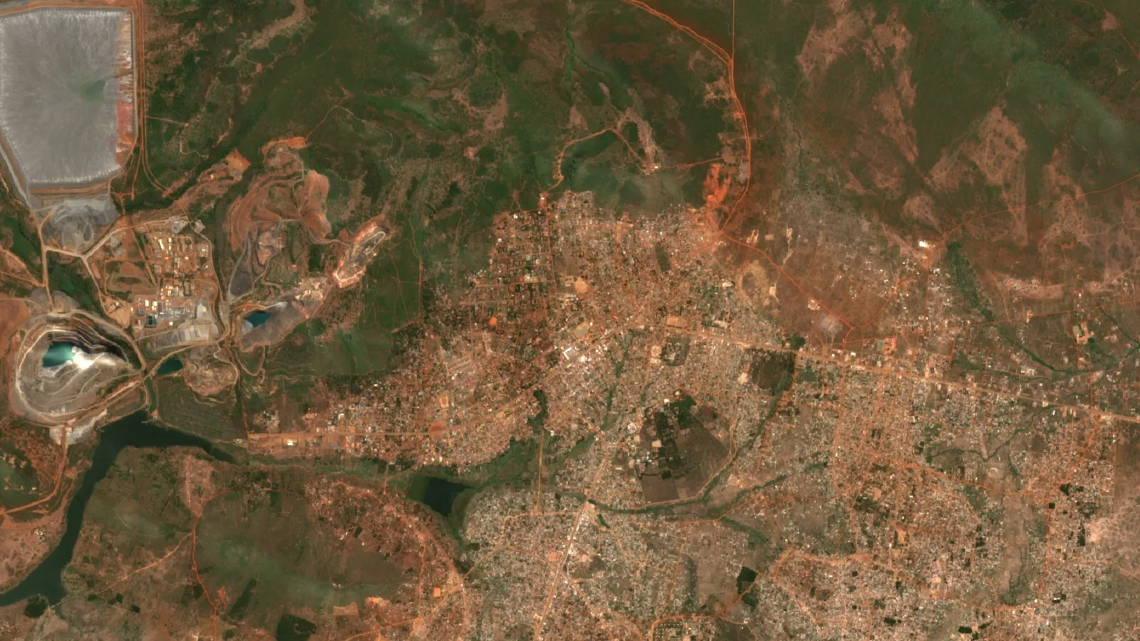
Satellite imagery fits here because it covers the whole licence at once. Sentinel-2, for example, records 13 spectral bands from visible to shortwave infrared, four of them at 10 m pixels, and passes over the same ground about every five days with its two-satellite constellation (Copernicus Sentinel-2 mission description). Analysts use those bands to map iron-oxide staining, clay alteration and rock types, which can point to where to walk first. Our explainer on how satellite mineral exploration works covers the method, and the report sample shows what a finished deliverable looks like.
A Farmonaut satellite mineral report is delivered in 5 to 20 business days, depending on area and mineral, for licences of at least 10 acres. Satellites map surface and near-surface signatures; sampling and drilling confirm them, and the results are exploration targets, not a mineral resource under JORC, NI 43-101 or SAMREC. You can request a quote, and the calculator below has a line for it. How this stage compares with soil sampling and geophysics is set out in satellite vs geochemistry vs geophysics.
Geological mapping, sampling and assays
Mapping and sampling turn a desk target into a ground fact. A geologist walks the licence, records rock types, veins, faults and alteration, and collects samples: soil on a grid, sediment from streams and chips from outcrop. A laboratory then reports how much metal each sample holds.
Chart
Where one small programme’s money went
Actual spend of C$12,018 on a 2010 prospecting and stream-sampling programme, 16 claims, British Columbia
A small filed programme shows how modest this stage can be. A report lodged with the BC Geological Survey describes a 2010 prospecting and stream-sampling programme on a 16-claim property that cost C$12,018 in total. The laboratory charged C$36.64 per stream-sediment (moss mat) sample and C$42.86 per rock sample in that year, and the whole analytical bill was C$1,712 (BC assessment report 32329). Prices have moved since 2010, so use it for proportions, not for today’s rates. The chart shows where that programme’s money went.
The Western Australia government gives a second proportion. For its prospector drilling grants, where holes are not cored, it expects analyses to equal about 25% of direct drilling cost, and its example splits an A$40,000 grant into A$30,000 of drilling and A$10,000 of assays (Co-funded Government Drilling Guidelines, Round 34). The lesson for your budget is that assays follow the drilling you do: a bigger drill programme needs a bigger assay line.
Laboratories publish price lists or give quotes on request, and rates depend on the method and the element package. Ask for the all-in price per sample, including preparation (crushing and grinding), and for how many quality-control samples they advise. Our overview of assay services explains the common methods.
Geophysics
Geophysics measures physical properties of the ground, such as magnetism or electrical response, to see below cover that mapping cannot. It is worth buying when the rock is hidden by soil or vegetation, or when a mapped target needs its shape and depth checked before a drill rig is booked. Canada’s explorers spent about C$146 million on geophysics in 2024, only 3.4% of the total, the smallest share of any category in the table.
It belongs after mapping and sampling because the result is hard to read without them. A magnetic high means little until a geologist can say which rock causes it. Prices depend on method, line spacing and access, so ask for a per-line-kilometre or per-station quote for your area. Our guide to geophysical survey companies compares ground and airborne options, and a hired geologist can help you choose; see geological consulting firms for how fees are quoted.
Trenching
A trench is a long shallow cut, usually dug by excavator, that exposes fresh rock across a soil-covered zone. The geologist maps and samples it before it is refilled. Trenching shows the width and continuity of a vein far better than a few scattered samples, and it costs far less than drilling. Natural Resources Canada groups it into rock work, which also covers stripping, shafts and rock sampling, and rock work made up about 7.0% of 2024 spending.
The filed British Columbia report above recommended a first phase of C$150,000: 20 days of soil sampling and mapping at C$2,500 per day, 20 days of prospecting at C$2,500 per day, and 10 days of trenching, mapping and sampling at C$5,000 per day. The report sets the trenching day rate at twice the mapping rate, which is consistent with the cost of a machine. The report says trenching can start as soon as the soil and prospecting results are in, which is the right order. Permits for ground disturbance, and the cost of putting the ground back, should sit in this line.
First drilling and what a metre costs
Drilling is the largest and least reversible line, so it should come last. Diamond drilling cuts a solid core of rock that a geologist can log and sample; reverse circulation drilling blows back chips and is usually cheaper per metre but gives less structural information. Our overview of the types of drilling and rigs explains the differences.
Chart
Diamond drilling cost per metre in Canada
Average cost per metre, Canadian dollars (nominal), survey years 2018 to 2024
A public price per metre can be worked out from Canadian survey data. Dividing Natural Resources Canada’s 2024 diamond-drilling cost of C$1,690 million by 5,959 thousand metres drilled gives about C$284 per metre, or about US$207 at the Bank of Canada’s 2024 average rate of 1.3698 (Bank of Canada). That is our own calculation from the survey totals. It is an average of the diamond drilling costs explorers reported, for surface and underground holes on and off mine sites, so treat it as a reference point, not a quote for your country. The same calculation for earlier survey years gives the trend in the chart.
A first drill programme for a small licence is usually a few hundred metres, enough to test the best target on two or three sections. At roughly US$200 per metre, 400 metres is about US$80,000 before assays; contractor quotes may add camp and mobilisation, which explains why drilling takes the largest share in the calculator below. Drilling also needs its own approval in most countries, and the ground must be restored afterwards.
Contingency and reporting
Contingency is money you hold back for things that go wrong: a wet season that delays trenching, a road that needs repair, a lab queue, a rig that costs more to move than quoted. Many planners set it as a percentage of the budget. We use 10% in the calculator as an example, not a published norm, and you should raise it for remote or high-rainfall ground.
Reporting is easy to under-budget. Most regulators expect a technical or assessment report with maps and data, and an investor, buyer or partner will expect one as well. In the filed example above, office studies and report preparation cost C$4,744 of the C$12,018 spent, about 39%, more than the field staff or the laboratory. On a small programme the writing and map work is a large part of the bill, and it is also what turns your samples into an asset you can show. For a look at what a finished exploration report contains, see the sample report.
Order of spend and staged gates
A gate is a decision point: you spend the next stage’s money only if the last stage’s results support it. The same logic runs through the cost table. Each gate below tells you what result should gain the next spend and what to do if it does not appear.
| Gate | Spend before it | Evidence needed to continue | If it is missing |
|---|---|---|---|
| 1. Desk review | Licence, desktop study, satellite screen | At least one target backed by two independent sources, such as old workings and an alteration zone | Narrow the licence or drop it before field costs |
| 2. Mapping and sampling | Field geologist, samples, assays | Anomalous samples that line up with a mapped structure | Re-sample or stop; do not buy geophysics for an unsupported target |
| 3. Geophysics and trenching | Surveys, excavator, trench sampling | A continuous zone with width and grade worth testing at depth | Hold the drill money for another target |
| 4. First drilling | Rig, crew, core assays | A drill-ready target with a planned angle, depth and approvals | Do not drill; write up and look for a partner |
The filed British Columbia report follows the same pattern: Phase 1 is soil sampling, mapping, prospecting and trenching, and a second phase is left open to follow only if the first phase supports it. Staging also protects you if cash runs short. Because the cheapest stages come first, a year-one budget that stops after gate 2 or 3 is still useful, since the maps, samples and report are an asset you can show to a partner.
Build your own first-year budget
The calculator below adds your phase costs, applies a 10% contingency and shows which phase takes the largest share and how many months the money lasts at your monthly spend. The starting values are examples, not benchmarks or quotes: replace each one with a written quote or your own estimate. The satellite report line starts at zero because Farmonaut report prices are not published; enter your quote if you request one.
Calculator
What would your first-year budget total, and how long does it last?
Replace each example with your own quote. Amounts are in US$.
- Phase costs before contingency: $154,000
- Contingency at 10%: $15,400
- Largest phase as share of total: 47.2%
- Months of runway at your monthly spend: 14.1 months
Example values only, not benchmarks or quotes: use your own quotes. Contingency is fixed at 10% of the phase costs as an example allowance, not a published norm. The satellite report quote starts at 0 because Farmonaut report prices are not published; enter your quote. Reporting is included in the licence line. Runway is the total budget divided by your monthly spend.
Frequently asked questions
How much should I budget for the first year of exploring a small licence?
There is no single answer, because costs depend on country, access and mineral. What the public data show is the shape: in Canada in 2024, drilling took about 41% of spending and geophysics about 3%. Build the budget stage by stage from written quotes, hold back a contingency, and plan to stop at a gate if the evidence does not support the next stage.
Which phase costs the most?
Drilling. Natural Resources Canada’s 2024 survey put drilling at about C$1.72 billion of C$4.23 billion, about 41%. A first-year plan for a small licence often spends less than that on drilling because it stops earlier, but drilling is still normally the single largest line.
Do I have to spend money on my licence each year?
Often yes, but the rule is set by the regulator. British Columbia requires exploration work of at least C$5 per hectare in each of the first two years, rising to C$20 later, or an equal cash payment at double the amount. The US BLM charges a US$200 annual maintenance fee per lode claim, with a waiver for holders of 10 or fewer claims who do US$100 of work per claim. Check your own ministry’s rules before you apply.
What does a metre of drilling cost?
In Canada in 2024, diamond drilling averaged about C$284 per metre, or about US$207, calculated from the national survey totals. Rates are lower or higher elsewhere. Ask contractors for a per-metre rate that includes mobilisation, and ask what is excluded, such as water, pads and core boxes.
How big should the assay budget be?
It should follow your sampling and drilling plan. The Western Australia drilling programme for prospectors expects analyses to be about 25% of direct drilling cost when holes are not cored. Count the samples you plan to take, multiply by the laboratory’s all-in price per sample, and add quality-control samples.
Where does a satellite report fit in the budget?
Early, in the desktop stage, before field crews are booked. It screens the whole licence and helps you choose where to map and sample first, so it can reduce wasted field days. It does not replace sampling or drilling. Request a quote from Farmonaut and enter the amount in the calculator.
Why keep a contingency?
Because exploration costs depend on weather, access and suppliers. A reserve stops a delay in one stage from forcing you to cut the next. The 10% used here is an example; remote and wet-season projects usually need more.
Is this budget advice?
No. It is general information with public figures, and your costs will differ. Get written quotes, take advice from a qualified geologist and confirm licence rules with the ministry that issued your title. For the wider picture of stages, methods and timelines, see our complete guide to mineral exploration.
This page is for information only. It is not legal, financial or investment advice. Costs vary by country, access and mineral; get written quotes and confirm licence rules and fees with the ministry that issued your title.
Farmonaut mining
Screen your licence before you spend in the field
Request a quote for a satellite mineral report on your ground, so your first-year budget starts from a target list.

Mining Pro sample view, synthetic data
Sources
- Natural Resources Canada, expenditure-category table, 2024: mmsd.nrcan-rncan.gc.ca
- Natural Resources Canada, expenditure-category table, 2022: mmsd.nrcan-rncan.gc.ca
- Natural Resources Canada, expenditure-category table, 2020: mmsd.nrcan-rncan.gc.ca
- Natural Resources Canada, expenditure-category table, 2018: mmsd.nrcan-rncan.gc.ca
- Natural Resources Canada, Canadian Mineral Exploration Information Bulletin (2024 totals): natural-resources.canada.ca
- Bureau of Land Management, mining claim fees (claims filed from 1 September 2024): blm.gov
- Bureau of Land Management, annual maintenance and assessment: blm.gov
- British Columbia, Mineral Tenure Act Regulation 529/2004: bclaws.gov.bc.ca
- Western Australia DMPE, Co-funded Government Drilling Guidelines, Round 34: wa.gov.au
- BC Geological Survey, assessment report 32329 (Hawthorn Lake property, filed 2010): apps.nrs.gov.bc.ca
- Bank of Canada, annual average exchange rates: bankofcanada.ca
- Copernicus, Sentinel-2 mission description: sentiwiki.copernicus.eu
Discussion
Questions, corrections or field experience? Share them below. First-time comments are reviewed before they appear, and your email is never published.
No comments yet. Be the first to add a question or your experience.

 Mining SARL
 SenGold Invest SAS
 Sania Corporation
 Sean Mining Limited
 NTS Group (Pty) Ltd
 Mine4Africa
 Lithspo Minerals Limited
 Tintina Mining Group
 Dalgety Minerals Pty Ltd
 Vortex Minerals Pty Ltd
 Faith At Work (Pty) Ltd
 Geotech Mining Solutions plc
 Vulcan International Limited
 Kidepo Associates
 GKY Mining
 Alkimy SARL
 Double A Trading
 GemSprout Metals Limited
 Qader Group
 Ileys General Trading
 SG Gold Mining LLC
 VRV Global Pte Ltd
 Omsri International FZE
 G.I.T.T.

 Client · Tanzania · Gold










