

Exploration strategy · Decision guide
Greenfield vs Brownfield Exploration: Where to Look First
Greenfield work searches ground with no known deposit; brownfield work searches around a known one. Start brownfield if proven mineralisation touches your licence, and screen the rest of a large block cheaply before any field survey.
Key takeaways
- Brownfield (minesite) work took 45% of global exploration budgets and grassroots 21% in 2025, both records (S&P Global, as reported by Business Day, 2026).
- The average spend per discovery tripled to US$218 million (2011-2020) from US$65 million (1975-2005), in 2023 dollars (MinEx Consulting, 2023).
- About 80% of Australia is under regolith or sediment cover, and most known resources lie in outcropping or near-outcropping geology (Geoscience Australia).
- Major mines that started up in 2010-2019 took over 16 years from discovery to first production (IEA).
- For a large concession, map what has been tested, screen the rest with satellite and public geophysics, then take only the top cells to the field.
In this article
- Greenfield and brownfield exploration: what the two terms mean
- Where exploration money is going now
- How often each approach finds a deposit, and what it costs
- Brownfield first: how to search around a known deposit
- Greenfield exploration: how to identify untapped gold deposits in unexplored areas
- The unexplored part of your concession
- How to explore a large concession without starting with extensive field surveys
- Near-mine, regional and reconnaissance work: which one fits your ground
- Which to explore first: a decision guide
- Splitting a budget between brownfield and greenfield ground
- What investors and partners should ask
- Frequently asked questions
Greenfield exploration searches ground with no known mine or deposit nearby. Brownfield exploration searches around a mine or deposit that is already known. Look at brownfield ground first if you hold land next to proven mineralisation: the geology is understood and the cost of a find is lower. Look at greenfield ground first only when you hold a large block with nothing proven on it and you can afford a long, uncertain search. Most licence owners end up doing both, in order: brownfield targets to earn the right to keep going, greenfield targets to find the next deposit.
This page is about where on or near your licence to look first. It covers the plain meaning of each term, what the discovery data says about each, how to explore a large concession without starting with a big field programme, and how to decide which part of your ground gets the first dollar. For how targets are ranked once you have candidates, see exploration targeting; for the full sequence of stages and costs, see the complete exploration guide.
Greenfield and brownfield exploration: what the two terms mean
The words came from the oil industry and moved into mining. An Australian parliamentary inquiry into resources exploration (reported in the early 2000s) notes that the terms were coined by the petroleum sector, and that minerals companies later adopted them to separate high-risk remote exploration from near-mine exploration. In that report brownfield work is the work done close to an operating mine to extend its life and use the infrastructure already there. Greenfield work aims to establish a new mine that needs new infrastructure.
The same report says the terms are widely used but loosely defined, and can mean different things in a small company and a global one. That matters when you read a company report. One firm may call a drill hole 500 metres from its pit “greenfield”; another may call it “near-mine”. Ask what the author means before you compare two sets of numbers.
A few related words you will see in the same reports:
- Grassroots exploration: the earliest stage, where explorers look for an entirely new deposit with little or no existing drilling. Most grassroots work is greenfield.
- Reconnaissance exploration: the first, wide-spaced look at a large area. It uses maps, satellite images, regional geophysics and widely spaced sampling to decide which small parts of a large area deserve follow-up.
- Regional exploration: work across a belt, district or large licence package rather than on one deposit. It sits between reconnaissance and brownfield work.
- Near-mine exploration: the closest form of brownfield work, looking for extensions and satellite deposits within trucking distance of an existing plant.
- Minesite exploration: the budget category S&P Global uses for work at and around operating mines (see the next section).
Greenfield versus brownfield at a glance
| Question | Greenfield | Brownfield |
|---|---|---|
| Where is the search? | Ground with no known mine or deposit | At, under or close to a known mine or deposit |
| What do you already know? | Regional maps and a few samples, often little else | Rock types, structures, grades, old drill logs |
| Main risk | There may be nothing there | The extension may be small or already mined out |
| Main prize | A new deposit, sometimes a new district | More life from an existing mine, or a satellite deposit that can use its plant |
| Infrastructure | Usually none; a find needs its own roads, power and water | Plant, roads and camp already exist |
| Typical first step | Desktop study, satellite and regional geophysics, wide sampling | Review old drill data, model the orebody, drill the gaps |
The South Australian Government, quoted in the same inquiry report, described a spectrum that runs from pre-competitive work (high risk, low cost) through grassroots and advanced exploration to brownfield work (low risk, high cost). That is a useful way to hold the idea: early-stage work is high risk and low cost; brownfield work is low risk and higher cost. The report does not say why; dense drilling is the usual reason.
Where exploration money is going now
Companies have been moving money from greenfield to brownfield for years. In the S&P Global Market Intelligence data for 2025, as reported by Business Day, global non-ferrous exploration budgets slipped 1% to US$12.4 billion. Budgets at and around existing mines rose 13% to a record US$5.63 billion, which is 45% of the total, the highest share on record. Grassroots exploration fell 8% to US$2.57 billion, or 21% of budgets, the lowest share in the dataset.
Chart
Share of global exploration budgets by stage
Non-ferrous metals, % of budgets; grassroots 2024, others 2025
The year before, S&P put the grassroots share at 22%. Its report, covered by Mining.com, contrasts that with 1997 to 2004, when grassroots projects received nearly half of annual global budgets. S&P’s analyst links the shift to a more risk-averse stance after metal prices fell from 2012, with more emphasis on extending known deposits, which tends to add company-held resources but limits new discoveries. The cost is a thinner pipeline: S&P said the long move away from grassroots work risks constraining the future project pipeline even as it supports mine-life extensions in the short term.
There is a second reading, and it helps a licence owner. If large companies spend less on early-stage ground, fewer people are testing it. Ground that has had little modern work may be untested because it was out of fashion, not because it is barren. That is not a promise of a discovery, but it is a reason to check what has been done on your own ground before you assume it is picked over. A Crux Investor summary of the same S&P data counts only nine gold discoveries since 2020 that passed S&P’s major-discovery threshold of 2 million ounces, which shows how rare big finds are.
How often each approach finds a deposit, and what it costs
MinEx Consulting, a mineral-economics firm that tracks discoveries worldwide, shows the scale of the problem. In its October 2023 presentation the world was finding about 50 deposits a year, half the rate of a decade earlier. The average spend per discovery (in 2023 US dollars) was US$65 million over 1975 to 2005, and tripled to US$218 million over 2011 to 2020. The same deck puts the best class of find, the “company-making” Tier 1 deposit, at only 2 to 3 a year worldwide.
Chart
Discoveries per decade by region
Number of discoveries, all commodities, selected regions
The regional table in that deck compares two decades. Discoveries fell in most regions between 2002-2011 and 2012-2021, and the value found per dollar spent fell with them. MinEx’s own measure of that ratio is the “bang-per-buck” (estimated value of discoveries divided by exploration spend). The world as a whole sat at 0.69 in 2012 to 2021, which means exploration did not repay its cost on average. Australia and Africa scored 1.19, Canada 0.78 and the United States 0.54. These are estimates by one consultancy, include an adjustment for unreported discoveries, and describe whole countries, not single licences. Read them as a sign of how hard new finds have become, not as a forecast for your ground.
MinEx’s data covers all discoveries, so it does not by itself prove that brownfield beats greenfield. What it does show is that the easy finds, those that sit at surface or beside a road, are largely taken. A paper by T. H. Whiting and R. C. Schodde, “Why Do Brownfields Exploration?” (AusIMM, 2006), gives the logic from the operator side. Brownfield search space is finite. Each camp is searched progressively, so later discoveries are smaller and cost more, and a company should track that trend. The first wave of finds in a camp is often found without much geological theory; the next wave, the hidden ones, needs better understanding of the ore environment.
The same paper uses the Kambalda nickel camp in Western Australia as its case: over 40 years more than 40 deposits were found there, holding over 1.7 million tonnes of nickel metal. That is the pattern brownfield owners hope for. A first find opens a district, and the district keeps paying while the geological model improves.
Brownfield first: how to search around a known deposit
If your licence touches a known deposit or an old working, start here. The target types are few and well understood.
Chart
Value found per dollar spent, 2012-2021
MinEx estimated value of discoveries divided by exploration spend; world average 0.69, selected regions
- Strike extensions. Strike is the direction a mineralised zone runs along the surface. Many orebodies are open at one end because drilling stopped at a licence boundary, a budget limit or a change in cover. Check where the last good hole ended and why.
- Depth extensions. Old open pits and shallow workings often stopped at the depth the economics allowed. At today’s prices the same zone may be worth testing deeper. Plunge, the direction the richest part of a body dips, is the thing to model.
- Parallel and repeated structures. A vein, shear or contact usually has siblings. Geophysics and structural mapping show where the same setting repeats within a few kilometres.
- Satellite deposits. Small bodies that can be trucked to the existing plant. They may be uneconomic alone and valuable together.
- Old data re-read. Historic holes with assays but no logs, abandoned soil lines and unprocessed geophysics. Digitising these is often the cheapest brownfield step.
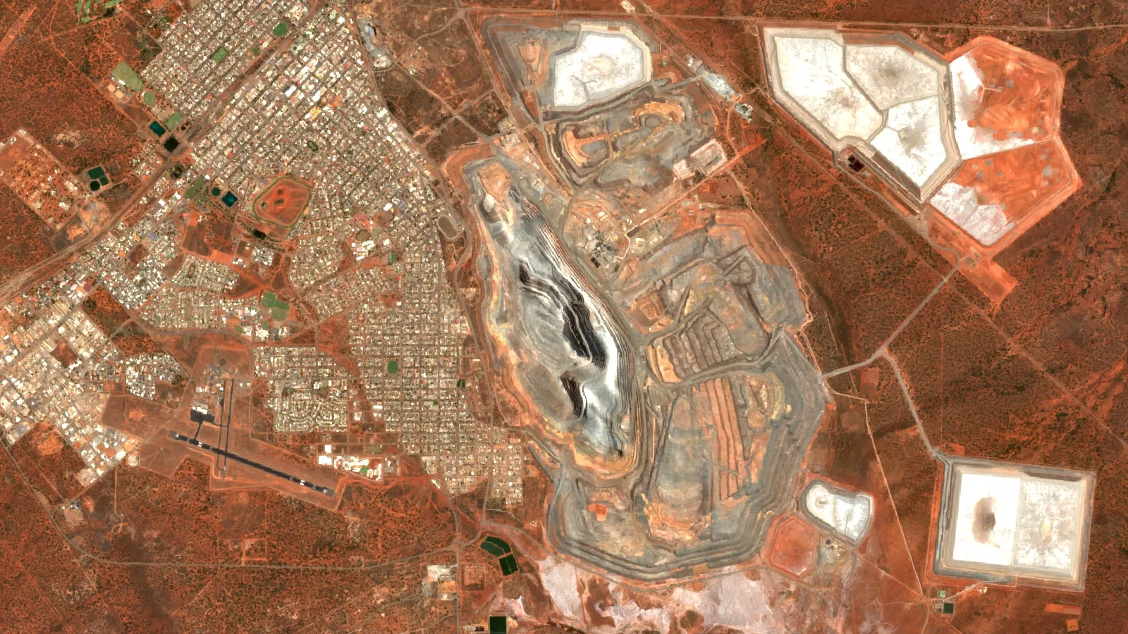
The Gruyere gold mine in Western Australia shows brownfield thinking applied to a mine that began as a greenfield find. Gold Road discovered Gruyere in October 2013 on the South Dorothy Hills Trend, 25 km north-east of the Central Bore discovery on the Yamarna Belt. Gold Fields’ own Gruyere page says first gold was poured in 2019 and that the planned mine life has been extended to 2031, with the extension including the Golden Highway satellite pits about 30 km from the main pit. A discovery on new ground became a mine; then satellite pits near it extended the plan.
Brownfield work also has a trap. Because drilling is dense and the target is close, it is easy to confuse “infill drilling” with exploration. Infill drilling makes a known resource more certain. It does not discover anything new. When you read a budget, split the two lines, since only the first can add a new body or a new zone.
Greenfield exploration: how to identify untapped gold deposits in unexplored areas
Gold is the largest single target in exploration: S&P’s 2025 data puts gold at US$6.15 billion, half of all global exploration spending. A search for untapped gold on ground with no known deposit has a standard order of work. Each step is cheaper than the next, and each one can end the search for a given area.
- Collect everything that already exists. Government geological maps, historic reports, old drill holes and airborne surveys. In Western Australia, for example, the GeoVIEW.WA tool lets users search the public mineral exploration report database (WAMEX) and a drillhole dataset compiled from those reports. In the United States, the USGS Mineral Resources Data System lists deposit and occurrence records with location, commodity and geology; the USGS stopped systematic updates in 2011, so use it mainly for older records and for sites outside the United States. Other jurisdictions have their own portals.
- Decide the deposit style you are after. An orogenic (shear-hosted) gold system, an epithermal vein system and a sediment-hosted system leave different traces. Choose the style that your rocks allow, or you will collect data that answers no question.
- Map the whole licence at coarse scale. Satellite imagery shows iron-oxide stains, clay and mica alteration, silica and long linear structures. Regional magnetics, which Geoscience Australia describes as measuring the field from magnetic minerals in crustal rocks, map rock boundaries and faults beneath thin cover.
- Rank cells, not whole licences. Divide the licence into cells and score each against the deposit style. The top few percent are where field crews go.
- Sample the top cells. Soil, stream-sediment or rock-chip lines over the best cells. Geochemistry tells you whether the surface signs carry gold.
- Drill only what survives. A first-pass drill programme belongs at the end, and the cost of drilling should be spent on the cells that passed all earlier steps.
Gruyere is also a greenfield example that opened new ground: Gold Fields’ 2016 joint-venture announcement describes it as part of the Yamarna gold belt, a new gold province on the eastern limb of the Yilgarn craton. The point is not that every licence will do this. The point is that provinces do get opened by explorers who test ground others had skipped.
Why cover is the main barrier to greenfield finds
Much of the untapped ground in the world is hidden under younger sediment or weathered soil. Geoscience Australia says that most of the mineral resource base found so far occurs from outcropping or near-outcropping geology, which makes up about 20% of the land area; the other 80% of Australia is covered by regolith or sediments, much of it only a few hundred metres thick, and prospective rocks beneath it are largely untested. The principle applies on every continent with deep weathering or glacial cover. If your licence is covered, expect to need geophysics and shallow drilling to see through it, and expect a slower and costlier search than on outcropping ground.
How much gold is still undiscovered?
Nobody knows exactly, but government assessments give a sense of scale. The USGS says about 244,000 metric tons of gold have been discovered to date: 187,000 tons produced plus 57,000 tons in underground reserves. For the United States, the USGS 1998 national assessment (Circular 1178) estimated 18,000 tons of gold in undiscovered deposits that could be mined with the technology of that time, compared with 15,000 tons in identified resources and 12,000 tons already produced from the largest deposits. Those figures are for one country, from the 1998 assessment, and the USGS lists the circular as superseded by a later report (Open-File Report 2002-198), so use them as scale, not as a map of where to dig. They do show that national geological surveys expect large amounts of gold still to be found in places not yet drilled.
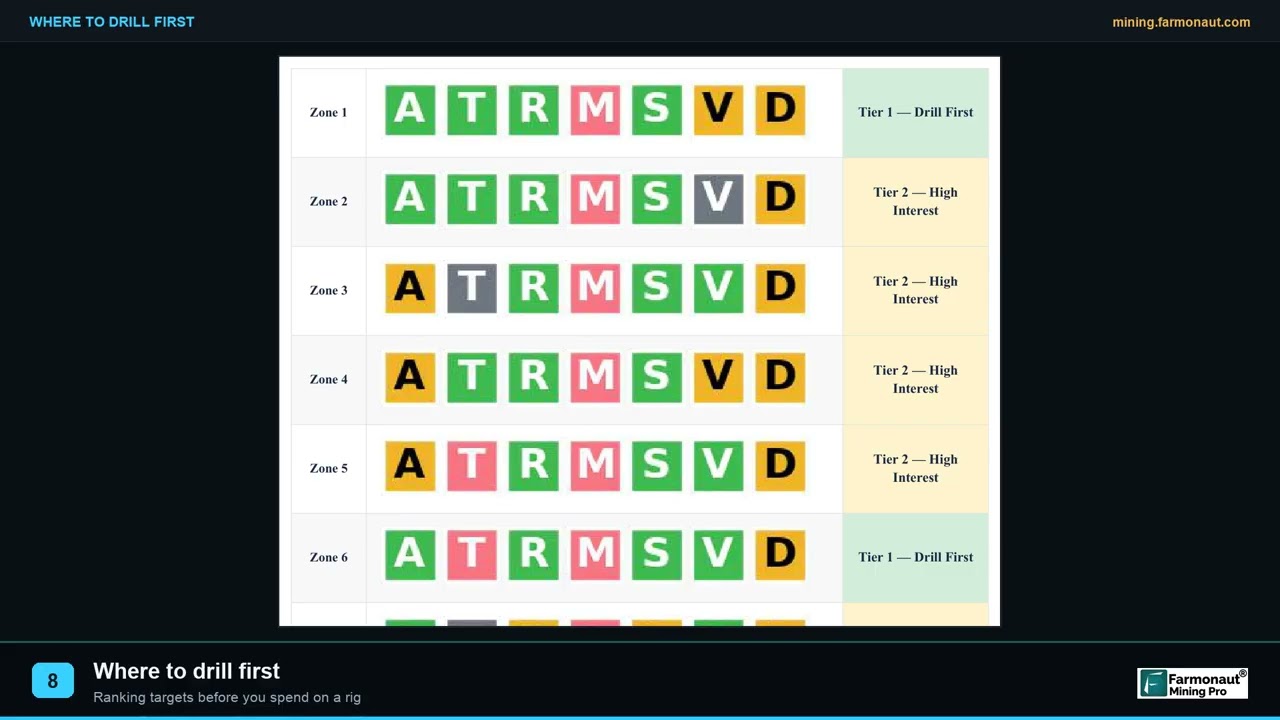
▶ How satellite targets are ranked into a drill order you can defend. · 2:19
The unexplored part of your concession
A common situation: a company holds a concession of several thousand hectares, and all its drilling and sampling sits in 5% or 10% of it, around an old working or a first discovery. The rest has had a few soil lines or nothing at all. Owners ask whether the remaining ground is worth testing or just a cost to keep. The answer starts with a coverage map, not with a drill rig.
Build the map in three layers. On the first layer, plot every drill collar, trench, soil line and geophysical survey, with the year and who did it. On the second, mark which parts have been tested by at least one method, and which methods cannot see what you are after (for example, a shallow soil survey over thick cover tells you little). On the third, add the new coarse-scale data: satellite alteration maps, structure lines and regional geophysics. Where untested ground carries the same signs as the tested area, you have a case to move forward. Where it does not, you have an honest reason to stop spending there or to hand the area back.
This is also how to tell a real gap from a false one. Some ground is untested because no one looked. Some is untested because someone looked and saw nothing. Old reports, which are public in many jurisdictions, usually say which. The licence area checklist lists the 12 points to verify on your own ground before you spend, including boundaries, tenure status and prior work.
How to explore a large concession without starting with extensive field surveys
A field survey across a large concession costs a lot and takes a full season or more. Starting with it is rarely the best order. A better order puts desk and remote work first, so that field time goes only to places that survive screening. The sequence below is what many explorers follow. The first three steps cost little compared with field work, and each shrinks the area to be tested.
Infographic
Screening a large concession in six steps
- 1CompileMaps, reports, old drill and tenure records.
- 2Screen from spaceSatellite alteration and structure over the whole licence.
- 3Add public geophysicsRegional magnetics and radiometrics where they exist.
- 4Rank cellsScore cells and keep the top few.
- 5Check in the fieldConfirm surface signs on the top cells.
- 6Sample, then drillSpend on cells that passed every step.
- Desktop compilation: maps, reports, records of past work, tenure and access.
- Satellite screening of the whole licence: multispectral images such as the European Space Agency’s Sentinel-2, which has 13 spectral bands and resolution down to 10 m, show alteration and structure patterns across thousands of hectares in one pass.
- Regional geophysics from public data: national magnetic and radiometric surveys, where they exist.
- Target ranking: score cells and keep the top few.
- Targeted field checks: a short visit to confirm that the surface signs are real.
- Sampling, then drilling: on the confirmed cells only.
Satellites map surface and near-surface signatures; sampling and drilling confirm what is in the ground. That is why the sequence ends in the field and not at the screen. Farmonaut’s satellite mineral report is built for the screening step: you send a licence boundary and receive high-potential zones for your project before field planning. For how this fits next to ground methods, see satellite vs geochemistry vs geophysics, and for a look at what a report contains see the report sample.
The budget logic is simple. If a first look at the whole licence removes half the area from consideration at a small share of the cost of a field survey, every later dollar is spent on better ground. Small licence holders can see how the arithmetic works in exploration budget for a small licence.
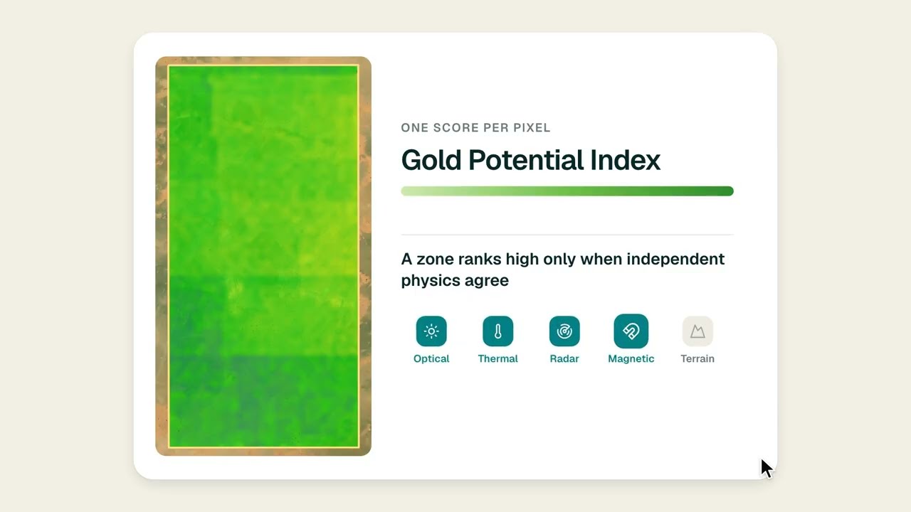
▶ Where on a mining licence to drill first, answered from satellite data before a rig moves. · 1:46
Near-mine, regional and reconnaissance work: which one fits your ground
The three words describe scale, not quality.
- Near-mine exploration fits you if an operating or past-producing mine sits on or beside your licence. The target is within a few kilometres, the geology is known, and a discovery can use an existing plant or share its infrastructure. It has the shortest path to a decision.
- Regional exploration fits you if you hold a belt or a large package of licences with a few known occurrences. The target is a district-scale pattern: where do the same structures, rock units and alteration repeat?
- Reconnaissance exploration fits you if you hold a large block with little known. The target is simply to find the first few places worth a second visit.
Most real projects mix them. A licence may have a brownfield core around an old pit, a regional belt that extends beyond it, and a large block of reconnaissance ground at the edge. Spend in that order of certainty, and tie each budget line to a question you can answer.
Which to explore first: a decision guide
| Your situation | Look first at | Why | Watch for |
|---|---|---|---|
| Old pit or working on your licence | Brownfield targets around it | Known geology, existing data and possibly infrastructure | Confusing infill drilling with new discovery |
| Producing mine next door, nothing on your ground | Near-mine ground that shares the same rock units and structures | The neighbour proves the system exists in your area | Ground that is geologically different but happens to be close |
| Large licence, drilling only in one corner | A coverage map, then satellite and geophysics on the untested remainder | Cheap screening shows whether the rest repeats the tested part | Surface signs that do not reach depth |
| Blank licence in a known belt | Regional work along the belt’s structures | Belt-scale patterns can be read from public data | Thick cover that hides the target |
| Blank licence in an unproven region | Reconnaissance, with a small first budget | It is the only honest starting point | Spending past the screening stage without evidence |
| You are an investor reading a company’s plan | Which budget line is brownfield and which is greenfield | They carry different risk and timing | Brownfield labels on what is really greenfield ground |
How long each path takes
Time matters as much as cost. The International Energy Agency found that major mines that came online between 2010 and 2019 took, on average, over 16 years from discovery to first production, with more than 12 years for exploration and feasibility work and four to five years for construction. A brownfield find that feeds an existing plant skips much of the construction and permitting time. A greenfield find carries the full clock. If your horizon is five years, that difference decides which targets you can afford to hold.
Splitting a budget between brownfield and greenfield ground
No rule says how to split money. What helps is to write down the answer to three questions for each part of your ground: what would a discovery be worth, how likely is it, and how soon would you know? Brownfield ground usually answers the last question best. Greenfield ground usually has the largest upside if it works. A common approach is to fund the brownfield or near-mine work first so it can inform the rest, and to hold a smaller, fixed share for screening the greenfield remainder. The calculator below shows what a budget buys once you fix the share for screening.
The calculator does not predict a result. It shows how many drill holes a budget pays for, which is a good check before you promise a programme to partners or lenders.
Calculator
How many drill holes does your budget buy?
Enter your own budget, screening share, drilling cost and hole depth.
- Budget for drilling (US$): $375,000
- Budget for screening (US$): $125,000
- Metres drilled: 2,500
- Holes per 100 ha of licence: 0.83
Example values only, not a benchmark. Use a contractor quote for the drilling cost per metre (example, use today’s quote). Amounts in US$. Hole depth and area are your own plan.
What investors and partners should ask
When you read a company’s exploration plan, or when a partner reads yours, a few questions separate a clear plan from a vague one.
- What share of the budget is brownfield, and what share is greenfield? Is the label used the same way throughout?
- Has the ground been tested by drilling, and to what depth? A shallow hole over thick cover says little.
- What is the exploration target, in tonnes and grade range, and is it labelled as an exploration target and not a resource? A target is not a JORC, NI 43-101 or SAMREC resource.
- What will the first-stage result change? A step that cannot change the next decision should not be funded.
- Who owns the data, and can it be checked? Public data can be checked by anyone.
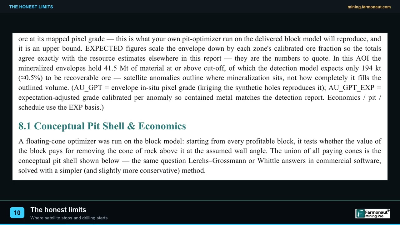
▶ The limits of satellite exploration that matter in due diligence. · 2:08
Frequently asked questions
What is the difference between greenfield and brownfield exploration?
Greenfield exploration looks for a deposit in an area with no known mine or deposit. Brownfield exploration looks around a known deposit or operating mine for extensions, parallel zones or satellite bodies. Greenfield has higher risk and higher upside; brownfield has lower risk and uses existing infrastructure.
What does greenfield exploration mean?
It means exploring ground with no known mineralisation or mine, aiming to find a new deposit that would need its own infrastructure. It is often used as a near synonym for grassroots exploration.
Is brownfield exploration cheaper than greenfield?
It depends on what you count. Brownfield work carries less risk because the geology is known and the infrastructure exists, and the South Australian Government’s spectrum rates it low risk but high cost. MinEx also notes that a camp’s search space is used up over time, so later brownfield finds are smaller and cost more. Which is cheaper for you depends on the ground.
Which has more discoveries, greenfield or brownfield?
Companies define the two labels differently, so discovery counts are rarely split this way. What the sources used here do show is that global spending has moved toward minesite work (45% of budgets in S&P’s 2025 data) and that new discoveries have become rarer and costlier (MinEx, 2023).
What is near-mine exploration?
It is brownfield work close to an existing mine, looking for extensions or new deposits that could use the same plant and roads.
What is regional exploration?
It is exploration at district or belt scale, looking for patterns across many kilometres rather than testing one deposit.
What is reconnaissance exploration?
It is the first wide-spaced look at a large area, using maps, satellite data, regional geophysics and sparse sampling to choose which small parts deserve follow-up.
How do I identify untapped gold deposits in unexplored areas?
Compile existing data, choose a deposit style, map the whole licence at coarse scale with satellite and regional geophysics, rank cells, sample the best cells and drill only those that pass. Satellites map surface and near-surface signatures; sampling and drilling confirm.
Why should a mining company investigate unexplored parts of its concession?
Because drilling often covers only the area around a first discovery. A coverage map and low-cost screening show whether the rest repeats the signs of the tested part, and whether it deserves more spending or should be released.
How can I explore a large concession without starting with field surveys?
Start with a desktop compilation, satellite screening of the whole licence and public geophysics, rank the cells, and take only the top cells to the field. This keeps the first spend small and the later spend focused.
Are undiscovered gold deposits really left to find?
Government geological surveys think so. The USGS 1998 assessment estimated 18,000 tons of gold in undiscovered US deposits, more than the 15,000 tons in identified resources. Such estimates are national and dated, and do not say where a new deposit sits.
Do I need a licence to start with satellite screening?
Check tenure and permission rules with the regulator for your area before any field work, sampling or drilling.
The figures on this page come from the sources listed at the end. Check any licence, tenure or regulatory point with the ministry or regulator for your jurisdiction before you act on it.
This page is for information only. It is not investment advice. Exploration targets are not mineral resources or reserves. Confirm licence and tenure rules with the regulator.
Farmonaut mining
Screen your whole licence from space
Send your licence boundary to get a quote for a satellite mineral report that ranks targets before field planning.

Mining Pro sample view, synthetic data
Sources
- Parliament of Australia, Resources exploration inquiry, chapter 1: greenfields and brownfields: aphref.aph.gov.au
- Business Day, Gold drives mining exploration as global budgets fall (S&P Global 2025 data): businessday.co.za
- Mining.com, Budget allocated to grassroots exploration at all-time low (S&P Global): mining.com
- Crux Investor, Shrinking exploration budgets raise the value of funded explorers: cruxinvestor.com
- MinEx Consulting, IMARC presentation (October 2023): minexconsulting.com
- AusIMM, Whiting and Schodde, Why Do Brownfields Exploration? (2006): ausimm.com
- Gold Fields, Gruyere operation page: careers.goldfields.com
- Gold Fields, Gruyere joint-venture announcement (2016): goldfields.com
- Geoscience Australia, Magnetics: ga.gov.au
- USGS, How much gold has been found in the world?: usgs.gov
- USGS, 1998 Assessment of Undiscovered Deposits of Gold, Silver, Copper, Lead, and Zinc in the United States (Circular 1178): pubs.usgs.gov
- USGS, Mineral Resources Data System: mrdata.usgs.gov
- Government of Western Australia, GeoVIEW.WA: dmirs.wa.gov.au
- IEA, The Role of Critical Minerals in Clean Energy Transitions: reliable supply: iea.org
- ESA, Sentinel-2: esa.int
Discussion
Questions, corrections or field experience? Share them below. First-time comments are reviewed before they appear, and your email is never published.
No comments yet. Be the first to add a question or your experience.

 GemSprout Metals Limited
 Qader Group
 Ileys General Trading
 SG Gold Mining LLC
 VRV Global Pte Ltd
 Omsri International FZE
 G.I.T.T.
 Jaunita Erss Ltd
 Almosi SARL
 SRK Consulting
 Berks Gold Limited
 Mwerezi Minerals Company Limited
 Mining SARL
 SenGold Invest SAS
 Sean Mining Limited
 NTS Group (Pty) Ltd
 Mine4Africa
 Lithspo Minerals Limited

 Client · Oregon, USA · Gold










