

Land owners and claim holders · How-to guide
How to Find Minerals on Your Land: 6 Steps and Costs
Find out who owns the minerals first, then read the public records, screen the ground by satellite, sample it and assay the samples. Each step is cheaper than the next. This guide gives the order, the checks and the costs.
Key takeaways
- Mineral rights can belong to someone other than the surface owner: the US federal government kept the minerals under many homestead patents (BLM), the UK Crown owns gold and silver (BGS), and Western Australia reserves all minerals to the Crown except on some land first granted to a private owner before 1899.
- Public data cost little and come first: geological maps (USGS, BGS), mine and prospect databases (USGS Mineral Resources Data) and claim records (BLM MLRS) show what is known before you spend on samples.
- Satellites map surface rock and alteration, not metal underground. Sentinel-2 sees 10 m pixels (ESA) and Landsat 9 sees 30 m (USGS), so they help rank ground, not prove it.
- Samples need a recorded chain of custody, blanks, certified standards and duplicates, and fire assay can report gold down to 1 ppb (CIM guidelines, ALS).
- A new US lode claim located on or after 1 September 2026 costs $274 to file for the 2027 assessment year, then $200 a year (BLM schedule); BLM counted 514,876 active claims at the end of fiscal year 2024.
In this article
- Step 1: Find out who owns the minerals under your land
- If you find gold on your property, is it yours?
- Step 2: Check the public record before you dig
- What is hiding beneath a mining concession or small claim
- Step 3: Screen the ground with satellite images
- Step 4: Walk the ground and take samples
- Step 5: How to test land for gold and read the assay
- Step 6: When to call a geologist
- What a small exploration budget should buy first
- What it costs to hold a US claim
- Land access and permission
- Frequently asked questions
To find minerals on your land, work in this order: confirm who owns the minerals, read the public geology and claim records, screen the ground with satellite images, walk it and take samples, then send those samples to a laboratory and ask a geologist to read the results. Each step costs more than the one before it, so the cheap steps come first and they decide whether the next one is worth paying for. This guide follows that order for landowners, claim holders and licence holders in the United States, the UK, Australia, Canada and other countries.
The first step surprises many owners. In much of the world the land you own does not include the minerals under it. Before you spend anything on tests, find out whether the rock beneath your boundary is yours, the state’s, or someone else’s.
Step 1: Find out who owns the minerals under your land
Surface rights and mineral rights are two different things. Surface rights let you use the land: build, farm, graze. Mineral rights, also called the mineral estate, cover the rock and the metals in it. They can belong to the same person or to different people. The rules depend on the country, and sometimes on the year your land was first granted. The table shows the pattern in five places, each from an official or geological survey source.
Chart
Share of each state’s land owned by the federal government
Per cent of state land area, 2024, eight selected states
| Place | Who owns the minerals | What the landowner can do |
|---|---|---|
| United States, private land | Usually the owner of the mineral estate, which may or may not be the surface owner | Trace the deeds to see whether minerals were reserved or sold earlier |
| United States, federal minerals under private surface | The federal government (split estate, mostly from homestead patents) | Contact the local BLM office; you cannot sell federal minerals |
| England, Wales, Scotland, Northern Ireland | Gold and silver: the Crown. Other metals: usually private owners. Northern Ireland vests most minerals in a government department | Gold and silver need an option from the Crown Estate; other minerals need planning permission |
| Western Australia | The Crown owns all minerals, except non-precious minerals on land first granted to a private owner before 1 January 1899 | You need a mining title before you explore, even on your own private land |
| Tanzania | The United Republic, held in trust by the President | Apply to the Mining Commission for a licence; land title does not give mineral title |
United States: three ownership layers
On private US land, the question is whether the minerals travelled with the surface. A deed that conveys the land with no reservation normally keeps both together. Earlier owners may have sold or kept part of the minerals, though. The Nevada Division of Minerals, in a beginner guide to mineral rights land research, says every deed ever drawn up for a property has to be traced. Its worked example shows how one buyer ends up with a 6.25% share after fractions pass through a family. The same guide notes that many county websites only reach back 10 to 15 years, so the work often happens at the recorder’s office, and it suggests hiring a land agent who specialises in minerals. The guide is explicit that it is not legal advice.
Where federal land was sold into private hands, the government often kept the minerals. The Bureau of Land Management (BLM) explains that this split estate is the legacy of the Stock Raising Homestead Act of 1916, which let settlers claim 640 acres of grazing land while the United States kept the minerals. The landowner owns the surface but cannot sell the reserved minerals. BLM staff check the master title plat and the original land patent to confirm who owns what, and if you have taken minerals without a permit, BLM says to stop and ask.
The third layer is public land that is open to mining claims. Federal land covers a large share of the West. The chart shows the share of each state’s land that the federal government owned in 2024. Not all of it is open to claims, because parks, wilderness and military land are closed, but it shows why claim records matter so much in the Western states.
The UK, Australia, Canada and Africa work differently
In the UK, the British Geological Survey (BGS) says the state owns gold, silver, coal, oil and gas, and that other minerals are generally in private ownership. Gold and silver mines are called mines royal. The Crown Estate grants an exclusive option to lease them for a given area, and the explorer still needs access rights from the landowner. For other metals and industrial minerals there is no national exploration licence, but extraction needs planning permission from the mineral planning authority.
In Western Australia the Mining Act reserves gold, silver and precious metals to the Crown on any land. The state’s private land provisions brochure explains that all other minerals are Crown property unless the land was first granted to a private owner before 1 January 1899. On a farm first granted after 1899, the farmer owns none of the minerals the Mining Act covers (common materials such as sand, gravel, limestone and most clay are treated differently), and anyone who wants to explore on private land must first obtain a mining title.
In Canada, each province runs its own mineral tenure. In Ontario, the Ministry publishes a policy on notifying surface rights owners: a company that wants to submit an exploration plan or permit application must first notify the owners of the surface rights and give them a map of the planned work. Check the current Ontario rules before you plan work. Tenure and claim data sit in the Mining Lands Administration System, whose map viewer is the public record of mining lands information.
In many countries the state owns the minerals. Tanzania’s Mining Act states that the entire property in and control of all minerals belongs to the United Republic, vested in the President in trust for the people. In a country like this, owning or farming the land gives you no mineral title. A small-scale miner starts with a licence; our guide to artisanal and small-scale mining licences explains the plot sizes and terms.
Whatever your country, ask the mining ministry or geological survey before you apply or dig. Rules, fees and areas change, and an old edition of a statute can mislead.
If you find gold on your property, is it yours?
It depends on who owns the mineral estate, not on who found the gold. On private US land where you hold both the surface and the minerals, the gold is generally yours, and you do not need to stake a claim, because claims apply to federal land. If the minerals were reserved or sold earlier, the gold belongs to whoever holds that reservation. Where the federal government kept the minerals under your land, they are not yours to sell.
In the UK, gold and silver belong to the Crown across the whole country, even if you own the field, although in Scotland some rights passed to private owners by ancient charter. In Western Australia, gold, silver and precious metals are Crown property on every block, whoever owns the land. In Tanzania, all minerals belong to the state. In each of these places, you would need a licence or an option before you could mine, and a find on your own land would not change that.
One more point applies to federal land. Under the General Mining Law of 1872, a claim gives you the right to develop a mineral deposit, but BLM’s claim packet is blunt that the surface of an unpatented claim is not your private property. The government keeps managing it. Using the surface for anything unrelated to mining can count as trespass.
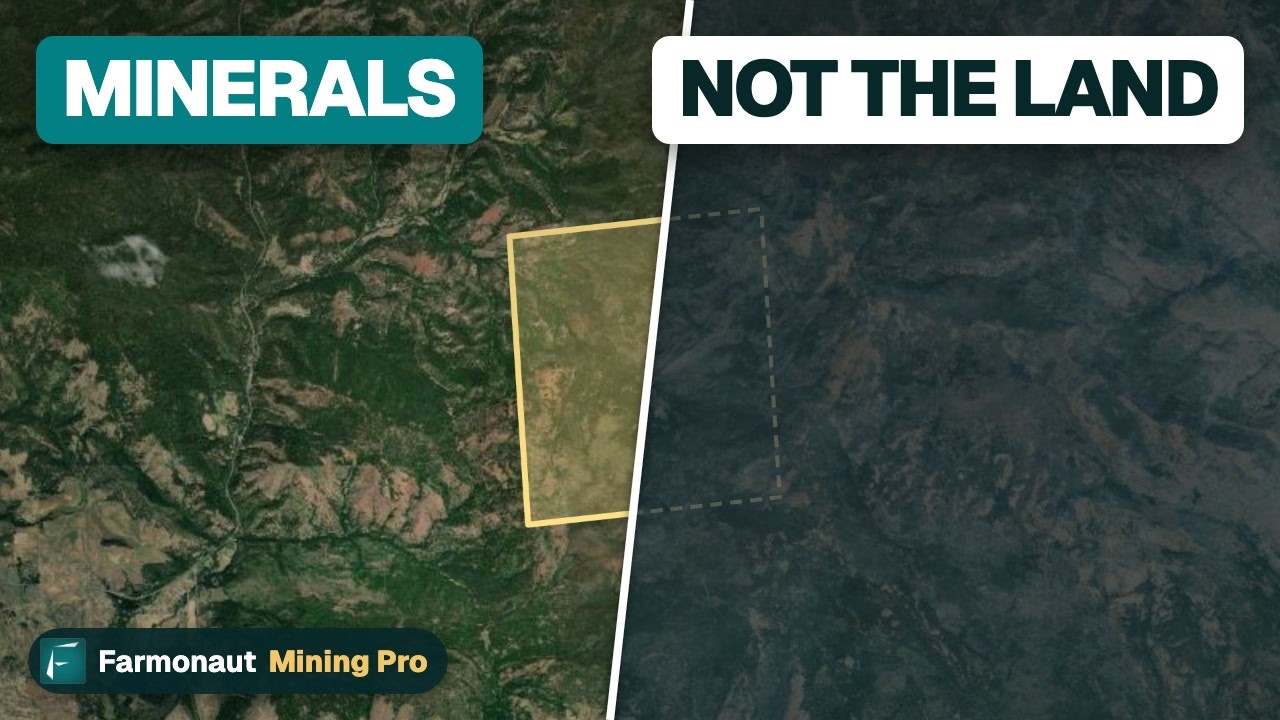
▶ Why owning a gold claim is not owning the land, and how to check the ground first · 3:19
Step 2: Check the public record before you dig
Governments have already mapped most of the ground you are likely to own. This step costs almost nothing and often saves a field season. Look for four things: the mapped rock types, known mines and prospects nearby, existing claims or licences over your ground, and old workings on the property.
- Geological maps. In the United States the USGS runs the National Geologic Map Database, and state surveys hold more detailed sheets. In Great Britain, the BGS Geology Viewer shows bedrock and superficial geology on a phone, with a satellite base map and a GPS position. Other countries have equivalents.
- Mine and prospect databases. The USGS Mineral Resources Data catalog lists the Mineral Resources Data System (deposit name, location, commodity and references), the USMIN deposit database, and the Alaska Resource Data File. A cluster of old prospects within a few kilometres tells you the rock in your area has hosted mineralisation before.
- Claim and licence records. In the US, BLM’s Mineral and Land Records System shows federal claims. The Montana claim packet tells readers to confirm that land is open to mineral entry using a master title plat and to research other active claims in the quarter section. Outside the US, use the cadastre or licence portal of your mining ministry.
- Old workings. Pits, shafts, dumps and trenches show that earlier owners found something worth chasing. Look at old topographic maps and aerial photographs, and ask neighbours. Treat any shaft as dangerous.
Write down what the desk work tells you. A one-page note with the mapped rock, the nearest known mine, the claim status and the old workings is the base for the rest of the project. If you hold a licence or concession, our licence area checklist turns this into 12 points to verify.
This desk review is also what a mineral survey starts with. The phrase is used loosely. It can mean a government survey of a district, a geologist’s visit to your property, or a package of mapping, sampling and reporting. Ask any provider which of these they mean and what you will receive.
What is hiding beneath a mining concession or small claim
A concession or licence is a permission from the state to explore or mine an area. It is not a measure of what is underneath. If you want the full picture, our guide to what a mining concession is covers rights, terms and costs. For this guide the point is simpler: nobody knows what lies under a concession until work is done. The records you pulled in step 2 are a start, and the next steps replace guesses with data.
A small area is not a handicap in itself. One square mile is 640 acres, or about 259 hectares. A single geochemical sample every 100 metres means one sample per hectare, so a grid over that square mile is about 259 sample points. That is a programme a small team can plan and price. Geology decides what is there. A narrow gold-bearing shear zone can sit inside a small block, and a large block can be barren. What area does limit is how much of a deposit you could hold, which is why small holders often work out how to test and rank targets cheaply before they commit to drilling.
Step 3: Screen the ground with satellite images
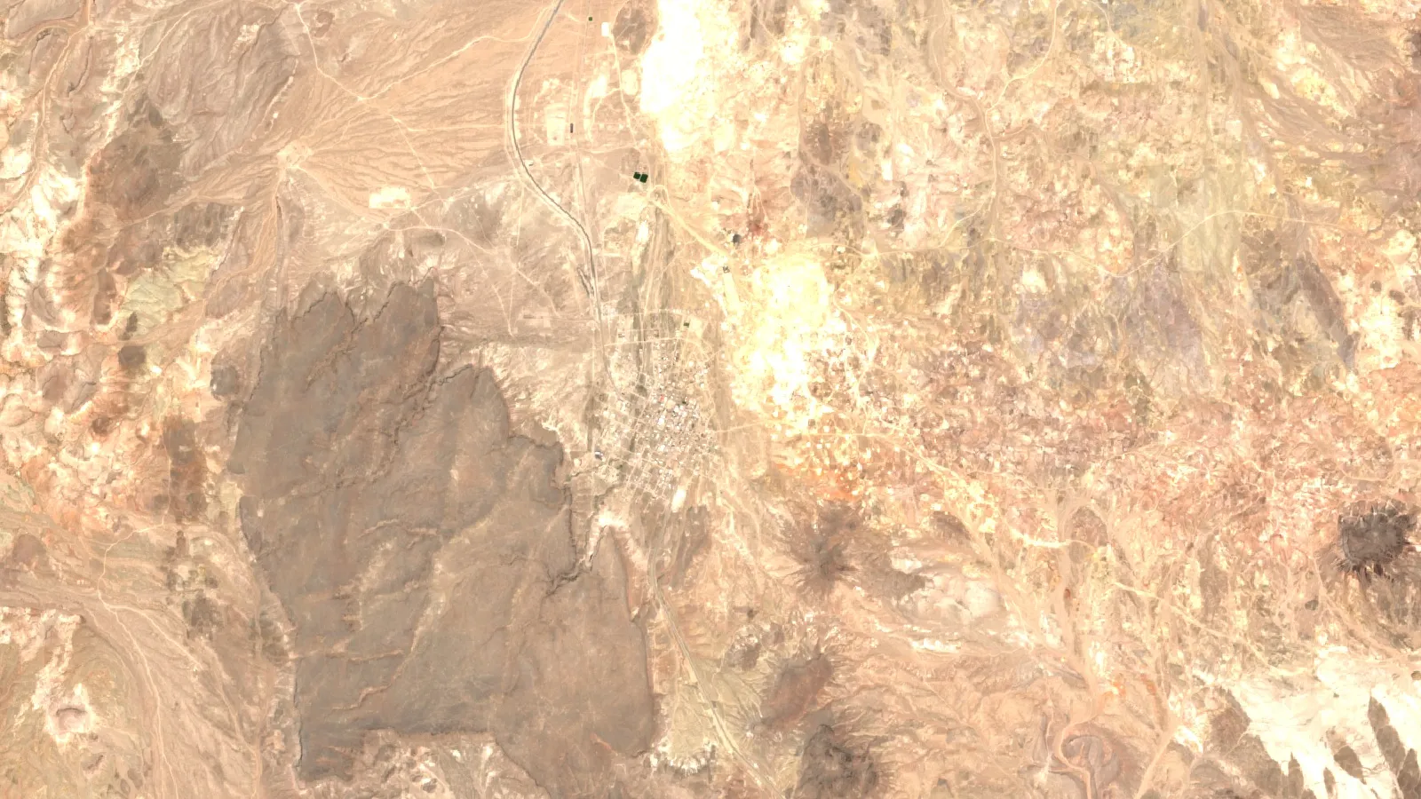
Satellite images cannot see gold or any metal under the surface. They show the rock at the surface and the changes that hot, mineral-rich water leaves behind. Iron-stained ground, clay and mica minerals, silica and long straight fractures can all show up in images, and they are common near many gold and copper deposits. Our video below explains this in plain words.
Chart
Ground size of one satellite pixel
Metres per side, bands used for geology and imaging
The USGS porphyry copper deposit model, for example, shows how Landsat band 7 (a shortwave infrared band) can outline clay-altered and mica-altered rock around known porphyry copper deposits as one zone. The same report says that single band cannot separate the different alteration types, and that sensors with more shortwave bands can show them apart. Government satellites that anyone can use are Sentinel-2 and Landsat. The European Space Agency lists Sentinel-2 at 10 metre resolution with 13 spectral bands, a 290 km swath and a 5-day revisit at the equator. SentiWiki specifies four bands at 10 m and six at 20 m, including the two shortwave infrared bands (B11 and B12). Clay and mica minerals reflect light differently in that part of the spectrum, which is why geologists use it. USGS describes Landsat 9 as nine bands at 30 m, with one panchromatic band at 15 m.
The pixel size sets how small a feature you can see. A 10 m pixel covers 0.01 hectare and a 30 m pixel covers 0.09 hectare. An area of 8 hectares, about the size of a 20-acre claim, is roughly 800 pixels in Sentinel-2 and about 90 in Landsat.
A satellite screen answers three questions. Does the pattern of alteration on my land resemble the pattern at known deposits nearby? Which part of my land is most worth walking first? Which parts can I skip? It does not answer how much metal there is or whether it can be mined. Surface signatures map the top of the ground, and sampling and drilling confirm what is below.
Farmonaut sells a satellite mineral report for this step, built from a boundary file (KML, KMZ or polygon) and delivered in 5 to 20 business days. We recommend a minimum area of 10 acres. A request starts with the quote form. To see what such a report looks like before you ask, read the mineral exploration report sample. For a comparison of satellite, soil geochemistry and geophysics as starting points, see where to start.

▶ What satellites can and cannot see: rock and alteration clues, not gold itself · 4:25
Step 4: Walk the ground and take samples
Fieldwork turns map clues into facts. Get written permission from every owner and occupier first, and follow local safety and environmental rules. Never use mercury. Take a map or GPS, a hammer, sample bags, a marker and a notebook, and photograph every sample site.
Start with what you can see. Look for outcrop (bare rock), quartz veins, rusty iron-stained rock, bleached or clay-rich rock, and old workings. Record the rock type and the direction of any veins or fractures at each stop. Our overview of prospecting methods for gold deposits shows what the common signs look like and how to read them.
Then sample in a pattern, not at random. Common choices are soil samples on a grid, stream sediment samples downstream of a catchment, and rock chips from outcrop or from the edge of a vein. A grid keeps the data comparable, and every sample needs a number, a location, a date and a description. The Canadian Institute of Mining, Metallurgy and Petroleum (CIM) exploration guidelines say samples need a recorded chain of custody, so that nobody can say a bag was swapped.
The calculator below prices a grid for your own area. Gold is often patchy, so one sample can show nothing next to another that shows a lot. That is why a grid, not a single sample, is the minimum that means anything.
Calculator
How much will a sampling grid cost?
Enter your own area, grid spacing and lab quote to price a soil or rock sampling grid.
- Laboratory cost (US$): $8,547
- Field cost (US$): $5,698
- Total (US$): $14,245
- Cost per hectare (US$): $55
Example values only, not a benchmark or a quote. Replace the assay and field costs with prices from your own laboratory and crew. The QA/QC share covers blanks, certified standards and duplicates; the CIM guidelines say a programme should include them but do not set a percentage, so the default is an example. Costs are in US$.
Step 5: How to test land for gold and read the assay
A pan or a hand lens tells you something is there. A laboratory assay tells you how much. In an assay the lab crushes and splits each sample, then measures metal content, usually in grams per tonne (g/t, the same as parts per million) or parts per billion for trace levels. Fire assay is a standard method for gold. ALS Geochemistry says the process removes everything except the precious metals before measurement, which allows detection levels down to 1 ppb for every sample. Low detection levels help in exploration because the signal near a deposit can be faint.
The CIM exploration guidelines say quality assurance and quality control (QA/QC) belongs in every programme. It should include external blanks, certified reference materials and duplicate samples, plus regular check sampling at a second laboratory. A blank is a piece of barren rock that should return nothing. A certified reference material is a sample with a known value. If the lab gets the blank or the standard wrong, you cannot trust the rest of the batch. The guidelines also recommend a qualified geochemist to plan and interpret geochemical surveys.
Read the results as a map, not a list. A few high values scattered over the grid are less useful than a trend, such as three or four neighbouring samples that rise together. Plot them. Look for a line of high values that follows a vein or fault you saw in the field. Our guides to choosing an assay lab and to grams per tonne of gold explain how to compare labs and put a grade in context.
Step 6: When to call a geologist
Call one before you sample if you have never done it, and call one after your first results come back. The CIM guidelines say a geoscientist should supervise sampling and the preparation of samples for analysis. A geologist who knows your region can tell you whether your results fit a deposit type that makes sense there, design the next round, and judge whether you need geophysics or drilling.
A geologist also keeps you inside the rules for reporting. The results you generate on your land are exploration data. They are not a mineral resource or a reserve. A resource estimate under NI 43-101 in Canada, JORC in Australia or SAMREC in South Africa needs a qualified or competent person, more drilling and a stated method. Do not quote a tonnage or a value from a sampling grid, and do not put one in a sale document or a pitch to an investor. This also applies to satellite results: they are exploration targets that sit ahead of any resource estimate.
What a small exploration budget should buy first
Spend in order of cost per unit of information. The cheapest steps come first, and each one should make the next one smaller.
- Ownership check. Deeds, a title report or a land agent. Without it, nothing else matters.
- Public records. Geological maps, mine databases and claim status. A few days of your own time.
- Satellite screening. One report over your whole boundary, to rank the ground.
- Field visit and mapping. A geologist walks the best-ranked ground.
- Sampling and assay. A grid over the top targets with QA/QC.
- Geophysics or trenching. Only over targets that your sampling confirmed.
- Drilling. Last, and only on targets that survive the earlier steps.
Drilling is usually the largest cost, and most holes are drilled to test a target that earlier work has narrowed. Our guide to a first-year exploration budget for a small licence shows how to split a limited budget across these steps. Reduce the number of unknowns before you drill, and each dollar goes further.
What it costs to hold a US claim
If you stake a claim on federal land in the United States, the holding costs are fixed by BLM and published each year. For a new lode claim, mill site or tunnel site located on or after 1 September 2026, BLM’s schedule lists a $25 processing fee, a $49 location fee and a $200 maintenance fee, a total of $274 per claim for the 2027 assessment year. A placer claim pays the maintenance fee for each 20 acres or part of it, so a 70-acre placer claim pays $800 in maintenance. New claims must be recorded with BLM within 90 days of location.
Chart
Federal land share and active mining claims, by state
Federal share of state land (2024) and active BLM claims at the end of fiscal year 2024
After the first year, the maintenance fee of $200 per claim is due on or before 1 September. BLM’s annual maintenance page describes a small miner’s waiver for holders of 10 or fewer claims nationwide. In exchange, the holder must spend at least $100 in labour or improvements on each claim and record proof by 30 December, with a $15 BLM processing fee per claim for the affidavit. BLM lists drilling, sampling and geological, geochemical and geophysical surveys as qualifying assessment work, so the sampling in step 4 can count. A missed deadline means the claim is lost by law.
Claims are common where federal land is. BLM’s Public Land Statistics show about 514,876 active claims at the end of fiscal year 2024, and Nevada alone held 253,485 of them. The scatter chart shows how the number of active claims lines up with each state’s share of federal land.
The US claim system is not used everywhere. In Australia you apply for a tenement (a mining title), in many African countries for a licence, and in Canada each province runs its own system; Ontario, for example, registers mining claims online. In each case the regulator sets the fees. Check the ministry’s current schedule, because fees and rules differ by country, province and licence type.
Land access and permission
A good geological target can still be out of reach. Access depends on who owns the surface, what is built on it, and what permits apply. On private land you need the owner’s agreement before you enter, and in many places the law requires you to compensate for damage. On federal land you must follow the surface management rules for the agency that runs it. In a densely built area, the rock may be excellent and still unmineable.
The video below describes a survey in which 59% of the anomalous ground lay under a town. Same rock, same grade, and no access. It is a reminder to map surface ownership next to the geology before you plan drilling. A claim or licence does not remove the surface owner’s interest, and a landowner does not hold the minerals unless the title says so.
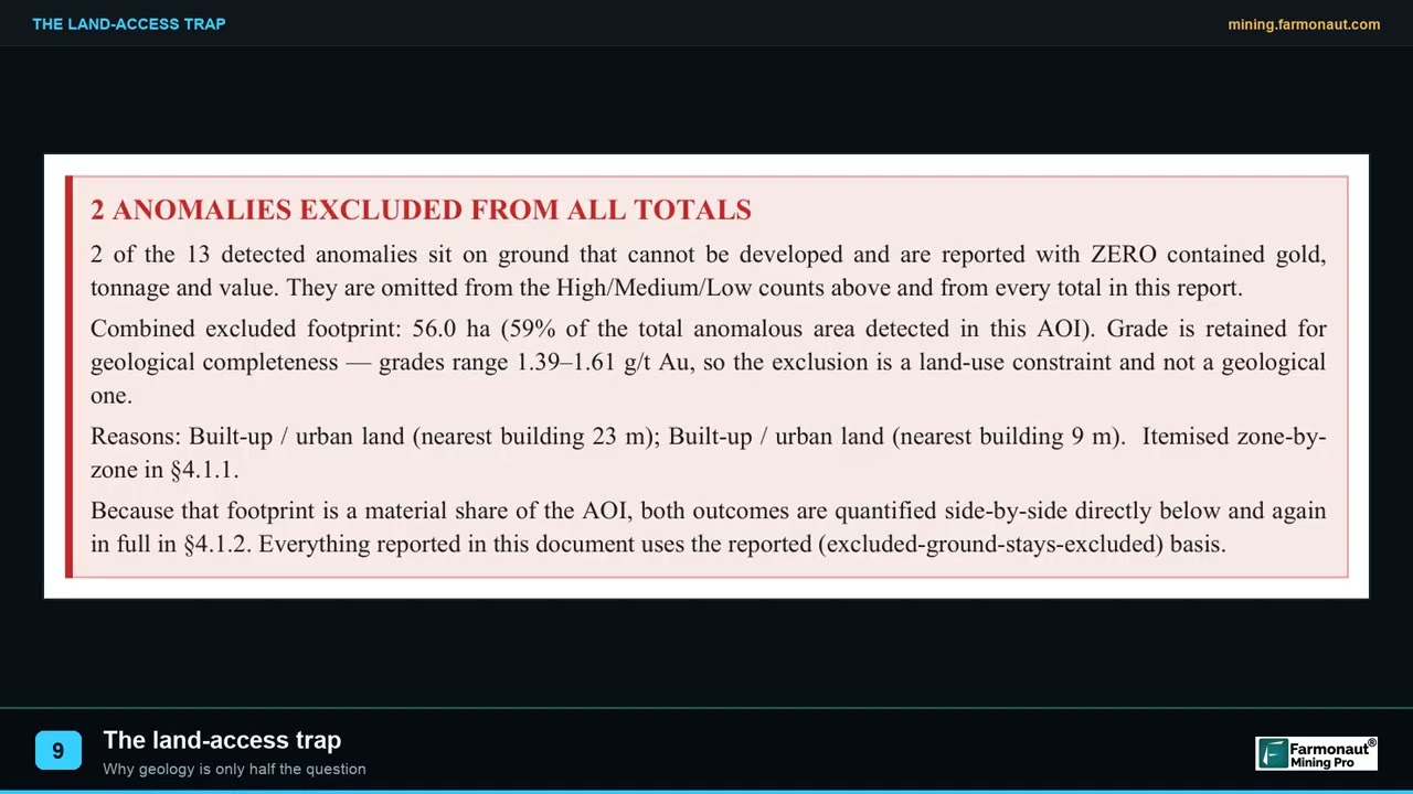
▶ A survey where most anomalous ground sat under a town: good rock blocked by land access · 2:05
Frequently asked questions
How do I find out what minerals are on my land?
Start with public geological maps and mine databases for your area, then read the claim and licence records. After that, a geologist can visit the land and take samples, and a laboratory can measure what is in them. Satellite screening can narrow the area before you walk it, but only sampling confirms what is in the rock.
Do I own the minerals under my property?
Not always. In the United States you may own them if your deed has no reservation, but earlier owners or the federal government may hold some or all. In the UK, the Crown owns gold and silver, and in Western Australia the Crown owns nearly all minerals. In Tanzania the state owns all minerals. Check your title and ask the mining authority in your country.
How do I check who owns the mineral rights in the US?
Get the legal description of your land, read your deed for any reservation, then trace earlier deeds at the county recorder. BLM staff can check the master title plat for federal minerals. If the chain is long or unclear, hire a land agent or a title company that works on minerals, and ask a lawyer to confirm the result.
How can I test my land for gold?
Take samples in a pattern, such as soil on a grid or chips from outcrop, record each location, and send them to a laboratory for fire assay. Include blanks and standards so you can check the lab. Panning gives a quick hint that gold is present, but it does not give a grade.
What is a mineral survey?
The phrase has no single meaning. It can describe a government survey of a district, a geologist’s visit to your land, or a package of mapping and sampling with a written report. Ask for the scope, the methods, the samples and what you receive in the end.
Can satellite images show minerals on my land?
They show surface clues, such as iron staining, clay and mica minerals, silica and fractures, that often travel with gold and copper deposits. They do not show metal underground or give a grade. Use them to decide where to walk and sample first.
Do I need a licence to prospect on my own land?
It depends on who owns the minerals. Where the state owns them, you generally need a licence or permit even on your own property, and Western Australia requires a mining title before exploration on private land. Where you own the minerals, you may still need permits for digging, drilling, water use and land disturbance. Check with the regulator before you start.
How much does it cost to explore a small piece of land?
Costs depend on your country, area and access. Ownership checks and public records cost mostly time. Sampling cost scales with the number of samples, and drilling costs much more than anything before it. Use the sampling calculator on this page with the lab prices you are quoted, and see the exploration budget guide for the rest.
What can I do with a small mining concession, such as one square mile?
You can run the same steps as a larger holder: ownership check, records, satellite screen, grid sampling and a geologist’s review. At 100 m spacing, a square mile needs roughly 259 grid samples. The size of the area changes the cost of each step but not the order.
Is a find on my land worth money before drilling?
Not on its own. Sample assays and satellite results are exploration data, not a resource. Buyers and investors expect a qualified person’s estimate, which needs drilling and a stated method. Do not quote a tonnage or value from early results.
This page is for information only. It is not legal or investment advice. Confirm mineral ownership, claim rules and fees with a lawyer and the regulator. Get the landowner’s permission before fieldwork, follow safety rules and never use mercury. Satellite and sampling results are exploration data, not a mineral resource under JORC, NI 43-101 or SAMREC.
Farmonaut mining
Screen your land from space before you sample
Send your boundary and request a quote for a Farmonaut satellite mineral report.

Mining Pro sample view, synthetic data
Sources
- Bureau of Land Management, Split Estate due to the Stock Raising Homestead Act: blm.gov
- Bureau of Land Management, Annual Maintenance and Assessment: blm.gov
- Bureau of Land Management, Mining Season schedule for the 2027 assessment year (fees): blm.gov
- Bureau of Land Management, Mining Claim Packet, Montana-Dakotas (February 2026): blm.gov
- Bureau of Land Management, Public Land Statistics 2024: blm.gov
- Congressional Research Service, Federal Land Ownership: Overview and Data (R42346): everycrsreport.com
- Nevada Division of Minerals, Mineral Rights Land Research How-To: minerals.nv.gov
- British Geological Survey, MineralsUK: UK mineral ownership: bgs.ac.uk
- British Geological Survey, BGS Geology Viewer: bgs.ac.uk
- Government of Western Australia, Private Land Provisions brochure: wa.gov.au
- Ontario Ministry of Mines, Notification of Proposed Exploration Work to Surface Rights Owners: geologyontario.mndm.gov.on.ca
- Ontario Ministry of Mines, MLAS Map Viewer Help: geologyontario.mndm.gov.on.ca
- Tume ya Madini (Mining Commission), Mining Act Cap. 123 R.E. 2023: tumemadini.go.tz
- USGS, National Geologic Map Database: ngmdb.usgs.gov
- USGS, Mineral Resources On-Line Spatial Data: mrdata.usgs.gov
- USGS, Porphyry Copper Deposit Model (Scientific Investigations Report 2010-5070-B): pubs.usgs.gov
- ESA, Sentinel-2 mission page: esa.int
- Copernicus SentiWiki, S2 Mission: sentiwiki.copernicus.eu
- USGS, Landsat 9: usgs.gov
- CIM, Mineral Exploration Best Practice Guidelines (2018): mrmr.cim.org
- ALS Geochemistry, Gold by fire assay: alsglobal.com
Discussion
Questions, corrections or field experience? Share them below. First-time comments are reviewed before they appear, and your email is never published.
No comments yet. Be the first to add a question or your experience.

 Nanita Company Limited
 Mwerezi Minerals Company Limited
 Congo Mining Solutions
 Mining SARL
 SenGold Invest SAS
 Sania Corporation
 Sean Mining Limited
 NTS Group (Pty) Ltd
 Mine4Africa
 Lithspo Minerals Limited
 Tintina Mining Group
 Dalgety Minerals Pty Ltd
 Vortex Minerals Pty Ltd
 Faith At Work (Pty) Ltd
 Geotech Mining Solutions plc
 Vulcan International Limited
 Kidepo Associates
 GKY Mining

 Licence holder · Nigeria · Gold + lithium
 Client · Somalia · Gold










