

Lithium · Project facts guide
Thacker Pass Lithium Mine: Capex, Output, Court Status
Thacker Pass in Nevada is a US$2.93 billion lithium clay project designed for 40,000 tonnes a year of lithium carbonate in Phase 1, with mechanical completion targeted for late 2027 (Lithium Americas, August 2026).
Key takeaways
- Phase 1 capex is estimated at US$2.93 billion for 40,000 tonnes a year of lithium carbonate, about US$73,000 per annual tonne (technical report, effective 31 December 2024).
- About US$1.6 billion of that estimate had been spent by 30 June 2026, and a definitive capital estimate, due by the end of Q3 2026, was not yet published as of 16 October 2026 (Lithium Americas, 13 August 2026).
- The reserve is 14.3 million tonnes of lithium carbonate equivalent at 2,540 ppm; at US$24,000 a tonne the company model gives an after-tax NPV of US$8.7 billion, falling to US$3.4 billion at US$18,000 (annual report, 2026).
- Courts left the federal approval in place: a February 2023 ruling sent a waste-rock mining-rights question back to the BLM, and the Ninth Circuit upheld the approval in July 2023.
- The federal review counts 5,695 acres of disturbance and 2,600 to 5,200 acre-feet of water a year, taken from existing farm rights (US Department of Energy, Final EIS, 2023).
In this article
- Thacker Pass lithium mine at a glance
- Production plan: from 40,000 tonnes to five phases
- Capex: what US$2.93 billion covers and what has been spent
- Calculator: capex intensity and simple payback
- Reserves and project economics at three lithium prices
- Construction progress and schedule
- Court rulings and legal status
- Land, water and wildlife: what the federal review measured
- How satellites can track a mine and its surroundings
- What to watch next at Thacker Pass
- Frequently asked questions
Thacker Pass lithium mine at a glance
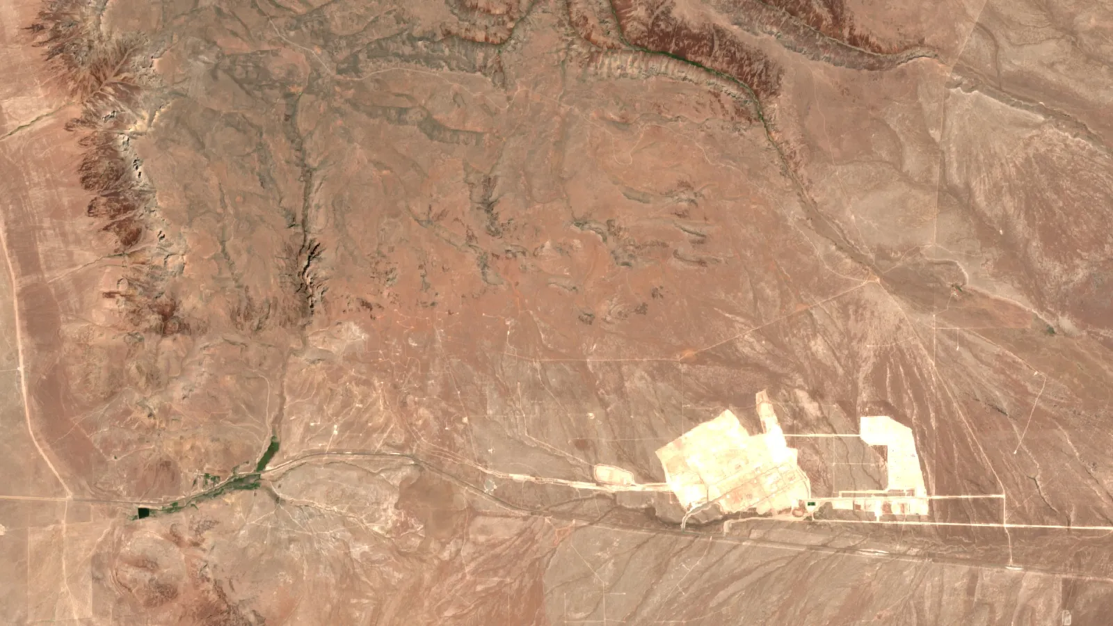
Thacker Pass is a lithium clay mine and chemical plant under construction in Humboldt County, northern Nevada. The first phase is designed to make 40,000 tonnes a year of battery-grade lithium carbonate, with a total capital cost estimate of US$2.93 billion and mechanical completion targeted for late 2027 (Lithium Americas, second-quarter results, 13 August 2026). Lithium carbonate is the white salt that battery makers turn into cathode material. This guide sorts the project facts into capex, output, economics, court history and land and water numbers, and says where each number comes from and how old it is.
The technical report sets Phase 1 at 40,000 tonnes a year, and the federal environmental review puts the land disturbance at 5,695 acres.
| Item | Figure | Source and date |
|---|---|---|
| Location | About 100 km north-northwest of Winnemucca, Humboldt County, Nevada; 33 km south of the Oregon border | Lithium Americas annual report on Form 10-K, filed 2026 |
| Operator | Lithium Americas Corp. (TSX and NYSE: LAC), which manages construction for a joint venture with General Motors | Company results, 13 August 2026; company fact sheet, February 2025 |
| Ownership of the joint venture | General Motors holds 38%; Lithium Americas holds about 62% | Fact sheet, February 2025; technical report summary |
| Phase 1 capital cost | US$2.93 billion | Technical report, effective 31 December 2024 |
| Phase 1 output | 40,000 tonnes a year of lithium carbonate | Technical report, effective 31 December 2024 |
| Proven and probable reserve | 14.3 million tonnes of lithium carbonate equivalent at 2,540 ppm lithium | Annual report: current as of 31 December 2025 |
| Planned mine life | 85 years across five phases | Technical report, effective 31 December 2024 |
| Federal land disturbance | About 5,695 acres inside a 17,933-acre project area | US Department of Energy, Final EIS, 2023 |
| Construction start | 28 February 2023 | Annual report on Form 10-K, filed 2026 |
Production plan: from 40,000 tonnes to five phases
The plan has five phases. Phases 1 to 4 each add a lithium carbonate processing plant sized at 40,000 tonnes a year, for a planned 160,000 tonnes a year in total. Phase 5 adds a beneficiation circuit and a sulfuric acid plant, with no extra carbonate plant, to feed the other four. Phases 2 and 3 are each planned four years after the one before, and Phases 4 and 5 four years after Phase 3, so Phase 2 would follow Phase 1 by about four years (Lithium Americas annual report on Form 10-K). Only Phase 1 is funded and under construction.
Lithium carbonate equivalent, or LCE, is the standard way to compare lithium projects. It converts every lithium product to the weight of lithium carbonate it would make, so one tonne of lithium metal is about 5.3 tonnes of LCE. Grades are given in parts per million (ppm): 2,540 ppm means 2,540 grams of lithium in each tonne of rock, or 0.254%.
The federal permit is written differently from the company plan. The approved plan of operations covers up to about 66,000 short tons a year of LCE, and the 2023 environmental review described 33,000 short tons a year in Phase 1 and 66,000 in Phase 2 (US Department of Energy, Final EIS). The company says it sees no identified issues that would prevent the permits for Phases 1 and 2, and that Phases 3 to 5 need more analysis. So 160,000 tonnes a year is a plan, not a permit.
How the ore becomes lithium carbonate
The deposit is a claystone, not a hard rock or a brine. Mined clay is slurried, leached with sulfuric acid, and the lithium is then separated from magnesium and other salts and precipitated as carbonate. The site includes its own sulfuric acid plant, and the company says the co-located plant is expected to produce electricity for the process (Lithium Americas fact sheet, February 2025). Leaching leaves a filter cake of clay, which is stacked dry on the site instead of held in a wet tailings pond.
Phase 1 output is committed to General Motors. The 20-year offtake agreement, extended in 2024, covers 100% of Phase 1 volumes, and GM also has a 20-year agreement for 38% of Phase 2 (company fact sheet, February 2025). An offtake agreement is a contract to buy a set share of production; it is not a price guarantee.
Capex: what US$2.93 billion covers and what has been spent
Capex means capital expenditure, the money spent building the mine and plant before they earn revenue. The US$2.93 billion estimate comes from the technical report with an effective date of 31 December 2024. It is for Phase 1 only, and the report calls it an AACE Class 3 estimate with a target accuracy of plus or minus 15%, not a definitive estimate. Divided by the 40,000 tonnes of annual capacity, that is about US$73,000 of capital per annual tonne, a ratio often called capex intensity. Our arithmetic: 2,930 million divided by 40,000.
Chart
Capex and DOE loan: used against plan
US$ billion, at 30 June 2026
Chart
Phase 1 construction spending against the US$2.93 billion estimate
Cumulative costs counted in the estimate, US$ million; 31 March value is derived from the quarterly table
By 30 June 2026 the company had capitalized US$1.8 billion of construction and related costs, of which US$1.6 billion counts toward the US$2.93 billion estimate. It targets total spending of US$1.3 to 1.6 billion in fiscal 2026 (second-quarter results, 13 August 2026). The difference between the two figures is made up of costs that accounting rules require the company to capitalize but that are not in the original estimate, such as other development costs and capitalized interest.
The same release says the original estimate does not include some recent cost pressure: tariffs, fuel prices, Middle East conflict effects on shipping, and a tighter market for skilled labor. Total tariff exposure is estimated at US$80 to 100 million, mostly in 2026. The definitive capital estimate is due by end of Q3 2026, not yet published as of 16 October 2026, so US$2.93 billion remains the last reported estimate (technical report, effective 31 December 2024; second-quarter results, 13 August 2026).
Who is paying
- US Department of Energy loan. A loan of US$2.26 billion (US$1.97 billion of principal plus an estimated US$289.6 million of capitalized interest) closed on 28 October 2024 under the Advanced Technology Vehicles Manufacturing program. The department announced a restructuring on 30 September 2025 (Mining Technology, 30 September 2025) and signed the amendment on 7 October 2025. Principal stayed at US$1.97 billion, and the expected total fell to about US$2.23 billion as capitalized interest was cut to US$256 million. The department also deferred US$184 million of early debt service and received warrants, issued on 30 January 2026, for 5% of Lithium Americas and 5% of the joint venture (annual report on Form 10-K). Cumulative advances reached US$1.209 billion after a US$342 million draw on 3 June 2026.
- General Motors. It put US$625 million in cash and letters of credit into the joint venture for 38%, on top of an earlier US$320 million equity investment in Lithium Americas (fact sheet, February 2025).
- Other capital. Orion Resource Partners made a US$250 million strategic investment in April 2025: US$195 million of convertible notes, a US$25 million production payment agreement, and a commitment to buy a further US$30 million of notes. On 5 August 2026 the company agreed to issue up to US$175 million of subordinated convertible debentures to an affiliate of Yorkville Advisors. Cash and restricted cash were about US$1.3 billion at 30 June 2026, including US$530.3 million inside the joint venture (second-quarter results).
Calculator: capex intensity and simple payback
Use the calculator below to test how the capital cost compares with output, price and operating cost. It is a simple back-of-envelope tool, not the company model.
Calculator
What is the capex per annual tonne, and a simple payback?
Enter your own output, price and cost. Results update as you type.
- Revenue per year: 960 US$ million
- Operating margin per year: 640 US$ million
- Simple payback: 4.6 years
Example values only, not benchmarks or forecasts. Defaults echo the technical report (40,000 t/y, US$2,930 million capex, US$24,000 price) but the cost is a round example. Pre-tax, ignores ramp-up, sustaining capital, royalties and financing, so it is not the company model; the technical report’s own after-tax payback is 8.7 years.
Reserves and project economics at three lithium prices
The proven and probable reserve is 14.3 million tonnes of LCE in 1,056.7 million tonnes of ore at 2,540 ppm lithium. The company states that the reserve estimate, prepared as of 31 December 2024, remained current at 31 December 2025 (annual report on Form 10-K). A reserve is the part of a deposit shown to be economic to mine under stated prices and costs, which makes it a tighter number than a resource. By our arithmetic, 1,056.7 million tonnes at 2,540 ppm holds about 2.7 million tonnes of lithium metal. For scale, the US Geological Survey lists US reserves of 4.4 million tonnes of lithium and withholds US mine production, because commercial output is one brine operation in Nevada (USGS Mineral Commodity Summaries 2026). The two figures use different methods and dates.
Chart
After-tax NPV at three lithium prices
US$ billion at an 8% discount rate, 85-year company model
The economic model in the technical report assumes a lithium carbonate price of US$24,000 a tonne for 85 years, an average operating cost of US$8,039 per tonne, an after-tax net present value of US$8.7 billion at an 8% discount rate and an internal rate of return (IRR) of 20.0% (S-K 1300 technical report summary, effective 31 December 2024). Net present value is the value today of all future cash flows after taxes; IRR is the discount rate at which that value falls to zero. The company’s price sensitivity shows how much the answer depends on one input.
| Price case | Carbonate price | After-tax NPV at 8% | IRR |
|---|---|---|---|
| Downside (-25%) | US$18,000 a tonne | US$3.4 billion | 12.8% |
| Base | US$24,000 a tonne | US$8.7 billion | 20.0% |
| High (+25%) | US$30,000 a tonne | US$13.6 billion | 26.5% |
Source: Lithium Americas annual report on Form 10-K, sensitivity analysis. These are the company’s 85-year model values, set before the cost increases described above.
For comparison with the model, the most active lithium carbonate contract on the Guangzhou Futures Exchange ended daytime trade at 104,740 yuan a tonne on 12 October 2026, about US$15,600 and below the model’s US$18,000 downside case, its lowest level since December 2025 (Reuters via Mining.com, 12 October 2026). In July it closed at 144,000 yuan, about US$21,000, after a two-year high above 200,000 yuan in mid-May (Mining.com, 22 July 2026). Chinese futures are one reference price. Contracts for a US plant such as this one are negotiated separately, so the two will not match.
The short-term outlook depends on the cost estimate update and the commissioning schedule more than on a spot price, because Phase 1 will not sell product until after mechanical completion in late 2027. This page is not investment advice.
Construction progress and schedule
As of the second-quarter report, more than 1,600 people were working on site, with more than 2,000 expected by the end of 2026, and over 1,500 workers were living in the company’s housing hub in Winnemucca. Detailed engineering was more than 95% complete and procurement more than 80%. The site was receiving more than 60 truckloads of equipment and materials a day. Off-site power upgrades were complete, with energization on track for the fourth quarter of 2026. A transload terminal about 60 miles from the mine, west of Winnemucca, is due in 2027 to handle reagents by rail (second-quarter results).
More than 85% of the structural steel, bought from the United Arab Emirates, was in transit or on site, and shipments were re-routed through the Port of Jeddah to avoid Middle East disruptions. The company has also recorded 3.42 million work hours without a serious injury or lost-time incident, with a recordable injury rate of 0.58. Mechanical completion, meaning the plant is built and ready for commissioning, is still targeted for late 2027. Commissioning and ramp-up come after that.
Court rulings and legal status
Several lawsuits tried to stop the project. The key decisions, in order:
- January 2021. The Bureau of Land Management (BLM) issued the Record of Decision approving the mine plan after an environmental impact statement (annual report on Form 10-K).
- February 2023, district court. US District Judge Miranda Du, in Reno, ruled that the BLM violated the Federal Land Policy and Management Act by approving about 1,300 acres of waste rock dumps without first deciding whether the company had valid mining rights on that land under the 1872 Mining Law. She sent that question back to the agency but did not cancel the approval (Western Watersheds Project, 7 February 2023, a plaintiff’s account of the ruling).
- July 2023, Ninth Circuit. The appeals court ruled that the federal government did not violate environmental law in approving the mine, and noted that the tribes’ claims of cultural significance became known after approval (NPR, 17 July 2023). The annual report says the appeals court affirmed the district court.
- November and December 2023. A separate suit by the Reno-Sparks tribal colony, the Burns Paiute Tribe and the Summit Lake Paiute Tribe on consultation was dismissed, and the final judgment in December 2023 was not appealed.
- 30 July 2025. The company settled the protest and state-court appeal over the project’s water rights, and the State Engineer confirmed the rights were in full force and effect.
Lithium Americas’ annual report states that there are no current adversarial matters involving the company or its regulatory authorizations. Construction was reported as continuing in August 2026. If you are checking a claim that a judge halted the mine, the federal rulings above date from 2023, and the permit was left in place. The latest company statement on legal matters is in the annual report on Form 10-K filed in 2026.
Land, water and wildlife: what the federal review measured
The final environmental impact statement (EIS), prepared by the BLM and adopted by the Department of Energy in 2023, is the best public source for the footprint. It puts the total disturbance at about 5,695 acres, made up of 5,545 acres under the mine plan and 150 acres for exploration, inside a project boundary of 17,933 acres. The largest single piece is the clay tailings filter stack, followed by the open pit.
Chart
Surface disturbance by facility, selected items
Acres, preferred alternative in the 2023 final EIS; total disturbance is 5,695 acres
The same document counts the effect on ranching. The mine would remove about 500 animal unit months of grazing, a measure of the forage one cow and calf eat in a month, worth roughly US$32,845 a year in direct production value (Final EIS). The area is also habitat for greater sage-grouse, and conservation groups say pit dewatering could affect aquifers that feed springs holding a rare springsnail; the EIS expects no direct effects on springsnails, apart from one spring that would be mined through.
Water
The EIS estimates consumptive water use of 2,600 acre-feet a year in Phase 1 and 5,200 acre-feet a year in Phase 2. One acre-foot is about 1,233 cubic metres, so 5,200 acre-feet is about 6.4 million cubic metres, or about 1.7 billion US gallons. That is about 9% of the estimated perennial yield (the long-term sustainable pumping rate) of the Quinn River Valley groundwater basin, which has fully allocated rights. The water comes from transferring existing farm irrigation rights to mining use, so the EIS says it would not raise total withdrawals above current levels. The Orovada subarea is over-allocated by about 30,271 acre-feet a year, meaning rights exceed the estimated supply. These water figures cover only the two permitted phases (about 66,000 short tons of lithium carbonate equivalent a year), not the 160,000 tonne company plan. For per-tonne comparisons with brine mines, see our guide to lithium water use per tonne.
The company states that the process recycles water an average of seven times, with a recycle rate of about 85%, uses a zero liquid discharge plant, and mines a shallow pit of less than 400 feet with active reclamation (company fact sheet, February 2025, based on the 2022 feasibility study). Those are company design claims. The reclamation bond for full Phase 1 construction was set at US$73 million, and the BLM approved the bond in March 2025 (annual report). The pit is planned to be backfilled during mining and fully backfilled at closure (Final EIS).
The land is also culturally important to some Native American communities. NPR reports that some tribes consider it sacred, as a site of ancient massacres, and that tribal elders still gather plants and hold ceremonies there. The company has paid US$5.0 million to the Fort McDermitt Paiute and Shoshone Tribe’s building fund under a community benefits agreement (second-quarter results). For a wider look at what mining does to land and water, the video below walks through seven impacts.
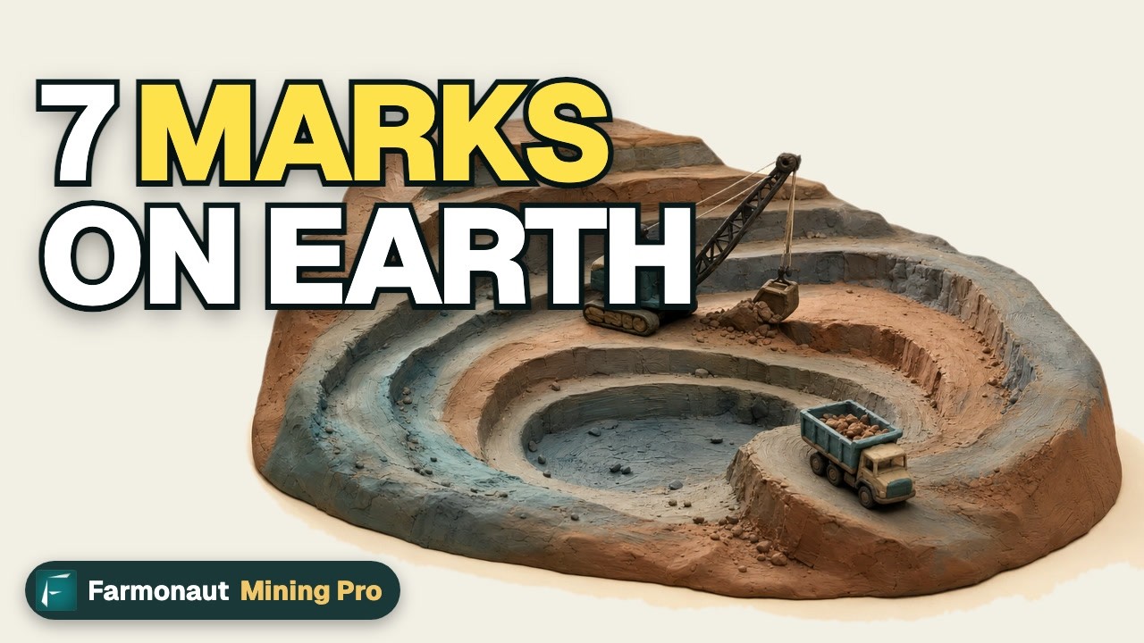
▶ The 7 environmental impacts of mining, explained in clay (2:31). · 2:31
How satellites can track a mine and its surroundings
Public satellites such as Sentinel-2 image the same ground every few days at 10-metre detail in visible and near-infrared bands (Copernicus, Sentinel-2 mission). That is enough to measure pit growth, stockpile and tailings-stack footprint, road and pipeline corridors, and vegetation around the site over time. Compare a mine’s reported disturbance with what the images show.
Farmonaut is a satellite data-analytics company that builds satellite mineral-detection maps from a licence or claim boundary you supply as a polygon or KML file, delivered in 5 to 20 business days. Read about satellite-based mineral detection, or send an area through the mining query form for a quote. For other lithium styles, see our guides to pegmatite, brine and clay deposits, spodumene in James Bay and the pros and cons of lithium mining.
▶ Remote sensing for mining explained in 2 minutes. · 2:01
What to watch next at Thacker Pass
- The definitive capital estimate, due by end of Q3 2026 and not yet published as of 16 October 2026, and whether it exceeds US$2.93 billion.
- Further Department of Energy loan advances against the US$1.97 billion principal.
- Energization of the site power supply in the fourth quarter of 2026 and the start of early commissioning of utilities.
- Mechanical completion, targeted for late 2027, and the first lithium carbonate that follows.
- State air and water permit amendments for the Phase 2 plant and for mining below the water table, which the annual report lists as expected steps.
We cover a connected topic in Salton Sea Lithium Projects: Status, Output and Tax.
For a closer look at a related question, see our guide: New Mexico Gold and Silver Production: Data by Year.
Frequently asked questions
How much does the Thacker Pass lithium mine cost to build?
The technical report puts Phase 1 capital at US$2.93 billion. By 30 June 2026 about US$1.6 billion of that estimate had been capitalized, and the definitive estimate is due by end of Q3 2026, not yet published as of 16 October 2026.
How much lithium will Thacker Pass produce?
Phase 1 is designed for 40,000 tonnes a year of battery-grade lithium carbonate. The long-term plan is 160,000 tonnes a year over several phases, but only Phase 1 is funded and being built.
When will Thacker Pass start producing lithium?
The company targets mechanical completion in late 2027. Commissioning and ramp-up follow, so commercial output is expected after that date.
Who owns the Thacker Pass project?
It is held through a joint venture in which General Motors owns 38% and Lithium Americas about 62%. The US Department of Energy holds warrants for 5% of the company and 5% of the joint venture under its restructured loan.
Is Thacker Pass the largest lithium deposit in the United States?
The company calls it the largest lithium measured and indicated resource in the world (annual report). Its technical report lists 29.5 million tonnes of lithium carbonate equivalent in that class, about 5.5 million tonnes of lithium metal by our arithmetic. The USGS puts all US measured and indicated lithium resources at 30 million tonnes (Mineral Commodity Summaries 2026), but the two figures use different methods.
Did a judge stop the Thacker Pass mine?
No. In February 2023 a federal judge sent one mining-rights question about waste rock back to the BLM but left the approval in place, and the Ninth Circuit upheld the approval in July 2023. The latest annual report lists no current adversarial matters.
How much water will Thacker Pass use?
The federal review estimates 2,600 acre-feet a year in Phase 1 and 5,200 in Phase 2, supplied by converting existing irrigation rights. That is about 9% of the Quinn River Valley basin’s perennial yield.
How much land does the mine disturb?
About 5,695 acres inside a project area of 17,933 acres, according to the Department of Energy’s final EIS from 2023. The BLM approved a modified plan of operations on 25 June 2024 with an updated facility layout, so some facility areas now differ from the 2023 figures.
What lithium price does the project assume?
The technical report uses US$24,000 a tonne of lithium carbonate for all years. At US$18,000 the after-tax net present value falls to US$3.4 billion, and at US$30,000 it rises to US$13.6 billion.
What are the main risks to the schedule and budget?
The company names tariffs, fuel and logistics costs, a competitive market for skilled labor and shipping disruption. It also notes that its original estimate does not include several of those items.
This page is for information only. It is not investment advice. Confirm project figures against company filings and regulator documents.
Farmonaut mining
Check a project area from space
Request a quote for satellite mineral-detection maps of a licence or claim area before fieldwork.

Mining Pro sample view, synthetic data
Keep reading
Sources
- Lithium Americas, Second Quarter 2026 Results (13 August 2026): nasdaq.com
- Lithium Americas, Annual Report on Form 10-K for fiscal 2025 (SEC): sec.gov
- Lithium Americas, S-K 1300 Technical Report Summary, Thacker Pass (effective 31 December 2024, SEC exhibit 96.1): sec.gov
- US Department of Energy, Thacker Pass Final Environmental Impact Statement, DOE/EIS-0561 (2023): energy.gov
- Lithium Americas, Thacker Pass fact sheet (February 2025): s203.q4cdn.com
- Mining Technology, US DoE restructures deal with Lithium Americas (30 September 2025): mining-technology.com
- NPR, Tribes object. But a federal ruling approves construction of the largest lithium mine (17 July 2023): npr.org
- Western Watersheds Project, Court rules the BLM broke the law in approving Thacker Pass (7 February 2023): westernwatersheds.org
- Mining.com, Lithium price sinks to five-month low (22 July 2026): mining.com
- USGS, Mineral Commodity Summaries 2026: Lithium: pubs.usgs.gov
- Copernicus, Sentinel-2 mission description (SentiWiki): sentiwiki.copernicus.eu
- Reuters via Mining.com, Chinese lithium prices tumble to nearly 10-month low (12 October 2026): mining.com
Discussion
Questions, corrections or field experience? Share them below. First-time comments are reviewed before they appear, and your email is never published.
No comments yet. Be the first to add a question or your experience.

 Rains of Favour
 Tintina Mining Group
 Dalgety Minerals Pty Ltd
 Vortex Minerals Pty Ltd
 Faith At Work (Pty) Ltd
 Geotech Mining Solutions plc
 Vulcan International Limited
 Kidepo Associates
 GKY Mining
 Alkimy SARL
 Double A Trading
 GemSprout Metals Limited
 Qader Group
 Ileys General Trading
 SG Gold Mining LLC
 VRV Global Pte Ltd
 Omsri International FZE
 G.I.T.T.
 Jaunita Erss Ltd
 Almosi SARL
 SRK Consulting
 Berks Gold Limited
 Mwerezi Minerals Company Limited
