

Crop modeling · Model guide
Crop Simulation Models: DSSAT, APSIM, AquaCrop and WOFOST
A crop simulation model grows a virtual crop day by day from weather, soil, variety and management data, then predicts yield and water and nitrogen use. DSSAT covers more than 45 crops (DSSAT, 2026); APSIM, FAO’s AquaCrop and WOFOST are three other well-documented options. Here is how they compare and how farmers use them.
Key takeaways
- Crop simulation models are process-based: they calculate daily growth from weather, soil, crop variety and management, and give a range of yields when run over many past seasons.
- DSSAT (over 45 crops), APSIM (systems and rotations), FAO AquaCrop (water-limited crops) and WOFOST (open Python code, EU forecasts) are four well-documented models; DSSAT is free on request and APSIM is free for general use.
- In a test of 27 wheat models, the average error for end-of-season results was 24-38%, and the median of many models beat any single one (Global Change Biology, 2015).
- UNL’s Hybrid-Maize model gave in-season corn forecasts for 43 Corn Belt sites in 2026; UNL says growers can use them to adjust yield goals, fertilizer and marketing decisions.
- Models such as UNL’s Hybrid-Maize leave out weeds, pests, diseases, hail and poor stands, so check their output against yield records, scouting and satellite maps.
In this article
- What is a crop simulation model?
- How a crop growth model works
- Four crop simulation models compared
- What crop models cost to use
- What data crop simulation models need
- How accurate are crop simulation models?
- How farmers and agronomists use crop models
- Crop models and climate change
- Crop models and satellite data
- What is closing your yield gap worth?
- How to start with a crop simulation model
- How we checked the numbers
- FAQ
Crop simulation models are computer programs that grow a virtual crop one day at a time from weather, soil, variety and management data, then predict yield, water use and nitrogen uptake. Four well-documented examples are DSSAT, APSIM, FAO’s AquaCrop and WOFOST. DSSAT alone covers more than 45 crops and has been used by more than 30,000 people in over 198 countries, according to its developers.
This guide explains how a crop growth model works, compares the four main models side by side, lists the data each one needs, and shows what peer-reviewed tests say about accuracy. It ends with real ways farmers and agronomists in the US, Europe and Australia use model output, and a calculator to test whether closing your own yield gap would pay.
What is a crop simulation model?
A crop simulation model is a set of equations for the processes that make a crop grow. It tracks light capture, photosynthesis, respiration, leaf growth, root growth, water uptake and nitrogen uptake. It also tracks the crop’s development stage, from emergence to flowering to maturity. At the end of each simulated day it updates the water and nutrient balance of the soil and the plant.
These are called process-based or mechanistic models. They differ from statistical yield models, which fit a line between past weather and past yields. Because a process model describes how the crop responds, you can ask it “what if” questions about conditions that have not happened yet: a new planting date, a different hybrid, less irrigation water or a hotter season.
Many models work with production levels. The WOFOST team at Wageningen describes three levels: potential production, set only by CO2, sunlight, temperature, the crop and its planting date; limited production, where water or nutrients run short; and reduced production, where weeds, pests and diseases cut the crop further. The gap between what a field could yield and what it does yield is the yield gap.
How a crop growth model works
Every crop growth model follows the same basic loop. It reads the inputs, moves the crop through its growth stages, calculates how much dry matter the crop makes each day, and checks whether water or nitrogen limits that growth.
Infographic
How a crop simulation model runs in 5 steps
- 1Read the inputsDaily weather, soil layers, variety traits and the management plan.
- 2Move the crop through stagesTemperature, and for some crops day length, set the pace from emergence to maturity.
- 3Grow the cropIntercepted light becomes dry matter, split between leaves, stems, roots and grain.
- 4Check water and nitrogenSoil balances are updated daily; shortages slow growth.
- 5Repeat over many seasonsRunning 20 or more years of weather gives a range of yields, not one number.
Development (phenology) is usually driven by temperature. In WOFOST, for example, the development stage is 0 at emergence, 1 at flowering in cereals and 2 at maturity, and the rate depends on temperature and, for some crops, day length and cold exposure. Growth depends on the light the canopy intercepts and on how much of that light it turns into sugars.
Water enters as rain or irrigation and leaves through runoff, drainage, soil evaporation and crop transpiration. When the root zone runs dry, the model slows growth. Nitrogen works in a similar way: the model compares the crop’s demand with what the soil and fertilizer can supply.
The model repeats this every day until harvest. Run it with 20 or 30 years of past weather and you get a range of possible yields for one field and one management plan, not a single number. That range is often the most useful output.
Four crop simulation models compared
Many crop models exist. This guide focuses on four with official websites, public documentation and training that any farm adviser can download. The table sums them up; each has its own section below.
| Model | Who maintains it | Crops and focus | Cost to use | Best for |
|---|---|---|---|---|
| DSSAT | DSSAT Foundation, with the University of Florida and partners | Over 45 crops; daily soil water, nitrogen, phosphorus and carbon | Free download on request | Field trials, variety and planting-date studies, nitrogen and irrigation strategies |
| APSIM | APSIM Initiative (CSIRO, Queensland, Iowa State and others) | Crops, pastures, rotations, livestock, soil | Free for general use with published results; paid licence if results are not published | Whole-farm systems and rotations, dryland grain in Australia |
| AquaCrop | FAO Land and Water Division | Herbaceous crops where water limits yield | Download from FAO; Python source code published | Irrigation and deficit-irrigation plans, water productivity |
| WOFOST | Wageningen Environmental Research, WUR and the EU Joint Research Centre | Annual field crops; potential and water-limited yield | Open source (EUPL licence) | Regional yield forecasting and yield gap studies |
DSSAT
The Decision Support System for Agrotechnology Transfer is a Windows program that bundles crop models with tools for soil, weather and management data. A key reference is the paper by Jones and colleagues in the European Journal of Agronomy (2003). Version 4.8.6 was released on 1 July 2026. Models run at a daily step, or hourly for some processes, and update the plant and soil water, nitrogen, phosphorus and carbon balances each day.
The DSSAT team lists uses from on-farm and precision management to climate change studies, breeding, greenhouse gas emissions and soil carbon. An international training course is held each year; the next one is set for May 2027 at the University of Georgia.
Best for: agronomists and researchers who want to test many crops, varieties and management options against field trial data.
APSIM
The Agricultural Production Systems sIMulator is run by the APSIM Initiative, set up in 2007. Members include CSIRO, the State of Queensland, the University of Queensland, AgResearch and Plant and Food Research in New Zealand, the University of Southern Queensland and Iowa State University. New work goes into APSIM Next Generation.
APSIM is strong on systems: crop sequences, fallows, pastures, soil water carried from one season to the next, and animal grazing. Under its licensing page, general use (public-good research, teaching and government policy work with published results) is free. Businesses that use it without publishing results need a Special Use Licence, priced by turnover.
Best for: rotation and whole-farm questions, dryland cropping and nitrogen planning, especially in Australia and New Zealand.
AquaCrop
AquaCrop is FAO’s crop water productivity model. It simulates how herbaceous crops respond to water and is built for places where water is the main limit. FAO designed it to need only a small number of parameters and mostly intuitive inputs. Version 7.3 is available as a desktop program, as stand-alone versions for Windows, Linux and Mac, and as Python source code.
FAO says AquaCrop is aimed mainly at extension services, government agencies, NGOs and farmer associations. Listed uses include comparing actual and attainable yields, building irrigation schedules, testing deficit irrigation and studying climate change effects.
Best for: irrigation planning and water allocation, and anyone who needs a simpler model with fewer inputs.
WOFOST
WOFOST (WOrld FOod STudies) simulates annual field crops from photosynthesis and respiration and how weather and soil affect them. It is maintained by Wageningen Environmental Research with the Plant Production Systems Group of Wageningen University and the Food Security unit of the European Commission’s Joint Research Centre. The main version now runs in Python inside the Python Crop Simulation Environment (PCSE), with source code under the EUPL licence.
The Joint Research Centre’s agricultural monitoring work issues monthly crop yield forecast bulletins for the EU, built on crop modelling, agro-meteorology and satellite data.
Best for: regional forecasts, yield potential and yield gap work, and users who want open Python code.
Other models you will meet
Many crops and regions have their own models. In the US Corn Belt, the University of Nebraska-Lincoln’s Hybrid-Maize model drives public in-season corn forecasts (see below). In Australia, Yield Prophet is a web tool for grain growers that runs APSIM in the background. The Agricultural Model Intercomparison and Improvement Project (AgMIP) links modelling teams worldwide to test and improve models against the same data.
What crop models cost to use
For research and teaching, the software itself is rarely the main cost. DSSAT is free on request, AquaCrop can be downloaded from FAO with its Python source code, and WOFOST is open source. APSIM is free for general use. The main cost is not the software but the time to learn it and the data to calibrate it.
APSIM’s Special Use Licence is the one published price list. It applies to businesses, such as consultancies or software firms, that use APSIM without making their results public. The annual fee depends on turnover.
Chart
APSIM Special Use Licence fee by business size
Australian dollars per year, Type 1 licence (improvements owned by the APSIM Initiative), 2026-27 financial year list prices
What data crop simulation models need
A model is only as good as its inputs. DSSAT’s minimum data set is a good checklist, and other models need much the same.
| Input | What is needed | Where farmers often get it |
|---|---|---|
| Weather | Daily solar radiation, maximum and minimum temperature and rainfall; wind and humidity help | Nearest official or university weather station, or your own farm station |
| Soil | Layer depths, sand, silt and clay, bulk density, organic carbon, pH, drainage | National soil surveys (for example NRCS SSURGO in the US), soil tests |
| Starting conditions | Soil water and nitrogen at or before planting | Pre-plant soil cores, or a simulated fallow season |
| Management | Planting date, density, row spacing, variety or hybrid, irrigation and fertilizer dates and rates | Your own field records |
| Cultivar traits | How the variety develops and grows | Model defaults, then calibrated with your own data |
| Observations | Yield, flowering and maturity dates | Yield monitor, harvest records, field notes |
Calibration is the step people skip. DSSAT notes that to calibrate and test a model you need at least some observed data, such as yield, yield components and the main growth stage dates. Without this, model defaults may not match your variety or your soil.
Soil data are a common weak point. The Birchip Cropping Group says Yield Prophet combines pre-plant soil tests, a soil picked from a library of about 1,000 Australian soils, weather from the nearest Bureau of Meteorology station and the grower’s crop details. Growers found it hard to pick the right soil for a new paddock, so since 2019 the tool uses national soil grid data from TERN to estimate starting water and nitrogen.
How accurate are crop simulation models?
Accuracy depends on the crop, the place, the inputs and the question. Large tests that run many models on the same field data give the clearest picture.
A study of 27 wheat models at four contrasting sites (Martre and colleagues, Global Change Biology, 2015) found an average relative error of 24 to 38% for end-of-season results such as grain yield and grain protein. The median of all the models beat any single model, and ranked first for grain yield. Adding models cut the error, with little gain beyond about 10 models.
An earlier study in Nature Climate Change (Asseng and colleagues, 2013) found that individual wheat models can simulate measured yields well across a range of environments, especially when input data are good. Their estimates of climate change effects differed more, and more of the spread came from differences between crop models than from differences between climate models.
Model teams also say what their model leaves out. The UNL Hybrid-Maize forecast team notes that its model does not account for nutrient shortages, weeds, insects, diseases, flooding, hail, poor stands, lodging, severe heat and drought around silking, or an early killing frost. Its forecasts track fields that did not suffer those losses, and they are not field-specific.
In practice this means three things. Use a model for ranges and comparisons, not for a single precise yield. Calibrate it with your own data where you can. And where the stakes are high, compare two or more models.
How farmers and agronomists use crop models
Few farmers run DSSAT or APSIM themselves. Farmers more often meet model results through extension forecasts, decision tools and advisers. These are the main uses with public examples.
Chart
Hybrid-Maize corn yield potential forecasts, 25 August 2026
bu/ac; simulated yield potential under optimal management at selected sites, 2026 forecast range vs the site’s 20-plus-year average
1. In-season corn yield forecasts
The University of Nebraska-Lincoln’s Yield Forecasting Center ran Hybrid-Maize for 43 Corn Belt locations in 2026, with faculty and extension educators from 10 universities. Each forecast uses local planting dates, plant density, hybrid maturity, the two or three main soils, measured weather to date and 20-plus years of past weather for the rest of the season. The result is a range of likely yields and the odds of a below, near or above-average year.
The team says growers can use the forecasts to adjust yield goals and, in some cases, fertilizer timing and rates, pesticide decisions during grain fill and marketing. The forecast of 25 August 2026 showed warm nights pulling irrigated yield potential below average at several Nebraska sites, while most rainfed sites were near or above average.
Best for: Corn Belt growers, grain buyers and crop insurers who want an early read on the season.
2. Nitrogen budgeting to yield potential
The Birchip Cropping Group’s fact sheet on Yield Prophet describes it as a user-friendly interface to APSIM that helps match nitrogen to yield potential in the current season. It shows yield as a probability curve across wet and dry outcomes, so a grower can weigh the odds of a good season before adding nitrogen. BCG has tested it in a network of nitrogen trials as part of a GRDC project.
Best for: dryland grain growers deciding whether to add in-season nitrogen.
3. Irrigation and deficit irrigation plans
AquaCrop and DSSAT can test irrigation schedules over many seasons before you commit water. FAO lists irrigation schedules, deficit irrigation strategies and water allocation among AquaCrop’s main uses. A grower or district can compare yield and water productivity for full and reduced irrigation under past weather.
Best for: irrigated farms with limited water rights or rising pumping costs.
4. Planting date, hybrid and variety choice
With 20 or more years of local weather, a model can show how often an earlier or later planting date, or a longer or shorter maturity hybrid, would have paid off. This is the classic DSSAT “what if” use: virtual experiments run in minutes on a desktop that would take years in the field.
Best for: agronomists building advice for a region, and seed companies placing products.
5. Yield gaps and benchmarking
Comparing modelled potential yield with real farm yields shows where better management could pay. The Yield Potential and Yield Gap Atlas (successor to the Global Yield Gap Atlas run by the University of Nebraska and Wageningen) covers staple food and oil crops in 83 countries. For Europe, a study in the European Journal of Agronomy (Schils and colleagues, 2018) put the mean yield gap of wheat, barley and maize at 42% of potential, with national gaps from 10 to 70%: small in much of north-western Europe and large in the east and south-west.
Best for: farm benchmarking, advisers, and research and policy planning.
6. Regional and national forecasts
Governments use models to forecast harvests before they happen. The EU’s Joint Research Centre publishes monthly yield forecast bulletins to support the Common Agricultural Policy, and its monitoring work also gives early warning of crop shortfalls in food-insecure countries.
Best for: traders, policy makers and food security planners.
Crop models and climate change
Crop models are a main tool for estimating how warming will affect harvests. They are also used to test adaptations, such as earlier planting or longer-season varieties.
A study in PNAS (Zhao and colleagues, 2017) pooled published results from four methods: global grid-based models, local point-based models, statistical regressions and field warming experiments. Without CO2 fertilization, adaptation or genetic gains, each 1 °C rise in global mean temperature would cut yields on average, at global scale, by 7.4% for maize, 6.0% for wheat, 3.2% for rice and 3.1% for soybean. The authors note that results vary widely between crops and regions, and some estimates are positive.
These are global averages under fixed assumptions, not forecasts for your farm. A local, calibrated model run with your own weather record is the better tool for farm decisions.
Chart
Average global yield loss per 1 °C of warming
% fall in global yield per 1 °C rise in global mean temperature, without CO2 fertilization, adaptation or genetic gains
Crop models and satellite data
Satellite images and crop models solve different problems. A model can explain why a crop should yield a certain amount, but it does not see what is really happening in each part of a field. Satellites see the canopy every few days, but they do not explain cause.
Researchers increasingly join the two. The APSIM Initiative highlights recent work that combines APSIM, remote sensing and artificial intelligence to estimate crop traits and biomass over large areas, and the EU’s JRC forecasts combine crop modelling with satellite data. In simple terms, satellite measures of leaf area or crop vigour can be used to correct the model’s crop during the season.
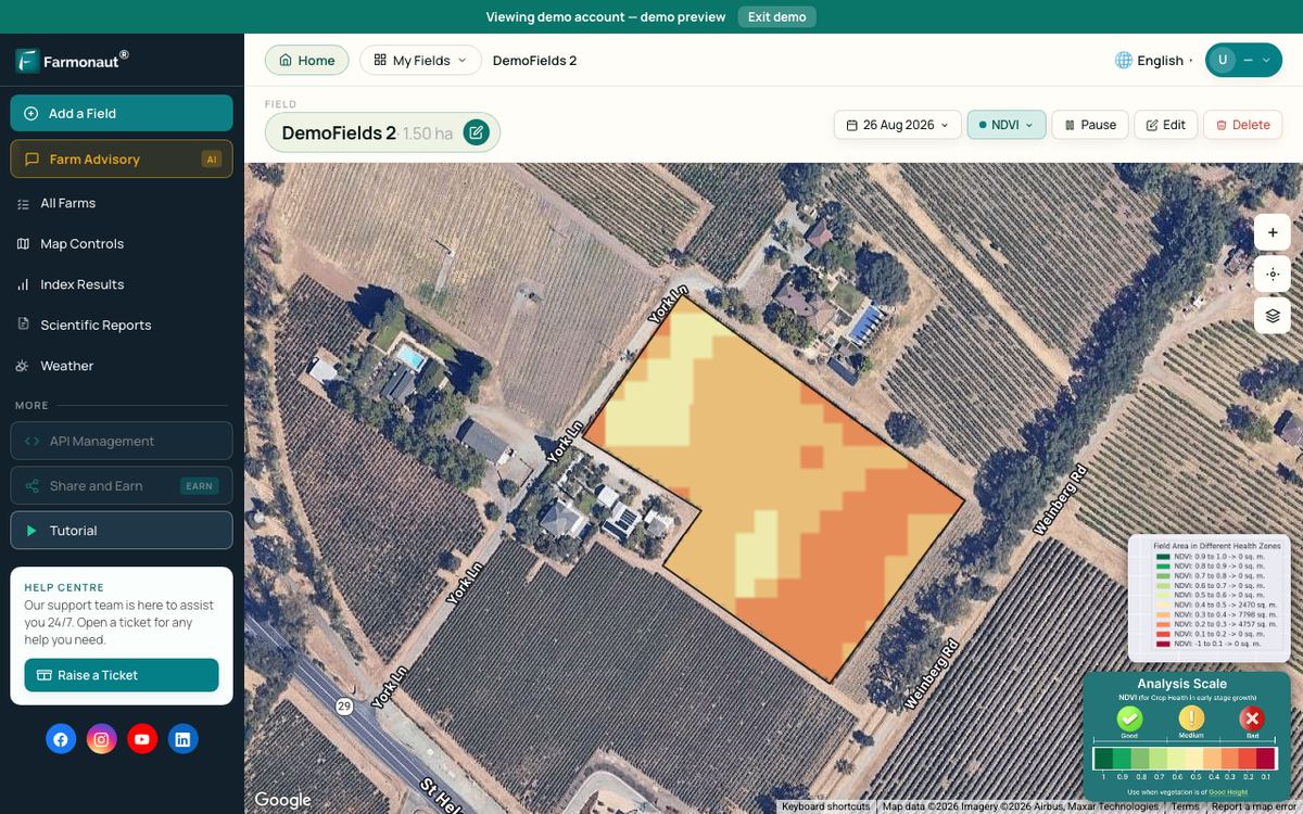
On a single farm, the practical step is simpler. A model or extension forecast tells you what a normal crop should look like by mid-season. Satellite vegetation maps, such as those in Farmonaut, show which zones fall behind, so you know where to walk and check. The map shows a change in the canopy; a field visit finds the cause.
▶ How satellite NDVI maps show crop stress across a large farm before it is visible from the road. · 4:09
What is closing your yield gap worth?
A crop model or yield gap atlas gives you a potential yield for your area. Reaching 100% of that potential is rarely practical on a working farm. Use the calculator below to set your own reachable share, compare it with your average yield and see whether the extra yield covers the extra cost per acre.
Try the numbers for your own farm below.
Calculator
Would closing part of your yield gap pay?
Enter your own area, modelled potential yield, average yield, price and the extra cost per acre.
- Reachable yield: 184.0 bu/ac
- Extra yield per acre: 9.0 bu/ac
- Extra revenue per acre: $36
- Net change per acre: $1
- Break-even price (needs extra yield above 0): $4 $/bu
Example values only, not a benchmark, forecast or recommendation; every number is your input. Potential yield can come from a crop model, an extension forecast or a yield gap atlas for your area. The reachable share is your own judgement of how much of that potential is practical. Extra cost is the added seed, fertilizer, water and labour per acre you would spend. Check fertilizer and pesticide labels and local rules before changing rates.
How to start with a crop simulation model
You do not need to be a programmer, but you need a clear question and some time.
- Write down the decision. For example: “Should I plant two weeks earlier?” or “How much nitrogen will pay in a dry spring?”
- Pick a tool that fits. Use an existing extension forecast or decision tool first. Use DSSAT for crop and variety trials, APSIM for rotations and dryland systems, AquaCrop for irrigation water and WOFOST for open Python code or regional work.
- Gather the minimum data. Daily weather, a soil profile, your planting and input records, and at least one season of yields and growth stage dates.
- Calibrate. Adjust cultivar settings until the model matches your observed flowering, maturity and yield.
- Run many seasons. Use 20 or more years of weather to see the range of outcomes, not just the average.
- Check in the field. Compare the model with yield maps, crop scouting and satellite images, and update it each year.
Training helps. DSSAT runs an annual course, APSIM has a training request portal, and FAO publishes AquaCrop training modules on its website.

▶ Six plain steps to start precision farming, from field records to satellite monitoring. · 4:18
How we checked the numbers
We used the official sites of DSSAT, APSIM, FAO AquaCrop and WOFOST for facts about each model, versions and licences. Accuracy and climate figures come from peer-reviewed studies in Global Change Biology, Nature Climate Change, PNAS and the European Journal of Agronomy. Forecast numbers come from the University of Nebraska-Lincoln’s CropWatch forecast of 25 August 2026. Licence fees are APSIM’s published 2026-27 list prices in Australian dollars. Every chart names its source.
Related pages on our site: web and mobile app, satellite data API, API developer docs, Agro Admin platform, crop loan and insurance verification, carbon footprinting, product traceability and fleet management.
If this topic matters to you, read Agricultural AI Simulation Platforms: 7 Breakthroughs Transforming Farming next.
FAQ
What is the difference between crop modeling and crop simulation?
The terms are often used for the same thing. Crop modeling is the wider field of describing crops with equations, including statistical models. Crop simulation usually means running a process-based model day by day to see how a crop grows under set weather, soil and management.
Which crop simulation model is best?
No single model is best for every job. DSSAT covers over 45 crops, APSIM is strong on rotations and farming systems, AquaCrop is built to need few inputs and centres on water, and WOFOST is open Python code used for regional forecasts. Tests of 27 wheat models found that the median of many models was more accurate than any single one.
Are DSSAT, APSIM, AquaCrop and WOFOST free?
DSSAT is free on request. AquaCrop can be downloaded from the FAO website, which also publishes its Python source code. WOFOST is open source under the EUPL licence. APSIM is free for general use such as public research and teaching. Businesses that use APSIM without publishing their results pay an annual Special Use Licence fee based on turnover.
Can a crop model predict my yield?
It can estimate the yield potential for your weather, soil and management, usually as a range. It does not see weeds, pests, diseases, hail or a poor stand unless you add them. Use it to compare options and set yield goals, and check it against your yield records and field scouting.
What data do I need to run a crop model?
At minimum: daily solar radiation, maximum and minimum temperature and rainfall; a soil profile with texture, organic carbon and water-holding data; planting date, density, variety and input records; and observed yields and growth stage dates for calibration.
Farmonaut crop monitoring
See your own fields from space
Draw your fields once and Farmonaut shows satellite vegetation maps through the season, so you can see which zones fall behind the crop your model expects.



Keep reading
Sources
- DSSAT Foundation, DSSAT Overview (DSSAT v4.8.6, 2026): dssat.net
- DSSAT Foundation, Minimum data for crop model calibration and evaluation: dssat.net
- APSIM Initiative, APSIM home page (2026): apsim.info
- APSIM Initiative, Licencing: General Use and Special Use licences, fees for 2026-27 FY: apsim.info
- FAO, About AquaCrop, the FAO crop water productivity model: fao.org
- FAO, AquaCrop home and downloads, version 7.3: fao.org
- Wageningen University and Research, WOFOST (WOrld FOod STudies): wur.nl
- European Commission Joint Research Centre, Monitoring agricultural resources (MARS): joint-research-centre.ec.europa.eu
- Martre et al., Multimodel ensembles of wheat growth: many models are better than one, Global Change Biology (2015): repository.rothamsted.ac.uk
- Asseng et al., Uncertainty in simulating wheat yields under climate change, Nature Climate Change (2013): nature.com
- Zhao et al., Temperature increase reduces global yields of major crops in four independent estimates, PNAS (2017), abstract via NASA GISS: giss.nasa.gov
- University of Nebraska-Lincoln CropWatch, 2026 Corn Yield Forecasts: Approach and Interpretation of Results (July 2026): cropwatch.unl.edu
- University of Nebraska-Lincoln CropWatch, 2026 Corn Yield Forecasts as of Aug. 25 (August 2026): cropwatch.unl.edu
- Birchip Cropping Group, N budgeting to meet yield potential: Yield Prophet fact sheet: bcg.org.au
- TERN, Big data and online tools improve farms from the ground up: tern.org.au
- Yield Potential and Yield Gap Atlas (YPYGA), University of Nebraska and Wageningen (2026): yieldgap.org
- Schils et al., Cereal yield gaps across Europe, European Journal of Agronomy 101 (2018), AGRIS record: agris.fao.org
- AgMIP, Agricultural Model Intercomparison and Improvement Project: agmip.org
Discussion
Questions, corrections or field experience? Share them below. First-time comments are reviewed before they appear, and your email is never published.
No comments yet. Be the first to add a question or your experience.

 Pulsar Supernova
 Magrifly
 LatConnect 60
 Disease Free Life
 WebsEdge
 Blickwinkel
 Agricultural Credit Policy Council
 BayWa
 MCSOD
 Marei Nursery
 eKGIS
 Mostas Tech
 Andex
 FCF India
 Unifrutti Gulf
 Deluxe Conseil
 WICO
 Chimera Innovation

 Licence holder · Niger · Gold
 Licence holder · Nigeria · Gold + lithium










